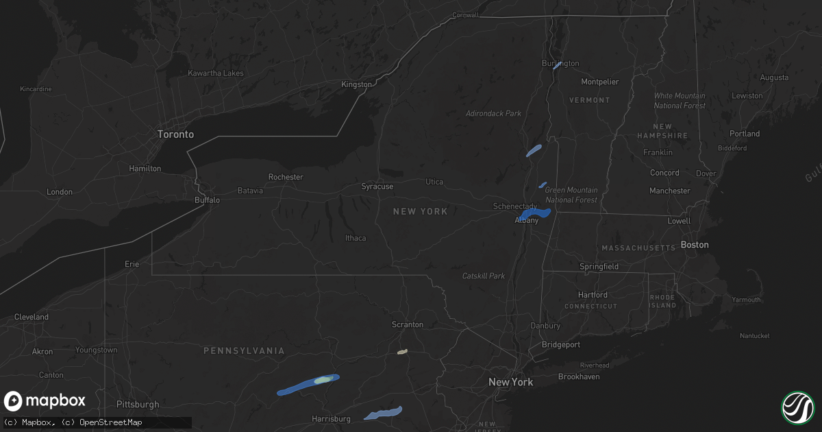
Hail Map in New York on September 8, 2021
Get this storm
September 8 map
$229
one time, instant access
Download today. No call, no setup
Keep the $229
Bought the map and want the full workflow? Apply the entire $229 to a subscription within 7 days. None of it is wasted.
Every map, not just this one
This buys you this map. Subscription and you get every map we run, in the markets you choose from a few cities to whole states to nationwide. Plus real-time alerts the moment a storm fires.
Contact data
Name, contact info, occupancy, even credit band for addresses in the footprint. You go from where it hit to who to call.
Become the source they trust
Unlimited branding weather history reports on demand. You already have the documented answer ready for the property owner, and you are the one who showed up with it.
Property data and RoofTrace estimates
Pull up any address you have got, its value and the exact code rules for that jurisdiction, straight from One Click Code. Then RoofTrace estimates the squares, pitch, and roof value, priced the way you price.
Storm reports in New York
New York
| Date | Description |
|---|---|
| 09/08/20216:56 PM CDT | Trees down on curtis hill road in nassau... Ny |
| 09/08/20216:44 PM CDT | A local report indicates 70 MPH wind near ALBANY INTL AP |
| 09/08/20216:43 PM CDT | Tree down on tripp road. Time estimated by radar. |
| 09/08/20216:41 PM CDT | Wires down. Time estimated by radar. |
| 09/08/20216:40 PM CDT | Large tree limb down |
| 09/08/20216:35 PM CDT | Downed tree blocking road. |
| 09/08/20216:35 PM CDT | Wires down on johnston road between ashford drive and ildra lane |
| 09/08/20216:35 PM CDT | Large tree limb down on soc ring road |
| 09/08/20216:34 PM CDT | Tree down on road... Route 113. Time estimated by radar. |
| 09/08/20216:20 PM CDT | Trees and wires down in hebron. |
| 09/08/20216:03 PM CDT | Tree down on tripp road. Time estimated by radar. |
| 09/08/20215:45 PM CDT | Trees and wires down in kingsbury |
| 09/08/20215:44 PM CDT | Tree down on bluebird road |
| 09/08/20215:33 PM CDT | Downed trees near exit 22 and route 9n on the northway. |
| 09/08/20215:30 PM CDT | Numerous trees snapped and uprooted. Approximately half-mile stretch of visible damage of exit 22 north of 9n. |
| 09/08/20215:28 PM CDT | Downed trees between walker lane and stonebridge road in the town of hague |
| 09/08/20215:22 PM CDT | Tree down on tannery hill road and miner road |
| 09/08/20215:13 PM CDT | Route 9 in the town of warrensburg 1 mile north of route 28 closed due to several downed trees. |
| 09/08/20215:11 PM CDT | Tree down on jockey street |
| 09/08/20214:59 PM CDT | 4 trees uprooted... 1 tree snapped and an outhouse overturned. |
| 09/08/20213:18 AM CDT | At 817 PM EDT, a severe thunderstorm was located near North-South Lake Campground, or 7 miles north of Saugerties, moving east at 30 mph. HAZARD...60 mph wind gusts. SOURCE...Radar indicated. IMPACT...Expect damage to roofs, siding, and trees. Locations impacted include... Hudson, Catskill, Claverack, Livingston, Athens, Philmont, Lorenz Park, Claverack-Red Mills, North-South Lake Campground, Ghent, Veteran, Stockport, Germantown, Taghkanic, Centerville, Tannersville, Quarryville, Burden Dock, Manorville and Katsbaan. |
| 09/08/20212:51 AM CDT | At 750 PM EDT, a severe thunderstorm was located over Tinmouth, moving northeast at 30 mph. HAZARD...60 mph wind gusts and penny size hail. SOURCE...Radar indicated. IMPACT...Expect damage to trees and powerlines. Locations impacted include... Rutland, Pawlet, Mount Holly, Mount Tabor, Tinmouth, Shrewsbury, Middletown Springs, Wallingford, Mt. Holly, Mt. Tabor, Danby, Rutland - Southern Vermont Airport, Plymouth, Mendon, Clarendon, Reading, Wells, Rutland City, Killington and Ira. |
| 09/08/20212:25 AM CDT | At 725 PM EDT, a severe thunderstorm was located near Voorheesville, or 7 miles west of Delmar, moving northeast at 25 mph. HAZARD...60 mph wind gusts and quarter size hail. SOURCE...Radar indicated. IMPACT...Hail damage to vehicles is expected. Expect wind damage to roofs, siding, and trees. Locations impacted include... Albany, Troy, East Greenbush, Cohoes, Watervliet, Rensselaer, Colonie, Latham, Delmar, Guilderland, Menands, Voorheesville, Green Island, Waterford, Altamont, Loudonville, West Sand Lake, Wyantskill, Averill Park and Feura Bush. |
| 09/08/20212:16 AM CDT | At 716 PM EDT, a severe thunderstorm was located over Mechanicville, moving east at 25 mph. HAZARD...60 mph wind gusts. SOURCE...Radar indicated. IMPACT...Expect damage to roofs, siding, and trees. Locations impacted include... Mechanicville, Hoosick Falls, Cambridge, Greenwich, Malta, Hoosick, Lee, Easton, Stillwater, Schaghticoke, Valley Falls, Schaghticoke Hill, Center White Creek, Hoosick Junction, Center Falls, Johnsonville, Willow Glen, Coons, Wayville and Eagleville. |
| 09/08/20211:11 AM CDT | At 611 PM EDT, a severe thunderstorm was located near Warrensburg, moving northeast at 45 mph. HAZARD...60 mph wind gusts. SOURCE...Radar indicated. IMPACT...Expect damage to roofs, siding, and trees. Locations impacted include... Warrensburg, Hague, Chestertown, Eagle Point Campground, Scaroon Manor Public Campground, Thurman, Thurman Station, Starbuckville, Riparius, Silver Bay, Pottersville, South Horicon, Graphite, Athol, Adirondack, Brant Lake, Riverbank, North Bolton and Darrowsville. |
| 09/08/202112:49 AM CDT | At 548 PM EDT, a severe thunderstorm was located over Red Rock Point, moving northeast at 40 mph. HAZARD...60 mph wind gusts. SOURCE...Radar indicated. IMPACT...Expect damage to trees and powerlines. Locations impacted include... Essex Junction, South Burlington, Burlington International Airport, Burlington, Morrisville, Charlotte, Cambridge, Winooski, Cambridge Village, Stowe, Westford, Jeffersonville Village, Colchester, Essex Junction Village, Fairfax, Williston, Bolton, Richmond, Mt. Philo State Park and Underhill. |
| 09/08/202112:02 AM CDT | At 502 PM EDT, severe thunderstorms were located along a line extending from Cedarville to near Cooperstown to Milford to Laurens, moving east at 60 mph. HAZARD...60 mph wind gusts. SOURCE...Radar indicated. IMPACT...Expect damage to roofs, siding, and trees. Locations impacted include... Oneonta, Worcester, Middlefield, Hartwick, Maryland, Cooperstown, Westville, Springfield, Richfield Springs and Burlington. |
| 09/07/20217:25 PM CDT | Downed tree near ramsey school road and route 23a |
| 09/07/20217:17 PM CDT | Downed tree between fox hollow road and route 22 |
| 09/07/20217:10 PM CDT | Downed tree on state route 2 in grafton |
All States Impacted by Hail Map on September 8, 2021
Cities Impacted by Hail Map on September 8, 2021
- Dunn, NC
- Newton Grove, NC
- Fayetteville, NC
- New Oxford, PA
- Gettysburg, PA
- East Berlin, PA
- Abbottstown, PA
- Dover, PA
- Biglerville, PA
- Orrtanna, PA
- York Springs, PA
- Aspers, PA
- Yorktown, VA
- Seaford, VA
- Norfolk, VA
- Black Mountain, NC
- Louisburg, NC
- Cerro Gordo, NC
- Evergreen, NC
- Chadbourn, NC
- San Angelo, TX
- Benson, NC
- Four Oaks, NC
- Myersville, MD
- Rutherfordton, NC
- Middleburg, PA
- Mount Pleasant Mills, PA
- Port Trevorton, PA
- Selinsgrove, PA
- Freeburg, PA
- Richfield, PA
- Eden, TX
- Moncks Corner, SC
- Bonneau, SC
- Forest City, NC
- Carrollton, VA
- Sunset, SC
- Centre, AL
- Cedar Bluff, AL
- Leesburg, AL
- Brady, TX
- Camden, NC
- Kingsville, MD
- Lancaster, SC
- Wade, NC
- Chesterfield, SC
- Mertzon, TX
- Heath Springs, SC
- Hendersonville, NC
- Godwin, NC
- Cross, SC
- Saint Marys, GA
- Yulee, FL
- North Wilkesboro, NC
- Roaring River, NC
- Williamsburg, VA
- Mason, TX
- Perry Hall, MD
- Glen Arm, MD
- Hydes, MD
- Fork, MD
- Bostic, NC
- Ellenboro, NC
- Henderson, NC
- North Augusta, SC
- Horse Shoe, NC
- Mills River, NC
- Fort Eustis, VA
- Newport News, VA
- Smithfield, VA
- Surry, VA
- Clewiston, FL
- Monroe, NC
- Taylorsville, NC
- Hayes, VA
- Gloucester, VA
- Brookfield, CT
- Danbury, CT
- Christoval, TX
- Menard, TX
- Gustine, TX
- Hamilton, TX
- Jasper, FL
- Granite Falls, NC
- Union Mills, NC
- Warrenton, NC
- Fairfield, PA
- Sonora, TX
- Minonk, IL
- Littleton, NC
- Macon, NC
- Lawn, TX
- Ovalo, TX
- Mocksville, NC
- Fair Bluff, NC
- Orrum, NC
- Mill Spring, NC
- Carlton, TX
- La Place, LA
- Hiddenite, NC
- Cheraw, SC
- Loxahatchee, FL
- West Palm Beach, FL
- San Saba, TX
- Asheboro, NC
- Orlando, FL
- Lenoir, NC
- Lake Lure, NC
- Virginia Beach, VA
- Knoxville, MD
- Jefferson, MD
- Marion, NC
- Voss, TX
- Millersview, TX
- Miles, TX
- Fort Monroe, VA
- Sharpsburg, MD
- Keedysville, MD
- Thurmont, MD
- Emmitsburg, MD
- Sabillasville, MD
- Disputanta, VA
- Lawrenceville, GA
- Suwanee, GA
- Freeland, PA
- White Haven, PA
- Lake Harmony, PA
- Franklin, VA
- Beavertown, PA
- Goldsboro, TX
- Melvin, TX
- Burlington, VT
- Shelburne, VT
- Lake George, NY
- Fort Ann, NY
- Kattskill Bay, NY
- Queensbury, NY
- Greenwich, NY
- Watervliet, NY
- Petersburg, NY
- Waterford, NY
- Troy, NY
- Cohoes, NY
- Cropseyville, NY
- Slingerlands, NY
- Poestenkill, NY
- Averill Park, NY
- Wynantskill, NY
- Latham, NY
- Albany, NY
- Panacea, FL
- Yeagertown, PA
- McClure, PA
- Lewistown, PA
- McAlisterville, PA
- Mifflintown, PA
- McVeytown, PA
- Herndon, PA
- Beaver Springs, PA
- Cocolamus, PA
- Burnham, PA
- Belleville, PA
- Dornsife, PA
- Sunbury, PA
- Newmanstown, PA
- Lititz, PA
- Womelsdorf, PA
- Myerstown, PA
- Wernersville, PA
- Oley, PA
- Denver, PA
- Stevens, PA
- Reinholds, PA
- Lebanon, PA
- Fleetwood, PA
- Douglassville, PA
- Robesonia, PA
- Schaefferstown, PA
- Birdsboro, PA
- Reading, PA
- Temple, PA


