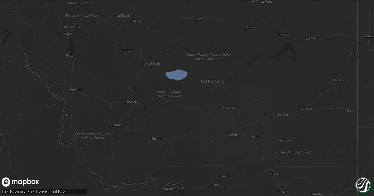
Hail Map in Montana on September 7, 2022
Get this storm
September 7 map
$229
one time, instant access
Download today. No call, no setup
Keep the $229
Bought the map and want the full workflow? Apply the entire $229 to a subscription within 7 days. None of it is wasted.
Every map, not just this one
This buys you this map. Subscription and you get every map we run, in the markets you choose from a few cities to whole states to nationwide. Plus real-time alerts the moment a storm fires.
Contact data
Name, contact info, occupancy, even credit band for addresses in the footprint. You go from where it hit to who to call.
Become the source they trust
Unlimited branding weather history reports on demand. You already have the documented answer ready for the property owner, and you are the one who showed up with it.
Property data and RoofTrace estimates
Pull up any address you have got, its value and the exact code rules for that jurisdiction, straight from One Click Code. Then RoofTrace estimates the squares, pitch, and roof value, priced the way you price.
Storm reports in Montana
Montana
| Date | Description |
|---|---|
| 09/07/20226:56 PM CDT | Mesonet aw hotel. |
| 09/07/20226:42 PM CDT | Mesonet station mtyep mdt - gary cooper bridge - dearborn. |
| 09/07/20226:30 PM CDT | Greenfield irrigation. |
| 09/07/20226:28 PM CDT | Via ambientweather. |
| 09/07/20226:28 PM CDT | Gust of 58.2mph recorded and relayed via ambient weather. |
| 09/07/20226:28 PM CDT | Corrects previous non-tstm wnd gst report from 8 ssw wolf creek. Mesonet station mtsbn sieben flats - mdt. |
| 09/07/20226:25 PM CDT | Asos station khln helena airport. |
| 09/07/20226:21 PM CDT | Awos station k1gm golf. |
| 09/07/20225:59 PM CDT | A local report indicates 58 MPH wind near 4 N BILLINGS |
| 09/07/20225:56 PM CDT | Mesonet station mtmdp macdonald pass |
| 09/07/20225:09 PM CDT | A local report indicates 58 MPH wind near 10 E MOLT |
| 09/07/20224:45 PM CDT | A local report indicates 63 MPH wind near 5 N RAPLEJE |
| 09/07/20224:40 PM CDT | A local report indicates 58 MPH wind near 2 ENE HARLOWTON |
| 09/07/20224:15 PM CDT | A local report indicates 62 MPH wind near BIG TIMBER |
| 09/07/20222:55 PM CDT | A local report indicates 58 MPH wind near 4 NNE MCALLISTER |
| 09/07/20223:32 AM CDT | At 830 PM MDT, a severe thunderstorm was located over Zortman, moving northeast at 45 mph. HAZARD...60 mph wind gusts. SOURCE...Radar indicated. IMPACT...Expect damage to roofs, siding, and trees. Locations impacted include... Malta, Zortman, Dodson, Fourchette, Phillips, Wagner, Landusky, Sun Prairie and Fred Robinson Bridge. |
| 09/07/20221:32 AM CDT | At 630 PM MDT, severe thunderstorms were located along a line extending from 16 miles north of Black Eagle to 19 miles southwest of Geyser to near White Sulphur Springs, moving east at 40 mph. HAZARD...70 mph wind gusts, and widespread blowing dust. SOURCE...Radar indicated. IMPACT...Expect considerable tree damage. Damage is likely to mobile homes, roofs, and outbuildings. Visibility will be reduced to less than 2 miles at times in blowing dust. Locations impacted include... Great Falls, Fort Benton, White Sulphur Springs, Stanford, Belt, Geraldine, Highwood, Black Eagle, Geyser, Carter, Neihart, Floweree, Windham, Sapphire Village, Stockett, Utica, Shonkin, Loma, Checkerboard and Raynesford. |
| 09/07/202212:57 AM CDT | At 556 PM MDT, severe thunderstorms were located along a line extending from near Dutton to 23 miles southeast of Cascade to 10 miles southwest of Townsend, moving east at 50 mph. HAZARD...70 mph wind gusts. SOURCE...Radar indicated. IMPACT...Expect considerable tree damage. Damage is likely to mobile homes, roofs, and outbuildings. Locations impacted include... Great Falls, Townsend, Fort Benton, White Sulphur Springs, Cascade, Stanford, Belt, Dutton, Fort Shaw, Highwood, Black Eagle, Geyser, Fort Shaw, Power, Carter, Neihart, Fort Logan On The Smith River, Floweree, Eden and Sapphire Village. |
| 09/07/202212:28 AM CDT | At 528 PM MDT, severe thunderstorms were located along a line extending from near Wolf Creek to 10 miles north of East Helena to 6 miles southwest of Montana City, moving northeast at 55 mph. HAZARD...70 mph wind gusts. SOURCE...Radar indicated. IMPACT...Expect considerable tree damage. Damage is likely to mobile homes, roofs, and outbuildings. Locations impacted include... Helena, East Helena, Montana City, York, Alhambra, Clancy, Black Sandy State Park and Goose Bay. |
| 09/06/202211:28 PM CDT | At 427 PM MDT, severe thunderstorms were located along a line extending from 10 miles northeast of Ryegate to 9 miles northwest of Pryor, moving northeast at 35 mph. HAZARD...60 mph wind gusts. SOURCE...Radar indicated. Gusts to 58 mph have been reported along this line. IMPACT...Expect damage to roofs, siding, and trees. Severe thunderstorms will be near... Billings around 435 PM MDT Roundup around 510 PM MDT.Other locations impacted by these severe thunderstorms include Laurel, Pompeys Pillar, Acton, Musselshell, Lavina, Klein, Broadview and Comanche.This replaces the warning previously in effect for this area. |
| 09/06/202211:02 PM CDT | At 401 PM MDT, a severe thunderstorm was located over Joliet, or 16 miles southeast of Columbus, moving east at 40 mph. HAZARD...60 mph wind gusts. SOURCE...Radar indicated. IMPACT...Expect damage to roofs, siding, and trees. Locations impacted include... Laurel, Joliet, Fromberg, Pryor, Billings West End, Edgar, Boyd, Roberts, Silesia, Cooney Reservoir State Park, Park City and Rockvale. |
| 09/06/20228:40 PM CDT | Measured via the big sky field asos site. |
| 09/06/20228:00 PM CDT | A local report indicates 62 MPH wind near 6 ESE EMIGRANT |
| 09/06/20227:59 PM CDT | A local report indicates 61 MPH wind near 4 SSE WHATLEY |
| 09/06/20227:52 PM CDT | Awos station k1gm golf. |
| 09/06/20227:14 PM CDT | Site kmtgreat49. |
| 09/06/20227:09 PM CDT | Site kmttowns11. |
| 09/06/20227:07 PM CDT | Great falls airport asos measured 58 mph wind gust. |
| 09/06/20227:07 PM CDT | Corrects previous tstm wnd gst report from 5 wsw great falls. Great falls airport asos measured 60 mph wind gust. |
| 09/06/20227:00 PM CDT | Trained spotter reported two sheds damaged... One leaned up against grain bins and the other with its roof torn off. A fabric carport was also damage. Estimated wind 60 |
All States Impacted by Hail Map on September 7, 2022
Cities Impacted by Hail Map on September 7, 2022
- Zwolle, LA
- Longville, LA
- Newton, TX
- Burkeville, TX
- Saratoga, TX
- Jena, LA
- Olla, LA
- Many, LA
- Hornbeck, LA
- Florien, LA
- Granger, TX
- Georgetown, TX
- Kaplan, LA
- Buckholts, TX
- Thorndale, TX
- Cameron, TX
- Davilla, TX
- Rockdale, TX
- Oakdale, LA
- Leesville, LA
- Kilgore, TX
- Maurice, LA
- Groveton, TX
- Orlando, FL
- Morriston, FL
- Utopia, TX
- Gueydan, LA
- Anacoco, LA
- Orange, TX
- Gonzales, TX
- Tyler, TX
- Arp, TX
- Jackson, AL
- Jeanerette, LA
- Atlanta, LA
- Lake Charles, LA
- Iowa, LA
- Robeline, LA
- Natchitoches, LA
- Glenmora, LA
- Elmer, LA
- Woodworth, LA
- Laurel, MS
- Beaumont, TX
- Walker, LA
- Waldo, AR
- Nixon, TX
- Leesville, TX
- Seguin, TX
- New Iberia, LA
- Carthage, TX
- Cleveland, TX
- New Llano, LA
- Huntsville, TX
- Hackberry, LA
- Buffalo, TX
- Baton Rouge, LA
- Richmond, TX
- Alexandria, LA
- Vinton, LA
- Damon, TX
- Cameron, LA
- Port Arthur, TX
- Sabine Pass, TX
- Rosharon, TX
- Caldwell, TX
- Saint Cloud, FL
- Buckner, AR
- Spring Hill, FL
- Livingston, TX
- Shepherd, TX
- Shelbyville, TX
- Rosston, AR
- Collins, MS
- Marble Falls, TX
- Spicewood, TX
- Deweyville, TX
- Jacksonville, TX
- Provencal, LA
- Deridder, LA
- Punta Gorda, FL
- Arcadia, FL
- Pointblank, TX
- Iota, LA
- Crowley, LA
- Rayne, LA
- Duson, LA
- Franklin, LA
- Mount Olive, NC
- Winnfield, LA
- Goodrich, TX
- Johnson City, TX
- Overton, TX
- Ball, LA
- Pineville, LA
- Pitkin, LA
- Elizabeth, LA
- Lena, MS
- Morgan City, LA
- New Waverly, TX
- Hamshire, TX
- Fort Polk, LA
- Cloutierville, LA
- Montgomery, LA
- Natchez, LA
- Colfax, LA
- Denham Springs, LA
- Bullard, TX
- Palestine, TX
- Troup, TX
- Frankston, TX
- Rusk, TX
- Okeechobee, FL
- Lumberton, TX
- Buna, TX
- Vidor, TX
- Saint Martinville, LA
- Maringouin, LA
- Paulding, MS
- Willis, TX
- Coldspring, TX
- Oakhurst, TX
- Melrose, LA
- Scott, LA
- Van Vleck, TX
- West Columbia, TX
- Bay City, TX
- Sweeny, TX
- Longview, TX
- Austin, TX
- Coupland, TX
- Manor, TX
- Bell City, LA
- Trinity, TX
- Dunnellon, FL
- Ochopee, FL
- Leesburg, FL
- Groveland, FL
- Howey In The Hills, FL
- North Fort Myers, FL
- Pomona Park, FL
- Crescent City, FL
- Quitman, MS
- Winnie, TX
- Houston, TX
- Pearland, TX
- Evans, LA
- Kingsbury, TX
- Fort Myers, FL
- Raynesford, MT
- Coffee Creek, MT
- Belt, MT
- Denton, MT
- Stanford, MT
- Geyser, MT


