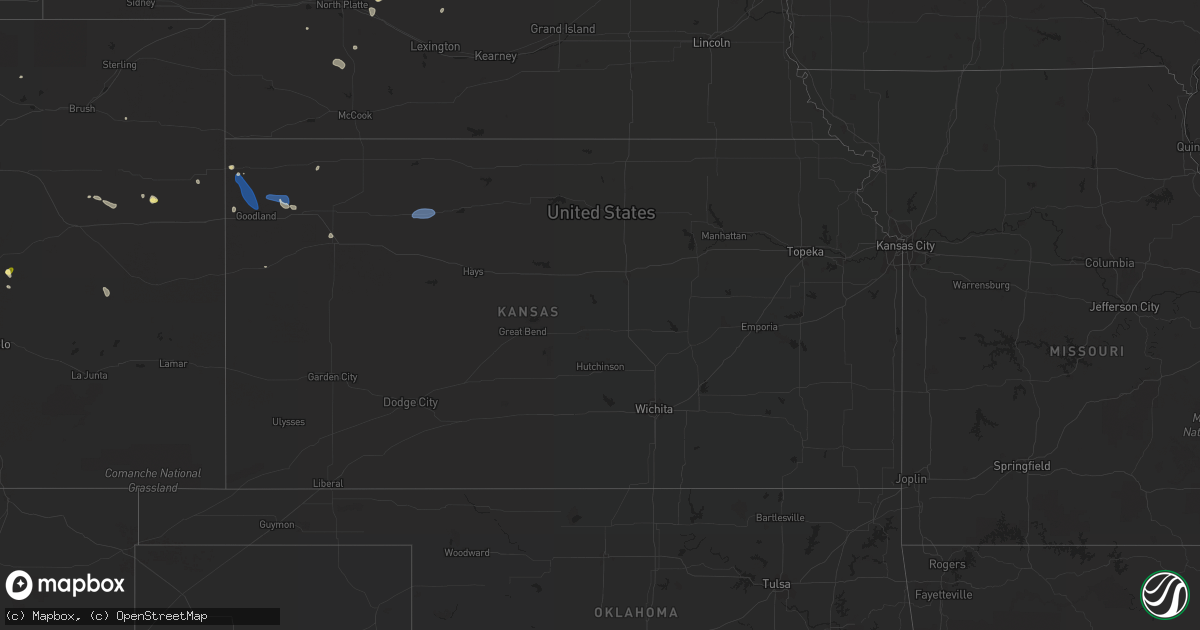
Hail Map in Kansas on August 31, 2022
Get this storm
August 31 map
$229
one time, instant access
Download today. No call, no setup
Keep the $229
Bought the map and want the full workflow? Apply the entire $229 to a subscription within 7 days. None of it is wasted.
Every map, not just this one
This buys you this map. Subscription and you get every map we run, in the markets you choose from a few cities to whole states to nationwide. Plus real-time alerts the moment a storm fires.
Contact data
Name, contact info, occupancy, even credit band for addresses in the footprint. You go from where it hit to who to call.
Become the source they trust
Unlimited branding weather history reports on demand. You already have the documented answer ready for the property owner, and you are the one who showed up with it.
Property data and RoofTrace estimates
Pull up any address you have got, its value and the exact code rules for that jurisdiction, straight from One Click Code. Then RoofTrace estimates the squares, pitch, and roof value, priced the way you price.
Storm reports in Kansas
Kansas
| Date | Description |
|---|---|
| 08/31/20225:24 PM CDT | Off duty nws employee reports 60 mph gust at the mcdonalds in colby... Ks. |
| 08/31/20225:01 PM CDT | Asos station kgld goodland. |
| 08/31/20224:53 PM CDT | Asos station kgld goodland. |
| 08/31/20224:35 PM CDT | Observed visibility at 1/4 mile due to blowing dust from gld asos. |
| 08/31/20224:25 PM CDT | Spotter reported estimated wind gust of 60 mph. |
| 08/31/20223:58 PM CDT | Nws employees are observing multiple landspouts near the leading edge of the storms to the north of goodland... Ks. |
| 08/31/20223:29 PM CDT | Off duty deputy reported a landspout more than 10 miles northwest of goodland... Ks. Location is estimated. |
| 08/31/20222:45 AM CDT | At 745 PM CDT, severe thunderstorms were located along a line extending from near Logan to 8 miles southwest of Bogue, moving southeast at 25 mph. HAZARD...60 mph wind gusts and penny size hail. SOURCE...Radar indicated. IMPACT...Expect damage to roofs, siding, and trees. Locations impacted include... Palco and Zurich. |
| 08/30/202210:44 PM CDT | At 343 PM MDT/443 PM CDT/, a severe thunderstorm was located 9 miles southeast of Goodland, moving southeast at 45 mph. HAZARD...60 mph wind gusts. SOURCE...60 mph wind gust reported at Goodland, Kansas. IMPACT...Expect damage to roofs, siding, and trees. Locations impacted include... Winona.This includes Interstate 70 in Kansas between mile markers 11 and 61. |
| 08/30/202210:38 PM CDT | At 338 PM CDT, a severe thunderstorm was located 5 miles west of St. Francis, moving east at 40 mph. HAZARD...60 mph wind gusts and quarter size hail. SOURCE...Radar indicated. IMPACT...Hail damage to vehicles is expected. Expect wind damage to roofs, siding, and trees. This severe thunderstorm will be near... St. Francis around 345 PM CDT.Other locations in the path of this severe thunderstorm include BirdCity. |
| 08/30/202210:04 PM CDT | At 303 PM MDT, a severe thunderstorm was located 13 miles north of Goodland, moving southeast at 45 mph. HAZARD...60 mph wind gusts. SOURCE...Radar indicated. IMPACT...Expect damage to roofs, siding, and trees. This severe thunderstorm will be near... Goodland around 315 PM MDT.This includes Interstate 70 in Kansas between mile markers 14 and 35. |
| 08/30/20227:32 PM CDT | Asos station khlc hill city measured a 69mph wind gust. |
All States Impacted by Hail Map on August 31, 2022
Cities Impacted by Hail Map on August 31, 2022
- Atwood, KS
- Ewing, NE
- Bartlett, NE
- Arriba, CO
- Genoa, CO
- Newcastle, NE
- Clearwater, NE
- Westfield, IA
- Briggsdale, CO
- Hammond, NY
- Heuvelton, NY
- Anselmo, NE
- Idalia, CO
- Arnold, NE
- Brady, NE
- Tryon, NE
- North Fort Myers, FL
- Punta Gorda, FL
- Vermillion, SD
- Burbank, SD
- Elk Point, SD
- Elgin, NE
- Spalding, NE
- Bassett, NE
- Kanorado, KS
- Seibert, CO
- Wheatland, WY
- Oakley, KS
- Jacksonville, FL
- Brewster, KS
- Edson, KS
- Karval, CO
- Vona, CO
- Saint Francis, KS
- Oconto, NE
- Eddyville, NE
- Wallace, NE
- Monticello, FL
- Brewster, NE
- Atkinson, NE
- Maxwell, NE
- Lake Park, GA
- Valdosta, GA
- Statenville, GA
- Colby, KS
- Johnstown, NE
- Pinetta, FL
- Montgomery, TX
- Gothenburg, NE
- Calhan, CO
- Peyton, CO
- Sanford, FL
- Mangum, OK
- Chadron, NE
- Ponca, NE
- Hayes Center, NE
- Maywood, NE
- Winter Springs, FL
- Casselberry, FL
- Akron, IA
- Nashville, GA
- Beulah, CO
- Long Pine, NE
- Fargo, GA
- New Smyrna Beach, FL
- Deland, FL
- Woodbine, GA
- Wellfleet, NE
- Chambers, NE
- Fort Myers, FL
- Wallace, KS
- Thedford, NE
- Wynot, NE
- Ainsworth, NE
- Rosanky, TX
- Waelder, TX
- Dale, TX
- Newport, NE
- Flagler, CO
- Colorado Springs, CO
- Ponte Vedra Beach, FL
- Akron, CO
- Osmond, NE
- Mclean, NE
- Pierce, NE
- Randolph, NE
- Folkston, GA
- Goodland, KS
- Bogue, KS
- Hill City, KS
- Penokee, KS


