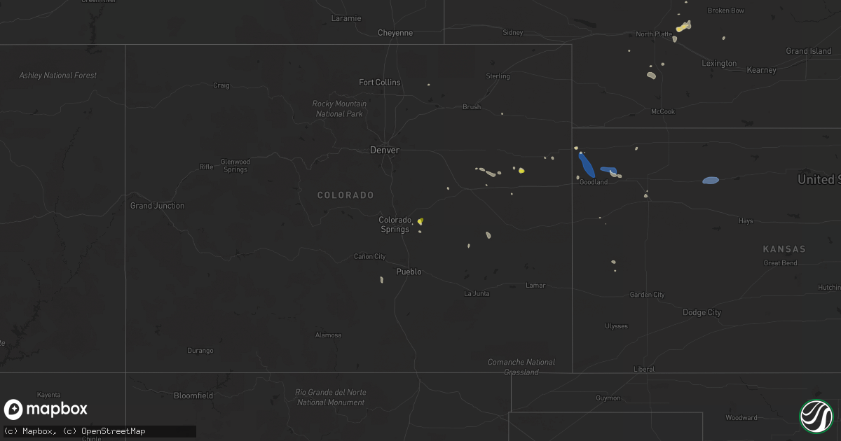
Hail Map on August 31, 2022
Get this storm
August 31 map
$229
one time, instant access
Download today. No call, no setup
Keep the $229
Bought the map and want the full workflow? Apply the entire $229 to a subscription within 7 days. None of it is wasted.
Every map, not just this one
This buys you this map. Subscription and you get every map we run, in the markets you choose from a few cities to whole states to nationwide. Plus real-time alerts the moment a storm fires.
Contact data
Name, contact info, occupancy, even credit band for addresses in the footprint. You go from where it hit to who to call.
Become the source they trust
Unlimited branding weather history reports on demand. You already have the documented answer ready for the property owner, and you are the one who showed up with it.
Property data and RoofTrace estimates
Pull up any address you have got, its value and the exact code rules for that jurisdiction, straight from One Click Code. Then RoofTrace estimates the squares, pitch, and roof value, priced the way you price.
States Impacted by Hail Map on August 31, 2022
Storm reports
Oklahoma
| Date | Description |
|---|---|
| 08/30/202210:24 PM CDT | At 324 PM CDT, a severe thunderstorm was located over Mangum, moving west at 15 mph. HAZARD...60 mph wind gusts and nickel size hail. SOURCE...Radar indicated. IMPACT...Expect damage to roofs, siding, and trees. Locations impacted include... Mangum. |
Nebraska
| Date | Description |
|---|---|
| 08/31/20223:00 PM CDT | Report via twitter. |
| 08/31/20221:03 AM CDT | At 602 PM CDT, a severe thunderstorm was located 4 miles southwest of Coleridge, or 10 miles south of Hartington, moving east at 15 mph. HAZARD...60 mph wind gusts and quarter size hail. SOURCE...Radar indicated. IMPACT...Hail damage to vehicles is expected. Expect wind damage to roofs, siding, and trees. This severe thunderstorm will be near... Belden around 615 PM CDT. Coleridge around 620 PM CDT.Other locations in the path of this severe thunderstorm includeLaurel. |
| 08/31/202212:38 AM CDT | At 537 PM CDT, a severe thunderstorm was located over Osmond, or 23 miles north of Norfolk, moving southeast at 15 mph. HAZARD...60 mph wind gusts and quarter size hail. SOURCE...Radar indicated. IMPACT...Hail damage to vehicles is expected. Expect wind damage to roofs, siding, and trees. This severe thunderstorm will remain over mainly rural areas of northeastern Pierce and southeastern Knox Counties, including the following locations... McLean and The Highway 81 And 20 Junction. |
| 08/30/20227:15 PM CDT | Winds from back side of departing thunderstorms. |
Georgia
| Date | Description |
|---|---|
| 08/31/20224:10 PM CDT | Tree down on rocky ford rd. Time estimated by radar. |
| 08/30/202211:56 PM CDT | At 456 PM EDT, a severe thunderstorm was located near Lake Park, moving southwest at 10 mph. HAZARD...60 mph wind gusts. SOURCE...Radar indicated. IMPACT...Expect damage to roofs, siding, and trees. Locations impacted include... Madison, Lake Park, Lee, Twin Lakes, Hopewell, Cherry Lake, Hamburg, Pinetta, I-75 At Exit 5, Lovett, Nankin, Clyattville, Hanson and I-75 At Exit 11. |
| 08/30/202210:26 PM CDT | At 326 PM EDT, a severe thunderstorm was located near Woodbine, moving east at 10 mph. HAZARD...60 mph wind gusts and half dollar size hail. SOURCE...Radar indicated. IMPACT...Hail damage to vehicles is expected. Expect wind damage to roofs, siding, and trees. Locations impacted include... Kingsland, Woodbine and Colesburg. |
| 08/30/202210:05 PM CDT | At 305 PM EDT, a severe thunderstorm was located near Woodbine, moving east at 10 mph. HAZARD...60 mph wind gusts and penny size hail. SOURCE...Radar indicated. IMPACT...Expect damage to roofs, siding, and trees. Locations impacted include... Brunswick, St. Simons Island, Sea Island, Jekyll Island, Cumberland Island, Harrietts Bluff and Dover Bluff. |
| 08/30/20229:33 PM CDT | At 233 PM EDT, a severe thunderstorm was located near Homeland, or 7 miles northwest of Folkston, moving east at 5 mph. HAZARD...60 mph wind gusts and quarter size hail. SOURCE...Radar indicated. IMPACT...Hail damage to vehicles is expected. Expect wind damage to roofs, siding, and trees. Locations impacted include... Folkston, Homeland, Race Pond and Tarboro. |
Idaho
| Date | Description |
|---|---|
| 08/30/20228:52 PM CDT | Downed tree and wires north of priest river... With over 1000 customers without power. Time estimated from radar and dispatch report. |
New York
| Date | Description |
|---|---|
| 08/31/20222:50 PM CDT | Tree down and power lines in the road |
| 08/30/202211:10 PM CDT | At 410 PM EDT, severe thunderstorms were located along a line extending from near North Russell to near Russell to near Hermon, moving east at 35 mph. HAZARD...60 mph wind gusts and penny size hail. SOURCE...Radar indicated. IMPACT...Expect damage to trees and powerlines. Locations impacted include... Potsdam, Canton, Parishville, Colton, Carry Falls Reservoir, Degrasse, Richville, Hermon, Lake Ozonia, Pierrepont, Russell, Stark, Pyrites, West Parishville, Higley Flow State Park, North Russell, Shurtleff, South Colton, Hannawa Falls and West Pierrepont. |
| 08/30/202210:40 PM CDT | At 339 PM EDT, a severe thunderstorm was located over South Hammond, moving east at 40 mph. HAZARD...60 mph wind gusts and quarter size hail. SOURCE...Radar indicated. IMPACT...Minor hail damage to vehicles is possible. Expect wind damage to trees and powerlines. Locations impacted include... Gouverneur, Fowler, Richville, Hermon, Russell, Rossie, Edwards, Talcville, Nelson Corner, Fullerville, North Gouverneur, Balmat, West Fowler, West Pierrepont and South Russell. |
| 08/30/202210:22 PM CDT | At 321 PM EDT, a severe thunderstorm was located 7 miles northwest of Wellesley Island State Park, or 29 miles northwest of Fort Drum, moving east at 50 mph. HAZARD...60 mph wind gusts and quarter size hail. SOURCE...Radar indicated. IMPACT...Minor damage to vehicles is possible. Expect wind damage to trees and power lines. Locations impacted include... Kring Point State Park, Wellesley Island State Park, Redwood and Alexandria Bay.This includes Interstate 81 between exits 51 and 52. |
| 08/30/202210:21 PM CDT | At 321 PM EDT, a severe thunderstorm was located over Edwardsville, moving east at 25 mph. HAZARD...60 mph wind gusts and quarter size hail. SOURCE...Radar indicated. IMPACT...Minor hail damage to vehicles is possible. Expect wind damage to trees and powerlines. Locations impacted include... Canton, Ogdensburg, Lisbon, De Kalb, Rensselaer Falls, Heuvelton, Morley, Edwardsville, Hammond, Hermon, Morristown, Waddington, Madrid, De Peyster, Chippewa Bay, South Hammond, Pyrites, North Hammond, Jacques Cartier State Park and North Russell. |
| 08/30/20229:03 PM CDT | Several large trees and trailer blown over. One tree on a home... Another through a garage. |
Florida
| Date | Description |
|---|---|
| 08/31/20224:39 PM CDT | Power line down along i-10 near mile marker 250. |
| 08/31/20222:30 PM CDT | Tree reported down over road in the vicinity of ponte vedra lakes blvd & great harbor way. |
| 08/31/202212:29 AM CDT | At 529 PM EDT, a severe thunderstorm was located over Madison, moving south at 10 mph. HAZARD...60 mph wind gusts. SOURCE...Radar indicated. IMPACT...Expect damage to roofs, siding, and trees. Locations impacted include... Madison, Greenville, Lee, Iddo, Moseley Hall, Ebb, Chancey, Boyd, Hopewell, Buckville, Eridu, Mayo Junction, Townsend, Lake Bird, Day, Sirmans and Shady Grove. |
| 08/30/202210:04 PM CDT | At 304 PM EDT, a severe thunderstorm was located over Craig Field, or over Unf, moving east at 10 mph. HAZARD...60 mph wind gusts and penny size hail. SOURCE...Radar indicated. IMPACT...Expect damage to roofs, siding, and trees. Locations impacted include... Unf, Ponte Vedra Beach, Neptune Beach, Palm Valley, Sawgrass, Baymeadows, Craig Field, San Pablo and Fort Caroline. |
| 08/30/20229:31 PM CDT | At 231 PM EDT, a severe thunderstorm was located over Riverside, or over Jacksonville, moving southeast at 5 mph. HAZARD...60 mph wind gusts and quarter size hail. SOURCE...Radar indicated. IMPACT...Hail damage to vehicles is expected. Expect wind damage to roofs, siding, and trees. Locations impacted include... Jacksonville, Arlington, Nas Jax, Ortega, Craig Field, Normandy, Fort Caroline, San Marco, Riverside and Tallyrand. |
Kansas
| Date | Description |
|---|---|
| 08/31/20225:24 PM CDT | Off duty nws employee reports 60 mph gust at the mcdonalds in colby... Ks. |
| 08/31/20225:01 PM CDT | Asos station kgld goodland. |
| 08/31/20224:53 PM CDT | Asos station kgld goodland. |
| 08/31/20224:35 PM CDT | Observed visibility at 1/4 mile due to blowing dust from gld asos. |
| 08/31/20224:25 PM CDT | Spotter reported estimated wind gust of 60 mph. |
| 08/31/20223:58 PM CDT | Nws employees are observing multiple landspouts near the leading edge of the storms to the north of goodland... Ks. |
| 08/31/20223:29 PM CDT | Off duty deputy reported a landspout more than 10 miles northwest of goodland... Ks. Location is estimated. |
| 08/31/20222:45 AM CDT | At 745 PM CDT, severe thunderstorms were located along a line extending from near Logan to 8 miles southwest of Bogue, moving southeast at 25 mph. HAZARD...60 mph wind gusts and penny size hail. SOURCE...Radar indicated. IMPACT...Expect damage to roofs, siding, and trees. Locations impacted include... Palco and Zurich. |
| 08/30/202210:44 PM CDT | At 343 PM MDT/443 PM CDT/, a severe thunderstorm was located 9 miles southeast of Goodland, moving southeast at 45 mph. HAZARD...60 mph wind gusts. SOURCE...60 mph wind gust reported at Goodland, Kansas. IMPACT...Expect damage to roofs, siding, and trees. Locations impacted include... Winona.This includes Interstate 70 in Kansas between mile markers 11 and 61. |
| 08/30/202210:38 PM CDT | At 338 PM CDT, a severe thunderstorm was located 5 miles west of St. Francis, moving east at 40 mph. HAZARD...60 mph wind gusts and quarter size hail. SOURCE...Radar indicated. IMPACT...Hail damage to vehicles is expected. Expect wind damage to roofs, siding, and trees. This severe thunderstorm will be near... St. Francis around 345 PM CDT.Other locations in the path of this severe thunderstorm include BirdCity. |
| 08/30/202210:04 PM CDT | At 303 PM MDT, a severe thunderstorm was located 13 miles north of Goodland, moving southeast at 45 mph. HAZARD...60 mph wind gusts. SOURCE...Radar indicated. IMPACT...Expect damage to roofs, siding, and trees. This severe thunderstorm will be near... Goodland around 315 PM MDT.This includes Interstate 70 in Kansas between mile markers 14 and 35. |
| 08/30/20227:32 PM CDT | Asos station khlc hill city measured a 69mph wind gust. |
Colorado
| Date | Description |
|---|---|
| 08/31/20223:21 PM CDT | Spotter report of hail pea to quarter size. |
| 08/30/20228:34 PM CDT | At 133 PM MDT, severe thunderstorms were located along a line extending from near Falcon to near Ellicott, moving southeast at 10 mph. HAZARD...60 mph wind gusts and quarter size hail. SOURCE...Radar indicated. IMPACT...Hail damage to vehicles is expected. Expect wind damage to roofs, siding, and trees. Locations impacted include... Schriever AFB and Ellicott. |
South Dakota
| Date | Description |
|---|---|
| 08/31/20222:10 AM CDT | At 710 PM CDT, a severe thunderstorm was located near Union Grove State Park, or 10 miles northeast of Vermillion, moving southeast at 10 mph. HAZARD...60 mph wind gusts and quarter size hail. SOURCE...Radar indicated. IMPACT...Hail damage to vehicles is expected. Expect wind damage to roofs, siding, and trees. This severe thunderstorm will remain over mainly rural areas of west central Union County. |
| 08/31/20221:43 AM CDT | At 643 PM CDT, a severe thunderstorm was located over Vermillion, moving southeast at 15 mph. HAZARD...60 mph wind gusts and quarter size hail. SOURCE...Radar indicated. IMPACT...Hail damage to vehicles is expected. Expect wind damage to roofs, siding, and trees. This severe thunderstorm will remain over mainly rural areas of northwestern Dixon, southeastern Clay and west central Union Counties. |
Cities Impacted by Hail Map on August 31, 2022
- Atwood, KS
- Ewing, NE
- Bartlett, NE
- Arriba, CO
- Genoa, CO
- Newcastle, NE
- Clearwater, NE
- Westfield, IA
- Briggsdale, CO
- Hammond, NY
- Heuvelton, NY
- Anselmo, NE
- Idalia, CO
- Arnold, NE
- Brady, NE
- Tryon, NE
- North Fort Myers, FL
- Punta Gorda, FL
- Vermillion, SD
- Burbank, SD
- Elk Point, SD
- Elgin, NE
- Spalding, NE
- Bassett, NE
- Kanorado, KS
- Seibert, CO
- Wheatland, WY
- Oakley, KS
- Jacksonville, FL
- Brewster, KS
- Edson, KS
- Karval, CO
- Vona, CO
- Saint Francis, KS
- Oconto, NE
- Eddyville, NE
- Wallace, NE
- Monticello, FL
- Brewster, NE
- Atkinson, NE
- Maxwell, NE
- Lake Park, GA
- Valdosta, GA
- Statenville, GA
- Colby, KS
- Johnstown, NE
- Pinetta, FL
- Montgomery, TX
- Gothenburg, NE
- Calhan, CO
- Peyton, CO
- Sanford, FL
- Mangum, OK
- Chadron, NE
- Ponca, NE
- Hayes Center, NE
- Maywood, NE
- Winter Springs, FL
- Casselberry, FL
- Akron, IA
- Nashville, GA
- Beulah, CO
- Long Pine, NE
- Fargo, GA
- New Smyrna Beach, FL
- Deland, FL
- Woodbine, GA
- Wellfleet, NE
- Chambers, NE
- Fort Myers, FL
- Wallace, KS
- Thedford, NE
- Wynot, NE
- Ainsworth, NE
- Rosanky, TX
- Waelder, TX
- Dale, TX
- Newport, NE
- Flagler, CO
- Colorado Springs, CO
- Ponte Vedra Beach, FL
- Akron, CO
- Osmond, NE
- Mclean, NE
- Pierce, NE
- Randolph, NE
- Folkston, GA
- Goodland, KS
- Bogue, KS
- Hill City, KS
- Penokee, KS