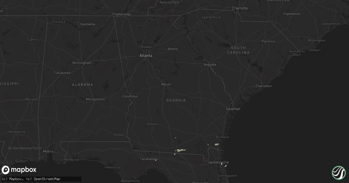
Hail Map in Georgia on August 31, 2022
Get this storm
August 31 map
$229
one time, instant access
Download today. No call, no setup
Keep the $229
Bought the map and want the full workflow? Apply the entire $229 to a subscription within 7 days. None of it is wasted.
Every map, not just this one
This buys you this map. Subscription and you get every map we run, in the markets you choose from a few cities to whole states to nationwide. Plus real-time alerts the moment a storm fires.
Contact data
Name, contact info, occupancy, even credit band for addresses in the footprint. You go from where it hit to who to call.
Become the source they trust
Unlimited branding weather history reports on demand. You already have the documented answer ready for the property owner, and you are the one who showed up with it.
Property data and RoofTrace estimates
Pull up any address you have got, its value and the exact code rules for that jurisdiction, straight from One Click Code. Then RoofTrace estimates the squares, pitch, and roof value, priced the way you price.
Storm reports in Georgia
Georgia
| Date | Description |
|---|---|
| 08/31/20224:10 PM CDT | Tree down on rocky ford rd. Time estimated by radar. |
| 08/30/202211:56 PM CDT | At 456 PM EDT, a severe thunderstorm was located near Lake Park, moving southwest at 10 mph. HAZARD...60 mph wind gusts. SOURCE...Radar indicated. IMPACT...Expect damage to roofs, siding, and trees. Locations impacted include... Madison, Lake Park, Lee, Twin Lakes, Hopewell, Cherry Lake, Hamburg, Pinetta, I-75 At Exit 5, Lovett, Nankin, Clyattville, Hanson and I-75 At Exit 11. |
| 08/30/202210:26 PM CDT | At 326 PM EDT, a severe thunderstorm was located near Woodbine, moving east at 10 mph. HAZARD...60 mph wind gusts and half dollar size hail. SOURCE...Radar indicated. IMPACT...Hail damage to vehicles is expected. Expect wind damage to roofs, siding, and trees. Locations impacted include... Kingsland, Woodbine and Colesburg. |
| 08/30/202210:05 PM CDT | At 305 PM EDT, a severe thunderstorm was located near Woodbine, moving east at 10 mph. HAZARD...60 mph wind gusts and penny size hail. SOURCE...Radar indicated. IMPACT...Expect damage to roofs, siding, and trees. Locations impacted include... Brunswick, St. Simons Island, Sea Island, Jekyll Island, Cumberland Island, Harrietts Bluff and Dover Bluff. |
| 08/30/20229:33 PM CDT | At 233 PM EDT, a severe thunderstorm was located near Homeland, or 7 miles northwest of Folkston, moving east at 5 mph. HAZARD...60 mph wind gusts and quarter size hail. SOURCE...Radar indicated. IMPACT...Hail damage to vehicles is expected. Expect wind damage to roofs, siding, and trees. Locations impacted include... Folkston, Homeland, Race Pond and Tarboro. |
All States Impacted by Hail Map on August 31, 2022
Cities Impacted by Hail Map on August 31, 2022
- Atwood, KS
- Ewing, NE
- Bartlett, NE
- Arriba, CO
- Genoa, CO
- Newcastle, NE
- Clearwater, NE
- Westfield, IA
- Briggsdale, CO
- Hammond, NY
- Heuvelton, NY
- Anselmo, NE
- Idalia, CO
- Arnold, NE
- Brady, NE
- Tryon, NE
- North Fort Myers, FL
- Punta Gorda, FL
- Vermillion, SD
- Burbank, SD
- Elk Point, SD
- Elgin, NE
- Spalding, NE
- Bassett, NE
- Kanorado, KS
- Seibert, CO
- Wheatland, WY
- Oakley, KS
- Jacksonville, FL
- Brewster, KS
- Edson, KS
- Karval, CO
- Vona, CO
- Saint Francis, KS
- Oconto, NE
- Eddyville, NE
- Wallace, NE
- Monticello, FL
- Brewster, NE
- Atkinson, NE
- Maxwell, NE
- Lake Park, GA
- Valdosta, GA
- Statenville, GA
- Colby, KS
- Johnstown, NE
- Pinetta, FL
- Montgomery, TX
- Gothenburg, NE
- Calhan, CO
- Peyton, CO
- Sanford, FL
- Mangum, OK
- Chadron, NE
- Ponca, NE
- Hayes Center, NE
- Maywood, NE
- Winter Springs, FL
- Casselberry, FL
- Akron, IA
- Nashville, GA
- Beulah, CO
- Long Pine, NE
- Fargo, GA
- New Smyrna Beach, FL
- Deland, FL
- Woodbine, GA
- Wellfleet, NE
- Chambers, NE
- Fort Myers, FL
- Wallace, KS
- Thedford, NE
- Wynot, NE
- Ainsworth, NE
- Rosanky, TX
- Waelder, TX
- Dale, TX
- Newport, NE
- Flagler, CO
- Colorado Springs, CO
- Ponte Vedra Beach, FL
- Akron, CO
- Osmond, NE
- Mclean, NE
- Pierce, NE
- Randolph, NE
- Folkston, GA
- Goodland, KS
- Bogue, KS
- Hill City, KS
- Penokee, KS


