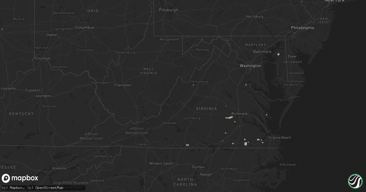
Hail Map in Virginia on August 30, 2021
Get this storm
August 30 map
$229
one time, instant access
Download today. No call, no setup
Keep the $229
Bought the map and want the full workflow? Apply the entire $229 to a subscription within 7 days. None of it is wasted.
Every map, not just this one
This buys you this map. Subscription and you get every map we run, in the markets you choose from a few cities to whole states to nationwide. Plus real-time alerts the moment a storm fires.
Contact data
Name, contact info, occupancy, even credit band for addresses in the footprint. You go from where it hit to who to call.
Become the source they trust
Unlimited branding weather history reports on demand. You already have the documented answer ready for the property owner, and you are the one who showed up with it.
Property data and RoofTrace estimates
Pull up any address you have got, its value and the exact code rules for that jurisdiction, straight from One Click Code. Then RoofTrace estimates the squares, pitch, and roof value, priced the way you price.
Storm reports in Virginia
Virginia
| Date | Description |
|---|---|
| 08/30/20216:57 PM CDT | One tree down blocking part of kentuck road. |
| 08/30/20216:54 PM CDT | Trees down along portions of jefferson davis highway. |
| 08/30/20216:53 PM CDT | One tree down along the 3200 block of oak hill road. |
| 08/30/20216:50 PM CDT | One tree down along the 8420 block of kentuck road. |
| 08/30/20216:47 PM CDT | One tree down along the 1880 block of sandy creek road. |
| 08/30/20216:45 PM CDT | One tree down along the 820 block of sportsman road. |
| 08/30/20216:39 PM CDT | One tree down along the 1740 block of stony mill road. |
| 08/30/20216:36 PM CDT | Numerous trees down near hull st and walmsley rd. |
| 08/30/20216:30 PM CDT | Trees down along adkins rd in the vicinity n wagstaff circle. Lanes closed. |
| 08/30/20216:24 PM CDT | Trees down along winterfield rd. |
| 08/30/20216:23 PM CDT | Several trees down along poplar fork road. Time estimated by radar. |
| 08/30/20216:16 PM CDT | Trees down along heritage woods rd. All lanes closed. |
| 08/30/20216:15 PM CDT | Trees down in the vicinity of duval rd. |
| 08/30/20216:15 PM CDT | Tree downed on old fox trail at millridge pkwy. |
| 08/30/20216:11 PM CDT | Numerous trees down around moseley. |
| 08/30/20216:10 PM CDT | Numerous trees down around otterdale and brandermill. |
| 08/30/20216:10 PM CDT | Trees down along wilson rd. |
| 08/30/20215:30 PM CDT | Numerous trees down across central goochland county. Lots of power outages across the area. |
| 08/30/20214:57 PM CDT | A local report indicates 59 MPH wind near BABER PT |
| 08/30/20214:35 PM CDT | 3-inch tree limbs and power poles broken on union mills rd... 1 e of n boston road. Time is radar estimated. |
| 08/30/20214:30 PM CDT | One tree down along the 3500 block of mount view road. |
| 08/30/20213:59 PM CDT | Tree down onto the shoulder of southbound i-95 at mile marker 148.2. |
| 08/30/20213:09 PM CDT | Tree down on a house in the 1500 block of bittersweet lane. |
| 08/30/20212:55 PM CDT | Tree down on riley lane near lake drive. |
| 08/30/20212:50 PM CDT | Tree down on old bust head road near oliver lane. |
| 08/30/20211:56 PM CDT | Multiple reports of trees and wires down in mt. Solon. |
| 08/30/20211:41 PM CDT | Tree and wires down on nazarene church road near jason lane. |
| 08/30/20211:33 PM CDT | Tree down on grindstone road at north river road. |
| 08/30/20215:17 AM CDT | At 1016 PM EDT, severe thunderstorms were located along a line extending from 9 miles northeast of Kempsville to near Fentress to near Sunbury, moving east at 30 mph. HAZARD...60 mph wind gusts. SOURCE...Radar indicated. IMPACT...Expect damage to trees and powerlines. Locations impacted include... Virginia Beach, Currituck, Elizabeth City, Camden, Elizabeth City State University, Grandy, Kempsville, Weeksville, Great Bridge, South Mills, Chesapeake, Fentress, Nixonton, Princess Anne, Shiloh, Back Bay, Indiantown, Morgans Corner, Corolla and Old Trap. |
| 08/30/20214:41 AM CDT | At 940 PM EDT, severe thunderstorms were located along a line extending from Churchland to Downtown Suffolk to near Como, moving east at 25 mph. HAZARD...60 mph wind gusts. SOURCE...Radar indicated. IMPACT...Expect damage to trees and powerlines. Locations impacted include... Virginia Beach, Gatesville, Sunbury, Ocean View, Kempsville, Virginia Wesleyan University, Old Dominion University, Downtown Norfolk, Regent University, Great Bridge, Downtown Suffolk, South Mills, Deep Creek, Downtown Portsmouth, Churchland, Norfolk State University, Norfolk, Chesapeake, Portsmouth and Suffolk. |
| 08/30/20214:23 AM CDT | At 922 PM EDT, a severe thunderstorm was located over Mathews, moving southeast at 25 mph. HAZARD...60 mph wind gusts. SOURCE...Radar indicated. IMPACT...Expect damage to trees and powerlines. Locations impacted include... Mathews, Gwynn, Bavon, Blakes, Mobjack, Diggs, Ruff, Moon, Peary, Cobbs Creek, Laban, Cardinal, Hudgins, Redart, Fort Nonsense, North, Soles, New Point and Port Haywood. |
| 08/30/20214:18 AM CDT | At 918 PM EDT, severe thunderstorms were located along a line extending from near Parksley to near Onancock to 7 miles south of Tangier, moving southeast at 30 mph. HAZARD...60 mph wind gusts. SOURCE...Radar indicated. IMPACT...Expect damage to trees and powerlines. Severe thunderstorms will be near... Onancock, Parksley and Onley around 925 PM EDT. Exmore around 945 PM EDT.Other locations impacted by these severe thunderstorms includeHallwood, Birdsnest, Harborton, Melfa, Mappsville, Jamesville, SilverBeach, Wachapreague, Machipongo and Wardtown.# # |
| 08/30/20213:13 AM CDT | At 812 PM EDT, severe thunderstorms were located along a line extending from Prince George to near Disputanta to Stony Creek, moving southeast at 20 mph. HAZARD...60 mph wind gusts and penny size hail. SOURCE...Radar indicated. IMPACT...Expect damage to trees and powerlines. Locations impacted include... Waverly, Wakefield, Disputanta, Sussex, Dendron, Stony Creek, Homeville, Carson, Booth Fork, Carsley, Newville, Booker, Yale, Lumberton, Ellis Fork, Barham, Littleton, Hilda, Templeton and Prince George Golf. |
| 08/30/20212:47 AM CDT | At 747 PM EDT, a severe thunderstorm was located over Ringgold, or 7 miles southeast of Blairs, moving east at 10 mph. HAZARD...60 mph wind gusts and quarter size hail. SOURCE...Radar indicated. IMPACT...Hail damage to vehicles is expected. Expect wind damage to roofs, siding, and trees. Locations impacted include... Turbeville... Ingram... Elmo... Ringgold... Alton... and Keeling. |
| 08/30/20212:43 AM CDT | At 743 PM EDT, a severe thunderstorm was located near Ettrick, or near Colonial Heights, moving east at 20 mph. HAZARD...60 mph wind gusts. SOURCE...Radar indicated. IMPACT...Expect damage to trees and powerlines. Locations impacted include... Petersburg, Hopewell, Colonial Heights, Virginia State University, Disputanta, Fort Lee, Chester, Prince George, Matoaca, Ettrick, Jordans Point, Birchett Estate, Addison, Jordan Point Country Club, Petersburg National Battlefield, New Bohemia, Richard Bland College and Prince George Golf. |
| 08/30/20212:16 AM CDT | At 716 PM EDT, a severe thunderstorm was located near Moseley, moving east at 15 mph. HAZARD...60 mph wind gusts. SOURCE...Radar indicated. IMPACT...Expect damage to trees and powerlines. Locations impacted include... Richmond, Bon Air, Chester, Bensley, Chesterfield Court House, Bellwood, Chesterfield, Winterpock, Midlothian, Pocahontas State Park, Beach, Drewrys Bluff and Centralia. |
| 08/30/20211:54 AM CDT | At 653 PM EDT, a severe thunderstorm was located over Chula, or near Moseley, moving east at 20 mph. HAZARD...60 mph wind gusts. SOURCE...Radar indicated. IMPACT...Expect damage to trees and powerlines. Locations impacted include... Moseley, Skinquarter, Winterpock and Pilkinton. |
| 08/30/20211:48 AM CDT | At 648 PM EDT, a severe thunderstorm was located over Wilsons, or near Mannboro, moving east at 20 mph. HAZARD...60 mph wind gusts. SOURCE...Radar indicated. IMPACT...Expect damage to trees and powerlines. Locations impacted include... McKenney, Wilsons, Sutherland, Spainville, North Wellville, Ammon, Darvills, Center Star, Church Road, Wellville, Five Forks, Walkers, Hebron, Rocky Run and Ford. |
| 08/30/20211:17 AM CDT | At 617 PM EDT, severe thunderstorms were located along a line extending from near Gum Spring to near Goochland to 6 miles northeast of Trenholm, moving east at 25 mph. HAZARD...60 mph wind gusts and penny size hail. SOURCE...Radar indicated. IMPACT...Expect damage to trees and powerlines. Locations impacted include... Goochland, Ashland, Tuckahoe, Gum Spring, Oilville, Manakin, Montpelier, Sabot, Wyndham, Laurel, Glen Allen, Crozier, Rock Castle, Vontay, Maidens, Three Square, Irwin, Johnsons Springs, Gilman and Fine Creek Mills.# # |
| 08/29/202111:29 PM CDT | At 429 PM EDT, a severe thunderstorm was located near Linton Hall, or 11 miles east of Warrenton, moving southeast at 20 mph. HAZARD...60 mph wind gusts. SOURCE...Radar indicated. IMPACT...Damaging winds will cause some trees and large branches to fall. This could injure those outdoors, as well as damage homes and vehicles. Roadways may become blocked by downed trees. Localized power outages are possible. Unsecured light objects may become projectiles. Locations impacted include... Linton Hall, Dumfries, Independent Hill, Nokesville, Catlett, Calverton, Aden, Heflin, Ruby, Somerville and Bristersburg. |
| 08/29/202111:16 PM CDT | At 416 PM EDT, a severe thunderstorm was located 7 miles north of Brownsburg, or 12 miles northeast of Rockbridge Baths, moving southeast at 5 mph. HAZARD...60 mph wind gusts. SOURCE...Radar indicated. IMPACT...Damaging winds will cause some trees and large branches to fall. This could injure those outdoors, as well as damage homes and vehicles. Roadways may become blocked by downed trees. Localized power outages are possible. Unsecured light objects may become projectiles. Locations impacted include... Greenville, Middlebrook, Summerdean and Spottswood. |
| 08/29/202110:59 PM CDT | At 359 PM EDT, a severe thunderstorm was located near Haymarket, or near Warrenton, moving southeast at 15 mph. HAZARD...60 mph wind gusts. SOURCE...Radar indicated. IMPACT...Damaging winds will cause some trees and large branches to fall. This could injure those outdoors, as well as damage homes and vehicles. Roadways may become blocked by downed trees. Localized power outages are possible. Unsecured light objects may become projectiles. Locations impacted include... Warrenton, Linton Hall, Manassas, Gainesville, New Baltimore, Nokesville, Catlett, Calverton, Midland, Broken Hill, Auburn, Casanova, Greenwich and Aden. |
| 08/29/20219:39 PM CDT | At 239 PM EDT, severe thunderstorms were located along a line extending from near Dale Enterprise to 6 miles west of Bridgewater, moving southeast at 15 mph. HAZARD...60 mph wind gusts. SOURCE...Radar indicated. IMPACT...Damaging winds will cause some trees and large branches to fall. This could injure those outdoors, as well as damage homes and vehicles. Roadways may become blocked by downed trees. Localized power outages are possible. Unsecured light objects may become projectiles. Locations impacted include... Harrisonburg, Bridgewater, Grottoes, Massanutten, Dale Enterprise, Verona, Elkton, Weyers Cave, Dayton, Mount Sidney, Mount Crawford, Penn Laird, Port Republic, Moscow, Clover Hill, Keezletown, Mcgaheysville, Hinton, Montevideo and Pleasant Valley. |
| 08/29/20219:08 PM CDT | Trees down near greenbrier. |
| 08/29/20218:35 PM CDT | Via social media. Trees downed at buckley road and us-14 clayton hwy. |
| 08/29/20218:30 PM CDT | Trees down across portions of southampton county. |
| 08/29/20217:57 PM CDT | Tree down on power lines. |
| 08/29/20217:45 PM CDT | Tree down at claibornetown road at dry bread rd. |
| 08/29/20217:20 PM CDT | Trees down along loving union rd and surrounding portions of southern prince george. |
| 08/29/20217:18 PM CDT | Trees down along robin rd. South bound lanes closed. |
All States Impacted by Hail Map on August 30, 2021
Cities Impacted by Hail Map on August 30, 2021
- Randolph, NE
- Carroll, NE
- Hoskins, NE
- Danville, IN
- Coatesville, IN
- Parkston, SD
- Syracuse, NE
- Avoca, NE
- Weeping Water, NE
- Alvo, NE
- Elmwood, NE
- Dunbar, NE
- Unadilla, NE
- Otoe, NE
- Hiawatha, KS
- Hartington, NE
- Niobrara, NE
- Lyerly, GA
- Rome, GA
- Solen, ND
- Center, ND
- New Salem, ND
- Beulah, ND
- Saint Anthony, ND
- Almont, ND
- Hazen, ND
- Flasher, ND
- Mandan, ND
- Meadow, SD
- Geddes, SD
- Platte, SD
- Waterloo, NE
- Yutan, NE
- Newman Grove, NE
- Saint Edward, NE
- Albion, NE
- Ethan, SD
- Mission, SD
- Nehawka, NE
- Plattsmouth, NE
- Louisville, NE
- Stanton, ND
- Lemmon, SD
- Hettinger, ND
- Corsica, SD
- Mount Vernon, SD
- Stickney, SD
- Mitchell, SD
- Canton, SD
- Inwood, IA
- Volin, SD
- Hooper, NE
- Fremont, NE
- Ames, NE
- North Bend, NE
- Wagner, SD
- Avon, SD
- Dante, SD
- Deloit, IA
- Cushing, IA
- Kiron, IA
- Manning, IA
- Holstein, IA
- Templeton, IA
- Schleswig, IA
- Manilla, IA
- Denison, IA
- Odebolt, IA
- Vail, IA
- Battle Creek, IA
- Westside, IA
- Arthur, IA
- Arcadia, IA
- Ida Grove, IA
- Omaha, NE
- Murray, NE
- Cedar Creek, NE
- Springfield, NE
- Elkhorn, NE
- Ashland, NE
- Gretna, NE
- Witten, SD
- Ideal, SD
- Windsor, VA
- Suffolk, VA
- Bison, SD
- Waverly, NE
- Greenwood, NE
- Verdigre, NE
- Wood Lake, NE
- Gaylesville, AL
- Eureka, MO
- Wildwood, MO
- Dupree, SD
- Creston, NE
- Columbus, NE
- Humphrey, NE
- Elgin, ND
- Carson, ND
- Stephan, SD
- Highmore, SD
- Lower Brule, SD
- Kennebec, SD
- Fairview, SD
- Faith, SD
- Harrison, SD
- Waterloo, IL
- Glen Ullin, ND
- Garrison, ND
- Vivian, SD
- Mott, ND
- Shelby, NE
- Osceola, NE
- Oakland, IA
- Wynot, NE
- Bloomfield, NE
- Crofton, NE
- Mount Solon, VA
- Osmond, NE
- Pierce, NE
- Winside, NE
- Petersburg, VA
- Hawarden, IA
- Rawlings, VA
- Fulton, SD
- Bronson, IA
- Ute, IA
- Mapleton, IA
- Hornick, IA
- Arion, IA
- Lawton, IA
- Moville, IA
- Rodney, IA
- Dow City, IA
- Smithland, IA
- Castana, IA
- Charter Oak, IA
- Dunlap, IA
- Sioux City, IA
- Anthon, IA
- Sergeant Bluff, IA
- Climbing Hill, IA
- Oto, IA
- Brodnax, VA
- La Crosse, VA
- Lynch, NE
- Unionville, MO
- Cayuga, IN
- Kingman, IN
- Hillsdale, IN
- Menno, SD
- Olivet, SD
- Freeman, SD
- Lenora, KS
- Creighton, NE
- Winnetoon, NE
- Brunswick, NE
- Hebron, ND
- Valentine, NE
- Ireton, IA
- Hancock, IA
- Griswold, IA
- Winner, SD
- Springfield, SD
- Roseglen, ND
- White River, SD
- Emery, SD
- Neola, IA
- Underwood, IA
- Stuart, NE
- Chamberlain, SD
- Pukwana, SD
- Oakdale, NE
- Dodge, NE
- Howells, NE
- Pilger, NE
- Wisner, NE
- Stanton, NE
- Wakonda, SD
- Artesian, SD
- Wausa, NE
- Norfolk, NE
- West Point, NE
- Wayne, NE
- Scribner, NE
- Plainview, NE
- Woonsocket, SD
- Ewing, NE
- Draper, SD
- Regent, ND
- Eagle Butte, SD
- Tyndall, SD
- Plankinton, SD
- Dimock, SD
- White Lake, SD
- Madison, NE
- Washburn, ND
- Sandy Hook, VA
- Goochland, VA
- Fordyce, NE
- Coleridge, NE
- Beresford, SD
- Alcester, SD
- Centerville, SD
- Vermillion, SD
- Worthing, SD
- Kimball, SD
- Clearwater, NE
- Neligh, NE
- Crookston, NE
- Akron, IA
- Irene, SD
- Elk Point, SD
- Roach, MO
- Clarkson, NE
- Nebraska City, NE
- Eagle, NE
- Lincoln, NE
- Murdock, NE
- Bonesteel, SD
- Tripp, SD
- Presho, SD
- Wood, SD
- Gregory, SD
- Dallas, SD
- Papillion, NE
- Memphis, NE
- Le Mars, IA
- Brunsville, IA
- Hamill, SD
- Alexandria, SD
- Emporia, VA
- Ryder, ND
- Blair, NE
- Shields, ND
- Herman, NE
- Fort Calhoun, NE
- Modale, IA
- Missouri Valley, IA
- Mclean, NE
- Crawfordsville, IN
- Burbank, SD
- Bridgewater, SD
- Calhoun, GA
- Adairsville, GA
- Saint Francis, KS
- Lodgepole, SD
- Bloomingdale, IN
- Montezuma, IN
- Rockville, IN
- Pacific, MO
- Saint Charles, SD
- Chesterfield, VA
- Center, NE
- Chestertown, MD
- Ashmore, IL
- Armour, SD
- Percival, IA
- Union, NE
- Gray, IA
- Audubon, IA
- Correctionville, IA
- Aspinwall, IA
- Carroll, IA
- Bancroft, NE
- Pender, NE
- Brayton, IA
- Anita, IA
- Exira, IA
- Robinson, KS
- Falls City, NE
- Rock Valley, IA
- Hudson, SD
- Sedona, AZ
- Reliance, SD
- Palmyra, NE
- Dutton, VA
- Gloucester, VA
- Murdo, SD
- Saint Helena, NE
- Georgetown, KY
- Wessington, SD
- Wessington Springs, SD
- Orchard, NE
- Tilden, NE
- Elgin, NE
- Thurman, IA
- Richardton, ND
- Malmo, NE
- Colon, NE
- Cedar Bluffs, NE
- Mead, NE
- Twentynine Palms, CA
- Alpena, SD
- Ladoga, IN
- Roachdale, IN
- Dawson, NE
- Verdon, NE
- Colome, SD
- Scotland, SD
- Hinton, IA
- Jefferson, SD
- Danbury, IA
- Defiance, IA
- North Sioux City, SD
- Westfield, IA
- Okaton, SD
- Parmelee, SD
- Gann Valley, SD
- Rising City, NE
- Minden, IA
- Council Bluffs, IA
- McClelland, IA
- Capron, VA
- Boykins, VA
- Saint Francis, SD
- Hamburg, IA
- Morse Bluff, NE
- Valley, NE
- Ceresco, NE
- Ithaca, NE
- South Bend, NE
- Wolsey, SD
- Belvidere, SD
- Lewis, IA
- Kadoka, SD
- Long Valley, SD
- Maurice, IA
- Novinger, MO
- Worthington, MO
- Livonia, MO
- Yale, VA
- Paris, IL
- Chrisman, IL
- Dana, IN
- Newsoms, VA
- Courtland, VA
- Craig, NE
- Tekamah, NE
- Snyder, NE
- Oneill, NE
- Meadow Grove, NE
- Beemer, NE
- Platte Center, NE
- Pacific Junction, IA
- Warner Springs, CA
- Atkinson, NE
- Sadieville, KY
- Marion, SD
- Moseley, VA
- Amelia Court House, VA
- Midlothian, VA
- Powhatan, VA
- Honey Creek, IA
- Crescent, IA
- Henderson, IA
- David City, NE
- Brainard, NE
- Nanjemoy, MD
- Letcher, SD
- Lennox, SD
- Danville, VA
- Ringgold, VA
- Charleston, IL
- Gettysburg, SD
- Walnut, IA
- Valmeyer, IL
- Richmond, VA
- Doon, IA
- Fulton, MO
- Lefor, ND
- Hill City, SD
- Rapid City, SD
- Milesville, SD
- Howes, SD
- Wall, SD
- Philip, SD
- Wasta, SD
- White Owl, SD
- Keystone, SD
- Custer, SD
- Fairburn, SD
- Buffalo Gap, SD
- Cherry Creek, SD
- Manley, NE
- Winslow, NE
- Arlington, NE
- Nickerson, NE
- Midland, SD
- Rosebud, SD
- Fort Pierre, SD
- Sparks, NE
- Springview, NE
- Norris, SD
- Des Moines, IA
- Prole, IA
- Van Meter, IA
- Johnston, IA
- Liberty Center, IA
- Urbandale, IA
- Luther, IA
- Indianola, IA
- Woodburn, IA
- Madrid, IA
- Osceola, IA
- Waukee, IA
- Granger, IA
- Winterset, IA
- Clive, IA
- Ankeny, IA
- Chariton, IA
- Martensdale, IA
- Saint Marys, IA
- Ackworth, IA
- Dallas Center, IA
- Carlisle, IA
- Norwalk, IA
- Boone, IA
- Saint Charles, IA
- New Virginia, IA
- Kelley, IA
- Windsor Heights, IA
- Cumming, IA
- Booneville, IA
- Woodward, IA
- Lacona, IA
- Williamson, IA
- Grimes, IA
- Milo, IA
- Adel, IA
- Bevington, IA
- Patterson, IA
- Polk City, IA
- Lucas, IA
- Truro, IA
- West Des Moines, IA


