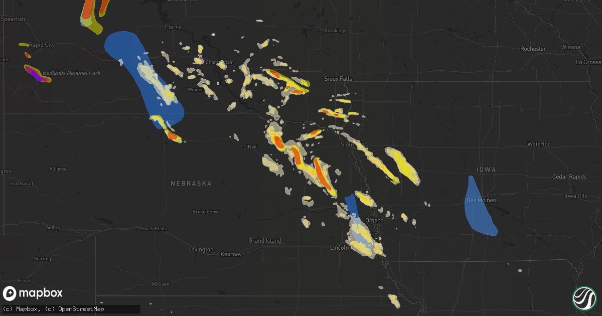
Hail Map on August 30, 2021
Get this storm
August 30 map
$229
one time, instant access
Download today. No call, no setup
Keep the $229
Bought the map and want the full workflow? Apply the entire $229 to a subscription within 7 days. None of it is wasted.
Every map, not just this one
This buys you this map. Subscription and you get every map we run, in the markets you choose from a few cities to whole states to nationwide. Plus real-time alerts the moment a storm fires.
Contact data
Name, contact info, occupancy, even credit band for addresses in the footprint. You go from where it hit to who to call.
Become the source they trust
Unlimited branding weather history reports on demand. You already have the documented answer ready for the property owner, and you are the one who showed up with it.
Property data and RoofTrace estimates
Pull up any address you have got, its value and the exact code rules for that jurisdiction, straight from One Click Code. Then RoofTrace estimates the squares, pitch, and roof value, priced the way you price.
States Impacted by Hail Map on August 30, 2021
Storm reports
Mississippi
| Date | Description |
|---|---|
| 08/30/20213:30 PM CDT | Flooding reported on front st and 14th st. |
| 08/30/20219:45 AM CDT | Emergency manager relayed public report of possible tornado damage at the intersection of coda road and saracennia road. Time estimated. |
New Jersey
| Date | Description |
|---|---|
| 08/30/202112:16 AM CDT | At 515 PM EDT, a severe thunderstorm was located over Cedarville, or 7 miles south of Bridgeton, moving east at 25 mph. HAZARD...60 mph wind gusts and penny size hail. SOURCE...Radar indicated. IMPACT...Damage to roofs, siding, trees, and power lines is possible. Locations impacted include... Vineland, Millville, Bridgeton, Cumberland, Buena, Laurel Lake, Woodbine, Estell Manor, Corbin City, Newport, Leesburg, Dorothy, Bricksboro, Fortesque, Mauricetown, Belleplain Forest, Port Norris, Dividing Creek, Fairton and Cedarville. |
Virginia
| Date | Description |
|---|---|
| 08/30/20216:57 PM CDT | One tree down blocking part of kentuck road. |
| 08/30/20216:54 PM CDT | Trees down along portions of jefferson davis highway. |
| 08/30/20216:53 PM CDT | One tree down along the 3200 block of oak hill road. |
| 08/30/20216:50 PM CDT | One tree down along the 8420 block of kentuck road. |
| 08/30/20216:47 PM CDT | One tree down along the 1880 block of sandy creek road. |
| 08/30/20216:45 PM CDT | One tree down along the 820 block of sportsman road. |
| 08/30/20216:39 PM CDT | One tree down along the 1740 block of stony mill road. |
| 08/30/20216:36 PM CDT | Numerous trees down near hull st and walmsley rd. |
| 08/30/20216:30 PM CDT | Trees down along adkins rd in the vicinity n wagstaff circle. Lanes closed. |
| 08/30/20216:24 PM CDT | Trees down along winterfield rd. |
| 08/30/20216:23 PM CDT | Several trees down along poplar fork road. Time estimated by radar. |
| 08/30/20216:16 PM CDT | Trees down along heritage woods rd. All lanes closed. |
| 08/30/20216:15 PM CDT | Tree downed on old fox trail at millridge pkwy. |
| 08/30/20216:15 PM CDT | Trees down in the vicinity of duval rd. |
| 08/30/20216:11 PM CDT | Numerous trees down around moseley. |
| 08/30/20216:10 PM CDT | Trees down along wilson rd. |
| 08/30/20216:10 PM CDT | Numerous trees down around otterdale and brandermill. |
| 08/30/20215:30 PM CDT | Numerous trees down across central goochland county. Lots of power outages across the area. |
| 08/30/20214:57 PM CDT | A local report indicates 59 MPH wind near BABER PT |
| 08/30/20214:35 PM CDT | 3-inch tree limbs and power poles broken on union mills rd... 1 e of n boston road. Time is radar estimated. |
| 08/30/20214:30 PM CDT | One tree down along the 3500 block of mount view road. |
| 08/30/20213:59 PM CDT | Tree down onto the shoulder of southbound i-95 at mile marker 148.2. |
| 08/30/20213:09 PM CDT | Tree down on a house in the 1500 block of bittersweet lane. |
| 08/30/20212:55 PM CDT | Tree down on riley lane near lake drive. |
| 08/30/20212:50 PM CDT | Tree down on old bust head road near oliver lane. |
| 08/30/20211:56 PM CDT | Multiple reports of trees and wires down in mt. Solon. |
| 08/30/20211:41 PM CDT | Tree and wires down on nazarene church road near jason lane. |
| 08/30/20211:33 PM CDT | Tree down on grindstone road at north river road. |
| 08/30/20215:17 AM CDT | At 1016 PM EDT, severe thunderstorms were located along a line extending from 9 miles northeast of Kempsville to near Fentress to near Sunbury, moving east at 30 mph. HAZARD...60 mph wind gusts. SOURCE...Radar indicated. IMPACT...Expect damage to trees and powerlines. Locations impacted include... Virginia Beach, Currituck, Elizabeth City, Camden, Elizabeth City State University, Grandy, Kempsville, Weeksville, Great Bridge, South Mills, Chesapeake, Fentress, Nixonton, Princess Anne, Shiloh, Back Bay, Indiantown, Morgans Corner, Corolla and Old Trap. |
| 08/30/20214:41 AM CDT | At 940 PM EDT, severe thunderstorms were located along a line extending from Churchland to Downtown Suffolk to near Como, moving east at 25 mph. HAZARD...60 mph wind gusts. SOURCE...Radar indicated. IMPACT...Expect damage to trees and powerlines. Locations impacted include... Virginia Beach, Gatesville, Sunbury, Ocean View, Kempsville, Virginia Wesleyan University, Old Dominion University, Downtown Norfolk, Regent University, Great Bridge, Downtown Suffolk, South Mills, Deep Creek, Downtown Portsmouth, Churchland, Norfolk State University, Norfolk, Chesapeake, Portsmouth and Suffolk. |
| 08/30/20214:23 AM CDT | At 922 PM EDT, a severe thunderstorm was located over Mathews, moving southeast at 25 mph. HAZARD...60 mph wind gusts. SOURCE...Radar indicated. IMPACT...Expect damage to trees and powerlines. Locations impacted include... Mathews, Gwynn, Bavon, Blakes, Mobjack, Diggs, Ruff, Moon, Peary, Cobbs Creek, Laban, Cardinal, Hudgins, Redart, Fort Nonsense, North, Soles, New Point and Port Haywood. |
| 08/30/20214:18 AM CDT | At 918 PM EDT, severe thunderstorms were located along a line extending from near Parksley to near Onancock to 7 miles south of Tangier, moving southeast at 30 mph. HAZARD...60 mph wind gusts. SOURCE...Radar indicated. IMPACT...Expect damage to trees and powerlines. Severe thunderstorms will be near... Onancock, Parksley and Onley around 925 PM EDT. Exmore around 945 PM EDT.Other locations impacted by these severe thunderstorms includeHallwood, Birdsnest, Harborton, Melfa, Mappsville, Jamesville, SilverBeach, Wachapreague, Machipongo and Wardtown.# # |
| 08/30/20213:13 AM CDT | At 812 PM EDT, severe thunderstorms were located along a line extending from Prince George to near Disputanta to Stony Creek, moving southeast at 20 mph. HAZARD...60 mph wind gusts and penny size hail. SOURCE...Radar indicated. IMPACT...Expect damage to trees and powerlines. Locations impacted include... Waverly, Wakefield, Disputanta, Sussex, Dendron, Stony Creek, Homeville, Carson, Booth Fork, Carsley, Newville, Booker, Yale, Lumberton, Ellis Fork, Barham, Littleton, Hilda, Templeton and Prince George Golf. |
| 08/30/20212:47 AM CDT | At 747 PM EDT, a severe thunderstorm was located over Ringgold, or 7 miles southeast of Blairs, moving east at 10 mph. HAZARD...60 mph wind gusts and quarter size hail. SOURCE...Radar indicated. IMPACT...Hail damage to vehicles is expected. Expect wind damage to roofs, siding, and trees. Locations impacted include... Turbeville... Ingram... Elmo... Ringgold... Alton... and Keeling. |
| 08/30/20212:43 AM CDT | At 743 PM EDT, a severe thunderstorm was located near Ettrick, or near Colonial Heights, moving east at 20 mph. HAZARD...60 mph wind gusts. SOURCE...Radar indicated. IMPACT...Expect damage to trees and powerlines. Locations impacted include... Petersburg, Hopewell, Colonial Heights, Virginia State University, Disputanta, Fort Lee, Chester, Prince George, Matoaca, Ettrick, Jordans Point, Birchett Estate, Addison, Jordan Point Country Club, Petersburg National Battlefield, New Bohemia, Richard Bland College and Prince George Golf. |
| 08/30/20212:16 AM CDT | At 716 PM EDT, a severe thunderstorm was located near Moseley, moving east at 15 mph. HAZARD...60 mph wind gusts. SOURCE...Radar indicated. IMPACT...Expect damage to trees and powerlines. Locations impacted include... Richmond, Bon Air, Chester, Bensley, Chesterfield Court House, Bellwood, Chesterfield, Winterpock, Midlothian, Pocahontas State Park, Beach, Drewrys Bluff and Centralia. |
| 08/30/20211:54 AM CDT | At 653 PM EDT, a severe thunderstorm was located over Chula, or near Moseley, moving east at 20 mph. HAZARD...60 mph wind gusts. SOURCE...Radar indicated. IMPACT...Expect damage to trees and powerlines. Locations impacted include... Moseley, Skinquarter, Winterpock and Pilkinton. |
| 08/30/20211:48 AM CDT | At 648 PM EDT, a severe thunderstorm was located over Wilsons, or near Mannboro, moving east at 20 mph. HAZARD...60 mph wind gusts. SOURCE...Radar indicated. IMPACT...Expect damage to trees and powerlines. Locations impacted include... McKenney, Wilsons, Sutherland, Spainville, North Wellville, Ammon, Darvills, Center Star, Church Road, Wellville, Five Forks, Walkers, Hebron, Rocky Run and Ford. |
| 08/30/20211:17 AM CDT | At 617 PM EDT, severe thunderstorms were located along a line extending from near Gum Spring to near Goochland to 6 miles northeast of Trenholm, moving east at 25 mph. HAZARD...60 mph wind gusts and penny size hail. SOURCE...Radar indicated. IMPACT...Expect damage to trees and powerlines. Locations impacted include... Goochland, Ashland, Tuckahoe, Gum Spring, Oilville, Manakin, Montpelier, Sabot, Wyndham, Laurel, Glen Allen, Crozier, Rock Castle, Vontay, Maidens, Three Square, Irwin, Johnsons Springs, Gilman and Fine Creek Mills.# # |
| 08/29/202111:29 PM CDT | At 429 PM EDT, a severe thunderstorm was located near Linton Hall, or 11 miles east of Warrenton, moving southeast at 20 mph. HAZARD...60 mph wind gusts. SOURCE...Radar indicated. IMPACT...Damaging winds will cause some trees and large branches to fall. This could injure those outdoors, as well as damage homes and vehicles. Roadways may become blocked by downed trees. Localized power outages are possible. Unsecured light objects may become projectiles. Locations impacted include... Linton Hall, Dumfries, Independent Hill, Nokesville, Catlett, Calverton, Aden, Heflin, Ruby, Somerville and Bristersburg. |
| 08/29/202111:16 PM CDT | At 416 PM EDT, a severe thunderstorm was located 7 miles north of Brownsburg, or 12 miles northeast of Rockbridge Baths, moving southeast at 5 mph. HAZARD...60 mph wind gusts. SOURCE...Radar indicated. IMPACT...Damaging winds will cause some trees and large branches to fall. This could injure those outdoors, as well as damage homes and vehicles. Roadways may become blocked by downed trees. Localized power outages are possible. Unsecured light objects may become projectiles. Locations impacted include... Greenville, Middlebrook, Summerdean and Spottswood. |
| 08/29/202110:59 PM CDT | At 359 PM EDT, a severe thunderstorm was located near Haymarket, or near Warrenton, moving southeast at 15 mph. HAZARD...60 mph wind gusts. SOURCE...Radar indicated. IMPACT...Damaging winds will cause some trees and large branches to fall. This could injure those outdoors, as well as damage homes and vehicles. Roadways may become blocked by downed trees. Localized power outages are possible. Unsecured light objects may become projectiles. Locations impacted include... Warrenton, Linton Hall, Manassas, Gainesville, New Baltimore, Nokesville, Catlett, Calverton, Midland, Broken Hill, Auburn, Casanova, Greenwich and Aden. |
| 08/29/20219:39 PM CDT | At 239 PM EDT, severe thunderstorms were located along a line extending from near Dale Enterprise to 6 miles west of Bridgewater, moving southeast at 15 mph. HAZARD...60 mph wind gusts. SOURCE...Radar indicated. IMPACT...Damaging winds will cause some trees and large branches to fall. This could injure those outdoors, as well as damage homes and vehicles. Roadways may become blocked by downed trees. Localized power outages are possible. Unsecured light objects may become projectiles. Locations impacted include... Harrisonburg, Bridgewater, Grottoes, Massanutten, Dale Enterprise, Verona, Elkton, Weyers Cave, Dayton, Mount Sidney, Mount Crawford, Penn Laird, Port Republic, Moscow, Clover Hill, Keezletown, Mcgaheysville, Hinton, Montevideo and Pleasant Valley. |
| 08/29/20219:08 PM CDT | Trees down near greenbrier. |
| 08/29/20218:35 PM CDT | Via social media. Trees downed at buckley road and us-14 clayton hwy. |
| 08/29/20218:30 PM CDT | Trees down across portions of southampton county. |
| 08/29/20217:57 PM CDT | Tree down on power lines. |
| 08/29/20217:45 PM CDT | Tree down at claibornetown road at dry bread rd. |
| 08/29/20217:20 PM CDT | Trees down along loving union rd and surrounding portions of southern prince george. |
| 08/29/20217:18 PM CDT | Trees down along robin rd. South bound lanes closed. |
Nebraska
| Date | Description |
|---|---|
| 08/30/20216:00 PM CDT | Delayed report of several large tree branches down ranging from 2 to 12 inches in diameter. Also reported at least 5 windows broke out of vehicles due to blowing gravel |
| 08/30/20216:55 AM CDT | At 1154 PM CDT, a severe thunderstorm was located 11 miles northeast of Valentine National Wildlife Refuge, or 18 miles south of Valentine, moving southeast at 20 mph. HAZARD...60 mph wind gusts and quarter size hail. SOURCE...Radar indicated. IMPACT...Hail damage to vehicles is expected. Expect wind damage to roofs, siding, and trees. Locations impacted include... Johnstown and Wood Lake. This includes the following highways... Highway 20 between mile markers 208 and 239. Highway 83 between mile markers 193 and 199. |
| 08/30/20216:54 AM CDT | At 1153 PM CDT, a severe thunderstorm was located over Pierce, or 10 miles northwest of Norfolk, moving southeast at 20 mph. HAZARD...60 mph wind gusts and quarter size hail. SOURCE...Radar indicated. IMPACT...Hail damage to vehicles is expected. Expect wind damage to roofs, siding, and trees. Locations impacted include... Hadar, Norfolk and Hoskins. |
| 08/30/20216:42 AM CDT | At 1142 PM CDT, a severe thunderstorm was located 5 miles southwest of Wisner, or 23 miles east of Norfolk, moving southeast at 30 mph. HAZARD...Ping pong ball size hail and 60 mph wind gusts. SOURCE...Radar indicated. IMPACT...People and animals outdoors will be injured. Expect hail damage to roofs, siding, windows, and vehicles. Expect wind damage to roofs, siding, and trees. This severe thunderstorm will be near... Beemer around 1155 PM CDT.Other locations in the path of this severe thunderstorm include WestPoint. |
| 08/30/20216:35 AM CDT | At 1134 PM CDT, a severe thunderstorm was located near Verdigre, or 28 miles east of O'Neill, moving southeast at 20 mph. HAZARD...60 mph wind gusts and quarter size hail. SOURCE...Radar indicated. IMPACT...Hail damage to vehicles is expected. Expect wind damage to roofs, siding, and trees. This severe thunderstorm will be near... Verdigre around 1145 PM CDT.Other locations in the path of this severe thunderstorm includeCreighton. |
| 08/30/20216:23 AM CDT | Delayed entry. |
| 08/30/20216:11 AM CDT | At 1110 PM CDT, a severe thunderstorm was located 7 miles south of Valentine, moving southeast at 15 mph. HAZARD...Golf ball size hail and 60 mph wind gusts. SOURCE...Radar indicated. IMPACT...People and animals outdoors will be injured. Expect hail damage to roofs, siding, windows, and vehicles. Expect wind damage to roofs, siding, and trees. Locations impacted include... Valentine, Valentine National Wildlife Refuge, Highway 97 crossing the Niobrara River, Big Alkali Lake State Wildlife Management Area and Schlagel Creek State Wildlife Management Area.This includes the following highways... Highway 20 between mile markers 191 and 220. Highway 97 between mile markers 129 and 141. Highway 83 between mile markers 186 and 218. Highway 12 between mile markers 1 and 3. |
| 08/30/20216:06 AM CDT | At 1105 PM CDT, a severe thunderstorm was located over Osmond, or 22 miles northwest of Norfolk, moving southeast at 20 mph. HAZARD...Golf ball size hail and 60 mph wind gusts. SOURCE...Radar indicated. IMPACT...People and animals outdoors will be injured. Expect hail damage to roofs, siding, windows, and vehicles. Expect wind damage to roofs, siding, and trees. Locations impacted include... Pierce and Hadar. |
| 08/30/20216:01 AM CDT | At 1101 PM CDT, a severe thunderstorm was located over Winside, or 16 miles northeast of Norfolk, moving southeast at 20 mph. HAZARD...Golf ball size hail and 60 mph wind gusts. SOURCE...Radar indicated. IMPACT...People and animals outdoors will be injured. Expect hail damage to roofs, siding, windows, and vehicles. Expect wind damage to roofs, siding, and trees. Locations impacted include... Pilger. |
| 08/30/20215:54 AM CDT | At 1053 PM CDT, a severe thunderstorm was located west of Hartington, or 18 miles south of Yankton, moving east at 30 mph. HAZARD...60 mph wind gusts and quarter size hail. SOURCE...Radar indicated. IMPACT...Hail damage to vehicles is expected. Expect wind damage to roofs, siding, and trees. This severe thunderstorm will be near... Wynot around 1105 PM CDT. |
| 08/30/20215:31 AM CDT | At 1031 PM CDT, a severe thunderstorm was located over Carroll, or 19 miles northeast of Norfolk, moving southeast at 25 mph. HAZARD...60 mph wind gusts and quarter size hail. SOURCE...Radar indicated. IMPACT...Hail damage to vehicles is expected. Expect wind damage to roofs, siding, and trees. This severe thunderstorm will be near... Wayne around 1050 PM CDT.Other locations in the path of this severe thunderstorm includeWakefield. |
| 08/30/20215:29 AM CDT | At 1028 PM CDT, a severe thunderstorm was located 6 miles northwest of Osmond, or 30 miles south of Lewis And Clark State Recreation Area, moving southeast at 20 mph. HAZARD...60 mph wind gusts and half dollar size hail. SOURCE...Radar indicated. IMPACT...Hail damage to vehicles is expected. Expect wind damage to roofs, siding, and trees. This severe thunderstorm will be near... Osmond and Wausa around 1040 PM CDT.Other locations in the path of this severe thunderstorm includeRandolph. |
| 08/30/20212:10 AM CDT | Emergency manager relayed report of peak wind gusts near 60 mph in louisville. |
| 08/30/20211:45 AM CDT | A local report indicates 60 MPH wind near 4 N GRETNA |
| 08/30/20211:35 AM CDT | Peak wind gust of 58 mph was measured at the office. |
| 08/30/20211:33 AM CDT | A local report indicates 58 MPH wind near 1 WNW VALLEY |
| 08/30/20211:07 AM CDT | Trained spotter estimated peak wind gust of 70 to 80 mph. |
| 08/30/202112:43 AM CDT | Report from mping: quarter |
| 08/30/202112:40 AM CDT | Trained spotter sent in a picture of quarter size hail in hadar. |
| 08/30/202112:30 AM CDT | Power also out. |
| 08/30/202112:17 AM CDT | 8 foot diameter tree blown down... Which took out a utility pole and power line. |
| 08/30/202112:05 AM CDT | Corrects previous hail report from 8 se stanton. Public reported via social media golf ball sized hail. |
| 08/29/202111:50 PM CDT | Public reported via social tennis ball size hail. |
| 08/29/202111:45 PM CDT | Trained spotter reported golf ball sized hail in verdigre. |
| 08/29/202111:45 PM CDT | Emergency manager reported golf ball size hail. |
| 08/29/202111:42 PM CDT | A local report indicates 1.00 inch wind near 2 WNW PILGER |
| 08/29/202111:40 PM CDT | Public reported via social media 2.5 inch hail north of stanton. |
| 08/29/202111:25 PM CDT | Delayed report |
| 08/29/202111:15 PM CDT | A local report indicates 1.75 inch wind near 5 ENE FORDYCE |
| 08/29/202111:11 PM CDT | Public reported via social media tennis ball size hail. |
| 08/29/202111:03 PM CDT | Quarter sized hail. |
| 08/29/202111:00 PM CDT | Delayed report |
| 08/29/202110:58 PM CDT | Report from mping: half dollar |
| 08/29/202110:55 PM CDT | Public reported via social media 1.5 inch hail in pierce. |
| 08/29/202110:50 PM CDT | Public estimated quarter sized hail falling in osmond. |
| 08/29/202110:37 PM CDT | Trained spotter reported 1 inch hail. |
| 08/29/20219:50 PM CDT | Delayed report. Time estimated by radar. |
Alabama
| Date | Description |
|---|---|
| 08/30/20213:45 PM CDT | Nws storm survey personnel found damage consistent with a brief ef-0 tornado near red rd... Generally east southeast of tuskegee... Al. A few trees and tree limbs were |
| 08/30/20212:10 PM CDT | Fire department reported a tornado at cr 3304 and highway 231. No damage reported at this time. |
| 08/30/20212:06 PM CDT | Corrects previous tornado report from 1 wnw antioch. Fire department reported a tornado at cr 3304 and highway 231. No damage reported at this time. Several videos were |
| 08/30/20212:02 PM CDT | Nws storm survey personnel found damage consistent with an ef-0 tornado in the antioch community southeast of troy... Al. The tornado touched down near white water cree |
| 08/30/20211:34 PM CDT | Trees down on evergreen rd. Probable tornado with debris signature noted on radar. |
| 08/30/20211:25 PM CDT | The tornado likely began near society hill rd south of oregon rd where a mobile home was rolled and another home lost most of its roof. The tornado continued northeast |
| 08/30/202112:32 PM CDT | Tree through a house on ellison ave. |
| 08/30/202112:29 PM CDT | Tree and power line damage reported off of lister dairy rd. Pictures via social media. |
| 08/30/202112:29 PM CDT | Damage reported with trees down on boboshilly circle. |
| 08/30/202112:22 PM CDT | *** 1 inj *** 18 wheeler flipped in a parking lot. The driver was injured and taken to the hospital. |
| 08/30/202112:20 PM CDT | *** 3 inj *** the tornado began at the intersection of highway 158 and 43 where trees were uprooted and a few pines snapped. As the tornado moved northeast along hwy 43 |
| 08/29/20219:33 PM CDT | At 233 PM EDT, a severe thunderstorm was located over Holland, or 9 miles south of Summerville, moving northwest at 20 mph. HAZARD...60 mph wind gusts and quarter size hail. SOURCE...Radar indicated. IMPACT...Hail damage to vehicles is expected. Expect wind damage to roofs, siding, and trees. Locations impacted include... Summerville, Trion, Lyerly, Menlo, Cloudland, Berryton, Chattoogaville, James H. Floyd State Park and Holland. |
North Dakota
| Date | Description |
|---|---|
| 08/30/20216:50 PM CDT | Report from august 30th storm. Not much wind... But large hail punched many holes through the metal roofs on pole barns. Five vehicles were substantially damaged. Hail |
| 08/30/20216:05 PM CDT | Report from august 30th storm. Time estimated from radar. Hailed for about one half hour. Crop was destroyed. |
| 08/30/20216:05 PM CDT | Report from august 30 storms. Tennis ball size hail combined with 60 mph wind gusts to cause extensive damage. All windows were broken out on north side of two homes. D |
| 08/30/20216:05 PM CDT | Report from august 30 storm. Crops were damaged and some windows were broken. Additional neighbors also had broken windows. |
| 08/30/20215:59 PM CDT | Photo relayed through social media... Including smashed windshield of car. Time estimated from radar but report included very large hail along highway 8 between hetting |
| 08/30/20215:57 PM CDT | Report from august 30 storm. Wind gust was measured while helping an individual in an overturned semi-truck. Winds were estimated to be even higher when the semi-truck |
| 08/30/20215:56 PM CDT | Social media report of overturned semi on highway 21 east of flasher at 5:56 pm cdt. Location estimated based on radar data at time of report. |
| 08/30/20215:55 PM CDT | Report from august 30 storms. Mainly dimes... A few quarters. |
| 08/30/20215:53 PM CDT | Time estimated from radar. Photos relayed through broadcast media. |
| 08/30/20215:50 PM CDT | Delayed report... Photo relayed through broadcast media. |
| 08/30/20215:34 PM CDT | Photo relayed through broadcast media. Time estimated from radar. |
| 08/30/20215:30 PM CDT | Report from august 30 storm. A few golf balls fell. Not much wind. |
| 08/30/20215:11 PM CDT | Hail ongoing for 15 minutes at the time of the call. No wind. 0.60 inches of rain. |
| 08/30/20214:55 PM CDT | Photo relayed through social media. |
| 08/30/20214:51 PM CDT | Report from mping: hen egg |
| 08/30/20214:50 PM CDT | Hail report from august 30 storm. Not much wind with the storm at this location. |
| 08/30/20214:18 PM CDT | Report from mping: quarter |
| 08/30/20214:05 PM CDT | Report from august 30 storm. Hail was between hen egg and tennis ball in size. Yard was white with hail... As it hailed for about one-half hour. 2.75 inches of rain als |
| 08/30/20214:00 PM CDT | Report from august 30 storm. Multiple vehicles were hail damaged. Canola crop nearby was severely damaged. |
| 08/30/20212:25 PM CDT | Report from august 30th storm. Various residents of the area were greatly damaged from baseball size hail. A couple of campers were damaged... Windows on homes were bro |
| 08/30/20212:24 PM CDT | Also estimated 50 mph winds. |
| 08/30/20212:11 PM CDT | A local report indicates 1.75 inch wind near 4 NE NEW SALEM |
| 08/30/20211:45 PM CDT | Report from august 30th. Hail damage a pickup truck. |
| 08/30/20211:40 PM CDT | Report from august 30 storm. |
| 08/30/20211:30 PM CDT | On highway 200 between beulah and hazen. Relayed through broadcast media. |
| 08/30/202112:14 PM CDT | Relayed through social media. Time estimated from radar. |
| 08/30/202111:00 AM CDT | Report from august 30. An unattached porch was tipped over. |
| 08/30/20217:58 AM CDT | At 1258 PM CDT, a severe thunderstorm was located 6 miles south of Hannover, or 24 miles northeast of Glen Ullin, moving southeast at 10 mph. HAZARD...Ping pong ball size hail and 60 mph wind gusts. SOURCE...Radar indicated. IMPACT...People and animals outdoors will be injured. Expect hail damage to roofs, siding, windows, and vehicles. Expect wind damage to roofs, siding, and trees. Locations impacted include... Center, Hannover, Sweet Briar Lake and Nelson Lake. |
| 08/30/20217:13 AM CDT | At 1212 PM CDT, a severe thunderstorm was located near Hannover, or 16 miles southeast of Beulah, moving southeast at 15 mph. HAZARD...Ping pong ball size hail and 60 mph wind gusts. SOURCE...Radar indicated. IMPACT...People and animals outdoors will be injured. Expect hail damage to roofs, siding, windows, and vehicles. Expect wind damage to roofs, siding, and trees. Locations impacted include... Hannover. |
| 08/30/20216:28 AM CDT | At 1127 AM CDT, a severe thunderstorm was located 9 miles west of Hannover, or 11 miles southeast of Beulah, and is nearly stationary. HAZARD...Golf ball size hail and 60 mph wind gusts. SOURCE...Radar indicated. IMPACT...People and animals outdoors will be injured. Expect hail damage to roofs, siding, windows, and vehicles. Expect wind damage to roofs, siding, and trees. Locations possibly impacted include... Hannover. |
| 08/30/20215:54 AM CDT | At 1054 AM CDT, a severe thunderstorm was located 9 miles south of Hazen, or 10 miles southeast of Beulah, moving southeast at 10 mph. HAZARD...60 mph wind gusts and half dollar size hail. SOURCE...Radar indicated. IMPACT...Hail damage to vehicles is expected. Expect wind damage to roofs, siding, and trees. This severe thunderstorm will remain over mainly rural areas of western Oliver County. |
| 08/30/20211:49 AM CDT | At 649 PM CDT/549 PM MDT/, severe thunderstorms were located along a line extending from 5 miles north of Solen to 7 miles west of Shields, moving southeast at 15 mph. HAZARD...60 mph wind gusts and quarter size hail. SOURCE...Radar indicated. IMPACT...Hail damage to vehicles is expected. Expect wind damage to roofs, siding, and trees. Severe thunderstorms will be near... Solen around 700 PM CDT.Other locations in the path of these severe thunderstorms includeCannon Ball, Fort Yates, Selfridge and Prairie Knights Resort. |
| 08/30/20211:02 AM CDT | At 601 PM CDT/501 PM MDT/, a severe thunderstorm was located 5 miles northeast of Flasher, or 25 miles southwest of Mandan, moving southeast at 15 mph. THIS IS A DESTRUCTIVE STORM FOR THE FLASHER AND BREIEN AREAS. HAZARD...Baseball size hail and 60 mph wind gusts. SOURCE...Radar indicated. IMPACT...People and animals outdoors will be severely injured. Expect shattered windows, extensive damage to roofs, siding, and vehicles. Locations impacted include... Solen and Breien. |
| 08/30/202112:54 AM CDT | At 553 PM CDT/453 PM MDT/, a severe thunderstorm was located 8 miles east of Heart Butte Dam, or 16 miles southeast of Glen Ullin, moving southeast at 15 mph. HAZARD...60 mph wind gusts and half dollar size hail. SOURCE...Radar indicated. IMPACT...Hail damage to vehicles is expected. Expect wind damage to roofs, siding, and trees. Locations impacted include... Carson. |
| 08/30/202112:53 AM CDT | At 553 PM MDT, a severe thunderstorm was located 4 miles northeast of Haynes, or 11 miles east of Hettinger, moving southeast at 20 mph. HAZARD...Tennis ball size hail and 60 mph wind gusts. SOURCE...Radar indicated. IMPACT...People and animals outdoors will be injured. Expect hail damage to roofs, siding, windows, and vehicles. Expect wind damage to roofs, siding, and trees. This severe thunderstorm will be near... White Butte around 610 PM MDT.Other locations in the path of this severe thunderstorm includeLemmon, Shadehill Reservoir and Shadehill. |
| 08/30/202112:43 AM CDT | At 543 PM CDT, severe thunderstorms were located along a line extending from 7 miles southeast of Roseglen to near Stanton, and are nearly stationary. HAZARD...Half dollar size hail. SOURCE...Radar indicated. IMPACT...Damage to vehicles is expected. These severe thunderstorms will remain over mainly rural areas of central McLean and northeastern Mercer Counties, including the following locations... Dakota Waters Recreation Area and Emmet. |
| 08/30/202112:30 AM CDT | At 529 PM MDT, a severe thunderstorm was located 8 miles north of Haynes, or 10 miles northeast of Hettinger, moving south at 15 mph. HAZARD...Tennis ball size hail and 60 mph wind gusts. SOURCE...Radar indicated. IMPACT...People and animals outdoors will be injured. Expect hail damage to roofs, siding, windows, and vehicles. Expect wind damage to roofs, siding, and trees. Locations impacted include... Haynes. |
| 08/30/202112:28 AM CDT | At 528 PM CDT, a severe thunderstorm was located 15 miles north of Glen Ullin, moving east at 25 mph. HAZARD...60 mph wind gusts and half dollar size hail. SOURCE...Radar indicated. IMPACT...Hail damage to vehicles is expected. Expect wind damage to roofs, siding, and trees. This severe thunderstorm will remain over mainly rural areas of southwestern Oliver and south central Mercer Counties. |
| 08/30/202112:00 AM CDT | At 500 PM CDT/400 PM MDT/, a severe thunderstorm was located 7 miles south of Fish Creek Dam, or 23 miles southwest of Mandan, moving southeast at 5 mph. HAZARD...Two inch hail and 60 mph wind gusts. SOURCE...Radar indicated. IMPACT...People and animals outdoors will be injured. Expect hail damage to roofs, siding, windows, and vehicles. Expect wind damage to roofs, siding, and trees. Locations impacted include... Flasher. |
| 08/29/202111:43 PM CDT | At 443 PM CDT/343 PM MDT/, a severe thunderstorm was located near Glen Ullin, moving southeast at 10 mph. HAZARD...Ping pong ball size hail and 60 mph wind gusts. SOURCE...Radar indicated. IMPACT...People and animals outdoors will be injured. Expect hail damage to roofs, siding, windows, and vehicles. Expect wind damage to roofs, siding, and trees. Locations impacted include... Almont. |
| 08/29/202111:29 PM CDT | At 429 PM MDT, a severe thunderstorm was located near Mott, moving southeast at 15 mph. THIS IS A DESTRUCTIVE STORM FOR SOUTHEASTERN HETTINGER AND NORTHEASTERN ADAMS COUNTIES. HAZARD...Baseball size hail and 60 mph wind gusts. SOURCE...Radar indicated. IMPACT...People and animals outdoors will be severely injured. Expect shattered windows, extensive damage to roofs, siding, and vehicles. This severe thunderstorm will remain over mainly rural areas of southeastern Hettinger and northeastern Adams Counties. |
| 08/29/202111:16 PM CDT | At 415 PM CDT, a severe thunderstorm was located 8 miles southeast of Fish Creek Dam, or 16 miles southwest of Mandan, moving southeast at 5 mph. HAZARD...Golf ball size hail and 60 mph wind gusts. SOURCE...Radar indicated. IMPACT...People and animals outdoors will be injured. Expect hail damage to roofs, siding, windows, and vehicles. Expect wind damage to roofs, siding, and trees. Locations impacted include... St. Anthony. |
| 08/29/202110:48 PM CDT | At 348 PM CDT, a severe thunderstorm was located 8 miles east of Roseglen, or 12 miles northwest of Garrison, moving east at 25 mph. HAZARD...60 mph wind gusts and half dollar size hail. SOURCE...Radar indicated. IMPACT...Hail damage to vehicles is expected. Expect wind damage to roofs, siding, and trees. Locations impacted include... Garrison and Max. |
| 08/29/202110:32 PM CDT | At 332 PM MDT, a severe thunderstorm was located 5 miles north of Regent, or 12 miles northwest of Mott, moving southeast at 10 mph. HAZARD...Ping pong ball size hail and 60 mph wind gusts. SOURCE...Radar indicated. IMPACT...People and animals outdoors will be injured. Expect hail damage to roofs, siding, windows, and vehicles. Expect wind damage to roofs, siding, and trees. This severe thunderstorm will be near... Regent around 350 PM MDT.Other locations in the path of this severe thunderstorm include Mott. |
| 08/29/202110:15 PM CDT | At 315 PM CDT, a severe thunderstorm was located over Fish Creek Dam, or 15 miles west of Mandan, moving southeast at 15 mph. HAZARD...Golf ball size hail and 60 mph wind gusts. SOURCE...Radar indicated. IMPACT...People and animals outdoors will be injured. Expect hail damage to roofs, siding, windows, and vehicles. Expect wind damage to roofs, siding, and trees. Locations impacted include... St. Anthony. |
| 08/29/20219:17 PM CDT | At 215 PM CDT, a severe thunderstorm was located near New Salem, or 19 miles west of Mandan, moving southeast at 10 mph. THIS IS A DESTRUCTIVE STORM FOR CENTRAL MORTON COUNTY INCLUDING SWEET BRIAR LAKE AND JUDSON. HAZARD...Baseball size hail and 60 mph wind gusts. SOURCE...Radar indicated. IMPACT...People and animals outdoors will be severely injured. Expect shattered windows, extensive damage to roofs, siding, and vehicles. Locations impacted include... Sweet Briar Lake, Judson, and Fish Creek Dam. |
| 08/29/20218:44 PM CDT | At 144 PM CDT, a severe thunderstorm was located over Hazen, or 7 miles east of Beulah, moving southeast at 10 mph. HAZARD...Ping pong ball size hail and 60 mph wind gusts. SOURCE...Radar indicated. IMPACT...People and animals outdoors will be injured. Expect hail damage to roofs, siding, windows, and vehicles. Expect wind damage to roofs, siding, and trees. This severe thunderstorm will remain over mainly rural areas of northwestern Oliver and central Mercer Counties. |
| 08/29/20218:42 PM CDT | At 142 PM CDT, a severe thunderstorm was located 7 miles northeast of New Salem, or 20 miles west of Mandan, moving southeast at 10 mph. HAZARD...Two inch hail. SOURCE...Radar indicated. IMPACT...People and animals outdoors will be injured. Expect damage to roofs, siding, windows, and vehicles. This severe thunderstorm will remain over mainly rural areas of north central Morton and south central Oliver Counties, including the following locations... Sweet Briar Lake, Judson and Crown Butte Lake. |
| 08/29/20218:02 PM CDT | At 101 PM CDT, a severe thunderstorm was located near Hazen, or 5 miles northeast of Beulah, moving southeast at 10 mph. HAZARD...Ping pong ball size hail and 60 mph wind gusts. SOURCE...Radar indicated. IMPACT...People and animals outdoors will be injured. Expect hail damage to roofs, siding, windows, and vehicles. Expect wind damage to roofs, siding, and trees. This severe thunderstorm will be near... Hazen around 115 PM CDT. |
| 08/29/20217:15 PM CDT | Report from august 30th storm. Wind driven hail near the hiddenwood hunt teepee site shredded a very nice looking field of eight foot high corn down to knee high. |
| 08/29/20217:15 PM CDT | Hail ranging in size from marble to baseball fell from 600 to 615 pm mdt. Report relayed by emergency management. |
Kentucky
| Date | Description |
|---|---|
| 08/30/202112:00 PM CDT | Roof damage to a home... Including bricks from the chimney and shingles. Some of the bricks damaged the roof and created a hole. Several trees down in the immediate are |
| 08/30/20218:50 AM CDT | Tree reported down on sycamore and 7th. Time estimated from radar. |
Kansas
| Date | Description |
|---|---|
| 08/30/20212:57 AM CDT | At 756 PM CDT, a severe thunderstorm was located 5 miles southwest of Oberlin, moving east at 30 mph. HAZARD...60 mph wind gusts and nickel size hail. SOURCE...Radar indicated. IMPACT...Expect damage to roofs, siding, and trees. This severe thunderstorm will be near... Oberlin around 805 PM CDT. Dresden around 815 PM CDT.Other locations in the path of this severe thunderstorm includeJennings and Clayton. |
| 08/30/20212:18 AM CDT | At 718 PM CDT, a severe thunderstorm was located 4 miles south of Ludell, or 4 miles east of Atwood, moving east at 35 mph. HAZARD...60 mph wind gusts and quarter size hail. SOURCE...Radar indicated. IMPACT...Hail damage to vehicles is expected. Expect wind damage to roofs, siding, and trees. Locations impacted include... Oberlin. |
| 08/30/202112:30 AM CDT | At 530 PM CDT, a severe thunderstorm was located 6 miles northwest of St. Francis, moving east at 35 mph. HAZARD...60 mph wind gusts and nickel size hail. SOURCE...Radar indicated. IMPACT...Expect damage to roofs, siding, and trees. This severe thunderstorm will be near... St. Francis around 540 PM CDT.Other locations in the path of this severe thunderstorm include BirdCity. |
| 08/29/20218:54 PM CDT | Wunderground stationkkscolby28 reported a 64 mph wind gust. |
South Dakota
| Date | Description |
|---|---|
| 08/30/20216:55 PM CDT | A local report indicates 1.75 inch wind near 10 SSE MEADOW |
| 08/30/20216:40 PM CDT | A local report indicates 74 MPH wind near 7 SSE MEADOW |
| 08/30/20216:35 PM CDT | A local report indicates 1.00 inch wind near 7 SW FAIRBURN |
| 08/30/20216:15 PM CDT | A local report indicates 2.75 inch wind near 4 ENE MEADOW |
| 08/30/20215:56 PM CDT | A local report indicates 1.00 inch wind near 8 SE CUSTER |
| 08/30/20215:48 PM CDT | A local report indicates 1.00 inch wind near 1 S CLAYTON |
| 08/30/20215:40 PM CDT | Lasted about 10 minutes |
| 08/30/20215:38 PM CDT | Hail up to the size of half dollars... And very little rainfall. |
| 08/30/20215:30 PM CDT | A lot of damage at the mt rushmore koa |
| 08/30/20215:27 PM CDT | Light rain and mostly small hail... But a few stones as big as golf balls. |
| 08/30/20215:25 PM CDT | A local report indicates 1.75 inch wind near 1 E HILL CITY |
| 08/30/20215:18 PM CDT | Picture via social media. Time estimated via radar... Location estimated via general location on social media. |
| 08/30/20215:14 PM CDT | Lasted 4 minutes |
| 08/30/20215:05 PM CDT | Delayed report. Golf ball up to tennis ball sized hail based on observation and windshield damage. Lasted 30 minutes. Strong winds but unsure of speed. Screens blown ou |
| 08/30/20215:03 PM CDT | Lots of variable sized hail and heavy rain... With biggest stones as big as quarters. |
| 08/30/20214:41 PM CDT | Quarter sized hail and heavy rain. |
| 08/30/20214:30 PM CDT | A local report indicates 1.00 inch wind near 2 ENE SILVER CITY |
| 08/30/20214:10 PM CDT | A local report indicates 1.00 inch wind near 5 SW NEMO |
| 08/30/20216:29 AM CDT | At 1129 PM MDT/1229 AM CDT/, severe thunderstorms were located along a line extending from 6 miles south of Van Metre to 5 miles north of George Town, moving southeast at 35 mph. HAZARD...60 mph wind gusts and penny size hail. SOURCE...Radar indicated. IMPACT...Expect damage to roofs, siding, and trees. Locations impacted include... White River, Parmelee, Long Valley, Norris, Belvidere, Cedar Butte, Black Pipe, Swift Bear, George Town, Horse Creek, Corn Creek and Intersection of Highway 73 and White River.This includes Interstate 90 in South Dakota between Mile Markers 156and 174. |
| 08/30/20216:19 AM CDT | At 1118 PM CDT, a severe thunderstorm was located near Woonsocket, or 18 miles south of Huron, moving northeast at 20 mph. HAZARD...60 mph wind gusts and half dollar size hail. SOURCE...Radar indicated. IMPACT...Hail damage to vehicles is expected. Expect wind damage to roofs, siding, and trees. This severe thunderstorm will remain over mainly rural areas of northwestern Sanborn, south central Beadle and east central Jerauld Counties. |
| 08/30/20216:14 AM CDT | At 1113 PM CDT, a severe thunderstorm was located near Joe Creek Rec Area, or 8 miles west of Lower Brule, moving north at 15 mph. HAZARD...60 mph wind gusts and quarter size hail. SOURCE...Radar indicated. IMPACT...Hail damage to vehicles is expected. Expect wind damage to roofs, siding, and trees. This severe thunderstorm will be near... Joe Creek Rec Area around 1130 PM CDT.Other locations in the path of this severe thunderstorm include WestBend Rec Area. |
| 08/30/20216:10 AM CDT | At 1109 PM CDT, a severe thunderstorm was located 8 miles southeast of Van Metre, or 15 miles north of Murdo, and is nearly stationary. HAZARD...60 mph wind gusts and quarter size hail. SOURCE...Radar indicated. IMPACT...Hail damage to vehicles is expected. Expect wind damage to roofs, siding, and trees. This severe thunderstorm will remain over mainly rural areas of north central Jones County. |
| 08/30/20215:29 AM CDT | At 1028 PM CDT, a severe thunderstorm was located 7 miles west of Valentine, moving southeast at 15 mph. HAZARD...Golf ball size hail and 60 mph wind gusts. SOURCE...Radar indicated. IMPACT...People and animals outdoors will be injured. Expect hail damage to roofs, siding, windows, and vehicles. Expect wind damage to roofs, siding, and trees. Locations impacted include... Valentine, Crookston, Highway 97 crossing the Niobrara River and Schlagel Creek State Wildlife Management Area.This includes the following highways... Highway 20 between mile markers 182 and 205. Highway 97 between mile markers 131 and 141. Highway 83 between mile markers 197 and 222. Highway 12 between mile markers 1 and 13. |
| 08/30/20214:47 AM CDT | At 947 PM CDT, a severe thunderstorm was located 8 miles west of Valentine, moving east at 15 mph. HAZARD...60 mph wind gusts and quarter size hail. SOURCE...Radar indicated. IMPACT...Hail damage to vehicles is expected. Expect wind damage to roofs, siding, and trees. Locations impacted include... Valentine, Crookston and Highway 97 crossing the Niobrara River. This includes the following highways... Highway 20 between mile markers 181 and 210. Highway 97 between mile markers 131 and 141. Highway 83 between mile markers 204 and 222. Highway 12 between mile markers 1 and 12. |
| 08/30/20214:26 AM CDT | At 926 PM MDT, a severe thunderstorm was located 12 miles northeast of Creighton, or 28 miles northwest of Philip, moving southeast at 25 mph. HAZARD...Quarter size hail. SOURCE...Radar indicated. IMPACT...Damage to vehicles is expected. Locations impacted include... Grindstone, Creighton and Grindstone Butte. This includes Interstate 90 in South Dakota between Mile Markers 101and 103. |
| 08/30/20214:08 AM CDT | At 908 PM MDT, a severe thunderstorm was located 9 miles southeast of Date, or 30 miles northwest of Faith, moving south at 15 mph. HAZARD...Ping pong ball size hail and 60 mph wind gusts. SOURCE...Radar indicated. IMPACT...People and animals outdoors will be injured. Expect hail damage to roofs, siding, windows, and vehicles. Expect wind damage to roofs, siding, and trees. Locations impacted include... Maurine. |
| 08/30/20213:46 AM CDT | At 846 PM MDT, a severe thunderstorm was located 3 miles northeast of Bridger, or 31 miles south of Faith, moving south at 15 mph. HAZARD...Golf ball size hail and 60 mph wind gusts. SOURCE...Radar indicated. IMPACT...People and animals outdoors will be injured. Expect hail damage to roofs, siding, windows, and vehicles. Expect wind damage to roofs, siding, and trees. This severe thunderstorm will be near... Bridger around 900 PM MDT. |
| 08/30/20213:40 AM CDT | At 840 PM MDT, a severe thunderstorm was located near Red Elm, or 9 miles west of Dupree, moving south at 10 mph. HAZARD...60 mph wind gusts and quarter size hail. SOURCE...Radar indicated. IMPACT...Hail damage to vehicles is expected. Expect wind damage to roofs, siding, and trees. This severe thunderstorm will be near... Red Elm around 900 PM MDT. |
| 08/30/20213:30 AM CDT | At 829 PM MDT, a severe thunderstorm was located 4 miles southwest of Plainview, or 32 miles south of Faith, moving south at 20 mph. HAZARD...Golf ball size hail and 60 mph wind gusts. SOURCE...Radar indicated. IMPACT...People and animals outdoors will be injured. Expect hail damage to roofs, siding, windows, and vehicles. Expect wind damage to roofs, siding, and trees. Locations impacted include... Creighton. |
| 08/30/20213:15 AM CDT | Delayed report. Power out for about three hours. Also two inches of rainfall. Time estimated from radar. |
| 08/30/20212:57 AM CDT | At 757 PM CDT, a severe thunderstorm was located near Dolton, or 14 miles west of Parker, moving east at 30 mph. HAZARD...60 mph wind gusts and quarter size hail. SOURCE...Radar indicated. IMPACT...Hail damage to vehicles is expected. Expect wind damage to roofs, siding, and trees. This severe thunderstorm will be near... Freeman around 800 PM CDT. Marion and Monroe around 815 PM CDT. Parker around 830 PM CDT. Hurley around 840 PM CDT. |
| 08/30/20212:41 AM CDT | At 741 PM MDT, severe thunderstorms were located along a line extending from 5 miles east of Red Scaffold to 9 miles southwest of Durkee Lake, moving south at 15 mph. HAZARD...Two inch hail and 70 mph wind gusts. SOURCE...Satellite and lightning indicated. IMPACT...People and animals outdoors will be injured. Expect hail damage to roofs, siding, windows, and vehicles. Expect considerable tree damage. Wind damage is also likely to mobile homes, roofs, and outbuildings. Severe thunderstorms will be near... Red Scaffold around 750 PM MDT.Other locations in the path of these severe thunderstorms includeTakini, Marcus, Plainview and Bridger. |
| 08/30/20212:29 AM CDT | At 728 PM CDT, a severe thunderstorm was located near Union Grove State Park, or 7 miles south of Beresford, moving east at 25 mph. HAZARD...60 mph wind gusts and quarter size hail. SOURCE...Radar indicated. IMPACT...Hail damage to vehicles is expected. Expect wind damage to roofs, siding, and trees. This severe thunderstorm will be near... Alcester around 745 PM CDT. Akron around 805 PM CDT.Other locations impacted by this severe thunderstorm includeChatsworth. |
| 08/30/20212:15 AM CDT | Delayed report. Power out for about three hours. Also two inches of rainfall. Time estimated from radar. |
| 08/30/20211:56 AM CDT | At 655 PM MDT, a severe thunderstorm was located 8 miles east of Lodgepole, or 16 miles southeast of Hettinger, moving south at 15 mph. HAZARD...Golf ball size hail and 60 mph wind gusts. SOURCE...Radar indicated. IMPACT...People and animals outdoors will be injured. Expect hail damage to roofs, siding, windows, and vehicles. Expect wind damage to roofs, siding, and trees. Locations impacted include... Bison. |
| 08/30/20211:50 AM CDT | A local report indicates 63 MPH wind near 15 SSE MISSION |
| 08/30/20211:45 AM CDT | A local report indicates 84 MPH wind near 9 ENE BELVIDERE |
| 08/30/20211:42 AM CDT | At 641 PM MDT, a severe thunderstorm was located 3 miles south of Arrow Head Buttes, or 7 miles north of Faith, moving south at 25 mph. THIS IS A DESTRUCTIVE STORM FOR FAITH. HAZARD...Three inch hail and 70 mph wind gusts. SOURCE...Radar indicated. IMPACT...People and animals outdoors will be severely injured. Expect shattered windows, extensive damage to roofs, siding, and vehicles. This severe thunderstorm will be near... Faith around 700 PM MDT.Other locations in the path of this severe thunderstorm includeDurkee Lake. |
| 08/30/20211:35 AM CDT | A local report indicates 67 MPH wind near 9 ENE BELVIDERE |
| 08/30/202112:59 AM CDT | At 558 PM CDT, a severe thunderstorm was located near Clayton, or 20 miles east of Parkston, moving southeast at 25 mph. HAZARD...60 mph wind gusts and quarter size hail. SOURCE...Public reported quarter size hail 1 mile south of Clayton at 548 PM. IMPACT...Hail damage to vehicles is expected. Expect wind damage to roofs, siding, and trees. Locations impacted include... Freeman and Hurley. |
| 08/30/202112:50 AM CDT | At 550 PM MDT, a severe thunderstorm was located 4 miles northeast of Buffalo Gap, or 13 miles northeast of Hot Springs, moving southeast at 15 mph. HAZARD...Tennis ball size hail and 60 mph wind gusts. SOURCE...Radar indicated. IMPACT...People and animals outdoors will be injured. Expect hail damage to roofs, siding, windows, and vehicles. Expect wind damage to roofs, siding, and trees. Locations impacted include... Oral. |
| 08/30/202112:45 AM CDT | At 542 PM MDT, a severe thunderstorm was located 10 miles east of Chance, or 23 miles north of Faith, moving south at 20 mph. THIS IS A DESTRUCTIVE STORM FOR USTA, IRON LIGHTNING, AND ARROW HEAD BUTTES. HAZARD...Three inch hail and 60 mph wind gusts. SOURCE...Radar indicated. IMPACT...People and animals outdoors will be severely injured. Expect shattered windows, extensive damage to roofs, siding, and vehicles. Locations impacted include... Usta, Arrow Head Buttes, Faith and Durkee Lake. |
| 08/30/202112:40 AM CDT | A local report indicates 72 MPH wind near 9 ENE BELVIDERE |
| 08/30/202112:30 AM CDT | At 529 PM CDT, a severe thunderstorm was located near Milltown, or 12 miles northeast of Parkston, moving southeast at 25 mph. HAZARD...60 mph wind gusts and half dollar size hail. SOURCE...Radar indicated. IMPACT...Hail damage to vehicles is expected. Expect wind damage to roofs, siding, and trees. This severe thunderstorm will be near... Clayton around 545 PM CDT. |
| 08/30/202112:25 AM CDT | At 525 PM CDT, a severe thunderstorm was located near Freeman, or 20 miles west of Parker, moving east at 20 mph. HAZARD...60 mph wind gusts and quarter size hail. SOURCE...Radar indicated. IMPACT...Hail damage to vehicles is expected. Expect wind damage to roofs, siding, and trees. This severe thunderstorm will be near... Freeman around 545 PM CDT. |
| 08/30/202112:25 AM CDT | A local report indicates 65 MPH wind near 1 NE MIDLAND |
| 08/30/202112:08 AM CDT | Heavy rain and hail up to the size of quarters. |
| 08/30/202112:06 AM CDT | At 503 PM MDT, a severe thunderstorm was located 7 miles east of Meadow, or 27 miles south of Lemmon, moving south at 10 mph. THIS IS A DESTRUCTIVE STORM FOR LOCATIONS BETWEEN MEADOW AND GLAD VALLEY. HAZARD...Baseball size hail and 60 mph wind gusts. SOURCE...Radar indicated. IMPACT...People and animals outdoors will be severely injured. Expect shattered windows, extensive damage to roofs, siding, and vehicles. This severe thunderstorm will remain over mainly rural areas of northwestern Ziebach and east central Perkins Counties between Meadow and Glad Valley. This includes Highway 20 between Coal Springs and Glad Valley. |
| 08/29/202111:58 PM CDT | At 458 PM MDT, a severe thunderstorm was located over southern Custer State Park, or 9 miles southeast of Custer, moving southeast at 10 mph. HAZARD...Two inch hail. SOURCE...Radar indicated. IMPACT...People and animals outdoors will be injured. Expect damage to roofs, siding, windows, and vehicles. This severe thunderstorm will be near... Buffalo Corrals around 515 PM MDT. |
| 08/29/202111:44 PM CDT | At 444 PM MDT, a severe thunderstorm was located near Shambo Ranch, or 27 miles southeast of Lemmon, moving east at 30 mph. HAZARD...Ping pong ball size hail and 60 mph wind gusts. SOURCE...Radar indicated. IMPACT...People and animals outdoors will be injured. Expect hail damage to roofs, siding, windows, and vehicles. Expect wind damage to roofs, siding, and trees. This severe thunderstorm will remain over mainly rural areas of southwestern Corson County. |
| 08/29/202111:29 PM CDT | At 428 PM MDT, a severe thunderstorm was located 6 miles southeast of Shadehill, or 17 miles south of Lemmon, and is nearly stationary. HAZARD...Tennis ball size hail and 60 mph wind gusts. SOURCE...Radar indicated. IMPACT...People and animals outdoors will be injured. Expect hail damage to roofs, siding, windows, and vehicles. Expect wind damage to roofs, siding, and trees. This severe thunderstorm will remain over mainly rural areas of northeastern Perkins County to the east and southeast of Shadehill Reservoir. |
| 08/29/202111:19 PM CDT | At 419 PM CDT, a severe thunderstorm was located near Mount Vernon, or 10 miles southwest of Mitchell, moving east at 20 mph. HAZARD...60 mph wind gusts and half dollar size hail. SOURCE...Radar indicated. IMPACT...Hail damage to vehicles is expected. Expect wind damage to roofs, siding, and trees. Locations impacted include... Ethan and Dimock. |
| 08/29/202111:09 PM CDT | At 408 PM MDT, a severe thunderstorm was located over Palmer Gulch Resort, or near Hill City, moving southeast at 15 mph. HAZARD...Quarter size hail. SOURCE...Radar indicated. IMPACT...Damage to vehicles is expected. This severe thunderstorm will be near... Keystone Wye and Custer State Park around 415 PM MDT. Rockerville, Mount Rushmore National Memorial and Horse Thief Lake around 420 PM MDT. Keystone around 425 PM MDT.Other locations in the path of this severe thunderstorm includeHayward, Black Hills Playhouse, Center Lake, Stockade Lake, LegionLake, Mount Coolidge and State Game Lodge. |
| 08/29/202111:03 PM CDT | 50-60 mph winds |
| 08/29/202110:54 PM CDT | At 353 PM MDT, a severe thunderstorm was located 11 miles northwest of Shambo Ranch, or 20 miles southeast of Lemmon, moving east at 25 mph. HAZARD...60 mph wind gusts and quarter size hail. SOURCE...Radar indicated. IMPACT...Hail damage to vehicles is expected. Expect wind damage to roofs, siding, and trees. This severe thunderstorm will remain over mainly rural areas of southwestern Corson County. |
| 08/29/202110:34 PM CDT | At 334 PM MDT, a severe thunderstorm was located 5 miles southeast of Shadehill, or 15 miles south of Lemmon, moving south at 10 mph. HAZARD...Ping pong ball size hail and 60 mph wind gusts. SOURCE...Radar indicated. IMPACT...People and animals outdoors will be injured. Expect hail damage to roofs, siding, windows, and vehicles. Expect wind damage to roofs, siding, and trees. Locations impacted include... Meadow. |
| 08/29/202110:03 PM CDT | 50-60 mpn winds |
| 08/29/20219:59 PM CDT | At 259 PM MDT, a severe thunderstorm was located near Silver City, or 11 miles north of Hill City, moving southeast at 15 mph. HAZARD...Quarter size hail. SOURCE...Satellite and lightning indicated. IMPACT...Damage to vehicles is expected. This severe thunderstorm will be near... Silver City and Pactola Reservoir around 310 PM MDT.Other locations in the path of this severe thunderstorm includeJohnson Siding, Hisega and Sheridan Lake.This includes Interstate 90 in South Dakota between Mile Markers 47and 56. |
| 08/29/20219:50 PM CDT | Marble with a few quarter size hail. |
| 08/29/20219:40 PM CDT | A local report indicates 1.00 inch wind near 7 SSW PLAINVIEW |
| 08/29/20219:00 PM CDT | A local report indicates 1.75 inch wind near 1 WNW RED SCAFFOLD |
| 08/29/20217:58 PM CDT | Corrects previous hail report from 6 s bridgewater. Mostly pea sized hail... But a few quarter sized stones... And heavy rain. |
| 08/29/20217:56 PM CDT | Mostly pea sized hail... But a few quarter sized stones... And heavy rain. |
| 08/29/20217:56 PM CDT | Delayed report. Hail fell for 20 minutes. Strong winds but unsure of speed. Damage to vehicles and shop. Start time estimated from radar. |
| 08/29/20217:55 PM CDT | A local report indicates 2.00 inch wind near 1 N FAITH |
| 08/29/20217:47 PM CDT | A local report indicates 68 MPH wind near 1 NNE FAITH |
| 08/29/20217:40 PM CDT | Delayed report. Winds at least 50 mph. Window and vehicle damage due to wind-driven hail. Time estimated from radar. |
| 08/29/20217:35 PM CDT | A local report indicates 1.75 inch wind near 6 SW WHITE BUTTE |
| 08/29/20217:32 PM CDT | A local report indicates 1.75 inch wind near 6 S BERESFORD |
| 08/29/20217:05 PM CDT | A local report indicates 1.00 inch wind near 7 SSE FAIRBURN |
Ohio
| Date | Description |
|---|---|
| 08/30/20217:25 AM CDT | At 1225 AM EDT, a severe thunderstorm was located near Muncie, moving east at 40 mph. HAZARD...60 mph wind gusts. SOURCE...Radar indicated. IMPACT...Expect damage to roofs, siding, and trees. This severe thunderstorm will be near... Selma around 1230 AM EDT. Parker City, Losantville and Blountsville around 1235 AM EDT. Farmland and Modoc around 1240 AM EDT.Other locations in the path of this severe thunderstorm includeWinchester, Lynn and Union City.This includes Interstate 69 between mile markers 231 and 246. |
North Carolina
| Date | Description |
|---|---|
| 08/30/20214:17 AM CDT | At 916 PM EDT, severe thunderstorms were located along a line extending from Windsor to near Franklin to near Newsoms to near Seaboard, moving east at 25 mph. HAZARD...60 mph wind gusts. SOURCE...Radar indicated. IMPACT...Expect damage to trees and powerlines. Locations impacted include... Franklin, Smithfield, Murfreesboro, Windsor, Courtland, Boykins, Gatesville, Sunbury, Downtown Suffolk, Holland, Chowan University, Chesapeake, Suffolk, Isle Of Wight, Gates, Conway, Winton, Newsoms, Como and Hunterdale. |
| 08/30/20213:37 AM CDT | At 836 PM EDT, severe thunderstorms were located along a line extending from near Jarratt to near Radium to near Barley, moving east at 20 mph. HAZARD...60 mph wind gusts. SOURCE...Radar indicated. IMPACT...Expect damage to trees and powerlines. Locations impacted include... Emporia, Lawrenceville, Purdy, Dahlia, Brunswick, Jarratt, Radium, Barley, Claresville, Green Plain, Adams Grove, Grizzard, Bufford Crossroads, Lanes Corner, Pleasant Shade, Bryants Corner, Slates Corner, Emporia Reservoir, Cowie Corner and Edgerton. |
Montana
| Date | Description |
|---|---|
| 08/30/20216:16 PM CDT | Corrects previous tstm wind gust value for kbzn. Gust came from convective clouds with no lightning observed. Ktfx/kblx radars showed only 20 to 25 dbz echoes. |
Delaware
| Date | Description |
|---|---|
| 08/30/20211:02 AM CDT | At 602 PM EDT, a severe thunderstorm was located near Viola, or 12 miles south of Dover, moving southeast at 15 mph. HAZARD...60 mph wind gusts. SOURCE...Radar indicated. IMPACT...Damage to roofs, siding, trees, and power lines is possible. Locations impacted include... Milford, Harrington, Woodside, Viola, Big Stone Beach, Felton, Frederica, Houston, Woodside East and Riverview. |
California
| Date | Description |
|---|---|
| 08/29/20219:30 PM CDT | ***delayed report*** approximately 33 power poles destroyed in the north shore area due to thunderstorm wind gusts upwards of 60 mph. Time/wind speed estimated by radar |
| 08/29/20217:50 PM CDT | Old woman mountain site pg163 in california gusted to 71 mph at 1750 due to nearby thunderstorms. |
Georgia
| Date | Description |
|---|---|
| 08/30/20215:00 PM CDT | Tree downed on cherry log st |
| 08/30/20214:51 PM CDT | Tree downed onto power lines on jones rd |
| 08/30/20214:48 PM CDT | Tree downed onto power lines at legion rd and newport dr |
| 08/30/202112:29 AM CDT | At 529 PM EDT, a severe thunderstorm was located near Talona, or near Ellijay, moving north at 40 mph. HAZARD...60 mph wind gusts. SOURCE...Radar indicated. IMPACT...Expect damage to roofs, siding, and trees. Locations impacted include... Jasper, Ellijay, Blue Ridge, East Ellijay, Talking Rock, Sequoyah Lake, Talona, Dial, Cartecay, Pisgah, Blaine, Lake Tamarack, Cherry Log, Mountaintown, Roy and Roundtop. |
Arizona
| Date | Description |
|---|---|
| 08/29/202111:50 PM CDT | At 449 PM MST, a severe thunderstorm was located over Three Points, and is nearly stationary. HAZARD...60 mph wind gusts and penny size hail. SOURCE...Radar indicated. IMPACT...Expect damage to roofs, siding, and trees. Locations impacted include... Three Points. |
| 08/29/20218:55 PM CDT | At 155 PM MST, a severe thunderstorm was located near Brenda, or 35 miles southeast of Parker, moving west at 5 mph. HAZARD...60 mph wind gusts and penny size hail. SOURCE...Radar indicated. IMPACT...Expect damage to roofs, siding, and trees. Locations impacted include... Quartzsite and Brenda. This includes the following highways...AZ Interstate 10 between mile markers 18 and 41.US Highway 60 between mile markers 31 and 44.AZ Route 95 between mile markers 100 and 112. |
Maryland
| Date | Description |
|---|---|
| 08/30/20216:31 PM CDT | Tree down on elizabeth drive. |
| 08/30/20216:06 PM CDT | A local report indicates 60 MPH wind near 2 WSW PINEY POINT |
| 08/30/20215:12 PM CDT | Tree down on budds creek road near davis road. |
| 08/30/20214:10 PM CDT | Trees down in the kingstown area. Time estimated from radar. |
| 08/30/20214:08 PM CDT | Some trees down in chestertown. Time estimated from radar. |
| 08/30/20211:04 AM CDT | At 604 PM EDT, a severe thunderstorm was located near Popes Creek, moving southeast at 30 mph. HAZARD...60 mph wind gusts. SOURCE...Radar indicated. IMPACT...Damaging winds will cause some trees and large branches to fall. This could injure those outdoors, as well as damage homes and vehicles. Roadways may become blocked by downed trees. Localized power outages are possible. Unsecured light objects may become projectiles. Locations impacted include... Saint Clements Bay, Wicomico River, White Point Beach, Cobb Island, Rock Point, Bushwood, Issue, Compton, Tompkinsville, Abell, Mount Victoria, Newburg, Swan Point, Maddox, Avenue and Oakley. |
| 08/29/202111:54 PM CDT | At 454 PM EDT, a severe thunderstorm was located over Morgnec, or 12 miles north of Centerville, moving southeast at 5 mph. HAZARD...60 mph wind gusts and penny size hail. SOURCE...Radar indicated. IMPACT...Damage to roofs, siding, trees, and power lines is possible. Locations impacted include... Chestertown, Church Hill, Millington, Sudlersville, Morgnec, Crumpton, Langford, Templeville, Barclay and Kingstown. |
Iowa
| Date | Description |
|---|---|
| 08/30/202111:58 AM CDT | A local report indicates 59 MPH wind near DES MOINES INT AIRPORT |
| 08/30/20216:54 AM CDT | At 1153 PM CDT, severe thunderstorms were located along a line extending from near State Center to near Norwalk, moving southeast at 50 mph. HAZARD...60 mph wind gusts and quarter size hail. SOURCE...Radar indicated. IMPACT...Hail damage to vehicles is expected. Expect wind damage to roofs, siding, and trees. Severe thunderstorms will be near... Baxter around 1200 AM CDT. Indianola around 1205 AM CDT.Other locations in the path of these severe thunderstorms includeRock Creek Lake.This includes the following highways... Interstate 35 between mile markers 59 and 69, and between milemarkers 87 and 89. Interstate 80 between mile markers 135 and 177. Interstate 235 between mile markers 4 and 14. |
| 08/30/20216:50 AM CDT | At 1150 PM CDT, a severe thunderstorm was located near State Center, or 11 miles southwest of Marshalltown, moving east at 40 mph. HAZARD...60 mph wind gusts and penny size hail. SOURCE...Radar indicated. IMPACT...Expect damage to roofs, siding, and trees. Locations impacted include... Rock Creek Lake. |
| 08/30/20216:29 AM CDT | At 1129 PM CDT, a severe thunderstorm was located over Slater, or 9 miles north of Ankeny, moving southeast at 35 mph. HAZARD...60 mph wind gusts and penny size hail. SOURCE...Radar indicated. IMPACT...Expect damage to roofs, siding, and trees. This severe thunderstorm will be near... Saylorville around 1140 PM CDT.Other locations in the path of this severe thunderstorm includeAnkeny and Bondurant.This includes the following highways... Interstate 35 between mile markers 68 and 72, and between milemarkers 87 and 120. Interstate 80 between mile markers 116 and 139. Interstate 235 between mile markers 1 and 8, and between milemarkers 13 and 14. |
| 08/30/20215:58 AM CDT | At 1058 PM CDT, a severe thunderstorm was located near Manning, or 9 miles southwest of Carroll, moving southeast at 25 mph. HAZARD...60 mph wind gusts and quarter size hail. SOURCE...Radar indicated. IMPACT...Hail damage to vehicles is expected. Expect wind damage to roofs, siding, and trees. Locations impacted include... Coon Rapids. |
| 08/30/20215:50 AM CDT | At 1050 PM CDT, a severe thunderstorm was located near Ute, or 15 miles west of Denison, moving southeast at 25 mph. HAZARD...60 mph wind gusts and half dollar size hail. SOURCE...Radar indicated. IMPACT...Hail damage to vehicles is expected. Expect wind damage to roofs, siding, and trees. Locations impacted include... Denison. |
| 08/30/20215:49 AM CDT | At 1049 PM CDT, a severe thunderstorm was located 5 miles north of Ute, or 20 miles southwest of Ida Grove, moving southeast at 20 mph. HAZARD...60 mph wind gusts and quarter size hail. SOURCE...Radar indicated. IMPACT...Hail damage to vehicles is expected. Expect wind damage to roofs, siding, and trees. This severe thunderstorm will be near... Ute around 1055 PM CDT. |
| 08/30/20215:05 AM CDT | At 1004 PM CDT, a severe thunderstorm was located near Arthur, or 7 miles southeast of Ida Grove, moving southeast at 25 mph. HAZARD...60 mph wind gusts and quarter size hail. SOURCE...Radar indicated. IMPACT...Hail damage to vehicles is expected. Expect wind damage to roofs, siding, and trees. This severe thunderstorm will remain over mainly rural areas of southeastern Ida County. |
| 08/30/20214:58 AM CDT | At 958 PM CDT, a severe thunderstorm was located near Odebolt, or 9 miles southeast of Ida Grove, moving east at 30 mph. HAZARD...Ping pong ball size hail and 60 mph wind gusts. SOURCE...Radar indicated. IMPACT...People and animals outdoors will be injured. Expect hail damage to roofs, siding, windows, and vehicles. Expect wind damage to roofs, siding, and trees. Locations impacted include... Lake View and Black Hawk Lake. |
| 08/30/20214:49 AM CDT | At 949 PM CDT, a severe thunderstorm was located over Ida Grove, moving southeast at 25 mph. HAZARD...60 mph wind gusts and quarter size hail. SOURCE...Radar indicated. IMPACT...Hail damage to vehicles is expected. Expect wind damage to roofs, siding, and trees. This severe thunderstorm will be near... Arthur around 1000 PM CDT. |
| 08/30/202112:51 AM CDT | Power lines down in lewis. Delayed report. |
| 08/30/202112:35 AM CDT | Minor tree damage. Delayed report. |
| 08/30/202112:17 AM CDT | Wires down near 55th and university. |
| 08/30/202112:02 AM CDT | 12 to 14 inch diameter tree limb down. Time estimated from koax radar. |
| 08/29/202111:58 PM CDT | Corrects previous tstm wnd gst report from des moines int airport |
| 08/29/202111:57 PM CDT | Tree down... Wires down. Time estimated from koax radar. |
| 08/29/202111:56 PM CDT | 12 inch diameter tree limb fell on a power line... Which caused a house fire. Multiple 5 to 6 inch diameter branches down in the area also. Time estimated. |
| 08/29/202111:53 PM CDT | Estimated 60 to 65 mph wind. |
| 08/29/202111:51 PM CDT | Large tree down across the road. Time estimated from koax radar. |
| 08/29/202111:42 PM CDT | Nws employee reports wind gusts near 60 mph in polk city. Branches down. |
| 08/29/202111:22 PM CDT | Measured on personal instrument by trained spotter. |
| 08/29/202111:04 PM CDT | Measured by personal weather station. |
| 08/29/202110:30 PM CDT | Estimated 50 to 60 mph wind also. |
| 08/29/202110:25 PM CDT | Second hand... Delayed report of wind damage from just north of vail to just east of deloit. Hog barn roof blown off... Several uprooted trees... And some hail damage. |
| 08/29/202110:06 PM CDT | Crops badly damaged by hail estimated as large as golf balls. |
| 08/29/202110:02 PM CDT | Golf ball sized hail shredded and pounded crops in the field. |
| 08/29/20217:06 PM CDT | Picture via social media. |
Tennessee
| Date | Description |
|---|---|
| 08/29/20219:01 PM CDT | At 201 PM CDT, a severe thunderstorm was located near Cowan, or 9 miles southeast of Winchester, moving north at 10 mph. HAZARD...60 mph wind gusts. SOURCE...Radar indicated. IMPACT...Expect damage to roofs, siding, and trees. Locations impacted include... Winchester, Cowan, Sewanee, Belvidere and Sherwood. |
Cities Impacted by Hail Map on August 30, 2021
- Randolph, NE
- Carroll, NE
- Hoskins, NE
- Danville, IN
- Coatesville, IN
- Parkston, SD
- Syracuse, NE
- Avoca, NE
- Weeping Water, NE
- Alvo, NE
- Elmwood, NE
- Dunbar, NE
- Unadilla, NE
- Otoe, NE
- Hiawatha, KS
- Hartington, NE
- Niobrara, NE
- Lyerly, GA
- Rome, GA
- Solen, ND
- Center, ND
- New Salem, ND
- Beulah, ND
- Saint Anthony, ND
- Almont, ND
- Hazen, ND
- Flasher, ND
- Mandan, ND
- Meadow, SD
- Geddes, SD
- Platte, SD
- Waterloo, NE
- Yutan, NE
- Newman Grove, NE
- Saint Edward, NE
- Albion, NE
- Ethan, SD
- Mission, SD
- Nehawka, NE
- Plattsmouth, NE
- Louisville, NE
- Stanton, ND
- Lemmon, SD
- Hettinger, ND
- Corsica, SD
- Mount Vernon, SD
- Stickney, SD
- Mitchell, SD
- Canton, SD
- Inwood, IA
- Volin, SD
- Hooper, NE
- Fremont, NE
- Ames, NE
- North Bend, NE
- Wagner, SD
- Avon, SD
- Dante, SD
- Deloit, IA
- Cushing, IA
- Kiron, IA
- Manning, IA
- Holstein, IA
- Templeton, IA
- Schleswig, IA
- Manilla, IA
- Denison, IA
- Odebolt, IA
- Vail, IA
- Battle Creek, IA
- Westside, IA
- Arthur, IA
- Arcadia, IA
- Ida Grove, IA
- Omaha, NE
- Murray, NE
- Cedar Creek, NE
- Springfield, NE
- Elkhorn, NE
- Ashland, NE
- Gretna, NE
- Witten, SD
- Ideal, SD
- Windsor, VA
- Suffolk, VA
- Bison, SD
- Waverly, NE
- Greenwood, NE
- Verdigre, NE
- Wood Lake, NE
- Gaylesville, AL
- Eureka, MO
- Wildwood, MO
- Dupree, SD
- Creston, NE
- Columbus, NE
- Humphrey, NE
- Elgin, ND
- Carson, ND
- Stephan, SD
- Highmore, SD
- Lower Brule, SD
- Kennebec, SD
- Fairview, SD
- Faith, SD
- Harrison, SD
- Waterloo, IL
- Glen Ullin, ND
- Garrison, ND
- Vivian, SD
- Mott, ND
- Shelby, NE
- Osceola, NE
- Oakland, IA
- Wynot, NE
- Bloomfield, NE
- Crofton, NE
- Mount Solon, VA
- Osmond, NE
- Pierce, NE
- Winside, NE
- Petersburg, VA
- Hawarden, IA
- Rawlings, VA
- Fulton, SD
- Bronson, IA
- Ute, IA
- Mapleton, IA
- Hornick, IA
- Arion, IA
- Lawton, IA
- Moville, IA
- Rodney, IA
- Dow City, IA
- Smithland, IA
- Castana, IA
- Charter Oak, IA
- Dunlap, IA
- Sioux City, IA
- Anthon, IA
- Sergeant Bluff, IA
- Climbing Hill, IA
- Oto, IA
- Brodnax, VA
- La Crosse, VA
- Lynch, NE
- Unionville, MO
- Cayuga, IN
- Kingman, IN
- Hillsdale, IN
- Menno, SD
- Olivet, SD
- Freeman, SD
- Lenora, KS
- Creighton, NE
- Winnetoon, NE
- Brunswick, NE
- Hebron, ND
- Valentine, NE
- Ireton, IA
- Hancock, IA
- Griswold, IA
- Winner, SD
- Springfield, SD
- Roseglen, ND
- White River, SD
- Emery, SD
- Neola, IA
- Underwood, IA
- Stuart, NE
- Chamberlain, SD
- Pukwana, SD
- Oakdale, NE
- Dodge, NE
- Howells, NE
- Pilger, NE
- Wisner, NE
- Stanton, NE
- Wakonda, SD
- Artesian, SD
- Wausa, NE
- Norfolk, NE
- West Point, NE
- Wayne, NE
- Scribner, NE
- Plainview, NE
- Woonsocket, SD
- Ewing, NE
- Draper, SD
- Regent, ND
- Eagle Butte, SD
- Tyndall, SD
- Plankinton, SD
- Dimock, SD
- White Lake, SD
- Madison, NE
- Washburn, ND
- Sandy Hook, VA
- Goochland, VA
- Fordyce, NE
- Coleridge, NE
- Beresford, SD
- Alcester, SD
- Centerville, SD
- Vermillion, SD
- Worthing, SD
- Kimball, SD
- Clearwater, NE
- Neligh, NE
- Crookston, NE
- Akron, IA
- Irene, SD
- Elk Point, SD
- Roach, MO
- Clarkson, NE
- Nebraska City, NE
- Eagle, NE
- Lincoln, NE
- Murdock, NE
- Bonesteel, SD
- Tripp, SD
- Presho, SD
- Wood, SD
- Gregory, SD
- Dallas, SD
- Papillion, NE
- Memphis, NE
- Le Mars, IA
- Brunsville, IA
- Hamill, SD
- Alexandria, SD
- Emporia, VA
- Ryder, ND
- Blair, NE
- Shields, ND
- Herman, NE
- Fort Calhoun, NE
- Modale, IA
- Missouri Valley, IA
- Mclean, NE
- Crawfordsville, IN
- Burbank, SD
- Bridgewater, SD
- Calhoun, GA
- Adairsville, GA
- Saint Francis, KS
- Lodgepole, SD
- Bloomingdale, IN
- Montezuma, IN
- Rockville, IN
- Pacific, MO
- Saint Charles, SD
- Chesterfield, VA
- Center, NE
- Chestertown, MD
- Ashmore, IL
- Armour, SD
- Percival, IA
- Union, NE
- Gray, IA
- Audubon, IA
- Correctionville, IA
- Aspinwall, IA
- Carroll, IA
- Bancroft, NE
- Pender, NE
- Brayton, IA
- Anita, IA
- Exira, IA
- Robinson, KS
- Falls City, NE
- Rock Valley, IA
- Hudson, SD
- Sedona, AZ
- Reliance, SD
- Palmyra, NE
- Dutton, VA
- Gloucester, VA
- Murdo, SD
- Saint Helena, NE
- Georgetown, KY
- Wessington, SD
- Wessington Springs, SD
- Orchard, NE
- Tilden, NE
- Elgin, NE
- Thurman, IA
- Richardton, ND
- Malmo, NE
- Colon, NE
- Cedar Bluffs, NE
- Mead, NE
- Twentynine Palms, CA
- Alpena, SD
- Ladoga, IN
- Roachdale, IN
- Dawson, NE
- Verdon, NE
- Colome, SD
- Scotland, SD
- Hinton, IA
- Jefferson, SD
- Danbury, IA
- Defiance, IA
- North Sioux City, SD
- Westfield, IA
- Okaton, SD
- Parmelee, SD
- Gann Valley, SD
- Rising City, NE
- Minden, IA
- Council Bluffs, IA
- McClelland, IA
- Capron, VA
- Boykins, VA
- Saint Francis, SD
- Hamburg, IA
- Morse Bluff, NE
- Valley, NE
- Ceresco, NE
- Ithaca, NE
- South Bend, NE
- Wolsey, SD
- Belvidere, SD
- Lewis, IA
- Kadoka, SD
- Long Valley, SD
- Maurice, IA
- Novinger, MO
- Worthington, MO
- Livonia, MO
- Yale, VA
- Paris, IL
- Chrisman, IL
- Dana, IN
- Newsoms, VA
- Courtland, VA
- Craig, NE
- Tekamah, NE
- Snyder, NE
- Oneill, NE
- Meadow Grove, NE
- Beemer, NE
- Platte Center, NE
- Pacific Junction, IA
- Warner Springs, CA
- Atkinson, NE
- Sadieville, KY
- Marion, SD
- Moseley, VA
- Amelia Court House, VA
- Midlothian, VA
- Powhatan, VA
- Honey Creek, IA
- Crescent, IA
- Henderson, IA
- David City, NE
- Brainard, NE
- Nanjemoy, MD
- Letcher, SD
- Lennox, SD
- Danville, VA
- Ringgold, VA
- Charleston, IL
- Gettysburg, SD
- Walnut, IA
- Valmeyer, IL
- Richmond, VA
- Doon, IA
- Fulton, MO
- Lefor, ND
- Hill City, SD
- Rapid City, SD
- Milesville, SD
- Howes, SD
- Wall, SD
- Philip, SD
- Wasta, SD
- White Owl, SD
- Keystone, SD
- Custer, SD
- Fairburn, SD
- Buffalo Gap, SD
- Cherry Creek, SD
- Manley, NE
- Winslow, NE
- Arlington, NE
- Nickerson, NE
- Midland, SD
- Rosebud, SD
- Fort Pierre, SD
- Sparks, NE
- Springview, NE
- Norris, SD
- Des Moines, IA
- Prole, IA
- Van Meter, IA
- Johnston, IA
- Liberty Center, IA
- Urbandale, IA
- Luther, IA
- Indianola, IA
- Woodburn, IA
- Madrid, IA
- Osceola, IA
- Waukee, IA
- Granger, IA
- Winterset, IA
- Clive, IA
- Ankeny, IA
- Chariton, IA
- Martensdale, IA
- Saint Marys, IA
- Ackworth, IA
- Dallas Center, IA
- Carlisle, IA
- Norwalk, IA
- Boone, IA
- Saint Charles, IA
- New Virginia, IA
- Kelley, IA
- Windsor Heights, IA
- Cumming, IA
- Booneville, IA
- Woodward, IA
- Lacona, IA
- Williamson, IA
- Grimes, IA
- Milo, IA
- Adel, IA
- Bevington, IA
- Patterson, IA
- Polk City, IA
- Lucas, IA
- Truro, IA
- West Des Moines, IA