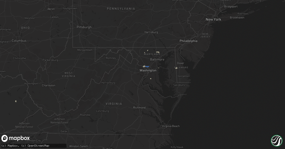
Hail Map in Maryland on August 27, 2021
Get this storm
August 27 map
$229
one time, instant access
Download today. No call, no setup
Keep the $229
Bought the map and want the full workflow? Apply the entire $229 to a subscription within 7 days. None of it is wasted.
Every map, not just this one
This buys you this map. Subscription and you get every map we run, in the markets you choose from a few cities to whole states to nationwide. Plus real-time alerts the moment a storm fires.
Contact data
Name, contact info, occupancy, even credit band for addresses in the footprint. You go from where it hit to who to call.
Become the source they trust
Unlimited branding weather history reports on demand. You already have the documented answer ready for the property owner, and you are the one who showed up with it.
Property data and RoofTrace estimates
Pull up any address you have got, its value and the exact code rules for that jurisdiction, straight from One Click Code. Then RoofTrace estimates the squares, pitch, and roof value, priced the way you price.
Storm reports in Maryland
Maryland
| Date | Description |
|---|---|
| 08/27/20216:33 PM CDT | Downed wires near perry cabin lane. Time estimated from radar. |
| 08/27/20216:31 PM CDT | Downed tree limbs and wires near grace street. Time estimated from radar. |
| 08/27/20216:23 PM CDT | Tree feel into a residence on cloverfields dr. No injuries. |
| 08/27/20215:35 PM CDT | A tree blew down in the 100 block of reckford road. |
| 08/27/20215:30 PM CDT | Trees blew down on md-24 rocks road south of saint clair bridge road. |
| 08/27/20215:17 PM CDT | Powerline wires down on the 12000 block of stoney batter road |
| 08/27/20215:15 PM CDT | Trees blew down near forest hill and jarrettsville... Including near the intersection of md-152 fallston road and fox meadow court... And in the 1800 block of parkwood |
| 08/27/20215:11 PM CDT | Tree down on fallston road near fox meadow court. |
| 08/27/20214:50 PM CDT | A tree and wires blew down on md-137 mount carmel road near cedar grove road. A tree blew down on md-138 monkton road near piney woods road. |
| 08/27/20214:25 PM CDT | Trees blew down on westbound us-50/us-301 prior to exit 32/md-908 oceanic drive. |
| 08/27/20214:03 PM CDT | A tree blew down in belvedere park. |
| 08/27/20213:50 PM CDT | Trees and wires blew down in herald harbor. |
| 08/27/20213:45 PM CDT | Trees and wires down in herald harbor. |
| 08/27/20213:40 PM CDT | Trees and wires blew down in millersville... Including along i-97 between exits 12 and 14. |
| 08/27/20213:17 PM CDT | Tree down on us-15 |
| 08/27/20213:14 PM CDT | Trees blew down on us-15 near emmitsburg. |
| 08/27/20212:54 PM CDT | Multiple trees down on elm street in takoma park. |
| 08/27/20212:54 PM CDT | Tree down and powerline wires down on the 1000 block of mimosa lane |
| 08/27/20212:45 PM CDT | A tree and wires blew down on md-180 jefferson pike near wye creek drive. |
| 08/27/20212:45 PM CDT | Tree down and powerlines down on the 100 block of eastmoor drive |
| 08/27/20212:40 PM CDT | *** 3 inj *** numerous trees and wires blew down in silver spring and takoma park. A tree and wires blew down onto a car on md-97 georgia avenue just south of i-495 cap |
| 08/27/20212:35 PM CDT | Tree and wires down on jefferson pike near wye creek drive. |
| 08/27/20212:35 PM CDT | Tree down on the 2000 block of clark place |
| 08/27/20212:33 PM CDT | Several trees blew down near the i-495 capital beltway/md-185 connecticut avenue interchange. |
| 08/27/20212:26 PM CDT | Powerline wires down on the 6000 block of tilden lane |
| 08/27/20212:21 PM CDT | Trees blew down on the ramp for exit 41 from i-495 capital beltway inner loop to westbound clara barton parkway. |
| 08/27/20212:21 PM CDT | Multiple trees down in the willerburn acres neighborhood. |
| 08/27/20212:17 PM CDT | Numerous trees and large branches blew down around montgomery mall... Including on gainsborough road north of democracy boulevard... And on democracy boulevard near the |
| 08/27/20212:16 PM CDT | A local report indicates 62 MPH wind near 1 NW GAITHERSBURG |
| 08/27/20212:11 PM CDT | A local report indicates 62 MPH wind near 2 E NORTH POTOMAC |
| 08/27/20214:35 AM CDT | At 935 PM EDT, severe thunderstorms were located along a line extending from near Woodbridge to 8 miles west of Montclair, moving east at 20 mph. HAZARD...60 mph wind gusts and quarter size hail. SOURCE...Radar indicated. IMPACT...Damaging winds will cause some trees and large branches to fall. This could injure those outdoors, as well as damage homes and vehicles. Roadways may become blocked by downed trees. Localized power outages are possible. Unsecured light objects may become projectiles. Locations impacted include... Stafford, Waldorf, Dale City, La Plata, Quantico, Montclair, Triangle, Dumfries, Saint Charles, Cherry Hill, Independent Hill, Bryans Road, Hughesville, Mason Neck, Potomac Heights, Bryantown, Pomfret, Port Tobacco Village, Garrisonville and Ironsides. |
| 08/27/20212:37 AM CDT | At 736 PM EDT, a severe thunderstorm was located near Overton, or 9 miles west of Centerville, moving east at 20 mph. HAZARD...60 mph wind gusts and penny size hail. SOURCE...Radar indicated. IMPACT...Damage to roofs, siding, trees, and power lines is possible. Locations impacted include... Chestertown, Rock Hall, Church Hill, Newtown, Starkey Corner, Morgnec, Old Town, Crumpton, Kennedyville, Langford and Kingstown. |
| 08/27/20212:10 AM CDT | At 710 PM EDT, severe thunderstorms were located along a line extending from near Magothy River to near Romancoke to Town Creek, moving east at 15 mph. HAZARD...60 mph wind gusts and penny size hail. SOURCE...Radar indicated. IMPACT...Damage to roofs, siding, trees, and power lines is possible. Locations impacted include... Easton, Centerville, Talbot, Centreville, Trappe, St. Michaels, Queen Anne, Grasonville, Starr, Stevensville, Skipton, Copperville, Chester, Matthews, Wye Mills, Hambleton, Cordova, Carville, Tilghman Island and Queenstown. |
| 08/27/20211:28 AM CDT | At 627 PM EDT, severe thunderstorms were located along a line extending from near Rhode River to near Dunkirk to 6 miles southeast of Waldorf, moving east at 25 mph. HAZARD...60 mph wind gusts. SOURCE...Radar indicated. IMPACT...Damaging winds will cause some trees and large branches to fall. This could injure those outdoors, as well as damage homes and vehicles. Roadways may become blocked by downed trees. Localized power outages are possible. Unsecured light objects may become projectiles. Locations impacted include... Chesapeake Ranch Estates, Mayo, Shady Side, Chesapeake Beach, Deale, Prince Frederick, Greenwell State Park, Hallowing Point, Saint Leonard Creek, Breezy Point, Town Creek, Rhode River, Cuckold Creek, Sheridan Point, Calvert Cliffs, Flag Harbor, California, Golden Beach, Dunkirk and Lusby. |
| 08/27/20211:17 AM CDT | At 616 PM EDT, a severe thunderstorm was located near Jarrettsville, or 8 miles northeast of Cockeysville, moving north at 20 mph. HAZARD...60 mph wind gusts and quarter size hail. SOURCE...Radar indicated. IMPACT...Damaging winds will cause some trees and large branches to fall. This could injure those outdoors, as well as damage homes and vehicles. Roadways may become blocked by downed trees. Localized power outages are possible. Unsecured light objects may become projectiles. Locations impacted include... Cockeysville, Bel Air North, Fallston, Kingsville, Pleasant Hills, Jarrettsville, Pylesville, Fork, Cardiff, Benson, Norrisville, Baldwin, Long Green, Hydes, Forest Hill, Chrome Hill, Bynum, Street, Rocks and Jacksonville. |
| 08/27/20211:10 AM CDT | At 610 PM EDT, severe thunderstorms were located along a line extending from near Upper Marlboro to near Saint Charles, moving northeast at 25 mph. HAZARD...60 mph wind gusts. SOURCE...Radar indicated. IMPACT...Damaging winds will cause some trees and large branches to fall. This could injure those outdoors, as well as damage homes and vehicles. Roadways may become blocked by downed trees. Localized power outages are possible. Unsecured light objects may become projectiles. Locations impacted include... Waldorf, La Plata, Saint Charles, Bryans Road, Hughesville, Bryantown, Pomfret, Northwood, Dentsville and White Plains. |
| 08/27/202112:52 AM CDT | At 552 PM EDT, a severe thunderstorm was located near Cockeysville, moving northeast at 10 mph. HAZARD...60 mph wind gusts. SOURCE...Radar indicated. IMPACT...Damaging winds will cause some trees and large branches to fall. This could injure those outdoors, as well as damage homes and vehicles. Roadways may become blocked by downed trees. Localized power outages are possible. Unsecured light objects may become projectiles. Locations impacted include... Jarrettsville, Pylesville, Glencoe, Chrome Hill, Street, Rocks, Hereford, Sparks and Monkton. |
| 08/27/202112:21 AM CDT | At 520 PM EDT, a severe thunderstorm was located over Woodbridge, moving east at 20 mph. HAZARD...60 mph wind gusts. SOURCE...Radar indicated. IMPACT...Damaging winds will cause some trees and large branches to fall. This could injure those outdoors, as well as damage homes and vehicles. Roadways may become blocked by downed trees. Localized power outages are possible. Unsecured light objects may become projectiles. Locations impacted include... Waldorf, Dale City, Clinton, Springfield, Fort Washington, Fort Hunt, Groveton, La Plata, Fort Belvoir, Woodbridge, National Harbor, Andrews Air Force Base, Lake Ridge, Montclair, Camp Springs, Lorton, Franconia, Oxon Hill, Hybla Valley and Newington. |
| 08/27/202112:06 AM CDT | At 505 PM EDT, a severe thunderstorm was located near Manchester, or 10 miles southeast of Parkville, moving northeast at 20 mph. HAZARD...60 mph wind gusts. SOURCE...Radar indicated. IMPACT...Damaging winds will cause some trees and large branches to fall. This could injure those outdoors, as well as damage homes and vehicles. Roadways may become blocked by downed trees. Localized power outages are possible. Unsecured light objects may become projectiles. Locations impacted include... Manchester, Bentley Springs, Millers, Freeland, Lineboro and Maryland Line. |
| 08/26/202111:59 PM CDT | At 459 PM EDT, severe thunderstorms were located along a line extending from Glen Burnie to near Severna Park, moving northeast at 20 mph. HAZARD...60 mph wind gusts. SOURCE...Radar indicated. IMPACT...Damaging winds will cause some trees and large branches to fall. This could injure those outdoors, as well as damage homes and vehicles. Roadways may become blocked by downed trees. Localized power outages are possible. Unsecured light objects may become projectiles. Locations impacted include... Annapolis, Riviera Beach, Naval Academy, Magothy River, Dobbins Island, Severn River, Fort Smallwood State Park, Pinehurst, Gibson Island, Sillery Bay, Bodkin Point, Glen Burnie, Severna Park, Pasadena, Arnold, Lake Shore, Ferndale, Parole, Green Haven and Linthicum. |
| 08/26/202110:25 PM CDT | At 325 PM EDT, a severe thunderstorm was located over Braddock Heights, or near Frederick, moving east at 10 mph. HAZARD...60 mph wind gusts and quarter size hail. SOURCE...Radar indicated. IMPACT...Damaging winds will cause some trees and large branches to fall. This could injure those outdoors, as well as damage homes and vehicles. Roadways may become blocked by downed trees. Localized power outages are possible. Unsecured light objects may become projectiles. Locations impacted include... Frederick, Harry Grove Stadium, Ballenger Creek, Braddock Heights, Clover Hill, Discovery-Spring Garden, Linganore-Bartonsville, Bloomfield, Middletown In Frederick Md, Clifton, Utica and Lewistown. |
| 08/26/20219:36 PM CDT | A tree blew down near the intersection of asher road and cox drive. |
| 08/26/20219:30 PM CDT | A tree blew down near the intersection of md-6 charles street and dubois road. A tree blew down near the intersection of dubois road and trinity church road. |
| 08/26/20219:22 PM CDT | A tree blew down near the intersection of md-231 burnt store road and old leonardtown road. |
| 08/26/20219:10 PM CDT | Trees blew down on md-5 leonardtown road south of md-488 la plata road. |
All States Impacted by Hail Map on August 27, 2021
Cities Impacted by Hail Map on August 27, 2021
- Webster, SD
- Bristol, SD
- Branch, MI
- Baldwin, MI
- Chase, MI
- Paris, MI
- Bitely, MI
- Reed City, MI
- Idlewild, MI
- Postville, IA
- Rio, WI
- Poynette, WI
- Columbus, WI
- Randolph, WI
- Arlington, WI
- Doylestown, WI
- Fox Lake, WI
- Fall River, WI
- Deforest, WI
- Beaver Dam, WI
- Sadieville, KY
- Corinth, KY
- Socorro, NM
- Yutan, NE
- Ashland, NE
- Mansfield, SD
- Aberdeen, SD
- Datil, NM
- Omaha, NE
- Almond, WI
- Wild Rose, WI
- Superior, NE
- Mankato, KS
- Webber, KS
- Hardy, NE
- Watford City, ND
- Arnegard, ND
- Keene, ND
- New Town, ND
- Mandaree, ND
- Eagle Butte, SD
- Trail City, SD
- Prairie Du Chien, WI
- Bagley, WI
- Hanlontown, IA
- Northwood, IA
- Lake Mills, IA
- Kensett, IA
- Joice, IA
- Marvin, SD
- Summit, SD
- South Shore, SD
- Marble Rock, IA
- Greene, IA
- Rockwell, IA
- Rockford, IA
- Dougherty, IA
- Charles City, IA
- Manistee, MI
- Hoven, SD
- Ipswich, SD
- Central City, NE
- Big Rapids, MI
- Valley, NE
- Arlington, NE
- Faith, SD
- Mason City, IA
- Plymouth, IA
- Manly, IA
- Benson, AZ
- Nelson, NE
- Lawrence, NE
- Oak, NE
- Belvidere, NE
- Narka, KS
- Mahaska, KS
- Belleville, KS
- Munden, KS
- Bruning, NE
- Strang, NE
- Wisconsin Rapids, WI
- Gettysburg, SD
- Agar, SD
- Milbank, SD
- Big Stone City, SD
- Prairie City, SD
- Reva, SD
- Wakpala, SD
- McLaughlin, SD
- Shell Rock, IA
- Clarksville, IA
- Warner, SD
- Roscoe, SD
- Java, SD
- Selby, SD
- Dupree, SD
- Bowdle, SD
- Ortonville, MN
- Waupaca, WI
- Amherst, WI
- Ortley, SD
- Lomira, WI
- Theresa, WI
- Campbellsport, WI
- Mazomanie, WI
- Carleton, NE
- Eau Claire, WI
- Valentine, NE
- Oshkosh, WI
- Winneconne, WI
- Barnard, SD
- Frederick, SD
- Westport, SD
- Leola, SD
- Kennard, NE
- Fremont, NE
- Waterloo, NE
- Bennington, NE
- Hayfield, MN
- Waltham, MN
- Blooming Prairie, MN
- New Hampton, IA
- Casa Blanca, NM
- Cubero, NM
- Parkersburg, IA
- Aplington, IA
- Glenham, SD
- Mobridge, SD
- Ventura, IA
- Garner, IA
- Rock Springs, WI
- Wykoff, MN
- Chatfield, MN
- Larslan, MT
- Calmar, IA
- Ossian, IA
- Decorah, IA
- Mitchell, IN
- Lawler, IA
- Waucoma, IA
- Stratford, SD
- Elkhorn, NE
- Black Creek, WI
- Seymour, WI
- Goodell, IA
- Farmersburg, IA
- Marquette, IA
- McGregor, IA
- Shickley, NE
- Waubay, SD
- Riceville, IA
- Mound City, SD
- Trempealeau, WI
- Dover, MN
- Rollingstone, MN
- Winona, MN
- Lewiston, MN
- Minnesota City, MN
- Utica, MN
- Saint Charles, MN
- Ettrick, WI
- Blair, WI
- Arcadia, WI
- Eyota, MN
- Altura, MN
- Dodge, WI
- Fountain City, WI
- Galesville, WI
- Chilton, WI
- Corona, NM
- Pulaski, WI
- Merriman, NE
- Salyersville, KY
- Phenix City, AL
- Fort Benning, GA
- Aurora, NE
- Hampton, NE
- Timber Lake, SD
- Stephen, MN
- Andover, SD
- Groton, SD
- Conde, SD
- Bath, SD
- Onaka, SD
- Tolstoy, SD
- Rosendale, WI
- Monona, IA
- Eastman, WI
- Harpers Ferry, IA
- Orchard, IA
- Floyd, IA
- Gilead, NE
- Alexandria, NE
- Livermore, IA
- Humboldt, IA
- Wellston, MI
- Osage, IA
- Little Cedar, IA
- Archer, NE
- Alamo, ND
- Luther, MI
- Irons, MI
- Republic, KS
- Byron, NE
- Grinnell, KS
- Custer, MI
- Newport, KY
- Elma, IA
- Hubbell, NE
- Haddam, KS
- Cuba, KS
- Browder, KY
- Drakesboro, KY
- Belton, KY
- Alta Vista, IA
- Milladore, WI
- Auburndale, WI
- Mosinee, WI
- Stratford, WI
- Clarks, NE
- Walkerville, MI
- Masonville, IA
- Edgewood, NM
- Tijeras, NM
- Alexandria, KY
- Morning View, KY
- Independence, KY
- Latonia, KY
- Horicon, WI
- Jonesville, IN
- Columbus, IN
- Marquette, NE
- Hyannis, NE
- Sauk City, WI
- Swanton, NE
- De Witt, NE
- Central City, KY
- Weyauwega, WI
- Fremont, WI
- Pine River, WI
- Hollandale, MN
- Clarks Grove, MN
- Albert Lea, MN
- Ellendale, MN
- Westminster, MD
- Epping, ND
- Canton, PA
- Juneau, WI
- Zumbro Falls, MN
- Fairbury, NE
- Florence, AZ
- Isabel, SD
- Neillsville, WI
- Lewisburg, KY
- Milmay, NJ
- Zahl, ND
- Oelwein, IA
- Edwardsville, IL
- Ohiowa, NE
- Oxford, WI
- Green Bay, WI
- Granton, WI
- Chili, WI
- Bloomington, WI
- Mount Hope, WI
- Luana, IA
- Birdseye, IN
- Fredericksburg, IA
- Thornton, IA
- Nashua, IA
- Ionia, IA
- Swaledale, IA
- Clear Lake, IA
- Saint Ansgar, IA
- Butte Des Morts, WI
- Omro, WI
- Neenah, WI
- Berlin, WI
- Larsen, WI
- Henderson, KY
- Dow City, IA
- Grafton, IA
- Grand Island, NE
- Cairo, NE
- Hartland, MN
- New Richland, MN
- Freeborn, MN
- Wells, MN
- Alden, MN
- West Bend, WI
- Hartford, WI
- Allenton, WI
- Iron Ridge, WI
- Mayville, WI
- Maynard, IA
- Westgate, IA
- Edgewater, MD
- Annapolis, MD
- Louisville, IL
- Akaska, SD
- Ferney, SD
- Pollock, SD
- Williston, ND
- Chapman, NE
- Elkhart Lake, WI
- Kiel, WI
- Paris, KY
- Lawrenceburg, KY
- Evart, MI
- Magdalena, NM
- Shiocton, WI
- Bonduel, WI
- Meservey, IA
- Glenville, MN
- Sheffield, IA
- Alexander, IA
- Fertile, IA
- Forest City, IA
- Kanawha, IA
- Klemme, IA
- Nora Springs, IA
- Fort Atkinson, IA
- Britt, IA
- Rock Falls, IA
- Belmond, IA
- Hayward, MN
- Cambria, WI
- Brandenburg, KY
- Waldorf, MD
- Eden, WI
- Woodman, WI
- Garnavillo, IA
- Rutland, IA
- Hawkeye, IA
- Blairstown, NJ
- Edinburgh, IN
- Bison, SD
- Glen Carbon, IL
- Bethel, OH
- Georgetown, OH
- Meadow, SD
- Alma Center, WI
- Fairchild, WI
- Wilber, NE
- McIntosh, SD
- Castalia, IA
- Cross Plains, IN
- Versailles, IN
- Saint Libory, NE
- Spring Green, WI
- Bear Creek, WI
- Clifton, AZ
- San Carlos, AZ
- Mount Orab, OH
- Hamersville, OH
- Potomac, MD
- Great Falls, VA
- Rockville, MD
- Fort Calhoun, NE
- Dawson, GA
- Courtland, KS
- Owensboro, KY
- Greenville, KY
- Ithaca, NE
- Clintonville, WI
- Hebron, NE
- Deshler, NE
- Woodbridge, VA
- Dumfries, VA
- Tucson, AZ
- Vail, AZ
- Felton, DE
- Greensboro, MD
- Harrington, DE
- Whitman, NE
- Rochester, MN
- Burnett, WI
- Plymouth, WI
- Glenbeulah, WI
- Union Bridge, MD
- Lamont, IA
- Dundee, IA
- Aurora, IA
- Independence, IA
- Hazleton, IA
- Arlington, IA
- Winthrop, IA
- Stanley, IA
- Strawberry Point, IA
- Grundy Center, IA
- Salvisa, KY
- Fallston, MD
- Sparks Glencoe, MD
- Phoenix, MD
- Baldwin, MD
- Monkton, MD
- Lebanon, KY
- Marshfield, WI
- Highland, WI
- Dodgeville, WI
- Arena, WI
- West Union, IA
- Saint Lucas, IA
- Edgar, NE
- New Providence, PA
- Willow Street, PA
- Strasburg, PA
- Greenfield, IL
- Palmyra, IL
- Renwick, IA
- Harrodsburg, KY
- Seymour, IN
- Bedford, IN
- Boonville, IN
- Butler, KY
- Vinton, VA
- Hardy, VA
- Missouri Valley, IA
- Honey Creek, IA
- Glencross, SD
- Phillipsburg, NJ
- Plover, WI
- Sells, AZ
- Jansen, NE
- Ute, IA
- Denison, IA
- Charter Oak, IA
- Chrisney, IN
- Santa Claus, IN
- Winchester, KY
- Merrillan, WI
- Sumner, IA
- Leroy, MI
- Tustin, MI
- Washington, NE
- Karlstad, MN
- Lodi, WI
- Dane, WI
- Avoca, WI
- Fairbank, IA
- Gilboa, NY
- Stamford, NY
- Grand Gorge, NY
- Hartford City, IN
- Latimer, IA
- Patch Grove, WI
- Clermont, IA
- Cross Plains, WI
- Barneveld, WI
- Blue Mounds, WI
- Black Earth, WI
- Ridgeway, WI
- Richland Center, WI
- Blue River, WI
- Muscoda, WI
- Soldiers Grove, WI
- Lone Rock, WI
- Mellette, SD
- Brentford, SD
- Florence, SD
- Newell, SD
- Belle Fourche, SD
- Mud Butte, SD
- Twin Brooks, SD
- Corona, SD
- Columbia, SD
- Hecla, SD
- Silver Spring, MD
- Garrett Park, MD
- Kensington, MD
- Bethesda, MD
- Chevy Chase, MD
- Blair, NE
- Richland, MT


