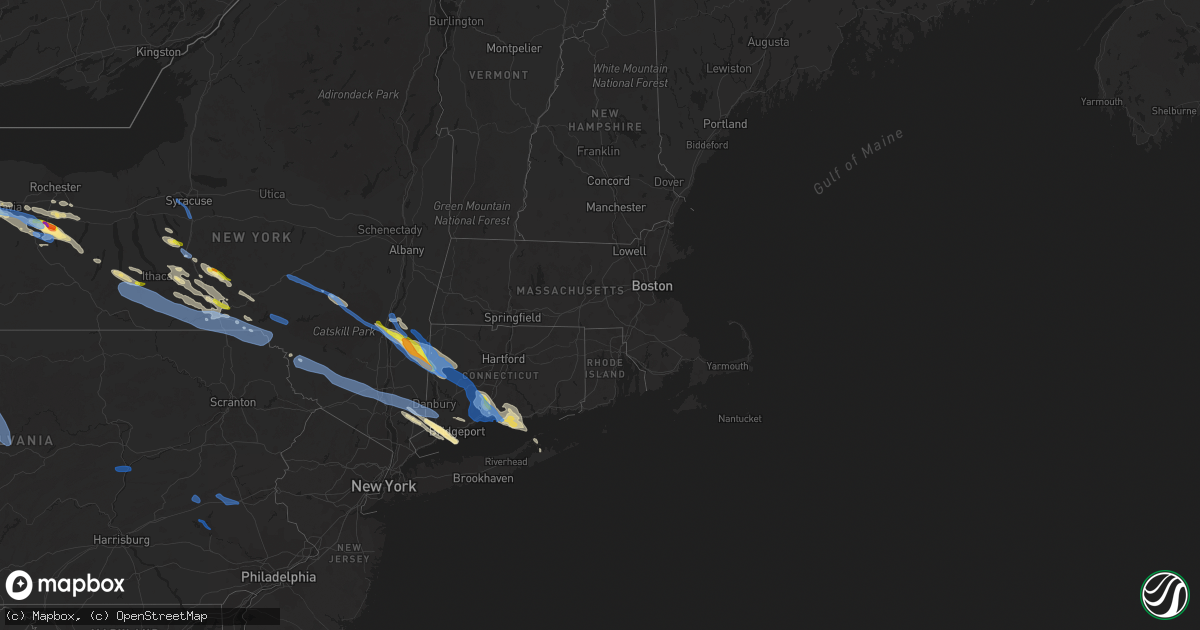
Hail Map in Connecticut on August 27, 2020
Get this storm
August 27 map
$229
one time, instant access
Download today. No call, no setup
Keep the $229
Bought the map and want the full workflow? Apply the entire $229 to a subscription within 7 days. None of it is wasted.
Every map, not just this one
This buys you this map. Subscription and you get every map we run, in the markets you choose from a few cities to whole states to nationwide. Plus real-time alerts the moment a storm fires.
Contact data
Name, contact info, occupancy, even credit band for addresses in the footprint. You go from where it hit to who to call.
Become the source they trust
Unlimited branding weather history reports on demand. You already have the documented answer ready for the property owner, and you are the one who showed up with it.
Property data and RoofTrace estimates
Pull up any address you have got, its value and the exact code rules for that jurisdiction, straight from One Click Code. Then RoofTrace estimates the squares, pitch, and roof value, priced the way you price.
Storm reports in Connecticut
Connecticut
| Date | Description |
|---|---|
| 08/27/20206:44 PM CDT | Trees down on journey's end rd |
| 08/27/20206:42 PM CDT | Trees down across rocky brook rd |
| 08/27/20206:18 PM CDT | Video of a large tree down on a house. |
| 08/27/20204:38 PM CDT | Power poles down on old hill road. Road is closed. |
| 08/27/20204:34 PM CDT | *** 1 inj *** trees down and wires on car with people trapped on wilton road. One person attempted to exit and was shocked. |
| 08/27/20204:30 PM CDT | Numerous tress and wires down across westport. |
| 08/27/20204:26 PM CDT | Trees down on danbury rd |
| 08/27/20203:36 PM CDT | Damage photos supplied by the public suggest that a brief ef0 tornado occurred on quanopaug trail in woodbury. Numerous trees were downed in various directions in a woo |
| 08/27/20203:16 PM CDT | Tree tops twisted and power lines down on featherbed lane. |
| 08/27/20203:15 PM CDT | Numerous large trees and power lines down across branford. |
| 08/27/20203:14 PM CDT | Multiple large trees down with extensive damage to homes on palmer road. |
| 08/27/20203:12 PM CDT | Large tree fell on suv on old quarry rd. Time estimated from radar. |
| 08/27/20203:10 PM CDT | Video of multiple large trees down. |
| 08/27/20203:10 PM CDT | A local report indicates 69 MPH wind near NEW HAVEN |
| 08/27/20203:10 PM CDT | A local report indicates 69 MPH wind near NEW HAVEN |
| 08/27/20203:06 PM CDT | Multiple large trees uprooted near i91 and i40 |
| 08/27/20203:06 PM CDT | 18 homes moderate to heavily damaged in the vicinity of sunset rd.... Oak hill rd.... Brook rd. And virginia rd. |
| 08/27/20203:04 PM CDT | Numerous trees and branches snapped and downed in montowese section of north haven with time estimated by radar |
| 08/27/20203:00 PM CDT | Parts of a roof blown off an apartment complex on evergreen ave. |
| 08/27/20203:00 PM CDT | Video of a tree down blocking 1 lane on i-84 |
| 08/27/20202:53 PM CDT | Ef1 tornado starting in bethany ct and ending in north haven ct. Maximum path width 500 yards. Path length 11.1 miles. |
| 08/27/20202:50 PM CDT | Tree and branches down on a house |
| 08/27/20202:48 PM CDT | Large tree uprooted on lounsbury street |
| 08/27/20202:45 PM CDT | Pole and multiple tres down along college farms rd. |
| 08/27/20202:44 PM CDT | Trees down near intersection of grassy hill rd. And owl ridge rd. |
| 08/27/20202:44 PM CDT | Numerous trees down throughout the town of roxbury. Utility reports over 80 percent of the town lost power. |
| 08/27/20202:44 PM CDT | Tree down on wires on blackville rd. |
| 08/27/20202:39 PM CDT | Tress down on painter ridge road. Time estimated from radar. |
| 08/27/20202:34 PM CDT | Tree down on wires on blackville rd. |
| 08/27/20202:31 PM CDT | Nws storm survey confirmed an ef0 tornado in kent... Ct. Damage was confined to uprooted and snapped trees. |
| 08/27/20202:30 PM CDT | Trees down on wire. Lane st. And cedar mtn rd. |
| 08/27/20202:30 PM CDT | Tree down on wires. |
| 08/27/20202:20 PM CDT | Tree down on wires. |
| 08/27/20202:18 PM CDT | Tree down on wires. |
| 08/27/20202:18 PM CDT | Multiple trees and wires down. |
| 08/27/20202:21 AM CDT | At 721 PM EDT, a severe thunderstorm was located over Ossining, moving east at 45 mph. HAZARD...60 mph wind gusts and penny size hail. SOURCE...Radar indicated. IMPACT...Expect damage to trees and power lines. This severe thunderstorm will be near... Yorktown Heights around 725 PM EDT. Mount Kisco and Hawthorne around 730 PM EDT. Bedford around 735 PM EDT. Stamford around 740 PM EDT. New Canaan and Greenwich around 745 PM EDT. Norwalk and Wilton around 750 PM EDT. |
| 08/27/20201:54 AM CDT | At 654 PM EDT, a severe thunderstorm was located near Mahopac, moving southeast at 55 mph. HAZARD...60 mph wind gusts and quarter size hail. SOURCE...Radar indicated. IMPACT...Minor hail damage to vehicles is possible. Expect wind damage to trees and power lines. This severe thunderstorm will be near... Brewster around 705 PM EDT. Bedford around 710 PM EDT. Danbury and New Canaan around 715 PM EDT. Wilton and Redding around 720 PM EDT. Fairfield and Westport around 725 PM EDT. Trumbull around 730 PM EDT. Shelton around 735 PM EDT. |
| 08/26/202011:11 PM CDT | At 411 PM EDT, severe thunderstorms were located along a line extending from near East Haddam to near Orange, moving southeast at 50 mph. HAZARD...70 mph wind gusts and quarter size hail. SOURCE...Radar indicated. IMPACT...Minor hail damage to vehicles is possible. Expect considerable tree damage. Wind damage is also likely to mobile homes, roofs, and outbuildings. Severe thunderstorms will be near... Chester and Killingworth around 415 PM EDT. Clinton and Old Saybrook around 420 PM EDT. Westbrook around 425 PM EDT. Southold and Greenport around 440 PM EDT. Wading River and Shelter Island around 445 PM EDT. Riverhead and Sag Harbor around 450 PM EDT. Westhampton and Bridgehampton around 455 PM EDT. Mastic Beach around 500 PM EDT. |
| 08/26/202010:40 PM CDT | At 340 PM EDT, severe thunderstorms were located along a line extending from near Hyde Park to near Millbrook to near Amenia, moving southeast at 45 mph. HAZARD...60 mph wind gusts and quarter size hail. SOURCE...Radar indicated. IMPACT...Hail damage to vehicles is expected. Expect wind damage to roofs, siding, and trees. Locations impacted include... Poughkeepsie, New Milford, Pawling, Hyde Park, Pleasant Valley, Hurley, Amenia, Kent, Sharon, Millbrook, Stanfordville, Gaylordsville, Fairview, Staatsburg, Cornwall Bridge, Wingdale, Dover Plains, New York--Newark, Tillson and Red Oaks Mill. |
| 08/26/202010:19 PM CDT | At 319 PM EDT, a severe thunderstorm was located near Litchfield, or 10 miles northeast of New Milford, moving southeast at 45 mph. HAZARD...60 mph wind gusts and nickel size hail. SOURCE...Radar indicated. IMPACT...Expect damage to trees and power lines. Locations impacted include... New Britain, Bristol, Southington, Farmington, Berlin, Plainville and Burlington. |
| 08/26/202010:17 PM CDT | At 316 PM EDT, severe thunderstorms were located along a line extending from near Litchfield to near Amenia, moving southeast at 65 mph. HAZARD...60 mph wind gusts and quarter size hail. SOURCE...Radar indicated. IMPACT...Minor hail damage to vehicles is possible. Expect wind damage to trees and power lines. Severe thunderstorms will be near... Meriden around 340 PM EDT. Middletown and Hartford around 345 PM EDT. Waterbury and Naugatuck around 350 PM EDT. Wolcott and East Hampton around 355 PM EDT. Chester and Hamden around 400 PM EDT. Wallingford and Old Saybrook around 405 PM EDT. Guilford and Old Lyme around 410 PM EDT. Clinton and North Madison around 415 PM EDT. |
| 08/26/20209:31 PM CDT | At 231 PM EDT, severe thunderstorms were located along a line extending from near Ancram to Red Hook to Phoenicia, moving southeast at 50 mph. HAZARD...60 mph wind gusts and quarter size hail. SOURCE...Radar indicated. IMPACT...Hail damage to vehicles is expected. Expect wind damage to roofs, siding, and trees. Locations impacted include... Poughkeepsie, Kingston, New Paltz, Saugerties, Rhinebeck, Hyde Park, Pleasant Valley, Hurley, Woodstock, Amenia, Livingston, Highland, Pine Plains, Clermont, Red Hook, Ancram, Millbrook, Millerton, Stanfordville and Tillson. |
| 08/26/20209:24 PM CDT | At 224 PM EDT, severe thunderstorms were located along a line extending from near Uxbridge to near Dudley, moving southeast at 60 mph. HAZARD...60 mph wind gusts. SOURCE...Radar indicated. IMPACT...Expect damage to trees and power lines. Locations impacted include... Providence, New Bedford, Fall River, Warwick, Cranston, Pawtucket, Plymouth, Taunton, East Providence, Woonsocket, Dartmouth, Cumberland, North Providence, Franklin, West Warwick, Johnston, North Attleborough, Milford, Bristol and Marion. |
All States Impacted by Hail Map on August 27, 2020
Cities Impacted by Hail Map on August 27, 2020
- Waseca, MN
- Janesville, MN
- Round Lake, MN
- Worthington, MN
- Hulett, WY
- Ortonville, MN
- West Olive, MI
- Almont, ND
- Mott, ND
- Elgin, ND
- New Leipzig, ND
- Carson, ND
- Glen Ullin, ND
- Cheyenne, WY
- Gillette, WY
- Philip, SD
- Midland, SD
- Moorcroft, WY
- Eagle Butte, SD
- Millbrook, NY
- Salt Point, NY
- Red Hook, NY
- Kingston, NY
- Stanfordville, NY
- Saugerties, NY
- Sharon, CT
- New Milford, CT
- Wingdale, NY
- Rhinebeck, NY
- Wassaic, NY
- Clinton Corners, NY
- Gaylordsville, CT
- Staatsburg, NY
- Dover Plains, NY
- Amenia, NY
- South Kent, CT
- Kent, CT
- Prairie City, SD
- Lodgepole, SD
- Willmar, MN
- Danube, MN
- Gibbon, MN
- Prinsburg, MN
- Fairfax, MN
- Hector, MN
- Bird Island, MN
- Blomkest, MN
- Raymond, MN
- Litchfield, MN
- Olivia, MN
- Renville, MN
- Buffalo Lake, MN
- Hutchinson, MN
- Cosmos, MN
- Lake Lillian, MN
- Stewart, MN
- Lemmon, SD
- Bison, SD
- Meadow, SD
- Ralph, SD
- Sundance, WY
- Madison, CT
- Clinton, CT
- Conesus, NY
- Groveland, NY
- Weston, WY
- Castle Creek, NY
- Whitney Point, NY
- Chenango Forks, NY
- Binghamton, NY
- Dupree, SD
- Roxbury, NY
- Ludington, MI
- Kewaunee, WI
- West Salem, WI
- Bangor, WI
- Palmersville, TN
- Mayfield, KY
- Sedalia, KY
- Cottage Grove, TN
- Farmington, KY
- Beulah, WY
- Belle Fourche, SD
- Spearfish, SD
- Aladdin, WY
- Newell, SD
- Edgemont, SD
- Victor, NY
- Killingworth, CT
- Guilford, CT
- Tomah, WI
- Warrens, WI
- Camp Douglas, WI
- La Crosse, WI
- Fort Pierre, SD
- Hayes, SD
- New Underwood, SD
- Wasta, SD
- Union Center, SD
- Enning, SD
- Lake City, PA
- North Springfield, PA
- Girard, PA
- East Springfield, PA
- Alzada, MT
- Berkshire, NY
- Brooktondale, NY
- Dryden, NY
- Richford, NY
- Scenic, SD
- Hardin, KY
- Benton, KY
- Waterville, MN
- Poynette, WI
- Arlington, WI
- Rio, WI
- Willow Lake, SD
- Toano, VA
- Vale, SD
- Hettinger, ND
- Regent, ND
- Zumbrota, MN
- Pine Island, MN
- Hemlock, NY
- Avon, NY
- Livonia, NY
- Geneseo, NY
- Honeoye, NY
- Lima, NY
- Lakeville, NY
- Springwater, NY
- Montour Falls, NY
- Alpine, NY
- Rock Stream, NY
- Dundee, NY
- Watkins Glen, NY
- Burdett, NY
- Odessa, NY
- Birch River, WV
- Newburgh, IN
- Katonah, NY
- Alva, WY
- Saint Onge, SD
- Whitewood, SD
- Hammond, MT
- Smiths Creek, MI
- Batavia, NY
- East Bethany, NY
- Corfu, NY
- Alexander, NY
- Gladstone, ND
- Dickinson, ND
- Sparta, WI
- Wilton, CT
- Revere, MN
- Dalton, WI
- Pardeeville, WI
- Montello, WI
- La Porte, IN
- Huron, SD
- Weatherford, TX
- Clara City, MN
- Port Crane, NY
- Wallingford, CT
- New Haven, CT
- Cheshire, CT
- Hamden, CT
- North Haven, CT
- Pavilion, NY
- Perry, NY
- Rush, NY
- Mount Morris, NY
- Bloomfield, NY
- Leicester, NY
- Linwood, NY
- West Bloomfield, NY
- Canandaigua, NY
- Piffard, NY
- Honeoye Falls, NY
- Naples, NY
- Ionia, NY
- Caledonia, NY
- Le Roy, NY
- York, NY
- Kyle, SD
- Wall, SD
- Pine Ridge, SD
- Oelrichs, SD
- Trumbull, CT
- Shelton, CT
- Stratford, CT
- Wisconsin Dells, WI
- Oxford, WI
- Endeavor, WI
- Grand Marsh, WI
- Mauston, WI
- Briggsville, WI
- Lyndon Station, WI
- Porter, MN
- Hot Springs, SD
- Quinn, SD
- McDonough, NY
- Willet, NY
- Isabel, SD
- Howes, SD
- Lewisville, MN
- Truman, MN
- Glen Aubrey, NY
- Greene, NY
- Smithville Flats, NY
- Cincinnatus, NY
- South Salem, NY
- Granite Falls, MN
- Melrose, WI
- Black River Falls, WI
- Charles City, VA
- Buffalo, SD
- Nisland, SD
- Allen Park, MI
- Baraboo, WI
- Portage, WI
- Reedsburg, WI
- La Valle, WI
- Elgin, MN
- Plainview, MN
- Norwalk, WI
- Pemberton, MN
- Owatonna, MN
- Port Sanilac, MI
- Deckerville, MI
- Carsonville, MI
- Redfield, SD
- West Concord, MN
- Vassar, MI
- Caro, MI
- Mayville, MI
- Butler, PA
- West Sunbury, PA
- Sturgis, SD
- Upton, WY
- Erbacon, WV
- Mindoro, WI
- Montevideo, MN
- Maynard, MN
- New Concord, KY
- Batesland, SD
- Scottsville, NY
- Mumford, NY
- Youngstown, OH
- Sacred Heart, MN
- Michigan City, IN
- Evansville, IN
- Walnut Grove, MN
- Fox Lake, WI
- Waupun, WI
- Eutaw, AL
- New Lisbon, WI
- Spring Grove, VA
- Rockland, WI
- Cashton, WI
- Dendron, VA
- Elberon, VA
- Waverly, VA
- Maiden Rock, WI
- Plum City, WI
- Kadoka, SD
- Leetonia, OH
- Belmont, MI
- Comstock Park, MI
- Henrietta, NY
- Piedmont, SD
- Byron, NY
- Oakfield, NY
- Stafford, NY
- Bergen, NY
- Fyffe, AL
- Dawson, AL
- Fort Meade, SD
- Stillwater, MN
- Clintonville, WI
- Cortland, NY
- Hampton, MN
- Yorktown, VA
- Elroy, WI
- Big Stone City, SD
- Nichols, WI
- Black Creek, WI
- Oneida, WI
- Bonduel, WI
- Seymour, WI
- Belfield, ND
- Winnebago, MN
- Blue Earth, MN
- Taylor, ND
- Buffalo Gap, SD
- Deposit, NY
- Windsor, NY
- Susquehanna, PA
- Murray, KY
- Locke, NY
- Moravia, NY
- Homer, NY
- Amboy, MN
- Onida, SD
- White Owl, SD
- Minneapolis, MN
- Pound Ridge, NY
- Amawalk, NY
- Bedford Hills, NY
- Salem, OH
- Denver, NY
- Deford, MI
- Moulton, AL
- Broadus, MT
- Ludlow, SD
- Springfield, MN
- Comfrey, MN
- Morris, CT
- Litchfield, CT
- Bantam, CT
- Cornwall Bridge, CT
- Pierre, SD
- Adams, WI
- Wilton, WI
- North Freedom, WI
- Merrimac, WI
- Wyocena, WI
- Kendall, WI
- Wonewoc, WI
- Hustler, WI
- Kendallville, IN
- Corunna, IN
- Fostoria, OH
- Bloomdale, OH
- Gilbertsville, KY
- Clarkfield, MN
- Fredonia, PA
- Greenville, PA
- Luxemburg, WI
- McGraw, NY
- Lake Park, IA
- Wanamingo, MN
- Long Valley, SD
- Necedah, WI
- Chadron, NE
- Warren, OH
- McDonald, OH
- Niles, OH
- Hendricks, MN
- Onalaska, WI
- Holmen, WI
- Newark Valley, NY
- Elk Horn, KY
- Cavour, SD
- Fleischmanns, NY
- West Kill, NY
- New Canaan, CT
- Norwalk, CT
- Marathon, NY
- Oxford, NY
- Rockwood, PA
- Markleton, PA
- Fort Hill, PA
- Surry, VA
- Milesville, SD
- Cherry Creek, SD
- Claremont, MN
- Ontario, WI
- Jeffers, MN
- Brewster, MN
- Cambria, WI
- Hilliards, PA
- Camp Crook, SD
- River Falls, WI
- Roberts, WI
- Hammond, WI
- Lynd, MN
- Russell, MN
- Cleveland, OH
- Belvidere, SD
- Maine, NY
- Candor, NY
- Harpursville, NY
- Ithaca, NY
- Endicott, NY
- Lisle, NY
- Harford, NY
- Freeville, NY
- Kirkwood, NY
- Johnson City, NY
- Harris, IA
- Tracy, MN
- Cygnet, OH
- Kingston, WI
- Markesan, WI
- Randolph, WI
- Maple Grove, MN
- Osseo, MN
- Harrisville, PA
- Slippery Rock, PA
- Branford, CT
- East Haven, CT
- Friesland, WI
- Frewsburg, NY
- Gann Valley, SD
- Rochester, MN
- Bedford, NY
- Shiocton, WI
- Bear Creek, WI
- Wyoming, NY
- Middlesex, NY
- East Pembroke, NY
- Hebron, ND
- Agar, SD
- Trumansburg, NY
- Virgil, SD
- Ridgefield, CT
- Westport, CT
- Fairfield, CT
- Weston, CT
- Southport, CT
- Bainbridge, NY
- Afton, NY
- Blooming Prairie, MN
- Denmark, WI
- Two Rivers, WI
- Mishicot, WI
- Scottville, MI
- Rock Springs, WI
- Loganville, WI
- Ralph, AL
- Buhl, AL
- Nappanee, IN
- New Paris, IN
- Cass City, MI
- Sag Harbor, NY
- Taylor, WI
- Homerville, OH
- West Salem, OH
- Box Elder, SD
- Ettrick, WI
- Delavan, MN
- Granada, MN
- Dexter, KY
- Bethany, CT
- Woodbridge, CT
- Northford, CT
- Prospect, CT
- Westbrook, CT
- North Branford, CT
- Williamsburg, VA
- Hamel, MN
- Pittsford, NY
- Mendon, NY
- Silver Lake, MN
- Sidney, MT
- Marlette, MI
- New Richmond, WI
- Friendship, WI
- Sutton, WV
- Little Birch, WV
- Interior, SD
- Skaneateles, NY
- Yorktown Heights, NY
- Goldens Bridge, NY
- Somers, NY
- Granite Springs, NY
- Auburn, MI
- Kawkawlin, MI
- Vestal, NY
- Tyler, MN
- Germantown, NY
- Elizaville, NY
- Tivoli, NY
- Ivanhoe, MN
- Dodge Center, MN
- Mantorville, MN
- Washington Depot, CT
- Glencoe, MN
- Mequon, WI
- Milford, IA
- North Liberty, IN
- Lucan, MN
- Shelter Island Heights, NY
- Shelter Island, NY
- Almo, KY
- Garvin, MN
- Balaton, MN
- South Bend, IN
- Kenyon, MN
- Lowellville, OH
- Morristown, MN
- Faribault, MN
- Avoca, MI
- Jeddo, MI
- Lakota, IA
- Bancroft, IA
- Ledyard, IA
- Swea City, IA
- Washington, CT
- Ruby, NY
- Barrytown, NY
- Lake Katrine, NY
- Woodstock, NY
- New Preston Marble Dale, CT
- Lakeside, CT
- Millerton, NY
- Hortonville, NY
- North Branch, NY
- Callicoon, NY
- Kellogg, MN
- Tioga, ND
- Prattsburgh, NY
- Keuka Park, NY
- Pulteney, NY
- Penn Yan, NY
- Branchport, NY
- Manning, ND
- Jeffersonville, NY
- Swan Lake, NY
- Dennison, OH
- Wessington, SD
- Hobart, NY
- Armstrong, IA
- Fairmont, MN
- Decker, MI
- Snover, MI
- Lodi, WI
- Hemingford, NE
- Lakeville, IN
- Wisconsin Rapids, WI
- White Earth, ND
- Stanley, ND
- Hillsboro, WI
- Poquoson, VA
- New Philadelphia, OH
- Cedarville, WV
- Gassaway, WV
- Exchange, WV
- Norris, SD
- Melvin, IA
- Wingo, KY
- Mahopac, NY
- Waccabuc, NY
- Cross River, NY
- North Salem, NY
- Purdys, NY
- Syracuse, IN
- Iroquois, SD
- Franklin, MN
- Campbell, OH
- Newport News, VA
- Mazeppa, MN
- Rudolph, OH
- Jerry City, OH
- Sanborn, MN
- Taylor, MI
- Caputa, SD
- White River, SD
- Murdo, SD
- Wanblee, SD
- Okaton, SD
- Young America, MN
- Winfred, SD
- Chester, SD
- Miller, SD
- Canistota, SD
- Clear Lake, SD
- Marietta, MN
- New Prague, MN
- Carver, MN
- Clements, MN
- Gary, SD
- De Smet, SD
- Plato, MN
- Milroy, MN
- Boyd, MN
- Chaska, MN
- Milan, MN
- Astoria, SD
- Dawson, MN
- Minneota, MN
- Ruthton, MN
- Murdock, MN
- Owanka, SD
- Canby, MN
- Alpena, SD
- Ghent, MN
- Deadwood, SD
- Taunton, MN
- Hartford, SD
- Wood Lake, MN
- Marshall, MN
- Madison, SD
- Colton, SD
- Volga, SD
- Hamburg, MN
- Jordan, MN
- Cottonwood, MN
- Belle Plaine, MN
- Estelline, SD
- Vesta, MN
- Lake Norden, SD
- Ramona, SD
- Carthage, SD
- Draper, SD
- Fedora, SD
- Shakopee, MN
- Lake Preston, SD
- Arco, MN
- Spencer, SD
- Brookings, SD
- Morgan, MN
- Montrose, SD
- Courtland, MN
- Mayer, MN
- Oldham, SD
- Gaylord, MN
- Ellsworth Afb, SD
- Woonsocket, SD
- Sleepy Eye, MN
- Brownton, MN
- Madison, MN
- Letcher, SD
- Castlewood, SD
- Watson, MN
- Carpenter, SD
- Echo, MN
- Arlington, SD
- Wolsey, SD
- Bryant, SD
- Waconia, MN
- New Auburn, MN
- Kerkhoven, MN
- Pennock, MN
- Blunt, SD
- Emery, SD
- Hayti, SD
- Lester Prairie, MN
- Brandt, SD
- Yale, SD
- Badger, SD
- Winthrop, MN
- Wabasso, MN
- Green Isle, MN
- Artesian, SD
- Alexandria, SD
- Wentworth, SD
- New Ulm, MN
- Highmore, SD
- Wessington Springs, SD
- Seaforth, MN
- New Germany, MN
- Ree Heights, SD
- Bruce, SD
- White, SD
- Wanda, MN
- Mount Vernon, SD
- Saint Peter, MN
- Erwin, SD
- Howard, SD
- Lake Benton, MN
- Cologne, MN
- Winsted, MN
- Redwood Falls, MN
- Norwood Young America, MN
- Arlington, MN
- Rapid City, SD
- Bridgewater, SD
- Saint Lawrence, SD
- Canova, SD
- Slayton, MN
- Lafayette, MN
- Hanley Falls, MN
- Nicollet, MN
- Fulton, SD
- Toronto, SD
- Le Sueur, MN
- Currie, MN
- Henderson, MN
- Mitchell, SD
- Aurora, SD
- Harrold, SD
- Salem, SD
- Morton, MN
- Lamberton, MN
- Humboldt, SD
- Holabird, SD
- Belview, MN
- Reliance, SD
- Oacoma, SD
- Kennebec, SD
- Lower Brule, SD
- Elizabeth, NJ
- Newark, NJ
- Recluse, WY
- Pittsburgh, PA
- Newfield, NY
- Winfield, PA
- Selinsgrove, PA
- Shamokin Dam, PA
- Middleburg, PA
- Sunbury, PA
- Kutztown, PA
- Breinigsville, PA
- New Tripoli, PA
- Kempton, PA
- Allentown, PA
- Lenhartsville, PA
- Fogelsville, PA
- Leesport, PA
- Bernville, PA
- Reading, PA
- Auburn, PA
- Orwigsburg, PA
- Hamburg, PA
- Port Clinton, PA
- Darlington, PA
- Coraopolis, PA
- Clinton, PA
- Shippingport, PA
- Beaver, PA
- Aliquippa, PA
- Monaca, PA
- Industry, PA
- Negley, OH
- Ambridge, PA
- Beaver Falls, PA
- South Heights, PA
- Midland, PA
- Sewickley, PA
- Leetsdale, PA
- Crescent, PA
- McKees Rocks, PA
- Bethel Park, PA
- Clairton, PA
- James City, PA
- Johnsonburg, PA
- Saint Marys, PA
- Cyclone, PA
- Lewis Run, PA
- Warren, PA
- Wilcox, PA
- Clarendon, PA
- Ludlow, PA
- Sheffield, PA
- Mount Jewett, PA
- Bradford, PA
- Russell, PA
- Hazel Hurst, PA
- Kane, PA
- Ridgway, PA
- Smethport, PA
- Tiona, PA
- Karthaus, PA
- Driftwood, PA
- Clearfield, PA
- Weedville, PA
- Benezett, PA
- Drifting, PA
- Grassflat, PA
- Frenchville, PA
- Elizabeth, PA
- Monongahela, PA
- West Mifflin, PA
- Dravosburg, PA
- Finleyville, PA
- Mckeesport, PA
- West Elizabeth, PA
- Glassport, PA
- Wyano, PA
- Smithton, PA
- Mill Run, PA
- Rillton, PA
- Ohiopyle, PA
- Ruffs Dale, PA
- Addison, PA
- Darragh, PA
- Star Junction, PA
- Confluence, PA
- Yukon, PA
- Vanderbilt, PA
- Markleysburg, PA
- Mount Braddock, PA
- Connellsville, PA
- West Newton, PA
- Fayette City, PA
- Lemont Furnace, PA
- Belle Vernon, PA
- Scottdale, PA
- Dunbar, PA
- Everson, PA
- Normalville, PA
- Uniontown, PA
- Perryopolis, PA
- Dawson, PA
- Irwin, PA
- Herminie, PA
- Dickerson Run, PA
- Smock, PA
- Somerset, PA
- Salisbury, PA
- Springs, PA
- Meyersdale, PA
- Hidden Valley, PA
- Garrett, PA
- Grantsville, MD
- West Salisbury, PA
- Champion, PA
- Millsap, TX
- Canton, OH
- East Sparta, OH
- Waynesburg, OH
- Magnolia, OH
- Syracuse, NY
- Camillus, NY
- Nedrow, NY
- La Fayette, NY
- Glenford, NY
- Bearsville, NY
- West Hurley, NY
- Lake Hill, NY
- Mount Tremper, NY
- Meridale, NY
- Oneonta, NY
- Phoenicia, NY
- Bovina Center, NY
- Shandaken, NY
- Willow, NY
- South Kortright, NY
- Hyde Park, NY
- Big Indian, NY
- Bloomville, NY
- Delhi, NY
- East Meredith, NY
- Sherman, CT
- Chichester, NY
- West Camp, NY
- Malden On Hudson, NY
- Downsville, NY
- Walton, NY
- East Branch, NY
- Seymour, CT
- West Haven, CT
- Watertown, CT
- Woodbury, CT
- Waterbury, CT
- Naugatuck, CT
- Orange, CT
- Bethlehem, CT
- Oakville, CT
- Middlebury, CT
- Roxbury, CT
- Pine Plains, NY
- Derby, CT
- Beacon Falls, CT
- Ansonia, CT
- Owego, NY
- Van Etten, NY
- Barton, NY
- Spencer, NY
- Horseheads, NY
- Lakewood, PA
- Hancock, NY
- Lockwood, NY
- Beaver Dams, NY
- Brackney, PA
- Lake Como, PA
- Hallstead, PA
- Thompson, PA
- Equinunk, PA
- Apalachin, NY
- Starrucca, PA
- Preston Park, PA
- Erin, NY
- Great Bend, PA
- Starlight, PA
- Millport, NY
- Cayuta, NY
- Ouaquaga, NY
- Conklin, NY
- Willseyville, NY
- Newburgh, NY
- South Fallsburg, NY
- Baldwin Place, NY
- Cornwall, NY
- Monticello, NY
- Rock Tavern, NY
- Salisbury Mills, NY
- Glen Wild, NY
- Pine Bush, NY
- Montgomery, NY
- Carmel, NY
- Redding, CT
- Beacon, NY
- Garrison, NY
- Croton Falls, NY
- Cornwall On Hudson, NY
- Danbury, CT
- Lake Huntington, NY
- Wurtsboro, NY
- Harris, NY
- Middletown, NY
- Rock Hill, NY
- Mongaup Valley, NY
- West Point, NY
- Bethel, NY
- Brewster, NY
- White Lake, NY
- Washingtonville, NY
- Smallwood, NY
- Ferndale, NY
- Circleville, NY
- Thompson Ridge, NY
- Campbell Hall, NY
- Maybrook, NY
- New Windsor, NY
- Putnam Valley, NY
- Kenoza Lake, NY
- Walden, NY
- Kiamesha Lake, NY
- Cold Spring, NY
- Bloomingburg, NY
- Cochecton, NY
- Buffalo, NY


