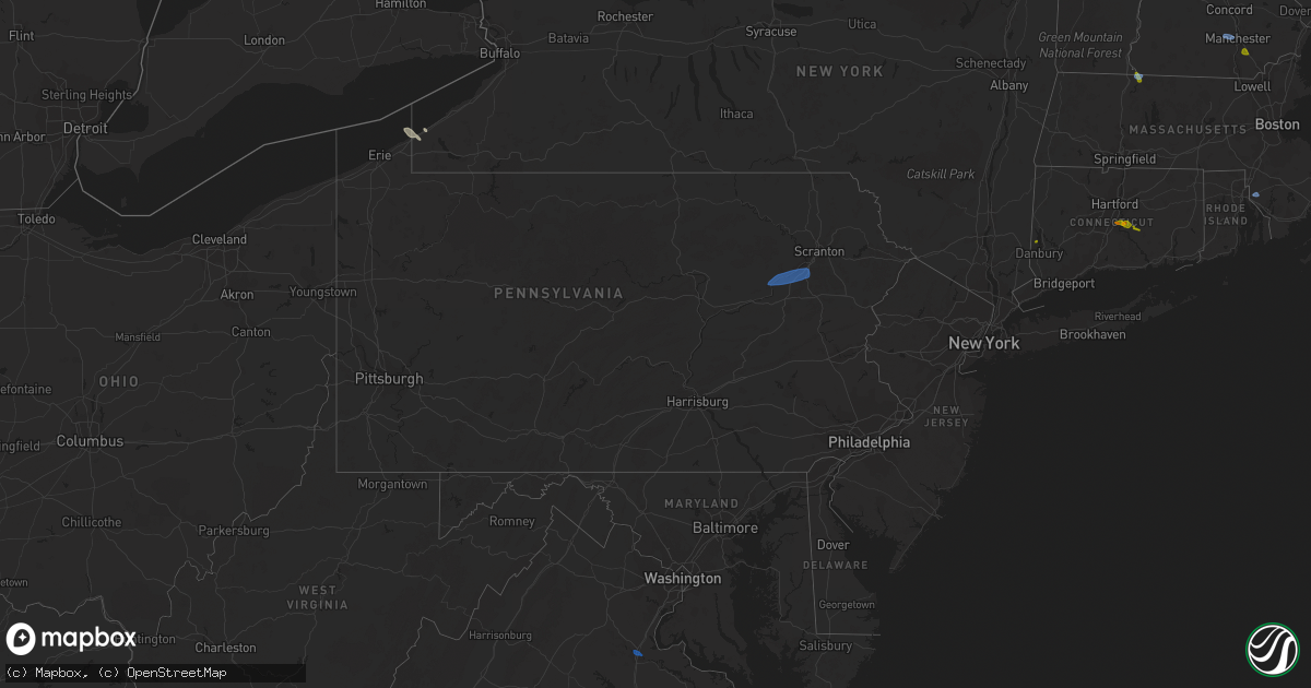
Hail Map in Pennsylvania on August 24, 2020
Get this storm
August 24 map
$229
one time, instant access
Download today. No call, no setup
Keep the $229
Bought the map and want the full workflow? Apply the entire $229 to a subscription within 7 days. None of it is wasted.
Every map, not just this one
This buys you this map. Subscription and you get every map we run, in the markets you choose from a few cities to whole states to nationwide. Plus real-time alerts the moment a storm fires.
Contact data
Name, contact info, occupancy, even credit band for addresses in the footprint. You go from where it hit to who to call.
Become the source they trust
Unlimited branding weather history reports on demand. You already have the documented answer ready for the property owner, and you are the one who showed up with it.
Property data and RoofTrace estimates
Pull up any address you have got, its value and the exact code rules for that jurisdiction, straight from One Click Code. Then RoofTrace estimates the squares, pitch, and roof value, priced the way you price.
Storm reports in Pennsylvania
Pennsylvania
| Date | Description |
|---|---|
| 08/24/20205:07 PM CDT | Downed trees and wires near easton road. Time estimated from radar. |
| 08/24/20205:03 PM CDT | Downed trees and wires in several locations in bethlehem twp. Time estimated from radar. |
| 08/24/20204:35 PM CDT | Two large trees down near the intersection of s oaks rd and e walker rd. Time estimated from radar. |
| 08/24/20204:04 PM CDT | Downed trees and wires near kunkletown road. Time estimated from radar. |
| 08/24/20203:55 PM CDT | At least one fire department call for a downed tree in eldred twp. Time estimated from radar. |
| 08/24/20203:53 PM CDT | Downed trees and wires near frable drive south of gilbert. Time estimated from radar. |
| 08/24/20203:50 PM CDT | Trees and wires down on stoney ridge rd. Time estimated from radar. |
| 08/24/20203:42 PM CDT | Downed trees and wires near woodchuck drive near trachsville. Time estimated from radar. |
| 08/24/20203:13 PM CDT | Wires down... Numerous poles knocked down... Numerous trees down. |
| 08/24/20203:13 PM CDT | Multiple trees blocking road |
| 08/24/20203:10 PM CDT | Wires down and pulled from house |
| 08/24/20203:03 PM CDT | Trees across road |
| 08/24/20201:30 PM CDT | Tree down on 18500 block of highway 87. |
| 08/24/20207:41 AM CDT | At 1241 PM EDT, a severe thunderstorm was located near Evans City, or 8 miles west of Butler, moving southeast at 15 mph. HAZARD...Wind gusts to 60 mph. SOURCE...Radar. IMPACT...Expect damage to trees and power lines, resulting in some power outages. Locations impacted include... Meridian... Oak Hills... Nixon... Connoquenessing... |
| 08/24/20207:19 AM CDT | At 1219 PM EDT, a severe thunderstorm was located over Rimersburg, moving east at 15 mph. HAZARD...Wind gusts to 60 mph. SOURCE...Radar. IMPACT...Expect damage to trees and power lines, resulting in some power outages. Locations impacted include... Rimersburg... New Bethlehem... Hawthorn... Distant... |
| 08/23/202011:38 PM CDT | At 437 PM EDT, a severe thunderstorm was located over McMichael, or 10 miles south of Mount Pocono, moving east at 35 mph. HAZARD...60 mph wind gusts and quarter size hail. SOURCE...Radar indicated. IMPACT...Minor damage to vehicles is possible. Wind damage to roofs, siding, trees, and power lines is possible. Locations impacted include... East Stroudsburg, Blairstown, Bangor, Pen Argyl, Wind Gap, Belvidere, Oxford, Hope, East Bangor, Stormville, Brodheadsville, Kunkletown, Werry Lake, Gilbert, Millbrook, Pocono Raceway, Delaware Water Gap, Tannersville, Rossland and Long Pond.This includes the following highways... Interstate 80 in Pennsylvania between mile markers 299 and 314. Interstate 80 in New Jersey between mile markers 0 and 13. |
| 08/23/202010:47 PM CDT | At 347 PM EDT, a severe thunderstorm was located over Shickshinny, or 10 miles northeast of Berwick, moving east at 15 mph. HAZARD...Quarter size hail. SOURCE...Radar indicated. IMPACT...Damage to vehicles is expected. Locations impacted include... Wilkes-Barre, Muhlenberg, Kingston, Nanticoke, Plymouth, Swoyersville, Edwardsville, Larksville, Forty Fort and Lehman. |
| 08/23/20208:53 PM CDT | At 153 PM EDT, a severe thunderstorm was located near Morris, moving east at 25 mph. HAZARD...60 mph wind gusts and quarter size hail. SOURCE...Radar indicated. IMPACT...Hail damage to vehicles is expected. Expect wind damage to trees, roofs, and siding. Locations impacted include... Ralston, Buttonwood and Ski Sawmill Ski Area. |
| 08/23/20208:15 PM CDT | At 115 PM EDT, a severe thunderstorm was located over Beltzville State Park, or 7 miles east of Lehighton, moving east at 10 mph. HAZARD...60 mph wind gusts and quarter size hail. SOURCE...Radar indicated. IMPACT...Minor damage to vehicles is possible. Wind damage to roofs, siding, trees, and power lines is possible. Locations impacted include... Northampton, Palmerton, Slatington, Bath, Walnutport, Danielsville, Kunkletown, Beltzville State Park, Saylorsburg, Rossland, Berlinsville, Beersville, Kresgeville, Bowmanstown, Parryville, Chapman, Trachsville and Fiddletown.This includes Northeast Extension between mile markers 72 and 74, andnear mile marker 77. |
All States Impacted by Hail Map on August 24, 2020
Cities Impacted by Hail Map on August 24, 2020
- Greenwood, WI
- Stoughton, WI
- Janesville, WI
- Edgerton, WI
- Sharon, WI
- Milton, WI
- Darien, WI
- Avalon, WI
- Cambridge, WI
- Clinton, WI
- Fort Atkinson, WI
- Augusta, WI
- Osseo, WI
- Fairchild, WI
- Markesan, WI
- Cambria, WI
- Fox Lake, WI
- Randolph, WI
- Columbus, WI
- Sun Prairie, WI
- Marshall, WI
- Deforest, WI
- Arlington, WI
- Rio, WI
- Poynette, WI
- Spencer, WI
- Chili, WI
- Pittsville, WI
- Necedah, WI
- Nekoosa, WI
- Arkdale, WI
- Willard, WI
- Franklin, MN
- Fairfax, MN
- Westfield, WI
- Oxford, WI
- Gibbon, MN
- Hector, MN
- Grand Marsh, WI
- Wisconsin Dells, WI
- Delavan, WI
- Butler, WI
- Brookfield, WI
- Milwaukee, WI
- Walworth, WI
- Burlington, WI
- Springfield, WI
- Lake Geneva, WI
- Elkhorn, WI
- Whitewater, WI
- Palmyra, WI
- Westfield, NY
- Eau Claire, WI
- Wisconsin Rapids, WI
- Stanley, WI
- Alma Center, WI
- Wautoma, WI
- Neshkoro, WI
- Lake Mills, WI
- Waterloo, WI
- Neillsville, WI
- Deerfield, WI
- Stratford, WI
- Waupun, WI
- Beaver Dam, WI
- Friendship, WI
- Coloma, WI
- Chippewa Falls, WI
- Elk Mound, WI
- Colfax, WI
- Olivia, MN
- Bird Island, MN
- Hebron, IL
- Woodstock, IL
- Wonder Lake, IL
- Babcock, WI
- Ripley, NY
- North East, PA
- Iron Ridge, WI
- Hartford, WI
- Rubicon, WI
- Horicon, WI
- Lodi, WI
- Dane, WI
- Adams, WI
- Montello, WI
- Marshfield, WI
- Auburndale, WI
- Hubertus, WI
- Colgate, WI
- Fall River, WI
- Pardeeville, WI
- Portage, WI
- Granton, WI
- Mosinee, WI
- Endeavor, WI
- Packwaukee, WI
- Hancock, WI
- Watertown, WI
- Dalton, WI
- Bancroft, WI
- Mchenry, IL
- Crystal Lake, IL
- Wyocena, WI
- Burnett, WI
- Harvard, IL
- Humbird, WI
- Fall Creek, WI
- Merrillan, WI
- Madison, WI
- Berlin, WI
- Hilton, NY
- Jefferson, WI
- Loyal, WI
- Cadott, WI
- Vesper, WI
- Arpin, WI
- Buffalo Lake, MN
- Lowell, WI
- Hustisford, WI
- Eleva, WI
- Neosho, WI
- Black River Falls, WI
- Port Edwards, WI
- Williams Bay, WI
- Lake In The Hills, IL
- Algonquin, IL
- Cottage Grove, WI
- Sussex, WI
- Barrington, IL
- Cary, IL
- Fox River Grove, IL
- Hoffman Estates, IL
- Richmond, IL
- Reeseville, WI
- Richfield, WI
- Fontana, WI
- Strum, WI
- Juneau, WI
- Palatine, IL
- Doylestown, WI
- Ringwood, IL
- Kingston, WI
- Brandon, WI
- New Lisbon, WI
- Tomah, WI
- Theresa, WI
- Allenton, WI
- Mayville, WI
- Owen, WI
- Brownsville, WI
- Lomira, WI
- Fond Du Lac, WI
- Oakfield, WI
- Menomonee Falls, WI
- West Bend, WI
- Lebanon, WI
- Ripon, WI
- Hewitt, WI
- Princeton, WI
- Carpentersville, IL
- Londonderry, NH
- Derry, NH
- Northfield, MA
- Winchester, NH
- Vernon, VT
- Hinsdale, NH
- East Hampton, CT
- Colchester, CT
- Portland, CT
- Cromwell, CT
- South Glastonbury, CT
- New Fairfield, CT
- Starksboro, VT
- Whitehall, NY
- Fair Haven, VT
- Huletts Landing, NY
- Clemons, NY
- Goffstown, NH
- Manchester, NH
- Rehoboth, MA
- Kents Hill, ME
- Canton, ME
- Livermore Falls, ME
- Jay, ME
- Skowhegan, ME
- Anson, ME
- Norridgewock, ME
- Naples, ME
- Sebago, ME
- Gardiner, ME
- Whitefield, ME
- Windham, ME
- Bristol, VT
- Poultney, VT
- Fredericksburg, VA
- Shickshinny, PA
- Plymouth, PA
- Wilkes Barre, PA
- Nanticoke, PA
- Wapwallopen, PA
- Hunlock Creek, PA
- Glen Lyon, PA
- Kingston, PA
- Mountain Top, PA
- Altoona, WI


