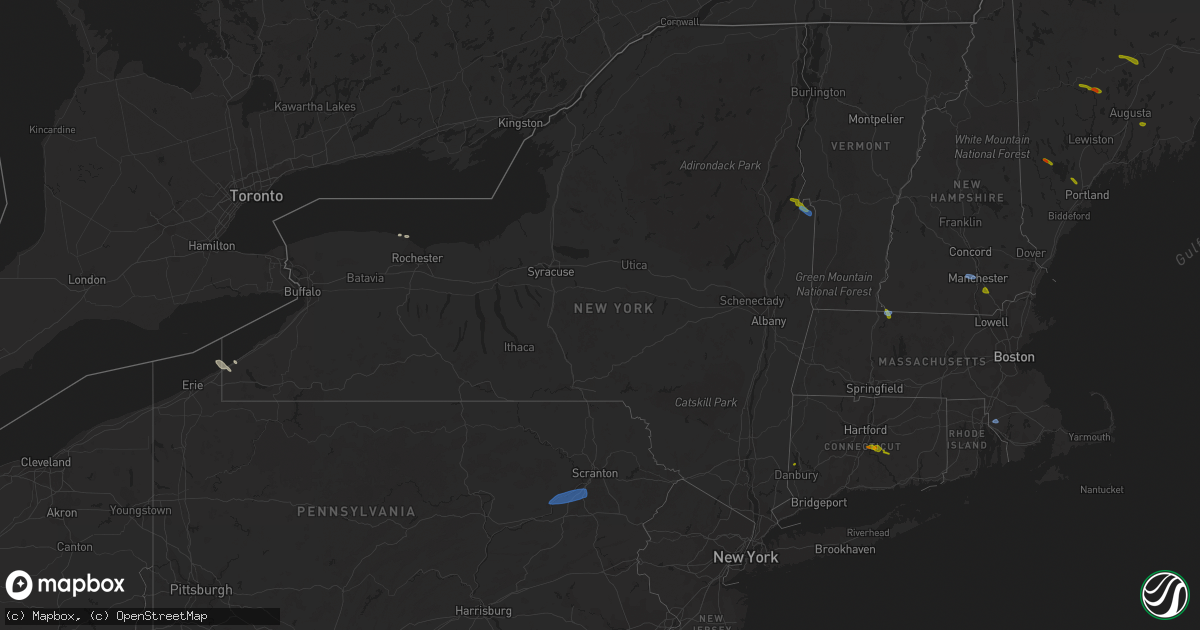
Hail Map in New York on August 24, 2020
Get this storm
August 24 map
$229
one time, instant access
Download today. No call, no setup
Keep the $229
Bought the map and want the full workflow? Apply the entire $229 to a subscription within 7 days. None of it is wasted.
Every map, not just this one
This buys you this map. Subscription and you get every map we run, in the markets you choose from a few cities to whole states to nationwide. Plus real-time alerts the moment a storm fires.
Contact data
Name, contact info, occupancy, even credit band for addresses in the footprint. You go from where it hit to who to call.
Become the source they trust
Unlimited branding weather history reports on demand. You already have the documented answer ready for the property owner, and you are the one who showed up with it.
Property data and RoofTrace estimates
Pull up any address you have got, its value and the exact code rules for that jurisdiction, straight from One Click Code. Then RoofTrace estimates the squares, pitch, and roof value, priced the way you price.
Storm reports in New York
New York
| Date | Description |
|---|---|
| 08/24/20205:57 PM CDT | Trees down on wires on north mountain street and tree donw on mccotter street. Time estimated by radar. |
| 08/24/20205:55 PM CDT | Trees dowon on wies on glimore street and potter terrace. Time estimated by radar. |
| 08/24/20205:05 PM CDT | Tree down route 4 and route 21. Time estimated by radar. |
| 08/24/20204:05 PM CDT | Trees down north and south williams streets and county route 12. Tree was on vehicle on south williams. Time estimated by radar. |
| 08/24/20204:03 PM CDT | Numerous snapped and downed trees near skenesborough drive in whitehall. House nearby has roof damage. |
| 08/24/20204:02 PM CDT | Trees down on wires on route 12/upper turnpike rd. Time estimated by radar. |
| 08/24/20204:00 PM CDT | Trees downed on skenesborough drive in front off skenesborough ems building |
| 08/24/20203:50 PM CDT | Trees were reported down on bellamy... North... West... Saunders and kirtland streets and on railrad avenue. Tree down on a vehicle on kirtland. Time estimated by radar |
| 08/24/20203:45 PM CDT | Tree down on wires on county route 7 and blue goose road. Time estimated by radar. |
| 08/24/20202:22 PM CDT | Wires down near 201 stage road. |
| 08/24/20202:10 PM CDT | Approximately a dozen trees were uprooted... Or snapped on the property. |
| 08/24/20202:00 PM CDT | Trees and wires down on day hollow road. Time estimated from radar. |
| 08/24/20202:00 PM CDT | Trees and wires down on marshland road. Time estimated from radar. |
| 08/24/20203:11 AM CDT | Tree down blocking road in lakewood. Time estimated based upon radar. |
| 08/24/20201:41 AM CDT | Tree down on ridge rd blocking road |
| 08/24/20201:35 AM CDT | Powerlines down on rt 62 in hamburg. Time estimated based upon radar. |
| 08/24/20201:30 AM CDT | Several trees down on smith road in hamburg. From wivb. Time estimated based on radar. |
| 08/24/20201:04 AM CDT | Trees down on gowanda zoar road. Time and location estimated based on radar. |
| 08/24/202012:50 AM CDT | Trees down on richardson rd in gowanda. Time estimated based upon radar. |
| 08/24/202012:11 AM CDT | At 511 PM EDT, a severe thunderstorm was located near Poultney Village, moving southeast at 25 mph. HAZARD...60 mph wind gusts and quarter size hail. SOURCE...Radar indicated. IMPACT...Minor hail damage to vehicles is possible. Expect wind damage to trees and powerlines. Locations impacted include... Rutland, Pawlet, Poultney Village, Tinmouth, Middletown Springs, Danby, Lake St. Catherine, Rutland - Southern Vermont Airport, Poultney, Fair Haven, Clarendon, Ira, West Haven, Wells, Castleton, West Rutland, Wallingford, Shrewsbury, East Clarendon and Hydeville. |
| 08/23/202010:30 PM CDT | At 330 PM EDT, a severe thunderstorm was located over Spencer, or 12 miles north of Waverly, moving east at 15 mph. HAZARD...60 mph wind gusts and quarter size hail. SOURCE...Radar indicated. IMPACT...Hail damage to vehicles is expected. Expect wind damage to roofs, siding, and trees. Locations impacted include... Owego, Newark Valley, Candor, Spencer, North Spencer, West Candor, Catatonk, West Newark and Weltonville. |
| 08/23/20209:53 PM CDT | At 253 PM EDT, a severe thunderstorm was located near Apalachin, or near Owego, moving east at 20 mph. HAZARD...60 mph wind gusts and quarter size hail. SOURCE...Radar indicated. IMPACT...Hail damage to vehicles is expected. Expect wind damage to roofs, siding, and trees. Locations impacted include... Binghamton, Vestal, Johnson City, Endicott, Maine, Owego, Port Dickinson, Newark Valley, Greater Binghamton Airport and Apalachin. |
| 08/23/20209:07 PM CDT | At 206 PM EDT, a severe thunderstorm was located over West Beekmantown, moving east at 25 mph. HAZARD...60 mph wind gusts and quarter size hail. SOURCE...Radar indicated. IMPACT...Minor hail damage to vehicles is possible. Expect wind damage to trees and powerlines. Locations impacted include... Plattsburgh, Beekmantown, Georgia, Grand Isle, St. Albans Town, North Hero, Milton, South Hero, Georgia Center, St. Albans City, Colchester, Isle La Motte, Swanton, Young Island, Wilcox Point, Scott Point, Hazen Point, West Milton, Hen Island and Conner Bay. |
| 08/23/20207:50 PM CDT | Trees down along river road to the albany city line. |
All States Impacted by Hail Map on August 24, 2020
Cities Impacted by Hail Map on August 24, 2020
- Greenwood, WI
- Stoughton, WI
- Janesville, WI
- Edgerton, WI
- Sharon, WI
- Milton, WI
- Darien, WI
- Avalon, WI
- Cambridge, WI
- Clinton, WI
- Fort Atkinson, WI
- Augusta, WI
- Osseo, WI
- Fairchild, WI
- Markesan, WI
- Cambria, WI
- Fox Lake, WI
- Randolph, WI
- Columbus, WI
- Sun Prairie, WI
- Marshall, WI
- Deforest, WI
- Arlington, WI
- Rio, WI
- Poynette, WI
- Spencer, WI
- Chili, WI
- Pittsville, WI
- Necedah, WI
- Nekoosa, WI
- Arkdale, WI
- Willard, WI
- Franklin, MN
- Fairfax, MN
- Westfield, WI
- Oxford, WI
- Gibbon, MN
- Hector, MN
- Grand Marsh, WI
- Wisconsin Dells, WI
- Delavan, WI
- Butler, WI
- Brookfield, WI
- Milwaukee, WI
- Walworth, WI
- Burlington, WI
- Springfield, WI
- Lake Geneva, WI
- Elkhorn, WI
- Whitewater, WI
- Palmyra, WI
- Westfield, NY
- Eau Claire, WI
- Wisconsin Rapids, WI
- Stanley, WI
- Alma Center, WI
- Wautoma, WI
- Neshkoro, WI
- Lake Mills, WI
- Waterloo, WI
- Neillsville, WI
- Deerfield, WI
- Stratford, WI
- Waupun, WI
- Beaver Dam, WI
- Friendship, WI
- Coloma, WI
- Chippewa Falls, WI
- Elk Mound, WI
- Colfax, WI
- Olivia, MN
- Bird Island, MN
- Hebron, IL
- Woodstock, IL
- Wonder Lake, IL
- Babcock, WI
- Ripley, NY
- North East, PA
- Iron Ridge, WI
- Hartford, WI
- Rubicon, WI
- Horicon, WI
- Lodi, WI
- Dane, WI
- Adams, WI
- Montello, WI
- Marshfield, WI
- Auburndale, WI
- Hubertus, WI
- Colgate, WI
- Fall River, WI
- Pardeeville, WI
- Portage, WI
- Granton, WI
- Mosinee, WI
- Endeavor, WI
- Packwaukee, WI
- Hancock, WI
- Watertown, WI
- Dalton, WI
- Bancroft, WI
- Mchenry, IL
- Crystal Lake, IL
- Wyocena, WI
- Burnett, WI
- Harvard, IL
- Humbird, WI
- Fall Creek, WI
- Merrillan, WI
- Madison, WI
- Berlin, WI
- Hilton, NY
- Jefferson, WI
- Loyal, WI
- Cadott, WI
- Vesper, WI
- Arpin, WI
- Buffalo Lake, MN
- Lowell, WI
- Hustisford, WI
- Eleva, WI
- Neosho, WI
- Black River Falls, WI
- Port Edwards, WI
- Williams Bay, WI
- Lake In The Hills, IL
- Algonquin, IL
- Cottage Grove, WI
- Sussex, WI
- Barrington, IL
- Cary, IL
- Fox River Grove, IL
- Hoffman Estates, IL
- Richmond, IL
- Reeseville, WI
- Richfield, WI
- Fontana, WI
- Strum, WI
- Juneau, WI
- Palatine, IL
- Doylestown, WI
- Ringwood, IL
- Kingston, WI
- Brandon, WI
- New Lisbon, WI
- Tomah, WI
- Theresa, WI
- Allenton, WI
- Mayville, WI
- Owen, WI
- Brownsville, WI
- Lomira, WI
- Fond Du Lac, WI
- Oakfield, WI
- Menomonee Falls, WI
- West Bend, WI
- Lebanon, WI
- Ripon, WI
- Hewitt, WI
- Princeton, WI
- Carpentersville, IL
- Londonderry, NH
- Derry, NH
- Northfield, MA
- Winchester, NH
- Vernon, VT
- Hinsdale, NH
- East Hampton, CT
- Colchester, CT
- Portland, CT
- Cromwell, CT
- South Glastonbury, CT
- New Fairfield, CT
- Starksboro, VT
- Whitehall, NY
- Fair Haven, VT
- Huletts Landing, NY
- Clemons, NY
- Goffstown, NH
- Manchester, NH
- Rehoboth, MA
- Kents Hill, ME
- Canton, ME
- Livermore Falls, ME
- Jay, ME
- Skowhegan, ME
- Anson, ME
- Norridgewock, ME
- Naples, ME
- Sebago, ME
- Gardiner, ME
- Whitefield, ME
- Windham, ME
- Bristol, VT
- Poultney, VT
- Fredericksburg, VA
- Shickshinny, PA
- Plymouth, PA
- Wilkes Barre, PA
- Nanticoke, PA
- Wapwallopen, PA
- Hunlock Creek, PA
- Glen Lyon, PA
- Kingston, PA
- Mountain Top, PA
- Altoona, WI


