Hail Map in New Jersey on August 23, 2020
Get this storm
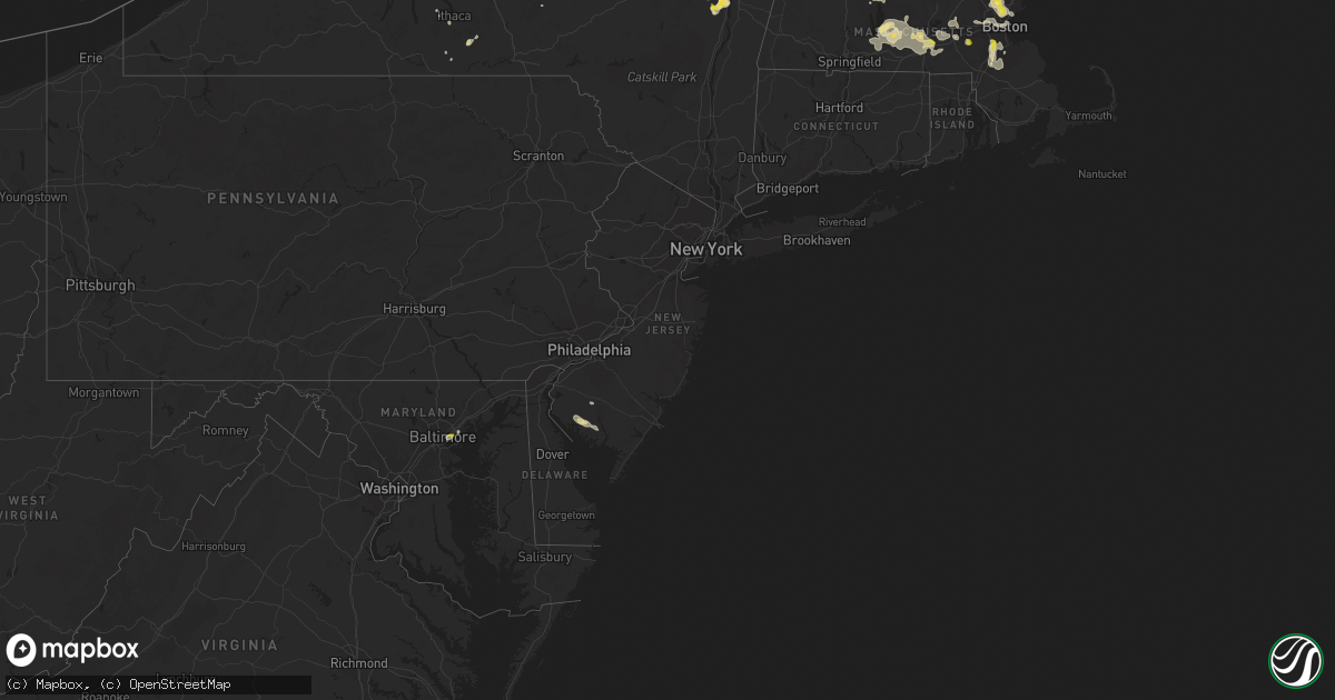
August 23 map
$229
one time, instant access
Download today. No call, no setup
Keep the $229
Bought the map and want the full workflow? Apply the entire $229 to a subscription within 7 days. None of it is wasted.
Every map, not just this one
This buys you this map. Subscription and you get every map we run, in the markets you choose from a few cities to whole states to nationwide. Plus real-time alerts the moment a storm fires.
Contact data
Name, contact info, occupancy, even credit band for addresses in the footprint. You go from where it hit to who to call.
Become the source they trust
Unlimited branding weather history reports on demand. You already have the documented answer ready for the property owner, and you are the one who showed up with it.
Property data and RoofTrace estimates
Pull up any address you have got, its value and the exact code rules for that jurisdiction, straight from One Click Code. Then RoofTrace estimates the squares, pitch, and roof value, priced the way you price.
Storm reports in New Jersey
New Jersey
| Date | Description |
|---|---|
| 08/23/20203:53 PM CDT | Reports of trees down in hopewell twp and the bridgeton area... Including near greenwood drive and osborn lane. Time estimated from radar. |
| 08/23/20203:53 PM CDT | Report of power lines down near victory road. Time estimated from radar. |
| 08/23/202012:33 AM CDT | At 532 PM EDT, a severe thunderstorm was located over Bricksboro, or near Millville, moving southeast at 15 mph. HAZARD...60 mph wind gusts and quarter size hail. SOURCE...Radar indicated. IMPACT...Minor damage to vehicles is possible. Wind damage to roofs, siding, trees, and power lines is possible. Locations impacted include... Ocean City, Woodbine, Sea Isle City, Estell Manor, Avalon, Stone Harbor, Corbin City, Mauricetown, Belleplain Forest, Leesburg, Scotch Bonnet, Beesleys Point, Port Norris, Seaville, Marmora, Dennisville, Bricksboro, Goshen, Strathmere and Port Elizabeth.This includes Garden State Parkway between mile markers 10 and 26. |
| 08/22/202011:53 PM CDT | At 453 PM EDT, a severe thunderstorm was located over Fairton, or near Bridgeton, moving east at 20 mph. HAZARD...60 mph wind gusts and penny size hail. SOURCE...Radar indicated. IMPACT...Damage to roofs, siding, trees, and power lines is possible. Locations impacted include... Vineland, Millville, Bridgeton, Cumberland, Laurel Lake, Greenwich, Newport, Mauricetown, Leesburg, Port Norris, Dividing Creek, Fairton, Bricksboro, Cedarville, Port Elizabeth, Bivalve, South Vineland and Rosenhayn. |
All States Impacted by Hail Map on August 23, 2020
Cities Impacted by Hail Map on August 23, 2020
- Owanka, SD
- Wasta, SD
- Tappen, ND
- Ypsilanti, ND
- Valley City, ND
- Baldwin, ND
- Streeter, ND
- Napoleon, ND
- Fort Ransom, ND
- Lisbon, ND
- Verona, ND
- Medina, ND
- Jud, ND
- Marion, ND
- Montpelier, ND
- Jamestown, ND
- Steele, ND
- Litchville, ND
- Pettibone, ND
- Driscoll, ND
- Pingree, ND
- Dawson, ND
- Tuttle, ND
- Gackle, ND
- Sterling, ND
- Cleveland, ND
- Spiritwood, ND
- Robinson, ND
- Sanborn, ND
- Kintyre, ND
- Wing, ND
- Regan, ND
- Woodworth, ND
- Faith, SD
- Mud Butte, SD
- Union Center, SD
- Palatine, IL
- Rolling Meadows, IL
- Arlington Heights, IL
- Sutton, MA
- Dumont, MN
- Chokio, MN
- Menomonee Falls, WI
- Milwaukee, WI
- Butler, WI
- Selkirk, NY
- Fairmount, ND
- Hankinson, ND
- Tuthill, SD
- Martin, SD
- Allen, SD
- Hackberry, AZ
- Oakes, ND
- Ellendale, ND
- Brockton, MA
- Dedham, MA
- South Easton, MA
- Foxboro, MA
- North Easton, MA
- Norwood, MA
- Sharon, MA
- East Walpole, MA
- Stoughton, MA
- Westwood, MA
- Canton, MA
- Worcester, MA
- Millbury, MA
- Auburn, MA
- Pekin, IL
- Tremont, IL
- Buchanan, ND
- Raymond, MN
- Willmar, MN
- Pennock, MN
- Kerkhoven, MN
- Londonderry, NH
- Hudson, NH
- Windham, NH
- Clinton, MN
- Corona, SD
- Ortonville, MN
- Edgeley, ND
- Spencer, MA
- Paxton, MA
- Leicester, MA
- Holden, MA
- Cherry Valley, MA
- Winchester, NH
- Swanzey, NH
- Forbes, ND
- Caputa, SD
- Rapid City, SD
- White River, SD
- Danvers, MN
- Hancock, MN
- Granite Falls, MN
- Maynard, MN
- Montevideo, MN
- Cuervo, NM
- New Underwood, SD
- Waubay, SD
- Webster, SD
- Frederick, SD
- Leola, SD
- Beardsley, MN
- Spencer, NY
- Newfield, NY
- Ithaca, NY
- Prescott, AZ
- Sacred Heart, MN
- Erving, MA
- Orange, MA
- Wendell, MA
- Wendell Depot, MA
- Box Elder, SD
- Correll, MN
- Appleton, MN
- Las Cruces, NM
- Hazelton, ND
- Moffit, ND
- Seligman, AZ
- Wood, SD
- Summit, SD
- Kulm, ND
- Cogswell, ND
- Alberta, MN
- Morris, MN
- Wheaton, MN
- Donnelly, MN
- Odessa, MN
- Dawson, MN
- Milan, MN
- Benson, MN
- Madison, MN
- Graceville, MN
- Clontarf, MN
- Holloway, MN
- Las Vegas, NV
- House, NM
- West Pawlet, VT
- Claire City, SD
- Pierpont, SD
- Elmer, NJ
- Danube, MN
- Renville, MN
- Cosmos, MN
- Lake Lillian, MN
- Blomkest, MN
- Hector, MN
- Hutchinson, MN
- Atwater, MN
- Stewart, MN
- Buffalo Lake, MN
- Fullerton, ND
- Roslyn, SD
- Andover, SD
- Braddock, ND
- Ware, MA
- Hardwick, MA
- Coeymans Hollow, NY
- Glenmont, NY
- Feura Bush, NY
- Alcove, NY
- Hannacroix, NY
- South Bethlehem, NY
- Ravena, NY
- Delmar, NY
- Wilmington, MA
- Wakefield, MA
- Saugus, MA
- Melrose, MA
- Woburn, MA
- Winchester, MA
- Medford, MA
- Malden, MA
- Stoneham, MA
- Reading, MA
- Burlington, MA
- Olivia, MN
- Happy Jack, AZ
- New Braintree, MA
- West Brookfield, MA
- North Brookfield, MA
- Milton, MA
- Mansfield, MA
- Walpole, MA
- Hyde Park, MA
- Putnam Station, NY
- Fair Haven, VT
- Melrose, NM
- Voorheesville, NY
- Westerlo, NY
- Clarksville, NY
- East Berne, NY
- Middle River, MD
- Essex, MD
- Warren, MA
- Gilbertville, MA
- Fremont, NH
- Epping, NH
- Exeter, NH
- Northborough, MA
- Shrewsbury, MA
- Westborough, MA
- Wimbledon, ND
- Brownsville, VT
- Windsor, VT
- Gwinner, ND
- Winner, SD
- Elm Grove, WI
- Brookfield, WI
- Fort Sumner, NM
- Gurnee, IL
- Middletown Springs, VT
- Lincolnshire, IL
- Lake Bluff, IL
- Highwood, IL
- Northbrook, IL
- Highland Park, IL
- Deerfield, IL
- Great Lakes, IL
- Wheeling, IL
- Lake Forest, IL
- Buffalo Grove, IL
- Willseyville, NY
- Candor, NY
- Morocco, IN
- Lake Village, IN
- Fair Oaks, IN
- Oral, SD
- New Berlin, WI
- Newfields, NH
- Bridgeton, NJ
- Sherborn, MA
- Holliston, MA
- Ashland, MA
- Milnor, ND
- Chester, VT
- Saint Anne, IL
- Pembroke Township, IL
- Lamoure, ND
- Randolph, MA
- Belchertown, MA
- Lockwood, NY
- Hoffman Estates, IL
- Schaumburg, IL
- New Ipswich, NH
- Fort Ann, NY
- Whitehall, NY
- Sisseton, SD
- Schoharie, NY
- Overton, NV
- Mercer, ND
- Momence, IL
- Delanson, NY
- Southborough, MA
- Bristol, SD
- Groton, SD
- New Salem, MA
- Athol, MA
- Warwick, MA
- Hopkinton, MA
- Candia, NH
- Deerfield, NH
- Kirkland, AZ
- Hamilton, NY
- Britton, SD
- Canajoharie, NY
- Coleharbor, ND
- Duanesburg, NY
- Okaton, SD
- Millville, NJ
- Cedarville, NJ
- Dickey, ND
- Big Stone City, SD
- Watson, MN
- Wells, VT
- Granville, NY
- North Andover, MA
- Andover, MA
- Hudson, MA
- East Boston, MA
- Boston, MA
- Wayland, MA
- Waltham, MA
- Weston, MA
- Brighton, MA
- Cambridge, MA
- Lincoln, MA
- Watertown, MA
- Lexington, MA
- Arlington, MA
- Charlestown, MA
- Chelsea, MA
- Allston, MA
- Belmont, MA
- Willow Beach, AZ
- Palmer, MA
- Berlin, MA
- Marlborough, MA
- Stow, MA
- Albert Lea, MN
- Barre, MA
- Bondsville, MA
- Grafton, MA
- Brookfield, MA
- Rutland, MA
- Charlton, MA
- Jefferson, MA
- Rochdale, MA
- Oakham, MA
- North Oxford, MA
- East Brookfield, MA
- South Barre, MA
- South Grafton, MA
- Oxford, MA
- Thorndike, MA
- Kathryn, ND
- Libertyville, IL
- Grayslake, IL
- Cavendish, VT
- Perkinsville, VT
- Keene, NH
- Howes Cave, NY
- Berne, NY
- Lake Zurich, IL
- Vernon Hills, IL
- Crown King, AZ
- Elk Grove Village, IL
- Raymond, NH
- Nottingham, NH
- Atkinson, NH
- Haverhill, MA
- Canton, IL
- Cuba, IL
- Troy, NH
- Spofford, NH
- Earlville, NY
- Eaton, NY
- Trumansburg, NY
- Revere, MA
- North Reading, MA
- Lynnfield, MA
- Lawrence, MA
- Tewksbury, MA
- Boxford, MA
- Lynn, MA
- Oxford, NY
- Mount Prospect, IL
- Prospect Heights, IL
- Slingerlands, NY
- Altamont, NY
- Murdo, SD
- Belvidere, SD
- Midland, SD
- Kingman, AZ
- Springfield, VT
- Saint George, UT
- Smyrna, NY
- Dundalk, MD
- Baltimore, MD
- Rosedale, MD
- Globe, AZ
- Orwell, VT
- Hague, NY
- Silver Bay, NY
- Framingham, MA
- Bismarck, ND
- Stirum, ND
- Ortley, SD
- Kandiyohi, MN
- Murdock, MN
- Philip, SD
- Quinn, SD
- Wall, SD
- Albany, NY
- Rindge, NH


