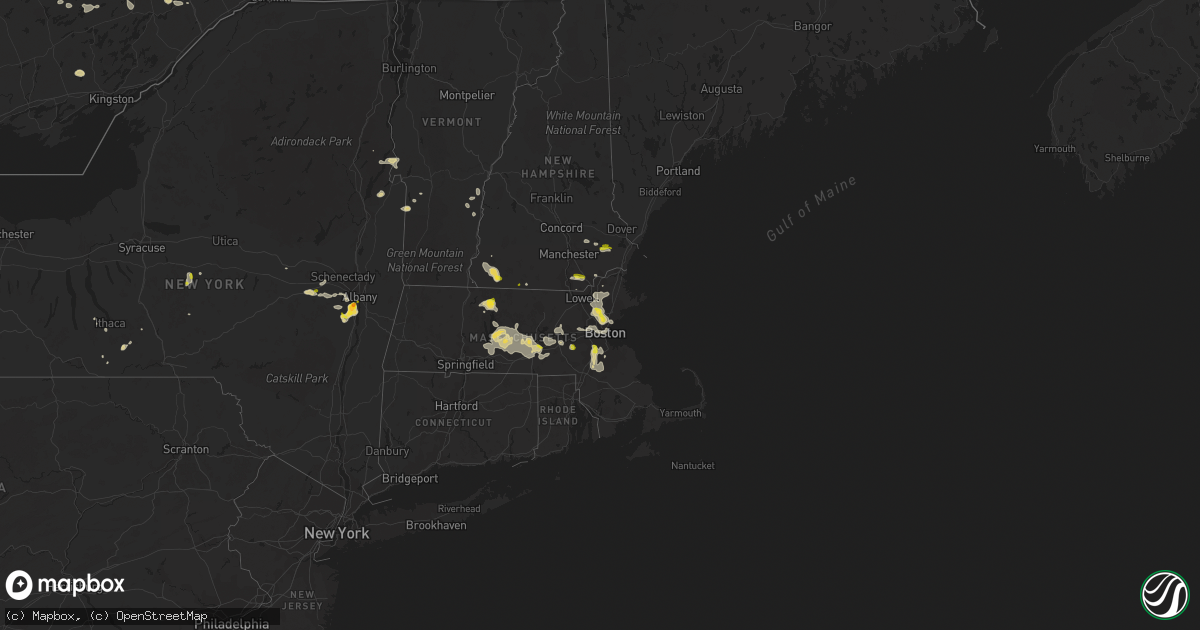
Hail Map on August 23, 2020
Get this storm
August 23 map
$229
one time, instant access
Download today. No call, no setup
Keep the $229
Bought the map and want the full workflow? Apply the entire $229 to a subscription within 7 days. None of it is wasted.
Every map, not just this one
This buys you this map. Subscription and you get every map we run, in the markets you choose from a few cities to whole states to nationwide. Plus real-time alerts the moment a storm fires.
Contact data
Name, contact info, occupancy, even credit band for addresses in the footprint. You go from where it hit to who to call.
Become the source they trust
Unlimited branding weather history reports on demand. You already have the documented answer ready for the property owner, and you are the one who showed up with it.
Property data and RoofTrace estimates
Pull up any address you have got, its value and the exact code rules for that jurisdiction, straight from One Click Code. Then RoofTrace estimates the squares, pitch, and roof value, priced the way you price.
States Impacted by Hail Map on August 23, 2020
Storm reports
Illinois
| Date | Description |
|---|---|
| 08/23/20205:00 PM CDT | Near hintz and kennicott. |
| 08/23/20204:42 PM CDT | Hail reported at the corner of euclid and route 53. |
| 08/23/20204:30 PM CDT | A local report indicates 1.00 inch wind near 1 E PALATINE |
| 08/23/20202:35 AM CDT | At 734 PM CDT, a severe thunderstorm was located over Schaumburg, and is nearly stationary. HAZARD...60 mph wind gusts and quarter size hail. SOURCE...Radar indicated. IMPACT...Hail damage to vehicles is expected. Expect wind damage to roofs, siding, and trees. Locations impacted include... Arlington Heights, Schaumburg, Palatine, Des Plaines, Mount Prospect, Hoffman Estates, Glenview, Streamwood, Hanover Park, Addison, Elk Grove Village, Rolling Meadows, Roselle, Bloomingdale, Bensenville, Prospect Heights, Wood Dale, Itasca, Inverness and Medinah.Including the following interstates... I-90 between mile markers 64 and 75. I-290 between mile markers 1 and 10. I-355 near mile marker 30.This includes... Oakton Community College, Schaumburg BoomersBaseball, and Harper College. |
| 08/23/20201:12 AM CDT | At 612 PM CDT, a severe thunderstorm was located near Lake Village, moving east at 15 mph. HAZARD...60 mph wind gusts and quarter size hail. SOURCE...Radar indicated. IMPACT...Hail damage to vehicles is expected. Expect wind damage to roofs, siding, and trees. Locations impacted include... DeMotte, Lake Village, Roselawn, Fair Oaks, Parr, Sumava Resorts and Thayer.Including the following interstate... Indiana I-65 between mile markers 218 and 233. This includes... US 41 Dragway. |
| 08/22/202011:44 PM CDT | At 443 PM CDT, a severe thunderstorm was located over Arlington Heights, moving east at 15 mph. HAZARD...60 mph wind gusts and quarter size hail. SOURCE...Radar indicated. IMPACT...Hail damage to vehicles is expected. Expect wind damage to roofs, siding, and trees. Locations impacted include... Arlington Heights, Schaumburg, Palatine, Des Plaines, Mount Prospect, Glenview, Buffalo Grove, Wheeling, Northbrook, Highland Park, Wilmette, Vernon Hills, Rolling Meadows, Deerfield, Prospect Heights, Long Grove, Inverness, Lincolnshire, Northfield and Riverwoods.Including the following interstates... I-90 between mile markers 67 and 71. I-94 between mile markers 22 and 29. I-290 near mile marker 1. I-294 between mile markers 22 and 29.This includes... Oakton Community College. |
| 08/22/20207:59 PM CDT | Hail reports estimated to be quarter size. |
| 08/22/20207:40 PM CDT | Corrects previous hail report from schaumburg. Hail reports estimated to be quarter size. |
Delaware
| Date | Description |
|---|---|
| 08/22/20208:14 PM CDT | Downed power lines near maryland avenue. Time estimated from radar. |
Pennsylvania
| Date | Description |
|---|---|
| 08/22/20208:10 PM CDT | Downed trees and wires near hillendale road east of kennett square. Time estimated from radar. |
| 08/22/20207:54 PM CDT | Downed trees and wires near the intersection of penn green road and chesterville road in ladenberg. Time estimated from radar. |
| 08/22/20207:46 PM CDT | Large tree down blocking doe run station road. Time estimated from radar and dispatch report. |
| 08/22/20207:45 PM CDT | Downed trees and wires near camp bonsul road in elk twp. Time estimated from radar. |
| 08/22/20207:40 PM CDT | Downed trees and wires near clonmell upland road north of avondale. Time estimated from radar. |
Nevada
| Date | Description |
|---|---|
| 08/22/20207:30 PM CDT | Reported at yucca mountain arl site oymab. |
New Mexico
| Date | Description |
|---|---|
| 08/22/20208:00 PM CDT | Numerous trees and power poles down in the northeast portion of las cruces. As of 8am monday... Still 500 customers without power. Wind gust from mesonet site on ridge |
Vermont
| Date | Description |
|---|---|
| 08/23/20203:40 AM CDT | At 840 PM EDT, severe thunderstorms were located along a line extending from 17 miles southwest of Lebanon to 6 miles west of Claremont to near Charlestown, moving northeast at 25 mph. HAZARD...60 mph wind gusts and penny size hail. SOURCE...Radar indicated. IMPACT...Expect damage to roofs, siding, and trees. Locations impacted include... Claremont, Lebanon, Charlestown, Enfield, Newport, Grantham, Cornish, Lempster, Acworth, Goshen, Croydon, Plainfield and Unity.This includes Interstate 89 between mile markers 43 and 60. |
| 08/22/202011:38 PM CDT | At 437 PM EDT, a severe thunderstorm was located over Benson Landing, moving southeast at 15 mph. HAZARD...60 mph wind gusts and quarter size hail. SOURCE...Radar indicated. IMPACT...Minor hail damage to vehicles is possible. Expect wind damage to trees and powerlines. Locations impacted include... Rutland, Castleton, West Castleton, Hubbardton, Poultney Village, Orwell, Lake St. Catherine, Proctor, Benson, Poultney, Fair Haven, West Rutland, Pittsford, West Haven, Sudbury, Ira, Wells, Brandon, Chittenden and Benson Bay. |
| 08/22/202011:31 PM CDT | At 431 PM EDT, a severe thunderstorm was located near Benson, or 12 miles north of Whitehall, moving southeast at 15 mph. HAZARD...60 mph wind gusts and quarter size hail. SOURCE...Radar indicated. IMPACT...Hail damage to vehicles is expected. Expect wind damage to roofs, siding, and trees. Locations impacted include... Hague, Rogers Rock Campground, Putnam, Wright, Indian Kettles, Graphite, Putnam Station, Silver Bay, Glenburnie and Adirondack. |
| 08/22/20207:36 PM CDT | Multiple trees down on lines in town |
Connecticut
| Date | Description |
|---|---|
| 08/23/202012:20 PM CDT | Small tree branchess down wiht a power outage in the area of route 305 and i-91. |
| 08/23/20201:20 AM CDT | At 617 PM EDT, a severe thunderstorm was located over Mendon, or near Milford, moving east at 15 mph. HAZARD...60 mph wind gusts and quarter size hail. SOURCE...Radar indicated. These storms have a history of producing pockets of significant wind damage. This includes downed trees and scattered power outages. Seek an indoor shelter immediately. IMPACT...Expect wind damage to trees and power lines. Minor hail damage to vehicles is possible. Locations impacted include... Brockton, Plymouth, Taunton, Woonsocket, Cumberland, Franklin, North Attleborough, Milford, Stoughton, Bridgewater, Marshfield, Attleboro, Walpole, Mansfield, Middleborough, Easton, Smithfield, Lincoln, Norton and Pembroke. |
North Dakota
| Date | Description |
|---|---|
| 08/23/20206:40 PM CDT | A local report indicates 1.00 inch wind near 4 NNE GUELPH |
| 08/23/20205:41 PM CDT | Golf ball size hail falling at time of call. Lots of lightning. |
| 08/23/20205:11 PM CDT | Time estimated from radar. |
| 08/23/20205:05 PM CDT | Hail started about 505 pm and ended around 515 pm. The largest stones were measured at 2.50 inches diameter. Rain total was measured 0.33 inches. Very little wind with |
| 08/23/20205:00 PM CDT | The largest hail ranged in size from quarter to just under golf ball size. Edges of the hail were very jagged. Hail lasted from 500 pm to 505 pm. Very little wind with |
| 08/23/20206:11 AM CDT | At 1110 PM CDT, a severe thunderstorm was located 8 miles northwest of Napoleon, moving east southeast at 25 mph. HAZARD...Ping pong ball size hail. SOURCE...Radar indicated. IMPACT...People and animals outdoors will be injured. Expect damage to roofs, siding, windows, and vehicles. This severe thunderstorm will be near... Napoleon around 1120 PM CDT.Other locations impacted by this severe thunderstorm include Kintyre. |
| 08/23/20205:41 AM CDT | At 1041 PM CDT, a severe thunderstorm was located 7 miles east of Montpelier, or 24 miles southwest of Valley City, moving east at 35 mph. HAZARD...Quarter size hail. SOURCE...Radar indicated. IMPACT...Damage to vehicles is expected. This severe thunderstorm will be near... Litchville around 1105 PM CDT. Hastings around 1110 PM CDT. |
| 08/23/20205:04 AM CDT | At 1003 PM CDT, severe thunderstorms were located along a line extending from 8 miles southwest of Steele to 7 miles southwest of Medina, moving southeast at 30 mph. HAZARD...Ping pong ball size hail and 60 mph wind gusts. SOURCE...Radar indicated. IMPACT...People and animals outdoors will be injured. Expect hail damage to roofs, siding, windows, and vehicles. Expect wind damage to roofs, siding, and trees. Severe thunderstorms will be near... Streeter around 1030 PM CDT. Napoleon around 1040 PM CDT. Gackle around 1045 PM CDT.Other locations impacted by these severe thunderstorms includeBurnstad, Beaver Lake State Park, Crystal Springs and Millarton. |
| 08/23/20204:49 AM CDT | At 948 PM CDT, a severe thunderstorm was located near Medina, moving southeast at 25 mph. HAZARD...60 mph wind gusts and half dollar size hail. SOURCE...Radar indicated. IMPACT...Hail damage to vehicles is expected. Expect wind damage to roofs, siding, and trees. This severe thunderstorm will be near... Cleveland around 1005 PM CDT.Other locations impacted by this severe thunderstorm includeEldridge, Chase Lake, Sydney and Windsor. |
| 08/23/20204:24 AM CDT | At 924 PM CDT, a severe thunderstorm was located near Eckelson, or 14 miles west of Valley City, moving east at 35 mph. HAZARD...Quarter size hail. SOURCE...Radar indicated. IMPACT...Damage to vehicles is expected. This severe thunderstorm will be near... Sanborn around 930 PM CDT. Valley City around 945 PM CDT.This includes Interstate 94 in North Dakota between mile markers 273and 292. |
| 08/23/20204:14 AM CDT | At 913 PM CDT, severe thunderstorms were located along a line extending from near Tuttle to 8 miles south of Regan, moving southeast at 15 mph. HAZARD...60 mph wind gusts and half dollar size hail. SOURCE...Radar indicated. IMPACT...Hail damage to vehicles is expected. Expect wind damage to roofs, siding, and trees. Severe thunderstorms will be near... Tuttle around 920 PM CDT. Robinson around 930 PM CDT. Sterling and Dawson around 1015 PM CDT.Other locations impacted by these severe thunderstorms includeDriscoll, Mckenzie, Arena, Lake Williams and Horsehead Lake. |
| 08/23/20204:08 AM CDT | At 908 PM CDT, a severe thunderstorm was located 7 miles southeast of Woodworth, or 14 miles northeast of Medina, moving east at 30 mph. HAZARD...60 mph wind gusts and half dollar size hail. SOURCE...Radar indicated. IMPACT...Hail damage to vehicles is expected. Expect wind damage to roofs, siding, and trees. This severe thunderstorm will be near... Buchanan around 940 PM CDT. Spiritwood Lake around 1005 PM CDT. |
| 08/23/20203:40 AM CDT | Tree downed on house with minor damage. Time estimated via radar. |
| 08/23/20201:33 AM CDT | At 633 PM CDT, a severe thunderstorm was located near Ludden, or 7 miles southwest of Oakes, moving east at 25 mph. HAZARD...Golf ball size hail and 60 mph wind gusts. SOURCE...Radar indicated. IMPACT...People and animals outdoors will be injured. Expect hail damage to roofs, siding, windows, and vehicles. Expect wind damage to roofs, siding, and trees. This severe thunderstorm will remain over mainly rural areas of southeastern Dickey County, including the following locations... Guelph. |
| 08/23/202012:57 AM CDT | At 557 PM CDT, a severe thunderstorm was located 7 miles north of Sand Lake Wildlife Refuge, or 14 miles southeast of Ellendale, moving east at 35 mph. HAZARD...Golf ball size hail. SOURCE...Trained weather spotters. This storm has a history of producing large hail. IMPACT...People and animals outdoors will be injured. Expect damage to roofs, siding, windows, and vehicles. This severe thunderstorm will be near... Sand Lake Wildlife Refuge around 605 PM CDT. Hecla and Houghton around 610 PM CDT. Claremont around 625 PM CDT. Amherst around 630 PM CDT. |
| 08/23/202012:49 AM CDT | At 548 PM CDT, a severe thunderstorm was located near Fullerton, or 12 miles west of Oakes, moving northeast at 35 mph. HAZARD...Ping pong ball size hail and 60 mph wind gusts. SOURCE...Radar indicated. IMPACT...People and animals outdoors will be injured. Expect hail damage to roofs, siding, windows, and vehicles. Expect wind damage to roofs, siding, and trees. This severe thunderstorm will be near... Oakes around 610 PM CDT. Verona around 620 PM CDT.Other locations impacted by this severe thunderstorm include Glover. |
| 08/23/202012:13 AM CDT | At 512 PM CDT, a severe thunderstorm was located near Forbes, or 9 miles west of Ellendale, moving east at 15 mph. HAZARD...Ping pong ball size hail and 60 mph wind gusts. SOURCE...Public reported golf ball sized hail in Forbes, North Dakota at around 505 pm CDT. IMPACT...People and animals outdoors will be injured. Expect hail damage to roofs, siding, windows, and vehicles. Expect wind damage to roofs, siding, and trees. Locations impacted include... Hecla, Forbes, Elm Lake and Sand Lake Wildlife Refuge. |
| 08/23/202012:07 AM CDT | At 507 PM CDT, a severe thunderstorm was located 5 miles southwest of Ellendale, moving east at 20 mph. HAZARD...Half dollar size hail. SOURCE...Radar indicated. IMPACT...Damage to vehicles is expected. This severe thunderstorm will be near... Ellendale around 520 PM CDT. Ludden around 600 PM CDT.Other locations impacted by this severe thunderstorm include Guelph. |
| 08/22/202011:12 PM CDT | Time estimated from radar. |
| 08/22/202010:25 PM CDT | Relayed via social media. |
| 08/22/202010:07 PM CDT | Relayed through broadcast media. |
| 08/22/20209:25 PM CDT | Report relayed through local media. Corrected for hail size. |
| 08/22/20209:20 PM CDT | Time estimated from radar. |
New Jersey
| Date | Description |
|---|---|
| 08/23/20203:53 PM CDT | Report of power lines down near victory road. Time estimated from radar. |
| 08/23/20203:53 PM CDT | Reports of trees down in hopewell twp and the bridgeton area... Including near greenwood drive and osborn lane. Time estimated from radar. |
| 08/23/202012:33 AM CDT | At 532 PM EDT, a severe thunderstorm was located over Bricksboro, or near Millville, moving southeast at 15 mph. HAZARD...60 mph wind gusts and quarter size hail. SOURCE...Radar indicated. IMPACT...Minor damage to vehicles is possible. Wind damage to roofs, siding, trees, and power lines is possible. Locations impacted include... Ocean City, Woodbine, Sea Isle City, Estell Manor, Avalon, Stone Harbor, Corbin City, Mauricetown, Belleplain Forest, Leesburg, Scotch Bonnet, Beesleys Point, Port Norris, Seaville, Marmora, Dennisville, Bricksboro, Goshen, Strathmere and Port Elizabeth.This includes Garden State Parkway between mile markers 10 and 26. |
| 08/22/202011:53 PM CDT | At 453 PM EDT, a severe thunderstorm was located over Fairton, or near Bridgeton, moving east at 20 mph. HAZARD...60 mph wind gusts and penny size hail. SOURCE...Radar indicated. IMPACT...Damage to roofs, siding, trees, and power lines is possible. Locations impacted include... Vineland, Millville, Bridgeton, Cumberland, Laurel Lake, Greenwich, Newport, Mauricetown, Leesburg, Port Norris, Dividing Creek, Fairton, Bricksboro, Cedarville, Port Elizabeth, Bivalve, South Vineland and Rosenhayn. |
Wisconsin
| Date | Description |
|---|---|
| 08/23/20206:45 PM CDT | Waukesha co. Dispatch has reports of mulitple trees and some wires down across brookfield and new berlin. Time estimated from radar. |
Indiana
| Date | Description |
|---|---|
| 08/23/20206:35 PM CDT | Thunderstorm winds snapped several metal umbrellas in an outdoor picnic area. |
New Hampshire
| Date | Description |
|---|---|
| 08/23/20202:30 PM CDT | Trees and wires down. |
| 08/23/20202:20 PM CDT | Trees and wires down. |
| 08/23/20202:20 PM CDT | Multiple trees and wires down. Reported at west hollis street nashua nh. |
| 08/23/20202:20 PM CDT | *** 6 inj *** thunderstorm blew over a tent where may people gathered an injured at least 6 people. Injuries did not appear to be life threatening. |
| 08/23/20201:55 PM CDT | Trees down. |
| 08/23/20201:50 PM CDT | Trees and wires down. |
| 08/23/20201:50 PM CDT | Trees and wires down. Reported at loudon road pittsfield nh. |
| 08/23/20201:50 PM CDT | Multiple trees and wires down. Reported at eaton road pittsfield nh. |
| 08/23/20201:35 PM CDT | Trees and wires down. Reported at jaffery road marlboro nh. |
| 08/23/20201:30 PM CDT | Road blocked by downed trees and wires. Reported at central square road troy nh. |
| 08/23/20201:25 PM CDT | Multiple trees down. Wires down also. |
| 08/23/20201:25 PM CDT | Multiple trees and wires down. Reported at oliver hill road swanzey nh. |
| 08/23/20201:25 PM CDT | 20 sections of wires down. |
| 08/23/20201:25 PM CDT | Wires down. Reported at taff road swanzey nh. |
| 08/23/20201:15 PM CDT | A local report indicates 1.00 inch wind near WINDHAM |
| 08/23/20203:30 AM CDT | At 829 PM EDT, severe thunderstorms were located along a line extending from Bridgewater Corners to near North Chester, moving east at 30 mph. HAZARD...60 mph wind gusts and quarter size hail. SOURCE...Radar indicated. IMPACT...Minor hail damage to vehicles is possible. Expect wind damage to trees and powerlines. Locations impacted include... Woodstock, Chester, Hartland Four Corners, Windsor, Woodstock Village, Cavendish, Perkinsville Village, Hartland, Bridgewater, Reading, Baltimore, Springfield, Weathersfield, West Windsor, Hartford, Plymouth, Perkinsville, Felchville, Brownsville and North Hartland Dam Recreation Area. |
| 08/23/20203:16 AM CDT | At 815 PM EDT, a severe thunderstorm was located near Keene, moving southeast at 10 mph. HAZARD...60 mph wind gusts and quarter size hail. SOURCE...Radar indicated. IMPACT...Hail damage to vehicles is expected. Expect wind damage to roofs, siding, and trees. Locations impacted include... Keene, Swanzey, Winchester, Richmond, Marlborough, Troy, Chesterfield and Westmoreland. |
| 08/22/202010:47 PM CDT | At 346 PM EDT, a severe thunderstorm was located over Phillipston, or 9 miles southeast of Orange, moving east at 15 mph. There are also several other storms stretching into northeast MA that may result in pockets of wind damage. HAZARD...60 mph wind gusts and quarter size hail. SOURCE...Radar indicated. IMPACT...Expect wind damage to trees and power lines. Minor hail damage to vehicles is possible. Locations impacted include... Lowell, Lawrence, Haverhill, Peabody, Methuen, Leominster, Fitchburg, Billerica, Beverly, Woburn, Chelmsford, Andover, Dracut, Tewksbury, Gloucester, North Andover, Danvers, Orange, Reading and Burlington. |
| 08/22/202010:16 PM CDT | At 316 PM EDT, a severe thunderstorm was located over New Ipswich, or 11 miles southeast of Jaffrey, moving east at 15 mph. HAZARD...60 mph wind gusts and nickel size hail. SOURCE...Radar indicated. IMPACT...Expect damage to roofs, siding, and trees. Locations impacted include... Nashua, Hollis, Brookline, Mason, Greenville, New Ipswich and Rindge. |
| 08/22/202010:14 PM CDT | At 313 PM EDT, a severe thunderstorm was located over Athol, or near Orange, moving east at 15 mph. HAZARD...60 mph wind gusts and quarter size hail. SOURCE...Radar indicated. IMPACT...Expect wind damage to trees and power lines. Minor hail damage to vehicles is possible. Locations impacted include... Lowell, Fitchburg, Chelmsford, Andover, Dracut, Tewksbury, Orange, Westford, Gardner, Athol, Pepperell, Tyngsborough, Groton, Winchendon, Lunenburg, Townsend, Templeton, Westminster, Shirley and Ashburnham. |
| 08/22/20209:21 PM CDT | At 221 PM EDT, a severe thunderstorm was located over Wendell, or near Orange, moving east at 15 mph. HAZARD...60 mph wind gusts and quarter size hail. SOURCE...Radar indicated. IMPACT...Expect wind damage to trees and power lines. Minor hail damage to vehicles is possible. Locations impacted include... Orange, Gardner, Athol, Winchendon, Montague, Templeton, Barre, Hubbardston, Northfield, Leverett, Erving, Shutesbury, Phillipston, Gill, Royalston, Petersham, New Salem, Wendell and Warwick. |
| 08/22/20208:56 PM CDT | At 154 PM EDT, a cluster of severe thunderstorms was located near Hooksett, or near Auburn, moving east at 15 mph. HAZARD...60 mph wind gusts and penny size hail. SOURCE...Radar indicated. IMPACT...Expect damage to roofs, siding, and trees. Locations impacted include... Northwood, Hooksett, Barrington, Epping, Epsom, Brentwood, Raymond, Chester, Lee, Allenstown, Fremont, Deerfield, Candia, Madbury, Nottingham, Pembroke and Strafford. |
| 08/22/20208:00 PM CDT | Tree down across the road. |
| 08/22/20207:55 PM CDT | Trees and wires down. Reported at oxbrook road charlestown nh. |
| 08/22/20207:25 PM CDT | Corrects previous tstm wnd dmg report from 3 wsw keene. Tree down across chesterfield rd. Time estimated from radar. Delayed report. Corrected to change source to law e |
Maryland
| Date | Description |
|---|---|
| 08/23/20206:03 PM CDT | A local report indicates 1.00 inch wind near 2 S ROSEDALE |
| 08/23/20204:30 PM CDT | A local report indicates 58 MPH wind near 2 W NEW MARKET |
| 08/23/20204:22 PM CDT | Tree down at 34 livingstone terrace |
| 08/23/20204:13 PM CDT | Tree down at n bentz st and dill ave |
| 08/23/20204:12 PM CDT | Spotter reported multiple large tree limbs that fell in backyard. |
| 08/23/20204:08 PM CDT | Trees and wires down on us-15 at w 7th st in frederick md. |
| 08/23/20204:08 PM CDT | Tree down at 34 livingstone terrace |
| 08/23/20203:42 AM CDT | At 842 PM EDT, severe thunderstorms were located along a line extending from near West Grove to Blake to Pleasant Hill to Brantwood, moving east at 30 mph. HAZARD...60 mph wind gusts. SOURCE...Radar indicated. IMPACT...Damage to roofs, siding, trees, and power lines is possible. Locations impacted include... Wilmington, Newark, West Chester, Elkton, Pennsville, Westtown, Carneys Point, Elsmere, Kennett Square, New Castle, Penns Grove, North East, West Grove, Delaware City, Newport, Arden, Blake, Stanton, Cheyney and Glasgow.This includes the following highways... Interstate 95 in Delaware between mile markers 0 and 23. Interstate 95 in Maryland between mile markers 100 and 109. |
| 08/23/20202:58 AM CDT | At 758 PM EDT, a severe thunderstorm was located near Rock Hall, or 7 miles east of Millers Island, moving east at 30 mph. HAZARD...60 mph wind gusts and penny size hail. SOURCE...Radar indicated. IMPACT...Damage to roofs, siding, trees, and power lines is possible. Locations impacted include... Chestertown, Rock Hall, Betterton, Newtown, Old Town, Langford and Kingstown. |
| 08/23/20201:58 AM CDT | At 658 PM EDT, a severe thunderstorm was located over Dundalk, or near Back River, moving east at 15 mph. HAZARD...60 mph wind gusts and quarter size hail. SOURCE...Radar indicated. IMPACT...Damaging winds will cause some trees and large branches to fall. This could injure those outdoors, as well as damage homes and vehicles. Roadways may become blocked by downed trees. Localized power outages are possible. Unsecured light objects may become projectiles. Locations impacted include... Baltimore, Middle River, North Point State Park, Sparrows Point, Back River, Millers Island, Dundalk, Essex, Rosedale, Rossville, Bowleys Quarters, Edgemere, Fort Howard, Eastpoint, Martin State Airport and Turners Station. |
| 08/23/202012:29 AM CDT | At 529 PM EDT, a severe thunderstorm was located over Linganore-Bartonsville, or near Harry Grove Stadium, moving southeast at 20 mph. HAZARD...60 mph wind gusts and quarter size hail. SOURCE...Radar indicated. Reports of downed trees. IMPACT...Damaging winds will cause some trees and large branches to fall. This could injure those outdoors, as well as damage homes and vehicles. Roadways may become blocked by downed trees. Localized power outages are possible. Unsecured light objects may become projectiles. Locations impacted include... Germantown, Frederick, Gaithersburg, Olney, Damascus, Montgomery Village, Eldersburg, Ballenger Creek, Redland, Mount Airy, Sykesville, New Market, Green Valley, Linganore-Bartonsville, Clarksburg, Derwood, Buckeystown, Libertytown, Washington Grove and Monrovia. |
| 08/23/202012:01 AM CDT | At 501 PM EDT, a severe thunderstorm was located over Braddock Heights, or near Frederick, moving southeast at 10 mph. HAZARD...60 mph wind gusts and quarter size hail. SOURCE...Radar indicated. IMPACT...Damaging winds will cause some trees and large branches to fall. This could injure those outdoors, as well as damage homes and vehicles. Roadways may become blocked by downed trees. Localized power outages are possible. Unsecured light objects may become projectiles. Locations impacted include... Frederick, Harry Grove Stadium, Ballenger Creek, Walkersville, Braddock Heights, New Market, Discovery-Spring Garden, Clover Hill, Linganore-Bartonsville, Adamstown, Jefferson, Buckeystown, Libertytown, Monrovia, Ijamsville, Bloomfield, Mount Pleasant, Clifton, Park Mills and Middletown In Frederick Md. |
| 08/22/202011:23 PM CDT | At 422 PM EDT, a severe thunderstorm was located over Kingsville, or near Middle River, moving southeast at 10 mph. HAZARD...60 mph wind gusts and quarter size hail. SOURCE...Radar indicated. IMPACT...Damaging winds will cause some trees and large branches to fall. This could injure those outdoors, as well as damage homes and vehicles. Roadways may become blocked by downed trees. Localized power outages are possible. Unsecured light objects may become projectiles. Locations impacted include... Middle River, Bel Air South, Perry Hall, White Marsh, Fallston, Bowleys Quarters, Kingsville, Pleasant Hills, Perryman, Edgewood, Joppatowne, Fork, Magnolia, Chase, Bradshaw, Abingdon, Joppa, Upper Falls and Gunpowder. |
South Dakota
| Date | Description |
|---|---|
| 08/23/20205:58 PM CDT | Mostly marble-sized hail. Said there were some up to one inch in diameter. 0.55in of rainfall... Too. |
| 08/23/20205:30 PM CDT | A local report indicates 4.00 inch wind near 9 E SPRING CREEK COLONY |
| 08/23/20205:30 PM CDT | A local report indicates 73 MPH wind near 3 NW WASTA |
| 08/23/20204:40 PM CDT | A local report indicates 58 MPH wind near RAPID CITY ARPT |
| 08/23/20203:08 AM CDT | At 806 PM CDT/706 PM MDT/, a severe thunderstorm was located near Midland, or 21 miles west of Murdo, moving east at 35 mph. HAZARD...70 mph wind gusts. SOURCE...Mesonet site in Midland, South Dakota reported a wind gust of 71 mph at 750 pm CDT. IMPACT...Expect considerable tree damage. Damage is likely to mobile homes, roofs, and outbuildings. Locations impacted include... Murdo, Draper, Okaton, Westover, Capa, Van Metre, Bunker and Wendte. |
| 08/23/20202:49 AM CDT | At 749 PM CDT, a severe thunderstorm was located over Sonora, or 17 miles southwest of Wahpeton, moving east at 15 mph. HAZARD...Quarter size hail. SOURCE...Radar indicated. IMPACT...Damage to vehicles is expected. This severe thunderstorm will be near... Sonora around 750 PM CDT. Lamars around 810 PM CDT. Fairmount around 815 PM CDT. Blackmer around 820 PM CDT. Tenney around 830 PM CDT.This includes Interstate 29 between mile markers 2 and 14. |
| 08/23/20202:09 AM CDT | A few hailstones up to golf ball sized. Radar estimated time. |
| 08/23/20202:07 AM CDT | Photo via social media. Radar estimated time. |
| 08/23/202012:52 AM CDT | At 552 PM CDT, a severe thunderstorm was located near Claire City, or 10 miles north of Sisseton, moving east at 25 mph. HAZARD...Golf ball size hail and 60 mph wind gusts. SOURCE...Radar indicated. IMPACT...People and animals outdoors will be injured. Expect hail damage to roofs, siding, windows, and vehicles. Expect wind damage to roofs, siding, and trees. Locations impacted include... New Effington, Claire City, Lake Traverse Housing Units and Lake Traverse. |
| 08/22/20208:53 PM CDT | 18 inch cedar tree downed via photo on social media. Event time is based on a personal weather station which recorded a peak gust of 55 mph. |
| 08/22/20208:25 PM CDT | Gust recorded on personal weather station. Damage to silo as well. |
| 08/22/20207:50 PM CDT | A local report indicates 71 MPH wind near 1 NE MIDLAND |
| 08/22/20207:45 PM CDT | A local report indicates 60 MPH wind near 1 NE MIDLAND |
| 08/22/20207:27 PM CDT | A local report indicates 65 MPH wind near 7 E WANBLEE |
Arizona
| Date | Description |
|---|---|
| 08/23/20207:26 AM CDT | At 1226 PM MST, a severe thunderstorm was located over Groom Creek Subdivision, or 7 miles south of Prescott Valley, and is nearly stationary. HAZARD...60 mph wind gusts and quarter size hail. SOURCE...Radar indicated. IMPACT...Hail damage to vehicles is expected. Expect wind damage to roofs, siding, and trees. Locations impacted include... Prescott Valley, Prescott, Groom Creek Subdivision, Walker, Prescott Gateway Mall, Downtown Prescott, Ponderosa Park, Indian Hill West Prescott, Oak Knoll Village, Lower Wolf Creek Campground, Lynx Lake Dam, Upper Wolf Creek Group Campground and White Spar Campground. |
| 08/23/20207:11 AM CDT | At 1210 AM MST, a severe thunderstorm was located near Bumble Bee, or 16 miles north of New River, moving west at 25 mph. HAZARD...70 mph wind gusts and quarter size hail. SOURCE...Radar indicated. IMPACT...Hail damage to vehicles is expected. Expect considerable tree damage. Wind damage is also likely to mobile homes, roofs, and outbuildings. Locations impacted include... Bumble Bee, Cordes, Turney Gulch Group Campground and Hazlett Hollow Campground. |
| 08/22/202010:48 PM CDT | At 348 PM MST, a severe thunderstorm was located near Middle Verde, or near Camp Verde, moving north at 10 mph. HAZARD...60 mph wind gusts and quarter size hail. SOURCE...Radar indicated. IMPACT...Hail damage to vehicles is expected. Expect wind damage to roofs, siding, and trees. Locations impacted include... Camp Verde, Middle Verde, Montezuma Castle National Monument and Cottonwood. |
| 08/22/202010:19 PM CDT | At 319 PM MST, a severe thunderstorm was located 12 miles southwest of Fraziers Well, or 55 miles northeast of Kingman, and is nearly stationary. HAZARD...60 mph wind gusts and quarter size hail. SOURCE...Radar indicated. IMPACT...Hail damage to vehicles is expected. Expect wind damage to roofs, siding, and trees. Locations impacted include... Fraziers Well and Hualapai Reservation. |
| 08/22/202010:00 PM CDT | At 259 PM MST, a severe thunderstorm was located over Diamond M Ranch, or 38 miles east of Kingman, moving west at 15 mph. HAZARD...60 mph wind gusts. SOURCE...Radar indicated. IMPACT...Expect damage to roofs and trees. Locations impacted include... Diamond M Ranch. |
| 08/22/20209:30 PM CDT | At 227 PM MST, a severe thunderstorm was along I-40 near mile marker 110 located 13 miles southeast of Diamond M Ranch, moving northwest at 10 mph. HAZARD...60 mph wind gusts and quarter size hail. SOURCE...Radar indicated. IMPACT...Hail damage to vehicles is expected. Expect wind damage to roofs, siding, and trees. Locations impacted include... Cross Mountain. |
| 08/22/20209:08 PM CDT | At 207 PM MST, a severe thunderstorm was located near Kirkland, or 24 miles southwest of Prescott Valley, and is nearly stationary. HAZARD...60 mph wind gusts and quarter size hail. SOURCE...Radar indicated. IMPACT...Hail damage to vehicles is expected. Expect wind damage to roofs, siding, and trees. Locations impacted include... Kirkland. |
| 08/22/20208:43 PM CDT | At 143 PM MST, a severe thunderstorm was located near Crown King, and is nearly stationary. HAZARD...60 mph wind gusts and quarter size hail. SOURCE...Radar indicated. IMPACT...Hail damage to vehicles is expected. Expect wind damage to roofs, siding, and trees. Locations impacted include... Crown King. |
Nebraska
| Date | Description |
|---|---|
| 08/23/20203:51 AM CDT | At 850 PM MDT/950 PM CDT/, a severe thunderstorm was located 3 miles north of Lacreek Wildlife Refuge, or 8 miles east of Martin, moving southeast at 20 mph. HAZARD...Ping pong ball size hail and 60 mph wind gusts. SOURCE...Radar indicated. IMPACT...People and animals outdoors will be injured. Expect hail damage to roofs, siding, windows, and vehicles. Expect wind damage to roofs, siding, and trees. This severe thunderstorm will be near... Tuthill around 900 PM MDT. |
Massachusetts
| Date | Description |
|---|---|
| 08/23/20206:39 PM CDT | Tree down blocking road on state st. |
| 08/23/20206:30 PM CDT | Trees and wires down on belchertown rd. |
| 08/23/20206:10 PM CDT | Large tree down on power lines on warner st. Multiple trees and wires down on east st from swift river wildlife to cold spring rd. |
| 08/23/20206:10 PM CDT | Multiple trees and wires down on ragged hill road. |
| 08/23/20206:05 PM CDT | Tree fell on roof of house on east main st with no injuries. Tree down on wires on myrick rd. |
| 08/23/20206:04 PM CDT | Power lines down blocking road on aldrich drive. |
| 08/23/20205:55 PM CDT | Trees and wires down on miller drive. Tree down on rte 67 near west brookfield line blocking road. |
| 08/23/20205:30 PM CDT | Tree down across the road on highland street. Tree down on wires on depot st. |
| 08/23/20205:10 PM CDT | High voltage power line down on pearl st. Tree and wires down on holy lane. Tree down blocking road on south st/fisher st. |
| 08/23/20205:00 PM CDT | Trees and wires down on lawrence st and fuller st. |
| 08/23/20205:00 PM CDT | Tree down on cristo lane blocking road. |
| 08/23/20205:00 PM CDT | Tree down on wires on henshaw st at south main st. Tree down on powerlines on white birch st. Tree down on marshall st. Tree down on greenville circle. |
| 08/23/20205:00 PM CDT | Multiple trees and wires down on strasser ave and fearing drive. |
| 08/23/20204:46 PM CDT | A local report indicates 59 MPH wind near NORWOOD AP |
| 08/23/20204:46 PM CDT | A local report indicates 60 MPH wind near BLUE HILL COOP |
| 08/23/20204:41 PM CDT | A local report indicates 1.00 inch wind near WORCESTER |
| 08/23/20204:40 PM CDT | Wires down on mower st... Brightwood ave and main st |
| 08/23/20204:35 PM CDT | Trees down on wires on carolyn drive... Linda st and haskell st |
| 08/23/20204:30 PM CDT | Tree down on brightwood ave |
| 08/23/20204:25 PM CDT | Tree down...went through a trailer in martys trailer park on southwest cutoff. No injuries. |
| 08/23/20204:20 PM CDT | Tree down on fisher st at otis st |
| 08/23/20204:18 PM CDT | A local report indicates 62 MPH wind near WORCESTER AP |
| 08/23/20204:15 PM CDT | Tree and wires down in the road on barre-paxton rd. |
| 08/23/20204:06 PM CDT | Tree down on rte 99 just before us rte 1 |
| 08/23/20204:05 PM CDT | Tree and wires down across road and a driveway on spencer rd. |
| 08/23/20204:05 PM CDT | Tree down on wires on hobson st |
| 08/23/20203:56 PM CDT | Large tree down on loring road in the area of south st. Tree down on root road at south st. Tree and wires down on clem court. Tree and wires down on church st. Tree an |
| 08/23/20203:45 PM CDT | Tree down on car on franklin st |
| 08/23/20203:45 PM CDT | A local report indicates 1.00 inch wind near WAKEFIELD |
| 08/23/20203:45 PM CDT | Trees down on avon ave... Green st. Tree down on house on main st at lake |
| 08/23/20203:24 PM CDT | Tree down on car and blocking road on woodstock rd. |
| 08/23/20203:20 PM CDT | Tree down on wires on wilmor rd |
| 08/23/20203:12 PM CDT | Tree down on house and blocking road on oak rd |
| 08/23/20203:10 PM CDT | Tree down on college rd |
| 08/23/20202:52 PM CDT | Trees and wires down on jonathan dr and groton school rd |
| 08/23/20202:46 PM CDT | Large trees down on townsend rd |
| 08/23/20202:46 PM CDT | Tree down blocking road on 7th st |
| 08/23/20202:45 PM CDT | Tree down on cars on cove rd |
| 08/23/20202:45 PM CDT | Trees and poles down on ashby state rd |
| 08/23/20202:43 PM CDT | Tree down on house at brigham park |
| 08/23/20202:40 PM CDT | Large tree down blocking road on orchard hill rd... Tree down on wires on brookside rd |
| 08/23/20202:36 PM CDT | Tree down blocking road on rogers ave |
| 08/23/20202:35 PM CDT | Tree and wires down on hillcrest rd and daniel shays hwy. |
| 08/23/20202:31 PM CDT | Tree down on house on roosevelt ave |
| 08/23/20202:26 PM CDT | Trees and wires down on east river st... East main st and brookside rd |
| 08/23/20201:56 PM CDT | Trees down on north orange rd... West orange rd... Wheeler ave and north main st. Damage began at 256pm and continued through 315pm. |
| 08/23/20202:22 AM CDT | At 721 PM EDT, a severe thunderstorm was located over Palmer, or 14 miles northeast of Springfield, moving east at 15 mph. HAZARD...60 mph wind gusts and quarter size hail. SOURCE...Radar indicated. IMPACT...Expect wind damage to trees and power lines. Minor hail damage to vehicles is possible. Locations impacted include... Worcester, Shrewsbury, Ludlow, Westborough, Grafton, Webster, Southbridge, Auburn, Northbridge, Belchertown, Wilbraham, Northborough, Oxford, Uxbridge, Millbury, Charlton, Palmer, Spencer, Dudley and Leicester. |
| 08/23/20201:32 AM CDT | At 632 PM EDT, a severe thunderstorm was located over Granby, or near Chicopee, moving east at 15 mph. HAZARD...60 mph wind gusts and quarter size hail. SOURCE...Radar indicated. IMPACT...Expect wind damage to trees and power lines. Minor hail damage to vehicles is possible. Locations impacted include... Worcester, Chicopee, Amherst, Ludlow, South Hadley, Holden, Auburn, Belchertown, Wilbraham, Oxford, Millbury, Charlton, Palmer, Spencer, Leicester, Ware, Rutland, West Boylston, Granby and Hadley. |
| 08/23/20201:15 AM CDT | At 615 PM EDT, a severe thunderstorm was located over Petersham, or 12 miles south of Orange, moving east at 15 mph. HAZARD...Ping pong ball size hail and 60 mph wind gusts. SOURCE...Radar indicated. IMPACT...Expect wind damage to trees and power lines. Minor hail damage to vehicles is possible. Locations impacted include... Worcester, Leominster, Holden, Belchertown, Spencer, Athol, Ware, Templeton, Rutland, Sterling, West Boylston, Westminster, Barre, Paxton, North Brookfield, Hubbardston, Princeton, Hardwick, Oakham and Phillipston. |
| 08/23/20201:10 AM CDT | At 609 PM EDT, a severe thunderstorm was located over Stoughton, moving east at 15 mph. HAZARD...60 mph wind gusts. SOURCE...Radar indicated. This storm has a history of producing significant wind damage. Seek an indoor shelter immediately! IMPACT...Expect damage to trees and power lines. Locations impacted include... Brockton, Weymouth, Braintree, Randolph, Norwood, Stoughton, Marshfield, Walpole, Mansfield, Easton, Hingham, Canton, Scituate, Pembroke, Sharon, Rockland, Foxborough, Abington, Duxbury and Westwood. |
| 08/23/202012:38 AM CDT | At 537 PM EDT, a severe thunderstorm was located over Millbury, or near Worcester, moving east at 15 mph. HAZARD...60 mph wind gusts and quarter size hail. SOURCE...Radar indicated. In addition, these storms have a history of significant wind damage. This includes downed trees and scattered power outages. Seek an indoor shelter immediately. IMPACT...Expect wind damage to trees and power lines. Minor hail damage to vehicles is possible. Locations impacted include... Boston, Worcester, Brockton, Quincy, Newton, Framingham, Brookline, Weymouth, Braintree, Shrewsbury, Natick, Randolph, Franklin, Needham, Norwood, Milford, Wellesley, Milton, Stoughton and Marshfield. |
| 08/23/202012:28 AM CDT | At 528 PM EDT, a severe thunderstorm was located over West Brookfield, or 16 miles west of Worcester, moving east at 15 mph. HAZARD...60 mph wind gusts and quarter size hail. SOURCE...Radar indicated. IMPACT...Expect wind damage to trees and power lines. Minor hail damage to vehicles is possible. Locations impacted include... Worcester, Springfield, Ludlow, Southbridge, Auburn, Belchertown, Wilbraham, Oxford, Charlton, Palmer, Spencer, Leicester, Ware, Sturbridge, Monson, Granby, Warren, Paxton, North Brookfield and West Brookfield. |
| 08/23/202012:12 AM CDT | At 510 PM EDT, a severe thunderstorm was located over Wellesley, moving east at 15 mph. HAZARD...60 mph wind gusts and quarter size hail. SOURCE...Radar indicated. These thunderstorms have a history of wind and tree damage across many parts of central and northeast Massachusetts. Seek an indoor shelter immediately. IMPACT...Expect wind damage to trees and power lines. Minor hail damage to vehicles is possible. Locations impacted include... Boston, Cambridge, Quincy, Lynn, Newton, Somerville, Framingham, Waltham, Malden, Brookline, Medford, Weymouth, Revere, Arlington, Everett, Braintree, Chelsea, Natick, Randolph and Watertown. |
| 08/22/202011:55 PM CDT | At 455 PM EDT, a severe thunderstorm was located over Paxton, or near Worcester, moving east at 15 mph. HAZARD...60 mph wind gusts and quarter size hail. SOURCE...Radar indicated. IMPACT...Expect wind damage to trees and power lines. Minor hail damage to vehicles is possible. Locations impacted include... Worcester, Framingham, Marlborough, Shrewsbury, Acton, Hudson, Westborough, Grafton, Holden, Southbridge, Ashland, Auburn, Northbridge, Hopkinton, Northborough, Oxford, Clinton, Millbury, Charlton and Spencer. |
| 08/22/202011:44 PM CDT | At 444 PM EDT, a severe thunderstorm was located near Rutland, or 13 miles southwest of Leominster, moving east at 15 mph. HAZARD...60 mph wind gusts and quarter size hail. SOURCE...Radar indicated. IMPACT...Expect wind damage to trees and power lines. Minor hail damage to vehicles is possible. Locations impacted include... Worcester, Leominster, Fitchburg, Marlborough, Shrewsbury, Gardner, Holden, Northborough, Clinton, Spencer, Lunenburg, Lancaster, Templeton, Rutland, Sterling, West Boylston, Westminster, Shirley, Harvard and Barre. |
| 08/22/202011:34 PM CDT | At 433 PM EDT, a severe thunderstorm was located over Reading, or near Woburn, moving east at 15 mph. HAZARD...60 mph wind gusts and quarter size hail. SOURCE...Radar indicated. IMPACT...Expect wind damage to trees and power lines. Minor hail damage to vehicles is possible. Locations impacted include... Boston, Cambridge, Lynn, Newton, Somerville, Framingham, Waltham, Malden, Brookline, Medford, Revere, Peabody, Arlington, Everett, Salem, Billerica, Beverly, Marlborough, Woburn and Chelsea. |
| 08/22/202011:12 PM CDT | At 412 PM EDT, a severe thunderstorm was located over Stow, or near Marlborough, moving east at 15 mph. HAZARD...60 mph wind gusts and quarter size hail. SOURCE...Radar indicated. IMPACT...Expect wind damage to trees and power lines. Minor hail damage to vehicles is possible. Locations impacted include... Boston, Cambridge, Newton, Somerville, Framingham, Waltham, Malden, Brookline, Medford, Arlington, Marlborough, Woburn, Natick, Watertown, Lexington, Wellesley, Reading, Belmont, Burlington and Acton. |
| 08/22/20209:28 PM CDT | At 228 PM EDT, a severe thunderstorm was located over Salem, moving east at 15 mph. HAZARD...70 mph wind gusts and quarter size hail. SOURCE...Radar indicated. IMPACT...Hail damage to vehicles is expected. Expect considerable tree damage. Wind damage is also likely to mobile homes, roofs, and outbuildings. Locations impacted include... Derry, Salem, Hampstead, Atkinson, Windham, Plaistow and Newton. This includes Interstate 93 between mile markers 2 and 8. |
| 08/22/20209:21 PM CDT | At 220 PM EDT, severe thunderstorms were located along a line extending from near Marlborough to near Swanzey, moving east at 25 mph. HAZARD...60 mph wind gusts and penny size hail. SOURCE...Radar indicated. IMPACT...Expect damage to roofs, siding, and trees. Locations impacted include... Keene, Jaffrey, Swanzey, Peterborough, Winchester, Dublin, Richmond, Harrisville, Marlborough, Rindge, Roxbury, Fitzwilliam, Troy, Chesterfield and Sharon.This also includes... Mount Monadnock. |
| 08/22/20208:42 PM CDT | At 142 PM EDT, a severe thunderstorm was located over Hudson, or near Nashua, moving east at 15 mph. HAZARD...60 mph wind gusts and penny size hail. SOURCE...Radar indicated. IMPACT...Expect damage to roofs, siding, and trees. Locations impacted include... Nashua, Derry, Salem, Merrimack, Litchfield, Hudson, Pelham, Londonderry, Atkinson, Windham, Plaistow and Newton.This includes Interstate 93 between mile markers 1 and 11. |
| 08/22/20207:10 PM CDT | Tree down on wires on birch hill rd. |
New York
| Date | Description |
|---|---|
| 08/23/20204:00 PM CDT | A local report indicates 1.00 inch wind near 4 SSW DELANSON |
| 08/23/20203:59 PM CDT | Downed limbs on larry hill road near kump road |
| 08/23/20203:55 PM CDT | Large tree down near state hwy 5s and canajoharie... Ny. |
| 08/23/20203:10 PM CDT | A local report indicates 1.00 inch wind near 3 W HAMILTON |
| 08/23/20202:49 PM CDT | Trees down on 1716 rt 143 in coeyman... Ny. |
| 08/23/20202:46 PM CDT | Barn roof torn off |
| 08/23/20202:27 PM CDT | Fire due to tree on wires |
| 08/23/20202:21 PM CDT | Trees down blocking road |
| 08/23/20202:16 PM CDT | Trees uprooted |
| 08/23/20202:13 PM CDT | Tree and wires down |
| 08/23/20202:12 PM CDT | Trees down on 1716 rt 143 in coeyman... Ny. |
| 08/23/20201:48 PM CDT | 0.5 to 1.5 inch hail reported |
| 08/23/20201:43 PM CDT | A local report indicates 1.00 inch wind near 2 WSW HAMPTON MANOR |
| 08/23/20201:42 PM CDT | Quarter size hail on elm ave. And feura bush rd. |
| 08/23/202012:30 PM CDT | Trees and wires down |
| 08/23/20207:48 AM CDT | At 1248 PM EDT, a severe thunderstorm was located near Lockwood, or 8 miles north of Waverly, moving northeast at 15 mph. HAZARD...60 mph wind gusts and quarter size hail. SOURCE...Radar indicated. IMPACT...Hail damage to vehicles is expected. Expect wind damage to roofs, siding, and trees. Locations impacted include... Owego, Candor, Catatonk, Weltonville and West Candor. |
| 08/22/202011:53 PM CDT | At 453 PM EDT, a severe thunderstorm was located over Canajoharie, moving east at 20 mph. HAZARD...60 mph wind gusts and quarter size hail. SOURCE...Radar indicated. IMPACT...Hail damage to vehicles is expected. Expect wind damage to roofs, siding, and trees. Locations impacted include... Amsterdam, Canajoharie, Fonda, Hagaman, Fort Johnson, Ames, Tribes Hill, Glen, Charleston, Fultonville, Palatine Bridge, Nelliston, Auriesville, Marshville, Cook Corners, Sprakers, Scotch Bush, Flat Creek, Young Corners and Lost Valley. |
| 08/22/202011:43 PM CDT | At 443 PM EDT, a severe thunderstorm was located near Schoharie, or 11 miles east of Cobleskill, moving east at 10 mph. HAZARD...60 mph wind gusts and quarter size hail. SOURCE...Radar indicated. IMPACT...Hail damage to vehicles is expected. Expect wind damage to roofs, siding, and trees. Locations impacted include... Berne, Altamont, Schoharie, Delanson, Central Bridge, Knox, East Berne, Old Central Bridge, West Berne, Old Stone Fort, Quaker Street, Dunnsville, Helderberg, Sidney Corners, West Township, Bensons Corners, Thompsons Lake, Vroman Corners, East Township and Thatcher State Park. |
| 08/22/202010:54 PM CDT | At 354 PM EDT, a severe thunderstorm was located over South Lebanon, or near Hamilton, moving east at 15 mph. HAZARD...60 mph wind gusts and quarter size hail. SOURCE...Radar indicated. IMPACT...Hail damage to vehicles is expected. Expect wind damage to roofs, siding, and trees. Locations impacted include... Hamilton, Brookfield, Sherburne, Lebanon, New Berlin, Columbus, Earlville, Smyrna, Poolville and South Lebanon. |
| 08/22/202010:47 PM CDT | At 347 PM EDT, a severe thunderstorm was located near Ravena, or 9 miles southwest of Delmar, moving west at 5 mph. HAZARD...60 mph wind gusts and quarter size hail. SOURCE...Radar indicated. IMPACT...Hail damage to vehicles is expected. Expect wind damage to roofs, siding, and trees. Locations impacted include... Ravena, Coeymans, Coeymans Hollow, Aquetuck, South Bethlehem, Bethlehem Heights, Roah Hook, Spawn Hollow and Callanans Corners. |
| 08/22/202010:08 PM CDT | At 308 PM EDT, a severe thunderstorm was located over Selkirk, or near Delmar, moving southeast at 10 mph. HAZARD...60 mph wind gusts and quarter size hail. SOURCE...Radar indicated. IMPACT...Hail damage to vehicles is expected. Expect wind damage to roofs, siding, and trees. Locations impacted include... Ravena, Coeymans, Coeymans Hollow, Aquetuck, South Bethlehem, Bethlehem Heights, Muitzes Kill, Roah Hook, Spawn Hollow, Callanans Corners and Schodack Landing. |
| 08/22/20209:39 PM CDT | At 239 PM EDT, a severe thunderstorm was located near Selkirk, or near Delmar, and is nearly stationary. HAZARD...60 mph wind gusts and penny size hail. SOURCE...Radar indicated. IMPACT...Expect damage to roofs, siding, and trees. Locations impacted include... East Greenbush, Rensselaer, Nassau, Delmar, Castleton-On-Hudson, Averill Park, West Sand Lake, Selkirk, Feura Bush, East Schodack, Brookview, Van Hoesen Station, South Albany, Selkirk Yards, Beckers Corners, East Greenbush Station, South Schodack, Meyers Corners, Cedar Hill and Houcks Corners. |
| 08/22/20208:25 PM CDT | At 125 PM EDT, a severe thunderstorm was located over Candor, or 11 miles north of Owego, moving northeast at 20 mph. HAZARD...60 mph wind gusts and quarter size hail. SOURCE...Radar indicated. IMPACT...Hail damage to vehicles is expected. Expect wind damage to roofs, siding, and trees. Locations impacted include... Caroline, Nanticoke, Berkshire, Richford, Newark Valley, Candor, Willseyville, Jenksville, Center Lisle and Speedville. |
| 08/22/20207:45 PM CDT | Trees and wires down on route 9n near rogers rock campground |
Minnesota
| Date | Description |
|---|---|
| 08/23/20203:12 AM CDT | Measured at kbdh. |
| 08/23/20202:50 AM CDT | Corrects previous tstm wnd gst report from 2 wnw benson. Measured at kbbb. |
| 08/23/20202:50 AM CDT | Trees of various size and power lines down. |
| 08/23/20202:40 AM CDT | Measured at kbbb. |
| 08/23/20202:18 AM CDT | Measured at kmox. |
Utah
| Date | Description |
|---|---|
| 08/22/202011:52 PM CDT | Badger spring - 3990 ft |
Maine
| Date | Description |
|---|---|
| 08/22/202010:45 PM CDT | At 345 PM EDT, severe thunderstorms were located along a line extending from near Epping to near Greenland, moving east at 30 mph. HAZARD...60 mph wind gusts and nickel size hail. SOURCE...Radar indicated. IMPACT...Expect damage to roofs, siding, and trees. Locations impacted include... Portsmouth, Hampton, Durham, Exeter, Kittery, Dover, Epping, Brentwood, Greenland, Newington, Seabrook, Rye, Stratham, Newmarket, Raymond, Eliot, Kingston, Lee, Fremont and Deerfield.This includes the following highways... Interstate 95 near mile marker 1. Interstate 95 in New Hampshire between mile markers 1 and 16.This also includes... Hampton Beach. |
| 08/22/202010:03 PM CDT | At 302 PM EDT, a severe thunderstorm was located over Epping, or near Exeter, moving east at 15 mph. HAZARD...60 mph wind gusts and quarter size hail. SOURCE...Radar indicated. IMPACT...Hail damage to vehicles is expected. Expect wind damage to roofs, siding, and trees. Locations impacted include... Portsmouth, Hampton, Durham, Exeter, Kittery, Epping, Brentwood, Greenland, Newington, Stratham, Newmarket, Rye, Seabrook, Raymond, Kingston, Lee, Fremont, East Kingston, Hampton Falls and Kensington.This includes Interstate 95 in New Hampshire between mile markers 2and 15. This also includes... Hampton Beach. |
Cities Impacted by Hail Map on August 23, 2020
- Owanka, SD
- Wasta, SD
- Tappen, ND
- Ypsilanti, ND
- Valley City, ND
- Baldwin, ND
- Streeter, ND
- Napoleon, ND
- Fort Ransom, ND
- Lisbon, ND
- Verona, ND
- Medina, ND
- Jud, ND
- Marion, ND
- Montpelier, ND
- Jamestown, ND
- Steele, ND
- Litchville, ND
- Pettibone, ND
- Driscoll, ND
- Pingree, ND
- Dawson, ND
- Tuttle, ND
- Gackle, ND
- Sterling, ND
- Cleveland, ND
- Spiritwood, ND
- Robinson, ND
- Sanborn, ND
- Kintyre, ND
- Wing, ND
- Regan, ND
- Woodworth, ND
- Faith, SD
- Mud Butte, SD
- Union Center, SD
- Palatine, IL
- Rolling Meadows, IL
- Arlington Heights, IL
- Sutton, MA
- Dumont, MN
- Chokio, MN
- Menomonee Falls, WI
- Milwaukee, WI
- Butler, WI
- Selkirk, NY
- Fairmount, ND
- Hankinson, ND
- Tuthill, SD
- Martin, SD
- Allen, SD
- Hackberry, AZ
- Oakes, ND
- Ellendale, ND
- Brockton, MA
- Dedham, MA
- South Easton, MA
- Foxboro, MA
- North Easton, MA
- Norwood, MA
- Sharon, MA
- East Walpole, MA
- Stoughton, MA
- Westwood, MA
- Canton, MA
- Worcester, MA
- Millbury, MA
- Auburn, MA
- Pekin, IL
- Tremont, IL
- Buchanan, ND
- Raymond, MN
- Willmar, MN
- Pennock, MN
- Kerkhoven, MN
- Londonderry, NH
- Hudson, NH
- Windham, NH
- Clinton, MN
- Corona, SD
- Ortonville, MN
- Edgeley, ND
- Spencer, MA
- Paxton, MA
- Leicester, MA
- Holden, MA
- Cherry Valley, MA
- Winchester, NH
- Swanzey, NH
- Forbes, ND
- Caputa, SD
- Rapid City, SD
- White River, SD
- Danvers, MN
- Hancock, MN
- Granite Falls, MN
- Maynard, MN
- Montevideo, MN
- Cuervo, NM
- New Underwood, SD
- Waubay, SD
- Webster, SD
- Frederick, SD
- Leola, SD
- Beardsley, MN
- Spencer, NY
- Newfield, NY
- Ithaca, NY
- Prescott, AZ
- Sacred Heart, MN
- Erving, MA
- Orange, MA
- Wendell, MA
- Wendell Depot, MA
- Box Elder, SD
- Correll, MN
- Appleton, MN
- Las Cruces, NM
- Hazelton, ND
- Moffit, ND
- Seligman, AZ
- Wood, SD
- Summit, SD
- Kulm, ND
- Cogswell, ND
- Alberta, MN
- Morris, MN
- Wheaton, MN
- Donnelly, MN
- Odessa, MN
- Dawson, MN
- Milan, MN
- Benson, MN
- Madison, MN
- Graceville, MN
- Clontarf, MN
- Holloway, MN
- Las Vegas, NV
- House, NM
- West Pawlet, VT
- Claire City, SD
- Pierpont, SD
- Elmer, NJ
- Danube, MN
- Renville, MN
- Cosmos, MN
- Lake Lillian, MN
- Blomkest, MN
- Hector, MN
- Hutchinson, MN
- Atwater, MN
- Stewart, MN
- Buffalo Lake, MN
- Fullerton, ND
- Roslyn, SD
- Andover, SD
- Braddock, ND
- Ware, MA
- Hardwick, MA
- Coeymans Hollow, NY
- Glenmont, NY
- Feura Bush, NY
- Alcove, NY
- Hannacroix, NY
- South Bethlehem, NY
- Ravena, NY
- Delmar, NY
- Wilmington, MA
- Wakefield, MA
- Saugus, MA
- Melrose, MA
- Woburn, MA
- Winchester, MA
- Medford, MA
- Malden, MA
- Stoneham, MA
- Reading, MA
- Burlington, MA
- Olivia, MN
- Happy Jack, AZ
- New Braintree, MA
- West Brookfield, MA
- North Brookfield, MA
- Milton, MA
- Mansfield, MA
- Walpole, MA
- Hyde Park, MA
- Putnam Station, NY
- Fair Haven, VT
- Melrose, NM
- Voorheesville, NY
- Westerlo, NY
- Clarksville, NY
- East Berne, NY
- Middle River, MD
- Essex, MD
- Warren, MA
- Gilbertville, MA
- Fremont, NH
- Epping, NH
- Exeter, NH
- Northborough, MA
- Shrewsbury, MA
- Westborough, MA
- Wimbledon, ND
- Brownsville, VT
- Windsor, VT
- Gwinner, ND
- Winner, SD
- Elm Grove, WI
- Brookfield, WI
- Fort Sumner, NM
- Gurnee, IL
- Middletown Springs, VT
- Lincolnshire, IL
- Lake Bluff, IL
- Highwood, IL
- Northbrook, IL
- Highland Park, IL
- Deerfield, IL
- Great Lakes, IL
- Wheeling, IL
- Lake Forest, IL
- Buffalo Grove, IL
- Willseyville, NY
- Candor, NY
- Morocco, IN
- Lake Village, IN
- Fair Oaks, IN
- Oral, SD
- New Berlin, WI
- Newfields, NH
- Bridgeton, NJ
- Sherborn, MA
- Holliston, MA
- Ashland, MA
- Milnor, ND
- Chester, VT
- Saint Anne, IL
- Pembroke Township, IL
- Lamoure, ND
- Randolph, MA
- Belchertown, MA
- Lockwood, NY
- Hoffman Estates, IL
- Schaumburg, IL
- New Ipswich, NH
- Fort Ann, NY
- Whitehall, NY
- Sisseton, SD
- Schoharie, NY
- Overton, NV
- Mercer, ND
- Momence, IL
- Delanson, NY
- Southborough, MA
- Bristol, SD
- Groton, SD
- New Salem, MA
- Athol, MA
- Warwick, MA
- Hopkinton, MA
- Candia, NH
- Deerfield, NH
- Kirkland, AZ
- Hamilton, NY
- Britton, SD
- Canajoharie, NY
- Coleharbor, ND
- Duanesburg, NY
- Okaton, SD
- Millville, NJ
- Cedarville, NJ
- Dickey, ND
- Big Stone City, SD
- Watson, MN
- Wells, VT
- Granville, NY
- North Andover, MA
- Andover, MA
- Hudson, MA
- East Boston, MA
- Boston, MA
- Wayland, MA
- Waltham, MA
- Weston, MA
- Brighton, MA
- Cambridge, MA
- Lincoln, MA
- Watertown, MA
- Lexington, MA
- Arlington, MA
- Charlestown, MA
- Chelsea, MA
- Allston, MA
- Belmont, MA
- Willow Beach, AZ
- Palmer, MA
- Berlin, MA
- Marlborough, MA
- Stow, MA
- Albert Lea, MN
- Barre, MA
- Bondsville, MA
- Grafton, MA
- Brookfield, MA
- Rutland, MA
- Charlton, MA
- Jefferson, MA
- Rochdale, MA
- Oakham, MA
- North Oxford, MA
- East Brookfield, MA
- South Barre, MA
- South Grafton, MA
- Oxford, MA
- Thorndike, MA
- Kathryn, ND
- Libertyville, IL
- Grayslake, IL
- Cavendish, VT
- Perkinsville, VT
- Keene, NH
- Howes Cave, NY
- Berne, NY
- Lake Zurich, IL
- Vernon Hills, IL
- Crown King, AZ
- Elk Grove Village, IL
- Raymond, NH
- Nottingham, NH
- Atkinson, NH
- Haverhill, MA
- Canton, IL
- Cuba, IL
- Troy, NH
- Spofford, NH
- Earlville, NY
- Eaton, NY
- Trumansburg, NY
- Revere, MA
- North Reading, MA
- Lynnfield, MA
- Lawrence, MA
- Tewksbury, MA
- Boxford, MA
- Lynn, MA
- Oxford, NY
- Mount Prospect, IL
- Prospect Heights, IL
- Slingerlands, NY
- Altamont, NY
- Murdo, SD
- Belvidere, SD
- Midland, SD
- Kingman, AZ
- Springfield, VT
- Saint George, UT
- Smyrna, NY
- Dundalk, MD
- Baltimore, MD
- Rosedale, MD
- Globe, AZ
- Orwell, VT
- Hague, NY
- Silver Bay, NY
- Framingham, MA
- Bismarck, ND
- Stirum, ND
- Ortley, SD
- Kandiyohi, MN
- Murdock, MN
- Philip, SD
- Quinn, SD
- Wall, SD
- Albany, NY
- Rindge, NH