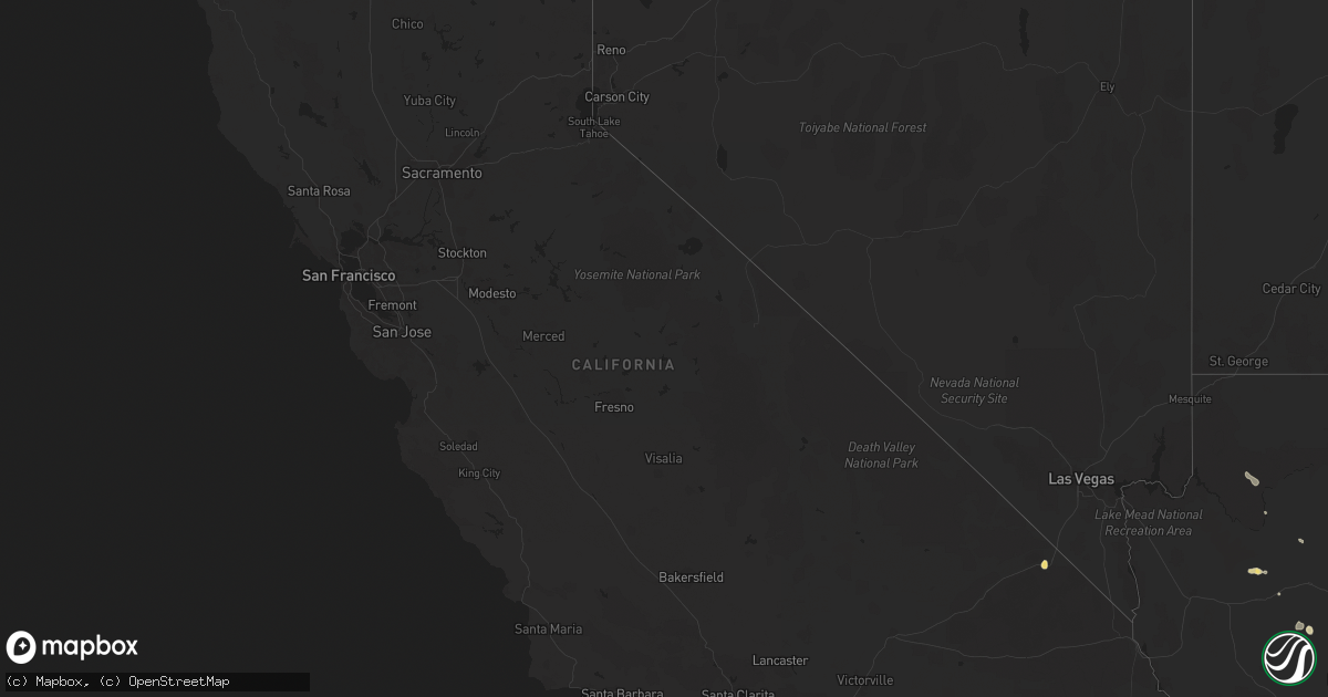
Hail Map in California on August 22, 2020
Get this storm
August 22 map
$229
one time, instant access
Download today. No call, no setup
Keep the $229
Bought the map and want the full workflow? Apply the entire $229 to a subscription within 7 days. None of it is wasted.
Every map, not just this one
This buys you this map. Subscription and you get every map we run, in the markets you choose from a few cities to whole states to nationwide. Plus real-time alerts the moment a storm fires.
Contact data
Name, contact info, occupancy, even credit band for addresses in the footprint. You go from where it hit to who to call.
Become the source they trust
Unlimited branding weather history reports on demand. You already have the documented answer ready for the property owner, and you are the one who showed up with it.
Property data and RoofTrace estimates
Pull up any address you have got, its value and the exact code rules for that jurisdiction, straight from One Click Code. Then RoofTrace estimates the squares, pitch, and roof value, priced the way you price.
Storm reports in California
California
| Date | Description |
|---|---|
| 08/22/20204:15 PM CDT | Hail just under golf ball size reported at mountain pass on i-15. Damage to cars and broken windshields reported. Hail accumulating on highway several inches deep in pl |
| 08/21/202011:13 PM CDT | At 413 PM PDT, a severe thunderstorm was located 11 miles south of Daggett, moving south at 15 mph. HAZARD...70 mph wind gusts and penny size hail. SOURCE...Radar indicated. IMPACT...Expect considerable tree damage. Damage is likely to mobile homes, roofs, and outbuildings. Locations impacted include... Apple Valley and Lucerne Valley. |
| 08/21/20209:21 PM CDT | At 220 PM PDT, a severe thunderstorm was located near I-8 Between Pine Valley And Boulevard, moving northwest at 20 mph. HAZARD...60 mph wind gusts and quarter size hail. SOURCE...Radar indicated. IMPACT...Hail damage to vehicles is expected. Expect wind damage to roofs, siding, and trees. Locations impacted include... Hwy 78 Between Banner And S2, I-8 Between Pine Valley And Boulevard, Mount Laguna, Cuyamaca Rancho State Park, Julian, Hwy 78 Between S2 And Borrego Springs Rd, Hwy S2 Between Shelter Valley And Agua Caliente, Lake Cuyamaca, Pine Valley and Hwy S1 Between Lake Cuyamaca And Mount Laguna. |
| 08/21/20209:00 PM CDT | At 159 PM PDT, a severe thunderstorm was located over Mountain Pass, or 11 miles southwest of Primm, and is nearly stationary. HAZARD...60 mph wind gusts and quarter size hail. SOURCE...Radar indicated. IMPACT...Hail damage to vehicles is expected. Expect wind damage to roofs and trees. Locations impacted include... Mountain Pass and Nipton And Ivanpah Roads. This includes Interstate 15 in California between mile markers 164and 180. |
All States Impacted by Hail Map on August 22, 2020
Cities Impacted by Hail Map on August 22, 2020
- De Witt, IA
- Flagstaff, AZ
- Baldwin, IA
- Fall River, MA
- Bristol, RI
- Warren, RI
- Portsmouth, RI
- Swansea, MA
- Tiverton, RI
- Emily, MN
- Palisade, MN
- Kiron, IA
- Odebolt, IA
- Campo, CA
- Pine Valley, CA
- Bridgewater, MA
- West Wareham, MA
- South Easton, MA
- Sharon, MA
- North Easton, MA
- Stoughton, MA
- Lakeville, MA
- West Bridgewater, MA
- Halifax, MA
- Carver, MA
- Raynham, MA
- Middleboro, MA
- Brockton, MA
- East Bridgewater, MA
- Prescott, AZ
- Nipton, CA
- Nashwauk, MN
- Willcox, AZ
- Crosby, MN
- Wolfeboro, NH
- Mirror Lake, NH
- Preston, IA
- Charlotte, IA
- Guilford, CT
- Garrison, MN
- Saint Cloud, MN
- Kendalia, TX
- Mansfield, MA
- East Taunton, MA
- Rochester, MA
- Norton, MA
- Hillman, MN
- Young, AZ
- Mayer, AZ
- East Haddam, CT
- Moodus, CT
- Elfrida, AZ
- Hibbing, MN
- Early, IA
- Schaller, IA
- Roosevelt, AZ
- Sandstone, MN
- Chisholm, MN
- Hackberry, AZ
- Freeport, MN
- Holdingford, MN
- Albany, MN
- Swanville, MN
- Upsala, MN
- Burtrum, MN
- Bowlus, MN
- Grey Eagle, MN
- Fort Ripley, MN
- Brainerd, MN
- Vail, IA
- Fonda, IA
- Pomeroy, IA
- Plympton, MA
- Williams, AZ
- Aitkin, MN
- New Hartford, IA
- Shell Rock, IA
- Galva, IA
- Coleman, TX
- Holy Cross, IA
- Sherrill, IA
- Pittsburgh, PA
- Sedona, AZ
- Pearce, AZ
- Side Lake, MN
- Spragueville, IA
- Maquoketa, IA
- Elgin, AZ
- Muscatine, IA
- Cushing, MN
- Seligman, AZ
- Somerset, MA
- Dewey, AZ
- Colchester, CT
- East Hampton, CT
- Quimby, IA
- Cherokee, IA
- Benson, AZ
- Berkley, MA
- Clarksville, IA
- Burkett, TX
- Cross Plains, TX
- Pima, AZ
- Thatcher, AZ
- Parkersburg, IA
- Pengilly, MN
- Goodland, MN
- Sweeny, TX
- Buckhorn, NM
- Deerwood, MN
- Onamia, MN
- San Simon, AZ
- Cook, MN
- Mount Sterling, KY
- Peach Springs, AZ
- Crosslake, MN
- Cave Creek, AZ
- Monmouth, IA
- Onslow, IA
- Richville, MN
- Lost Nation, IA
- Oxford Junction, IA
- Chino Valley, AZ
- Whitman, MA
- Wareham, MA
- Abington, MA
- Plymouth, MA
- Hanson, MA
- Kingston, MA
- Marion, MA
- Pembroke, MA
- Ida Grove, IA
- Arthur, IA
- Atalissa, IA
- Moscow, IA
- Bay City, TX
- New Bedford, MA
- Mattapoisett, MA
- Acushnet, MA
- East Freetown, MA
- Allen, NE
- Fifty Lakes, MN
- Boerne, TX
- Waverly, IA
- Janesville, IA
- Clyde, TX
- Garner, IA
- Klemme, IA
- League City, TX
- Handley, WV
- Underwood, MN
- Pocahontas, IA
- Palmer, IA
- Santa Anna, TX
- Royalton, MN
- Outing, MN
- Ottertail, MN
- Durango, IA
- French Creek, WV
- Baird, TX
- Animas, NM
- Manson, IA
- Littlefield, AZ
- Sugar Grove, OH
- Lancaster, OH
- Grand Rapids, MN
- Foley, MN
- Wells, ME
- Sanford, ME
- North Berwick, ME
- Berwick, ME
- Center Tuftonboro, NH
- Moultonborough, NH
- Chatham, NY
- Ghent, NY
- Sauk Rapids, MN
- Rice, MN


