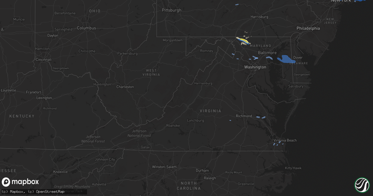
Hail Map in Virginia on August 22, 2019
Get this storm
August 22 map
$229
one time, instant access
Download today. No call, no setup
Keep the $229
Bought the map and want the full workflow? Apply the entire $229 to a subscription within 7 days. None of it is wasted.
Every map, not just this one
This buys you this map. Subscription and you get every map we run, in the markets you choose from a few cities to whole states to nationwide. Plus real-time alerts the moment a storm fires.
Contact data
Name, contact info, occupancy, even credit band for addresses in the footprint. You go from where it hit to who to call.
Become the source they trust
Unlimited branding weather history reports on demand. You already have the documented answer ready for the property owner, and you are the one who showed up with it.
Property data and RoofTrace estimates
Pull up any address you have got, its value and the exact code rules for that jurisdiction, straight from One Click Code. Then RoofTrace estimates the squares, pitch, and roof value, priced the way you price.
Storm reports in Virginia
Virginia
| Date | Description |
|---|---|
| 08/22/20196:50 PM CDT | Reports of trees down near va-9. |
| 08/22/20196:49 PM CDT | 1-inch tree limbs broken; shingles blown off. |
| 08/22/20196:00 PM CDT | Report of trees down in the lovettsville area. |
| 08/22/20195:56 PM CDT | Tree down on belair avenue. |
| 08/22/20195:49 PM CDT | Tree down on powerlines on north fork road. |
| 08/22/20195:45 PM CDT | Tree down on power lines on russ road near the intersection with totten lane. Two trees down near intersection of laing road and wakeman mill road. Tree down on mountai |
| 08/22/20195:45 PM CDT | Tree down by the post office in barhamsville. |
| 08/22/20195:44 PM CDT | Tree down on power lines on russ road near intersection with totten lane. Two trees down near intersection of laing road and wakeman mill road. Tree down on mountain ro |
| 08/22/20195:30 PM CDT | Tree down near the intersection of bromley and commonwealth. |
| 08/22/20195:25 PM CDT | Multiple trees down on rural point rd near us 301. |
| 08/22/20195:25 PM CDT | Power line down across black creek rd. |
| 08/22/20195:18 PM CDT | Trees down on oxford road near us route 1. |
| 08/22/20195:15 PM CDT | Tree down on power lines at 500 southhicks lawrenceville... Va. |
| 08/22/20195:10 PM CDT | A tree down on stone quarry dr near verdon rd. |
| 08/22/20195:00 PM CDT | A tree down at dunn chapel rd and vontay rd. |
| 08/22/20194:58 PM CDT | Trees and power lines down reported on coatsville rd. |
| 08/22/20194:40 PM CDT | Several trees down. |
| 08/22/20194:40 PM CDT | Trees down. |
| 08/22/20194:35 PM CDT | Numerous trees down throughout powhatan county. |
| 08/22/20194:21 PM CDT | Large limbs snapped off trees along hwy us 460 between waverly and wakefield. |
| 08/22/20194:20 PM CDT | Corrects time of previous tstm wnd dmg report from 1 sse meadowville. Tree down causing power outages in meadowville. Relayed by nws employee. Time estimated from radar |
| 08/22/20194:20 PM CDT | Tree down near intersection of venable ave and stebbins street. Timing estimated by radar. |
| 08/22/20194:05 PM CDT | Trees down along clinton rd. |
| 08/22/20193:58 PM CDT | Multiple trees down near intersection of wolf trap and nichols ferry rd. Timing estimated by radar. |
| 08/22/20193:45 PM CDT | Numerous trees knocked down in the westover hills area of danville. One house was destroyed... Another house and a mobile home suffered structural damage. More details |
| 08/22/20193:35 PM CDT | Several small to large limbs down in the gold hill area. Pea-sized hail was also observed. |
| 08/22/20193:24 PM CDT | Several calls of trees and wires down in and near the city of charlottesville. |
| 08/22/20193:20 PM CDT | Tree down causing power outages in meadowville. Relayed by nws employee. Time estimated from radar. |
| 08/22/20193:18 PM CDT | Tree down along shiloh church road. |
| 08/22/20193:13 PM CDT | Shingles blown off home. |
| 08/22/20193:10 PM CDT | Trees down near scottsville. |
| 08/22/20193:08 PM CDT | Tree down along mt. Cross road. |
| 08/22/20193:00 PM CDT | Several reports of trees and wires down in and just west of the city of charlottesville. Corrected event time. |
| 08/22/20192:59 PM CDT | Multiple trees down along presidents road near scottsville. Corrected event time. |
| 08/22/20192:58 PM CDT | Several calls of trees and wires down in and near the city of charlottesville. Corrected event time. |
| 08/22/20192:58 PM CDT | Tree down blocking rocky road. |
| 08/22/20192:58 PM CDT | Power lines down along mt. Cross road. |
| 08/22/20192:53 PM CDT | Tree down along mt. Cross road. |
| 08/22/20192:53 PM CDT | Corrects previous tstm wnd dmg report from 5 nnw westover hills. Tree down along clearview drive. |
| 08/22/20192:45 PM CDT | Railroad pole blown over near wingina. Several trees down in area. |
| 08/22/20192:43 PM CDT | Railroad pole knocked over. Several trees down in area. |
| 08/22/20192:40 PM CDT | Several trees down blocking roadways in the ivy and crozet areas. |
| 08/22/20192:38 PM CDT | Several trees down blocking roadways in the ivy and crozet areas. |
| 08/22/20192:31 PM CDT | Three or four trees and a couple of power lines down between gretna and the northwest border of the county. |
| 08/22/20192:20 PM CDT | Multiple trees reported down near us-29 between oakridge and fresh water cove. |
| 08/22/20192:19 PM CDT | Multiple trees reported down near rt. 29 between the oakridge and fresh water cove areas. |
| 08/22/20192:11 PM CDT | Tree down at intersection of old ferrum rd. And iron bridge rd. Timing estimated by radar. |
| 08/22/20192:08 PM CDT | Tree down along ravens den lane. |
| 08/22/20191:55 PM CDT | Tree down on coulson church rd. |
| 08/22/20191:45 PM CDT | Multiple trees down near the intersection of 501 and river rd. Timing estimated by radar. |
| 08/22/20191:42 PM CDT | Corrects previous tstm wnd dmg report from 2 e byllesby. Sheet metal torn off a trailer... Damaging a nearby truck. Time estimated from radar. |
| 08/22/20191:40 PM CDT | Tree down at the intersection of gogginsville and grassyhill rd. Timing estimated by radar. |
| 08/22/20191:30 PM CDT | Sheet metal torn off a trailer... Damaging a nearby truck. |
| 08/22/20191:25 PM CDT | Tree down on trott circle near carver elementary. Timing estimated by radar. |
| 08/22/20191:25 PM CDT | Tree down at the intersection of raceway dr. And rockwood park rd. Timing estimated by radar. |
| 08/22/20191:23 PM CDT | Tree down along pawnee lane. |
| 08/22/20191:23 PM CDT | Tree down along southriver rd. Timing estimated by radar. |
| 08/22/20191:15 PM CDT | Tree limbs down in the hollins area. Timing estimated by radar. |
| 08/22/20191:07 PM CDT | Tree down along forge rd. Timing estimated by radar. |
| 08/22/201912:45 PM CDT | Sveral mostly small tree limbs down in the haymaker road area near fincastle and stone gap going up the mountain toward craig county. |
| 08/22/201912:25 PM CDT | Tree down near intersection of market street and rte. 615. Timing estimated by radar. |
| 08/22/201912:13 PM CDT | Home with tile and gutter damage: multiple trees down. |
| 08/22/201911:50 AM CDT | One tree blown down at hortons store drive located along big stoney creek road. |
| 08/22/20192:33 AM CDT | At 733 PM EDT, a severe thunderstorm was located over Bluemont, or 12 miles south of Charles Town, moving east at 30 mph. HAZARD...60 mph wind gusts. SOURCE...Radar indicated. IMPACT...Damaging winds will cause some trees and large branches to fall. This could injure those outdoors, as well as damage homes and vehicles. Roadways may become blocked by downed trees. Localized power outages are possible. Unsecured light objects may become projectiles. Locations impacted include... Leesburg, Purcellville, Round Hill, Bluemont, Hamilton, Paeonian Springs, Philomont, Lincoln, Hughesville and Gleedsville. |
| 08/22/20192:20 AM CDT | At 719 PM EDT, a severe thunderstorm was located over Western Branch, or near Churchland, moving northeast at 15 mph. HAZARD...60 mph wind gusts. SOURCE...Radar indicated. IMPACT...Expect damage to trees and powerlines. This severe thunderstorm will be near, Chesapeake and Cradock around 725 PM EDT. Downtown Portsmouth, Old Dominion University and Portsmouth around 735 PM EDT. Downtown Norfolk, Norfolk State University and Ghent around 740 PM EDT. Norfolk NAS around 745 PM EDT. Regent University and Norview around 750 PM EDT. Ocean View around 755 PM EDT. Virginia Wesleyan University, Kempsville, Norfolk and Norfolk International around 800 PM EDT.Other locations impacted by this severe thunderstorm include SouthNorfolk, Portlock, Princess Anne Plaza, Huntersville, HerbertsCorner, Oceana NAS, Macons Corner, Greenbrier, Bayside and WardsCorner. |
| 08/22/20191:56 AM CDT | At 656 PM EDT, a severe thunderstorm was located near Front Royal, moving east at 25 mph. HAZARD...60 mph wind gusts. SOURCE...Radar indicated. IMPACT...Damaging winds will cause some trees and large branches to fall. This could injure those outdoors, as well as damage homes and vehicles. Roadways may become blocked by downed trees. Localized power outages are possible. Unsecured light objects may become projectiles. Locations impacted include... Front Royal, Millwood, Howellsville, Nineveh, Riverton, Bethel and Cedarville. |
| 08/22/20191:42 AM CDT | At 641 PM EDT, a severe thunderstorm was located near Barhamsville, or near Toano, moving northeast at 15 mph. HAZARD...60 mph wind gusts and quarter size hail. SOURCE...Radar indicated. IMPACT...Minor damage to vehicles is possible. Expect wind damage to trees and powerlines. This severe thunderstorm will be near, Shacklefords around 655 PM EDT. Gloucester Courthouse around 715 PM EDT. Glenns around 720 PM EDT. Saluda around 725 PM EDT. Urbanna around 730 PM EDT.Other locations impacted by this severe thunderstorm include Eltham,Croaker, Harmony Village, Grafton, Harcum, Cash, Mattaponi, Warner,Mascot and Fort Nonsense. |
| 08/22/20191:38 AM CDT | At 637 PM EDT, a severe thunderstorm was located near Charles Town, moving east at 20 mph. Additional thunderstorms were developing near Harpers Ferry. HAZARD...60 mph wind gusts. SOURCE...Radar indicated. IMPACT...Damaging winds will cause some trees and large branches to fall. This could injure those outdoors, as well as damage homes and vehicles. Roadways may become blocked by downed trees. Localized power outages are possible. Unsecured light objects may become projectiles. Locations impacted include... Charles Town, Brunswick, Ranson, Harpers Ferry, Point Of Rocks, Corporation Of Ranson, Adamstown, Jefferson, Lovettsville, Bolivar, Shenandoah Junction, Rosemont, Burkittsville, Gapland, Brownsville, Hillsboro, Waterford, Doubs, Petersville and Pleasantville. |
| 08/22/20191:31 AM CDT | At 631 PM EDT, a severe thunderstorm was located near Woodstock, moving east at 15 mph. HAZARD...60 mph wind gusts. SOURCE...Radar indicated. IMPACT...Damaging winds will cause some trees and large branches to fall. This could injure those outdoors, as well as damage homes and vehicles. Roadways may become blocked by downed trees. Localized power outages are possible. Unsecured light objects may become projectiles. Locations impacted include... Front Royal, Maurertown, Fort Valley, Kings Crossing, Compton, Seven Fountains, Dilbeck, Riverton, Karo, Saint Davids Church, Glen Echo, Bentonville, Browntown, Buckton, Riverside and Rileyville. |
| 08/22/20191:11 AM CDT | At 610 PM EDT, severe thunderstorms were located along a line extending from near Wyndham to University Of Richmond to near Chesterfield Court House, moving east at 40 mph. HAZARD...60 mph wind gusts. SOURCE...Radar indicated. IMPACT...Expect damage to trees and powerlines. Severe thunderstorms will be near, Richmond, Downtown Richmond, Virginia Commonwealth University and Virginia Union University around 615 PM EDT. Ashland, Chester, Glen Allen, Bensley, East Highland Park and Lakeside around 620 PM EDT. Highland Springs, Mechanicsville and Bellwood around 625 PM EDT. Hanover around 630 PM EDT. Studley around 635 PM EDT. Bottoms Bridge around 640 PM EDT. Manquin and Tunstall around 645 PM EDT. Talleysville, Roxbury, Adkins Store and Aylett around 650 PM EDT.Other locations impacted by these severe thunderstorms includeEltham, Wayside, Cohoke, Etna Mills, Montrose, Sandston, Glendale,Rose Garden, Mattaponi and Biscoe. |
| 08/22/20191:10 AM CDT | At 609 PM EDT, a severe thunderstorm was located over Zuni, or near Windsor, moving east at 20 mph. HAZARD...60 mph wind gusts and quarter size hail. SOURCE...Radar indicated. IMPACT...Minor damage to vehicles is possible. Expect wind damage to trees and powerlines. Locations impacted include... Franklin, Windsor, Courtland, Holland, Suffolk, Isle Of Wight, Ivor, Hunterdale, Sedley, Carrsville, Zuni, Vicksville, Pons, Dory, Sunbeam, Lees Mill, Walters, Elwood, Story and Berlin. |
| 08/22/201912:49 AM CDT | At 548 PM EDT, a severe thunderstorm was located over Montpelier, or 11 miles northwest of Randolph Macon College, moving east at 40 mph. HAZARD...60 mph wind gusts and penny size hail. SOURCE...Radar indicated. IMPACT...This storm has produced numerous reports of downed trees over southeast Louisa county. Expect damage to trees and powerlines. This severe thunderstorm will be near, Randolph Macon College around 600 PM EDT. Ashland and Kings Dominion around 605 PM EDT. Dawn around 610 PM EDT. Mangohick around 620 PM EDT. Beulahville around 625 PM EDT. Newtown around 630 PM EDT.Other locations impacted by this severe thunderstorm includeGolansville, Vontay, Gum Tree, Etna Mills, Penola, Epworth, Gilman,Globe, Cedar Fork and Duane Fork. |
| 08/22/201912:42 AM CDT | At 542 PM EDT, a severe thunderstorm was located 7 miles southeast of Rehoboth, or 10 miles northwest of South Hill, moving east at 25 mph. HAZARD...60 mph wind gusts and quarter size hail. SOURCE...Radar indicated. IMPACT...Minor damage to vehicles is possible. Expect wind damage to trees and powerlines. This severe thunderstorm will be near, South Hill around 600 PM EDT. Dundas around 610 PM EDT. Lawrenceville and Alberta around 630 PM EDT.Other locations impacted by this severe thunderstorm include Gary,Bacons Fork, Cochran, Wilburn, Gills Corner, Loves Mill, BarrowsStore, North View, Meredithville and Forksville. |
| 08/22/201912:39 AM CDT | At 539 PM EDT, severe thunderstorms were located along a line extending from near Sabot to Moseley, moving east at 25 mph. HAZARD...60 mph wind gusts and nickel size hail. SOURCE...Radar indicated. IMPACT...These storms have produced numerous reports of downed trees in Powhatan county. Expect damage to trees and powerlines. Severe thunderstorms will be near, Manakin around 550 PM EDT. Tuckahoe and Wyndham around 600 PM EDT. University Of Richmond, Bon Air and Chesterfield Court House around 610 PM EDT. Laurel around 615 PM EDT. Richmond, Chester, Virginia Union University, Virginia Commonwealth University, Downtown Richmond, Lakeside, Bellwood, Glen Allen and Bensley around 620 PM EDT. East Highland Park around 625 PM EDT. Mechanicsville and Highland Springs around 630 PM EDT.Other locations impacted by these severe thunderstorms includeCrozier, Richmond Heights, Pilkinton, Johnsons Springs, Elmont,Montrose, Pocahontas State Park, Skinquarter, Solomons Store andChamberlayne. |
| 08/22/201912:14 AM CDT | At 514 PM EDT, severe thunderstorms were located along a line extending from near Louisa to Fife, moving northeast at 35 mph. HAZARD...60 mph wind gusts and penny size hail. SOURCE...Radar indicated. IMPACT...Expect damage to trees and powerlines. Severe thunderstorms will be near, Mineral and Gum Spring around 525 PM EDT. Bumpass around 550 PM EDT.Other locations impacted by these severe thunderstorms includeChilesburg, Orchid, Pendleton, Coatesville, Hewlett, Mabelton, Noel,Cuckoo, Yanceyville and Beaverdam. |
| 08/22/201912:08 AM CDT | At 507 PM EDT, a severe thunderstorm was located near Homeville, or near Wakefield, moving northeast at 25 mph. HAZARD...60 mph wind gusts and quarter size hail. SOURCE...Radar indicated. IMPACT...Minor damage to vehicles is possible. Expect wind damage to trees and powerlines. Locations impacted include... Waverly, Wakefield, Ivor, Dendron, Homeville, Elberon, Booth Fork, Pons, Carsley, Newville, Ellis Fork, Manry, Delk Crossroads, Littleton, Dory, Comet, Gwaltney Corner, Raynor and Runnymede. |
| 08/22/201912:04 AM CDT | At 504 PM EDT, a severe thunderstorm was located near Bellwood, or near Chester, moving east at 15 mph. HAZARD...60 mph wind gusts and quarter size hail. SOURCE...Radar indicated. IMPACT...Minor damage to vehicles is possible. Expect wind damage to trees and powerlines. This severe thunderstorm will be near, Hopewell around 510 PM EDT. Roxbury and Adkins Store around 545 PM EDT.Other locations impacted by this severe thunderstorm include WrightsCorner, Meadowville, Wayside, Browns Corner, Varina, Mountcastle,Barnetts, Elko, New Kent Airport and Glendale. |
| 08/22/201912:01 AM CDT | At 500 PM EDT, severe thunderstorms were located along a line extending from near Keysville to near Hitesburg to Milton, moving southeast at 25 mph. HAZARD...60 mph wind gusts. SOURCE...Radar indicated. IMPACT...Expect damage to roofs, siding, and trees. Locations impacted include... South Boston... Halifax... Brookneal... Keysville... and Charlotte Court House. |
| 08/22/201912:00 AM CDT | At 500 PM EDT, a severe thunderstorm was located near Tobaccoville, or 7 miles east of Cumberland, moving east at 25 mph. HAZARD...60 mph wind gusts and quarter size hail. SOURCE...Radar indicated. IMPACT...Minor damage to vehicles is possible. Expect wind damage to trees and powerlines. This severe thunderstorm will be near, Ballsville and Trenholm around 505 PM EDT. Macon around 520 PM EDT. Powhatan around 525 PM EDT. Moseley, Sabot and Manakin around 545 PM EDT.Other locations impacted by this severe thunderstorm include Crozier,Rock Castle, Oak Forest, Pilkinton, Maidens, Johnsons Springs,Whiteville, Fine Creek Mills, Michaux and West View. |
| 08/21/201911:53 PM CDT | At 453 PM EDT, a severe thunderstorm was located over New Kent, moving east at 10 mph. HAZARD...60 mph wind gusts and quarter size hail. SOURCE...Radar indicated. IMPACT...Minor damage to vehicles is possible. Expect wind damage to trees and powerlines. Locations impacted include... New Kent, West Point, Little Plymouth, Shacklefords, Holly Forks, Eltham, Cohoke, Mattaponi, Lanesville, Cooke, Romancoke, Plum Point and Slaterville. |
| 08/21/201911:13 PM CDT | At 412 PM EDT, a severe thunderstorm was located near Pine Hall, moving east at 30 mph. HAZARD...60 mph wind gusts and quarter size hail. SOURCE...Radar indicated. IMPACT...Hail damage to vehicles is expected. Expect wind damage to roofs, siding, and trees. Locations impacted include... Eden... Reidsville... Wentworth... Mayodan... and Madison. |
| 08/21/201911:07 PM CDT | At 407 PM EDT, severe thunderstorms were located along a line extending from Pamplin City to near Ridgeway to near Mayfield, moving southeast at 40 mph. HAZARD...60 mph wind gusts. SOURCE...Radar indicated. IMPACT...Expect damage to roofs, siding, and trees. Locations impacted include... South Boston... Halifax... Brookneal... Keysville... and Charlotte Court House. |
| 08/21/201910:54 PM CDT | At 353 PM EDT, a severe thunderstorm was located over Charlottesville, moving east at 20 mph. HAZARD...60 mph wind gusts. SOURCE...Law enforcement has reported trees down in the Ivy and Crozet areas. IMPACT...Damaging winds will cause some trees and large branches to fall. This could injure those outdoors, as well as damage homes and vehicles. Roadways may become blocked by downed trees. Localized power outages are possible. Unsecured light objects may become projectiles. Locations impacted include... Charlottesville, Campbell, Westmoreland, Hollymead, Cobham, Cismont, Newcomb Hall, Boyd Tavern, Monticello, Keswick, Stony Point, Flordon, Carrsbrook, Shadwell, Barracks, Overton and Scott Stadium. |
| 08/21/201910:34 PM CDT | At 334 PM EDT, severe thunderstorms were located along a line extending from 7 miles northwest of Schuyler to near Bent Creek, moving east at 25 mph. HAZARD...60 mph wind gusts. SOURCE...Radar indicated. IMPACT...Damaging winds will cause some trees and large branches to fall. This could injure those outdoors, as well as damage homes and vehicles. Roadways may become blocked by downed trees. Localized power outages are possible. Unsecured light objects may become projectiles. Locations impacted include... Shipman, Schuyler, Arrington, Scottsville, Esmont, Damon, Allens Creek, North Garden, Covesville, Rockfish, Buffalo Springs, Norwood, Keene, Glendower, Five Forks, Alberene, Gladstone, Elma, Faber and Wingina. |
| 08/21/201910:20 PM CDT | At 320 PM EDT, a severe thunderstorm was located near Crozet, or 8 miles east of Waynesboro, moving east at 25 mph. HAZARD...60 mph wind gusts. SOURCE...Radar indicated. IMPACT...Damaging winds will cause some trees and large branches to fall. This could injure those outdoors, as well as damage homes and vehicles. Roadways may become blocked by downed trees. Localized power outages are possible. Unsecured light objects may become projectiles. Locations impacted include... Charlottesville, Crozet, Crimora, Free Union, Westmoreland, Hollymead, Ivy, Greenwood, Newcomb Hall, Batesville, Yancey Mills, Monticello, Flordon, Carrsbrook, Barracks, Overton, Scott Stadium and White Hall. |
| 08/21/201910:00 PM CDT | At 300 PM EDT, a severe thunderstorm was located near Lowesville, or 7 miles north of Clifford, moving east at 15 mph. HAZARD...60 mph wind gusts. SOURCE...Radar indicated. IMPACT...Damaging winds will cause some trees and large branches to fall. This could injure those outdoors, as well as damage homes and vehicles. Roadways may become blocked by downed trees. Localized power outages are possible. Unsecured light objects may become projectiles. Locations impacted include... Shipman, Arrington, Lovingston, Bryant, Norwood, Piney River, Jonesboro, Roseland, Elma, Tyro and Massies Mill. |
| 08/21/20199:32 PM CDT | At 232 PM EDT, severe thunderstorms were located along a line extending from near Harrisonburg to near Montebello to near Natural Bridge, moving east at 50 mph. HAZARD...60 mph wind gusts and quarter size hail. SOURCE...Radar indicated. IMPACT...Hail damage to vehicles is expected. Expect wind damage to roofs, siding, and trees. Locations impacted include... Lynchburg... Lexington... Buena Vista... Amherst... and Glasgow.This includes The following Locations VMI and Liberty University. |
| 08/21/20198:48 PM CDT | At 148 PM EDT, severe thunderstorms were located along a line extending from near Oriskany to near Glenvar to Childress, moving east at 20 mph. HAZARD...60 mph wind gusts. SOURCE...Radar indicated. IMPACT...Expect damage to roofs, siding, and trees. Locations impacted include... Roanoke... Lynchburg... Salem... Christiansburg... and Vinton.This includes The following Locations The Salem Fairgrounds, TheNational D-Day Memorial, and Roanoke Regional Airport. |
| 08/21/20198:29 PM CDT | At 128 PM EDT, severe thunderstorms were located along a line extending from near Williamsville to Clifton Forge, moving east at 20 mph. HAZARD...60 mph wind gusts and quarter size hail. SOURCE...Radar indicated. IMPACT...Hail damage to vehicles is expected. Expect wind damage to roofs, siding, and trees. Locations impacted include... Lexington... Buena Vista... Covington... Clifton Forge... and Buchanan.This includes The following Location VMI. |
| 08/21/20198:06 PM CDT | At 106 PM EDT, a severe thunderstorm was located near Potts Creek, moving east at 25 mph. HAZARD...60 mph wind gusts and quarter size hail. SOURCE...Radar indicated. IMPACT...Hail damage to vehicles is expected. Expect wind damage to roofs, siding, and trees. Locations impacted include... Buchanan... Troutville... New Castle... Paint Bank... and Oriskany. |
All States Impacted by Hail Map on August 22, 2019
Cities Impacted by Hail Map on August 22, 2019
- Ralph, SD
- Colorado Springs, CO
- Hastings, NE
- Shepherd, MT
- Billings, MT
- Huntley, MT
- Buffalo, WY
- Clearmont, WY
- Anadarko, OK
- Apache, OK
- Alda, NE
- Doniphan, NE
- Wood River, NE
- Juniata, NE
- Forsyth, MT
- Pine Bluffs, WY
- Grover, CO
- Carpenter, WY
- Wellston, OK
- Smithsburg, MD
- Rocky Ridge, MD
- Hagerstown, MD
- Thurmont, MD
- Woodsboro, MD
- Sabillasville, MD
- Keymar, MD
- Chandler, OK
- Emmitsburg, MD
- Tecumseh, OK
- Littlestown, PA
- Glasgow, MT
- Macomb, OK
- Yeso, NM
- Cuervo, NM
- Luther, OK
- Otter, MT
- Busby, MT
- Ravenna, NE
- Brule, NE
- Orrtanna, PA
- Raton, NM
- New Raymer, CO
- Fort Sumner, NM
- Glenvil, NE
- Arcadia, OK
- Wanette, OK
- Capulin, NM
- Jones, OK
- Broadus, MT
- Capitol, MT
- Des Moines, NM
- Kimball, NE
- Matador, TX
- Floydada, TX
- Hammond, MT
- Mustang, OK
- Weston, WY
- Whitewater, MT
- Kersey, CO
- Fairfield, PA
- Choctaw, OK
- Asher, OK
- Santa Rosa, NM
- Crosbyton, TX
- Frederick, MD
- Myersville, MD
- Walkersville, MD
- Gettysburg, PA
- Winston Salem, NC
- Union Bridge, MD
- Springer, NM
- Nogales, AZ
- Briggsdale, CO
- Lame Deer, MT
- Arvada, WY
- Saco, MT
- Alzada, MT
- Union City, OK
- Boyes, MT
- Jordan, MT
- Usaf Academy, CO
- Harrah, OK
- Mcloud, OK
- Meeker, OK
- Cyril, OK
- Pauls Valley, OK
- Stratford, OK
- El Reno, OK
- Yukon, OK
- Oklahoma City, OK
- Birney, MT
- Volborg, MT
- Gill, CO
- Edenton, NC
- Tyner, NC
- Knotts Island, NC
- Ballantine, MT
- Worden, MT
- Childress, TX
- Gaithersburg, MD
- Rockville, MD
- Ashton, MD
- Sandy Spring, MD
- Silver Spring, MD
- Olney, MD
- Derwood, MD
- Spencerville, MD
- Fulton, MD
- Brookeville, MD
- Highland, MD
- Burtonsville, MD
- Curtis Bay, MD
- Glen Burnie, MD
- Severn, MD
- Pasadena, MD
- Henderson, MD
- Rock Hall, MD
- Centreville, MD
- Church Hill, MD
- Barclay, MD
- Marydel, MD
- Chestertown, MD
- Felton, DE
- Goldsboro, MD
- Camden Wyoming, DE
- Millington, MD
- Queen Anne, MD
- Ingleside, MD
- Marydel, DE
- Sudlersville, MD
- Greensboro, MD
- Ridgely, MD
- Chesapeake, VA
- Virginia Beach, VA
- Lanexa, VA
- New Kent, VA
- Amelia Court House, VA
- Shacklefords, VA
- Barhamsville, VA
- Hamilton, VA
- Purcellville, VA
- Leesburg, VA
- Ayr, NE
- Blue Hill, NE
- Clay Center, NE
- Edgar, NE
- Fairfield, NE
- Belleville, PA
- Lewistown, PA
- Saylorsburg, PA
- Brodheadsville, PA
- Almyra, AR
- De Witt, AR
- Davidson, OK
- Frederick, OK
- Hollister, OK
- Lyman, SC
- Duncan, SC
- Greer, SC
- Charles Town, WV
- Harpers Ferry, WV
- New York, NY
- Brooklyn, NY
- Jersey City, NJ
- Bellmore, NY
- Wantagh, NY
- Seaford, NY
- West Babylon, NY
- Brentwood, NY
- Bohemia, NY
- Southold, NY
- Laurel, NY
- Smithtown, NY
- Deer Park, NY
- Lindenhurst, NY
- Yaphank, NY
- South Jamesport, NY
- Lake Grove, NY
- Islip Terrace, NY
- West Islip, NY
- Great River, NY
- Shelter Island, NY
- Ronkonkoma, NY
- Centereach, NY
- Patchogue, NY
- Jamesport, NY
- Calverton, NY
- Selden, NY
- Shelter Island Heights, NY
- Massapequa, NY
- Hauppauge, NY
- Babylon, NY
- Cutchogue, NY
- Farmingville, NY
- Islip, NY
- East Islip, NY
- Bay Shore, NY
- Copiague, NY
- Holtsville, NY
- Farmingdale, NY
- Wyandanch, NY
- Oakdale, NY
- Manorville, NY
- Medford, NY
- Brightwaters, NY
- Amityville, NY
- Levittown, NY
- Peconic, NY
- North Babylon, NY
- Greenport, NY
- East Meadow, NY
- Islandia, NY
- Middle Island, NY
- Bethpage, NY
- Wading River, NY
- Central Islip, NY
- Nesconset, NY
- Holbrook, NY
- Mattituck, NY
- Riverhead, NY
- Sayville, NY
- Ridge, NY
- Massapequa Park, NY
- Coram, NY


