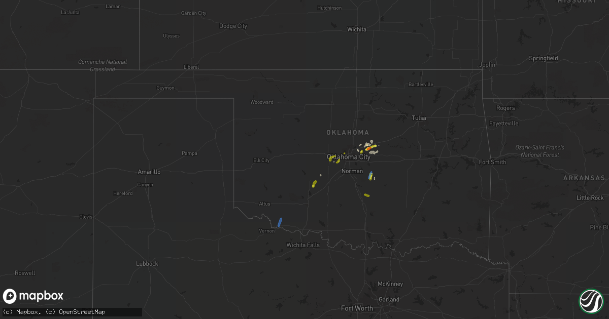
Hail Map in Oklahoma on August 22, 2019
Get this storm
August 22 map
$229
one time, instant access
Download today. No call, no setup
Keep the $229
Bought the map and want the full workflow? Apply the entire $229 to a subscription within 7 days. None of it is wasted.
Every map, not just this one
This buys you this map. Subscription and you get every map we run, in the markets you choose from a few cities to whole states to nationwide. Plus real-time alerts the moment a storm fires.
Contact data
Name, contact info, occupancy, even credit band for addresses in the footprint. You go from where it hit to who to call.
Become the source they trust
Unlimited branding weather history reports on demand. You already have the documented answer ready for the property owner, and you are the one who showed up with it.
Property data and RoofTrace estimates
Pull up any address you have got, its value and the exact code rules for that jurisdiction, straight from One Click Code. Then RoofTrace estimates the squares, pitch, and roof value, priced the way you price.
Storm reports in Oklahoma
Oklahoma
| Date | Description |
|---|---|
| 08/22/20196:25 PM CDT | A local report indicates 60 MPH wind near 2 N TRIBBEY |
| 08/22/20196:25 PM CDT | A local report indicates 1.00 inch wind near 2 N TRIBBEY |
| 08/22/20195:48 PM CDT | Tree damage across southern part of town. Power also out. |
| 08/22/20195:31 PM CDT | A local report indicates 1.00 inch wind near 1 WSW ANADARKO |
| 08/22/20193:30 PM CDT | Several power poles blown over. |
| 08/22/20193:29 AM CDT | At 829 PM CDT, a severe thunderstorm was located 4 miles south of Bristow, moving northeast at 45 mph. HAZARD...60 mph wind gusts. SOURCE...Radar indicated. IMPACT...Expect damage to roofs, siding, and trees. Locations in or near the path include... Tulsa... Sand Springs... Bristow... Sapulpa... Jenks... Glenpool... Mannford... Kiefer... Mounds... Kellyville... Depew... Slick... Keystone State Park... Jenks Riverside Airport... Gray... This includes Interstate 44 between mile markers 184 and 226. |
| 08/22/20193:10 AM CDT | At 810 PM CDT, a severe thunderstorm was located 7 miles north of Paden, moving northeast at 40 mph. HAZARD...60 mph wind gusts. SOURCE...Radar indicated. IMPACT...Expect damage to roofs, siding, and trees. Locations in or near the path include... Bristow... Boley... Depew... Paden... Slick... Shamrock... Welty... Milfay...This includes Interstate 44 between mile markers 178 and 191. |
| 08/22/20192:44 AM CDT | At 743 PM CDT, a severe thunderstorm was located 6 miles southeast of Luther, moving northeast at 25 mph. HAZARD...Ping pong ball size hail and 60 mph wind gusts. SOURCE...Radar indicated. IMPACT...People and animals outdoors will be injured. Expect hail damage to roofs, siding, windows, and vehicles. Expect wind damage to roofs, siding, and trees. Locations impacted include... Chandler, Wellston, Carney, Warwick and Fallis. |
| 08/22/20191:38 AM CDT | At 638 PM CDT, a severe thunderstorm was located near Tuttle, moving northeast at 25 mph. HAZARD...60 mph wind gusts and quarter size hail. SOURCE...Radar indicated. IMPACT...Hail damage to vehicles is expected. Expect wind damage to roofs, siding, and trees. Locations impacted include... Oklahoma City, southwestern Edmond, Moore, Midwest City, Del City, El Reno, Newcastle, Yukon, Bethany, Mustang, Choctaw, Warr Acres, The Village, Tuttle, Piedmont, Harrah, Spencer, Nichols Hills, Nicoma Park and Union City. |
| 08/22/20191:24 AM CDT | At 624 PM CDT, severe thunderstorms were located along a line extending from near Norman to near Macomb to 4 miles east of Bowlegs, moving northeast at 30 mph. HAZARD...60 mph wind gusts and quarter size hail. SOURCE...Radar indicated. IMPACT...Hail damage to vehicles is expected. Expect wind damage to roofs, siding, and trees. Locations impacted include... Southeastern Oklahoma City, southeastern Norman, Shawnee, Seminole, Tecumseh, Noble, Slaughterville, McLoud, Wewoka, Pink, Maud, Earlsboro, Bowlegs, Tribbey, Cromwell, Johnson, St. Louis, Etowah, Brooksville and Macomb. |
| 08/22/201912:45 AM CDT | At 545 PM CDT, severe thunderstorms were located along a line extending from near Maysville to 5 miles east of Paoli, moving northeast at 20 mph. HAZARD...60 mph wind gusts and quarter size hail. SOURCE...Radar indicated. IMPACT...Hail damage to vehicles is expected. Expect wind damage to roofs, siding, and trees. Locations impacted include... Purcell, Slaughterville, Lexington, Maysville, Wayne, Paoli, Asher, Tribbey, Wanette, Byars, St. Louis, Etowah, Rosedale and Trousdale. |
| 08/22/201912:36 AM CDT | At 536 PM CDT, a severe thunderstorm was located 6 miles south of Anadarko, moving north at 10 mph. HAZARD...60 mph wind gusts and quarter size hail. SOURCE...Radar indicated. IMPACT...Hail damage to vehicles is expected. Expect wind damage to roofs, siding, and trees. Locations impacted include... Anadarko, Verden, Gracemont, Lake Chickasha and Laverty. |
| 08/22/201912:05 AM CDT | At 505 PM CDT, a severe thunderstorm was located 4 miles northwest of Fletcher, moving northeast at 5 mph. HAZARD...60 mph wind gusts and quarter size hail. SOURCE...Radar indicated. IMPACT...Hail damage to vehicles is expected. Expect wind damage to roofs, siding, and trees. Locations impacted include... Anadarko, Elgin, Apache, Fletcher, Cyril, Cement, Norge, Agawam, northeastern Lake Ellsworth, Ninnekah, Stecker and Laverty. |
| 08/21/201910:40 PM CDT | At 339 PM CDT, severe thunderstorms were located 7 miles north of Cookietown and near Temple, moving northeast at 25 mph. HAZARD...60 mph wind gusts and quarter size hail. SOURCE...Radar indicated. IMPACT...Hail damage to vehicles is expected. Expect wind damage to roofs, siding, and trees. Locations impacted include... Lawton, Duncan, Walters, Comanche, Geronimo, Temple, Medicine Park, Hastings, Waurika Lake, Lake Lawtonka, Fort Sill, Corum, Central High, Empire City, Hulen and eastern Wichita Mountains Wildlife Refuge. |
| 08/21/20197:50 PM CDT | A local report indicates 1.75 inch wind near 5 S WELLSTON |
| 08/21/20197:09 PM CDT | A local report indicates 1.00 inch wind near 2 E WARR ACRES |
| 08/21/20197:05 PM CDT | A local report indicates 1.00 inch wind near 2 ESE WARR ACRES |
All States Impacted by Hail Map on August 22, 2019
Cities Impacted by Hail Map on August 22, 2019
- Ralph, SD
- Colorado Springs, CO
- Hastings, NE
- Shepherd, MT
- Billings, MT
- Huntley, MT
- Buffalo, WY
- Clearmont, WY
- Anadarko, OK
- Apache, OK
- Alda, NE
- Doniphan, NE
- Wood River, NE
- Juniata, NE
- Forsyth, MT
- Pine Bluffs, WY
- Grover, CO
- Carpenter, WY
- Wellston, OK
- Smithsburg, MD
- Rocky Ridge, MD
- Hagerstown, MD
- Thurmont, MD
- Woodsboro, MD
- Sabillasville, MD
- Keymar, MD
- Chandler, OK
- Emmitsburg, MD
- Tecumseh, OK
- Littlestown, PA
- Glasgow, MT
- Macomb, OK
- Yeso, NM
- Cuervo, NM
- Luther, OK
- Otter, MT
- Busby, MT
- Ravenna, NE
- Brule, NE
- Orrtanna, PA
- Raton, NM
- New Raymer, CO
- Fort Sumner, NM
- Glenvil, NE
- Arcadia, OK
- Wanette, OK
- Capulin, NM
- Jones, OK
- Broadus, MT
- Capitol, MT
- Des Moines, NM
- Kimball, NE
- Matador, TX
- Floydada, TX
- Hammond, MT
- Mustang, OK
- Weston, WY
- Whitewater, MT
- Kersey, CO
- Fairfield, PA
- Choctaw, OK
- Asher, OK
- Santa Rosa, NM
- Crosbyton, TX
- Frederick, MD
- Myersville, MD
- Walkersville, MD
- Gettysburg, PA
- Winston Salem, NC
- Union Bridge, MD
- Springer, NM
- Nogales, AZ
- Briggsdale, CO
- Lame Deer, MT
- Arvada, WY
- Saco, MT
- Alzada, MT
- Union City, OK
- Boyes, MT
- Jordan, MT
- Usaf Academy, CO
- Harrah, OK
- Mcloud, OK
- Meeker, OK
- Cyril, OK
- Pauls Valley, OK
- Stratford, OK
- El Reno, OK
- Yukon, OK
- Oklahoma City, OK
- Birney, MT
- Volborg, MT
- Gill, CO
- Edenton, NC
- Tyner, NC
- Knotts Island, NC
- Ballantine, MT
- Worden, MT
- Childress, TX
- Gaithersburg, MD
- Rockville, MD
- Ashton, MD
- Sandy Spring, MD
- Silver Spring, MD
- Olney, MD
- Derwood, MD
- Spencerville, MD
- Fulton, MD
- Brookeville, MD
- Highland, MD
- Burtonsville, MD
- Curtis Bay, MD
- Glen Burnie, MD
- Severn, MD
- Pasadena, MD
- Henderson, MD
- Rock Hall, MD
- Centreville, MD
- Church Hill, MD
- Barclay, MD
- Marydel, MD
- Chestertown, MD
- Felton, DE
- Goldsboro, MD
- Camden Wyoming, DE
- Millington, MD
- Queen Anne, MD
- Ingleside, MD
- Marydel, DE
- Sudlersville, MD
- Greensboro, MD
- Ridgely, MD
- Chesapeake, VA
- Virginia Beach, VA
- Lanexa, VA
- New Kent, VA
- Amelia Court House, VA
- Shacklefords, VA
- Barhamsville, VA
- Hamilton, VA
- Purcellville, VA
- Leesburg, VA
- Ayr, NE
- Blue Hill, NE
- Clay Center, NE
- Edgar, NE
- Fairfield, NE
- Belleville, PA
- Lewistown, PA
- Saylorsburg, PA
- Brodheadsville, PA
- Almyra, AR
- De Witt, AR
- Davidson, OK
- Frederick, OK
- Hollister, OK
- Lyman, SC
- Duncan, SC
- Greer, SC
- Charles Town, WV
- Harpers Ferry, WV
- New York, NY
- Brooklyn, NY
- Jersey City, NJ
- Bellmore, NY
- Wantagh, NY
- Seaford, NY
- West Babylon, NY
- Brentwood, NY
- Bohemia, NY
- Southold, NY
- Laurel, NY
- Smithtown, NY
- Deer Park, NY
- Lindenhurst, NY
- Yaphank, NY
- South Jamesport, NY
- Lake Grove, NY
- Islip Terrace, NY
- West Islip, NY
- Great River, NY
- Shelter Island, NY
- Ronkonkoma, NY
- Centereach, NY
- Patchogue, NY
- Jamesport, NY
- Calverton, NY
- Selden, NY
- Shelter Island Heights, NY
- Massapequa, NY
- Hauppauge, NY
- Babylon, NY
- Cutchogue, NY
- Farmingville, NY
- Islip, NY
- East Islip, NY
- Bay Shore, NY
- Copiague, NY
- Holtsville, NY
- Farmingdale, NY
- Wyandanch, NY
- Oakdale, NY
- Manorville, NY
- Medford, NY
- Brightwaters, NY
- Amityville, NY
- Levittown, NY
- Peconic, NY
- North Babylon, NY
- Greenport, NY
- East Meadow, NY
- Islandia, NY
- Middle Island, NY
- Bethpage, NY
- Wading River, NY
- Central Islip, NY
- Nesconset, NY
- Holbrook, NY
- Mattituck, NY
- Riverhead, NY
- Sayville, NY
- Ridge, NY
- Massapequa Park, NY
- Coram, NY


