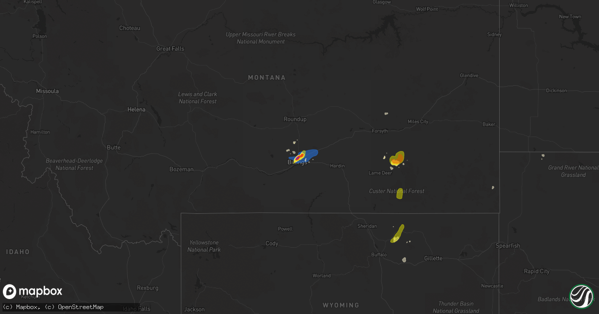
Hail Map on August 22, 2019
Get this storm
August 22 map
$229
one time, instant access
Download today. No call, no setup
Keep the $229
Bought the map and want the full workflow? Apply the entire $229 to a subscription within 7 days. None of it is wasted.
Every map, not just this one
This buys you this map. Subscription and you get every map we run, in the markets you choose from a few cities to whole states to nationwide. Plus real-time alerts the moment a storm fires.
Contact data
Name, contact info, occupancy, even credit band for addresses in the footprint. You go from where it hit to who to call.
Become the source they trust
Unlimited branding weather history reports on demand. You already have the documented answer ready for the property owner, and you are the one who showed up with it.
Property data and RoofTrace estimates
Pull up any address you have got, its value and the exact code rules for that jurisdiction, straight from One Click Code. Then RoofTrace estimates the squares, pitch, and roof value, priced the way you price.
States Impacted by Hail Map on August 22, 2019
Storm reports
Oklahoma
| Date | Description |
|---|---|
| 08/22/20196:25 PM CDT | A local report indicates 1.00 inch wind near 2 N TRIBBEY |
| 08/22/20196:25 PM CDT | A local report indicates 60 MPH wind near 2 N TRIBBEY |
| 08/22/20195:48 PM CDT | Tree damage across southern part of town. Power also out. |
| 08/22/20195:31 PM CDT | A local report indicates 1.00 inch wind near 1 WSW ANADARKO |
| 08/22/20193:30 PM CDT | Several power poles blown over. |
| 08/22/20193:29 AM CDT | At 829 PM CDT, a severe thunderstorm was located 4 miles south of Bristow, moving northeast at 45 mph. HAZARD...60 mph wind gusts. SOURCE...Radar indicated. IMPACT...Expect damage to roofs, siding, and trees. Locations in or near the path include... Tulsa... Sand Springs... Bristow... Sapulpa... Jenks... Glenpool... Mannford... Kiefer... Mounds... Kellyville... Depew... Slick... Keystone State Park... Jenks Riverside Airport... Gray... This includes Interstate 44 between mile markers 184 and 226. |
| 08/22/20193:10 AM CDT | At 810 PM CDT, a severe thunderstorm was located 7 miles north of Paden, moving northeast at 40 mph. HAZARD...60 mph wind gusts. SOURCE...Radar indicated. IMPACT...Expect damage to roofs, siding, and trees. Locations in or near the path include... Bristow... Boley... Depew... Paden... Slick... Shamrock... Welty... Milfay...This includes Interstate 44 between mile markers 178 and 191. |
| 08/22/20192:44 AM CDT | At 743 PM CDT, a severe thunderstorm was located 6 miles southeast of Luther, moving northeast at 25 mph. HAZARD...Ping pong ball size hail and 60 mph wind gusts. SOURCE...Radar indicated. IMPACT...People and animals outdoors will be injured. Expect hail damage to roofs, siding, windows, and vehicles. Expect wind damage to roofs, siding, and trees. Locations impacted include... Chandler, Wellston, Carney, Warwick and Fallis. |
| 08/22/20191:38 AM CDT | At 638 PM CDT, a severe thunderstorm was located near Tuttle, moving northeast at 25 mph. HAZARD...60 mph wind gusts and quarter size hail. SOURCE...Radar indicated. IMPACT...Hail damage to vehicles is expected. Expect wind damage to roofs, siding, and trees. Locations impacted include... Oklahoma City, southwestern Edmond, Moore, Midwest City, Del City, El Reno, Newcastle, Yukon, Bethany, Mustang, Choctaw, Warr Acres, The Village, Tuttle, Piedmont, Harrah, Spencer, Nichols Hills, Nicoma Park and Union City. |
| 08/22/20191:24 AM CDT | At 624 PM CDT, severe thunderstorms were located along a line extending from near Norman to near Macomb to 4 miles east of Bowlegs, moving northeast at 30 mph. HAZARD...60 mph wind gusts and quarter size hail. SOURCE...Radar indicated. IMPACT...Hail damage to vehicles is expected. Expect wind damage to roofs, siding, and trees. Locations impacted include... Southeastern Oklahoma City, southeastern Norman, Shawnee, Seminole, Tecumseh, Noble, Slaughterville, McLoud, Wewoka, Pink, Maud, Earlsboro, Bowlegs, Tribbey, Cromwell, Johnson, St. Louis, Etowah, Brooksville and Macomb. |
| 08/22/201912:45 AM CDT | At 545 PM CDT, severe thunderstorms were located along a line extending from near Maysville to 5 miles east of Paoli, moving northeast at 20 mph. HAZARD...60 mph wind gusts and quarter size hail. SOURCE...Radar indicated. IMPACT...Hail damage to vehicles is expected. Expect wind damage to roofs, siding, and trees. Locations impacted include... Purcell, Slaughterville, Lexington, Maysville, Wayne, Paoli, Asher, Tribbey, Wanette, Byars, St. Louis, Etowah, Rosedale and Trousdale. |
| 08/22/201912:36 AM CDT | At 536 PM CDT, a severe thunderstorm was located 6 miles south of Anadarko, moving north at 10 mph. HAZARD...60 mph wind gusts and quarter size hail. SOURCE...Radar indicated. IMPACT...Hail damage to vehicles is expected. Expect wind damage to roofs, siding, and trees. Locations impacted include... Anadarko, Verden, Gracemont, Lake Chickasha and Laverty. |
| 08/22/201912:05 AM CDT | At 505 PM CDT, a severe thunderstorm was located 4 miles northwest of Fletcher, moving northeast at 5 mph. HAZARD...60 mph wind gusts and quarter size hail. SOURCE...Radar indicated. IMPACT...Hail damage to vehicles is expected. Expect wind damage to roofs, siding, and trees. Locations impacted include... Anadarko, Elgin, Apache, Fletcher, Cyril, Cement, Norge, Agawam, northeastern Lake Ellsworth, Ninnekah, Stecker and Laverty. |
| 08/21/201910:40 PM CDT | At 339 PM CDT, severe thunderstorms were located 7 miles north of Cookietown and near Temple, moving northeast at 25 mph. HAZARD...60 mph wind gusts and quarter size hail. SOURCE...Radar indicated. IMPACT...Hail damage to vehicles is expected. Expect wind damage to roofs, siding, and trees. Locations impacted include... Lawton, Duncan, Walters, Comanche, Geronimo, Temple, Medicine Park, Hastings, Waurika Lake, Lake Lawtonka, Fort Sill, Corum, Central High, Empire City, Hulen and eastern Wichita Mountains Wildlife Refuge. |
| 08/21/20197:50 PM CDT | A local report indicates 1.75 inch wind near 5 S WELLSTON |
| 08/21/20197:09 PM CDT | A local report indicates 1.00 inch wind near 2 E WARR ACRES |
| 08/21/20197:05 PM CDT | A local report indicates 1.00 inch wind near 2 ESE WARR ACRES |
Ohio
| Date | Description |
|---|---|
| 08/22/20197:23 AM CDT | Several trees down. |
Arizona
| Date | Description |
|---|---|
| 08/22/20193:04 AM CDT | At 803 PM MST, a severe thunderstorm was located 8 miles south of Kitt Peak, or 15 miles east of Sells, moving east at 5 mph. HAZARD...60 mph wind gusts and nickel size hail. SOURCE...Radar indicated. IMPACT...Expect damage to roofs, siding, and trees. Locations impacted include... Kitt Peak and Fresnal Canyon. This includes the following highways... Route 86 near mile marker 142. Route 286 between mile markers 20 and 33. |
| 08/21/201911:42 PM CDT | At 441 PM MST, severe thunderstorms were located along a line extending from near Patagonia Lake State Park to 7 miles southeast of Nogales International Airport, and are nearly stationary. HAZARD...60 mph wind gusts and penny size hail. SOURCE...Radar indicated. IMPACT...Expect damage to roofs, siding, and trees. Locations impacted include... Nogales International Airport, Patagonia Lake State Park and Kino Springs.This includes Route 82 between mile markers 5 and 17. |
| 08/21/20199:50 PM CDT | At 250 PM MST, a severe thunderstorm was located 11 miles north of Bisbee, and is nearly stationary. HAZARD...60 mph wind gusts and quarter size hail. SOURCE...Radar indicated. IMPACT...Hail damage to vehicles is expected. Expect wind damage to roofs, siding, and trees. This severe thunderstorm will remain over mainly remote areas of south central Cochise County. |
| 08/21/20199:21 PM CDT | At 221 PM MST, a severe thunderstorm was located over Huachuca City, or near Sierra Vista, moving southeast at 5 mph. HAZARD...60 mph wind gusts and quarter size hail. SOURCE...Radar indicated. IMPACT...Hail damage to vehicles is expected. Expect wind damage to roofs, siding, and trees. Locations impacted include... Sierra Vista, Whetstone, Huachuca City, Fort Huachuca and Charleston.This includes the following highways... Route 82 between mile markers 50 and 51. Route 90 between mile markers 309 and 326. Route 92 between mile markers 322 and 324. |
| 08/21/20198:31 PM CDT | At 130 PM MST, a severe thunderstorm was located over Parker Canyon Lake, or 13 miles southwest of Sierra Vista, and is nearly stationary. HAZARD...60 mph wind gusts and penny size hail. SOURCE...Radar indicated. IMPACT...Expect damage to roofs, siding, and trees. Locations impacted include... Parker Canyon Lake, Fort Huachuca and Lochiel. This includes Route 83 between mile markers 3 and 9. |
New York
| Date | Description |
|---|---|
| 08/22/20198:49 AM CDT | Multiple trees down on walnut ave. |
| 08/22/20195:45 AM CDT | At 1045 PM EDT, a severe thunderstorm was located over Greenport, or over Southold, moving northeast at 50 mph. HAZARD...60 mph wind gusts. SOURCE...Radar indicated. IMPACT...Expect damage to trees and power lines. This severe thunderstorm will be near... Plum Island around 1100 PM EDT. |
| 08/22/20194:55 AM CDT | At 954 PM EDT, a severe thunderstorm was located over Farmingville, or over Centereach, moving east at 45 mph. HAZARD...70 mph wind gusts. SOURCE...Radar indicated. IMPACT...Expect considerable tree damage. Damage is likely to mobile homes, roofs, and outbuildings. This severe thunderstorm will be near... Mount Sinai around 1000 PM EDT. Shirley and Middle Island around 1005 PM EDT. Center Moriches and Mastic around 1010 PM EDT. Manorville and Wading River around 1015 PM EDT. Westhampton around 1020 PM EDT. Riverhead around 1025 PM EDT. Mattituck and Shinnecock Hills around 1035 PM EDT. Peconic around 1040 PM EDT. Southold around 1045 PM EDT. |
| 08/22/20194:25 AM CDT | At 925 PM EDT, a severe thunderstorm was located over Lindenhurst, moving east at 40 mph. HAZARD...60 mph wind gusts. SOURCE...Radar indicated. IMPACT...Expect damage to trees and power lines. This severe thunderstorm will be near... Deer Park around 930 PM EDT. Brentwood and Bay Shore around 935 PM EDT. Islip and Hauppauge around 940 PM EDT. Ronkonkoma around 945 PM EDT. Holbrook and Sayville around 950 PM EDT. Farmingville around 955 PM EDT. |
| 08/21/201910:12 PM CDT | Trees and wires down througout island. |
| 08/21/20199:16 PM CDT | Multiple trees down on copiague rd. |
| 08/21/20199:14 PM CDT | Trees down deer park ave. |
| 08/21/20199:12 PM CDT | Large tree limbs blocking westbound lane of moriches middle island road just east of william floyd parkway. |
| 08/21/20199:10 PM CDT | Trees down on yaphank middle island road near main street and on e main street near river road. |
| 08/21/20199:05 PM CDT | Tree down. Outdoor furniture damage. |
| 08/21/20199:00 PM CDT | Large tree limbs ripped off tree near michael murphy park. |
| 08/21/20198:53 PM CDT | Large tree branch down on gibbs pond rd. Near steuben blvd. |
| 08/21/20198:53 PM CDT | 3 inch tree limbs down... Power poles snapped |
| 08/21/20198:50 PM CDT | Mutliple trees and wires down across ronkonkoma with several roads blocked. |
| 08/21/20198:49 PM CDT | Multiple trees down on walnut ave. |
| 08/21/20198:47 PM CDT | A local report indicates 60 MPH wind near SAYVILLE |
| 08/21/20198:47 PM CDT | Large oak tree snapped at the intersection of depot st and railroad ave. |
| 08/21/20198:45 PM CDT | Large tree down on grand blvd. |
| 08/21/20198:43 PM CDT | Numerous trees reported down around town. |
| 08/21/20198:43 PM CDT | Numerous trees reported down around town. |
| 08/21/20198:40 PM CDT | A local report indicates 61 MPH wind near BRENTWOOD |
| 08/21/20198:37 PM CDT | Large tree down on power lines on richland blvd. |
| 08/21/20198:35 PM CDT | Trees down on deer park ave. |
| 08/21/20198:34 PM CDT | A local report indicates 60 MPH wind near 1 ESE BABYLON |
| 08/21/20198:34 PM CDT | A local report indicates 60 MPH wind near WEST ISLIP |
| 08/21/20198:27 PM CDT | Partial building collapse onto multiple vehicles on executive boulevard. |
| 08/21/20198:27 PM CDT | Multiple trees down on copiague rd. |
| 08/21/20198:25 PM CDT | Tree down on ketcham avenue. Outdoor furniture damage. |
| 08/21/20198:25 PM CDT | Tree down across wantagh parkway. |
| 08/21/20198:13 PM CDT | Tree down across wantagh parkway. |
| 08/21/20198:13 PM CDT | Larges branches down. |
| 08/21/20198:10 PM CDT | Tree down at wantagh ave and bunker ave |
| 08/21/20197:39 PM CDT | A local report indicates 58 MPH wind near TRIBECA |
Maryland
| Date | Description |
|---|---|
| 08/22/20196:29 PM CDT | Tree down along sams creek road. Corrected event time. |
| 08/22/20196:11 PM CDT | Tree down along sams creek road. |
| 08/22/20196:11 PM CDT | Trees down on alesia lineboro road. |
| 08/22/20195:52 PM CDT | Open-faced pole barn blown down by thunderstorm winds. |
| 08/22/20195:50 PM CDT | Tree down blocking md-75 green valley road near handboard road. |
| 08/22/20195:45 PM CDT | Numerous trees down on copper oaks drive. Tree on a car on second street. |
| 08/22/20195:30 PM CDT | Numerous large trees... Wires and poles down near the intersection of hessong bridge road and blue mountain road. |
| 08/22/20195:29 PM CDT | Numerous large trees... Wires and poles down near the intersection of hessong bridge road and blue mountain road. |
| 08/22/20195:29 PM CDT | Golf ball size hail reported near thurmont elementary school. |
| 08/22/20195:20 PM CDT | Multiple trees down on catoctin mountain road near william houck drive. |
| 08/22/20195:15 PM CDT | Multiple trees down along md-77 foxville road near tower road. |
| 08/22/20195:13 PM CDT | Tree reported down on the 12200 block of cloverly farm lane. |
| 08/22/20195:12 PM CDT | Numerous trees down in the smithsburg area. |
| 08/22/20195:11 PM CDT | Tree reported down on the 40 block of n main street. |
| 08/22/20195:09 PM CDT | Tree reported down on eagle nest road near bradbury ave |
| 08/22/20195:09 PM CDT | 51-knot wind gust measured at smithsburg middle school. |
| 08/22/20195:04 PM CDT | Tree reported down on little antietam road near serenity drive. |
| 08/22/20194:10 AM CDT | At 909 PM EDT, severe thunderstorms were located along a line extending from Dundalk to Millersville, moving east at 25 mph. HAZARD...60 mph wind gusts. SOURCE...Radar indicated. IMPACT...Damaging winds will cause some trees and large branches to fall. This could injure those outdoors, as well as damage homes and vehicles. Roadways may become blocked by downed trees. Localized power outages are possible. Unsecured light objects may become projectiles. Locations impacted include... Baltimore, Severn, Crofton, Middle River, Riviera Beach, Baltimore-Washington Airport, Fort Smallwood State Park, Gibson Island, Bodkin Point, Sillery Bay, Millers Island, North Point State Park, Magothy River, Sparrows Point, Dobbins Island, Pinehurst, Back River, Glen Burnie, Dundalk and Essex. |
| 08/22/20193:54 AM CDT | At 854 PM EDT, severe thunderstorms were located along a line extending from near Havre De Grace to near Aberdeen Proving Ground to near Newtown, moving east at 30 mph. HAZARD...60 mph wind gusts and penny size hail. SOURCE...Radar indicated. IMPACT...Damage to roofs, siding, trees, and power lines is possible. Locations impacted include... Newark, Middletown, Elkton, New Castle, North East, Delaware City, Charlestown, Cecilton, Millington, Betterton, Warwick, Glasgow, Bear, Bohemias Mills, Newtown, Port Penn, Brantwood, Wilmington Manor, Delaney Corner and Saint Georges.This includes the following highways... Interstate 95 in Maryland between mile markers 92 and 109. Interstate 95 in Delaware between mile markers 0 and 10. |
| 08/22/20193:23 AM CDT | At 823 PM EDT, a severe thunderstorm was located over Redland, or over Gaithersburg, moving east at 35 mph. HAZARD...60 mph wind gusts. SOURCE...Radar indicated. IMPACT...Damaging winds will cause some trees and large branches to fall. This could injure those outdoors, as well as damage homes and vehicles. Roadways may become blocked by downed trees. Localized power outages are possible. Unsecured light objects may become projectiles. Locations impacted include... Columbia, Germantown, Rockville, Gaithersburg, Bowie, Severn, Olney, College Park, Crofton, Greenbelt, Beltsville, Elkridge, Damascus, Historic Ellicott City, Ellicott City, Aspen Hill, Potomac, North Bethesda, Catonsville and Odenton. |
| 08/22/20192:57 AM CDT | At 757 PM EDT, a severe thunderstorm was located over Mays Chapel, or over Pikesville, moving east at 30 mph. HAZARD...60 mph wind gusts. SOURCE...Radar indicated. IMPACT...Damaging winds will cause some trees and large branches to fall. This could injure those outdoors, as well as damage homes and vehicles. Roadways may become blocked by downed trees. Localized power outages are possible. Unsecured light objects may become projectiles. Locations impacted include... Baltimore, Pikesville, Middle River, Cockeysville, Aberdeen, Aberdeen Proving Ground, Back River, Dundalk, Towson, Bel Air South, Essex, Randallstown, Parkville, Carney, Milford Mill, Perry Hall, Lochearn, Rosedale, Rossville and Mays Chapel. |
| 08/22/20192:27 AM CDT | At 727 PM EDT, severe thunderstorms were located along a line extending from near Hampstead to near Eldersburg, moving southeast at 25 mph. HAZARD...60 mph wind gusts. SOURCE...Radar indicated. IMPACT...Damaging winds will cause some trees and large branches to fall. This could injure those outdoors, as well as damage homes and vehicles. Roadways may become blocked by downed trees. Localized power outages are possible. Unsecured light objects may become projectiles. Locations impacted include... Pikesville, Cockeysville, Westminster, Towson, Randallstown, Owings Mills, Eldersburg, Milford Mill, Reisterstown, Lochearn, Mays Chapel, Timonium, Hampstead, Sykesville, Oakland, Gamber, Lutherville-Timonium, Garrison, Lutherville and Finksburg. |
| 08/22/20192:11 AM CDT | At 710 PM EDT, a severe thunderstorm was located near Manchester, or 11 miles southeast of Parkville, moving east at 25 mph. HAZARD...60 mph wind gusts. SOURCE...Radar indicated. IMPACT...Damaging winds will cause some trees and large branches to fall. This could injure those outdoors, as well as damage homes and vehicles. Roadways may become blocked by downed trees. Localized power outages are possible. Unsecured light objects may become projectiles. Locations impacted include... Hampstead, Manchester, Jarrettsville, Glencoe, Freeland, Lineboro, Norrisville, Sparks, Bentley Springs, Parkton, Phoenix, Hereford, Millers, Greenmount, Jacksonville, Maryland Line and Monkton. |
| 08/22/20191:49 AM CDT | At 649 PM EDT, a severe thunderstorm was located over Walkersville, or 7 miles northeast of Frederick, moving southeast at 25 mph. HAZARD...Ping pong ball size hail and 60 mph wind gusts. SOURCE...Radar indicated. IMPACT...Damaging winds will cause some trees and large branches to fall. This could injure those outdoors, as well as damage homes and vehicles. Roadways may become blocked by downed trees. Localized power outages are possible. Unsecured light objects may become projectiles. Locations impacted include... Damascus, Eldersburg, Mount Airy, Walkersville, New Market, Discovery-Spring Garden, Green Valley, Linganore-Bartonsville, Libertytown, Monrovia, Winfield, Lisbon, Mount Pleasant, Watersville, Poplar Springs, Woodbine and Unionville. |
| 08/22/20191:25 AM CDT | At 624 PM EDT, a severe thunderstorm was located over Thurmont, moving east at 30 mph. HAZARD...60 mph wind gusts and quarter size hail. SOURCE...Radar indicated. This storm produced a 59 mph wind gust in Smithsburg. IMPACT...Damaging winds will cause some trees and large branches to fall. This could injure those outdoors, as well as damage homes and vehicles. Roadways may become blocked by downed trees. Localized power outages are possible. Unsecured light objects may become projectiles. Locations impacted include... Westminster, Thurmont, Emmitsburg, Taneytown, New Windsor, Woodsboro, Union Bridge, Libertytown, Sabillasville, Winfield, New Midway, Ladiesburg, Rocky Ridge, Linwood, Detour, Uniontown, Wagners Mill, Keysville, Marston and Keymar. |
| 08/21/20198:43 PM CDT | Multiple trees down around the chestertown area. Time estimated from radar. |
| 08/21/20198:43 PM CDT | Multiple trees and branches down around the kingstown area. Time estimated from radar. |
| 08/21/20198:25 PM CDT | Trees... Wires and poles down near the intersection of marley neck boulevard and creekside village boulevard. |
| 08/21/20198:15 PM CDT | Tree down at intersection of md-648 and magothy bridge road. |
| 08/21/20198:13 PM CDT | Downed trees and power outages reported in the perryville area... Including near the intersection of u.s. Highway 40 and state highway 222. Time estimated from radar. |
| 08/21/20198:09 PM CDT | Tree down at intersection of md-648 and magothy bridge road. |
| 08/21/20197:35 PM CDT | Reports of trees down in the laytsonville and sandy springs area. |
| 08/21/20197:35 PM CDT | Several large trees down in the abingdon area. |
| 08/21/20197:30 PM CDT | Multiple reports of trees and wires down in the germantown/gaithersburg/montgomery village area. |
| 08/21/20197:30 PM CDT | Reports of trees down in the laytsonville area. |
| 08/21/20197:25 PM CDT | Tree down blocking part of harford square drive near hanson road. |
| 08/21/20197:22 PM CDT | Multiple reports of trees and wires down in the germantown/gaithersburg area. |
Pennsylvania
| Date | Description |
|---|---|
| 08/22/20195:52 PM CDT | Downed tree in wires on jacobsburg road near belfast road. All lanes closed. Time estimated from radar. |
| 08/22/20195:47 PM CDT | Downed tree in wires on state highway 512 near cherry hill road. All lanes closed. Time estimated from radar. |
| 08/22/20195:47 PM CDT | Downed trees and wires near seifert road and moorestown road. Time estimated from radar. |
| 08/22/20195:45 PM CDT | Tree fell into a house. Time estimated from radar. |
| 08/22/20195:25 PM CDT | Downed trees and wires near gun club road. Time estimated from radar. |
| 08/22/20195:23 PM CDT | Downed trees and wires on greenwood street south of hemlock street. Time estimated from radar. |
| 08/22/20195:15 PM CDT | Tree and wires down. Time estimated from radar. |
| 08/22/20195:13 PM CDT | Downed trees and wires near the intersection of beaver run drive and hemlock drive. Time estimated from radar. |
| 08/22/20195:01 PM CDT | Downed trees and wires near titus lane and quakake road. Time estimated from radar. |
| 08/22/20194:14 PM CDT | Tree across orlskany road. |
| 08/22/20193:36 PM CDT | Tree tops and large branches down in the altoona area baseball association parking lot |
| 08/22/20199:56 AM CDT | Large tree tops and branches down in the altoona area baseball association parking lot. |
| 08/22/20191:43 AM CDT | At 643 PM EDT, a severe thunderstorm was located over Saylorsburg, or 13 miles south of Mount Pocono, moving east at 40 mph. HAZARD...60 mph wind gusts and penny size hail. SOURCE...Radar indicated. IMPACT...Damage to roofs, siding, trees, and power lines is possible. Locations impacted include... East Stroudsburg, Hackettstown, Blairstown, Bangor, Pen Argyl, Wind Gap, Belvidere, Harmony, Oxford, Hope, Belfast, East Bangor, Stormville, Brodheadsville, Kunkletown, Gilbert, Delaware Water Gap, Rossland, Sun Valley and Great Meadows-Vienna.This includes the following highways... Interstate 80 in New Jersey between mile markers 0 and 21. Interstate 80 in Pennsylvania between mile markers 305 and 314. |
| 08/22/20191:01 AM CDT | At 601 PM EDT, a severe thunderstorm was located near Nesquehoning, or near Hazleton, moving east at 40 mph. HAZARD...60 mph wind gusts and penny size hail. SOURCE...Radar indicated. IMPACT...Damage to roofs, siding, trees, and power lines is possible. Locations impacted include... Lehighton, Bethlehem, Nazareth, Palmerton, Jim Thorpe, Pen Argyl, Nesquehoning, Wind Gap, Bath, Weatherly, Walnutport, Belfast, Steuben, Stormville, Brodheadsville, New Mahoning, Kunkletown, Gilbert, Rossland and Berlinsville. |
| 08/22/201912:52 AM CDT | At 552 PM EDT, a severe thunderstorm was located over Long Meadow, or near Hagerstown, moving east at 25 mph. HAZARD...60 mph wind gusts and quarter size hail. SOURCE...Radar indicated. IMPACT...Damaging winds will cause some trees and large branches to fall. This could injure those outdoors, as well as damage homes and vehicles. Roadways may become blocked by downed trees. Localized power outages are possible. Unsecured light objects may become projectiles. Locations impacted include... Hagerstown, Thurmont, Municipal Stadium, Robinwood, Fountainhead-Orchard Hills, Smithsburg, Paramount-Long Meadow, Wilson-Conococheague, Mount Aetna, Long Meadow, Maugansville, Cavetown, Leitersburg, Sabillasville, Fort Ritchie, Chewsville, Ringgold, Middleburg, Warrenton and Bridgeport. |
| 08/21/201911:27 PM CDT | At 426 PM EDT, a severe thunderstorm was located over Horseshoe Curve, moving east at 40 mph. HAZARD...60 mph wind gusts. SOURCE...Radar indicated. IMPACT...Expect damage to trees, roofs, and siding. This severe thunderstorm will be near... Hollidaysburg, Lakemont and Duncansville around 430 PM EDT. Altoona, Canoe Creek State Park and Sinking Valley around 440 PM EDT. Williamsburg around 450 PM EDT. Huntingdon and Raystown Dam around 510 PM EDT.Other locations impacted by this severe thunderstorm includeTunnelhill, Mapleton, McConnellstown, Mill Creek, Petersburg,Alexandria, Ashville, Peoples Natural Gas Field, Allegheny PortageRailroad National Historic Site and Penn State Altoona.This includes Interstate 99 from mile markers 27 to 40. |
New Jersey
| Date | Description |
|---|---|
| 08/22/20196:47 PM CDT | Delayed report. Downed trees and wires near leddel road just south of tempe wick road. Time estimated from radar. |
| 08/22/20196:47 PM CDT | Delayed report. Downed trees and wires near ballantine road northeast of claremont road. Time estimated from radar. |
| 08/22/20196:36 PM CDT | Report from mping: some shingles blown off. Time estimated from radar. |
| 08/22/20196:31 PM CDT | Corrects previous tstm wnd dmg report from 2 s califon. Downed trees and power lines near cokesbury califon road. Time estimated from radar. |
| 08/22/20196:30 PM CDT | Corrects previous tstm wnd dmg report from 2 sw califon. Downed trees and wires near hoffmans crossing road and raritan river road. Time estimated from radar. |
| 08/22/20196:30 PM CDT | Downed tree near the intersection of u.s. Highway 46 near hearthstone road. Time estimated from radar. |
| 08/22/20196:23 PM CDT | Delayed report. Downed trees and wires near old mine hill road. Time estimated from radar. |
| 08/22/20196:17 PM CDT | Delayed report. Downed trees and wires near brass castle road and hartmans corner road. Time estimated from radar. |
| 08/22/20195:59 PM CDT | Reports of trees and power lines down near belvidere road and harmony road. Time estimated from radar. |
| 08/22/20195:31 PM CDT | Downed trees and power lines near cokesbury califon road. Time estimated from radar. |
| 08/22/20195:30 PM CDT | Downed trees and wires near hoffmans crossing road and raritan river road. Time estimated from radar. |
| 08/22/20195:55 AM CDT | At 1055 PM EDT, severe thunderstorms were located along a line extending from 7 miles southeast of Woodland Beach to near Bowers to Milford, moving east at 35 mph. HAZARD...60 mph wind gusts and penny size hail. SOURCE...Radar indicated. IMPACT...Damage to roofs, siding, trees, and power lines is possible. Locations impacted include... Atlantic City, Millville, Ocean City, Cape May, Cumberland, Pleasantville, Somers Point, Ventnor City, Brigantine, Northfield, Absecon, Margate City, North Wildwood, Laurel Lake, Wildwood Crest, Woodbine, Sea Isle City, Estell Manor, Avalon and West Cape May.This includes the following highways... Atlantic City Expressway between mile markers 0 and 4. Garden State Parkway between mile markers 0 and 27, and between milemarkers 30 and 35. |
| 08/22/20193:33 AM CDT | At 832 PM EDT, a severe thunderstorm was located over Jersey City, moving southeast at 35 mph. HAZARD...60 mph wind gusts. SOURCE...Radar indicated. IMPACT...Expect damage to trees and power lines. This severe thunderstorm will be near... Bensonhurst around 840 PM EDT. Flatbush and Coney Island around 845 PM EDT. Forest Hills and Canarsie around 850 PM EDT. Jamaica and Kennedy Airport around 855 PM EDT. Valley Stream and Rockaway Beach around 900 PM EDT. Lynbrook and Woodmere around 905 PM EDT. Long Beach and Oceanside around 910 PM EDT. Lido Beach around 915 PM EDT. |
| 08/22/20192:57 AM CDT | At 757 PM EDT, a severe thunderstorm was located over Madison, or near Summit, moving southeast at 35 mph. HAZARD...60 mph wind gusts. SOURCE...Radar indicated. IMPACT...Damage to roofs, siding, trees, and power lines is possible. Locations impacted include... Morristown, Madison, Florham Park, East Hanover, Chatham, Morris Plains, Far Hills, Millington, Basking Ridge, North Plainfield, Bernardsville, Watchung and Hanover Township.This includes the following highways... Interstate 287 in New Jersey between mile markers 24 and 41. Interstate 78 in New Jersey between mile markers 35 and 42. |
| 08/22/20192:54 AM CDT | At 753 PM EDT, a severe thunderstorm was located over Morristown, moving southeast at 35 mph. HAZARD...60 mph wind gusts. SOURCE...Radar indicated. IMPACT...Expect damage to trees and power lines. This severe thunderstorm will be near... Plainfield and Summit around 805 PM EDT. Orange around 810 PM EDT. Clark and Union around 815 PM EDT. Newark and Elizabeth around 820 PM EDT. Port Richmond around 825 PM EDT. Jersey City and Bayonne around 830 PM EDT. The Verrazano Narrows Bridge and Bay Ridge around 835 PM EDT. Flatbush and Coney Island around 840 PM EDT. Sheepshead Bay around 845 PM EDT. |
| 08/22/20192:30 AM CDT | At 729 PM EDT, a severe thunderstorm was located over Succasunna, or 11 miles northwest of Morristown, moving east at 40 mph. HAZARD...60 mph wind gusts. SOURCE...Radar indicated. IMPACT...Damage to roofs, siding, trees, and power lines is possible. Locations impacted include... Morristown, Dover, Madison, Hopatcong, Florham Park, East Hanover, Lincoln Park, Hackettstown, Chatham, Boonton, Wharton, Rockaway, Morris Plains, Mount Arlington, Mendham, Mountain Lakes, High Bridge, Stanhope, Netcong and Peapack And Gladstone.This includes the following highways... Interstate 287 in New Jersey between mile markers 21 and 51. Interstate 78 in New Jersey between mile markers 29 and 39. Interstate 80 in New Jersey between mile markers 26 and 48. |
| 08/21/20197:34 PM CDT | Tree and wires down at 9th ave and 10th st. |
| 08/21/20197:00 PM CDT | Delayed report. Downed trees and wires near van doren avenue and clark street. Time estimated from radar. |
| 08/21/20197:00 PM CDT | Downed trees and wires near nicholson drive and sunset drive. Time estimated from radar. |
| 08/21/20197:00 PM CDT | Delayed report. Downed trees and wires near the intersection of kice road and deerfield drive. Time estimated from radar. |
New Mexico
| Date | Description |
|---|---|
| 08/22/20196:05 PM CDT | A local report indicates 1.00 inch wind near 3 N CAPULIN |
| 08/22/201912:03 AM CDT | At 503 PM MDT, a severe thunderstorm was located near Folsom, or near Des Moines, moving northeast at 25 mph. HAZARD...Ping pong ball size hail and 60 mph wind gusts. SOURCE...Radar indicated. IMPACT...People and animals outdoors will be injured. Expect hail damage to roofs, siding, windows, and vehicles. Expect wind damage to roofs, siding, and trees. Locations impacted include... Des Moines, Folsom and Capulin. |
Virginia
| Date | Description |
|---|---|
| 08/22/20196:50 PM CDT | Reports of trees down near va-9. |
| 08/22/20196:49 PM CDT | 1-inch tree limbs broken; shingles blown off. |
| 08/22/20196:00 PM CDT | Report of trees down in the lovettsville area. |
| 08/22/20195:56 PM CDT | Tree down on belair avenue. |
| 08/22/20195:49 PM CDT | Tree down on powerlines on north fork road. |
| 08/22/20195:45 PM CDT | Tree down by the post office in barhamsville. |
| 08/22/20195:45 PM CDT | Tree down on power lines on russ road near the intersection with totten lane. Two trees down near intersection of laing road and wakeman mill road. Tree down on mountai |
| 08/22/20195:44 PM CDT | Tree down on power lines on russ road near intersection with totten lane. Two trees down near intersection of laing road and wakeman mill road. Tree down on mountain ro |
| 08/22/20195:30 PM CDT | Tree down near the intersection of bromley and commonwealth. |
| 08/22/20195:25 PM CDT | Power line down across black creek rd. |
| 08/22/20195:25 PM CDT | Multiple trees down on rural point rd near us 301. |
| 08/22/20195:18 PM CDT | Trees down on oxford road near us route 1. |
| 08/22/20195:15 PM CDT | Tree down on power lines at 500 southhicks lawrenceville... Va. |
| 08/22/20195:10 PM CDT | A tree down on stone quarry dr near verdon rd. |
| 08/22/20195:00 PM CDT | A tree down at dunn chapel rd and vontay rd. |
| 08/22/20194:58 PM CDT | Trees and power lines down reported on coatsville rd. |
| 08/22/20194:40 PM CDT | Several trees down. |
| 08/22/20194:40 PM CDT | Trees down. |
| 08/22/20194:35 PM CDT | Numerous trees down throughout powhatan county. |
| 08/22/20194:21 PM CDT | Large limbs snapped off trees along hwy us 460 between waverly and wakefield. |
| 08/22/20194:20 PM CDT | Tree down near intersection of venable ave and stebbins street. Timing estimated by radar. |
| 08/22/20194:20 PM CDT | Corrects time of previous tstm wnd dmg report from 1 sse meadowville. Tree down causing power outages in meadowville. Relayed by nws employee. Time estimated from radar |
| 08/22/20194:05 PM CDT | Trees down along clinton rd. |
| 08/22/20193:58 PM CDT | Multiple trees down near intersection of wolf trap and nichols ferry rd. Timing estimated by radar. |
| 08/22/20193:45 PM CDT | Numerous trees knocked down in the westover hills area of danville. One house was destroyed... Another house and a mobile home suffered structural damage. More details |
| 08/22/20193:35 PM CDT | Several small to large limbs down in the gold hill area. Pea-sized hail was also observed. |
| 08/22/20193:24 PM CDT | Several calls of trees and wires down in and near the city of charlottesville. |
| 08/22/20193:20 PM CDT | Tree down causing power outages in meadowville. Relayed by nws employee. Time estimated from radar. |
| 08/22/20193:18 PM CDT | Tree down along shiloh church road. |
| 08/22/20193:13 PM CDT | Shingles blown off home. |
| 08/22/20193:10 PM CDT | Trees down near scottsville. |
| 08/22/20193:08 PM CDT | Tree down along mt. Cross road. |
| 08/22/20193:00 PM CDT | Several reports of trees and wires down in and just west of the city of charlottesville. Corrected event time. |
| 08/22/20192:59 PM CDT | Multiple trees down along presidents road near scottsville. Corrected event time. |
| 08/22/20192:58 PM CDT | Power lines down along mt. Cross road. |
| 08/22/20192:58 PM CDT | Several calls of trees and wires down in and near the city of charlottesville. Corrected event time. |
| 08/22/20192:58 PM CDT | Tree down blocking rocky road. |
| 08/22/20192:53 PM CDT | Corrects previous tstm wnd dmg report from 5 nnw westover hills. Tree down along clearview drive. |
| 08/22/20192:53 PM CDT | Tree down along mt. Cross road. |
| 08/22/20192:45 PM CDT | Railroad pole blown over near wingina. Several trees down in area. |
| 08/22/20192:43 PM CDT | Railroad pole knocked over. Several trees down in area. |
| 08/22/20192:40 PM CDT | Several trees down blocking roadways in the ivy and crozet areas. |
| 08/22/20192:38 PM CDT | Several trees down blocking roadways in the ivy and crozet areas. |
| 08/22/20192:31 PM CDT | Three or four trees and a couple of power lines down between gretna and the northwest border of the county. |
| 08/22/20192:20 PM CDT | Multiple trees reported down near us-29 between oakridge and fresh water cove. |
| 08/22/20192:19 PM CDT | Multiple trees reported down near rt. 29 between the oakridge and fresh water cove areas. |
| 08/22/20192:11 PM CDT | Tree down at intersection of old ferrum rd. And iron bridge rd. Timing estimated by radar. |
| 08/22/20192:08 PM CDT | Tree down along ravens den lane. |
| 08/22/20191:55 PM CDT | Tree down on coulson church rd. |
| 08/22/20191:45 PM CDT | Multiple trees down near the intersection of 501 and river rd. Timing estimated by radar. |
| 08/22/20191:42 PM CDT | Corrects previous tstm wnd dmg report from 2 e byllesby. Sheet metal torn off a trailer... Damaging a nearby truck. Time estimated from radar. |
| 08/22/20191:40 PM CDT | Tree down at the intersection of gogginsville and grassyhill rd. Timing estimated by radar. |
| 08/22/20191:30 PM CDT | Sheet metal torn off a trailer... Damaging a nearby truck. |
| 08/22/20191:25 PM CDT | Tree down on trott circle near carver elementary. Timing estimated by radar. |
| 08/22/20191:25 PM CDT | Tree down at the intersection of raceway dr. And rockwood park rd. Timing estimated by radar. |
| 08/22/20191:23 PM CDT | Tree down along pawnee lane. |
| 08/22/20191:23 PM CDT | Tree down along southriver rd. Timing estimated by radar. |
| 08/22/20191:15 PM CDT | Tree limbs down in the hollins area. Timing estimated by radar. |
| 08/22/20191:07 PM CDT | Tree down along forge rd. Timing estimated by radar. |
| 08/22/201912:45 PM CDT | Sveral mostly small tree limbs down in the haymaker road area near fincastle and stone gap going up the mountain toward craig county. |
| 08/22/201912:25 PM CDT | Tree down near intersection of market street and rte. 615. Timing estimated by radar. |
| 08/22/201912:13 PM CDT | Home with tile and gutter damage: multiple trees down. |
| 08/22/201911:50 AM CDT | One tree blown down at hortons store drive located along big stoney creek road. |
| 08/22/20192:33 AM CDT | At 733 PM EDT, a severe thunderstorm was located over Bluemont, or 12 miles south of Charles Town, moving east at 30 mph. HAZARD...60 mph wind gusts. SOURCE...Radar indicated. IMPACT...Damaging winds will cause some trees and large branches to fall. This could injure those outdoors, as well as damage homes and vehicles. Roadways may become blocked by downed trees. Localized power outages are possible. Unsecured light objects may become projectiles. Locations impacted include... Leesburg, Purcellville, Round Hill, Bluemont, Hamilton, Paeonian Springs, Philomont, Lincoln, Hughesville and Gleedsville. |
| 08/22/20192:20 AM CDT | At 719 PM EDT, a severe thunderstorm was located over Western Branch, or near Churchland, moving northeast at 15 mph. HAZARD...60 mph wind gusts. SOURCE...Radar indicated. IMPACT...Expect damage to trees and powerlines. This severe thunderstorm will be near, Chesapeake and Cradock around 725 PM EDT. Downtown Portsmouth, Old Dominion University and Portsmouth around 735 PM EDT. Downtown Norfolk, Norfolk State University and Ghent around 740 PM EDT. Norfolk NAS around 745 PM EDT. Regent University and Norview around 750 PM EDT. Ocean View around 755 PM EDT. Virginia Wesleyan University, Kempsville, Norfolk and Norfolk International around 800 PM EDT.Other locations impacted by this severe thunderstorm include SouthNorfolk, Portlock, Princess Anne Plaza, Huntersville, HerbertsCorner, Oceana NAS, Macons Corner, Greenbrier, Bayside and WardsCorner. |
| 08/22/20191:56 AM CDT | At 656 PM EDT, a severe thunderstorm was located near Front Royal, moving east at 25 mph. HAZARD...60 mph wind gusts. SOURCE...Radar indicated. IMPACT...Damaging winds will cause some trees and large branches to fall. This could injure those outdoors, as well as damage homes and vehicles. Roadways may become blocked by downed trees. Localized power outages are possible. Unsecured light objects may become projectiles. Locations impacted include... Front Royal, Millwood, Howellsville, Nineveh, Riverton, Bethel and Cedarville. |
| 08/22/20191:42 AM CDT | At 641 PM EDT, a severe thunderstorm was located near Barhamsville, or near Toano, moving northeast at 15 mph. HAZARD...60 mph wind gusts and quarter size hail. SOURCE...Radar indicated. IMPACT...Minor damage to vehicles is possible. Expect wind damage to trees and powerlines. This severe thunderstorm will be near, Shacklefords around 655 PM EDT. Gloucester Courthouse around 715 PM EDT. Glenns around 720 PM EDT. Saluda around 725 PM EDT. Urbanna around 730 PM EDT.Other locations impacted by this severe thunderstorm include Eltham,Croaker, Harmony Village, Grafton, Harcum, Cash, Mattaponi, Warner,Mascot and Fort Nonsense. |
| 08/22/20191:38 AM CDT | At 637 PM EDT, a severe thunderstorm was located near Charles Town, moving east at 20 mph. Additional thunderstorms were developing near Harpers Ferry. HAZARD...60 mph wind gusts. SOURCE...Radar indicated. IMPACT...Damaging winds will cause some trees and large branches to fall. This could injure those outdoors, as well as damage homes and vehicles. Roadways may become blocked by downed trees. Localized power outages are possible. Unsecured light objects may become projectiles. Locations impacted include... Charles Town, Brunswick, Ranson, Harpers Ferry, Point Of Rocks, Corporation Of Ranson, Adamstown, Jefferson, Lovettsville, Bolivar, Shenandoah Junction, Rosemont, Burkittsville, Gapland, Brownsville, Hillsboro, Waterford, Doubs, Petersville and Pleasantville. |
| 08/22/20191:31 AM CDT | At 631 PM EDT, a severe thunderstorm was located near Woodstock, moving east at 15 mph. HAZARD...60 mph wind gusts. SOURCE...Radar indicated. IMPACT...Damaging winds will cause some trees and large branches to fall. This could injure those outdoors, as well as damage homes and vehicles. Roadways may become blocked by downed trees. Localized power outages are possible. Unsecured light objects may become projectiles. Locations impacted include... Front Royal, Maurertown, Fort Valley, Kings Crossing, Compton, Seven Fountains, Dilbeck, Riverton, Karo, Saint Davids Church, Glen Echo, Bentonville, Browntown, Buckton, Riverside and Rileyville. |
| 08/22/20191:11 AM CDT | At 610 PM EDT, severe thunderstorms were located along a line extending from near Wyndham to University Of Richmond to near Chesterfield Court House, moving east at 40 mph. HAZARD...60 mph wind gusts. SOURCE...Radar indicated. IMPACT...Expect damage to trees and powerlines. Severe thunderstorms will be near, Richmond, Downtown Richmond, Virginia Commonwealth University and Virginia Union University around 615 PM EDT. Ashland, Chester, Glen Allen, Bensley, East Highland Park and Lakeside around 620 PM EDT. Highland Springs, Mechanicsville and Bellwood around 625 PM EDT. Hanover around 630 PM EDT. Studley around 635 PM EDT. Bottoms Bridge around 640 PM EDT. Manquin and Tunstall around 645 PM EDT. Talleysville, Roxbury, Adkins Store and Aylett around 650 PM EDT.Other locations impacted by these severe thunderstorms includeEltham, Wayside, Cohoke, Etna Mills, Montrose, Sandston, Glendale,Rose Garden, Mattaponi and Biscoe. |
| 08/22/20191:10 AM CDT | At 609 PM EDT, a severe thunderstorm was located over Zuni, or near Windsor, moving east at 20 mph. HAZARD...60 mph wind gusts and quarter size hail. SOURCE...Radar indicated. IMPACT...Minor damage to vehicles is possible. Expect wind damage to trees and powerlines. Locations impacted include... Franklin, Windsor, Courtland, Holland, Suffolk, Isle Of Wight, Ivor, Hunterdale, Sedley, Carrsville, Zuni, Vicksville, Pons, Dory, Sunbeam, Lees Mill, Walters, Elwood, Story and Berlin. |
| 08/22/201912:49 AM CDT | At 548 PM EDT, a severe thunderstorm was located over Montpelier, or 11 miles northwest of Randolph Macon College, moving east at 40 mph. HAZARD...60 mph wind gusts and penny size hail. SOURCE...Radar indicated. IMPACT...This storm has produced numerous reports of downed trees over southeast Louisa county. Expect damage to trees and powerlines. This severe thunderstorm will be near, Randolph Macon College around 600 PM EDT. Ashland and Kings Dominion around 605 PM EDT. Dawn around 610 PM EDT. Mangohick around 620 PM EDT. Beulahville around 625 PM EDT. Newtown around 630 PM EDT.Other locations impacted by this severe thunderstorm includeGolansville, Vontay, Gum Tree, Etna Mills, Penola, Epworth, Gilman,Globe, Cedar Fork and Duane Fork. |
| 08/22/201912:42 AM CDT | At 542 PM EDT, a severe thunderstorm was located 7 miles southeast of Rehoboth, or 10 miles northwest of South Hill, moving east at 25 mph. HAZARD...60 mph wind gusts and quarter size hail. SOURCE...Radar indicated. IMPACT...Minor damage to vehicles is possible. Expect wind damage to trees and powerlines. This severe thunderstorm will be near, South Hill around 600 PM EDT. Dundas around 610 PM EDT. Lawrenceville and Alberta around 630 PM EDT.Other locations impacted by this severe thunderstorm include Gary,Bacons Fork, Cochran, Wilburn, Gills Corner, Loves Mill, BarrowsStore, North View, Meredithville and Forksville. |
| 08/22/201912:39 AM CDT | At 539 PM EDT, severe thunderstorms were located along a line extending from near Sabot to Moseley, moving east at 25 mph. HAZARD...60 mph wind gusts and nickel size hail. SOURCE...Radar indicated. IMPACT...These storms have produced numerous reports of downed trees in Powhatan county. Expect damage to trees and powerlines. Severe thunderstorms will be near, Manakin around 550 PM EDT. Tuckahoe and Wyndham around 600 PM EDT. University Of Richmond, Bon Air and Chesterfield Court House around 610 PM EDT. Laurel around 615 PM EDT. Richmond, Chester, Virginia Union University, Virginia Commonwealth University, Downtown Richmond, Lakeside, Bellwood, Glen Allen and Bensley around 620 PM EDT. East Highland Park around 625 PM EDT. Mechanicsville and Highland Springs around 630 PM EDT.Other locations impacted by these severe thunderstorms includeCrozier, Richmond Heights, Pilkinton, Johnsons Springs, Elmont,Montrose, Pocahontas State Park, Skinquarter, Solomons Store andChamberlayne. |
| 08/22/201912:14 AM CDT | At 514 PM EDT, severe thunderstorms were located along a line extending from near Louisa to Fife, moving northeast at 35 mph. HAZARD...60 mph wind gusts and penny size hail. SOURCE...Radar indicated. IMPACT...Expect damage to trees and powerlines. Severe thunderstorms will be near, Mineral and Gum Spring around 525 PM EDT. Bumpass around 550 PM EDT.Other locations impacted by these severe thunderstorms includeChilesburg, Orchid, Pendleton, Coatesville, Hewlett, Mabelton, Noel,Cuckoo, Yanceyville and Beaverdam. |
| 08/22/201912:08 AM CDT | At 507 PM EDT, a severe thunderstorm was located near Homeville, or near Wakefield, moving northeast at 25 mph. HAZARD...60 mph wind gusts and quarter size hail. SOURCE...Radar indicated. IMPACT...Minor damage to vehicles is possible. Expect wind damage to trees and powerlines. Locations impacted include... Waverly, Wakefield, Ivor, Dendron, Homeville, Elberon, Booth Fork, Pons, Carsley, Newville, Ellis Fork, Manry, Delk Crossroads, Littleton, Dory, Comet, Gwaltney Corner, Raynor and Runnymede. |
| 08/22/201912:04 AM CDT | At 504 PM EDT, a severe thunderstorm was located near Bellwood, or near Chester, moving east at 15 mph. HAZARD...60 mph wind gusts and quarter size hail. SOURCE...Radar indicated. IMPACT...Minor damage to vehicles is possible. Expect wind damage to trees and powerlines. This severe thunderstorm will be near, Hopewell around 510 PM EDT. Roxbury and Adkins Store around 545 PM EDT.Other locations impacted by this severe thunderstorm include WrightsCorner, Meadowville, Wayside, Browns Corner, Varina, Mountcastle,Barnetts, Elko, New Kent Airport and Glendale. |
| 08/22/201912:01 AM CDT | At 500 PM EDT, severe thunderstorms were located along a line extending from near Keysville to near Hitesburg to Milton, moving southeast at 25 mph. HAZARD...60 mph wind gusts. SOURCE...Radar indicated. IMPACT...Expect damage to roofs, siding, and trees. Locations impacted include... South Boston... Halifax... Brookneal... Keysville... and Charlotte Court House. |
| 08/22/201912:00 AM CDT | At 500 PM EDT, a severe thunderstorm was located near Tobaccoville, or 7 miles east of Cumberland, moving east at 25 mph. HAZARD...60 mph wind gusts and quarter size hail. SOURCE...Radar indicated. IMPACT...Minor damage to vehicles is possible. Expect wind damage to trees and powerlines. This severe thunderstorm will be near, Ballsville and Trenholm around 505 PM EDT. Macon around 520 PM EDT. Powhatan around 525 PM EDT. Moseley, Sabot and Manakin around 545 PM EDT.Other locations impacted by this severe thunderstorm include Crozier,Rock Castle, Oak Forest, Pilkinton, Maidens, Johnsons Springs,Whiteville, Fine Creek Mills, Michaux and West View. |
| 08/21/201911:53 PM CDT | At 453 PM EDT, a severe thunderstorm was located over New Kent, moving east at 10 mph. HAZARD...60 mph wind gusts and quarter size hail. SOURCE...Radar indicated. IMPACT...Minor damage to vehicles is possible. Expect wind damage to trees and powerlines. Locations impacted include... New Kent, West Point, Little Plymouth, Shacklefords, Holly Forks, Eltham, Cohoke, Mattaponi, Lanesville, Cooke, Romancoke, Plum Point and Slaterville. |
| 08/21/201911:13 PM CDT | At 412 PM EDT, a severe thunderstorm was located near Pine Hall, moving east at 30 mph. HAZARD...60 mph wind gusts and quarter size hail. SOURCE...Radar indicated. IMPACT...Hail damage to vehicles is expected. Expect wind damage to roofs, siding, and trees. Locations impacted include... Eden... Reidsville... Wentworth... Mayodan... and Madison. |
| 08/21/201911:07 PM CDT | At 407 PM EDT, severe thunderstorms were located along a line extending from Pamplin City to near Ridgeway to near Mayfield, moving southeast at 40 mph. HAZARD...60 mph wind gusts. SOURCE...Radar indicated. IMPACT...Expect damage to roofs, siding, and trees. Locations impacted include... South Boston... Halifax... Brookneal... Keysville... and Charlotte Court House. |
| 08/21/201910:54 PM CDT | At 353 PM EDT, a severe thunderstorm was located over Charlottesville, moving east at 20 mph. HAZARD...60 mph wind gusts. SOURCE...Law enforcement has reported trees down in the Ivy and Crozet areas. IMPACT...Damaging winds will cause some trees and large branches to fall. This could injure those outdoors, as well as damage homes and vehicles. Roadways may become blocked by downed trees. Localized power outages are possible. Unsecured light objects may become projectiles. Locations impacted include... Charlottesville, Campbell, Westmoreland, Hollymead, Cobham, Cismont, Newcomb Hall, Boyd Tavern, Monticello, Keswick, Stony Point, Flordon, Carrsbrook, Shadwell, Barracks, Overton and Scott Stadium. |
| 08/21/201910:34 PM CDT | At 334 PM EDT, severe thunderstorms were located along a line extending from 7 miles northwest of Schuyler to near Bent Creek, moving east at 25 mph. HAZARD...60 mph wind gusts. SOURCE...Radar indicated. IMPACT...Damaging winds will cause some trees and large branches to fall. This could injure those outdoors, as well as damage homes and vehicles. Roadways may become blocked by downed trees. Localized power outages are possible. Unsecured light objects may become projectiles. Locations impacted include... Shipman, Schuyler, Arrington, Scottsville, Esmont, Damon, Allens Creek, North Garden, Covesville, Rockfish, Buffalo Springs, Norwood, Keene, Glendower, Five Forks, Alberene, Gladstone, Elma, Faber and Wingina. |
| 08/21/201910:20 PM CDT | At 320 PM EDT, a severe thunderstorm was located near Crozet, or 8 miles east of Waynesboro, moving east at 25 mph. HAZARD...60 mph wind gusts. SOURCE...Radar indicated. IMPACT...Damaging winds will cause some trees and large branches to fall. This could injure those outdoors, as well as damage homes and vehicles. Roadways may become blocked by downed trees. Localized power outages are possible. Unsecured light objects may become projectiles. Locations impacted include... Charlottesville, Crozet, Crimora, Free Union, Westmoreland, Hollymead, Ivy, Greenwood, Newcomb Hall, Batesville, Yancey Mills, Monticello, Flordon, Carrsbrook, Barracks, Overton, Scott Stadium and White Hall. |
| 08/21/201910:00 PM CDT | At 300 PM EDT, a severe thunderstorm was located near Lowesville, or 7 miles north of Clifford, moving east at 15 mph. HAZARD...60 mph wind gusts. SOURCE...Radar indicated. IMPACT...Damaging winds will cause some trees and large branches to fall. This could injure those outdoors, as well as damage homes and vehicles. Roadways may become blocked by downed trees. Localized power outages are possible. Unsecured light objects may become projectiles. Locations impacted include... Shipman, Arrington, Lovingston, Bryant, Norwood, Piney River, Jonesboro, Roseland, Elma, Tyro and Massies Mill. |
| 08/21/20199:32 PM CDT | At 232 PM EDT, severe thunderstorms were located along a line extending from near Harrisonburg to near Montebello to near Natural Bridge, moving east at 50 mph. HAZARD...60 mph wind gusts and quarter size hail. SOURCE...Radar indicated. IMPACT...Hail damage to vehicles is expected. Expect wind damage to roofs, siding, and trees. Locations impacted include... Lynchburg... Lexington... Buena Vista... Amherst... and Glasgow.This includes The following Locations VMI and Liberty University. |
| 08/21/20198:48 PM CDT | At 148 PM EDT, severe thunderstorms were located along a line extending from near Oriskany to near Glenvar to Childress, moving east at 20 mph. HAZARD...60 mph wind gusts. SOURCE...Radar indicated. IMPACT...Expect damage to roofs, siding, and trees. Locations impacted include... Roanoke... Lynchburg... Salem... Christiansburg... and Vinton.This includes The following Locations The Salem Fairgrounds, TheNational D-Day Memorial, and Roanoke Regional Airport. |
| 08/21/20198:29 PM CDT | At 128 PM EDT, severe thunderstorms were located along a line extending from near Williamsville to Clifton Forge, moving east at 20 mph. HAZARD...60 mph wind gusts and quarter size hail. SOURCE...Radar indicated. IMPACT...Hail damage to vehicles is expected. Expect wind damage to roofs, siding, and trees. Locations impacted include... Lexington... Buena Vista... Covington... Clifton Forge... and Buchanan.This includes The following Location VMI. |
| 08/21/20198:06 PM CDT | At 106 PM EDT, a severe thunderstorm was located near Potts Creek, moving east at 25 mph. HAZARD...60 mph wind gusts and quarter size hail. SOURCE...Radar indicated. IMPACT...Hail damage to vehicles is expected. Expect wind damage to roofs, siding, and trees. Locations impacted include... Buchanan... Troutville... New Castle... Paint Bank... and Oriskany. |
Wyoming
| Date | Description |
|---|---|
| 08/22/20196:44 PM CDT | Severe gust from a combination of weak showers and an outflow from distant thunderstorms. |
| 08/22/20195:09 PM CDT | A local report indicates 1.75 inch wind near 8 SSW PINE BLUFFS |
| 08/22/20193:00 AM CDT | At 759 PM MDT, severe thunderstorms were located along a line extending from 8 miles northeast of Savageton to 16 miles south of Wright, moving east at 20 mph. HAZARD...60 mph wind gusts and quarter size hail. SOURCE...Radar indicated. IMPACT...Hail damage to vehicles is expected. Expect wind damage to roofs, siding, and trees. Locations impacted include... Wright and Reno Junction. |
| 08/22/20192:59 AM CDT | At 758 PM MDT, a severe thunderstorm was located 16 miles north of Powder River Rest Area, which is 23 miles east of Buffalo, moving northeast at 20 mph. HAZARD...60 mph wind gusts and quarter size hail. SOURCE...Radar indicated. IMPACT...Hail damage to vehicles is expected. Expect wind damage to roofs, siding, and trees. This severe thunderstorm will remain over mainly rural areas of northeastern Johnson County. |
| 08/22/20191:36 AM CDT | At 634 PM MDT, a severe thunderstorm was located 22 miles west of Spotted Horse, or 28 miles northeast of Buffalo, moving northeast at 25 mph. HAZARD...60 mph wind gusts and half dollar size hail. SOURCE...Radar indicated. IMPACT...Hail damage to vehicles is expected. Expect wind damage to roofs, siding, and trees. Locations impacted include... Clearmont, Leiter and Arvada. |
| 08/22/20191:34 AM CDT | At 634 PM MDT, a severe thunderstorm was located over Powder River Rest Area, which is 26 miles east of Buffalo, moving northeast at 10 mph. HAZARD...60 mph wind gusts. SOURCE...Radar indicated. IMPACT...Expect damage to roofs, siding, and trees. This severe thunderstorm will be near... Powder River Rest Area around 645 PM MDT.This includes Interstate 90 between mile markers 78 and 95. |
| 08/21/201911:03 PM CDT | At 403 PM MDT, a severe thunderstorm was located 7 miles northwest of Panorama Point, or 28 miles southwest of Kimball, moving east at 10 mph. HAZARD...Half dollar size hail. SOURCE...Radar indicated. IMPACT...Damage to vehicles is expected. Locations impacted include... Pine Bluffs, Panorama Point and Carpenter. This includes the following highways... Interstate 80 in Wyoming between mile markers 391 and 402. Interstate 80 in Nebraska between mile markers 1 and 5. |
| 08/21/20198:00 PM CDT | A local report indicates 1.00 inch wind near 28 E BUFFALO |
| 08/21/20197:40 PM CDT | Quarter size hail and lots of rain. |
Tennessee
| Date | Description |
|---|---|
| 08/22/20196:50 PM CDT | Several trees down near the intersection of thorngrove pike and john sevier highway. |
| 08/22/20193:30 AM CDT | At 828 PM EDT, a severe thunderstorm was located near Dandridge, moving east at 25 mph. HAZARD...60 mph wind gusts. SOURCE...Radar indicated. IMPACT...Expect damage to roofs, siding, and trees. Locations impacted include... Sevierville, Jefferson City, Newport, Dandridge, White Pine, Baneberry, Parrottsville, Bird Crossing, Fairgarden, Bybee, Chestnut Hill, Harrisburg, Piedmont, Kodak and Hartford. |
| 08/22/20192:39 AM CDT | At 739 PM EDT, a severe thunderstorm was located near Knoxville, moving east at 25 mph. HAZARD...60 mph wind gusts and penny size hail. SOURCE...Radar indicated. IMPACT...Expect damage to roofs, siding, and trees. Locations impacted include... Knoxville, Sevierville, Jefferson City, Dandridge, New Market, Strawberry Plains, Blaine, Kimberlin Heights, House Mountain State Park, McMahan, Lake Forest, Maloneyville, Mascot, Piedmont, Kodak and Seymour. |
| 08/21/20197:45 PM CDT | Several trees down around the kodak area. |
| 08/21/20197:02 PM CDT | Several trees and poles down. Power outages reported. |
Montana
| Date | Description |
|---|---|
| 08/22/20196:54 PM CDT | A local report indicates 67 MPH wind near BILLINGS |
| 08/22/20193:40 AM CDT | At 840 PM MDT, a line of severe thunderstorms were located from Busby, and through Colstrip, moving northeast at 20 mph. HAZARD...60 mph wind gusts and half dollar size hail. SOURCE...Radar indicated. IMPACT...Hail damage to vehicles is expected. Expect wind damage to roofs, siding, and trees. Locations impacted include... Colstrip, Lame Deer, Busby and Northern Cheyenne Indian Reservation. |
| 08/22/20192:53 AM CDT | At 753 PM MDT, a severe thunderstorm was located 12 miles north of Ashland, or 18 miles southeast of Colstrip, moving east at 15 mph. HAZARD...60 mph wind gusts and quarter size hail. SOURCE...Radar indicated. IMPACT...Hail damage to vehicles is expected. Expect wind damage to roofs, siding, and trees. Locations impacted include... Ashland and Brandenberg. |
| 08/22/20192:25 AM CDT | At 724 PM MDT, a severe thunderstorm was located over Huntley, or 12 miles northeast of Billings, moving northeast at 25 mph. HAZARD...70 mph wind gusts and quarter size hail and torrenital rain. SOURCE...Trained weather spotters and weather radar. IMPACT...Hail damage to vehicles is expected. Expect considerable tree damage. Wind damage is also likely to mobile homes, roofs, and outbuildings. Locations impacted include... Lockwood, Shepherd, Huntley, Worden, Ballantine and Pompeys Pillar.This replaces the warning previously in effect for this area. |
| 08/22/20191:59 AM CDT | At 659 PM MDT, a severe thunderstorm was located over Billings Heights, or near Billings, moving northeast at 15 mph. HAZARD...60 mph wind gusts and quarter size hail. SOURCE...Radar indicated. IMPACT...Hail damage to vehicles is expected. Expect wind damage to roofs, siding, and trees. Locations impacted include... Billings, Lockwood, Shepherd, Huntley and Billings Heights. |
| 08/22/20191:48 AM CDT | At 647 PM MDT, a severe thunderstorm was located 22 miles south of Ashland, or 42 miles west of Broadus, moving north at 25 mph. HAZARD...60 mph wind gusts and half dollar size hail. Also torrential rain. SOURCE...Radar indicated. IMPACT...Hail damage to vehicles is expected. Expect wind damage to roofs, siding, and trees. Locations impacted include... Ashland, Otter and Birney Village. |
| 08/21/20199:10 PM CDT | Torrential rain as well. |
| 08/21/20198:35 PM CDT | A local report indicates 60 MPH wind near WORDEN |
| 08/21/20198:10 PM CDT | A local report indicates 1.00 inch wind near 4 NE BILLINGS |
| 08/21/20198:10 PM CDT | A local report indicates 60 MPH wind near 4 NE BILLINGS |
| 08/21/20198:08 PM CDT | Dime to golf-ball sized hail. Broken windows and damage to fences and siding. |
| 08/21/20198:08 PM CDT | Broken windows |
| 08/21/20198:05 PM CDT | Significant damage to house. |
| 08/21/20198:05 PM CDT | A local report indicates 1.25 inch wind near 1 NNE BILLINGS |
| 08/21/20197:58 PM CDT | A local report indicates 67 MPH wind near 3 NW BILLINGS |
| 08/21/20197:58 PM CDT | Water on grand ave. |
| 08/21/20197:54 PM CDT | A local report indicates 67 MPH wind near BILLINGS |
| 08/21/20197:53 PM CDT | A local report indicates 60 MPH wind near 3 NW BILLINGS |
West Virginia
| Date | Description |
|---|---|
| 08/22/20195:42 PM CDT | About a dozen reports of trees and wires down in eastern jefferson county... Mainly from ranson to bloomery. |
| 08/22/20197:26 AM CDT | Small tree limbs broken |
| 08/22/20193:22 AM CDT | At 822 AM EDT, a severe thunderstorm was located near Gallipolis, moving east at 35 mph. HAZARD...60 mph wind gusts and penny size hail. SOURCE...Radar indicated. IMPACT...Expect damage to roofs, siding, and trees. Locations impacted include... Leon, Cottageville, Southside, Mount Alto, Gallopolis Ferry and Evans. |
| 08/21/20198:12 PM CDT | At 111 PM EDT, severe thunderstorms were located along a line extending from near Newport to Pulaski, moving southeast at 20 mph. HAZARD...60 mph wind gusts. SOURCE...Radar indicated. IMPACT...Expect damage to roofs, siding, and trees. Locations impacted include... Blacksburg... Christiansburg... Radford... Pulaski... and Dublin.This includes The following Location Virginia Tech. |
Nebraska
| Date | Description |
|---|---|
| 08/22/20193:47 AM CDT | Estimated 60-65 mph wind gusts. Strong wind gusts were ongoing at time of call and likely lasted for at least 20 minutes in the area... Roughly from around 330 am to 35 |
| 08/22/20193:15 AM CDT | Quarter to half dollar sized hail. Est winds to be 75mph. Tree branches down... Gardens shredded siding damaged on houses. Delayed report. |
| 08/22/20193:15 AM CDT | Quarter to half dollar sized hail. Est winds to be 75mph. Tree branches down... Gardens shredded siding damaged on houses. Delayed report. |
| 08/22/20193:00 AM CDT | A local report indicates 70 MPH wind near 2 ENE JUNIATA |
| 08/22/20192:59 AM CDT | Peak wind gust at the hastings... Ne airport at 2:59am. |
| 08/22/20192:59 AM CDT | Light helicopter blown over at the hsi airport. Time est from pk wnd report from asos. |
| 08/22/20192:12 AM CDT | Delayed report. Large hardwood tree snapped off about 4 ft abv ground. Svr dmg to soybeans and corn in adjacent fields to the e due to hail. All foliage gone. All that |
| 08/22/20192:12 AM CDT | Delayed report of large tree blown over. Time estimated from radar. |
| 08/22/20191:30 AM CDT | Hall county sheriff reported strong winds blew over semis near mm 305 on interstate 80. Sheriff said wind/rain caused some trucks to run off the road or where blown ove |
| 08/22/20191:03 AM CDT | At 602 PM MDT, a severe thunderstorm was located 8 miles north of Kimball, moving northeast at 20 mph. HAZARD...Half dollar size hail. SOURCE...Radar indicated. IMPACT...Damage to vehicles is expected. This severe thunderstorm will remain over mainly rural areas of northeastern Kimball and southeastern Banner Counties. |
Indiana
| Date | Description |
|---|---|
| 08/22/20197:34 AM CDT | At 1234 AM CDT, severe thunderstorms were located along a line extending from near Petersburg to 6 miles northeast of Lynnville, moving east at 35 mph. HAZARD...60 mph wind gusts. SOURCE...Radar indicated. IMPACT...Expect damage to roofs, siding, and trees. Locations impacted include... Petersburg, Winslow and Spurgeon. This includes Interstate 69 in Indiana between Mile Markers 46 and52. |
| 08/21/20199:43 PM CDT | At 242 AM EDT, a severe thunderstorm was located near Carefree Town, moving east at 40 mph. HAZARD...60 mph wind gusts. SOURCE...Radar indicated. IMPACT...Expect damage to roofs, siding, and trees. Locations impacted include... Corydon, Milltown, Lanesville, Elizabeth, Crandall, New Middletown, Moberly, White Cloud, Fairdale and Seven Springs. |
North Carolina
| Date | Description |
|---|---|
| 08/22/20196:45 PM CDT | Trees down on hemlock ridge. |
| 08/22/20196:35 PM CDT | Trees and power lines down at hwy 37 and bagley swamp rd. |
| 08/22/20196:35 PM CDT | Corrects time of previous tstm wnd dmg report from 1 sw mavaton. Power lines down. Report relayed by 911 call center. |
| 08/22/20196:31 PM CDT | Power lines down on evans church road. |
| 08/22/20196:05 PM CDT | Large tree down at brentwood rd and julian dr. |
| 08/22/20196:00 PM CDT | Trees were reported down on power lines near the intersection of fairview road and cambridge road. |
| 08/22/20195:53 PM CDT | Tree down on roadway between pink hill and deep run. |
| 08/22/20195:45 PM CDT | Multiple trees and power lines down in pittsboro... Including at the following locations: west st near johnson st... Thompson st and davie st... Sanford rd and e cornwa |
| 08/22/20195:17 PM CDT | Tree down at siler city snow camp rd and pearleman teague rd. |
| 08/22/20194:56 PM CDT | Large pecan tree down at carter rd and saw mill rd in new london. |
| 08/22/20194:51 PM CDT | Tree down at antioch rd and bulluck school rd. |
| 08/22/20194:47 PM CDT | Roof ripped off a house on the 2200 block of phillip rd in scotland neck. Power lines also down. |
| 08/22/20194:20 PM CDT | Tree down at cedar square rd and canter rd. |
| 08/22/20194:09 PM CDT | Tree down near intersection of law and gentlemens rd. Timing estimated by radar. |
| 08/22/20193:40 PM CDT | Scotch irish fd reports a tree down across utility lines and the roadway. |
| 08/22/20193:39 PM CDT | A handful of trees were blown down in the northern portion of reidsville. Time estimated from radar. |
| 08/22/20193:33 PM CDT | Tree down at gibbs ave and nc highway 561. |
| 08/22/20193:30 PM CDT | Tree down on a house on martin lake rd off nc highway 150 w. About 10-12 trees down |
| 08/22/20193:26 PM CDT | Power outages at garcia kennedy rd and cecil st... From fallen trees on power lines. |
| 08/22/20193:18 PM CDT | 59 mph wind gust at the piedmont triad international airport. |
| 08/22/20193:06 PM CDT | Tree down at darrow rd and walkertown-guthrie rd. |
| 08/22/20193:06 PM CDT | Tree down at the 7000 block of walnut cove rd. |
| 08/22/20193:06 PM CDT | Tree down at the 5800 block of walnut cove rd. |
| 08/22/20193:04 PM CDT | Tree down on lynnhaven park dr off friendship-ledford rd. |
| 08/22/20192:48 PM CDT | 2 trees fell on cemetery road. |
| 08/22/20192:47 PM CDT | Tree down at the 4000 block of hampton rd. |
| 08/22/20192:45 PM CDT | Power outages caused by trees falling on power lines near the intersection of us 401 s and tarboro rd. |
| 08/22/20192:23 PM CDT | Tree down on a vehicle on the 3100 block of rogers rd in wake forest. |
| 08/22/20192:15 PM CDT | Tree down along courtney-hunstville rd. Timing estimated by radar. |
| 08/22/20192:09 PM CDT | Corrects previous tstm wnd dmg report from 4 sw purnell. Power outages in stony hill from trees falling on power lines. |
| 08/22/20192:06 PM CDT | Power outages in stony hill from trees falling on power lines. |
| 08/22/20191:55 PM CDT | Thunderstorm winds downed several trees along us-64 in the vicinity of ramseur. |
| 08/22/20191:55 PM CDT | Trees down in far eastern part of burke county. Time estimated by radar. |
| 08/22/20191:42 PM CDT | Tree down along walnut street. Timing estimated by radar. |
| 08/22/20191:18 PM CDT | Tree down at vine street in elkin. Timing estimated by radar. |
| 08/22/20191:15 PM CDT | Emergency mngr reported numerous incidences of trees and lines down in marion |
| 08/22/20191:08 PM CDT | A few power lines down. |
| 08/22/20191:05 PM CDT | 911 call center reported a tree down on a residence on baldwin ave. |
| 08/22/201912:20 PM CDT | Trained spotter reported trees down on norwood st. |
| 08/22/201912:15 PM CDT | 911 call center reported downed tree on a trailer in green mountain park. |
| 08/22/201912:10 PM CDT | 911 call center reported tree down across powell rd near camelot ct. |
| 08/22/20197:53 AM CDT | At 1253 PM EDT, a severe thunderstorm was located near Lenoir, and is nearly stationary. HAZARD...60 mph wind gusts and quarter size hail. SOURCE...Radar indicated. IMPACT...Minor hail damage to vehicles is expected. Expect wind damage to trees and power lines. Locations impacted include... Lenoir, Hudson, Cajah's Mountain, Cedar Rock, Kings Creek, Patterson and Sawmills. |
| 08/22/20193:56 AM CDT | At 856 PM EDT, a severe thunderstorm was located over Tarboro, moving east at 45 mph. HAZARD...60 mph wind gusts and penny size hail. SOURCE...Radar indicated. IMPACT...Expect damage to roofs, siding, and trees. Locations impacted include... Williamston, Bethel, Robersonville, Gold Point, Jamesville, Hamilton, Oak City, Parmele, Everetts, Dardens, Hassell and Beargrass. |
| 08/22/20193:47 AM CDT | At 847 PM EDT, severe thunderstorms were located along a line extending from 12 miles east of Rocky Mount to near Tarboro to near Wilson, moving east at 30 mph. HAZARD...60 mph wind gusts. SOURCE...Radar indicated. IMPACT...Expect damage to roofs, siding, and trees. Locations impacted include... Tarboro, Wilson, Princeville, Pinetops, Macclesfield, Hobgood, Conetoe, Speed, Leggett and Willbanks. |
| 08/22/20192:42 AM CDT | At 742 PM EDT, a severe thunderstorm was located near Fentress, or near Great Bridge, moving east at 20 mph. HAZARD...60 mph wind gusts and penny size hail. SOURCE...Radar indicated. IMPACT...Expect damage to trees and powerlines. This severe thunderstorm will be near, Back Bay around 750 PM EDT. Princess Anne around 755 PM EDT.Other locations impacted by this severe thunderstorm include Oceana,Rudee Heights, Mount Pleasant, Sigma, Sandbridge Beach, Dam Neck,North Virginia Beach, Oceana NAS, Munden and Macons Corner. |
| 08/22/20192:28 AM CDT | At 728 PM EDT, a severe thunderstorm was located over Sanford, moving east at 35 mph. HAZARD...60 mph wind gusts. SOURCE...Radar indicated. IMPACT...Expect damage to roofs, siding, and trees. Locations impacted include... Sanford, Broadway, Lemon Springs, Gum Springs, Moncure, Cumnock, Tramway and Shearon Harris Reservoir. |
| 08/22/20192:27 AM CDT | At 726 PM EDT, a severe thunderstorm was located near Valhalla, or 12 miles northeast of Windsor, moving northeast at 30 mph. HAZARD...60 mph wind gusts and quarter size hail. SOURCE...Radar indicated. IMPACT...Minor damage to vehicles is possible. Expect wind damage to trees and powerlines. This severe thunderstorm will be near, Rockyhock around 735 PM EDT. Valhalla around 740 PM EDT. Snug Harbor and Belvidere around 800 PM EDT. Hertford, Winfall and Burgess around 805 PM EDT.Other locations impacted by this severe thunderstorm include GoosePond, Holiday Island, Smalls Crossroads, Mavaton, Arrowhead Beach,Edenhouse, Whiteston, Mill Crossroads, Mount Gould and Hancock. |
| 08/22/20192:12 AM CDT | At 712 PM EDT, a severe thunderstorm was located over Potters Hill, or 16 miles northwest of Half Moon, moving east at 40 mph. HAZARD...60 mph wind gusts and nickel size hail. SOURCE...Radar indicated. IMPACT...Expect damage to roofs, siding, and trees. Locations impacted include... Jacksonville, Half Moon, Phillips Crossroads, Richlands, Beulaville, Maysville, Kellum, Comfort, Belgrade, Potters Hill, Petersburg, Pleasant Hill, Richlands South, Deppe, Loco VFD, Pollocksville, Hargetts Crossroads and Trenton. |
| 08/22/20191:53 AM CDT | At 653 PM EDT, a severe thunderstorm was located near Cary, moving east at 15 mph. HAZARD...60 mph wind gusts and penny size hail. SOURCE...Radar indicated. IMPACT...Expect damage to roofs, siding, and trees. Locations impacted include... Raleigh, Cary, Smithfield, Lillington, Garner, Fuquay-Varina, Clayton, Dunn, Zebulon and Angier. |
| 08/22/20191:22 AM CDT | At 621 PM EDT, severe thunderstorms were located along a line extending from near Siler City to 6 miles east of Ansonville, moving east at 15 mph. HAZARD...60 mph wind gusts and penny size hail. SOURCE...Radar indicated. IMPACT...Expect damage to roofs, siding, and trees. Locations impacted include... Sanford, Southern Pines, Pittsboro, Troy, Carthage, Siler City, Pinehurst, Aberdeen, Biscoe and Hoffman. |
| 08/22/20191:11 AM CDT | At 611 PM EDT, a severe thunderstorm was located 7 miles northwest of Harrells, or 12 miles south of Clinton, moving northeast at 30 mph. HAZARD...60 mph wind gusts and quarter size hail. SOURCE...Radar indicated. IMPACT...Hail damage to vehicles is expected. Expect wind damage to roofs, siding, and trees. Locations impacted include... Warsaw, Mount Olive, Kornegay, Rose Hill, Beulaville, Deep Run, Bowdens, Beautancus, Kenansville, Potters Hill, Albertson, Harrells, Sarecta, Magnolia, Greenevers, Pink Hill and Calypso. |
| 08/22/201912:13 AM CDT | At 512 PM EDT, a severe thunderstorm was located over Bethel, moving east at 30 mph. HAZARD...60 mph wind gusts. SOURCE...Radar indicated. IMPACT...Expect damage to roofs, siding, and trees. Locations impacted include... Yanceyville... Bethel... Providence... Jericho... and Prospect Hill. |
| 08/22/201912:13 AM CDT | At 513 PM EDT, a severe thunderstorm was located 7 miles west of Maysville, or 9 miles northeast of Half Moon, and is nearly stationary. HAZARD...60 mph wind gusts and quarter size hail. SOURCE...Radar indicated. IMPACT...Hail damage to vehicles is expected. Expect wind damage to roofs, siding, and trees. Locations impacted include... Maysville, Loco VFD, Pollocksville and Trenton. |
| 08/21/201911:54 PM CDT | At 454 PM EDT, severe thunderstorms were located along a line extending from near Halifax to near Nashville, moving east at 20 mph. HAZARD...60 mph wind gusts and penny size hail. SOURCE...Radar indicated. IMPACT...Expect damage to roofs, siding, and trees. Locations impacted include... Rocky Mount, Roanoke Rapids, Tarboro, Nashville, Halifax, Scotland Neck, Dortches, Red Oak, Enfield and Princeville. |
| 08/21/201911:41 PM CDT | At 441 PM EDT, severe thunderstorms were located along a line extending from near Gold Hill to Westover Hills, moving northeast at 25 mph. HAZARD...60 mph wind gusts. SOURCE...Radar indicated. IMPACT...Expect damage to roofs, siding, and trees. Locations impacted include... Danville... Chatham... Brookneal... Dillwyn... and Mt Airy.This includes The following Location Danville Airport. |
| 08/21/201911:39 PM CDT | At 439 PM EDT, severe thunderstorms were located along a line extending from near Monroeton to near High Point to near Lexington, moving east at 25 mph. HAZARD...60 mph wind gusts. SOURCE...Radar indicated. IMPACT...Expect damage to roofs, siding, and trees. Locations impacted include... Greensboro, High Point, Burlington, Asheboro, Lexington, Graham, Randleman, Thomasville, Mebane and Elon. |
| 08/21/201911:19 PM CDT | At 419 PM EDT, a severe thunderstorm was located 5 miles south of Huntersville, or near Northeast Charlotte, moving east at 20 mph. HAZARD...60 mph wind gusts and quarter size hail. SOURCE...Radar indicated. IMPACT...Minor hail damage to vehicles is expected. Expect wind damage to trees and power lines. Locations impacted include... Northeast Charlotte, Northwest Charlotte, University City, Reedy Creek Park, Hidden Valley, Croft, Huntersville, Harrisburg and Central Charlotte. |
| 08/21/201911:06 PM CDT | At 406 PM EDT, severe thunderstorms were located along a line extending from near Kernersville to 6 miles southeast of Clemmons, moving northeast at 30 mph. HAZARD...60 mph wind gusts. SOURCE...Radar indicated. IMPACT...Expect damage to roofs, siding, and trees. Locations impacted include... Greensboro, High Point, Kernersville, Summerfield, Stokesdale, Jamestown, Lake Jeanette Marina, Monticello, Oak Hollow Marina and Lake Townsend Marina. |
| 08/21/201910:31 PM CDT | At 331 PM EDT, severe thunderstorms were located along a line extending from near Centenary to near Leesville, moving east at 75 mph. HAZARD...60 mph wind gusts. SOURCE...Radar indicated. IMPACT...Expect damage to roofs, siding, and trees. Locations impacted include... Lynchburg... Danville... Buckingham... Bedford... and Altavista.This includes The following Locations Liberty University, DanvilleAirport, and Lynchburg Airport. |
| 08/21/201910:31 PM CDT | At 331 PM EDT, severe thunderstorms were located along a line extending from near Clemmons to near Mocksville, moving east at 30 mph. HAZARD...60 mph wind gusts. SOURCE...Radar indicated. IMPACT...Expect damage to roofs, siding, and trees. Locations impacted include... Winston-Salem, Lexington, Thomasville, Kernersville, Clemmons, Bermuda Run, Linwood, Huntsville, Lewisville and Walkertown. |
| 08/21/201910:07 PM CDT | At 307 PM EDT, a severe thunderstorm was located near Wake Forest, or 9 miles south of Creedmoor, moving east at 15 mph. HAZARD...60 mph wind gusts. SOURCE...Radar indicated. IMPACT...Expect damage to roofs, siding, and trees. Locations impacted include... Raleigh, Creedmoor, Wake Forest, Franklinton, Rolesville, Youngsville, Falls Lake, Falls Lake State Rec Area, Falls Lake Boat Ramp and Purnell. |
| 08/21/20199:54 PM CDT | At 254 PM EDT, severe thunderstorms were located along a line extending from Sedalia to near Endicott, moving east at 20 mph. HAZARD...60 mph wind gusts and quarter size hail. SOURCE...Radar indicated. IMPACT...Hail damage to vehicles is expected. Expect wind damage to roofs, siding, and trees. Locations impacted include... Lynchburg... Martinsville... Bedford... Rocky Mount... and Boones Mill.This includes The following Locations Liberty University and TheNational D-Day Memorial. |
| 08/21/20199:45 PM CDT | At 245 PM EDT, severe thunderstorms were located along a line extending from 6 miles southeast of Lenoir to 15 miles south of Morganton to near Forest City, moving east at 15 mph. HAZARD...60 mph wind gusts and quarter size hail. SOURCE...Radar indicated. IMPACT...Minor hail damage to vehicles is expected. Expect wind damage to trees and power lines. Locations impacted include... Hickory, Lenoir, Morganton, Rutherfordton, Taylorsville, St. Stephens, Conover, Longview, Sawmills and Granite Falls. |
| 08/21/20199:42 PM CDT | At 241 PM EDT, a severe thunderstorm was located 7 miles east of Randleman, moving east at 15 mph. HAZARD...60 mph wind gusts. SOURCE...Radar indicated. IMPACT...Expect damage to roofs, siding, and trees. Locations impacted include... Asheboro, Randleman, Siler City, Liberty, Ramseur, Franklinville, Staley, Snow Camp, Coleridge and Hasty. |
| 08/21/20199:38 PM CDT | At 238 PM EDT, severe thunderstorms were located along a line extending from near Spring Valley to Mc Grady, moving east at 25 mph. HAZARD...60 mph wind gusts. SOURCE...Radar indicated. IMPACT...Expect damage to roofs, siding, and trees. Locations impacted include... Mount Airy... Galax... Elkin... Fairview... and Flat Rock. |
| 08/21/20199:24 PM CDT | At 224 PM EDT, a severe thunderstorm was located over Oak Level, moving northeast at 10 mph. HAZARD...60 mph wind gusts and quarter size hail. SOURCE...Radar indicated. IMPACT...Hail damage to vehicles is expected. Expect wind damage to roofs, siding, and trees. Locations impacted include... Martinsville... Spencer... Bassett... Sydnorsville... and Axton.This includes The following Locations The Martinsville Speedway andMartinsville Airport. |
| 08/21/20199:11 PM CDT | At 211 PM EDT, a severe thunderstorm was located over Windy Gap, moving northeast at 10 mph. HAZARD...60 mph wind gusts. SOURCE...Radar indicated. IMPACT...Expect damage to roofs, siding, and trees. Locations impacted include... North Wilkesboro... Wilkesboro... Yadkinville... Jonesville... and Boonville. |
| 08/21/20199:05 PM CDT | At 205 PM EDT, severe thunderstorms were located along a line extending from 8 miles east of Boomer to 3 miles northeast of Taylorsville to 5 miles northwest of Hickory, moving east at 20 mph. HAZARD...60 mph wind gusts and quarter size hail. SOURCE...Radar indicated. IMPACT...Minor hail damage to vehicles is expected. Expect wind damage to trees and power lines. Locations impacted include... Taylorsville, St. Stephens, Bethlehem, Stony Point, Love Valley, Lookout Shoals Lake, Hiddenite, Little River In Alexander County, Olin and Millersville. |
| 08/21/20198:00 PM CDT | Thunderstorm winds downed several trees along nc 33 between tarboro and loggett. |
| 08/21/20197:57 PM CDT | Power lines down. Report relayed by 911 call center. |
Arkansas
| Date | Description |
|---|---|
| 08/22/20195:20 PM CDT | Large tree limbs snapped and a power line was blown down. Time estimated by radar. |
| 08/22/20193:03 AM CDT | At 803 PM CDT, a severe thunderstorm was located near Bonanza, moving northeast at 25 mph. HAZARD...60 mph wind gusts. SOURCE...Radar indicated. IMPACT...Expect damage to roofs, siding, and trees. Locations in or near the path include... Fort Smith... Van Buren... Greenwood... Alma... Barling... Pocola... Lavaca... Arkoma... Hackett... Bonanza... Bloomer... Excelsior... Fort Smith Regional Airport... Jenny Lind... Kibler... Rock Island... Central City... Concord... Shibley... Braden...This includes the following highways, Interstate 40 in Arkansas between mile markers 5 and 11. Interstate 540 between mile markers 1 and 14. |
| 08/22/201912:12 AM CDT | At 512 PM CDT, a severe thunderstorm was located over Almyra, or 9 miles southeast of Stuttgart, moving east at 20 mph. HAZARD...60 mph wind gusts and nickel size hail. SOURCE...Radar indicated. IMPACT...Expect damage to roofs, siding, and trees. Locations impacted include... Almyra... St. Charles... De Witt... Indian Bay... Ethel... De Luce... Almyra Airport... Casscoe... Crocketts Bluff... Lawrenceville... Cross Roads in Monroe County... |
| 08/21/20199:44 PM CDT | A porch and metal roof were damaged... And trees were blown down. |
Texas
| Date | Description |
|---|---|
| 08/22/20196:25 PM CDT | West texas mesonet |
| 08/22/20195:42 PM CDT | Delayed report due to cell tower being down. Site also had 1.21 inches of rain with the storm. |
| 08/21/201910:35 PM CDT | At 335 PM CDT, a severe thunderstorm was located 4 miles east of Davidson, moving northeast at 25 mph. HAZARD...60 mph wind gusts and nickel size hail. SOURCE...Trained weather spotters reported power poles down east of Davidson. IMPACT...Expect damage to roofs, siding, and trees. Locations impacted include... Frederick, Grandfield, Davidson, Hollister and Loveland. |
South Carolina
| Date | Description |
|---|---|
| 08/22/20196:58 PM CDT | 2 trees down at the intersection of east poinsett street and j. Verne smith parkway. Time estimated by radar. |
| 08/22/20192:27 PM CDT | South carolina highway patrol reported a tree down along south carolina highway 462 near coolers crocery. Time estimated is based on radar. The report was also relayed |
| 08/21/201910:44 PM CDT | At 343 PM EDT, a severe thunderstorm was located 5 miles south of Shelby, or near Earl, moving northeast at 10 mph. HAZARD...60 mph wind gusts and half dollar size hail. SOURCE...Radar indicated. IMPACT...Minor hail damage to vehicles is expected. Expect wind damage to trees and power lines. Locations impacted include... Shelby, Patterson Springs, Earl, Grover and Kings Mountain. |
| 08/21/20198:56 PM CDT | At 156 PM EDT, severe thunderstorms were located along a line extending from 12 miles east of Spruce Pine to 8 miles east of Marion to 15 miles northwest of Rutherfordton to near Hendersonville, moving east at 10 mph. HAZARD...60 mph wind gusts and quarter size hail. SOURCE...Radar indicated. IMPACT...Minor hail damage to vehicles is expected. Expect wind damage to trees and power lines. Locations impacted include... Morganton, Hendersonville, Marion, Valdese, Flat Rock, Drexel, Glen Alpine, Lake Lure, Old Fort and Saluda. |
Illinois
| Date | Description |
|---|---|
| 08/22/20197:49 AM CDT | At 1249 AM EDT, a severe thunderstorm was located over Vincennes, moving east at 30 mph. HAZARD...60 mph wind gusts. SOURCE...Radar indicated. IMPACT...Expect damage to roofs, siding, and trees. Locations impacted include... Vincennes, Bicknell, Oaktown, Monroe City, Wheatland, Bruceville, Edwardsport, Decker, Vincennes University and Freelandville. |
Delaware
| Date | Description |
|---|---|
| 08/22/20195:11 AM CDT | At 1011 PM EDT, severe thunderstorms were located along a line extending from Millington to near Hartly to Oakland, moving east at 35 mph. HAZARD...70 mph wind gusts and penny size hail. SOURCE...Radar indicated. IMPACT...Expect considerable tree damage. Damage is likely to mobile homes, roofs, and outbuildings. Locations impacted include... Dover, Smyrna, Milford, Harrington, Camden, Clayton, Greensboro, Oakland, Ridgely, Cheswold, Millington, Sudlersville, Bowers, Goldsboro, Woodside, Viola, Hartly, Starr, Hazlettville and Delaney Corner. |
| 08/22/20194:21 AM CDT | At 921 PM EDT, severe thunderstorms were located along a line extending from 6 miles southwest of Newtown to near Bodkin Point to Arnold, moving east at 30 mph. HAZARD...60 mph wind gusts and penny size hail. SOURCE...Radar indicated. IMPACT...Damage to roofs, siding, trees, and power lines is possible. Locations impacted include... Dover, Easton, Centerville, Smyrna, Chestertown, Centreville, Clayton, Greensboro, Oakland, Ridgely, Cheswold, Rock Hall, Church Hill, Millington, Sudlersville, Goldsboro, Queen Anne, Hartly, Old Town and Starr. |
| 08/21/20199:34 PM CDT | Downed tree on kenton road near wimbledon drive. Time estimated from radar. |
Colorado
| Date | Description |
|---|---|
| 08/22/20195:59 PM CDT | A local report indicates 1.00 inch wind near 21 N NEW RAYMER |
| 08/22/20195:21 AM CDT | At 1021 PM MDT, a severe thunderstorm was located 7 miles northwest of Chivington, or 23 miles southwest of Cheyenne Wells, moving east at 10 mph. HAZARD...60 mph wind gusts and quarter size hail. SOURCE...Radar indicated. IMPACT...Hail damage to vehicles is expected. Expect wind damage to roofs, siding, and trees. Locations impacted include... Sheridan Lake and Brandon. |
| 08/22/20191:01 AM CDT | At 601 PM MDT, a severe thunderstorm was located near North Sterling Reservoir, or 13 miles north of Sterling, moving east at 25 mph. HAZARD...60 mph wind gusts and quarter size hail. SOURCE...Radar indicated. IMPACT...Expect damage to roofs, siding, and trees. Hail damage to vehicles is expected. Locations impacted include... Peetz, North Sterling Reservoir, Padroni and Westplains. |
| 08/22/201912:28 AM CDT | At 527 PM MDT, a severe thunderstorm was located over Westplains, or 21 miles northwest of Sterling, moving east at 25 mph. HAZARD...60 mph wind gusts and quarter size hail. SOURCE...Radar indicated. IMPACT...Expect damage to roofs, siding, and trees. Hail damage to vehicles is expected. Locations impacted include... Peetz, North Sterling Reservoir, Padroni and Westplains. |
| 08/21/201911:50 PM CDT | At 450 PM MDT, a severe thunderstorm was located 8 miles southwest of Fort Carson, or 13 miles south of Colorado Springs, moving northeast at 20 mph. HAZARD...60 mph wind gusts and quarter size hail. SOURCE...Radar indicated. IMPACT...Hail damage to vehicles is expected. Expect wind damage to roofs, siding, and trees. Locations impacted include... Southern Colorado Springs, Fountain, Fort Carson, Security, Security-Widefield and Stratmoor. |
| 08/21/201911:43 PM CDT | At 442 PM MDT, a severe thunderstorm was located near Pawnee Buttes, or 31 miles southwest of Kimball, moving east at 10 mph. HAZARD...Golf ball size hail and 60 mph wind gusts. SOURCE...Radar indicated. IMPACT...Expect damage to roofs, siding, and trees. People and animals outdoors will be injured. Expect hail damage to roofs, siding, windows, and vehicles. Locations impacted include... Pawnee Buttes and Keota. |
| 08/21/201911:19 PM CDT | At 418 PM MDT, a severe thunderstorm was located 4 miles west of Keota, or 35 miles northwest of Fort Morgan, moving northeast at 30 mph. HAZARD...60 mph wind gusts and quarter size hail. SOURCE...Radar indicated. IMPACT...Expect damage to roofs, siding, and trees. Hail damage to vehicles is expected. Locations impacted include... Briggsdale, Pawnee Buttes and Keota. |
| 08/21/201911:04 PM CDT | At 404 PM MDT, a severe thunderstorm was located near Panorama Point, or 26 miles southwest of Kimball, moving east at 35 mph. HAZARD...60 mph wind gusts and half dollar size hail. SOURCE...Radar indicated. IMPACT...Expect damage to roofs, siding, and trees. Hail damage to vehicles is expected. Locations impacted include... Grover and Hereford. |
| 08/21/201910:41 PM CDT | At 341 PM MDT, a severe thunderstorm was located over Air Force Academy, or 11 miles north of Colorado Springs, moving east at 15 mph. HAZARD...60 mph wind gusts and quarter size hail. SOURCE...Radar indicated. IMPACT...Hail damage to vehicles is expected. Expect wind damage to roofs, siding, and trees. Locations impacted include... Northwestern Colorado Springs, Air Force Academy and Gleneagle. |
| 08/21/201910:40 PM CDT | At 339 PM MDT, a severe thunderstorm was located 7 miles west of Riverside Reservoir, or 19 miles east of Greeley, moving northeast at 15 mph. HAZARD...60 mph wind gusts and quarter size hail. SOURCE...Radar indicated. IMPACT...Expect damage to roofs, siding, and trees. Hail damage to vehicles is expected. Locations impacted include... Barnesville and Riverside Reservoir. |
Kentucky
| Date | Description |
|---|---|
| 08/22/20197:55 AM CDT | At 1255 AM CDT, severe thunderstorms were located along a line extending from 6 miles northwest of Dale to 6 miles northwest of Rockport, moving east at 35 mph. HAZARD...60 mph wind gusts. SOURCE...Radar indicated. IMPACT...Expect damage to roofs, siding, and trees. Locations impacted include... Dale, Grandview, Santa Claus, Folsomville, Chrisney, Tennyson and Gentryville.This includes Interstate 64 in Indiana between Mile Markers 47 and60. |
| 08/22/20197:54 AM CDT | At 1254 PM CDT, a severe thunderstorm was located near Lovelaceville, or 8 miles northeast of Bardwell, moving southeast at 20 mph. HAZARD...60 mph wind gusts and nickel size hail. SOURCE...Radar indicated. IMPACT...Expect damage to roofs, siding, and trees. Locations impacted include... Arlington, Lowes and Fancy Farm. |
| 08/22/201912:44 AM CDT | At 544 AM EDT, a severe thunderstorm was located over Alexandria, moving east at 35 mph. HAZARD...60 mph wind gusts. SOURCE...Radar indicated. IMPACT...Expect damage to trees and power lines. Locations impacted include... Alexandria, Taylor Mill, Claryville, Amelia, Mount Orab, Wilder, Bethel, New Richmond, Williamsburg, Batavia, Silver Grove, Melbourne, Withamsville, Cold Spring, Ryland Heights, Hamersville, Crestview, Mentor, California and Visalia. |
| 08/22/201912:15 AM CDT | At 515 AM EDT, a severe thunderstorm was located over Walton, moving east at 35 mph. HAZARD...60 mph wind gusts. SOURCE...Radar indicated. IMPACT...Expect damage to trees and power lines. Locations impacted include... Covington, Florence, Independence, Erlanger, Alexandria, Taylor Mill, Walton, Claryville, Union, Wilder, Silver Grove, Melbourne, Coldstream, Cold Spring, Ryland Heights, Crestview, Fairview, California, Visalia and Atwood.This includes the following Interstates... I-71 in Kentucky between mile markers 69 and 77. I-75 in Kentucky between mile markers 168 and 178. |
Cities Impacted by Hail Map on August 22, 2019
- Ralph, SD
- Colorado Springs, CO
- Hastings, NE
- Shepherd, MT
- Billings, MT
- Huntley, MT
- Buffalo, WY
- Clearmont, WY
- Anadarko, OK
- Apache, OK
- Alda, NE
- Doniphan, NE
- Wood River, NE
- Juniata, NE
- Forsyth, MT
- Pine Bluffs, WY
- Grover, CO
- Carpenter, WY
- Wellston, OK
- Smithsburg, MD
- Rocky Ridge, MD
- Hagerstown, MD
- Thurmont, MD
- Woodsboro, MD
- Sabillasville, MD
- Keymar, MD
- Chandler, OK
- Emmitsburg, MD
- Tecumseh, OK
- Littlestown, PA
- Glasgow, MT
- Macomb, OK
- Yeso, NM
- Cuervo, NM
- Luther, OK
- Otter, MT
- Busby, MT
- Ravenna, NE
- Brule, NE
- Orrtanna, PA
- Raton, NM
- New Raymer, CO
- Fort Sumner, NM
- Glenvil, NE
- Arcadia, OK
- Wanette, OK
- Capulin, NM
- Jones, OK
- Broadus, MT
- Capitol, MT
- Des Moines, NM
- Kimball, NE
- Matador, TX
- Floydada, TX
- Hammond, MT
- Mustang, OK
- Weston, WY
- Whitewater, MT
- Kersey, CO
- Fairfield, PA
- Choctaw, OK
- Asher, OK
- Santa Rosa, NM
- Crosbyton, TX
- Frederick, MD
- Myersville, MD
- Walkersville, MD
- Gettysburg, PA
- Winston Salem, NC
- Union Bridge, MD
- Springer, NM
- Nogales, AZ
- Briggsdale, CO
- Lame Deer, MT
- Arvada, WY
- Saco, MT
- Alzada, MT
- Union City, OK
- Boyes, MT
- Jordan, MT
- Usaf Academy, CO
- Harrah, OK
- Mcloud, OK
- Meeker, OK
- Cyril, OK
- Pauls Valley, OK
- Stratford, OK
- El Reno, OK
- Yukon, OK
- Oklahoma City, OK
- Birney, MT
- Volborg, MT
- Gill, CO
- Edenton, NC
- Tyner, NC
- Knotts Island, NC
- Ballantine, MT
- Worden, MT
- Childress, TX
- Gaithersburg, MD
- Rockville, MD
- Ashton, MD
- Sandy Spring, MD
- Silver Spring, MD
- Olney, MD
- Derwood, MD
- Spencerville, MD
- Fulton, MD
- Brookeville, MD
- Highland, MD
- Burtonsville, MD
- Curtis Bay, MD
- Glen Burnie, MD
- Severn, MD
- Pasadena, MD
- Henderson, MD
- Rock Hall, MD
- Centreville, MD
- Church Hill, MD
- Barclay, MD
- Marydel, MD
- Chestertown, MD
- Felton, DE
- Goldsboro, MD
- Camden Wyoming, DE
- Millington, MD
- Queen Anne, MD
- Ingleside, MD
- Marydel, DE
- Sudlersville, MD
- Greensboro, MD
- Ridgely, MD
- Chesapeake, VA
- Virginia Beach, VA
- Lanexa, VA
- New Kent, VA
- Amelia Court House, VA
- Shacklefords, VA
- Barhamsville, VA
- Hamilton, VA
- Purcellville, VA
- Leesburg, VA
- Ayr, NE
- Blue Hill, NE
- Clay Center, NE
- Edgar, NE
- Fairfield, NE
- Belleville, PA
- Lewistown, PA
- Saylorsburg, PA
- Brodheadsville, PA
- Almyra, AR
- De Witt, AR
- Davidson, OK
- Frederick, OK
- Hollister, OK
- Lyman, SC
- Duncan, SC
- Greer, SC
- Charles Town, WV
- Harpers Ferry, WV
- New York, NY
- Brooklyn, NY
- Jersey City, NJ
- Bellmore, NY
- Wantagh, NY
- Seaford, NY
- West Babylon, NY
- Brentwood, NY
- Bohemia, NY
- Southold, NY
- Laurel, NY
- Smithtown, NY
- Deer Park, NY
- Lindenhurst, NY
- Yaphank, NY
- South Jamesport, NY
- Lake Grove, NY
- Islip Terrace, NY
- West Islip, NY
- Great River, NY
- Shelter Island, NY
- Ronkonkoma, NY
- Centereach, NY
- Patchogue, NY
- Jamesport, NY
- Calverton, NY
- Selden, NY
- Shelter Island Heights, NY
- Massapequa, NY
- Hauppauge, NY
- Babylon, NY
- Cutchogue, NY
- Farmingville, NY
- Islip, NY
- East Islip, NY
- Bay Shore, NY
- Copiague, NY
- Holtsville, NY
- Farmingdale, NY
- Wyandanch, NY
- Oakdale, NY
- Manorville, NY
- Medford, NY
- Brightwaters, NY
- Amityville, NY
- Levittown, NY
- Peconic, NY
- North Babylon, NY
- Greenport, NY
- East Meadow, NY
- Islandia, NY
- Middle Island, NY
- Bethpage, NY
- Wading River, NY
- Central Islip, NY
- Nesconset, NY
- Holbrook, NY
- Mattituck, NY
- Riverhead, NY
- Sayville, NY
- Ridge, NY
- Massapequa Park, NY
- Coram, NY