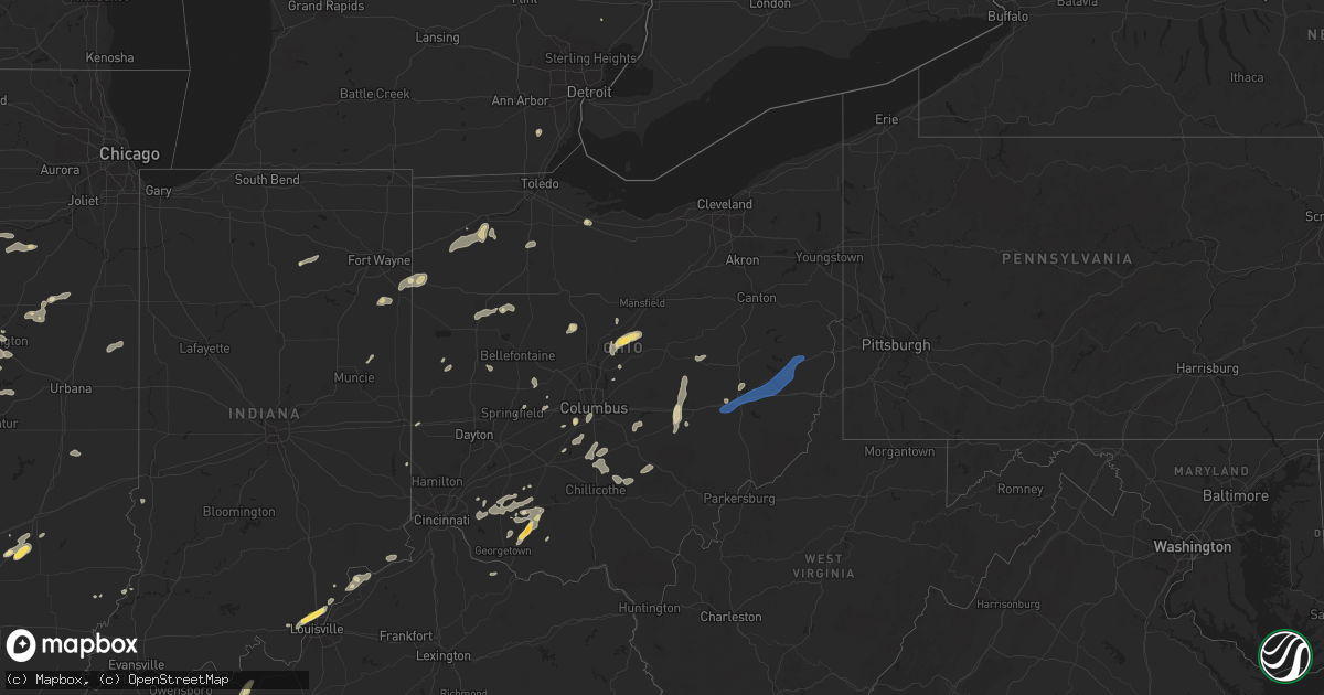
Hail Map in Ohio on August 20, 2022
Get this storm
August 20 map
$229
one time, instant access
Download today. No call, no setup
Keep the $229
Bought the map and want the full workflow? Apply the entire $229 to a subscription within 7 days. None of it is wasted.
Every map, not just this one
This buys you this map. Subscription and you get every map we run, in the markets you choose from a few cities to whole states to nationwide. Plus real-time alerts the moment a storm fires.
Contact data
Name, contact info, occupancy, even credit band for addresses in the footprint. You go from where it hit to who to call.
Become the source they trust
Unlimited branding weather history reports on demand. You already have the documented answer ready for the property owner, and you are the one who showed up with it.
Property data and RoofTrace estimates
Pull up any address you have got, its value and the exact code rules for that jurisdiction, straight from One Click Code. Then RoofTrace estimates the squares, pitch, and roof value, priced the way you price.
Storm reports in Ohio
Ohio
| Date | Description |
|---|---|
| 08/20/20226:58 PM CDT | Perry county 911 center has a report of a tree down in junction city. Time estimated by radar. |
| 08/20/20226:58 PM CDT | Perry county 911 center had a report of a tree down on township road 122. Time estimated by radar. |
| 08/20/20226:58 PM CDT | Perry county 911 center has a report of a tree down on township rd 106 in madison township. |
| 08/20/20225:30 PM CDT | Trees down on state route 60. |
| 08/20/20225:30 PM CDT | Trees down on state route 60. |
| 08/20/20225:26 PM CDT | Small shed displaced on county road 3. |
| 08/20/20225:10 PM CDT | Numerous trees down in bainbridge area. Time estimated from radar. |
| 08/20/20225:00 PM CDT | Wind damage reported in frazeysburg |
| 08/20/20224:44 PM CDT | Trees on power line on small road. Time estimated from radar. |
| 08/20/20224:40 PM CDT | Photo sent to broadcast media... Relayed to us. Time estimated from radar. |
| 08/20/20224:39 PM CDT | Tree down on wildcat road. Time estimated from radar. |
| 08/20/20224:06 PM CDT | Two trees down on snowhill road. Time estimated from radar. |
| 08/20/20224:03 PM CDT | Numerous trees damaged in green lawn cemetery including uprooted and snapped trunks as well as downed large branches. |
| 08/20/20224:00 PM CDT | Quarter inch hail a couple up to the size of a half dollar. |
| 08/20/20223:41 PM CDT | Tree down reported on monnett chapel road/ time estimated via radar. |
| 08/20/20223:41 PM CDT | Multiple trees reported down that also destroyed a couple fences. Time estimated via radar. |
| 08/20/20222:33 PM CDT | Tree downed into a house. Time estimated via radar. |
| 08/20/20222:20 PM CDT | Asos station kaoh lima. |
| 08/20/20222:18 PM CDT | Tree down. |
| 08/20/20222:01 PM CDT | Tree downed across larue-green camp road. Time estimated via radar. |
| 08/20/20223:41 AM CDT | At 841 PM EDT, a severe thunderstorm was located near New Concord, or 7 miles southwest of Cambridge, moving east at 40 mph. HAZARD...60 mph wind gusts. SOURCE...Radar indicated. IMPACT...Expect damage to trees and power lines, resulting in some power outages. Locations impacted include... Cambridge, Barnesville, Byesville, Bethesda, Antrim, Flushing, Quaker City, Senecaville, Pleasant City, Cumberland, Holloway, and Lore City. |
| 08/20/20223:40 AM CDT | At 840 PM EDT, a severe thunderstorm was located over New Philadelphia, moving east at 30 mph. HAZARD...60 mph wind gusts. SOURCE...Radar indicated. IMPACT...Expect damage to trees and power lines, resulting in some power outages. Locations impacted include... New Philadelphia, Dover, Uhrichsville, Carrollton, Dennison, Strasburg, Sugarcreek, Gnadenhutten, Malvern, Tuscarawas, Scio, and Midvale. |
| 08/20/20223:25 AM CDT | At 824 PM EDT, a severe thunderstorm was located near Berlin, or near Millersburg, moving northeast at 15 mph. HAZARD...60 mph wind gusts. SOURCE...Radar indicated. IMPACT...Expect damage to trees and power lines. Locations impacted include... Millersburg, Berlin, Walnut Creek, Sugarcreek, Winesburg, Farmerstown, Baltic, Mount Hope and Charm. |
| 08/20/20223:02 AM CDT | At 802 PM EDT, a severe thunderstorm was located near South Zanesville, or near Zanesville, moving east at 40 mph. HAZARD...60 mph wind gusts and quarter size hail. SOURCE...Radar indicated. IMPACT...Minor hail damage to vehicles is possible. Expect wind damage to trees and power lines, resulting in some power outages. Locations impacted include... Zanesville, New Concord, South Zanesville, North Zanesville, Philo, Pleasant Grove, Fultonham, Norwich, Cannelville, High Hill, Chandlersville, and Bridgeville. |
| 08/20/20223:01 AM CDT | At 801 PM EDT, a severe thunderstorm was located near Coshocton, moving east at 55 mph. HAZARD...60 mph wind gusts and quarter size hail. SOURCE...Radar indicated. IMPACT...Minor hail damage to vehicles is possible. Expect wind damage to trees and power lines, resulting in some power outages. Locations impacted include... New Philadelphia, Dover, Coshocton, Uhrichsville, Newcomerstown, Dennison, Strasburg, West Lafayette, Sugarcreek, Gnadenhutten, Tuscarawas, and Baltic. |
| 08/20/20222:58 AM CDT | At 758 PM EDT, a severe thunderstorm was located over New Lexington, moving east at 15 mph. HAZARD...60 mph wind gusts and nickel size hail. SOURCE...Radar indicated. IMPACT...Expect damage to roofs, siding, and trees. Locations impacted include... New Lexington, Perry State Forest, Crooksville and Junction City. |
| 08/20/202212:58 AM CDT | At 558 PM EDT, a severe thunderstorm was located over Frazeysburg, or 12 miles north of Zanesville, moving north at 30 mph. HAZARD...60 mph wind gusts and quarter size hail. SOURCE...Radar indicated. IMPACT...Minor hail damage to vehicles is possible. Expect wind damage to trees and power lines, resulting in some power outages. Locations impacted include... Coshocton, Dresden, Frazeysburg, Warsaw, Conesville, Nellie, Drake, Walhonding, Layland, Blissfield, New Guilford, and Cooperdale. |
| 08/20/202212:57 AM CDT | At 557 PM EDT, a severe thunderstorm was located over Marshall, moving northeast at 30 mph. HAZARD...60 mph wind gusts and quarter size hail. SOURCE...Radar indicated. IMPACT...Minor hail damage to vehicles is possible. Expect wind damage to trees and power lines. Locations impacted include... Marshall, Bainbridge, Belfast, Rocky Fork Point, Cynthiana, Highland Holiday, Rocky Fork Lake, Rainsboro, Berrysville and Paint Creek State Park. |
| 08/20/202212:36 AM CDT | At 535 PM EDT, a severe thunderstorm was located near Winchester, moving northeast at 25 mph. HAZARD...60 mph wind gusts and quarter size hail. SOURCE...Radar indicated. IMPACT...Minor hail damage to vehicles is possible. Expect wind damage to trees and power lines. Locations impacted include... Hillsboro, Winchester, Marshall, Belfast, Rocky Fork Point, Highland Holiday, New Market, Emerald, Rocky Fork Lake, Fincastle, Berrysville, State Route 136 at US Route 62, Highland County Airport and State Route 32 at US Route 62. |
| 08/20/202212:26 AM CDT | At 526 PM EDT, a severe thunderstorm was located near South Zanesville, or 7 miles southwest of Zanesville, moving north at 30 mph. HAZARD...60 mph wind gusts. SOURCE...Radar indicated. IMPACT...Expect damage to trees and power lines, resulting in some power outages. Locations impacted include... Zanesville, South Zanesville, North Zanesville, Dresden, Frazeysburg, Pleasant Grove, Conesville, Gratiot, Fultonham, East Fultonham, Drake, and Dillon State Park. |
| 08/20/202212:25 AM CDT | At 524 PM EDT, a severe thunderstorm was located near Fredericktown, or 11 miles north of Mount Vernon, moving northeast at 20 mph. HAZARD...60 mph wind gusts and quarter size hail. SOURCE...Radar indicated. IMPACT...Minor damage to vehicles is possible. Expect damage to trees and power lines. One inch hail has been reported with this storm with a few hailstones one and one quarter inches by a storm spotter. Locations impacted include... Mansfield, Ashland, Lexington, Loudonville, Bellville, Hayesville, Butler, Perrysville, Lucas, Jeromesville, Mifflin, Gann, North Liberty, Rowsburg and Mohicanville. |
| 08/20/202212:12 AM CDT | At 512 PM EDT, severe thunderstorms were located along a line extending from near Shelby to 8 miles north of Ontario to near Mansfield, moving northeast at 35 mph. HAZARD...60 mph wind gusts and nickel size hail. SOURCE...Radar indicated. IMPACT...Expect damage to trees and power lines. Locations impacted include... Mansfield, Ashland, Shelby, New London, Plymouth, Savannah, Polk, Sullivan, Greenwich, North Fairfield, Bailey Lakes, Tiro, Nova, Nankin, Shenandoah and Olivesburg. |
| 08/19/202211:51 PM CDT | At 450 PM EDT, a severe thunderstorm was located near Chesterville, or 8 miles southeast of Mount Gilead, moving northeast at 20 mph. HAZARD...70 mph wind gusts and quarter size hail. SOURCE...Radar indicated. IMPACT...Minor damage to vehicles is possible. Expect considerable tree damage. Wind damage is also likely to mobile homes, roofs, and outbuildings. Locations impacted include... Fredericktown, Chesterville, Sparta, Waterford and Shauck. |
| 08/19/202210:29 PM CDT | At 328 PM EDT, a severe thunderstorm was located over Ada, moving northeast at 50 mph. HAZARD...70 mph wind gusts. SOURCE...Radar indicated. IMPACT...Expect considerable tree damage. Damage is likely to mobile homes, roofs, and outbuildings. Locations impacted include... Bluffton and Harrod. This includes Interstate 75 between mile markers 138 and 141. |
| 08/19/202210:21 PM CDT | At 320 PM EDT, a severe thunderstorm was located near Marion, moving northeast at 10 mph. HAZARD...60 mph wind gusts and quarter size hail. SOURCE...Radar indicated. IMPACT...Minor damage to vehicles is possible. Expect damage to trees and power lines. Locations impacted include... Marion, Morral and Green Camp. |
| 08/19/20228:07 PM CDT | Tree down on putney ridge road. |
| 08/19/20227:53 PM CDT | Trees down in downtown dover... Oh |
| 08/19/20227:40 PM CDT | Lines down in the town of dundee... Oh |
| 08/19/20227:10 PM CDT | Trees down along state route 40. |
| 08/19/20227:08 PM CDT | Perry county 911 center advised there is a tree down in roseville town limits. Time estimated by radar. |
| 08/19/20227:02 PM CDT | Perry county 911 center advised there is a tree down at township road 29 and butcher knife rd. Time estimated by radar. |
| 08/19/20227:00 PM CDT | Perry county sheriffs office advised there is a tree that has fallen on tunnel hill rd in new lexington. |
All States Impacted by Hail Map on August 20, 2022
Cities Impacted by Hail Map on August 20, 2022
- Goshen, OH
- Florence, IN
- Vevay, IN
- Earlville, NY
- Smyrna, NY
- Clyde, OH
- Fremont, OH
- Yorkshire, OH
- Metamora, IL
- Mount Carmel, IL
- West Salem, IL
- Centerburg, OH
- Croton, OH
- Belgrade, MO
- Potosi, MO
- Marlette, MI
- Kingston, MI
- Snover, MI
- Towanda, IL
- Normal, IL
- Sainte Genevieve, MO
- Kingston, OH
- South Bloomingville, OH
- Laurelville, OH
- Salem, MO
- Norwood, MO
- Cygnet, OH
- Bloomdale, OH
- North Baltimore, OH
- Augusta, KY
- Germantown, KY
- Maynard, AR
- Pocahontas, AR
- Cardington, OH
- Marengo, OH
- Fulton, OH
- Mount Gilead, OH
- Fredericktown, OH
- Chesterville, OH
- Bellville, OH
- Auburntown, TN
- Woodbury, TN
- Rockvale, TN
- Murfreesboro, TN
- Convoy, OH
- Monroeville, IN
- Land O'Lakes, FL
- Lutz, FL
- Odessa, FL
- Mountain Grove, MO
- Hartville, MO
- Hillsboro, OH
- Boonville, NY
- Hawthorne, FL
- Orient, OH
- Ashville, OH
- Mount Sterling, OH
- Milton, TN
- Brownsville, TN
- Patterson, MO
- Lithia, FL
- Prairie Du Rocher, IL
- Edwards, IL
- Hanna City, IL
- Peoria, IL
- Bonne Terre, MO
- Harrod, OH
- Forrest, IL
- Chatsworth, IL
- Congress, AZ
- Wittmann, AZ
- Ransom, IL
- Streator, IL
- Tuskegee, AL
- Union Springs, AL
- Luverne, AL
- Russia, OH
- Versailles, OH
- Littlefield, AZ
- Verona, IL
- Kinsman, IL
- Dunlap, IL
- McNabb, IL
- Varna, IL
- Hennepin, IL
- Magnolia, IL
- Putnam, IL
- Lacon, IL
- Chillicothe, IL
- Henry, IL
- Washburn, IL
- Edelstein, IL
- Sparland, IL
- McLean, IL
- Marion, OH
- Pleasant Plain, OH
- Cable, OH
- North Lewisburg, OH
- Mechanicsburg, OH
- Woodstock, OH
- Mount Orab, OH
- Blanchester, OH
- New Vienna, OH
- Martinsville, OH
- Lynchburg, OH
- Williamsburg, OH
- Fayetteville, OH
- Midland, OH
- Defiance, OH
- Dunkirk, IN
- Albany, IN
- Redkey, IN
- Rankin, IL
- Rossville, IL
- Hoopeston, IL
- Grove City, OH
- Columbus, OH
- Speer, IL
- Bradford, IL
- Paragonah, UT
- Grovespring, MO
- Lebanon, MO
- Mineral Point, MO
- Irondale, MO
- Bolivar, NY
- Little Genesee, NY
- Seaman, OH
- Sardinia, OH
- Winchester, OH
- Craigville, IN
- Bluffton, IN
- Decatur, IN
- Waynesville, IL
- Heyworth, IL
- Downs, IL
- Le Roy, IL
- Shirley, IL
- Wapella, IL
- Bloomington, IL
- Vanzant, MO
- Pomona, MO
- Willow Springs, MO
- Richfield, UT
- New Paris, OH
- Dalton, GA
- Chatsworth, GA
- Congerville, IL
- Eureka, IL
- Charleston, IL
- Arcadia, MO
- Vulcan, MO
- Centerville, MO
- Ellington, MO
- Lesterville, MO
- Redford, MO
- Annapolis, MO
- Elkville, IL
- Ava, IL
- De Soto, IL
- Vergennes, IL
- Murphysboro, IL
- Peebles, OH
- Lodi, MO
- Colorado City, AZ
- Farmington, MO
- Hillsboro, MO
- Oakdale, IL
- Woodlawn, IL
- Tamaroa, IL
- Du Bois, IL
- Pinckneyville, IL
- Baldwin, IL
- Coulterville, IL
- Nashville, IL
- Ashley, IL
- Sparta, IL
- Decker, MI
- Cass City, MI
- Deford, MI
- London, OH
- Charleston, WV
- Poca, WV
- Kenna, WV
- Bloomsdale, MO
- Georgetown, IN
- Corydon, IN
- Colfax, IL
- Chenoa, IL
- Cropsey, IL
- Fairbury, IL
- Patoka, IL
- Vandalia, IL
- Vernon, IL
- Leesburg, OH
- Phelps, NY
- Standish, MI
- Maybee, MI
- Monroe, MI
- Glasford, IL
- Manito, IL
- Mapleton, IL
- Kingston Mines, IL
- Springfield, OH
- Modoc, IL
- Surprise, AZ
- Red Bud, IL
- Blackwell, MO
- Cadet, MO
- French Village, MO
- Valles Mines, MO
- Evansville, IL
- Festus, MO
- Fults, IL
- Valmeyer, IL
- De Soto, MO
- Mount Vernon, IL
- Waltonville, IL
- Gordon, WV
- Bob White, WV
- Van, WV
- Twilight, WV
- Madison, WV
- Claypool, IN
- Pierceton, IN
- Silver Lake, IN
- Port Allegany, PA
- Turtlepoint, PA
- Scott, OH
- Van Wert, OH
- Galion, OH
- Longmont, CO
- Mead, CO
- Logan, OH
- Calamus, IA
- Wheatland, IA
- Dixon, IA
- New Liberty, IA
- Williamsport, OH
- Circleville, OH
- Morton, IL
- Deer Creek, IL
- Tremont, IL
- Mackinaw, IL
- Creve Coeur, IL
- Peoria Heights, IL
- East Peoria, IL
- Washington, IL
- El Paso, IL
- Secor, IL
- Wapakoneta, OH
- Lima, OH
- Boss, MO
- Bixby, MO
- Thurston, OH
- Millersport, OH
- Baltimore, OH
- Lancaster, OH
- Pleasantville, OH
- Sidney, OH
- Quincy, OH
- Pekin, IL
- Van Buren, MO
- Bennett, IA
- McGuffey, OH
- Alger, OH
- Ada, OH
- Georgetown, OH
- Lachine, MI
- Hanksville, UT
- Dowell, IL
- Benton, IL
- Christopher, IL
- Mulkeytown, IL
- Buckner, IL
- Du Quoin, IL
- Malinta, OH
- Deshler, OH
- Hamler, OH
- Roseville, OH
- New Bavaria, OH
- Napoleon, OH
- Continental, OH
- Holgate, OH
- Oakwood, OH
- Grand Ridge, IL
- Ottawa, IL
- Marseilles, IL
- Armada, MI
- Ava, NY
- Lee Center, NY
- House Springs, MO
- Cambridge, OH
- Dieterich, IL
- Saint Elmo, IL
- Eminence, MO
- Hartshorn, MO
- Raymondville, MO
- Grand Marais, MI
- Farmersburg, IN
- Licking, MO
- Thomaston, GA
- Thompsons Station, TN
- Franklin, TN
- Lenox, MO
- Lascassas, TN
- Gainesville, FL
- Brooker, FL
- Meadview, AZ
- Fort Payne, AL
- Valley Head, AL
- Mentone, AL
- Bradyville, TN
- Windermere, FL
- Winter Garden, FL
- Orlando, FL
- Hopewell, OH
- Mount Perry, OH
- Zanesville, OH
- Heath, OH
- Somerset, OH
- Glennville, GA
- Frazeysburg, OH
- Dresden, OH
- Nashport, OH
- Kingman, AZ
- Saint Mary, MO
- Campbell Hill, IL
- Chester, IL
- Perryville, MO
- Rockwood, IL
- Wappapello, MO
- Greenville, MO
- Williamsville, MO
- Bedford, KY
- Morrison, TN
- Koshkonong, MO
- Mammoth Spring, AR
- Salem, AR
- Camp, AR
- Thayer, MO
- West Plains, MO
- Fitzpatrick, AL
- Pevely, MO
- Barnhart, MO
- Saint Peter, IL
- Berryville, AR
- Eureka Springs, AR
- Iowa Park, TX
- Quanah, TX
- Welch, TX
- Clarksville, IN
- New Albany, IN
- Sellersburg, IN
- Floyds Knobs, IN
- Charlestown, IN
- Jeffersonville, IN
- West Fork, AR
- Fayetteville, AR
- Farina, IL
- Fordsville, KY
- Hardinsburg, KY
- Falls Of Rough, KY
- Harned, KY
- Saint Petersburg, FL
- Aguila, AZ
- Wickenburg, AZ
- Lake Park, GA
- Valdosta, GA
- Bunker, MO
- Herculaneum, MO
- Ocala, FL
- Odum, GA
- Pinson, TN
- Ray City, GA
- Hahira, GA
- Henderson, TN
- Hornsby, TN
- Piper City, IL
- Williamsville, IL
- Kimbolton, OH
- Milton, KY
- Edgewood, IL
- Springfield, MO
- Dowelltown, TN
- Smithville, TN
- Liberty, TN
- Kinmundy, IL
- Herrin, IL
- West Frankfort, IL
- Edgar Springs, MO
- Peach Orchard, AR
- Delaplaine, AR
- Paragould, AR
- Conifer, CO
- Birch Tree, MO
- Vincennes, IN
- Columbia, TN
- Spring Hill, TN
- Seligman, AZ
- Sturkie, AR
- Beechgrove, TN
- Mcminnville, TN
- Manchester, TN
- Columbia, AL
- Abbeville, AL
- Waterloo, IL
- Fredericktown, MO
- Frohna, MO
- Liberty, IN
- West College Corner, IN
- Bristol, FL
- Saint George, UT
- Winona, MO
- Fremont, MO
- Allendale, IL
- Auburn, AL
- Waverly, AL
- Alachua, FL
- Beech Bluff, TN
- Huron, TN
- Lexington, TN
- Maroa, IL
- Clinton, IL
- Weldon, IL
- South Vienna, OH
- Stoutsville, OH
- Floral City, FL
- Macon, MS
- Sulligent, AL
- Detroit, AL
- Prairie Grove, AR
- Farmington, AR
- Chiefland, FL
- Bronson, FL
- Lanesville, IN
- New Lexington, OH
- Batavia, OH
- Owensville, OH
- Mason, IL
- Nabb, IN
- Marysville, IN
- Bethlehem, IN
- New Washington, IN
- Carrollton, KY
- Caneyville, KY
- Mill Spring, MO
- Colcord, OK
- Bagdad, AZ
- Lake Butler, FL
- College Grove, TN
- Folkston, GA
- Reform, AL
- Fargo, GA
- Lake City, FL
- Cisco, GA
- Washington Court House, OH
- Bolivar, TN
- Finger, TN
- Seagrove, NC
- Brownfield, TX
- Morrison, CO
- Goodlettsville, TN
- Warsaw, OH
- Fresno, OH
- Coshocton, OH
- Galena, OH
- Lovington, NM
- Gordo, AL
- Menlo, GA
- Summerville, GA
- Littleton, CO
- Cadiz, OH
- Hopedale, OH
- Freeport, OH
- Quaker City, OH
- Piedmont, OH
- Kipling, OH
- Flushing, OH
- Saint Clairsville, OH
- Lore City, OH
- Barnesville, OH
- Salesville, OH
- Jewett, OH
- Cumberland, OH
- Byesville, OH
- Old Washington, OH
- New Concord, OH
- Marshfield, MO


