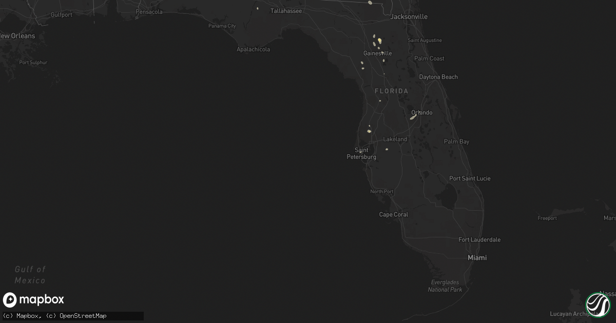
Hail Map in Florida on August 20, 2022
Get this storm
August 20 map
$229
one time, instant access
Download today. No call, no setup
Keep the $229
Bought the map and want the full workflow? Apply the entire $229 to a subscription within 7 days. None of it is wasted.
Every map, not just this one
This buys you this map. Subscription and you get every map we run, in the markets you choose from a few cities to whole states to nationwide. Plus real-time alerts the moment a storm fires.
Contact data
Name, contact info, occupancy, even credit band for addresses in the footprint. You go from where it hit to who to call.
Become the source they trust
Unlimited branding weather history reports on demand. You already have the documented answer ready for the property owner, and you are the one who showed up with it.
Property data and RoofTrace estimates
Pull up any address you have got, its value and the exact code rules for that jurisdiction, straight from One Click Code. Then RoofTrace estimates the squares, pitch, and roof value, priced the way you price.
Storm reports in Florida
Florida
| Date | Description |
|---|---|
| 08/20/20225:47 PM CDT | Broadcast media relayed picture of damaged manufactured home along 83rd ave n in the village green community... Consisting of partial roof removal... A collapsed carpor |
| 08/20/20224:20 AM CDT | At 920 PM EDT, a severe thunderstorm was located near New River, or 7 miles south of Lake Butler, moving north at 15 mph. HAZARD...60 mph wind gusts and penny size hail. SOURCE...Radar indicated. IMPACT...Expect damage to roofs, siding, and trees. Locations impacted include... Lake Butler, Raiford, Worthington Spring, Worthington Springs, Groves, Beasley, New River, La Crosse, Brooker and Johnstown. |
| 08/20/20221:18 AM CDT | At 618 PM EDT, a severe thunderstorm was located over Windermere, moving southwest at 10 mph. HAZARD...60 mph wind gusts and penny size hail. SOURCE...Radar indicated. IMPACT...Expect damage to roofs, siding, and trees. Locations impacted include... Orlando, Ocoee, Winter Garden, Windermere and Bay Lake. |
| 08/19/202210:42 PM CDT | At 342 PM EDT, a severe thunderstorm was located near Greensboro, or 14 miles southwest of Quincy, moving northeast at 10 mph. HAZARD...60 mph wind gusts and penny size hail. SOURCE...Radar indicated. IMPACT...Expect damage to roofs, siding, and trees. Locations impacted include... Quincy, Greensboro, Rock Bluff, Juniper, Sycamore, Lowry, Sawdust and Roy. |
| 08/19/20229:02 PM CDT | At 202 PM EDT, a severe thunderstorm was located 15 miles north of Eastpoint, moving northwest at 5 mph. HAZARD...60 mph wind gusts and penny size hail. SOURCE...Radar indicated. IMPACT...Expect damage to roofs, siding, and trees. Locations impacted include... Twin Pole, Sumatra and Owens Bridge. |
| 08/19/20228:25 PM CDT | Delayed report. Tree down across the road on nw cr 236 near n sr 121. |
All States Impacted by Hail Map on August 20, 2022
Cities Impacted by Hail Map on August 20, 2022
- Goshen, OH
- Florence, IN
- Vevay, IN
- Earlville, NY
- Smyrna, NY
- Clyde, OH
- Fremont, OH
- Yorkshire, OH
- Metamora, IL
- Mount Carmel, IL
- West Salem, IL
- Centerburg, OH
- Croton, OH
- Belgrade, MO
- Potosi, MO
- Marlette, MI
- Kingston, MI
- Snover, MI
- Towanda, IL
- Normal, IL
- Sainte Genevieve, MO
- Kingston, OH
- South Bloomingville, OH
- Laurelville, OH
- Salem, MO
- Norwood, MO
- Cygnet, OH
- Bloomdale, OH
- North Baltimore, OH
- Augusta, KY
- Germantown, KY
- Maynard, AR
- Pocahontas, AR
- Cardington, OH
- Marengo, OH
- Fulton, OH
- Mount Gilead, OH
- Fredericktown, OH
- Chesterville, OH
- Bellville, OH
- Auburntown, TN
- Woodbury, TN
- Rockvale, TN
- Murfreesboro, TN
- Convoy, OH
- Monroeville, IN
- Land O'Lakes, FL
- Lutz, FL
- Odessa, FL
- Mountain Grove, MO
- Hartville, MO
- Hillsboro, OH
- Boonville, NY
- Hawthorne, FL
- Orient, OH
- Ashville, OH
- Mount Sterling, OH
- Milton, TN
- Brownsville, TN
- Patterson, MO
- Lithia, FL
- Prairie Du Rocher, IL
- Edwards, IL
- Hanna City, IL
- Peoria, IL
- Bonne Terre, MO
- Harrod, OH
- Forrest, IL
- Chatsworth, IL
- Congress, AZ
- Wittmann, AZ
- Ransom, IL
- Streator, IL
- Tuskegee, AL
- Union Springs, AL
- Luverne, AL
- Russia, OH
- Versailles, OH
- Littlefield, AZ
- Verona, IL
- Kinsman, IL
- Dunlap, IL
- McNabb, IL
- Varna, IL
- Hennepin, IL
- Magnolia, IL
- Putnam, IL
- Lacon, IL
- Chillicothe, IL
- Henry, IL
- Washburn, IL
- Edelstein, IL
- Sparland, IL
- McLean, IL
- Marion, OH
- Pleasant Plain, OH
- Cable, OH
- North Lewisburg, OH
- Mechanicsburg, OH
- Woodstock, OH
- Mount Orab, OH
- Blanchester, OH
- New Vienna, OH
- Martinsville, OH
- Lynchburg, OH
- Williamsburg, OH
- Fayetteville, OH
- Midland, OH
- Defiance, OH
- Dunkirk, IN
- Albany, IN
- Redkey, IN
- Rankin, IL
- Rossville, IL
- Hoopeston, IL
- Grove City, OH
- Columbus, OH
- Speer, IL
- Bradford, IL
- Paragonah, UT
- Grovespring, MO
- Lebanon, MO
- Mineral Point, MO
- Irondale, MO
- Bolivar, NY
- Little Genesee, NY
- Seaman, OH
- Sardinia, OH
- Winchester, OH
- Craigville, IN
- Bluffton, IN
- Decatur, IN
- Waynesville, IL
- Heyworth, IL
- Downs, IL
- Le Roy, IL
- Shirley, IL
- Wapella, IL
- Bloomington, IL
- Vanzant, MO
- Pomona, MO
- Willow Springs, MO
- Richfield, UT
- New Paris, OH
- Dalton, GA
- Chatsworth, GA
- Congerville, IL
- Eureka, IL
- Charleston, IL
- Arcadia, MO
- Vulcan, MO
- Centerville, MO
- Ellington, MO
- Lesterville, MO
- Redford, MO
- Annapolis, MO
- Elkville, IL
- Ava, IL
- De Soto, IL
- Vergennes, IL
- Murphysboro, IL
- Peebles, OH
- Lodi, MO
- Colorado City, AZ
- Farmington, MO
- Hillsboro, MO
- Oakdale, IL
- Woodlawn, IL
- Tamaroa, IL
- Du Bois, IL
- Pinckneyville, IL
- Baldwin, IL
- Coulterville, IL
- Nashville, IL
- Ashley, IL
- Sparta, IL
- Decker, MI
- Cass City, MI
- Deford, MI
- London, OH
- Charleston, WV
- Poca, WV
- Kenna, WV
- Bloomsdale, MO
- Georgetown, IN
- Corydon, IN
- Colfax, IL
- Chenoa, IL
- Cropsey, IL
- Fairbury, IL
- Patoka, IL
- Vandalia, IL
- Vernon, IL
- Leesburg, OH
- Phelps, NY
- Standish, MI
- Maybee, MI
- Monroe, MI
- Glasford, IL
- Manito, IL
- Mapleton, IL
- Kingston Mines, IL
- Springfield, OH
- Modoc, IL
- Surprise, AZ
- Red Bud, IL
- Blackwell, MO
- Cadet, MO
- French Village, MO
- Valles Mines, MO
- Evansville, IL
- Festus, MO
- Fults, IL
- Valmeyer, IL
- De Soto, MO
- Mount Vernon, IL
- Waltonville, IL
- Gordon, WV
- Bob White, WV
- Van, WV
- Twilight, WV
- Madison, WV
- Claypool, IN
- Pierceton, IN
- Silver Lake, IN
- Port Allegany, PA
- Turtlepoint, PA
- Scott, OH
- Van Wert, OH
- Galion, OH
- Longmont, CO
- Mead, CO
- Logan, OH
- Calamus, IA
- Wheatland, IA
- Dixon, IA
- New Liberty, IA
- Williamsport, OH
- Circleville, OH
- Morton, IL
- Deer Creek, IL
- Tremont, IL
- Mackinaw, IL
- Creve Coeur, IL
- Peoria Heights, IL
- East Peoria, IL
- Washington, IL
- El Paso, IL
- Secor, IL
- Wapakoneta, OH
- Lima, OH
- Boss, MO
- Bixby, MO
- Thurston, OH
- Millersport, OH
- Baltimore, OH
- Lancaster, OH
- Pleasantville, OH
- Sidney, OH
- Quincy, OH
- Pekin, IL
- Van Buren, MO
- Bennett, IA
- McGuffey, OH
- Alger, OH
- Ada, OH
- Georgetown, OH
- Lachine, MI
- Hanksville, UT
- Dowell, IL
- Benton, IL
- Christopher, IL
- Mulkeytown, IL
- Buckner, IL
- Du Quoin, IL
- Malinta, OH
- Deshler, OH
- Hamler, OH
- Roseville, OH
- New Bavaria, OH
- Napoleon, OH
- Continental, OH
- Holgate, OH
- Oakwood, OH
- Grand Ridge, IL
- Ottawa, IL
- Marseilles, IL
- Armada, MI
- Ava, NY
- Lee Center, NY
- House Springs, MO
- Cambridge, OH
- Dieterich, IL
- Saint Elmo, IL
- Eminence, MO
- Hartshorn, MO
- Raymondville, MO
- Grand Marais, MI
- Farmersburg, IN
- Licking, MO
- Thomaston, GA
- Thompsons Station, TN
- Franklin, TN
- Lenox, MO
- Lascassas, TN
- Gainesville, FL
- Brooker, FL
- Meadview, AZ
- Fort Payne, AL
- Valley Head, AL
- Mentone, AL
- Bradyville, TN
- Windermere, FL
- Winter Garden, FL
- Orlando, FL
- Hopewell, OH
- Mount Perry, OH
- Zanesville, OH
- Heath, OH
- Somerset, OH
- Glennville, GA
- Frazeysburg, OH
- Dresden, OH
- Nashport, OH
- Kingman, AZ
- Saint Mary, MO
- Campbell Hill, IL
- Chester, IL
- Perryville, MO
- Rockwood, IL
- Wappapello, MO
- Greenville, MO
- Williamsville, MO
- Bedford, KY
- Morrison, TN
- Koshkonong, MO
- Mammoth Spring, AR
- Salem, AR
- Camp, AR
- Thayer, MO
- West Plains, MO
- Fitzpatrick, AL
- Pevely, MO
- Barnhart, MO
- Saint Peter, IL
- Berryville, AR
- Eureka Springs, AR
- Iowa Park, TX
- Quanah, TX
- Welch, TX
- Clarksville, IN
- New Albany, IN
- Sellersburg, IN
- Floyds Knobs, IN
- Charlestown, IN
- Jeffersonville, IN
- West Fork, AR
- Fayetteville, AR
- Farina, IL
- Fordsville, KY
- Hardinsburg, KY
- Falls Of Rough, KY
- Harned, KY
- Saint Petersburg, FL
- Aguila, AZ
- Wickenburg, AZ
- Lake Park, GA
- Valdosta, GA
- Bunker, MO
- Herculaneum, MO
- Ocala, FL
- Odum, GA
- Pinson, TN
- Ray City, GA
- Hahira, GA
- Henderson, TN
- Hornsby, TN
- Piper City, IL
- Williamsville, IL
- Kimbolton, OH
- Milton, KY
- Edgewood, IL
- Springfield, MO
- Dowelltown, TN
- Smithville, TN
- Liberty, TN
- Kinmundy, IL
- Herrin, IL
- West Frankfort, IL
- Edgar Springs, MO
- Peach Orchard, AR
- Delaplaine, AR
- Paragould, AR
- Conifer, CO
- Birch Tree, MO
- Vincennes, IN
- Columbia, TN
- Spring Hill, TN
- Seligman, AZ
- Sturkie, AR
- Beechgrove, TN
- Mcminnville, TN
- Manchester, TN
- Columbia, AL
- Abbeville, AL
- Waterloo, IL
- Fredericktown, MO
- Frohna, MO
- Liberty, IN
- West College Corner, IN
- Bristol, FL
- Saint George, UT
- Winona, MO
- Fremont, MO
- Allendale, IL
- Auburn, AL
- Waverly, AL
- Alachua, FL
- Beech Bluff, TN
- Huron, TN
- Lexington, TN
- Maroa, IL
- Clinton, IL
- Weldon, IL
- South Vienna, OH
- Stoutsville, OH
- Floral City, FL
- Macon, MS
- Sulligent, AL
- Detroit, AL
- Prairie Grove, AR
- Farmington, AR
- Chiefland, FL
- Bronson, FL
- Lanesville, IN
- New Lexington, OH
- Batavia, OH
- Owensville, OH
- Mason, IL
- Nabb, IN
- Marysville, IN
- Bethlehem, IN
- New Washington, IN
- Carrollton, KY
- Caneyville, KY
- Mill Spring, MO
- Colcord, OK
- Bagdad, AZ
- Lake Butler, FL
- College Grove, TN
- Folkston, GA
- Reform, AL
- Fargo, GA
- Lake City, FL
- Cisco, GA
- Washington Court House, OH
- Bolivar, TN
- Finger, TN
- Seagrove, NC
- Brownfield, TX
- Morrison, CO
- Goodlettsville, TN
- Warsaw, OH
- Fresno, OH
- Coshocton, OH
- Galena, OH
- Lovington, NM
- Gordo, AL
- Menlo, GA
- Summerville, GA
- Littleton, CO
- Cadiz, OH
- Hopedale, OH
- Freeport, OH
- Quaker City, OH
- Piedmont, OH
- Kipling, OH
- Flushing, OH
- Saint Clairsville, OH
- Lore City, OH
- Barnesville, OH
- Salesville, OH
- Jewett, OH
- Cumberland, OH
- Byesville, OH
- Old Washington, OH
- New Concord, OH
- Marshfield, MO


