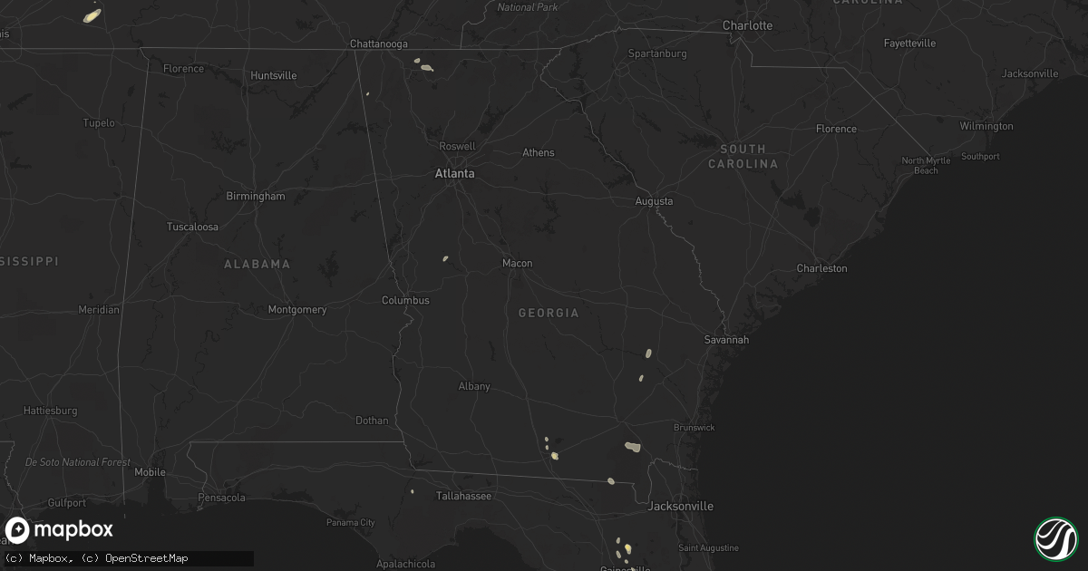
Hail Map in Georgia on August 20, 2022
Get this storm
August 20 map
$229
one time, instant access
Download today. No call, no setup
Keep the $229
Bought the map and want the full workflow? Apply the entire $229 to a subscription within 7 days. None of it is wasted.
Every map, not just this one
This buys you this map. Subscription and you get every map we run, in the markets you choose from a few cities to whole states to nationwide. Plus real-time alerts the moment a storm fires.
Contact data
Name, contact info, occupancy, even credit band for addresses in the footprint. You go from where it hit to who to call.
Become the source they trust
Unlimited branding weather history reports on demand. You already have the documented answer ready for the property owner, and you are the one who showed up with it.
Property data and RoofTrace estimates
Pull up any address you have got, its value and the exact code rules for that jurisdiction, straight from One Click Code. Then RoofTrace estimates the squares, pitch, and roof value, priced the way you price.
Storm reports in Georgia
Georgia
| Date | Description |
|---|---|
| 08/20/20226:05 PM CDT | Medium sized trees down on power lines near 1523 old valdosta road. |
| 08/20/20224:57 PM CDT | Tree down on highway 37 about 3 miles outside of newton. |
| 08/20/20224:47 PM CDT | Tree down along highway 10 east. |
| 08/20/20224:29 AM CDT | At 929 PM EDT, a severe thunderstorm was located over Crest, or 9 miles west of Thomaston, moving north at 20 mph. HAZARD...60 mph wind gusts. SOURCE...Radar indicated. IMPACT...Expect damage to roofs, siding, and trees. Locations impacted include... Thomaston, Zebulon, Molena, Meansville, Sunset Village, Lincoln Park, Concord, Atwater, Hilltop, Lifsey Springs, Sprewell Bluff State Park, Crest, Sunnyside and Hannahs Mill. |
| 08/20/20223:09 AM CDT | At 809 PM EDT, severe thunderstorms were located along a line extending from 6 miles west of Glennville to near Donald, moving northeast at 15 mph. HAZARD...60 mph wind gusts and penny size hail. SOURCE...Radar indicated. IMPACT...Expect damage to trees and powerlines. Locations impacted include: Reidsville, Glennville, Claxton, Hagan, Collins, Daisy, Bellville, Manassas, Gordonia Altamaha State Park, Mendes and Donald. |
| 08/20/20222:32 AM CDT | At 732 PM EDT, a severe thunderstorm was located near Race Pond, or 9 miles northwest of Folkston, moving southeast at 10 mph. HAZARD...60 mph wind gusts and penny size hail. SOURCE...Radar indicated. IMPACT...Expect damage to roofs, siding, and trees. Locations impacted include... Homeland and Race Pond. |
| 08/20/20222:04 AM CDT | At 704 PM EDT, a severe thunderstorm was located 7 miles southwest of Race Pond, or 10 miles northeast of Stephen Foster State Park, and is nearly stationary. HAZARD...60 mph wind gusts and quarter size hail. SOURCE...Radar indicated. IMPACT...Hail damage to vehicles is expected. Expect wind damage to roofs, siding, and trees. Locations impacted include... Race Pond. |
| 08/20/20222:00 AM CDT | At 659 PM EDT, a severe thunderstorm was located near Fort Mountain State Park, or 7 miles east of Chatsworth, moving east at 35 mph. HAZARD...60 mph wind gusts and quarter size hail. SOURCE...Radar indicated. IMPACT...Hail damage to vehicles is expected. Expect wind damage to roofs, siding, and trees. Locations impacted include... Ellijay, East Ellijay, Conasauga Lake, Cherry Log, Mountaintown, Higdon and Fort Mountain State Park. |
| 08/20/20221:58 AM CDT | At 658 PM EDT, a severe thunderstorm was located near Ray City, or 11 miles north of Valdosta, moving north at 10 mph. HAZARD...60 mph wind gusts. SOURCE...Radar indicated. IMPACT...Expect damage to roofs, siding, and trees. Locations impacted include... Nashville, Adel, Hahira, Sparks, Ray City, Cecil, Cottle, Berrien Co A/P, Barretts, New Lois, Massee, I-75 At Exit 29, Allenville, Weber and Laconte. |
| 08/20/202212:46 AM CDT | At 546 PM EDT/446 PM CDT/, a severe thunderstorm was located over Fort Gaines, moving northeast at 10 mph. HAZARD...60 mph wind gusts. SOURCE...Radar indicated. IMPACT...Expect damage to roofs, siding, and trees. Locations impacted include... Fort Gaines, Days Crossroads, Shorterville, Walter F. George Lock And Dam, Walter F George Lake, Standleys Store, Otho, Watson Crossroads, Moores Crossroads, Ricks Place, Pecan, Garnersville, Bagby State Park, Coleman, Hatcher, Jones Crossing, Bethel, Cotton Hill and Fort Gaines-Clay Airport. |
| 08/20/202212:16 AM CDT | At 516 PM EDT, a severe thunderstorm was located 8 miles southwest of Pelham, moving north at 20 mph. HAZARD...60 mph wind gusts. SOURCE...Radar indicated. IMPACT...Expect damage to roofs, siding, and trees. Locations impacted include... Newton, Pelham, Camilla, Hawkinstown, Flint, Hopeful, Mitchell Co A/P, Branchville and Greenough. |
| 08/19/202211:55 PM CDT | At 455 PM EDT, a severe thunderstorm was located over Cairo, moving north at 10 mph. HAZARD...60 mph wind gusts. SOURCE...Radar indicated. IMPACT...Expect damage to roofs, siding, and trees. Locations impacted include... Cairo, Whigham, Akridge, Peoples Still, Spence, Capel, Elpino and Harrells Still. |
| 08/19/20228:44 PM CDT | Trees were downed on power lines on vickery road. |
| 08/19/20228:40 PM CDT | A power pole with electical lines and a tree down |
| 08/19/20228:37 PM CDT | Power lines were downed on smyrna church road near weems road. |
| 08/19/20228:32 PM CDT | A tree was downed on lawrence road. |
| 08/19/20228:31 PM CDT | A tree was downed onto ga-36 near west jefferson street... Blocking both lanes. |
| 08/19/20228:30 PM CDT | Hendricks church road is closed due to multiple downed trees and utility poles. |
| 08/19/20227:30 PM CDT | Numerous trees and large branches down near ga-53 and christian ave in tate. |
All States Impacted by Hail Map on August 20, 2022
Cities Impacted by Hail Map on August 20, 2022
- Goshen, OH
- Florence, IN
- Vevay, IN
- Earlville, NY
- Smyrna, NY
- Clyde, OH
- Fremont, OH
- Yorkshire, OH
- Metamora, IL
- Mount Carmel, IL
- West Salem, IL
- Centerburg, OH
- Croton, OH
- Belgrade, MO
- Potosi, MO
- Marlette, MI
- Kingston, MI
- Snover, MI
- Towanda, IL
- Normal, IL
- Sainte Genevieve, MO
- Kingston, OH
- South Bloomingville, OH
- Laurelville, OH
- Salem, MO
- Norwood, MO
- Cygnet, OH
- Bloomdale, OH
- North Baltimore, OH
- Augusta, KY
- Germantown, KY
- Maynard, AR
- Pocahontas, AR
- Cardington, OH
- Marengo, OH
- Fulton, OH
- Mount Gilead, OH
- Fredericktown, OH
- Chesterville, OH
- Bellville, OH
- Auburntown, TN
- Woodbury, TN
- Rockvale, TN
- Murfreesboro, TN
- Convoy, OH
- Monroeville, IN
- Land O'Lakes, FL
- Lutz, FL
- Odessa, FL
- Mountain Grove, MO
- Hartville, MO
- Hillsboro, OH
- Boonville, NY
- Hawthorne, FL
- Orient, OH
- Ashville, OH
- Mount Sterling, OH
- Milton, TN
- Brownsville, TN
- Patterson, MO
- Lithia, FL
- Prairie Du Rocher, IL
- Edwards, IL
- Hanna City, IL
- Peoria, IL
- Bonne Terre, MO
- Harrod, OH
- Forrest, IL
- Chatsworth, IL
- Congress, AZ
- Wittmann, AZ
- Ransom, IL
- Streator, IL
- Tuskegee, AL
- Union Springs, AL
- Luverne, AL
- Russia, OH
- Versailles, OH
- Littlefield, AZ
- Verona, IL
- Kinsman, IL
- Dunlap, IL
- McNabb, IL
- Varna, IL
- Hennepin, IL
- Magnolia, IL
- Putnam, IL
- Lacon, IL
- Chillicothe, IL
- Henry, IL
- Washburn, IL
- Edelstein, IL
- Sparland, IL
- McLean, IL
- Marion, OH
- Pleasant Plain, OH
- Cable, OH
- North Lewisburg, OH
- Mechanicsburg, OH
- Woodstock, OH
- Mount Orab, OH
- Blanchester, OH
- New Vienna, OH
- Martinsville, OH
- Lynchburg, OH
- Williamsburg, OH
- Fayetteville, OH
- Midland, OH
- Defiance, OH
- Dunkirk, IN
- Albany, IN
- Redkey, IN
- Rankin, IL
- Rossville, IL
- Hoopeston, IL
- Grove City, OH
- Columbus, OH
- Speer, IL
- Bradford, IL
- Paragonah, UT
- Grovespring, MO
- Lebanon, MO
- Mineral Point, MO
- Irondale, MO
- Bolivar, NY
- Little Genesee, NY
- Seaman, OH
- Sardinia, OH
- Winchester, OH
- Craigville, IN
- Bluffton, IN
- Decatur, IN
- Waynesville, IL
- Heyworth, IL
- Downs, IL
- Le Roy, IL
- Shirley, IL
- Wapella, IL
- Bloomington, IL
- Vanzant, MO
- Pomona, MO
- Willow Springs, MO
- Richfield, UT
- New Paris, OH
- Dalton, GA
- Chatsworth, GA
- Congerville, IL
- Eureka, IL
- Charleston, IL
- Arcadia, MO
- Vulcan, MO
- Centerville, MO
- Ellington, MO
- Lesterville, MO
- Redford, MO
- Annapolis, MO
- Elkville, IL
- Ava, IL
- De Soto, IL
- Vergennes, IL
- Murphysboro, IL
- Peebles, OH
- Lodi, MO
- Colorado City, AZ
- Farmington, MO
- Hillsboro, MO
- Oakdale, IL
- Woodlawn, IL
- Tamaroa, IL
- Du Bois, IL
- Pinckneyville, IL
- Baldwin, IL
- Coulterville, IL
- Nashville, IL
- Ashley, IL
- Sparta, IL
- Decker, MI
- Cass City, MI
- Deford, MI
- London, OH
- Charleston, WV
- Poca, WV
- Kenna, WV
- Bloomsdale, MO
- Georgetown, IN
- Corydon, IN
- Colfax, IL
- Chenoa, IL
- Cropsey, IL
- Fairbury, IL
- Patoka, IL
- Vandalia, IL
- Vernon, IL
- Leesburg, OH
- Phelps, NY
- Standish, MI
- Maybee, MI
- Monroe, MI
- Glasford, IL
- Manito, IL
- Mapleton, IL
- Kingston Mines, IL
- Springfield, OH
- Modoc, IL
- Surprise, AZ
- Red Bud, IL
- Blackwell, MO
- Cadet, MO
- French Village, MO
- Valles Mines, MO
- Evansville, IL
- Festus, MO
- Fults, IL
- Valmeyer, IL
- De Soto, MO
- Mount Vernon, IL
- Waltonville, IL
- Gordon, WV
- Bob White, WV
- Van, WV
- Twilight, WV
- Madison, WV
- Claypool, IN
- Pierceton, IN
- Silver Lake, IN
- Port Allegany, PA
- Turtlepoint, PA
- Scott, OH
- Van Wert, OH
- Galion, OH
- Longmont, CO
- Mead, CO
- Logan, OH
- Calamus, IA
- Wheatland, IA
- Dixon, IA
- New Liberty, IA
- Williamsport, OH
- Circleville, OH
- Morton, IL
- Deer Creek, IL
- Tremont, IL
- Mackinaw, IL
- Creve Coeur, IL
- Peoria Heights, IL
- East Peoria, IL
- Washington, IL
- El Paso, IL
- Secor, IL
- Wapakoneta, OH
- Lima, OH
- Boss, MO
- Bixby, MO
- Thurston, OH
- Millersport, OH
- Baltimore, OH
- Lancaster, OH
- Pleasantville, OH
- Sidney, OH
- Quincy, OH
- Pekin, IL
- Van Buren, MO
- Bennett, IA
- McGuffey, OH
- Alger, OH
- Ada, OH
- Georgetown, OH
- Lachine, MI
- Hanksville, UT
- Dowell, IL
- Benton, IL
- Christopher, IL
- Mulkeytown, IL
- Buckner, IL
- Du Quoin, IL
- Malinta, OH
- Deshler, OH
- Hamler, OH
- Roseville, OH
- New Bavaria, OH
- Napoleon, OH
- Continental, OH
- Holgate, OH
- Oakwood, OH
- Grand Ridge, IL
- Ottawa, IL
- Marseilles, IL
- Armada, MI
- Ava, NY
- Lee Center, NY
- House Springs, MO
- Cambridge, OH
- Dieterich, IL
- Saint Elmo, IL
- Eminence, MO
- Hartshorn, MO
- Raymondville, MO
- Grand Marais, MI
- Farmersburg, IN
- Licking, MO
- Thomaston, GA
- Thompsons Station, TN
- Franklin, TN
- Lenox, MO
- Lascassas, TN
- Gainesville, FL
- Brooker, FL
- Meadview, AZ
- Fort Payne, AL
- Valley Head, AL
- Mentone, AL
- Bradyville, TN
- Windermere, FL
- Winter Garden, FL
- Orlando, FL
- Hopewell, OH
- Mount Perry, OH
- Zanesville, OH
- Heath, OH
- Somerset, OH
- Glennville, GA
- Frazeysburg, OH
- Dresden, OH
- Nashport, OH
- Kingman, AZ
- Saint Mary, MO
- Campbell Hill, IL
- Chester, IL
- Perryville, MO
- Rockwood, IL
- Wappapello, MO
- Greenville, MO
- Williamsville, MO
- Bedford, KY
- Morrison, TN
- Koshkonong, MO
- Mammoth Spring, AR
- Salem, AR
- Camp, AR
- Thayer, MO
- West Plains, MO
- Fitzpatrick, AL
- Pevely, MO
- Barnhart, MO
- Saint Peter, IL
- Berryville, AR
- Eureka Springs, AR
- Iowa Park, TX
- Quanah, TX
- Welch, TX
- Clarksville, IN
- New Albany, IN
- Sellersburg, IN
- Floyds Knobs, IN
- Charlestown, IN
- Jeffersonville, IN
- West Fork, AR
- Fayetteville, AR
- Farina, IL
- Fordsville, KY
- Hardinsburg, KY
- Falls Of Rough, KY
- Harned, KY
- Saint Petersburg, FL
- Aguila, AZ
- Wickenburg, AZ
- Lake Park, GA
- Valdosta, GA
- Bunker, MO
- Herculaneum, MO
- Ocala, FL
- Odum, GA
- Pinson, TN
- Ray City, GA
- Hahira, GA
- Henderson, TN
- Hornsby, TN
- Piper City, IL
- Williamsville, IL
- Kimbolton, OH
- Milton, KY
- Edgewood, IL
- Springfield, MO
- Dowelltown, TN
- Smithville, TN
- Liberty, TN
- Kinmundy, IL
- Herrin, IL
- West Frankfort, IL
- Edgar Springs, MO
- Peach Orchard, AR
- Delaplaine, AR
- Paragould, AR
- Conifer, CO
- Birch Tree, MO
- Vincennes, IN
- Columbia, TN
- Spring Hill, TN
- Seligman, AZ
- Sturkie, AR
- Beechgrove, TN
- Mcminnville, TN
- Manchester, TN
- Columbia, AL
- Abbeville, AL
- Waterloo, IL
- Fredericktown, MO
- Frohna, MO
- Liberty, IN
- West College Corner, IN
- Bristol, FL
- Saint George, UT
- Winona, MO
- Fremont, MO
- Allendale, IL
- Auburn, AL
- Waverly, AL
- Alachua, FL
- Beech Bluff, TN
- Huron, TN
- Lexington, TN
- Maroa, IL
- Clinton, IL
- Weldon, IL
- South Vienna, OH
- Stoutsville, OH
- Floral City, FL
- Macon, MS
- Sulligent, AL
- Detroit, AL
- Prairie Grove, AR
- Farmington, AR
- Chiefland, FL
- Bronson, FL
- Lanesville, IN
- New Lexington, OH
- Batavia, OH
- Owensville, OH
- Mason, IL
- Nabb, IN
- Marysville, IN
- Bethlehem, IN
- New Washington, IN
- Carrollton, KY
- Caneyville, KY
- Mill Spring, MO
- Colcord, OK
- Bagdad, AZ
- Lake Butler, FL
- College Grove, TN
- Folkston, GA
- Reform, AL
- Fargo, GA
- Lake City, FL
- Cisco, GA
- Washington Court House, OH
- Bolivar, TN
- Finger, TN
- Seagrove, NC
- Brownfield, TX
- Morrison, CO
- Goodlettsville, TN
- Warsaw, OH
- Fresno, OH
- Coshocton, OH
- Galena, OH
- Lovington, NM
- Gordo, AL
- Menlo, GA
- Summerville, GA
- Littleton, CO
- Cadiz, OH
- Hopedale, OH
- Freeport, OH
- Quaker City, OH
- Piedmont, OH
- Kipling, OH
- Flushing, OH
- Saint Clairsville, OH
- Lore City, OH
- Barnesville, OH
- Salesville, OH
- Jewett, OH
- Cumberland, OH
- Byesville, OH
- Old Washington, OH
- New Concord, OH
- Marshfield, MO


