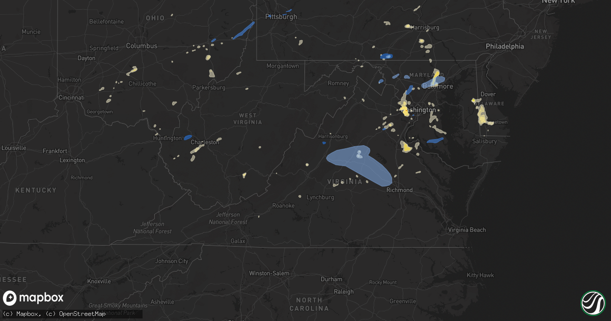
Hail Map in Virginia on August 13, 2021
Get this storm
August 13 map
$229
one time, instant access
Download today. No call, no setup
Keep the $229
Bought the map and want the full workflow? Apply the entire $229 to a subscription within 7 days. None of it is wasted.
Every map, not just this one
This buys you this map. Subscription and you get every map we run, in the markets you choose from a few cities to whole states to nationwide. Plus real-time alerts the moment a storm fires.
Contact data
Name, contact info, occupancy, even credit band for addresses in the footprint. You go from where it hit to who to call.
Become the source they trust
Unlimited branding weather history reports on demand. You already have the documented answer ready for the property owner, and you are the one who showed up with it.
Property data and RoofTrace estimates
Pull up any address you have got, its value and the exact code rules for that jurisdiction, straight from One Click Code. Then RoofTrace estimates the squares, pitch, and roof value, priced the way you price.
Storm reports in Virginia
Virginia
| Date | Description |
|---|---|
| 08/13/20216:15 PM CDT | Several tree branches down in addition to roof damage to a building. |
| 08/13/20215:35 PM CDT | There were about two dozen calls for trees and wires down throughout the county. Several cars struck fallen trees in the roadway... But no injuries were reported. |
| 08/13/20215:34 PM CDT | Trees down near the intersection of va-218 caledon road and bluff way. |
| 08/13/20215:27 PM CDT | Trees down near the intersection of va-607 port conway road and va-660 canning way. |
| 08/13/20215:25 PM CDT | Trees down near the intersection of va-694 lambs creek church road and va-608 igo road. |
| 08/13/20215:15 PM CDT | Trees down on va-621 marlborough point road near potomac overlook lane. |
| 08/13/20215:15 PM CDT | Several trees down on penola road. |
| 08/13/20215:10 PM CDT | Several trees down in the white oak area. |
| 08/13/20215:10 PM CDT | Numerous trees down across eastern caroline county. Trees down along richmond turnpike south of bowling green. Trees also down around bowling green. |
| 08/13/20215:05 PM CDT | Several trees down in the brooke area. |
| 08/13/20215:00 PM CDT | Trees down on brookside drive near va-236 little river turnpike. |
| 08/13/20214:57 PM CDT | Several large trees down in annandale. |
| 08/13/20214:56 PM CDT | Several trees down in the widewater area. |
| 08/13/20214:55 PM CDT | Trees down on earlehurst street near leesville boulevard. |
| 08/13/20214:49 PM CDT | Trees down near the intersection of sandburg street and sandburg court. |
| 08/13/20214:48 PM CDT | Trees down near the intersection of beau lane and hideaway road. |
| 08/13/20214:47 PM CDT | Large tree down near the intersection of oak street and morgan lane. |
| 08/13/20214:47 PM CDT | Trees down near the intersection of worcester drive and laurel street. |
| 08/13/20214:45 PM CDT | Multiple large trees down in vienna. |
| 08/13/20214:43 PM CDT | A local report indicates 1.75 inch wind near 1 SSE OAKTON |
| 08/13/20214:41 PM CDT | Trees down near the intersection of clover glen drive and barnwood terrace. |
| 08/13/20214:40 PM CDT | Large tree down near the intersection of clarks crossing road and elgin drive. |
| 08/13/20214:40 PM CDT | Large tree down in the 2300 block of trott avenue. |
| 08/13/20214:38 PM CDT | Large tree down near the intersection of wendover drive and round springs drive |
| 08/13/20214:38 PM CDT | Trees down near the intersection of wendover drive and bird drive. |
| 08/13/20214:35 PM CDT | Trees down on hunter station road near roundhouse road. |
| 08/13/20214:25 PM CDT | Goochland 911 reported numerous trees down across the county with widespread power outages and roads blocked. |
| 08/13/20214:25 PM CDT | Trees down along line rd. All east bound lanes closed. |
| 08/13/20214:21 PM CDT | A tree was blown down by thunderstorm winds along wades lane. |
| 08/13/20214:20 PM CDT | A tree was blown down on top of a vehicle near the intersection of grove avenue and west main street. |
| 08/13/20214:20 PM CDT | A tree was blown down by thunderstorm winds near the intersection of 1st street and chrisman street. |
| 08/13/20214:20 PM CDT | Trees down along hawktown rd and whitehall ave. All north bound lanes were closed. |
| 08/13/20214:18 PM CDT | There were about a dozen calls for trees and wires down throughout the county. |
| 08/13/20214:18 PM CDT | Numerous trees down in the 8900 block of va-667 old dumfries road. |
| 08/13/20214:18 PM CDT | Tree down on va-609 courthouse road. |
| 08/13/20214:08 PM CDT | Tree down near the intersection of midland road and airport road |
| 08/13/20214:05 PM CDT | Trees down along zachary taylor highway near mineral. |
| 08/13/20214:05 PM CDT | Trees down on va616 casanova road near poplar springs manor. |
| 08/13/20214:04 PM CDT | Tree down on the 8900 block of old dumfries road |
| 08/13/20214:04 PM CDT | Tree down near the intersection of beverly mill road and i-66 |
| 08/13/20214:00 PM CDT | Numerous trees down near the intersection of va-616 casanova road and va-643 meetze road. |
| 08/13/20213:57 PM CDT | Trees and wires down on va-193 georgetown pike between va-674 springvale road and va-681 walker road. |
| 08/13/20213:50 PM CDT | Numerous trees down across central and south central louisa. |
| 08/13/20213:50 PM CDT | A large tree blew down in the 9800 block of arnon chapel road. |
| 08/13/20213:48 PM CDT | Tree down near the intersection of kennedy road and vint hill parkway. |
| 08/13/20213:45 PM CDT | Tree down in the 6600 block of va-675 kelly road. |
| 08/13/20213:45 PM CDT | Trees down near the intersection of va-600 beverleys mill road and us-29/us-15 lee highway. |
| 08/13/20213:45 PM CDT | Trees down near the intersection of va-28 catlett road and smith midland lane. |
| 08/13/20213:45 PM CDT | Trees down in the 5100 block of germantown road. |
| 08/13/20213:44 PM CDT | Tree down on va-603 beach mill road near patowmack drive. |
| 08/13/20213:31 PM CDT | Tree branches and power poles brought down along va rt 7 near northern virginia community college and east of dulles town center mall |
| 08/13/20213:30 PM CDT | Trees down along 164 from mm141 to mm136. |
| 08/13/20213:30 PM CDT | Tree down in the 300 block of bock street. Tree down near the intersection of va-643 cox mill road and va-648 browntown road. |
| 08/13/20213:30 PM CDT | Large trees... Branches and wires down near the northern virginia community college - loudoun campus. Poles down and traffic light stands blown over near the intersecti |
| 08/13/20213:27 PM CDT | A wind gust of 64 knots |
| 08/13/20213:22 PM CDT | Numerous trees down near warrenton airport... Including near the intersection of va-610 midland road and airport road. |
| 08/13/20213:20 PM CDT | A tree blew down near the intersection of va-646 lovers lane and briar patch drive. |
| 08/13/20213:08 PM CDT | Tree down near the intersection of west hoover road and arrington mountain road |
| 08/13/20213:05 PM CDT | Tree down on the 400 block of advance mills road |
| 08/13/20213:04 PM CDT | Tree down near the intersection of matthew mill road and sterling lamm drive |
| 08/13/20213:04 PM CDT | Large tree limbs down on va-621 south blue ridge turnpike. |
| 08/13/20213:04 PM CDT | A tree was blown down by thunderstorm winds along river road. |
| 08/13/20213:04 PM CDT | Tree down near the intersection of route 810 and dyke road |
| 08/13/20213:04 PM CDT | Tree down on the 1400 block of carpenters mill road |
| 08/13/20213:04 PM CDT | Tree down on roadway. |
| 08/13/20213:00 PM CDT | Wires down in the 15200 block of albano road. |
| 08/13/20212:59 PM CDT | Tree down on covesville lane near monacan trail road. |
| 08/13/20212:57 PM CDT | Tree down in the 2100 block of va-688 leeds manor road. |
| 08/13/20212:54 PM CDT | Tree down near the intersection of va-655 blue run road and va-20 constitution highway. |
| 08/13/20212:54 PM CDT | Tree down near the intersection of va-641 weaver hollow road and va-609 west hoover road. |
| 08/13/20212:54 PM CDT | Tree and power lines down in the 4200 block of burton road. |
| 08/13/20212:50 PM CDT | Tree blew down in the 4800 block of plank road |
| 08/13/20212:50 PM CDT | Tree down near the intersection of va-231 and holden lane |
| 08/13/20212:40 PM CDT | Large tree down near intersection of ridge rd and marsh run ln |
| 08/13/20212:37 PM CDT | Tree onto powerlines at 4247 burton rd |
| 08/13/20212:36 PM CDT | Power lines down on the 100 block of fairground road |
| 08/13/20212:35 PM CDT | Tree and powerline down near the intersection of stage road and us-29. About a half dozen other trees down in the area. |
| 08/13/20212:35 PM CDT | Power lines down on va-661 fairground road. |
| 08/13/20212:35 PM CDT | Tree down near the intersection of va-604 celt road and william monroe trail. |
| 08/13/20212:32 PM CDT | Tree down near intersection of rockfish gap turnpike and critzers shop rd |
| 08/13/20212:31 PM CDT | Large tree down near ivy rd and rockfish gap turnpike |
| 08/13/20212:31 PM CDT | Power line down near the intersection of blue ridge avenue and east prospect street |
| 08/13/20212:28 PM CDT | Large tree blocking entire road at 895 old ballard rd |
| 08/13/20212:26 PM CDT | Power lines down on blue ridge avenue. |
| 08/13/20212:25 PM CDT | A large tree was blown down by thunderstorm winds near the intersection of bearskin road and banister road. |
| 08/13/20212:20 PM CDT | Tree down in the 1300 block of va-616 good hope church road. |
| 08/13/20212:15 PM CDT | Wires down near the intersection of va-609 naked creek road and va-758 fox mountain road. |
| 08/13/20212:12 PM CDT | Numerous trees and wires blew down near and south of stephens city. A tree blew down in the 500 block of peace and plenty lane. Numerous large trees blew down on va-735 |
| 08/13/20212:00 PM CDT | Wires down in the 9200 block of valley view road. |
| 08/13/20211:37 PM CDT | Tree down on maury river road. Time estimated from radar. |
| 08/13/20211:34 PM CDT | Numerous trees and powerlines down along highway 33 between harrisonburg and hinton |
| 08/13/20211:30 PM CDT | Trees blew down in the 4100 block of va-622 cedar creek grade. |
| 08/13/20211:20 PM CDT | Trees down near the intersection of va-752 muddy creek road and va-726 mount clinton pike. Large tree down at a residence in the 2100 block of custers road. |
| 08/13/20211:20 PM CDT | Large tree limbs blew down on va-600 north hayfield road. |
| 08/13/20211:20 PM CDT | A local report indicates 61 MPH wind near 2 NNW DALE ENTERPRISE |
| 08/13/20211:19 PM CDT | A wind gust of 55 knots |
| 08/13/20211:15 PM CDT | Several trees down in the mount solon area. |
| 08/13/20211:11 PM CDT | Large tree down on the 2100 block of custers road |
| 08/13/20211:07 PM CDT | Numerous trees and powerlines down in the mount solon area... Especially along moscow loop towards hwy 42 from mossy creek road |
| 08/13/202111:56 AM CDT | One large tree was blown down by thunderstorm winds... Partially blocking stayman road. |
| 08/13/202111:42 AM CDT | A large tree was blown down by thunderstorm winds along crutchfield street. |
| 08/13/202111:40 AM CDT | A tree was blown down by thunderstorm winds along stanley farm road. |
| 08/13/20217:40 AM CDT | At 1240 PM EDT, a severe thunderstorm was located over Glenvar, or near Salem, moving east at 5 mph. HAZARD...60 mph wind gusts. SOURCE...Radar indicated. IMPACT...Expect damage to roofs, siding, and trees. Locations impacted include... Roanoke... Salem... Vinton... Troutville... Hollins... Bradshaw... and Glenvar.This includes The following Locations The Salem Fairgrounds andRoanoke Regional Airport. |
| 08/13/20215:46 AM CDT | At 1046 PM EDT, a severe thunderstorm was located near Cleveland Va, or 10 miles west of Lebanon, moving east at 15 mph. HAZARD...60 mph wind gusts and penny size hail. SOURCE...Radar indicated. IMPACT...Expect damage to roofs, siding, and trees. Locations impacted include... Lebanon, Cleveland Va, Honaker, St. Paul, Dye, Castlewood and Rosedale. |
| 08/13/20214:23 AM CDT | At 922 PM EDT, a severe thunderstorm was located 7 miles southwest of Gate City, moving northeast at 15 mph. HAZARD...60 mph wind gusts and penny size hail. SOURCE...Radar indicated. IMPACT...Expect damage to roofs, siding, and trees. Locations impacted include... Kingsport, Gate City, Weber City, Church Hill, Mount Carmel, Nickelsville, Okolona, Hiltons, Bloomingdale and Bays Mountain Park.This includes Interstate 26 in Tennessee between mile markers 1 and2. |
| 08/13/20211:03 AM CDT | At 602 PM EDT, a severe thunderstorm was located near Milford, moving northeast at 15 mph. HAZARD...60 mph wind gusts, quarter size hail and heavy rain. SOURCE...Radar indicated. IMPACT...Minor damage to vehicles is possible. Expect wind damage to trees and powerlines. Rainfall up to 2 inches is possible. This severe thunderstorm will be near... Milford around 620 PM EDT. Bowling Green around 630 PM EDT. Port Royal and Fort A.p. Hill around 645 PM EDT.Other locations impacted by this severe thunderstorm includeRappahannock Academy, Sparta, Villboro, Corbin, Supply, Woodford,Penola and Golansville.# # |
| 08/13/202112:39 AM CDT | At 539 PM EDT, a severe thunderstorm was located 10 miles northeast of Monterey, moving northeast at 10 mph. HAZARD...60 mph wind gusts. SOURCE...Radar indicated. IMPACT...Damaging winds will cause some trees and large branches to fall. This could injure those outdoors, as well as damage homes and vehicles. Roadways may become blocked by downed trees. Localized power outages are possible. Unsecured light objects may become projectiles. Locations impacted include... Franklin, Brandywine, Deer Run and Oak Flat. |
| 08/13/202112:16 AM CDT | At 516 PM EDT, severe thunderstorms were located along a line extending from near Linton Hall to 10 miles west of Stafford, moving east at 15 mph. HAZARD...60 mph wind gusts and quarter size hail. SOURCE...Radar indicated. IMPACT...Damaging winds will cause some trees and large branches to fall. This could injure those outdoors, as well as damage homes and vehicles. Roadways may become blocked by downed trees. Localized power outages are possible. Unsecured light objects may become projectiles. Locations impacted include... Stafford, Linton Hall, Manassas, New Baltimore, Independent Hill, Nokesville, Catlett, Calverton, Roseville, Auburn, Garrisonville, Ramoth, Aden, Heflin, Aquia, Storck, Ruby, Somerville, Bristersburg and Goldvein. |
| 08/13/202112:14 AM CDT | At 513 PM EDT, a severe thunderstorm was located 7 miles south of Linton Hall, or 12 miles southeast of Warrenton, moving east at 10 mph. THIS IS A DESTRUCTIVE STORM FOR EAST CENTRAL FAUQUIER COUNTY AND WEST CENTRAL PRINCE WILLIAM COUNTY IN NORTHERN VIRGINIA. HAZARD...80 mph wind gusts and golf ball size hail. SOURCE...Radar indicated. IMPACT...Expect considerable damage to trees and power lines. Your life is at significant risk if outdoors. In addition to some trees falling into homes, wind damage is possible to roofs, sheds, open garages, and mobile homes. Locations impacted include... Linton Hall, Manassas, Nokesville, Catlett and Aden. |
| 08/13/202112:11 AM CDT | At 511 PM EDT, a severe thunderstorm was located near Childress, or near Christiansburg, moving northeast at 20 mph. HAZARD...60 mph wind gusts and quarter size hail. SOURCE...Radar indicated. IMPACT...Hail damage to vehicles is expected. Expect wind damage to roofs, siding, and trees. Locations impacted include... Blacksburg... Christiansburg... Radford... Pilot... Shawsville... Mc Donalds Mill... and Merrimac.This includes The following Location Virginia Tech. |
| 08/13/202112:00 AM CDT | At 500 PM EDT, severe thunderstorms were located along a line extending from 6 miles north of Louisa to near Hadensville to Gold Hill, moving east southeast at 20 mph. HAZARD...60 mph wind gusts. SOURCE...Radar indicated. IMPACT...Expect damage to trees and powerlines. Severe thunderstorms will be near... Hadensville around 505 PM EDT. Gum Spring around 515 PM EDT. Lakeside Village around 520 PM EDT. Cumberland and Mineral around 525 PM EDT. Cartersville and Sunnyside around 535 PM EDT. Montpelier around 540 PM EDT. Ballsville, Tobaccoville, Trenholm, Bumpass, Macon and Morven around 545 PM EDT.Other locations impacted by these severe thunderstorms includeOrchid, Angola, Maidens, Three Square, Whiteville, Fine Creek Mills,Michaux, West View, Grays Siding and Wares Crossroads.# # |
| 08/12/202111:55 PM CDT | At 454 PM EDT, severe thunderstorms were located along a line extending from Fife to near Buckingham, moving east at 25 mph. HAZARD...60 mph wind gusts and quarter size hail. SOURCE...Radar indicated. IMPACT...Hail damage to vehicles is expected. Expect wind damage to roofs, siding, and trees. Locations impacted include... Buckingham... Dillwyn... New Canton... Gold Hill... and Centenary. |
| 08/12/202111:35 PM CDT | At 435 PM EDT, a severe thunderstorm was located 7 miles northeast of Culpeper, moving northeast at 5 mph. HAZARD...70 mph wind gusts and quarter size hail. SOURCE...Radar indicated. IMPACT...Damaging winds will cause some trees and large branches to fall. This could injure those outdoors, as well as damage homes and vehicles. Roadways may become blocked by downed trees. Localized power outages are possible. Unsecured light objects may become projectiles. Locations impacted include... Opal, Turnbull, Rixeyville, Jeffersonton and Alanthus. |
| 08/12/202111:32 PM CDT | At 432 PM EDT, a severe thunderstorm was located near Warrenton, moving east at 5 mph. HAZARD...70 mph wind gusts and half dollar size hail. SOURCE...Radar indicated. IMPACT...Damaging winds will cause some trees and large branches to fall. This could injure those outdoors, as well as damage homes and vehicles. Roadways may become blocked by downed trees. Localized power outages are possible. Unsecured light objects may become projectiles. Locations impacted include... Warrenton, Linton Hall, Haymarket, Gainesville, New Baltimore, Meadowville, Airlie, Broad Run, Broken Hill, Auburn, Ada and Greenwich. |
| 08/12/202111:31 PM CDT | At 431 PM EDT, severe thunderstorms were located along a line extending from near Orange to near Ferncliff to near Palmyra, moving east at 15 mph. HAZARD...60 mph wind gusts. SOURCE...Radar indicated. IMPACT...Expect damage to trees and powerlines. Severe thunderstorms will be near... Ferncliff around 440 PM EDT. Louisa around 505 PM EDT. Mineral around 515 PM EDT.Other locations impacted by these severe thunderstorms includePendleton, Louisa Airport, Green Springs, Zion Crossroads, UnionMills, Cuckoo, Bybee, Yanceyville, Waldrop and Byrd Mill.# # |
| 08/12/202111:28 PM CDT | At 428 PM EDT, a severe thunderstorm was located near Bealeton, or 9 miles southeast of Warrenton, moving east at 5 mph. HAZARD...70 mph wind gusts and half dollar size hail. SOURCE...Radar indicated. IMPACT...Damaging winds will cause some trees and large branches to fall. This could injure those outdoors, as well as damage homes and vehicles. Roadways may become blocked by downed trees. Localized power outages are possible. Unsecured light objects may become projectiles. Locations impacted include... Bealeton, Nokesville, Opal, Catlett, Calverton, Midland, Casanova, Bristersburg and Auburn. |
| 08/12/202111:15 PM CDT | Tree down on witten valley road near frog level. Time estimated by radar. |
| 08/12/202111:05 PM CDT | At 405 PM EDT, a severe thunderstorm was located over Poolesville, and is nearly stationary. HAZARD...60 mph wind gusts and quarter size hail. SOURCE...Radar indicated. IMPACT...Damaging winds will cause some trees and large branches to fall. This could injure those outdoors, as well as damage homes and vehicles. Roadways may become blocked by downed trees. Localized power outages are possible. Unsecured light objects may become projectiles. Locations impacted include... Germantown, Reston, Herndon, Broadlands, Lansdowne, Lowes Island, Poolesville, Potomac, Ashburn, Sterling, Wolf Trap, Great Falls, Countryside, Clarksburg, Darnestown, Belmont, Barnesville, Beallsville and Sterling Park. |
| 08/12/202111:04 PM CDT | Corrects source of report. One tree down on us 460 in cedar bluff. Time estimated by radar. |
| 08/12/202111:02 PM CDT | At 402 PM EDT, severe thunderstorms were located along a line extending from near Schuyler to near Bent Creek, moving east at 15 mph. HAZARD...60 mph wind gusts and quarter size hail. SOURCE...Radar indicated. IMPACT...Damaging winds will cause some trees and large branches to fall. This could injure those outdoors, as well as damage homes and vehicles. Roadways may become blocked by downed trees. Localized power outages are possible. Unsecured light objects may become projectiles. Locations impacted include... Shipman, Schuyler, Arrington, Lovingston, Norwood, Five Forks, Allens Creek, Wingina, Gladstone, Elma, Rockfish and Buffalo Springs. |
| 08/12/202110:59 PM CDT | At 359 PM EDT, severe thunderstorms were located along a line extending from near Schuyler to near Stonewall, moving east at 35 mph. HAZARD...60 mph wind gusts and quarter size hail. SOURCE...Radar indicated. IMPACT...Hail damage to vehicles is expected. Expect wind damage to roofs, siding, and trees. Locations impacted include... Buckingham... Dillwyn... Bent Creek... New Canton... Toga... Centenary... and Riverville. |
| 08/12/202110:53 PM CDT | At 353 PM EDT, a severe thunderstorm was located near Boswells Tavern, or 11 miles northeast of Charlottesville, moving northeast at 25 mph. HAZARD...60 mph wind gusts and quarter size hail. SOURCE...Radar indicated. IMPACT...Damaging winds will cause some trees and large branches to fall. This could injure those outdoors, as well as damage homes and vehicles. Roadways may become blocked by downed trees. Localized power outages are possible. Unsecured light objects may become projectiles. Locations impacted include... Orange, Gordonsville, Nasons, Madison Mills, Montford, Eheart, Old Somerset, Barboursville, Montpelier Station, Madison Run and Somerset. |
| 08/12/202110:50 PM CDT | At 350 PM EDT, a severe thunderstorm was located over Lowes Island, moving northeast at 10 mph. HAZARD...60 mph wind gusts and quarter size hail. SOURCE...Radar indicated. IMPACT...Damaging winds will cause some trees and large branches to fall. This could injure those outdoors, as well as damage homes and vehicles. Roadways may become blocked by downed trees. Localized power outages are possible. Unsecured light objects may become projectiles. Locations impacted include... Germantown, Rockville, Gaithersburg, Lowes Island, Potomac, North Potomac, Redland, Boyds, Clarksburg, Darnestown, Derwood and Dawsonville. |
| 08/12/202110:30 PM CDT | Several trees down. |
| 08/12/202110:30 PM CDT | At 330 PM EDT, severe thunderstorms were located along a line extending from Big Meadows to Madison to 7 miles west of Orange, moving east at 10 mph. HAZARD...60 mph wind gusts and quarter size hail. SOURCE...Radar indicated. IMPACT...Damaging winds will cause some trees and large branches to fall. This could injure those outdoors, as well as damage homes and vehicles. Roadways may become blocked by downed trees. Localized power outages are possible. Unsecured light objects may become projectiles. Locations impacted include... Orange, Madison, Big Meadows, Brightwood, Criglersville, Etlan, Oakpark, Haywood, Montpelier Station, Pratts, Syria, Rochelle, Aroda, Banco, Madison Mills, Montford, Old Somerset, Shelby, Twymans Mill and Aylor. |
| 08/12/202110:26 PM CDT | At 326 PM EDT, a severe thunderstorm was located near Front Royal, and is nearly stationary. HAZARD...60 mph wind gusts. SOURCE...Radar indicated. IMPACT...Damaging winds will cause some trees and large branches to fall. This could injure those outdoors, as well as damage homes and vehicles. Roadways may become blocked by downed trees. Localized power outages are possible. Unsecured light objects may become projectiles. Locations impacted include... Front Royal, Strasburg, Linden, Middletown, Fort Valley, Howellsville, Riverton, Reliance, Karo, Cedarville, Clary, Buckton and Riverside. |
| 08/12/202110:18 PM CDT | At 317 PM EDT, a severe thunderstorm was located over Afton, or near Waynesboro, moving east at 10 mph. HAZARD...60 mph wind gusts and quarter size hail. SOURCE...Radar indicated. IMPACT...Damaging winds will cause some trees and large branches to fall. This could injure those outdoors, as well as damage homes and vehicles. Roadways may become blocked by downed trees. Localized power outages are possible. Unsecured light objects may become projectiles. Locations impacted include... Waynesboro, Crozet, Crimora, Free Union, Afton, Ivy, Greenwood, Batesville, Yancey Mills, Afton Mountain and White Hall. |
| 08/12/202110:11 PM CDT | At 311 PM EDT, a severe thunderstorm was located near Callands, moving east at 10 mph. HAZARD...60 mph wind gusts and quarter size hail. SOURCE...Radar indicated. IMPACT...Hail damage to vehicles is expected. Expect wind damage to roofs, siding, and trees. Locations impacted include... Chatham... Blairs... Callands... Swansonville... Dry Fork... Climax... and Keeling. |
| 08/12/202110:08 PM CDT | Large tree down in the 2300 block of trott avenue. |
| 08/12/202110:05 PM CDT | At 300 PM EDT, a severe thunderstorm was located 9 miles southeast of Stanardsville, or 10 miles west of Orange, and is nearly stationary. HAZARD...70 mph wind gusts and half dollar size hail. SOURCE...Radar indicated. IMPACT...Damaging winds will cause some trees and large branches to fall. This could injure those outdoors, as well as damage homes and vehicles. Roadways may become blocked by downed trees. Localized power outages are possible. Unsecured light objects may become projectiles. Locations impacted include... Orange, Gordonsville, Eheart, Barboursville, Montpelier Station, Madison Run, Rochelle, Aroda, Madison Mills, Montford, Old Somerset, Somerset and Newtown. |
| 08/12/202110:05 PM CDT | A few trees down. |
| 08/12/202110:01 PM CDT | At 301 PM EDT, a severe thunderstorm was located over Montebello, or 15 miles north of Forks Of Buffalo, moving southeast at 10 mph. HAZARD...60 mph wind gusts and half dollar size hail. SOURCE...Radar indicated. IMPACT...Damaging winds will cause some trees and large branches to fall. This could injure those outdoors, as well as damage homes and vehicles. Roadways may become blocked by downed trees. Localized power outages are possible. Unsecured light objects may become projectiles. Locations impacted include... Stuarts Draft, Sherando, Wintergreen, Montebello, Lyndhurst, Nellysford, Bryant, Jonesboro and Tyro. |
| 08/12/202110:01 PM CDT | There were about two dozen calls for trees and wires down throughout the county. Several cars struck fallen trees in the roadway... But no injuries were reported. |
| 08/12/20219:59 PM CDT | At 259 PM EDT, a severe thunderstorm was located over Stephens City, or near Millwood Pike, moving southeast at 10 mph. HAZARD...60 mph wind gusts and quarter size hail. SOURCE...Radar indicated. IMPACT...Damaging winds will cause some trees and large branches to fall. This could injure those outdoors, as well as damage homes and vehicles. Roadways may become blocked by downed trees. Localized power outages are possible. Unsecured light objects may become projectiles. Locations impacted include... Stephens City, Boyce, Millwood, White Post, Nineveh, Armel, Bethel and Briggs. |
| 08/12/20219:55 PM CDT | At 255 PM EDT, severe thunderstorms were located along a line extending from near Massanutten to near Grottoes, moving east at 15 mph. HAZARD...60 mph wind gusts and quarter size hail. SOURCE...Radar indicated. IMPACT...Damaging winds will cause some trees and large branches to fall. This could injure those outdoors, as well as damage homes and vehicles. Roadways may become blocked by downed trees. Localized power outages are possible. Unsecured light objects may become projectiles. Locations impacted include... Grottoes, Massanutten, Crimora, Elkton, Rocky Bar, Penn Laird, Port Republic, Boonesville, Haneytown, Mission Home, Swift Run, Keezletown, Jollett, Mcgaheysville, Saint George, Shady Grove and Montevideo. |
| 08/12/20219:51 PM CDT | At 251 PM EDT, a severe thunderstorm was located over Waynesboro, and is nearly stationary. HAZARD...60 mph wind gusts. SOURCE...Radar indicated. IMPACT...Damaging winds will cause some trees and large branches to fall. This could injure those outdoors, as well as damage homes and vehicles. Roadways may become blocked by downed trees. Localized power outages are possible. Unsecured light objects may become projectiles. Locations impacted include... Waynesboro, Crozet, Afton, Fishersville, Lyndhurst, Greenwood, Yancey Mills and Afton Mountain. |
| 08/12/20219:36 PM CDT | At 236 PM EDT, a severe thunderstorm was located near Bells Valley, or near Goshen, moving east at 30 mph. HAZARD...60 mph wind gusts and quarter size hail. SOURCE...Radar indicated. IMPACT...Hail damage to vehicles is expected. Expect wind damage to roofs, siding, and trees. Locations impacted include... Goshen... Rockbridge Baths... Bells Valley... Brownsburg... and Vesuvius. |
| 08/12/20219:24 PM CDT | At 223 PM EDT, a severe thunderstorm was located near Upper Tract, or 9 miles northeast of Franklin, moving east at 10 mph. HAZARD...60 mph wind gusts and quarter size hail. SOURCE...Radar indicated. IMPACT...Damaging winds will cause some trees and large branches to fall. This could injure those outdoors, as well as damage homes and vehicles. Roadways may become blocked by downed trees. Localized power outages are possible. Unsecured light objects may become projectiles. Locations impacted include... Deer Run, Criders and Bergton. |
| 08/12/20219:19 PM CDT | At 218 PM EDT, a severe thunderstorm was located near Dale Enterprise, or near Harrisonburg, moving east at 15 mph. HAZARD...60 mph wind gusts and quarter size hail. SOURCE...Radar indicated. IMPACT...Damaging winds will cause some trees and large branches to fall. This could injure those outdoors, as well as damage homes and vehicles. Roadways may become blocked by downed trees. Localized power outages are possible. Unsecured light objects may become projectiles. Locations impacted include... Harrisonburg, Shenandoah, Massanutten, Dale Enterprise, Elkton, Newport, Ingham, Lacey Spring, Linville and Keezletown. |
| 08/12/20219:18 PM CDT | At 218 PM EDT, severe thunderstorms were located along a line extending from 7 miles north of Winchester to near Wardensville, moving south at 5 mph. HAZARD...60 mph wind gusts and quarter size hail. SOURCE...Radar indicated. IMPACT...Damaging winds will cause some trees and large branches to fall. This could injure those outdoors, as well as damage homes and vehicles. Roadways may become blocked by downed trees. Localized power outages are possible. Unsecured light objects may become projectiles. Locations impacted include... Winchester, Millwood Pike, Stephens City, Wardensville, Star Tannery, Brucetown, Gravel Springs, Yellow Spring, High View, Greenwood, High View Manor, Gainesboro, Wilde Acres, Cedar Grove, Clear Brook, Stephenson, Cedar Hill, Rock Enon Springs, Albin and Gore. |
| 08/12/20219:17 PM CDT | Trees down in the 5100 block of germantown road. |
| 08/12/20219:15 PM CDT | Trees down near the intersection of va-28 catlett road and smith midland lane. |
| 08/12/20218:59 PM CDT | At 159 PM EDT, a severe thunderstorm was located 11 miles west of Bridgewater, or 14 miles northwest of Staunton, moving east at 15 mph. HAZARD...60 mph wind gusts and half dollar size hail. SOURCE...Radar indicated. IMPACT...Damaging winds will cause some trees and large branches to fall. This could injure those outdoors, as well as damage homes and vehicles. Roadways may become blocked by downed trees. Localized power outages are possible. Unsecured light objects may become projectiles. Locations impacted include... Harrisonburg, Staunton, Bridgewater, Fishersville, Verona, Weyers Cave, Mount Sidney, Mount Crawford, Churchville, Moscow, Montezuma, Mount Solon, Sangerville and Fort Defiance. |
| 08/12/20218:57 PM CDT | Tree down in the 300 block of bock street. |
| 08/12/20218:53 PM CDT | A local report indicates 1.00 inch wind near 2 WSW GATE CITY |
| 08/12/20218:28 PM CDT | At 127 PM EDT, a severe thunderstorm was located 9 miles northwest of Dale Enterprise, or 13 miles northwest of Harrisonburg, and is nearly stationary. HAZARD...60 mph wind gusts and quarter size hail. SOURCE...Radar indicated. IMPACT...Damaging winds will cause some trees and large branches to fall. This could injure those outdoors, as well as damage homes and vehicles. Roadways may become blocked by downed trees. Localized power outages are possible. Unsecured light objects may become projectiles. Locations impacted include... Rawley Springs. |
All States Impacted by Hail Map on August 13, 2021
Cities Impacted by Hail Map on August 13, 2021
- Glen Aubrey, NY
- Whitney Point, NY
- Lisle, NY
- Dill City, OK
- Yellville, AR
- Lead Hill, AR
- Fort Mcdowell, AZ
- Pottsboro, TX
- Oakland, KY
- Chantilly, VA
- Centreville, VA
- Butler, OK
- Paden, OK
- Williamsport, OH
- New Holland, OH
- Prince Frederick, MD
- Catlett, VA
- Reston, VA
- Humboldt, TN
- Bells, TN
- Oklahoma City, OK
- Checotah, OK
- Pine Valley, UT
- New Harmony, UT
- Chandlersville, OH
- Willcox, AZ
- Foss, OK
- Cordell, OK
- Bessie, OK
- Corn, OK
- Rogers, AR
- Garfield, AR
- Cord, AR
- Windsor, NY
- Sweetwater, OK
- Booneville, AR
- Greensboro, MD
- Howard, OH
- Danville, OH
- Ash Fork, AZ
- Falls Church, VA
- China Grove, NC
- Mount Ulla, NC
- Sedona, AZ
- Stuttgart, AR
- Gould, OK
- Middlebourne, WV
- Sistersville, WV
- Pine, AZ
- Tappahannock, VA
- Saint Stephens Church, VA
- Phoenix, AZ
- Globe, AZ
- Miami, AZ
- Slingerlands, NY
- Voorheesville, NY
- South Charleston, WV
- Alum Creek, WV
- Chesapeake, OH
- Ballston Lake, NY
- Ballston Spa, NY
- Galway, NY
- McConnellsburg, PA
- Muskogee, OK
- Webbers Falls, OK
- Georgetown, DE
- Searchlight, NV
- New Blaine, AR
- Scranton, AR
- East Meredith, NY
- Davenport, NY
- Davenport Center, NY
- Oneonta, NY
- Crawfordsville, AR
- Proctor, AR
- Prescott, AR
- Covington, VA
- Hancock, MD
- Warfordsburg, PA
- Bedford, VA
- Great Falls, VA
- Fombell, PA
- New Brighton, PA
- Owings, MD
- Friendship, MD
- Dunkirk, MD
- Okmulgee, OK
- Haskell, OK
- Boynton, OK
- Morris, OK
- Colony, OK
- Valley Springs, AR
- Baltimore, MD
- Henderson, MD
- Goldsboro, MD
- Colorado City, AZ
- Wellsville, PA
- Dover, PA
- Bentonville, AR
- Zanesville, OH
- Peridot, AZ
- Mount Pleasant, NC
- Shermans Dale, PA
- Landisburg, PA
- Carlisle, PA
- Vinton, OH
- Bidwell, OH
- Langsville, OH
- Saint Johnsville, NY
- Congress, AZ
- Alderson, WV
- Meadow Bridge, WV
- Green Sulphur Springs, WV
- Salisbury, NC
- Dolgeville, NY
- Burnt Hills, NY
- Barnsdall, OK
- Black Canyon City, AZ
- Pine Bluff, AR
- Bowie, MD
- New Freedom, PA
- Glen Rock, PA
- Freeland, MD
- Witter, AR
- Eufaula, OK
- Barboursville, VA
- Gordonsville, VA
- Sod, WV
- Sumerco, WV
- Sayre, OK
- Elk City, OK
- Ogallala, NE
- Mountain Home, AR
- Vian, OK
- Mena, AR
- Rose, OK
- King George, VA
- Harrington, DE
- East Waterford, PA
- Blairs Mills, PA
- Orbisonia, PA
- Colonial Beach, VA
- Dillsburg, PA
- Covington, TN
- Eureka Springs, AR
- Mooresville, NC
- Keswick, VA
- Corning, NY
- Supai, AZ
- Williams, AZ
- Montoursville, PA
- Williamsport, PA
- Coalgate, OK
- Kingsport, TN
- Saint David, AZ
- Federalsburg, MD
- Denton, MD
- Greenwood, DE
- Paris, AR
- Subiaco, AR
- Grandin, MO
- Poplar Bluff, MO
- Bon Aqua, TN
- Burns, TN
- Arapaho, OK
- Gold Hill, NC
- Feura Bush, NY
- Selkirk, NY
- Coeymans Hollow, NY
- Rochester, PA
- Beaver Falls, PA
- Connellsville, PA
- Dunbar, PA
- Granite, OK
- Willow, OK
- Waverly, TN
- Hurricane Mills, TN
- Edmond, OK
- Lothian, MD
- Brandywine, MD
- Upper Marlboro, MD
- Centerville, TN
- Nunnelly, TN
- Lobelville, TN
- Central, UT
- Stigler, OK
- Mayer, AZ
- Mcalester, OK
- Decatur, AR
- Gravette, AR
- Franklin, TN
- Greencastle, PA
- Port Royal, VA
- Woodford, VA
- Rappahannock Academy, VA
- Fredericksburg, VA
- Potomac, MD
- Doniphan, MO
- Lascassas, TN
- Lebanon, TN
- Lutherville Timonium, MD
- Pikesville, MD
- Stevenson, MD
- Salem, OH
- Beloit, OH
- Washingtonville, OH
- Alliance, OH
- Damascus, OH
- Leetonia, OH
- Arlington, TN
- Eads, TN
- Sapulpa, OK
- Kiefer, OK
- Fairfax, VA
- Oakton, VA
- Vienna, VA
- Hillsboro, OH
- Herndon, VA
- Jenks, OK
- Glenpool, OK
- Newport, AR
- Newark Valley, NY
- Binghamton, NY
- Endicott, NY
- Johnson City, NY
- Maine, NY
- Leesburg, OH
- Willisburg, KY
- Lawrenceburg, KY
- Smiths Grove, KY
- Colcord, OK
- Gentry, AR
- Fisher, AR
- White Hall, AR
- Clinton, NY
- Nipton, CA
- York, PA
- Thomasville, PA
- Charleston, WV
- Golden, MO
- Eagle Rock, MO
- Seaford, DE
- Bridgeville, DE
- Cumberland, OH
- Belle Valley, OH
- Caldwell, OH
- Paulden, AZ
- Reydon, OK
- Peel, AR
- Marietta, OH
- Lowell, OH
- Whipple, OH
- Nanjemoy, MD
- Rockbridge Baths, VA
- Goshen, VA
- Bunch, OK
- Waynesboro, PA
- Glenwood, MD
- Dayton, MD
- Glenelg, MD
- Ravena, NY
- Andover, OH
- Weiner, AR
- Fountain Hills, AZ
- Gladstone, VA
- Wingina, VA
- Sheffield, AL
- Kirkwood, NY
- Conklin, NY
- Paris, KY
- Warner, OK
- Gore, OK
- Gwynn Oak, MD
- Phoenix, MD
- Cockeysville, MD
- Sparks Glencoe, MD
- Hunt Valley, MD
- Sterling, VA
- Boyds, MD
- Springfield, VA
- Poolesville, MD
- Fairfax Station, VA
- Ashburn, VA
- Germantown, MD
- Burke, VA
- Annandale, VA
- Clarksburg, MD
- Seminole, TX
- Payson, AZ
- Hope, AR
- Harrison, AR
- New Cumberland, PA
- Harrisburg, PA
- Marydel, DE
- Camden Wyoming, DE
- Felton, DE
- Carter, OK
- Sentinel, OK
- Bardstown, KY
- Garrett, WY
- Greenfield, OH
- Clarksburg, OH
- New Concord, OH
- Norwich, OH
- Albany, NY
- Delmar, NY
- East Berne, NY
- Clarksville, NY
- Blue Rock, OH
- Duncan Falls, OH
- Laurel, MD
- Glenn Dale, MD
- Quaker City, OH
- Adamsville, TN
- Cedar City, UT
- Keystone, NE
- Gaithersburg, MD
- Gainesville, VA
- Haymarket, VA
- Ripley, MS
- Blue Mountain, MS
- Palmyra, VA
- Scottsville, VA
- Wardensville, WV
- Midland, VA
- Nokesville, VA
- Warrenton, VA
- Bealeton, VA
- Brownsville, TN
- Brighton, TN
- Little Falls, NY
- Gambrills, MD
- Davidsonville, MD
- Trout Run, PA
- Wynne, AR
- Cherry Valley, AR
- Mercersburg, PA
- Stephens City, VA
- Saint Joe, AR
- Linden, TN
- Mangum, OK
- Spring Grove, PA
- East Berlin, PA
- Rosedale, MS
- Bella Vista, AR
- Hiwasse, AR
- Peach Springs, AZ
- Choctaw, OK
- Harrah, OK
- Bethany, OK
- Jones, OK
- Spencer, OK
- Ashford, WV
- Columbia, VA
- Cartersville, VA
- Dickson, TN
- Hazen, AR
- Cammal, PA
- Lock Haven, PA
- North Bend, PA
- Belmont, OH
- Flushing, OH
- Salina, OK
- Everton, AR
- Cheyenne, OK
- Ranger, WV
- Branchland, WV
- Cambridge, OH
- Clinton, OK
- Dahlgren, VA
- Windsor Mill, MD
- Towson, MD
- Catonsville, MD
- Monkton, MD
- Town Creek, AL
- Buckingham, VA
- Depew, OK
- Erick, OK
- Mesa, AZ
- Clendenin, WV
- Lebanon Junction, KY
- Boston, KY
- Monroe, MI
- Ashland, VA
- Berkeley Springs, WV
- Great Cacapon, WV
- Church Hill, TN
- Wheeler, TX
- Shamrock, TX
- McRae, AR
- Locust Grove, OK
- Rimrock, AZ
- Pleasant City, OH
- Millerstown, PA
- Liverpool, PA
- Scottdale, PA
- Dawson, PA
- Mounds, OK
- Poland, NY
- Newport, NY
- Fort Plain, NY
- Jeffersonton, VA
- Remington, VA
- Harrisonburg, VA
- Broad Run, VA
- White Bluff, TN
- Falkner, MS
- Ashland, MS
- Richwood, WV
- Claypool, AZ
- Mount Sterling, OH
- Washington Court House, OH
- Norfork, AR
- Vernon, TX
- Cave Springs, AR
- Charles Town, WV
- Ranson, WV
- Kearneysville, WV
- Denmark, TN
- Jackson, TN
- Stafford, VA
- Kitts Hill, OH
- Ironton, OH
- Lawrenceburg, TN
- Leoma, TN
- Artemas, PA
- Clarksville, TX
- Tulsa, OK
- San Carlos, AZ
- Sardinia, OH
- Winchester, OH
- Zelienople, PA
- Beaver, PA
- Darlington, PA
- Berryville, AR
- Roosevelt, AZ
- Lyles, TN
- Lore City, OH
- Byesville, OH
- Salesville, OH
- Senecaville, OH
- Port Republic, MD
- Aquasco, MD
- Huntingtown, MD
- Porum, OK
- Murphy, NC
- Lorton, VA
- Meridianville, AL
- Huntsville, AL
- Selmer, TN
- Bethel Springs, TN
- Altus Afb, OK
- Altus, OK
- Kansas, OK
- Jasper, AR
- Crowell, TX
- Junction City, OH
- Sevierville, TN
- Bosler, WY
- Edgewater, MD
- Harwood, MD
- Seven Valleys, PA
- Idabel, OK
- Denison, TX
- Dawson, GA
- Charlottesville, VA
- Rattan, OK
- Lone Wolf, OK
- Delmar, MD
- Delmar, DE
- Decatur, AL
- Trinity, AL
- Humphrey, AR
- Arnett, OK
- Sugar Tree, TN
- Harts, WV
- Julian, WV
- Danville, WV
- Huntsville, AR
- Waldorf, MD
- Ruther Glen, VA
- Cedarcreek, MO
- Smyrna, TN
- Murfreesboro, TN
- Rio Rico, AZ
- Painted Post, NY
- Deposit, NY
- Christiansburg, VA
- Riner, VA
- Lucasville, OH
- Burbank, OK
- Alexandria, VA
- Fort Belvoir, VA
- Brandy Station, VA
- Rixeyville, VA
- Lowell, AR
- Wellston, OK
- Mcloud, OK
- Meeker, OK
- Broken Arrow, OK
- Lemoyne, NE
- Lebanon, KY
- Roseville, OH
- Pedro, OH
- Macon, GA
- Atwood, TN
- Hillsboro, AL
- Manchester, MD
- Watertown, TN
- Concord, NC
- Griffithsville, WV
- Alkol, WV
- Yawkey, WV
- Fayetteville, OH
- Lynchburg, OH
- Midland, OH
- Blanchester, OH
- Bixby, OK
- Camp Verde, AZ
- Pawnee, OK
- Mason, TN
- Prague, OK
- Laurel, DE
- Sandstone, WV
- Ashland, KY
- Mount Judea, AR
- Savanna, OK
- Laveen, AZ
- Kiahsville, WV
- West Union, WV
- New Milton, WV
- Mount Solon, VA
- Bridgewater, VA
- Aroda, VA
- Kents Store, VA
- Rochelle, VA
- Mineral, VA
- North Garden, VA
- Grottoes, VA
- Greenwood, VA
- Staunton, VA
- Maidens, VA
- Henrico, VA
- Crimora, VA
- Ruckersville, VA
- Fork Union, VA
- Stanardsville, VA
- Bumpass, VA
- Sandy Hook, VA
- Earlysville, VA
- Dyke, VA
- Glen Allen, VA
- Fishersville, VA
- Rockville, VA
- Oilville, VA
- Crozet, VA
- Powhatan, VA
- Afton, VA
- Free Union, VA
- Stuarts Draft, VA
- Manakin Sabot, VA
- Goochland, VA
- Orange, VA
- Radiant, VA
- Louisa, VA
- Waynesboro, VA
- Crozier, VA
- Lyndhurst, VA
- State Farm, VA
- Somerset, VA
- Troy, VA
- Gum Spring, VA
- Montpelier, VA
- Herkimer, NY
- Round Lake, NY
- Schenectady, NY
- Rexford, NY
- Amsterdam, NY
- Schuylerville, NY
- Fort Hunter, NY
- Mechanicville, NY
- Pattersonville, NY
- Hagaman, NY
- Clifton Park, NY
- Broadalbin, NY
- Saratoga Springs, NY
- Fort Johnson, NY
- Stillwater, NY
- Schaghticoke, NY
- Tribes Hill, NY
- Gloversville, NY
- Johnstown, NY
- Fonda, NY
- Chenango Forks, NY
- Castle Creek, NY
- Port Crane, NY
- Glenmont, NY
- Castleton On Hudson, NY
- Hurricane, WV
- Winfield, WV
- Culloden, WV
- Scott Depot, WV
- Frederick, MD
- Middletown, MD
- Walkersville, MD
- New Market, MD
- Mount Airy, MD
- Union Bridge, MD
- Owings Mills, MD
- Parkville, MD
- Nottingham, MD
- Sykesville, MD
- Glen Arm, MD
- Marriottsville, MD
- Woodstock, MD
- Perry Hall, MD
- Randallstown, MD
- Rosedale, MD
- Ellicott City, MD
- West Friendship, MD
- Damascus, MD
- Montgomery Village, MD
- Loveville, MD
- Saint Leonard, MD
- Leonardtown, MD
- Clements, MD
- Chaptico, MD
- Mechanicsville, MD
- Hollywood, MD
- Broomes Island, MD
- Duke, OK
- Hollis, OK
- Wickenburg, AZ
- Crown King, AZ
- Aguila, AZ
- Morristown, AZ
- Scottsdale, AZ
- Apache Junction, AZ
- Gold Canyon, AZ
- New Hartford, NY
- Sauquoit, NY
- Old Washington, OH
- Follansbee, WV
- Cadiz, OH
- Dillonvale, OH
- Brilliant, OH
- Colliers, WV
- Adena, OH
- Saint Clairsville, OH
- Mount Pleasant, OH
- Rayland, OH
- Mingo Junction, OH
- Chambersburg, PA
- Harpers Ferry, WV
- Shepherdstown, WV
- Shenandoah Junction, WV
- Oakdale, PA
- Coraopolis, PA
- Imperial, PA
- Pittsburgh, PA
- Verona, PA
- Oakmont, PA
- Cheswick, PA
- New Kensington, PA
- Tarentum, PA
- Springdale, PA


