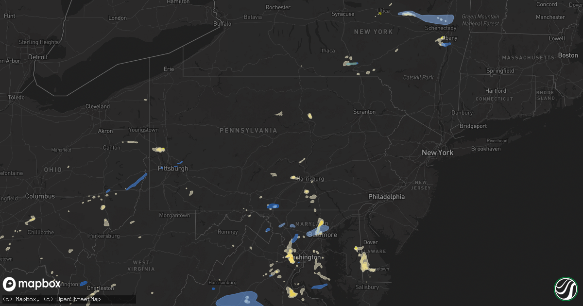
Hail Map in Pennsylvania on August 13, 2021
Get this storm
August 13 map
$229
one time, instant access
Download today. No call, no setup
Keep the $229
Bought the map and want the full workflow? Apply the entire $229 to a subscription within 7 days. None of it is wasted.
Every map, not just this one
This buys you this map. Subscription and you get every map we run, in the markets you choose from a few cities to whole states to nationwide. Plus real-time alerts the moment a storm fires.
Contact data
Name, contact info, occupancy, even credit band for addresses in the footprint. You go from where it hit to who to call.
Become the source they trust
Unlimited branding weather history reports on demand. You already have the documented answer ready for the property owner, and you are the one who showed up with it.
Property data and RoofTrace estimates
Pull up any address you have got, its value and the exact code rules for that jurisdiction, straight from One Click Code. Then RoofTrace estimates the squares, pitch, and roof value, priced the way you price.
Storm reports in Pennsylvania
Pennsylvania
| Date | Description |
|---|---|
| 08/13/20216:58 PM CDT | Report of multiple trees and power lines down. Time estimated based on radar. |
| 08/13/20216:57 PM CDT | Tree down. Time estimated from radar. |
| 08/13/20216:52 PM CDT | Report of numerous trees down in the area. Time estimated based on radar. |
| 08/13/20216:51 PM CDT | Several trees snapped in half |
| 08/13/20216:45 PM CDT | Report of severe large tree limbs lost in springdale township. |
| 08/13/20216:40 PM CDT | Trees down |
| 08/13/20216:39 PM CDT | Report of multiple trees and power lines down. Time estimated based on radar. |
| 08/13/20216:35 PM CDT | Report of branches and small trees downed by wind. |
| 08/13/20216:31 PM CDT | Tree down. Time estimated from radar. |
| 08/13/20216:31 PM CDT | Trees down in bullskin twp |
| 08/13/20216:29 PM CDT | Penndot reported tree down in hopewell along route 151. |
| 08/13/20216:28 PM CDT | Trees and wires down on route 268 just south of route 68 |
| 08/13/20216:23 PM CDT | Tree down in 100 block of green st |
| 08/13/20216:20 PM CDT | Trees down in independence twp |
| 08/13/20216:17 PM CDT | Report of house siding removed and trees damaged. |
| 08/13/20216:15 PM CDT | Tree limbs and power poles down |
| 08/13/20216:12 PM CDT | Report of a 40ft tree down near bellview circle. |
| 08/13/20216:10 PM CDT | Trees down in imperial |
| 08/13/20216:05 PM CDT | Numerous trees down in rostraver twp |
| 08/13/20216:03 PM CDT | Report of house siding removed and trees damaged. |
| 08/13/20216:03 PM CDT | Trees down |
| 08/13/20216:03 PM CDT | Report of trees down on twilight hollow road. Time estimated based on radar. |
| 08/13/20216:01 PM CDT | Trees and wires down |
| 08/13/20216:01 PM CDT | Report of numerous trees down in the area. Time estimated based on radar. |
| 08/13/20216:00 PM CDT | Numerous large trees down on grandview and gregg lane |
| 08/13/20215:53 PM CDT | Trees down |
| 08/13/20215:48 PM CDT | Report of numerous trees down in daugherty township. Time estimated based on radar. |
| 08/13/20215:48 PM CDT | Report of numerous trees down in the area. Time estimated based on radar. |
| 08/13/20215:48 PM CDT | Report of numerous trees down in the area. Time estimated based on radar. |
| 08/13/20215:45 PM CDT | Trees down along twilight hollow rd |
| 08/13/20215:29 PM CDT | Report of numerous trees down in the area. Time estimated based on radar. |
| 08/13/20215:19 PM CDT | Report of tree down in morris township. |
| 08/13/20215:00 PM CDT | Tree down on deerlick station road. Time estimated from radar. |
| 08/13/20214:52 PM CDT | Tree down on toms run road |
| 08/13/20214:49 PM CDT | Report of tree blocking toms run road near intersection of grinnage run road. |
| 08/13/20214:32 PM CDT | Trees down in penn township near the franklin township line. |
| 08/13/20214:27 PM CDT | Strong thunderstorm winds knocked down a tree onto the roadway. |
| 08/13/20214:20 PM CDT | Several trees down. |
| 08/13/20214:01 PM CDT | Multiple reports of trees and wires down in the vicinity of mill creek... Wolf... And penn townships. |
| 08/13/20213:50 PM CDT | Tree into a home. |
| 08/13/20213:50 PM CDT | Numerous trees down in the vicinity. |
| 08/13/20213:48 PM CDT | Wires down. |
| 08/13/20213:32 PM CDT | Wires down. |
| 08/13/20213:02 PM CDT | Roof blown off home. |
| 08/13/20213:00 PM CDT | Tree through the roof of a house. |
| 08/13/20213:00 PM CDT | Multiple trees down in the vicinity. |
| 08/13/20212:46 PM CDT | Tree damage causing multiple power outages in the area. |
| 08/13/20212:45 PM CDT | Trees and wires down. |
| 08/13/20212:24 PM CDT | Damage to regency woods north mobile home park and multiple trees down in the area. |
| 08/13/20211:45 PM CDT | Wires down. |
| 08/13/20211:42 PM CDT | Fort stouffer road closed due to at least 8 trees across the road. |
| 08/13/20211:40 PM CDT | Multiple reports of trees and wires down west of greencastle. |
| 08/13/20216:29 AM CDT | At 1129 PM EDT, a severe thunderstorm was located over Spring Mills, moving northeast at 30 mph. HAZARD...60 mph wind gusts. SOURCE...Radar indicated. IMPACT...Expect damage to roofs, siding, and trees. Locations impacted include... Woodward, Millheim, Aaronsburg, Rebersburg, Spring Mills, Coburn, Madisonburg, Poe Valley State Park and Potters Mills. |
| 08/13/20213:11 AM CDT | At 811 PM EDT, a severe thunderstorm was located over Leechburg, or near Vandergrift, moving northeast at 40 mph. HAZARD...60 mph wind gusts. SOURCE...Radar indicated. IMPACT...Expect damage to trees and power lines, resulting in some power outages. Locations impacted include... Vandergrift, Apollo, Lower Burrell, Harrison Township, Ford City, Leechburg, Freeport, North Apollo, West Leechburg, Orchard Hills, Rural Valley, and Oklahoma. |
| 08/13/20212:45 AM CDT | At 745 PM EDT, severe thunderstorms were located along a line extending from near Beaver Falls to near Zelienople to McCandless Township, moving north at 40 mph. HAZARD...60 mph wind gusts. SOURCE...Radar indicated. IMPACT...Damage to trees and power lines. Locations impacted include... McCandless Township, Cranberry, New Castle, Butler, Franklin Park, Beaver Falls, Monaca, Hampton Township, Economy, Ellwood City, Wexford, and Homeacre-Lyndora. |
| 08/13/20212:42 AM CDT | At 742 PM EDT, a severe thunderstorm was located over Verona, or over Penn Hills, moving east at 40 mph. HAZARD...60 mph wind gusts. SOURCE...Radar indicated. IMPACT...Expect damage to trees and power lines, resulting in some power outages. Locations impacted include... Pittsburgh, Penn Hills, Monroeville, Shaler Township, Plum, West Mifflin, Baldwin, Murrysville, Hampton Township, Wilkinsburg, New Kensington, and Lower Burrell. |
| 08/13/20212:37 AM CDT | At 737 PM EDT, a severe thunderstorm was located over Murrysville, or near Jeannette, moving northeast at 35 mph. HAZARD...60 mph wind gusts. SOURCE...Radar indicated. IMPACT...Expect damage to trees and power lines, resulting in some power outages. Locations impacted include... Greensburg, Jeannette, Latrobe, Vandergrift, Homer City, Apollo, Murrysville, Irwin, McChesneytown-Loyalhanna, Blairsville, Manor, and Trafford. |
| 08/13/20212:29 AM CDT | At 729 PM EDT, a severe thunderstorm was located near Mount Pleasant, or 9 miles northeast of Connellsville, moving northeast at 25 mph. HAZARD...60 mph wind gusts. SOURCE...Radar indicated. IMPACT...Expect damage to trees and power lines, resulting in some power outages. Locations impacted include... Latrobe, Mount Pleasant, Scottdale, McChesneytown-Loyalhanna, Derry, Lawson Heights, Ligonier, Calumet-Norvelt, Everson, Youngstown, Laurel Mountain, and Donegal. |
| 08/13/20212:27 AM CDT | At 727 PM EDT, a severe thunderstorm was located 11 miles east of Shanor-Northvue, or 11 miles southwest of Rimersburg, moving east at 20 mph. HAZARD...60 mph wind gusts. SOURCE...Radar indicated. IMPACT...Expect damage to trees and power lines, resulting in some power outages. Locations impacted include... Kittanning, Rimersburg, New Bethlehem, West Kittanning, Chicora, East Brady, West Hills, Applewold, Petrolia, Karns City, Templeton, and Distant. |
| 08/13/20212:22 AM CDT | At 722 PM EDT, a severe thunderstorm was located near Shippingport, or 9 miles southwest of Aliquippa, moving east at 35 mph. HAZARD...60 mph wind gusts. SOURCE...Radar indicated. IMPACT...Expect damage to trees and power lines, resulting in some power outages. Locations impacted include... Moon Township, Franklin Park, Aliquippa, Monaca, Robinson Township, Economy, Ambridge, Coraopolis, Beaver, Baden, Sewickley, and Rochester. |
| 08/13/20212:21 AM CDT | At 720 PM EDT, a severe thunderstorm was located over Stowe Township, or near Ross Township, moving east at 30 mph. HAZARD...60 mph wind gusts. SOURCE...Radar indicated. IMPACT...Expect damage to trees and power lines, resulting in some power outages. Locations impacted include... Pittsburgh, Penn Hills, Ross Township, McCandless Township, Monroeville, Franklin Park, Shaler Township, Plum, West Mifflin, North Side Pittsburgh, Baldwin, and Hampton Township. |
| 08/13/20212:11 AM CDT | At 710 PM EDT, a severe thunderstorm was located over Andover, or 19 miles west of Meadville, moving east at 25 mph. HAZARD...60 mph wind gusts and penny size hail. SOURCE...Radar indicated. IMPACT...Expect damage to trees and power lines. Locations impacted include... Meadville, Andover, Linesville, Harmonsburg, Pymatuning North, Pymatuning Central, Atlantic, Adamsville, Saegertown, Conneaut Lake, Conneaut Lakeshore, Geneva and Hartstown. |
| 08/13/20212:04 AM CDT | At 704 PM EDT, a severe thunderstorm was located over Imperial, or near Moon Township, moving east at 25 mph. HAZARD...60 mph wind gusts. SOURCE...Radar indicated. IMPACT...Expect damage to trees and power lines, resulting in some power outages. Locations impacted include... Pittsburgh, Mount Lebanon, Bethel Park, Ross Township, Shaler Township, North Side Pittsburgh, Scott Township, Whitehall, Robinson Township, Dormont, Bellevue, and Castle Shannon. |
| 08/13/20212:02 AM CDT | At 702 PM EDT, severe thunderstorms were located along a line extending from Donora to near South Connellsville, moving east at 25 mph. HAZARD...60 mph wind gusts. SOURCE...Radar indicated. IMPACT...Damage to trees and power lines. Locations impacted include... Greensburg, Jeannette, Connellsville, Monessen, California, Donora, Mount Pleasant, Scottdale, Charleroi, Youngwood, West Newton, and New Stanton. |
| 08/13/20212:01 AM CDT | At 701 PM EDT, a severe thunderstorm was located over Cranberry, moving southeast at 30 mph. HAZARD...60 mph wind gusts and quarter size hail. SOURCE...Radar indicated. IMPACT...Minor hail damage to vehicles is possible. Expect wind damage to trees and power lines, resulting in some power outages. Locations impacted include... Ross Township, McCandless Township, Cranberry, Franklin Park, Monaca, Shaler Township, Hampton Township, Economy, O'hara Township, Wexford, New Brighton, and Fox Chapel. |
| 08/13/20212:00 AM CDT | At 700 PM EDT, a severe thunderstorm was located over Cranberry, moving southeast at 30 mph. HAZARD...60 mph wind gusts and quarter size hail. SOURCE...Radar indicated. IMPACT...Minor hail damage to vehicles is possible. Expect wind damage to trees and power lines, resulting in some power outages. Locations impacted include... Ross Township, McCandless Township, Cranberry, Franklin Park, Beaver Falls, Monaca, Shaler Township, Hampton Township, Economy, O'hara Township, Wexford, and New Brighton. |
| 08/13/20211:56 AM CDT | At 656 PM EDT, a severe thunderstorm was located over Hooverson Heights, or near Wellsburg, moving northeast at 30 mph. HAZARD...60 mph wind gusts. SOURCE...Radar indicated. IMPACT...Expect damage to trees and power lines, resulting in some power outages. Locations impacted include... Weirton, Steubenville, Wellsburg, Avella, Wintersville, Mingo Junction, Follansbee, Hooverson Heights, Imperial, McDonald, Sturgeon-Noblestown, and Oakdale. |
| 08/13/20211:47 AM CDT | At 647 PM EDT, a severe thunderstorm was located over Beaver Falls, moving east at 20 mph. HAZARD...60 mph wind gusts. SOURCE...Radar indicated. IMPACT...Expect damage to trees and power lines, resulting in some power outages. Locations impacted include... Cranberry, Franklin Park, Aliquippa, Beaver Falls, Monaca, Economy, New Brighton, Beaver, Baden, Zelienople, Rochester, and Evans City. |
| 08/13/202112:29 AM CDT | At 529 PM EDT, severe thunderstorms were located along a line extending from near Muncy Valley to near Lairdsville, moving east at 25 mph. HAZARD...60 mph wind gusts and penny size hail. SOURCE...Radar indicated. IMPACT...Expect damage to roofs, siding, and trees. Locations impacted include... Muncy, Hughesville, Rohrsburg, Iola, Jamison City, Waller, Biggertown, Lairdsville, Central, Benton, Picture Rocks and Stillwater.This includes Interstate 180 from mile markers 11 to 13. |
| 08/12/202111:30 PM CDT | At 429 PM EDT, severe thunderstorms were located along a line extending from near Shunk to near Kettle Creek Gorge to near Barbours, moving east at 40 mph. HAZARD...60 mph wind gusts and penny size hail. SOURCE...Radar indicated. IMPACT...Expect damage to roofs, siding, and trees. Locations impacted include... Hughesville, Jamison City, Waller, Kettle Creek Gorge, Lairdsville, Ricketts Glen State Park, Central, Biggertown, Muncy Valley, Lincoln Falls, Barbours, Shunk, Loyalsockville, Benton, Picture Rocks, Dushore, Laporte, Stillwater, Forksville and Eagles Mere. |
| 08/12/202110:43 PM CDT | At 343 PM EDT, a severe thunderstorm was located over Wertzville, moving east at 20 mph. HAZARD...60 mph wind gusts and quarter size hail. SOURCE...Radar indicated. IMPACT...Hail damage to vehicles is expected. Expect wind damage to roofs, siding, and trees. Locations impacted include... Harrisburg, Lower Allen, Hershey, Colonial Park, Progress, Camp Hill, New Cumberland, Linglestown, Enola, Steelton, Lemoyne, Hummelstown, Paxtonia, Rutherford, Skyline View, Lawnton, Wormleysburg, Bressler-Enhaut-Oberlin, Penbrook and Marysville.This includes the following Interstates... Interstate 81 from mile markers 55 to 77. Interstate 83 from mile markers 41 to 50. Interstate 283 near mile marker 2. |
| 08/12/202110:35 PM CDT | At 335 PM EDT, a severe thunderstorm was located near Siddonsburg, moving northeast at 20 mph. HAZARD...60 mph wind gusts and quarter size hail. SOURCE...Radar indicated. IMPACT...Hail damage to vehicles is expected. Expect wind damage to roofs, siding, and trees. Locations impacted include... Weigelstown, Valley Green, Manchester, Dover, Mount Wolf, Goldsboro, York Haven, Franklintown, Lewisberry, Wellsville, Newberrytown, Capital City Airport and Ski Roundtop Ski Area.This includes the following Interstates... The Pennsylvania Turnpike from mile markers 243 to 245. Interstate 83 from mile markers 24 to 38. |
| 08/12/202110:22 PM CDT | At 322 PM EDT, a severe thunderstorm was located near Cammal, moving east at 25 mph. HAZARD...60 mph wind gusts and quarter size hail. SOURCE...Radar indicated. IMPACT...Hail damage to vehicles is expected. Expect wind damage to roofs, siding, and trees. Locations impacted include... English Center, Cammal, Little Pine State Park and Ski Sawmill Ski Area. |
| 08/12/202110:14 PM CDT | At 313 PM EDT, a severe thunderstorm was located over Carlisle Springs, moving east at 10 mph. HAZARD...60 mph wind gusts and half dollar size hail. SOURCE...Radar indicated. IMPACT...Hail damage to vehicles is expected. Expect wind damage to roofs, siding, and trees. Locations impacted include... Mechanicsburg, Schlusser, Duncannon, New Kingstown, Carlisle Springs, Wertzville, Hogestown and Shermansdale.This includes the following Interstates... The Pennsylvania Turnpike from mile markers 225 to 230. Interstate 81 from mile markers 50 to 63. |
| 08/12/202110:12 PM CDT | At 310 PM EDT, a severe thunderstorm was located near Carroll Valley, moving east at 30 mph. HAZARD...60 mph wind gusts and penny size hail. SOURCE...Radar indicated. IMPACT...Expect damage to roofs, siding, and trees. Locations impacted include... Chambersburg, Hanover, Waynesboro, Gettysburg, Greencastle, Hampton, Guilford, Littlestown, Carroll Valley, Fayetteville, McSherrystown, Wayne Heights, Bonneauville, New Oxford, Mont Alto, Lake Heritage, Rouzerville, Marion, Cashtown and Orrtanna.This includes Interstate 81 from mile markers 0 to 18. |
| 08/12/20218:43 PM CDT | At 143 PM EDT, a severe thunderstorm was located near Barnes Gap, or near Hancock, moving southeast at 10 mph. HAZARD...60 mph wind gusts and quarter size hail. SOURCE...Radar indicated. IMPACT...Damaging winds will cause some trees and large branches to fall. This could injure those outdoors, as well as damage homes and vehicles. Roadways may become blocked by downed trees. Localized power outages are possible. Unsecured light objects may become projectiles. Locations impacted include... Hancock, Berkeley Springs, Great Cacapon, Forest Park, Lineburg, Bellegrove, Berryville and Shady Grove. |
| 08/12/20217:12 PM CDT | Trees down around crooked creek park |
| 08/12/20217:09 PM CDT | Trees and branches down |
| 08/12/20217:00 PM CDT | Report of multiple trees and power lines down. Time estimated based on radar. |
All States Impacted by Hail Map on August 13, 2021
Cities Impacted by Hail Map on August 13, 2021
- Glen Aubrey, NY
- Whitney Point, NY
- Lisle, NY
- Dill City, OK
- Yellville, AR
- Lead Hill, AR
- Fort Mcdowell, AZ
- Pottsboro, TX
- Oakland, KY
- Chantilly, VA
- Centreville, VA
- Butler, OK
- Paden, OK
- Williamsport, OH
- New Holland, OH
- Prince Frederick, MD
- Catlett, VA
- Reston, VA
- Humboldt, TN
- Bells, TN
- Oklahoma City, OK
- Checotah, OK
- Pine Valley, UT
- New Harmony, UT
- Chandlersville, OH
- Willcox, AZ
- Foss, OK
- Cordell, OK
- Bessie, OK
- Corn, OK
- Rogers, AR
- Garfield, AR
- Cord, AR
- Windsor, NY
- Sweetwater, OK
- Booneville, AR
- Greensboro, MD
- Howard, OH
- Danville, OH
- Ash Fork, AZ
- Falls Church, VA
- China Grove, NC
- Mount Ulla, NC
- Sedona, AZ
- Stuttgart, AR
- Gould, OK
- Middlebourne, WV
- Sistersville, WV
- Pine, AZ
- Tappahannock, VA
- Saint Stephens Church, VA
- Phoenix, AZ
- Globe, AZ
- Miami, AZ
- Slingerlands, NY
- Voorheesville, NY
- South Charleston, WV
- Alum Creek, WV
- Chesapeake, OH
- Ballston Lake, NY
- Ballston Spa, NY
- Galway, NY
- McConnellsburg, PA
- Muskogee, OK
- Webbers Falls, OK
- Georgetown, DE
- Searchlight, NV
- New Blaine, AR
- Scranton, AR
- East Meredith, NY
- Davenport, NY
- Davenport Center, NY
- Oneonta, NY
- Crawfordsville, AR
- Proctor, AR
- Prescott, AR
- Covington, VA
- Hancock, MD
- Warfordsburg, PA
- Bedford, VA
- Great Falls, VA
- Fombell, PA
- New Brighton, PA
- Owings, MD
- Friendship, MD
- Dunkirk, MD
- Okmulgee, OK
- Haskell, OK
- Boynton, OK
- Morris, OK
- Colony, OK
- Valley Springs, AR
- Baltimore, MD
- Henderson, MD
- Goldsboro, MD
- Colorado City, AZ
- Wellsville, PA
- Dover, PA
- Bentonville, AR
- Zanesville, OH
- Peridot, AZ
- Mount Pleasant, NC
- Shermans Dale, PA
- Landisburg, PA
- Carlisle, PA
- Vinton, OH
- Bidwell, OH
- Langsville, OH
- Saint Johnsville, NY
- Congress, AZ
- Alderson, WV
- Meadow Bridge, WV
- Green Sulphur Springs, WV
- Salisbury, NC
- Dolgeville, NY
- Burnt Hills, NY
- Barnsdall, OK
- Black Canyon City, AZ
- Pine Bluff, AR
- Bowie, MD
- New Freedom, PA
- Glen Rock, PA
- Freeland, MD
- Witter, AR
- Eufaula, OK
- Barboursville, VA
- Gordonsville, VA
- Sod, WV
- Sumerco, WV
- Sayre, OK
- Elk City, OK
- Ogallala, NE
- Mountain Home, AR
- Vian, OK
- Mena, AR
- Rose, OK
- King George, VA
- Harrington, DE
- East Waterford, PA
- Blairs Mills, PA
- Orbisonia, PA
- Colonial Beach, VA
- Dillsburg, PA
- Covington, TN
- Eureka Springs, AR
- Mooresville, NC
- Keswick, VA
- Corning, NY
- Supai, AZ
- Williams, AZ
- Montoursville, PA
- Williamsport, PA
- Coalgate, OK
- Kingsport, TN
- Saint David, AZ
- Federalsburg, MD
- Denton, MD
- Greenwood, DE
- Paris, AR
- Subiaco, AR
- Grandin, MO
- Poplar Bluff, MO
- Bon Aqua, TN
- Burns, TN
- Arapaho, OK
- Gold Hill, NC
- Feura Bush, NY
- Selkirk, NY
- Coeymans Hollow, NY
- Rochester, PA
- Beaver Falls, PA
- Connellsville, PA
- Dunbar, PA
- Granite, OK
- Willow, OK
- Waverly, TN
- Hurricane Mills, TN
- Edmond, OK
- Lothian, MD
- Brandywine, MD
- Upper Marlboro, MD
- Centerville, TN
- Nunnelly, TN
- Lobelville, TN
- Central, UT
- Stigler, OK
- Mayer, AZ
- Mcalester, OK
- Decatur, AR
- Gravette, AR
- Franklin, TN
- Greencastle, PA
- Port Royal, VA
- Woodford, VA
- Rappahannock Academy, VA
- Fredericksburg, VA
- Potomac, MD
- Doniphan, MO
- Lascassas, TN
- Lebanon, TN
- Lutherville Timonium, MD
- Pikesville, MD
- Stevenson, MD
- Salem, OH
- Beloit, OH
- Washingtonville, OH
- Alliance, OH
- Damascus, OH
- Leetonia, OH
- Arlington, TN
- Eads, TN
- Sapulpa, OK
- Kiefer, OK
- Fairfax, VA
- Oakton, VA
- Vienna, VA
- Hillsboro, OH
- Herndon, VA
- Jenks, OK
- Glenpool, OK
- Newport, AR
- Newark Valley, NY
- Binghamton, NY
- Endicott, NY
- Johnson City, NY
- Maine, NY
- Leesburg, OH
- Willisburg, KY
- Lawrenceburg, KY
- Smiths Grove, KY
- Colcord, OK
- Gentry, AR
- Fisher, AR
- White Hall, AR
- Clinton, NY
- Nipton, CA
- York, PA
- Thomasville, PA
- Charleston, WV
- Golden, MO
- Eagle Rock, MO
- Seaford, DE
- Bridgeville, DE
- Cumberland, OH
- Belle Valley, OH
- Caldwell, OH
- Paulden, AZ
- Reydon, OK
- Peel, AR
- Marietta, OH
- Lowell, OH
- Whipple, OH
- Nanjemoy, MD
- Rockbridge Baths, VA
- Goshen, VA
- Bunch, OK
- Waynesboro, PA
- Glenwood, MD
- Dayton, MD
- Glenelg, MD
- Ravena, NY
- Andover, OH
- Weiner, AR
- Fountain Hills, AZ
- Gladstone, VA
- Wingina, VA
- Sheffield, AL
- Kirkwood, NY
- Conklin, NY
- Paris, KY
- Warner, OK
- Gore, OK
- Gwynn Oak, MD
- Phoenix, MD
- Cockeysville, MD
- Sparks Glencoe, MD
- Hunt Valley, MD
- Sterling, VA
- Boyds, MD
- Springfield, VA
- Poolesville, MD
- Fairfax Station, VA
- Ashburn, VA
- Germantown, MD
- Burke, VA
- Annandale, VA
- Clarksburg, MD
- Seminole, TX
- Payson, AZ
- Hope, AR
- Harrison, AR
- New Cumberland, PA
- Harrisburg, PA
- Marydel, DE
- Camden Wyoming, DE
- Felton, DE
- Carter, OK
- Sentinel, OK
- Bardstown, KY
- Garrett, WY
- Greenfield, OH
- Clarksburg, OH
- New Concord, OH
- Norwich, OH
- Albany, NY
- Delmar, NY
- East Berne, NY
- Clarksville, NY
- Blue Rock, OH
- Duncan Falls, OH
- Laurel, MD
- Glenn Dale, MD
- Quaker City, OH
- Adamsville, TN
- Cedar City, UT
- Keystone, NE
- Gaithersburg, MD
- Gainesville, VA
- Haymarket, VA
- Ripley, MS
- Blue Mountain, MS
- Palmyra, VA
- Scottsville, VA
- Wardensville, WV
- Midland, VA
- Nokesville, VA
- Warrenton, VA
- Bealeton, VA
- Brownsville, TN
- Brighton, TN
- Little Falls, NY
- Gambrills, MD
- Davidsonville, MD
- Trout Run, PA
- Wynne, AR
- Cherry Valley, AR
- Mercersburg, PA
- Stephens City, VA
- Saint Joe, AR
- Linden, TN
- Mangum, OK
- Spring Grove, PA
- East Berlin, PA
- Rosedale, MS
- Bella Vista, AR
- Hiwasse, AR
- Peach Springs, AZ
- Choctaw, OK
- Harrah, OK
- Bethany, OK
- Jones, OK
- Spencer, OK
- Ashford, WV
- Columbia, VA
- Cartersville, VA
- Dickson, TN
- Hazen, AR
- Cammal, PA
- Lock Haven, PA
- North Bend, PA
- Belmont, OH
- Flushing, OH
- Salina, OK
- Everton, AR
- Cheyenne, OK
- Ranger, WV
- Branchland, WV
- Cambridge, OH
- Clinton, OK
- Dahlgren, VA
- Windsor Mill, MD
- Towson, MD
- Catonsville, MD
- Monkton, MD
- Town Creek, AL
- Buckingham, VA
- Depew, OK
- Erick, OK
- Mesa, AZ
- Clendenin, WV
- Lebanon Junction, KY
- Boston, KY
- Monroe, MI
- Ashland, VA
- Berkeley Springs, WV
- Great Cacapon, WV
- Church Hill, TN
- Wheeler, TX
- Shamrock, TX
- McRae, AR
- Locust Grove, OK
- Rimrock, AZ
- Pleasant City, OH
- Millerstown, PA
- Liverpool, PA
- Scottdale, PA
- Dawson, PA
- Mounds, OK
- Poland, NY
- Newport, NY
- Fort Plain, NY
- Jeffersonton, VA
- Remington, VA
- Harrisonburg, VA
- Broad Run, VA
- White Bluff, TN
- Falkner, MS
- Ashland, MS
- Richwood, WV
- Claypool, AZ
- Mount Sterling, OH
- Washington Court House, OH
- Norfork, AR
- Vernon, TX
- Cave Springs, AR
- Charles Town, WV
- Ranson, WV
- Kearneysville, WV
- Denmark, TN
- Jackson, TN
- Stafford, VA
- Kitts Hill, OH
- Ironton, OH
- Lawrenceburg, TN
- Leoma, TN
- Artemas, PA
- Clarksville, TX
- Tulsa, OK
- San Carlos, AZ
- Sardinia, OH
- Winchester, OH
- Zelienople, PA
- Beaver, PA
- Darlington, PA
- Berryville, AR
- Roosevelt, AZ
- Lyles, TN
- Lore City, OH
- Byesville, OH
- Salesville, OH
- Senecaville, OH
- Port Republic, MD
- Aquasco, MD
- Huntingtown, MD
- Porum, OK
- Murphy, NC
- Lorton, VA
- Meridianville, AL
- Huntsville, AL
- Selmer, TN
- Bethel Springs, TN
- Altus Afb, OK
- Altus, OK
- Kansas, OK
- Jasper, AR
- Crowell, TX
- Junction City, OH
- Sevierville, TN
- Bosler, WY
- Edgewater, MD
- Harwood, MD
- Seven Valleys, PA
- Idabel, OK
- Denison, TX
- Dawson, GA
- Charlottesville, VA
- Rattan, OK
- Lone Wolf, OK
- Delmar, MD
- Delmar, DE
- Decatur, AL
- Trinity, AL
- Humphrey, AR
- Arnett, OK
- Sugar Tree, TN
- Harts, WV
- Julian, WV
- Danville, WV
- Huntsville, AR
- Waldorf, MD
- Ruther Glen, VA
- Cedarcreek, MO
- Smyrna, TN
- Murfreesboro, TN
- Rio Rico, AZ
- Painted Post, NY
- Deposit, NY
- Christiansburg, VA
- Riner, VA
- Lucasville, OH
- Burbank, OK
- Alexandria, VA
- Fort Belvoir, VA
- Brandy Station, VA
- Rixeyville, VA
- Lowell, AR
- Wellston, OK
- Mcloud, OK
- Meeker, OK
- Broken Arrow, OK
- Lemoyne, NE
- Lebanon, KY
- Roseville, OH
- Pedro, OH
- Macon, GA
- Atwood, TN
- Hillsboro, AL
- Manchester, MD
- Watertown, TN
- Concord, NC
- Griffithsville, WV
- Alkol, WV
- Yawkey, WV
- Fayetteville, OH
- Lynchburg, OH
- Midland, OH
- Blanchester, OH
- Bixby, OK
- Camp Verde, AZ
- Pawnee, OK
- Mason, TN
- Prague, OK
- Laurel, DE
- Sandstone, WV
- Ashland, KY
- Mount Judea, AR
- Savanna, OK
- Laveen, AZ
- Kiahsville, WV
- West Union, WV
- New Milton, WV
- Mount Solon, VA
- Bridgewater, VA
- Aroda, VA
- Kents Store, VA
- Rochelle, VA
- Mineral, VA
- North Garden, VA
- Grottoes, VA
- Greenwood, VA
- Staunton, VA
- Maidens, VA
- Henrico, VA
- Crimora, VA
- Ruckersville, VA
- Fork Union, VA
- Stanardsville, VA
- Bumpass, VA
- Sandy Hook, VA
- Earlysville, VA
- Dyke, VA
- Glen Allen, VA
- Fishersville, VA
- Rockville, VA
- Oilville, VA
- Crozet, VA
- Powhatan, VA
- Afton, VA
- Free Union, VA
- Stuarts Draft, VA
- Manakin Sabot, VA
- Goochland, VA
- Orange, VA
- Radiant, VA
- Louisa, VA
- Waynesboro, VA
- Crozier, VA
- Lyndhurst, VA
- State Farm, VA
- Somerset, VA
- Troy, VA
- Gum Spring, VA
- Montpelier, VA
- Herkimer, NY
- Round Lake, NY
- Schenectady, NY
- Rexford, NY
- Amsterdam, NY
- Schuylerville, NY
- Fort Hunter, NY
- Mechanicville, NY
- Pattersonville, NY
- Hagaman, NY
- Clifton Park, NY
- Broadalbin, NY
- Saratoga Springs, NY
- Fort Johnson, NY
- Stillwater, NY
- Schaghticoke, NY
- Tribes Hill, NY
- Gloversville, NY
- Johnstown, NY
- Fonda, NY
- Chenango Forks, NY
- Castle Creek, NY
- Port Crane, NY
- Glenmont, NY
- Castleton On Hudson, NY
- Hurricane, WV
- Winfield, WV
- Culloden, WV
- Scott Depot, WV
- Frederick, MD
- Middletown, MD
- Walkersville, MD
- New Market, MD
- Mount Airy, MD
- Union Bridge, MD
- Owings Mills, MD
- Parkville, MD
- Nottingham, MD
- Sykesville, MD
- Glen Arm, MD
- Marriottsville, MD
- Woodstock, MD
- Perry Hall, MD
- Randallstown, MD
- Rosedale, MD
- Ellicott City, MD
- West Friendship, MD
- Damascus, MD
- Montgomery Village, MD
- Loveville, MD
- Saint Leonard, MD
- Leonardtown, MD
- Clements, MD
- Chaptico, MD
- Mechanicsville, MD
- Hollywood, MD
- Broomes Island, MD
- Duke, OK
- Hollis, OK
- Wickenburg, AZ
- Crown King, AZ
- Aguila, AZ
- Morristown, AZ
- Scottsdale, AZ
- Apache Junction, AZ
- Gold Canyon, AZ
- New Hartford, NY
- Sauquoit, NY
- Old Washington, OH
- Follansbee, WV
- Cadiz, OH
- Dillonvale, OH
- Brilliant, OH
- Colliers, WV
- Adena, OH
- Saint Clairsville, OH
- Mount Pleasant, OH
- Rayland, OH
- Mingo Junction, OH
- Chambersburg, PA
- Harpers Ferry, WV
- Shepherdstown, WV
- Shenandoah Junction, WV
- Oakdale, PA
- Coraopolis, PA
- Imperial, PA
- Pittsburgh, PA
- Verona, PA
- Oakmont, PA
- Cheswick, PA
- New Kensington, PA
- Tarentum, PA
- Springdale, PA


