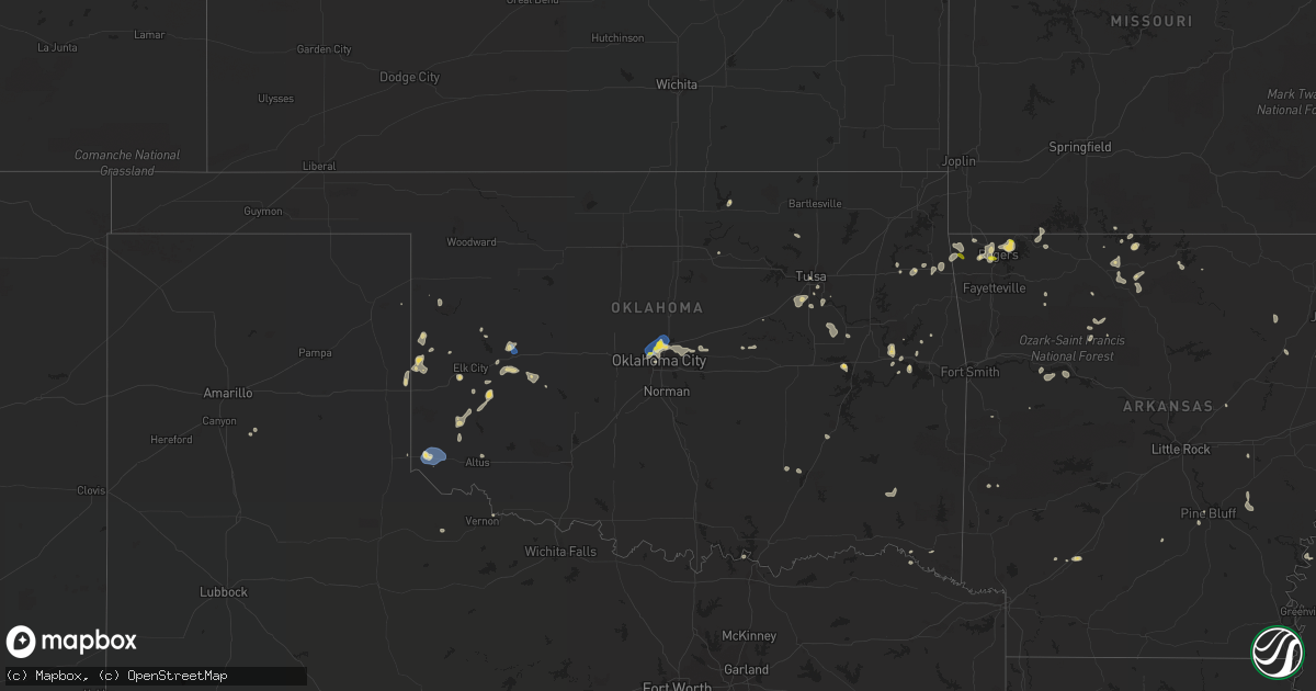
Hail Map on August 13, 2021
Get this storm
August 13 map
$229
one time, instant access
Download today. No call, no setup
Keep the $229
Bought the map and want the full workflow? Apply the entire $229 to a subscription within 7 days. None of it is wasted.
Every map, not just this one
This buys you this map. Subscription and you get every map we run, in the markets you choose from a few cities to whole states to nationwide. Plus real-time alerts the moment a storm fires.
Contact data
Name, contact info, occupancy, even credit band for addresses in the footprint. You go from where it hit to who to call.
Become the source they trust
Unlimited branding weather history reports on demand. You already have the documented answer ready for the property owner, and you are the one who showed up with it.
Property data and RoofTrace estimates
Pull up any address you have got, its value and the exact code rules for that jurisdiction, straight from One Click Code. Then RoofTrace estimates the squares, pitch, and roof value, priced the way you price.
States Impacted by Hail Map on August 13, 2021
Storm reports
Oklahoma
| Date | Description |
|---|---|
| 08/13/20214:50 PM CDT | Large limbs down. Relayed via social media pictures. |
| 08/13/20213:55 PM CDT | Powerlines downed i-35 and memorial rd. Radar estimated time. |
| 08/13/20213:46 PM CDT | A local report indicates 60 MPH wind near EDMOND |
| 08/13/20213:45 PM CDT | Tree limbs downed. Power pole damaged. Covered porch damaged. |
| 08/13/20213:40 PM CDT | Power pole damage at nw 50th and meridian. |
| 08/13/20213:25 PM CDT | A local report indicates 64 MPH wind near 3 W GOULD |
| 08/13/20212:51 AM CDT | At 751 PM CDT, a severe thunderstorm was located near Cloud Chief, moving north at 20 mph. HAZARD...60 mph wind gusts and nickel size hail. SOURCE...Radar indicated. IMPACT...Expect damage to roofs, siding, and trees. Locations impacted include... Weatherford, Carnegie, Hydro, Mountain View, Corn, Eakly, Colony, Alfalfa, Cloud Chief, Fort Cobb Reservoir and Cowden. |
| 08/13/20212:27 AM CDT | At 727 PM CDT, severe thunderstorms were located along a line extending from near Arapaho to 4 miles east of Burns Flat, moving southeast at 5 mph. HAZARD...60 mph wind gusts and quarter size hail. SOURCE...Radar indicated. IMPACT...Hail damage to vehicles is expected. Expect wind damage to roofs, siding, and trees. Locations impacted include... Clinton, Cordell, Burns Flat, Arapaho, Dill City, Custer City, Bessie, Foss, Foss Reservoir and Stafford. |
| 08/13/20211:54 AM CDT | At 654 PM CDT, a severe thunderstorm was located near Sentinel, moving north at 10 mph. HAZARD...60 mph wind gusts and quarter size hail. SOURCE...Radar indicated. IMPACT...Hail damage to vehicles is expected. Expect wind damage to roofs, siding, and trees. Locations impacted include... Burns Flat, Sentinel, Dill City and Canute. |
| 08/13/20211:53 AM CDT | At 653 PM CDT, a severe thunderstorm was located 7 miles east of Sayre, and is nearly stationary. HAZARD...60 mph wind gusts and quarter size hail. SOURCE...Radar indicated. IMPACT...Hail damage to vehicles is expected. Expect wind damage to roofs, siding, and trees. Locations impacted include... Elk City. |
| 08/13/20211:17 AM CDT | At 617 PM CDT, a severe thunderstorm was located near Texola, or 12 miles east of Shamrock, moving south at 15 mph. HAZARD...60 mph wind gusts and quarter size hail. SOURCE...Radar indicated. IMPACT...Minor damage to roofs, siding, and trees is possible. Hail damage to vehicles is expected. Locations impacted include... Lutie. |
| 08/13/202112:10 AM CDT | At 510 PM CDT, a severe thunderstorm was located 4 miles northwest of Granite, moving northeast at 10 mph. HAZARD...60 mph wind gusts and nickel size hail. SOURCE...Radar indicated. IMPACT...Expect damage to roofs, siding, and trees. Locations impacted include... Mangum, Granite, Lone Wolf, Willow, Brinkman and Altus-Lugert Lake. |
| 08/12/202110:43 PM CDT | At 342 PM CDT, severe thunderstorms were located along a line extending from 6 miles north of Meeker to 5 miles northeast of Harrah to near Oklahoma City to 3 miles northeast of The Village, and are nearly stationary. HAZARD...60 mph wind gusts and nickel size hail. SOURCE...Radar indicated. IMPACT...Expect damage to roofs, siding, and trees. Locations impacted include... Northeastern Oklahoma City, Edmond, Midwest City, Shawnee, Del City, Chandler, Choctaw, The Village, Harrah, McLoud, Spencer, Nichols Hills, Jones, Nicoma Park, Prague, Luther, Meeker, Wellston, Arcadia and Sparks. |
| 08/12/202110:20 PM CDT | At 319 PM CDT, a severe thunderstorm was located near Warr Acres, and is nearly stationary. HAZARD...60 mph wind gusts and nickel size hail. SOURCE...Radar indicated. IMPACT...Expect damage to roofs, siding, and trees. Locations impacted include... Oklahoma City, Del City, Yukon, Bethany, Warr Acres, The Village, Nichols Hills, Valley Brook, Forest Park, Woodlawn Park, Lake Aluma and Smith Village. |
| 08/12/20218:00 PM CDT | Power poles down along highway 183 n of county road east-west 1020. |
| 08/12/20217:47 PM CDT | A local report indicates 58 MPH wind near 1 N CLINTON |
| 08/12/20217:35 PM CDT | A local report indicates 63 MPH wind near 3 NE CLINTON |
Arizona
| Date | Description |
|---|---|
| 08/13/20216:43 AM CDT | At 1143 PM MST, severe thunderstorms were located along a line extending from 15 miles southeast of Vicksburg Junction to 13 miles north of Sundad, moving southwest at 35 mph. HAZARD...60 mph wind gusts and penny size hail. SOURCE...Radar indicated. IMPACT...Expect damage to roofs, siding, and trees. Locations impacted include... Palm Canyon.This includes the following highways...AZ Interstate 10 between mile markers 41 and 78.US Highway 60 between mile markers 48 and 49. |
| 08/13/20216:31 AM CDT | At 1131 PM MST, a severe thunderstorm was located near San Carlos, or 22 miles east of Globe, moving west at 35 mph. HAZARD...60 mph wind gusts and penny size hail. SOURCE...Radar indicated. IMPACT...Expect damage to roofs, siding, and trees. Locations impacted include... Globe, San Carlos and Cutter. This includes the following highways...US Highway 60 between mile markers 252 and 261.AZ Route 70 between mile markers 253 and 271.AZ Route 77 between mile markers 165 and 170. |
| 08/13/20216:01 AM CDT | At 1100 PM MST, severe thunderstorms were located along a line extending from 14 miles south of Alamo Lake State Park to near Wenden to 13 miles south of Gladden to 11 miles northwest of Tonopah, moving southwest at 60 mph. HAZARD...70 mph wind gusts and penny size hail. SOURCE...Radar indicated. IMPACT...Expect considerable tree damage. Damage is likely to mobile homes, roofs, and outbuildings. Locations impacted include... Quartzsite, Salome, Aguila, Brenda, Vicksburg Junction, Wenden, Kofa Wildlife Refuge, Vicksburg, Bouse, Gladden, Harcuvar and Palm Canyon.This includes the following highways...AZ Interstate 10 between mile markers 6 and 88.US Highway 60 between mile markers 31 and 85.AZ Route 72 between mile markers 25 and 49. |
| 08/13/20215:44 AM CDT | At 1043 PM MST, severe thunderstorms were located along a line extending from Saguaro Lake to Goldfield to near Gold Canyon, moving southwest at 45 mph. HAZARD...70 mph wind gusts and nickel size hail. SOURCE...Radar indicated. IMPACT...Expect considerable tree damage. Damage is likely to mobile homes, roofs, and outbuildings. Locations impacted include... Phoenix, Mesa, Chandler, Scottsdale, Gilbert, Tempe, Apache Junction, Fountain Hills, Paradise Valley, Superior, Roosevelt, East Mesa, Gold Canyon, Sugarloaf Mountain and Sun Lakes.This includes the following highways...AZ Interstate 10 between mile markers 144 and 186.AZ Interstate 17 between mile markers 195 and 197.AZ Route 51 between mile markers 1 and 15. |
| 08/13/20215:24 AM CDT | At 1023 PM MST, severe thunderstorms were located along a line extending from 18 miles east of Alamo Lake State Park to near Aguila to 9 miles east of Gladden to 18 miles north of Tonopah, moving southwest at 45 mph. HAZARD...60 mph wind gusts and penny size hail. SOURCE...Radar indicated. IMPACT...Expect damage to roofs, siding, and trees. Locations impacted include... Alamo Lake State Park, Salome, Aguila, Vicksburg Junction, Wenden, Vicksburg, Gladden and Harcuvar.This includes the following highways...AZ Interstate 10 between mile markers 44 and 78.US Highway 60 between mile markers 41 and 97.AZ Route 72 between mile markers 39 and 49. |
| 08/13/20215:16 AM CDT | At 1016 PM MST, a severe thunderstorm was located over Metro Center Mall, or near Glendale, moving west at 20 mph. HAZARD...60 mph wind gusts and nickel size hail. SOURCE...Radar indicated. IMPACT...Expect damage to roofs, siding, and trees. Locations impacted include... Phoenix, Glendale, Tempe, Peoria, Surprise, Avondale, Goodyear, Buckeye, El Mirage, Paradise Valley, Tolleson, Youngtown, Sun City West, Waddell and Laveen.This includes the following highways...AZ Interstate 10 between mile markers 112 and 157.AZ Interstate 17 between mile markers 195 and 223.AZ Route 51 between mile markers 1 and 12. |
| 08/13/20214:58 AM CDT | At 957 PM MST, severe thunderstorms were located along a line extending from 6 miles north of Roosevelt to 6 miles east of Tonto National Monument to 8 miles north of Claypool, moving west at 35 mph. HAZARD...70 mph wind gusts and penny size hail. SOURCE...Radar indicated. IMPACT...Expect considerable tree damage. Damage is likely to mobile homes, roofs, and outbuildings. Locations impacted include... Ballantine Trailhead, Sugarloaf Mountain, Roosevelt, Canyon Lake, Tonto National Monument, Four Peaks, Roosevelt Dam, Apache Lake, Tonto Basin, Roosevelt Estates and Tortilla Flat.This includes the following highways...AZ Route 87 between mile markers 201 and 211.AZ Route 188 between mile markers 220 and 256. |
| 08/13/20214:54 AM CDT | At 954 PM MST, a severe thunderstorm was located near Fountain Hills, moving west at 20 mph. HAZARD...60 mph wind gusts and nickel size hail. SOURCE...Radar indicated. IMPACT...Expect damage to roofs, siding, and trees. Locations impacted include... Phoenix, Mesa, Scottsdale, Tempe, Fountain Hills, Paradise Valley, Sugarloaf Mountain, Ballantine Trailhead, Papago Park, Piestewa Peak Park, Deer Valley Airport, Granite Reef Dam, Falcon Field Airport, Salt River Indian Community and North Mountain Park.This includes the following highways...AZ Route 51 between mile markers 6 and 15.AZ Route 87 between mile markers 176 and 211.AZ Route 202 between mile markers 3 and 7, and between mile markers12 and 24. |
| 08/13/20214:43 AM CDT | At 943 PM MST, a severe thunderstorm was located near Yarnell, or 13 miles north of Wickenburg, moving west at 40 mph. HAZARD...60 mph wind gusts. SOURCE...Radar indicated. IMPACT...Expect damage to roofs, siding, and trees. Locations impacted include... Congress, Walnut Grove, Wagoner, Yarnell, Peeples Valley and Glen Ilah. |
| 08/13/20214:41 AM CDT | **delayed report** county flood gage at buckeye rd/agua fria river exceeded alarm stage |
| 08/13/20214:38 AM CDT | At 938 PM MST, severe thunderstorms were located along a line extending from near Walnut Grove to 11 miles west of Castle Hot Springs to 6 miles west of Lake Pleasant, moving west at 35 mph. HAZARD...60 mph wind gusts and nickel size hail. SOURCE...Radar indicated. IMPACT...Expect damage to roofs, siding, and trees. Locations impacted include... Wickenburg, Wittmann, Circle City, Morristown, Aguila and Lake Pleasant.This includes the following highways...US Highway 60 between mile markers 83 and 131.AZ Route 74 between mile markers 1 and 20. |
| 08/13/20214:19 AM CDT | At 917 PM MST, multiple severe thunderstorms were located from Fountain Hills east to Lake Roosevelt, moving west at 15 mph. HAZARD...60 mph wind gusts and nickel size hail. SOURCE...Radar indicated. IMPACT...Expect damage to roofs, siding, and trees. Locations impacted include... Scottsdale, Fountain Hills, Round Valley, Sugarloaf Mountain, Ballantine Trailhead, Roosevelt, Granite Reef Dam, Punkin Center, McDowell Mountain Park, Roosevelt Dam, Saguaro Lake, Canyon Lake, Tonto Basin, Tonto National Monument and Goldfield Ranch.This includes the following highways...AZ Route 87 between mile markers 182 and 218.AZ Route 188 between mile markers 234 and 261. |
| 08/13/20214:03 AM CDT | At 902 PM MST, a severe thunderstorm was located 8 miles south of Walker, moving west at 35 mph. HAZARD...60 mph wind gusts. SOURCE...Radar indicated. IMPACT...Expect damage to roofs, siding, and trees. Locations impacted include... Walnut Grove, Crown King, Wagoner, Yarnell, Peeples Valley, Turney Gulch Group Campground and Hazlett Hollow Campground. |
| 08/13/20214:03 AM CDT | At 903 PM MST, severe thunderstorms were located along a line extending from near Crown King to near Rock Springs to near New River, moving west at 35 mph. HAZARD...60 mph wind gusts and quarter size hail. SOURCE...Radar indicated. IMPACT...Hail damage to vehicles is expected. Expect wind damage to roofs, siding, and trees. Locations impacted include... New River, Cave Creek, Carefree, Lake Pleasant, Desert Mountain, Camp Creek, Anthem and Seven Springs.This includes the following highways...AZ Interstate 17 between mile markers 225 and 241.AZ Route 74 between mile markers 8 and 26. |
| 08/13/20213:38 AM CDT | At 838 PM MST, a severe thunderstorm was located near Cordes Lakes, or 18 miles southwest of Camp Verde, moving west at 25 mph. HAZARD...60 mph wind gusts. SOURCE...Radar indicated. IMPACT...Expect damage to roofs, siding, and trees. Locations impacted include... Camp Verde, Cordes Junction, Bumble Bee, Cordes Lakes, Black Canyon City, Rock Springs, Cordes, Spring Valley, Childs Power Plant and Clear Creek Campgrounds. |
| 08/13/20213:09 AM CDT | At 809 PM MST, a severe thunderstorm was located 8 miles northwest of Hualapai Reservation, moving west at 10 mph. HAZARD...Half dollar size hail. SOURCE...Radar indicated. IMPACT...Damage to vehicles is expected. Locations impacted include... Hualapai Reservation. |
| 08/13/20212:39 AM CDT | At 738 PM MST, a severe thunderstorm was located near Pine, or 8 miles northwest of Payson, moving west at 10 mph. HAZARD...Quarter size hail. SOURCE...Radar indicated. IMPACT...Damage to vehicles is expected. Locations impacted include... Tonto Natural Bridge State Park. |
| 08/13/20212:00 AM CDT | At 659 PM MST, a severe thunderstorm was located 11 miles south of Diamond M Ranch, moving west at 15 mph. HAZARD...Quarter size hail. SOURCE...Radar indicated. IMPACT...Damage to vehicles is expected. Locations impacted include... Cross Mountain. |
| 08/13/20211:44 AM CDT | ***delayed report*** five transmission towers were knocked over by strong winds. |
| 08/13/20211:40 AM CDT | At 640 PM MST, a severe thunderstorm was located over Benson, moving southwest at 20 mph. HAZARD...60 mph wind gusts and penny size hail. SOURCE...Radar indicated. IMPACT...Expect damage to roofs, siding, and trees. Locations impacted include... Benson, Vail, St. David, Kartchner Caverns State Park and Mescal. |
| 08/13/20211:35 AM CDT | Post-event report from friday evening. Adot reported sr 89 closed in both directions south of prescott due to fallen trees at milepost 308. Closure reported via twitter |
| 08/13/20211:18 AM CDT | At 618 PM MST, a severe thunderstorm was located 11 miles southwest of Seligman, moving west at 15 mph. HAZARD...Half dollar size hail. SOURCE...Radar indicated. IMPACT...Damage to vehicles is expected. Locations impacted include... Cross Mountain. |
| 08/13/20211:09 AM CDT | At 608 PM MST, a severe thunderstorm was located 8 miles northeast of Rose Well, moving northwest at 10 mph. HAZARD...Quarter size hail. SOURCE...Radar indicated. IMPACT...Damage to vehicles is expected. Locations impacted include... Rose Well and Hualapai Reservation. |
| 08/13/20211:05 AM CDT | At 605 PM MST, severe thunderstorms were located along a line extending from 14 miles southwest of Willcox to near Dragoon to 6 miles east of Pearce-Sunsites, moving southwest at 15 mph. HAZARD...60 mph wind gusts and penny size hail. SOURCE...Radar indicated. IMPACT...Expect damage to roofs, siding, and trees. Locations impacted include... Dragoon, Pearce-Sunsites, Cochise and Texas Canyon. |
| 08/13/20211:00 AM CDT | ***delayed report***20-30 trees and a few saguaro cacti down or broken along brown and ellsworth. Time of 55-65 mph winds estimated by radar. |
| 08/13/202112:55 AM CDT | Mesonet station srp32 near durango and 27th ave. |
| 08/13/202112:55 AM CDT | ***delayed report*** 40 foot tree fell through a 5 foot cinderblock wall and onto a chicken coop. No injuries reported. Winds estimated 55 to 65 mph. Time estimated fro |
| 08/13/202112:52 AM CDT | ***delayed report***public report confirmed by police that road was blocked by downed power lines at south 83rd avenue and west broadway. Time of damage estimated by ra |
| 08/13/202112:41 AM CDT | At 540 PM MST, a severe thunderstorm was located 14 miles south of Seligman, moving southwest at 20 mph. HAZARD...Quarter size hail. SOURCE...Radar indicated. IMPACT...Damage to vehicles is expected. This severe thunderstorm will remain over mainly rural areas of Yavapai County about 15 miles south of Seligman. |
| 08/13/202112:23 AM CDT | ***delayed report***multiple reports of mature trees down at apartment complex and roof awning damage near 19th avenue between union hills and thunderbird. Time of 55-6 |
| 08/13/202112:14 AM CDT | At 513 PM MST, a severe thunderstorm was located 10 miles north of Top-Of-The-World, or 13 miles southeast of Roosevelt, moving west at 30 mph. HAZARD...60 mph wind gusts and quarter size hail. SOURCE...Radar indicated. IMPACT...Hail damage to vehicles is expected. Expect wind damage to roofs, siding, and trees. Locations impacted include... Roosevelt, Canyon Lake, Superstition Mountains, Tonto National Monument, Four Peaks, Roosevelt Dam, Lost Dutchman State Park, Goldfield, Apache Lake, Top-Of-The-World and Tortilla Flat.This includes AZ Route 188 between mile markers 226 and 246. |
| 08/13/202112:00 AM CDT | Mesonet station qsta3 stanton estimated winds 60 mph. |
| 08/12/202111:55 PM CDT | 60 mph gust measured from home weather station. |
| 08/12/202111:43 PM CDT | Thunderstorm wind gusts estimated between 50mph and 60mph. Tree branches down in area. |
| 08/12/202111:43 PM CDT | At 443 PM MST, a severe thunderstorm was located over Rio Rico, or 9 miles southeast of Tubac, moving southwest at 5 mph. HAZARD...60 mph wind gusts and quarter size hail. SOURCE...Radar indicated. IMPACT...Hail damage to vehicles is expected. Expect wind damage to roofs, siding, and trees. Locations impacted include... Rio Rico. |
| 08/12/202111:40 PM CDT | Mesonet station qhba3 humbug creek raws. |
| 08/12/202111:34 PM CDT | At 433 PM MST, a severe thunderstorm was located over Claypool, or near Globe, moving west at 15 mph. HAZARD...60 mph wind gusts and quarter size hail. SOURCE...Radar indicated. IMPACT...Hail damage to vehicles is expected. Expect wind damage to roofs, siding, and trees. Locations impacted include... Globe, Superior, Miami, Central Heights-Midland City, Top-Of-The-World, Claypool and Inspiration.This includes the following highways...US Highway 60 between mile markers 227 and 255.AZ Route 70 between mile markers 253 and 257.AZ Route 77 between mile markers 168 and 170. |
| 08/12/202110:30 PM CDT | At 330 PM MST, a severe thunderstorm was located near San Carlos, or 21 miles east of Globe, moving southwest at 5 mph. HAZARD...60 mph wind gusts and nickel size hail. SOURCE...Radar indicated. IMPACT...Expect damage to roofs, siding, and trees. Locations impacted include... Globe, San Carlos and Cutter. This includes the following highways...US Highway 60 between mile markers 254 and 259.AZ Route 70 between mile markers 256 and 271. |
| 08/12/202110:30 PM CDT | At 330 PM MST, a severe thunderstorm was located over San Carlos, or 18 miles east of Globe, moving southwest at 10 mph. HAZARD...60 mph wind gusts and nickel size hail. SOURCE...Radar indicated. IMPACT...Expect damage to roofs, siding, and trees. Locations impacted include... San Carlos Reservoir. |
California
| Date | Description |
|---|---|
| 08/13/20216:22 PM CDT | Peak wind gust of 60 mph associated with a thunderstorm at approximately 422 pm measured at mid hills ca. Sustained winds with the observation were 7 mph from the wnw. |
| 08/13/20214:16 PM CDT | Peak wind gust of 61 mph reported at 216 pm and 221 pm with a thunderstorm near moore... Ca. Sustained winds with the observations were 61 mph from the wnw and 33 mph f |
| 08/12/202111:55 PM CDT | At 454 PM PDT, a severe thunderstorm was located 11 miles south of Mitchell Caverns, moving south at 65 mph. HAZARD...60 mph wind gusts and quarter size hail. SOURCE...Radar indicated. IMPACT...Hail damage to vehicles is expected. Expect wind damage to roofs and trees. Locations impacted include... Mitchell Caverns, Kelso, Amboy, Hole In The Wall Campground, Mid Hills Campground, Essex and Black Canyon Equestrian Campground.This includes Interstate 40 in California between mile markers 60 and115. |
| 08/12/202111:04 PM CDT | At 403 PM PDT, a severe thunderstorm was located over Mid Hills Campground, or near Cima, moving southwest at 15 mph. HAZARD...60 mph wind gusts and quarter size hail. SOURCE...Radar indicated. IMPACT...Hail damage to vehicles is expected. Expect wind damage to roofs and trees. Locations impacted include... Cima, Kelso, Mitchell Caverns, Mid Hills Campground, Black Canyon Equestrian Campground and Hole In The Wall Campground. |
| 08/12/202110:20 PM CDT | At 320 PM PDT, a severe thunderstorm was located 13 miles northeast of Mid Hills Campground, or 14 miles east of Cima, moving southeast at 20 mph. HAZARD...60 mph wind gusts and quarter size hail. SOURCE...Radar indicated. IMPACT...Hail damage to vehicles is expected. Expect wind damage to roofs and trees. This severe thunderstorm will remain over mainly rural areas of northeastern San Bernardino County. |
Nevada
| Date | Description |
|---|---|
| 08/13/20214:50 PM CDT | The record-courier reported branches down on waterloo lane after strong wind gusts in carson valley. Mesonet nv021 0.5 miles west of the damged trees reported a wind gu |
| 08/12/20219:23 PM CDT | At 222 PM PDT, a severe thunderstorm was located near Nipton, or 15 miles south of Primm, and is nearly stationary. HAZARD...60 mph wind gusts and quarter size hail. SOURCE...Radar indicated. IMPACT...Hail damage to vehicles is expected. Expect wind damage to roofs and trees. Locations impacted include... Cima, Nipton, and Nipton And Ivanpah Roads. |
New York
| Date | Description |
|---|---|
| 08/13/20216:46 PM CDT | Tree down on road. |
| 08/13/20216:42 PM CDT | Tree down on scott avenue |
| 08/13/20216:30 PM CDT | Two medium size trees down... One on lines |
| 08/13/20216:26 PM CDT | Trees and wires down. |
| 08/13/20216:21 PM CDT | Mulitple large limbs and small trees down on colonial quad on the university at albany campus |
| 08/13/20216:21 PM CDT | Tree down on dutch quad at university of albany. |
| 08/13/20216:21 PM CDT | Tree blocking road. |
| 08/13/20216:16 PM CDT | Tree down on road. |
| 08/13/20216:10 PM CDT | A local report indicates 1.00 inch wind near VOORHEESVILLE |
| 08/13/20215:45 PM CDT | Corrects previous tstm wnd dmg report from schenevus. Tree down on wires blocking rd. Time estimated from radar. |
| 08/13/20214:35 PM CDT | Large tree down blocking a line on west grand street. |
| 08/13/20214:29 PM CDT | 2 trees down on route 5s near on ramp to nys thruway. |
| 08/13/20214:18 PM CDT | Strong thunderstorm winds knocked down tree and wires. |
| 08/13/20214:11 PM CDT | Strong thunderstorm winds knocked down wires on road. |
| 08/13/20214:07 PM CDT | A local report indicates 1.00 inch wind near NWS BINGHAMTON |
| 08/13/20213:54 PM CDT | Wires down on structure on silver beach rd. |
| 08/13/20213:51 PM CDT | Pine tree snapped. Lots of large branches down. Power out. |
| 08/13/20213:51 PM CDT | Multiple trees down and trees on wires on route 50 between middleline and brookline rd. |
| 08/13/20213:51 PM CDT | Trees on wires. |
| 08/13/20213:48 PM CDT | Tree on car on lake rd. |
| 08/13/20213:47 PM CDT | Wires down on ballston ave. |
| 08/13/20213:45 PM CDT | Tree down on wires on brookline rd. |
| 08/13/20213:40 PM CDT | Tree down on house on lakeside ave. |
| 08/13/20213:34 PM CDT | Wires down. |
| 08/13/20213:31 PM CDT | Power pole down across road. |
| 08/13/20213:15 PM CDT | A large tree down at the intersection of mcdonald dr. And noonan rd. |
| 08/13/20213:11 PM CDT | Tree down across road. |
| 08/13/20213:10 PM CDT | Siding and gutter damage to house... And large limbs down at hagaman rd and cr 107. |
| 08/13/20212:56 PM CDT | Tree snapped on new york 29 and west green st. |
| 08/13/20212:56 PM CDT | Tree snapped on west state st. And hall ave. |
| 08/13/20212:51 PM CDT | Large branches down along with a trampoline blown onto new york highway 29 near earl rd. |
| 08/13/20212:41 PM CDT | Widespread tree damage in caroga. Damage consist of many medium to large size branches along with two trees down. |
| 08/13/20212:36 PM CDT | Trees on wires. |
| 08/13/20212:30 PM CDT | Wires down on n main st. |
| 08/13/20212:28 PM CDT | A local report indicates 65 MPH wind near 2 ESE OPPENHEIM |
| 08/13/20212:16 PM CDT | Trees on wires. |
| 08/13/20212:12 PM CDT | Large oak tree down. |
| 08/13/20212:02 PM CDT | Tree down on wires near north williams street and garden street... Partially blocking road |
| 08/13/20212:01 PM CDT | Large oak tree down. |
| 08/13/20211:40 PM CDT | Trees and wires down blocking road in newport... Ny |
| 08/13/20211:12 PM CDT | A local report indicates 1.00 inch wind near UTICA |
| 08/13/20215:51 AM CDT | At 1050 PM EDT, a severe thunderstorm was located near East Concord, or 17 miles south of East Aurora, moving east at 20 mph. HAZARD...60 mph wind gusts and penny size hail. SOURCE...Radar indicated. IMPACT...Expect damage to trees and power lines. Locations impacted include... Boston, Springville, Colden, Arcade, Houghton, Chaffee, East Concord, Varysburg, Ashford Hollow and Yorkshire. |
| 08/13/20213:47 AM CDT | At 847 PM EDT, a severe thunderstorm was located over Staatsburg, or near Rhinebeck, moving east at 15 mph. HAZARD...60 mph wind gusts and quarter size hail. SOURCE...Radar indicated. IMPACT...Hail damage to vehicles is expected. Expect wind damage to roofs, siding, and trees. Locations impacted include... Rhinebeck, Amenia, Pine Plains, Stanfordville, Staatsburg, Bethel, Milan, Smithfield, Ellerslie, Pachin Mills, Ancramdale, Norrie Heights, Dutchess County Fairgrounds, Lithgow, Rhinecliff, Dewitt Mills, Attlebury, Shunpike, Pleasant Plains and Shekomeko. |
| 08/13/20213:12 AM CDT | At 812 PM EDT, a severe thunderstorm was located near Kerhonkson, or 8 miles north of Ellenville, moving east at 25 mph. HAZARD...60 mph wind gusts and quarter size hail. SOURCE...Radar indicated. IMPACT...Hail damage to vehicles is expected. Expect wind damage to roofs, siding, and trees. Locations impacted include... Kingston, New Paltz, Rhinebeck, Hyde Park, Hurley, Highland, Fairview, High Falls, Kerhonkson, Staatsburg, Tillson, Napanoch, Port Ewen, Wawarsing, Lloyd, Esopus, Rosendale, Marbletown, Cherrytown and Rolling Meadows. |
| 08/13/20212:28 AM CDT | At 728 PM EDT, severe thunderstorms were located along a line extending from Loudonville to near Westerlo, moving east at 15 mph. HAZARD...60 mph wind gusts and quarter size hail. SOURCE...Radar indicated. IMPACT...Hail damage to vehicles is expected. Expect wind damage to roofs, siding, and trees. Locations impacted include... Albany, Troy, East Greenbush, Watervliet, Rensselaer, Colonie, Delmar, Menands, Ravena, Green Island, Grafton, Castleton-On-Hudson, Loudonville, West Sand Lake, Center Brunswick, Wyantskill, Averill Park, Feura Bush, Selkirk and Wynantskill. |
| 08/13/20211:45 AM CDT | At 645 PM EDT, a severe thunderstorm was located near Voorheesville, or near Delmar, moving east at 10 mph. HAZARD...60 mph wind gusts and quarter size hail. SOURCE...Radar indicated. IMPACT...Hail damage to vehicles is expected. Expect wind damage to roofs, siding, and trees. Locations impacted include... Albany, Cohoes, Watervliet, Colonie, Latham, Delmar, Guilderland, Menands, Berne, Voorheesville, Green Island, Loudonville, Feura Bush, New Scotland, Knox, Clarksville, Shakers, Bleecker Stadium, East Berne and Spawn Hollow. |
| 08/13/20211:42 AM CDT | At 642 PM EDT, severe thunderstorms were located along a line extending from Downsville to near East Branch to Peabrook, moving northeast at 30 mph. HAZARD...60 mph wind gusts and penny size hail. SOURCE...Radar indicated. IMPACT...Expect damage to roofs, siding, and trees. Locations impacted include... Rockland, Liberty, Neversink, Walton, Colchester, Hamden, Andes, Hancock, Fremont and Margaretville. |
| 08/13/20211:38 AM CDT | At 638 PM EDT, a severe thunderstorm was located over Davenport, or 10 miles east of Oneonta, moving northeast at 25 mph. HAZARD...60 mph wind gusts and penny size hail. SOURCE...Radar indicated. IMPACT...Expect damage to roofs, siding, and trees. Locations impacted include... Davenport, Worcester, Kortright, Schenevus, East Meredith, Butts Corner, Fergusonville and Davenport Center. |
| 08/13/202112:59 AM CDT | At 559 PM EDT, a severe thunderstorm was located near Deposit, moving east at 15 mph. HAZARD...60 mph wind gusts and quarter size hail. SOURCE...Radar indicated. IMPACT...Hail damage to vehicles is expected. Expect wind damage to roofs, siding, and trees. Locations impacted include... Walton, Colchester, Hamden, Downsville, Stilesville, Trout Creek, Cannonsville, Beerston, Loomis and Shinhopple. |
| 08/13/202112:37 AM CDT | At 536 PM EDT, a severe thunderstorm was located over Kirkwood, or 8 miles east of Binghamton, moving east at 15 mph. HAZARD...60 mph wind gusts and quarter size hail. SOURCE...Radar indicated. IMPACT...Hail damage to vehicles is expected. Expect wind damage to roofs, siding, and trees. Locations impacted include... Sanford, Deposit, Windsor, Afton, Harpursville, Nineveh, Stilesville, Oquaga Creek State Park and East Windsor. |
| 08/13/202112:31 AM CDT | At 531 PM EDT, severe thunderstorms were located along a line extending from near Fort Plain to near Richfield Springs, moving east at 15 mph. HAZARD...60 mph wind gusts and quarter size hail. SOURCE...Trained weather spotters reported downed trees and nickel size hail in Canajoharie. IMPACT...Hail damage to vehicles is expected. Expect wind damage to roofs, siding, and trees. Locations impacted include... Gloversville, Johnstown, Canajoharie, Fonda, Fort Plain, Ephratah, Broadalbin, Sharon Springs, Fort Johnson, Ames, Tribes Hill, Perth, Glen, Berkshire, Fultonville, Palatine Bridge, Nelliston, West Perth, Cook Corners and Church Corners. |
| 08/13/202112:24 AM CDT | At 524 PM EDT, a severe thunderstorm was located near Ridgebury, or near Chemung, moving east at 30 mph. HAZARD...60 mph wind gusts and quarter size hail. SOURCE...Radar indicated. IMPACT...Hail damage to vehicles is expected. Expect wind damage to roofs, siding, and trees. Locations impacted include... Chemung, Barton, Sayre, Waverly, Athens, Ridgebury, Litchfield, South Waverly, Windham and Wellsburg. |
| 08/13/202112:05 AM CDT | At 504 PM EDT, a severe thunderstorm was located over Greater Binghamton Airport, moving east at 30 mph. HAZARD...60 mph wind gusts and quarter size hail. SOURCE...Radar indicated. IMPACT...Hail damage to vehicles is expected. Expect wind damage to roofs, siding, and trees. Locations impacted include... Guilford, Coventry, Greene, Bainbridge, Whitney Point, Afton, Greater Binghamton Airport, South Oxford, Chenango Forks and Chenango Bridge. |
| 08/12/202111:33 PM CDT | At 433 PM EDT, a severe thunderstorm was located near Ballston Spa, or 9 miles southwest of Saratoga Springs, moving east at 35 mph. HAZARD...60 mph wind gusts and penny size hail. SOURCE...Radar indicated. IMPACT...Expect damage to roofs, siding, and trees. Locations impacted include... Saratoga Springs, Mechanicville, Ballston Spa, Round Lake, Galway, Country Knolls, North Ballston Spa, Rock City Falls, Malta, Charlton, Parkis Mills, Deans Corners, Shaw Corners, Barkersville, West Milton, Willow Glen, Coons, Wayville, Wiley Corners and Halls Corner. |
| 08/12/202111:27 PM CDT | At 427 PM EDT, a severe thunderstorm was located near Candor, or 7 miles northwest of Owego, moving east at 30 mph. HAZARD...60 mph wind gusts and quarter size hail. SOURCE...Radar indicated. IMPACT...Hail damage to vehicles is expected. Expect wind damage to roofs, siding, and trees. Locations impacted include... Binghamton, Vestal, Johnson City, Endicott, Maine, Owego, Nanticoke, Port Dickinson, Newark Valley and Whitney Point. |
| 08/12/202111:16 PM CDT | At 416 PM EDT, a severe thunderstorm was located near Bath, or 16 miles east of Hornell, moving east at 25 mph. HAZARD...60 mph wind gusts and quarter size hail. SOURCE...Radar indicated. IMPACT...Hail damage to vehicles is expected. Expect wind damage to roofs, siding, and trees. Locations impacted include... Bath, Campbell, Hornby, Tyrone, Thurston, Bradford, Savona, Meads Creek, Monterey and Sonora. |
| 08/12/202110:51 PM CDT | At 351 PM EDT, a severe thunderstorm was located over Erin, or 9 miles northeast of Elmira, moving east at 25 mph. HAZARD...60 mph wind gusts and quarter size hail. SOURCE...Radar indicated. IMPACT...Hail damage to vehicles is expected. Expect wind damage to roofs, siding, and trees. Locations impacted include... Owego, Erin, Candor, Spencer, Van Etten, Willseyville, North Spencer, West Candor, Swartwood and Catatonk. |
| 08/12/202110:42 PM CDT | At 342 PM EDT, a severe thunderstorm was located near Johnstown, moving east at 30 mph. HAZARD...60 mph wind gusts. SOURCE...Radar indicated. IMPACT...Expect damage to roofs, siding, and trees. Locations impacted include... Amsterdam, Gloversville, Johnstown, Fonda, Broadalbin, Hagaman, Mayfield, Fort Johnson, Tribes Hill, Caroga Lake Public Campground, Caroga Lake, Perth, Berkshire, Fultonville, Bleecker, Meco, West Perth, Munsonville, Church Corners and Broadalbin Junction. |
| 08/12/202110:24 PM CDT | At 324 PM EDT, a severe thunderstorm was located over Horseheads North, or 7 miles south of Odessa, moving east at 20 mph. HAZARD...60 mph wind gusts and quarter size hail. SOURCE...Radar indicated. IMPACT...Hail damage to vehicles is expected. Expect wind damage to roofs, siding, and trees. Locations impacted include... Big Flats, Horseheads, Elmira Heights, Erin, Catharine, Montour Falls, Odessa, Millport, Breesport and Wedgewood. |
| 08/12/202110:10 PM CDT | At 309 PM EDT, a severe thunderstorm was located near Dolgeville, or near Little Falls, moving east at 25 mph. HAZARD...60 mph wind gusts. SOURCE...Radar indicated. IMPACT...Expect damage to roofs, siding, and trees. Locations impacted include... Little Falls, Fort Plain, Dolgeville, St. Johnsville, Ephratah, Oppenheim, Palatine Bridge, Nelliston, Ingham Mills, Cook Corners, Lotville, Rasbach Corner, Mindenville, Davys Corners, Fical Corners, Shedd Corners, McKinley, Phipps Corners, Ingham Mills Station and West Saint Johnsville. |
| 08/12/202110:09 PM CDT | At 309 PM EDT, a severe thunderstorm was located near Big Flats, or 8 miles northeast of Corning, moving east at 20 mph. HAZARD...60 mph wind gusts and quarter size hail. SOURCE...Radar indicated. IMPACT...Hail damage to vehicles is expected. Expect wind damage to roofs, siding, and trees. Locations impacted include... Big Flats, Horseheads, Elmira Heights, Erin, Watkins Glen, Catharine, Montour Falls, Odessa, Millport and Breesport. |
| 08/12/202110:04 PM CDT | At 303 PM EDT, a severe thunderstorm was located 15 miles southwest of Star Lake, or 22 miles northwest of Old Forge, moving northeast at 20 mph. HAZARD...60 mph wind gusts and quarter size hail. SOURCE...Radar indicated. IMPACT...Minor damage to vehicles is possible. Expect wind damage to trees and power lines. Locations impacted include... Indian River, Belfort and Soft Maple Reservoir. |
| 08/12/20219:45 PM CDT | At 245 PM EDT, a severe thunderstorm was located over Corning, moving east at 20 mph. HAZARD...60 mph wind gusts and quarter size hail. SOURCE...Radar indicated. IMPACT...Hail damage to vehicles is expected. Expect wind damage to roofs, siding, and trees. Locations impacted include... Elmira, Corning, Big Flats, Horseheads, Elmira Heights, Watkins Glen, Painted Post, Montour Falls, Hornby and South Corning. |
| 08/12/20219:36 PM CDT | At 235 PM EDT, a severe thunderstorm was located over Poland, or 9 miles northeast of Utica, moving northeast at 15 mph. HAZARD...60 mph wind gusts and quarter size hail. SOURCE...Radar indicated. IMPACT...Hail damage to vehicles is expected. Expect wind damage to roofs, siding, and trees. Locations impacted include... Ohio, Newport, Poland, Cold Brook, Russia, Norway, Old City, Grant, Gray, Black Creek Reservoir, Farrel Corner, Carey Corners, Woodin Corners, Irish Settlement, Martin Corners, Bull Hill, Pardeeville Corners, Wilmurt Corners, Gravesville and Windfall. |
| 08/12/20219:05 PM CDT | At 203 PM EDT, a severe thunderstorm was located over Clinton, or near New Hartford, moving northeast at 25 mph. HAZARD...60 mph wind gusts and quarter size hail. SOURCE...Radar indicated. IMPACT...Hail damage to vehicles is expected. Expect wind damage to roofs, siding, and trees. Locations impacted include... Utica, Kirkland, Paris, Deerfield, Whitesboro, New York Mills, Yorkville, Clinton, New Hartford and Waterville. |
| 08/12/20217:34 PM CDT | Tree and wires down on rest plaus road |
| 08/12/20217:17 PM CDT | Tree and wires down on rochester center road |
| 08/12/20217:15 PM CDT | Tree down on wires on melody lane |
| 08/12/20217:12 PM CDT | Wires down on mettacahonts road |
| 08/12/20217:12 PM CDT | Tree and wires down on weber lane |
Maryland
| Date | Description |
|---|---|
| 08/13/20216:43 PM CDT | Several trees down along point lookout road in leonardtown. |
| 08/13/20216:20 PM CDT | Several trees and wires down in the prince frederick area. |
| 08/13/20216:10 PM CDT | Trees down on md-238 maddox road near vixen run lane. |
| 08/13/20216:06 PM CDT | Several trees down along yowaiski mill road in mechanicsville. |
| 08/13/20215:58 PM CDT | A local report indicates 62 MPH wind near 1 NE SWAN POINT |
| 08/13/20215:57 PM CDT | Numerous trees and power lines down in the cobb island area |
| 08/13/20215:53 PM CDT | A local report indicates 63 MPH wind near 3 ENE DAHLGREN |
| 08/13/20215:53 PM CDT | Trees down on us-301 crain highway near edge hill road. |
| 08/13/20215:52 PM CDT | Numerous trees and power lines down in the newburg area |
| 08/13/20215:50 PM CDT | Numerous trees down in the morgantown and newburg area. |
| 08/13/20215:20 PM CDT | Trees down on md-468 muddy creek road near md-255 galesville road. |
| 08/13/20215:20 PM CDT | Trees down near the intersection of md-725 main street and md-202 largo road. |
| 08/13/20215:15 PM CDT | Trees down on southbound md-222 susquehanna river road near us-1 conowingo road. |
| 08/13/20215:15 PM CDT | Trees down on md-4 southern maryland boulevard near md-408 mount zion marlboro road. |
| 08/13/20215:06 PM CDT | Wires down on md 424 at md 214. |
| 08/13/20214:55 PM CDT | Tree down in the 1400 block of hollingsworth road. Branch down on wires and on fire in the 3000 block of clayton road. |
| 08/13/20214:50 PM CDT | Trees down near the intersection of md-193 watkins park drive and keverton drive. Trees down on md-193 watkins park drive near oak grove road. |
| 08/13/20214:43 PM CDT | Trees down on southbound md-197 near race track road. |
| 08/13/20214:43 PM CDT | 3 inch tree limbs broken off and a powerline pole down |
| 08/13/20214:40 PM CDT | Power lines down in the 300 block of baltimore pike. Tree down near the intersection of jade drive and emerald drive. |
| 08/13/20214:40 PM CDT | Tree down near the intersection of coen road and rocks road. Tree down on wires on fire on southbound md-543 ady road near brinegar road. Tree down near the intersectio |
| 08/13/20214:40 PM CDT | Tree down blocking roadway in the 1100 block of harkins road. Tree down in the 4900 block of rocks road. Street down near the intersection of saint paul's church road a |
| 08/13/20214:40 PM CDT | Tree down at mile mark 1 on east-west highway. |
| 08/13/20214:35 PM CDT | Tree down on md-152 fallston road near rochelle drive. Tree down near the intersection of durham road and bellechase road. Tree down in the 2800 block of pleasantville |
| 08/13/20214:30 PM CDT | Trees down near the intersection of md-152 and carrs mill road. |
| 08/13/20214:29 PM CDT | Trees down on southbound md-136 harkins road prior to linkous road. |
| 08/13/20214:29 PM CDT | Trees down on md-24 rocks road near saint mary's road. |
| 08/13/20214:20 PM CDT | Tree down on hess road near md-146 jarrettsville pike. |
| 08/13/20214:18 PM CDT | 2 trees down near the intersection of broken lane parkway and patuxent woods drive |
| 08/13/20214:18 PM CDT | Hundreds of trees down throughout baltimore city. |
| 08/13/20214:18 PM CDT | Power line wires down on tree... Causing a fire |
| 08/13/20214:17 PM CDT | Wires down near the intersection of md-586 veirs mill road and newport mill road. |
| 08/13/20214:14 PM CDT | Tree down on launcelot lane |
| 08/13/20214:04 PM CDT | Trees down on northbound i-83 at mile marker 35. |
| 08/13/20214:00 PM CDT | Several trees down in the columbia area. |
| 08/13/20213:57 PM CDT | Large tree and several branches down near intersection of biltmore ave and pinkney rd |
| 08/13/20213:53 PM CDT | Trees down on md-99 old frederick road near taylor farm road. |
| 08/13/20213:52 PM CDT | Large tree down near intersection of ten oaks rd and green bridge rd |
| 08/13/20213:52 PM CDT | Trees down near the intersection of us-40 baltimore national pike and md-144 frederick road. |
| 08/13/20213:48 PM CDT | Tree down near the intersection of md-124 and sweepstakes road |
| 08/13/20213:46 PM CDT | Tree down near gared rd and sharp rd |
| 08/13/20213:45 PM CDT | Numerous trees down in the west friendship area. |
| 08/13/20213:45 PM CDT | Numerous trees down in the dayton area. |
| 08/13/20213:42 PM CDT | Tree down at mcneal rd and union chapel rd |
| 08/13/20213:41 PM CDT | Power line down on the 9500 block of pleasant plains road |
| 08/13/20213:41 PM CDT | Multiple trees and powerlines down near the intersection of laytonsville road and hipsley mill road |
| 08/13/20213:41 PM CDT | Multiple trees near the intersection of rt 94 and damascus road |
| 08/13/20213:40 PM CDT | Numerous trees down in the woodbine area. |
| 08/13/20213:37 PM CDT | Trees down on md-94 woodbine road near annapolis rock road. |
| 08/13/20213:36 PM CDT | Multiple trees down near the intersection of md-108 and md-650 |
| 08/13/20213:36 PM CDT | Tree down near the intersection of hawkins creamery road and woodfield school road |
| 08/13/20213:31 PM CDT | Numerous trees down on the 17000 block of germantown road |
| 08/13/20213:31 PM CDT | Large tree down on central park circle at the south germantown recreational park |
| 08/13/20213:31 PM CDT | Power lines down on the 30 block of clearwater court |
| 08/13/20213:24 PM CDT | Trees down on md-117 clopper road near mateny road. |
| 08/13/20213:20 PM CDT | Several large pine trees snapped with many large branches down near the maryland soccerplex. |
| 08/13/20213:20 PM CDT | Wires down in the 24800 block of md-124 woodfield road. Wires down in the 25900 block of md-27 ridge road. Trees and wires down on md-124 near greenel road. |
| 08/13/20213:15 PM CDT | A wind gust of 50 knots |
| 08/13/20213:10 PM CDT | Trees blew down near the intersection of md-190 river road and travilah road. |
| 08/13/20213:08 PM CDT | Tree down on the 1500 block of bowersox road |
| 08/13/20212:53 PM CDT | Trees down on southbound md-75 walnut street near jones road. |
| 08/13/20212:48 PM CDT | Trees and wires down on mckaig road past allview drive. |
| 08/13/20212:47 PM CDT | Wires down in the 7600 block of mckaig road. |
| 08/13/20212:38 PM CDT | Trees down on northbound us-40 baltimore national pike near gambrills park road. |
| 08/13/20212:25 PM CDT | Several reports of wires down near middletown. |
| 08/13/20212:41 AM CDT | At 741 PM EDT, severe thunderstorms were located along a line extending from California to near Saint George Island, moving east at 30 mph. HAZARD...60 mph wind gusts. SOURCE...Radar indicated. IMPACT...Damaging winds will cause some trees and large branches to fall. This could injure those outdoors, as well as damage homes and vehicles. Roadways may become blocked by downed trees. Localized power outages are possible. Unsecured light objects may become projectiles. Locations impacted include... Lexington Park, Saint Marys City, Saint Inigoes Creek, Saint Marys River, California, Patuxent River Naval Air Station, Drum Point, Dameron, Saint Inigoes, Park Hall and Ridge. |
| 08/13/20212:23 AM CDT | At 722 PM EDT, severe thunderstorms were located along a line extending from near Prince Frederick to near Hollywood, moving east at 45 mph. HAZARD...60 mph wind gusts. SOURCE...Radar indicated. IMPACT...Expect damage to trees and powerlines. Severe thunderstorms will be near... Taylors Island around 740 PM EDT. University Of Maryland Center For Environmental Studies around 750 PM EDT. Cambridge around 755 PM EDT. Secretary around 805 PM EDT. Hurlock and Vienna around 810 PM EDT.Other locations impacted by these severe thunderstorms includeMadison, Brookview, Eldorado, Andrews, Hudson, Crocheron, Honga,Church Creek, Wingate and Lloyds.# # |
| 08/13/20212:12 AM CDT | At 712 PM EDT, a severe thunderstorm was located over Sandtown, or 12 miles southwest of Dover, moving east at 25 mph. HAZARD...60 mph wind gusts and penny size hail. SOURCE...Radar indicated. IMPACT...Damage to roofs, siding, trees, and power lines is possible. Locations impacted include... Dover, Milford, Denton, Harrington, Camden, Greensboro, Bowers, Goldsboro, Woodside, Viola, Hartly, Rising Sun-Lebanon, Hazlettville, Dover Base Housing, Dover Speedway, Sandtown, Andrewsville, Rising Sun, Wyoming and Felton. |
| 08/13/20212:11 AM CDT | At 710 PM EDT, severe thunderstorms were located along a line extending from Chesapeake Beach to near Hallowing Point, moving east at 35 mph. HAZARD...60 mph wind gusts. SOURCE...Radar indicated. IMPACT...Damaging winds will cause some trees and large branches to fall. This could injure those outdoors, as well as damage homes and vehicles. Roadways may become blocked by downed trees. Localized power outages are possible. Unsecured light objects may become projectiles. Locations impacted include... Chesapeake Beach, Prince Frederick, Hallowing Point, Breezy Point, Sheridan Point, Golden Beach, Dunkirk, Saint Leonard, Huntingtown, Hughesville, Owings, Baden, Mechanicsville, Charlotte Hall, Aquasco, Calvert Beach, Benedict, Eagle Harbor, Lower Marlboro and Barstow. |
| 08/13/20212:07 AM CDT | At 707 PM EDT, a severe thunderstorm was located near Leonardtown, moving east at 35 mph. HAZARD...60 mph wind gusts. SOURCE...Radar indicated. IMPACT...Damaging winds will cause some trees and large branches to fall. This could injure those outdoors, as well as damage homes and vehicles. Roadways may become blocked by downed trees. Localized power outages are possible. Unsecured light objects may become projectiles. Locations impacted include... Chesapeake Ranch Estates, Leonardtown, Cuckold Creek, Calvert Cliffs, Greenwell State Park, Saint Leonard Creek, Town Creek, Flag Harbor, California, Lusby, Saint Leonard, Hollywood, Drum Point, Long Beach, Mechanicsville, Calvert Beach, Bushwood, Clements, Chaptico and Sandgates. |
| 08/13/20211:45 AM CDT | At 644 PM EDT, a severe thunderstorm was located near Greensboro, or 18 miles east of Centerville, moving northeast at 10 mph. HAZARD...60 mph wind gusts. SOURCE...Radar indicated. IMPACT...Damage to roofs, siding, trees, and power lines is possible. Locations impacted include... Denton, Harrington, Greensboro, Oakland, Ridgely, Goldsboro, Woodside, Viola, Jumptown, Griffin, Sandtown, Felton, Henderson, Marydel, Woodside East and Riverview. |
| 08/13/20211:33 AM CDT | At 633 PM EDT, severe thunderstorms were located along a line extending from near Quantico to Port Royal, moving east at 20 mph. HAZARD...60 mph wind gusts and half dollar size hail. SOURCE...Radar indicated. IMPACT...Damaging winds will cause some trees and large branches to fall. This could injure those outdoors, as well as damage homes and vehicles. Roadways may become blocked by downed trees. Localized power outages are possible. Unsecured light objects may become projectiles. Locations impacted include... Waldorf, La Plata, King George, Dahlgren, Fairview Beach, Nanjemoy Creek, Popes Creek, Port Tobacco River, Saint Charles, Wicomico, Cobb Island, Rock Point, Port Tobacco Village, Issue, Potomac Beach, Weedonville, Tompkinsville, Ninde, Ironsides and Bel Alton. |
| 08/13/20211:29 AM CDT | At 629 PM EDT, a severe thunderstorm was located near Kent Point, or near South River, moving east at 25 mph. HAZARD...60 mph wind gusts. SOURCE...Radar indicated. IMPACT...Damage to roofs, siding, trees, and power lines is possible. Locations impacted include... Easton, Talbot, Trappe, St. Michaels, Oxford, Grasonville, Tilghman Island, Skipton, Copperville, Chester, Wye Mills, Hambleton, Cordova, Stevensville South and Dominion. |
| 08/13/20211:15 AM CDT | At 615 PM EDT, a severe thunderstorm was located over Dunkirk, or near Upper Marlboro, moving east at 5 mph. HAZARD...60 mph wind gusts. SOURCE...Radar indicated. IMPACT...Damaging winds will cause some trees and large branches to fall. This could injure those outdoors, as well as damage homes and vehicles. Roadways may become blocked by downed trees. Localized power outages are possible. Unsecured light objects may become projectiles. Locations impacted include... Shady Side, Chesapeake Beach, Deale, Marlton, Dunkirk, Owings, Baden, Galesville, Friendship, Tracys Landing, Lothian, Sunderland and Mount Harmony. |
| 08/13/20211:05 AM CDT | At 605 PM EDT, a severe thunderstorm was located near Fredericksburg, moving east at 15 mph. HAZARD...60 mph wind gusts and quarter size hail. SOURCE...Radar indicated. IMPACT...Damaging winds will cause some trees and large branches to fall. This could injure those outdoors, as well as damage homes and vehicles. Roadways may become blocked by downed trees. Localized power outages are possible. Unsecured light objects may become projectiles. Locations impacted include... Fredericksburg, King George, Fairview Beach, Potomac Creek, Port Royal, Falmouth, Passapatanzy, Stones Corner, Leeland, Weedonville, Brooke, Lambs Creek, White Oak, Sealston, Brookfield and Dogue. |
| 08/13/20211:01 AM CDT | At 601 PM EDT, severe thunderstorms were located along a line extending from Odenton to near Upper Marlboro, moving east at 15 mph. HAZARD...60 mph wind gusts and quarter size hail. SOURCE...Radar indicated. IMPACT...Damaging winds will cause some trees and large branches to fall. This could injure those outdoors, as well as damage homes and vehicles. Roadways may become blocked by downed trees. Localized power outages are possible. Unsecured light objects may become projectiles. Locations impacted include... Bowie, Severn, Annapolis, Crofton, Mayo, Shady Side, Naval Academy, Upper Marlboro, Severn River, South River, Gibson Island, Sillery Bay, Bodkin Point, Rhode River, Magothy River, Dobbins Island, Pinehurst, Glen Burnie, Severna Park and Odenton. |
| 08/13/202112:35 AM CDT | At 535 PM EDT, a severe thunderstorm was located near Goddard, or near Bowie, moving northeast at 10 mph. HAZARD...70 mph wind gusts and ping pong ball size hail. SOURCE...Radar indicated. IMPACT...Damaging winds will cause some trees and large branches to fall. This could injure those outdoors, as well as damage homes and vehicles. Roadways may become blocked by downed trees. Localized power outages are possible. Unsecured light objects may become projectiles. Locations impacted include... Bowie, Severn, Crofton, Odenton, Mitchellville, Fort Meade, Lanham-Seabrook, Goddard, Glenn Dale and Gambrills. |
| 08/13/202112:25 AM CDT | At 524 PM EDT, a severe thunderstorm was located over Marlton, or near Upper Marlboro, moving northeast at 10 mph. HAZARD...60 mph wind gusts and quarter size hail. SOURCE...Radar indicated. IMPACT...Damaging winds will cause some trees and large branches to fall. This could injure those outdoors, as well as damage homes and vehicles. Roadways may become blocked by downed trees. Localized power outages are possible. Unsecured light objects may become projectiles. Locations impacted include... Rosaryville, Marlton, Dunkirk, Owings, Baden and Friendship. |
| 08/13/202112:22 AM CDT | At 522 PM EDT, severe thunderstorms were located along a line extending from 6 miles west of Delta to near Kingsville, moving northeast at 25 mph. HAZARD...60 mph wind gusts. SOURCE...Radar indicated. IMPACT...Damaging winds will cause some trees and large branches to fall. This could injure those outdoors, as well as damage homes and vehicles. Roadways may become blocked by downed trees. Localized power outages are possible. Unsecured light objects may become projectiles. Locations impacted include... Aberdeen, Havre De Grace, Bel Air South, Bel Air North, Fallston, Pleasant Hills, Jarrettsville, Pylesville, Darlington, Cardiff, Benson, Churchville, Carsins, Scarboro, Forest Hill, Chrome Hill, Bynum, Harford Furnace, Street and Rocks. |
| 08/13/202112:20 AM CDT | At 520 PM EDT, severe thunderstorms were located along a line extending from near Parkville to near Brooklyn Park, moving east at 20 mph. HAZARD...60 mph wind gusts and quarter size hail. SOURCE...Radar indicated. IMPACT...Damaging winds will cause some trees and large branches to fall. This could injure those outdoors, as well as damage homes and vehicles. Roadways may become blocked by downed trees. Localized power outages are possible. Unsecured light objects may become projectiles. Locations impacted include... Baltimore, Pikesville, Middle River, Aberdeen, Millers Island, North Point State Park, Back River, Dundalk, Towson, Bel Air South, Catonsville, Essex, Parkville, Carney, Perry Hall, Arbutus, Rosedale, Rossville, Mays Chapel and Timonium. |
| 08/12/202111:59 PM CDT | At 459 PM EDT, severe thunderstorms were located along a line extending from near Cockeysville to near Pikesville, moving east at 15 mph. HAZARD...60 mph wind gusts. SOURCE...Radar indicated. IMPACT...Damaging winds will cause some trees and large branches to fall. This could injure those outdoors, as well as damage homes and vehicles. Roadways may become blocked by downed trees. Localized power outages are possible. Unsecured light objects may become projectiles. Locations impacted include... Baltimore, Pikesville, Cockeysville, Towson, Parkville, Bel Air North, Carney, Perry Hall, Rossville, Mays Chapel, Timonium, White Marsh, Fallston, Hampton, Kingsville, Pleasant Hills, Lutherville-Timonium, Lutherville, Nottingham and Glen Arm. |
| 08/12/202111:49 PM CDT | At 448 PM EDT, severe thunderstorms were located along a line extending from near Ellicott City to near Columbia to Fairland, moving southeast at 35 mph. HAZARD...70 mph wind gusts. SOURCE...Radar indicated. IMPACT...Damaging winds will cause some trees and large branches to fall. This could injure those outdoors, as well as damage homes and vehicles. Roadways may become blocked by downed trees. Localized power outages are possible. Unsecured light objects may become projectiles. Locations impacted include... Columbia, Bowie, Severn, Crofton, Beltsville, Elkridge, Baltimore-Washington Airport, Historic Ellicott City, Glen Burnie, Ellicott City, Catonsville, Severna Park, Odenton, Laurel, Pasadena, Fairland, Arbutus, Ferndale, Colesville and Brooklyn Park. |
| 08/12/202111:42 PM CDT | At 442 PM EDT, a severe thunderstorm was located over Lochearn, or near Baltimore, and is nearly stationary. HAZARD...60 mph wind gusts and quarter size hail. SOURCE...Radar indicated. IMPACT...Damaging winds will cause some trees and large branches to fall. This could injure those outdoors, as well as damage homes and vehicles. Roadways may become blocked by downed trees. Localized power outages are possible. Unsecured light objects may become projectiles. Locations impacted include... Baltimore, Pikesville, Catonsville, Woodlawn, Randallstown, Milford Mill and Lochearn. |
| 08/12/202111:30 PM CDT | At 430 PM EDT, a severe thunderstorm was located over Damascus, moving southeast at 5 mph. HAZARD...70 mph wind gusts and quarter size hail. SOURCE...Radar indicated. IMPACT...Damaging winds will cause some trees and large branches to fall. This could injure those outdoors, as well as damage homes and vehicles. Roadways may become blocked by downed trees. Localized power outages are possible. Unsecured light objects may become projectiles. Locations impacted include... Columbia, Germantown, Rockville, Bethesda, Gaithersburg, Olney, Damascus, Ellicott City, Aspen Hill, Potomac, North Bethesda, Montgomery Village, North Potomac, Redland, North Kensington, Mount Airy, South Kensington, Boyds, Rossmoor and Wheaton-Glenmont. |
| 08/12/202111:07 PM CDT | At 407 PM EDT, severe thunderstorms were located along a line extending from Rutherford to Emigsville to near Littlestown, moving east at 25 mph. HAZARD...60 mph wind gusts and quarter size hail. SOURCE...Radar indicated. IMPACT...Hail damage to vehicles is expected. Expect wind damage to roofs, siding, and trees. Locations impacted include... Harrisburg, York, Lebanon, Hanover, Hershey, Colonial Park, Weigelstown, Elizabethtown, Columbia, Progress, Middletown, Millersville, Mount Joy, Palmyra, New Cumberland, Parkville, Red Lion, Steelton, Spry and Manheim.This includes the following Interstates... The Pennsylvania Turnpike from mile markers 241 to 270. Interstate 81 from mile markers 69 to 70. Interstate 83 between mile markers 0 and 39...and from mile markers43 to 50. Interstate 283 from mile markers 0 to 2. |
| 08/12/202110:36 PM CDT | At 336 PM EDT, a severe thunderstorm was located over Clover Hill, or over Frederick, moving northeast at 20 mph. HAZARD...60 mph wind gusts. SOURCE...Radar indicated. IMPACT...Damaging winds will cause some trees and large branches to fall. This could injure those outdoors, as well as damage homes and vehicles. Roadways may become blocked by downed trees. Localized power outages are possible. Unsecured light objects may become projectiles. Locations impacted include... Frederick, Thurmont, Harry Grove Stadium, Ballenger Creek, Walkersville, Braddock Heights, New Market, Clover Hill, Discovery-Spring Garden, Linganore-Bartonsville, Jefferson, Myersville, Woodsboro, Union Bridge, Libertytown, New Midway, Utica, Unionville, Graceham and Lewistown. |
| 08/12/20219:38 PM CDT | At 238 PM EDT, severe thunderstorms were located along a line extending from Shepherdstown to 6 miles north of Berryville, moving southeast at 10 mph. HAZARD...60 mph wind gusts and quarter size hail. SOURCE...Radar indicated. IMPACT...Damaging winds will cause some trees and large branches to fall. This could injure those outdoors, as well as damage homes and vehicles. Roadways may become blocked by downed trees. Localized power outages are possible. Unsecured light objects may become projectiles. Locations impacted include... Charles Town, Shepherdstown, Ranson, Harpers Ferry, Kearneysville, Corporation Of Ranson, Bolivar, Sharpsburg, Shenandoah Junction, Middleway, Rohrersville, Gapland, Brownsville, Antietam, Gaylord, Moler Crossroads, Halltown, Wickliffe, Wadesville and Summit Point. |
| 08/12/20219:12 PM CDT | At 211 PM EDT, severe thunderstorms were located along a line extending from near Spruce Hill to near Claylick, moving east at 25 mph. HAZARD...60 mph wind gusts and penny size hail. SOURCE...Radar indicated. IMPACT...Expect damage to roofs, siding, and trees. Locations impacted include... Chambersburg, Carlisle, Waynesboro, Gettysburg, Shippensburg, Greencastle, Guilford, Plainfield, St. Thomas, Schlusser, Carroll Valley, Boiling Springs, Fayetteville, Warfordsburg, Wayne Heights, Mount Holly Springs, Mont Alto, Newport, Mercersburg and Duncannon.This includes the following Interstates... Interstate 70 from mile markers 168 to 169. The Pennsylvania Turnpike from mile markers 177 to 231. Interstate 81 from mile markers 0 to 57. |
Pennsylvania
| Date | Description |
|---|---|
| 08/13/20216:58 PM CDT | Report of multiple trees and power lines down. Time estimated based on radar. |
| 08/13/20216:57 PM CDT | Tree down. Time estimated from radar. |
| 08/13/20216:52 PM CDT | Report of numerous trees down in the area. Time estimated based on radar. |
| 08/13/20216:51 PM CDT | Several trees snapped in half |
| 08/13/20216:45 PM CDT | Report of severe large tree limbs lost in springdale township. |
| 08/13/20216:40 PM CDT | Trees down |
| 08/13/20216:39 PM CDT | Report of multiple trees and power lines down. Time estimated based on radar. |
| 08/13/20216:35 PM CDT | Report of branches and small trees downed by wind. |
| 08/13/20216:31 PM CDT | Trees down in bullskin twp |
| 08/13/20216:31 PM CDT | Tree down. Time estimated from radar. |
| 08/13/20216:29 PM CDT | Penndot reported tree down in hopewell along route 151. |
| 08/13/20216:28 PM CDT | Trees and wires down on route 268 just south of route 68 |
| 08/13/20216:23 PM CDT | Tree down in 100 block of green st |
| 08/13/20216:20 PM CDT | Trees down in independence twp |
| 08/13/20216:17 PM CDT | Report of house siding removed and trees damaged. |
| 08/13/20216:15 PM CDT | Tree limbs and power poles down |
| 08/13/20216:12 PM CDT | Report of a 40ft tree down near bellview circle. |
| 08/13/20216:10 PM CDT | Trees down in imperial |
| 08/13/20216:05 PM CDT | Numerous trees down in rostraver twp |
| 08/13/20216:03 PM CDT | Trees down |
| 08/13/20216:03 PM CDT | Report of trees down on twilight hollow road. Time estimated based on radar. |
| 08/13/20216:03 PM CDT | Report of house siding removed and trees damaged. |
| 08/13/20216:01 PM CDT | Trees and wires down |
| 08/13/20216:01 PM CDT | Report of numerous trees down in the area. Time estimated based on radar. |
| 08/13/20216:00 PM CDT | Numerous large trees down on grandview and gregg lane |
| 08/13/20215:53 PM CDT | Trees down |
| 08/13/20215:48 PM CDT | Report of numerous trees down in the area. Time estimated based on radar. |
| 08/13/20215:48 PM CDT | Report of numerous trees down in daugherty township. Time estimated based on radar. |
| 08/13/20215:48 PM CDT | Report of numerous trees down in the area. Time estimated based on radar. |
| 08/13/20215:45 PM CDT | Trees down along twilight hollow rd |
| 08/13/20215:29 PM CDT | Report of numerous trees down in the area. Time estimated based on radar. |
| 08/13/20215:19 PM CDT | Report of tree down in morris township. |
| 08/13/20215:00 PM CDT | Tree down on deerlick station road. Time estimated from radar. |
| 08/13/20214:52 PM CDT | Tree down on toms run road |
| 08/13/20214:49 PM CDT | Report of tree blocking toms run road near intersection of grinnage run road. |
| 08/13/20214:32 PM CDT | Trees down in penn township near the franklin township line. |
| 08/13/20214:27 PM CDT | Strong thunderstorm winds knocked down a tree onto the roadway. |
| 08/13/20214:20 PM CDT | Several trees down. |
| 08/13/20214:01 PM CDT | Multiple reports of trees and wires down in the vicinity of mill creek... Wolf... And penn townships. |
| 08/13/20213:50 PM CDT | Tree into a home. |
| 08/13/20213:50 PM CDT | Numerous trees down in the vicinity. |
| 08/13/20213:48 PM CDT | Wires down. |
| 08/13/20213:32 PM CDT | Wires down. |
| 08/13/20213:02 PM CDT | Roof blown off home. |
| 08/13/20213:00 PM CDT | Tree through the roof of a house. |
| 08/13/20213:00 PM CDT | Multiple trees down in the vicinity. |
| 08/13/20212:46 PM CDT | Tree damage causing multiple power outages in the area. |
| 08/13/20212:45 PM CDT | Trees and wires down. |
| 08/13/20212:24 PM CDT | Damage to regency woods north mobile home park and multiple trees down in the area. |
| 08/13/20211:45 PM CDT | Wires down. |
| 08/13/20211:42 PM CDT | Fort stouffer road closed due to at least 8 trees across the road. |
| 08/13/20211:40 PM CDT | Multiple reports of trees and wires down west of greencastle. |
| 08/13/20216:29 AM CDT | At 1129 PM EDT, a severe thunderstorm was located over Spring Mills, moving northeast at 30 mph. HAZARD...60 mph wind gusts. SOURCE...Radar indicated. IMPACT...Expect damage to roofs, siding, and trees. Locations impacted include... Woodward, Millheim, Aaronsburg, Rebersburg, Spring Mills, Coburn, Madisonburg, Poe Valley State Park and Potters Mills. |
| 08/13/20213:11 AM CDT | At 811 PM EDT, a severe thunderstorm was located over Leechburg, or near Vandergrift, moving northeast at 40 mph. HAZARD...60 mph wind gusts. SOURCE...Radar indicated. IMPACT...Expect damage to trees and power lines, resulting in some power outages. Locations impacted include... Vandergrift, Apollo, Lower Burrell, Harrison Township, Ford City, Leechburg, Freeport, North Apollo, West Leechburg, Orchard Hills, Rural Valley, and Oklahoma. |
| 08/13/20212:45 AM CDT | At 745 PM EDT, severe thunderstorms were located along a line extending from near Beaver Falls to near Zelienople to McCandless Township, moving north at 40 mph. HAZARD...60 mph wind gusts. SOURCE...Radar indicated. IMPACT...Damage to trees and power lines. Locations impacted include... McCandless Township, Cranberry, New Castle, Butler, Franklin Park, Beaver Falls, Monaca, Hampton Township, Economy, Ellwood City, Wexford, and Homeacre-Lyndora. |
| 08/13/20212:42 AM CDT | At 742 PM EDT, a severe thunderstorm was located over Verona, or over Penn Hills, moving east at 40 mph. HAZARD...60 mph wind gusts. SOURCE...Radar indicated. IMPACT...Expect damage to trees and power lines, resulting in some power outages. Locations impacted include... Pittsburgh, Penn Hills, Monroeville, Shaler Township, Plum, West Mifflin, Baldwin, Murrysville, Hampton Township, Wilkinsburg, New Kensington, and Lower Burrell. |
| 08/13/20212:37 AM CDT | At 737 PM EDT, a severe thunderstorm was located over Murrysville, or near Jeannette, moving northeast at 35 mph. HAZARD...60 mph wind gusts. SOURCE...Radar indicated. IMPACT...Expect damage to trees and power lines, resulting in some power outages. Locations impacted include... Greensburg, Jeannette, Latrobe, Vandergrift, Homer City, Apollo, Murrysville, Irwin, McChesneytown-Loyalhanna, Blairsville, Manor, and Trafford. |
| 08/13/20212:29 AM CDT | At 729 PM EDT, a severe thunderstorm was located near Mount Pleasant, or 9 miles northeast of Connellsville, moving northeast at 25 mph. HAZARD...60 mph wind gusts. SOURCE...Radar indicated. IMPACT...Expect damage to trees and power lines, resulting in some power outages. Locations impacted include... Latrobe, Mount Pleasant, Scottdale, McChesneytown-Loyalhanna, Derry, Lawson Heights, Ligonier, Calumet-Norvelt, Everson, Youngstown, Laurel Mountain, and Donegal. |
| 08/13/20212:27 AM CDT | At 727 PM EDT, a severe thunderstorm was located 11 miles east of Shanor-Northvue, or 11 miles southwest of Rimersburg, moving east at 20 mph. HAZARD...60 mph wind gusts. SOURCE...Radar indicated. IMPACT...Expect damage to trees and power lines, resulting in some power outages. Locations impacted include... Kittanning, Rimersburg, New Bethlehem, West Kittanning, Chicora, East Brady, West Hills, Applewold, Petrolia, Karns City, Templeton, and Distant. |
| 08/13/20212:22 AM CDT | At 722 PM EDT, a severe thunderstorm was located near Shippingport, or 9 miles southwest of Aliquippa, moving east at 35 mph. HAZARD...60 mph wind gusts. SOURCE...Radar indicated. IMPACT...Expect damage to trees and power lines, resulting in some power outages. Locations impacted include... Moon Township, Franklin Park, Aliquippa, Monaca, Robinson Township, Economy, Ambridge, Coraopolis, Beaver, Baden, Sewickley, and Rochester. |
| 08/13/20212:21 AM CDT | At 720 PM EDT, a severe thunderstorm was located over Stowe Township, or near Ross Township, moving east at 30 mph. HAZARD...60 mph wind gusts. SOURCE...Radar indicated. IMPACT...Expect damage to trees and power lines, resulting in some power outages. Locations impacted include... Pittsburgh, Penn Hills, Ross Township, McCandless Township, Monroeville, Franklin Park, Shaler Township, Plum, West Mifflin, North Side Pittsburgh, Baldwin, and Hampton Township. |
| 08/13/20212:11 AM CDT | At 710 PM EDT, a severe thunderstorm was located over Andover, or 19 miles west of Meadville, moving east at 25 mph. HAZARD...60 mph wind gusts and penny size hail. SOURCE...Radar indicated. IMPACT...Expect damage to trees and power lines. Locations impacted include... Meadville, Andover, Linesville, Harmonsburg, Pymatuning North, Pymatuning Central, Atlantic, Adamsville, Saegertown, Conneaut Lake, Conneaut Lakeshore, Geneva and Hartstown. |
| 08/13/20212:04 AM CDT | At 704 PM EDT, a severe thunderstorm was located over Imperial, or near Moon Township, moving east at 25 mph. HAZARD...60 mph wind gusts. SOURCE...Radar indicated. IMPACT...Expect damage to trees and power lines, resulting in some power outages. Locations impacted include... Pittsburgh, Mount Lebanon, Bethel Park, Ross Township, Shaler Township, North Side Pittsburgh, Scott Township, Whitehall, Robinson Township, Dormont, Bellevue, and Castle Shannon. |
| 08/13/20212:02 AM CDT | At 702 PM EDT, severe thunderstorms were located along a line extending from Donora to near South Connellsville, moving east at 25 mph. HAZARD...60 mph wind gusts. SOURCE...Radar indicated. IMPACT...Damage to trees and power lines. Locations impacted include... Greensburg, Jeannette, Connellsville, Monessen, California, Donora, Mount Pleasant, Scottdale, Charleroi, Youngwood, West Newton, and New Stanton. |
| 08/13/20212:01 AM CDT | At 701 PM EDT, a severe thunderstorm was located over Cranberry, moving southeast at 30 mph. HAZARD...60 mph wind gusts and quarter size hail. SOURCE...Radar indicated. IMPACT...Minor hail damage to vehicles is possible. Expect wind damage to trees and power lines, resulting in some power outages. Locations impacted include... Ross Township, McCandless Township, Cranberry, Franklin Park, Monaca, Shaler Township, Hampton Township, Economy, O'hara Township, Wexford, New Brighton, and Fox Chapel. |
| 08/13/20212:00 AM CDT | At 700 PM EDT, a severe thunderstorm was located over Cranberry, moving southeast at 30 mph. HAZARD...60 mph wind gusts and quarter size hail. SOURCE...Radar indicated. IMPACT...Minor hail damage to vehicles is possible. Expect wind damage to trees and power lines, resulting in some power outages. Locations impacted include... Ross Township, McCandless Township, Cranberry, Franklin Park, Beaver Falls, Monaca, Shaler Township, Hampton Township, Economy, O'hara Township, Wexford, and New Brighton. |
| 08/13/20211:56 AM CDT | At 656 PM EDT, a severe thunderstorm was located over Hooverson Heights, or near Wellsburg, moving northeast at 30 mph. HAZARD...60 mph wind gusts. SOURCE...Radar indicated. IMPACT...Expect damage to trees and power lines, resulting in some power outages. Locations impacted include... Weirton, Steubenville, Wellsburg, Avella, Wintersville, Mingo Junction, Follansbee, Hooverson Heights, Imperial, McDonald, Sturgeon-Noblestown, and Oakdale. |
| 08/13/20211:47 AM CDT | At 647 PM EDT, a severe thunderstorm was located over Beaver Falls, moving east at 20 mph. HAZARD...60 mph wind gusts. SOURCE...Radar indicated. IMPACT...Expect damage to trees and power lines, resulting in some power outages. Locations impacted include... Cranberry, Franklin Park, Aliquippa, Beaver Falls, Monaca, Economy, New Brighton, Beaver, Baden, Zelienople, Rochester, and Evans City. |
| 08/13/202112:29 AM CDT | At 529 PM EDT, severe thunderstorms were located along a line extending from near Muncy Valley to near Lairdsville, moving east at 25 mph. HAZARD...60 mph wind gusts and penny size hail. SOURCE...Radar indicated. IMPACT...Expect damage to roofs, siding, and trees. Locations impacted include... Muncy, Hughesville, Rohrsburg, Iola, Jamison City, Waller, Biggertown, Lairdsville, Central, Benton, Picture Rocks and Stillwater.This includes Interstate 180 from mile markers 11 to 13. |
| 08/12/202111:30 PM CDT | At 429 PM EDT, severe thunderstorms were located along a line extending from near Shunk to near Kettle Creek Gorge to near Barbours, moving east at 40 mph. HAZARD...60 mph wind gusts and penny size hail. SOURCE...Radar indicated. IMPACT...Expect damage to roofs, siding, and trees. Locations impacted include... Hughesville, Jamison City, Waller, Kettle Creek Gorge, Lairdsville, Ricketts Glen State Park, Central, Biggertown, Muncy Valley, Lincoln Falls, Barbours, Shunk, Loyalsockville, Benton, Picture Rocks, Dushore, Laporte, Stillwater, Forksville and Eagles Mere. |
| 08/12/202110:43 PM CDT | At 343 PM EDT, a severe thunderstorm was located over Wertzville, moving east at 20 mph. HAZARD...60 mph wind gusts and quarter size hail. SOURCE...Radar indicated. IMPACT...Hail damage to vehicles is expected. Expect wind damage to roofs, siding, and trees. Locations impacted include... Harrisburg, Lower Allen, Hershey, Colonial Park, Progress, Camp Hill, New Cumberland, Linglestown, Enola, Steelton, Lemoyne, Hummelstown, Paxtonia, Rutherford, Skyline View, Lawnton, Wormleysburg, Bressler-Enhaut-Oberlin, Penbrook and Marysville.This includes the following Interstates... Interstate 81 from mile markers 55 to 77. Interstate 83 from mile markers 41 to 50. Interstate 283 near mile marker 2. |
| 08/12/202110:35 PM CDT | At 335 PM EDT, a severe thunderstorm was located near Siddonsburg, moving northeast at 20 mph. HAZARD...60 mph wind gusts and quarter size hail. SOURCE...Radar indicated. IMPACT...Hail damage to vehicles is expected. Expect wind damage to roofs, siding, and trees. Locations impacted include... Weigelstown, Valley Green, Manchester, Dover, Mount Wolf, Goldsboro, York Haven, Franklintown, Lewisberry, Wellsville, Newberrytown, Capital City Airport and Ski Roundtop Ski Area.This includes the following Interstates... The Pennsylvania Turnpike from mile markers 243 to 245. Interstate 83 from mile markers 24 to 38. |
| 08/12/202110:22 PM CDT | At 322 PM EDT, a severe thunderstorm was located near Cammal, moving east at 25 mph. HAZARD...60 mph wind gusts and quarter size hail. SOURCE...Radar indicated. IMPACT...Hail damage to vehicles is expected. Expect wind damage to roofs, siding, and trees. Locations impacted include... English Center, Cammal, Little Pine State Park and Ski Sawmill Ski Area. |
| 08/12/202110:14 PM CDT | At 313 PM EDT, a severe thunderstorm was located over Carlisle Springs, moving east at 10 mph. HAZARD...60 mph wind gusts and half dollar size hail. SOURCE...Radar indicated. IMPACT...Hail damage to vehicles is expected. Expect wind damage to roofs, siding, and trees. Locations impacted include... Mechanicsburg, Schlusser, Duncannon, New Kingstown, Carlisle Springs, Wertzville, Hogestown and Shermansdale.This includes the following Interstates... The Pennsylvania Turnpike from mile markers 225 to 230. Interstate 81 from mile markers 50 to 63. |
| 08/12/202110:12 PM CDT | At 310 PM EDT, a severe thunderstorm was located near Carroll Valley, moving east at 30 mph. HAZARD...60 mph wind gusts and penny size hail. SOURCE...Radar indicated. IMPACT...Expect damage to roofs, siding, and trees. Locations impacted include... Chambersburg, Hanover, Waynesboro, Gettysburg, Greencastle, Hampton, Guilford, Littlestown, Carroll Valley, Fayetteville, McSherrystown, Wayne Heights, Bonneauville, New Oxford, Mont Alto, Lake Heritage, Rouzerville, Marion, Cashtown and Orrtanna.This includes Interstate 81 from mile markers 0 to 18. |
| 08/12/20218:43 PM CDT | At 143 PM EDT, a severe thunderstorm was located near Barnes Gap, or near Hancock, moving southeast at 10 mph. HAZARD...60 mph wind gusts and quarter size hail. SOURCE...Radar indicated. IMPACT...Damaging winds will cause some trees and large branches to fall. This could injure those outdoors, as well as damage homes and vehicles. Roadways may become blocked by downed trees. Localized power outages are possible. Unsecured light objects may become projectiles. Locations impacted include... Hancock, Berkeley Springs, Great Cacapon, Forest Park, Lineburg, Bellegrove, Berryville and Shady Grove. |
| 08/12/20217:12 PM CDT | Trees down around crooked creek park |
| 08/12/20217:09 PM CDT | Trees and branches down |
| 08/12/20217:00 PM CDT | Report of multiple trees and power lines down. Time estimated based on radar. |
Alabama
| Date | Description |
|---|---|
| 08/13/20214:50 PM CDT | Tree down in tuscumbia near the intersection of 2nd street and indian street that knocked down powerlines and landed on a house. Report relayed via social media and tim |
Missouri
| Date | Description |
|---|---|
| 08/13/20212:05 AM CDT | At 704 PM CDT, severe thunderstorms were located along a line extending from near Lakeway to near Maumee to 6 miles west of Duff, moving east at 10 mph. HAZARD...60 mph wind gusts and quarter size hail. SOURCE...Radar indicated. IMPACT...Hail damage to vehicles is expected. Expect wind damage to roofs, siding, and trees. Locations impacted include... Mountain Home... Bull Shoals... Marshall... Yellville... Gassville... Flippin... Lakeview in Baxter County... Pyatt... Arkawana... Marsena... Duff... Lakeway... Bull Shoals State Park... Clark Hill... Point Peter... Maumee... Colfax... Advance... Cartney... Bohannon... |
| 08/12/202111:25 PM CDT | At 425 PM CDT, severe thunderstorms were located along a line extending from 2 miles northwest of Grandview to 6 miles south of Garfield to 4 miles west of Gentry, moving southeast at 15 mph. HAZARD...60 mph wind gusts and quarter size hail. SOURCE...Radar indicated. IMPACT...Hail damage to vehicles is expected. Expect wind damage to roofs, siding, and trees. Locations in or near the path include... Fayetteville... Springdale... Rogers... Bentonville... Siloam Springs... Berryville... Eureka Springs... Lowell... Gentry... Green Forest... Tontitown... Bethel Heights... Cave Springs... Decatur... Highfill... Beaver... Springtown... Hindsville... Carrollton... Rudd...This includes Interstate 49 between mile markers 63 and 89. |
District of Columbia
| Date | Description |
|---|---|
| 08/13/20214:55 PM CDT | There were a couple of calls for trees blown down in dc. |
| 08/13/202112:56 AM CDT | At 554 PM EDT, severe thunderstorms were located along a line extending from near American University to Lincolnia to Aquia Creek, moving east at 20 mph. HAZARD...60 mph wind gusts and quarter size hail. SOURCE...Radar indicated. IMPACT...Damaging winds will cause some trees and large branches to fall. This could injure those outdoors, as well as damage homes and vehicles. Roadways may become blocked by downed trees. Localized power outages are possible. Unsecured light objects may become projectiles. Locations impacted include... Arlington, Alexandria, Waldorf, Dale City, Bethesda, Annandale, Clinton, Springfield, College Park, Fort Washington, Greenbelt, Langley Park, Beltsville, Fort Hunt, Vienna, Groveton, Forestville, Falls Church, Huntington and Coral Hills. |
| 08/13/202112:11 AM CDT | At 511 PM EDT, severe thunderstorms were located along a line extending from Wheaton-Glenmont to near Centreville, moving southeast at 15 mph. HAZARD...60 mph wind gusts. SOURCE...Radar indicated. IMPACT...Damaging winds will cause some trees and large branches to fall. This could injure those outdoors, as well as damage homes and vehicles. Roadways may become blocked by downed trees. Localized power outages are possible. Unsecured light objects may become projectiles. Locations impacted include... Arlington, Alexandria, Centreville, Dale City, Rockville, Bethesda, Reston, Bowie, Annandale, Springfield, College Park, Fort Washington, Greenbelt, Fairfax, Langley Park, Beltsville, Fort Hunt, Vienna, Groveton and Forestville. |
| 08/12/202111:46 PM CDT | At 446 PM EDT, a severe thunderstorm was located over Great Falls, or near Reston, moving southeast at 10 mph. HAZARD...60 mph wind gusts and quarter size hail. SOURCE...Radar indicated. IMPACT...Damaging winds will cause some trees and large branches to fall. This could injure those outdoors, as well as damage homes and vehicles. Roadways may become blocked by downed trees. Localized power outages are possible. Unsecured light objects may become projectiles. Locations impacted include... Arlington, Bethesda, Reston, South Riding, Herndon, Vienna, Falls Church, Lowes Island, Pimmit Hills, American Legion Bridge, Mclean, Dulles International Airport, Potomac, North Bethesda, Oakton, Sterling, Chantilly, Tysons Corner, Wolf Trap and Great Falls. |
Utah
| Date | Description |
|---|---|
| 08/13/202112:14 AM CDT | At 513 PM MDT, a severe thunderstorm was located near Washington, or 26 miles northeast of Virgin River Gorge, moving south at 20 mph. HAZARD...Quarter size hail. SOURCE...Radar indicated. IMPACT...Damage to vehicles is expected. Locations impacted include... Washington and Snow Canyon State Park. This includes the following highways... Interstate 15 near mile marker 14. Utah Route 18 between mile markers 9 and 10. |
| 08/12/202111:40 PM CDT | At 439 PM MDT, a severe thunderstorm was located 11 miles southwest of New Harmony, or 28 miles west of Zion National Park, moving south at 20 mph. HAZARD...60 mph wind gusts and quarter size hail. SOURCE...Radar indicated. IMPACT...Hail damage to vehicles is expected. Expect wind damage to roofs, siding, and trees. Locations impacted include... Pine Valley. |
| 08/12/202111:20 PM CDT | At 419 PM MDT, a severe thunderstorm was located near New Harmony, or 16 miles southwest of Cedar City, and is nearly stationary. HAZARD...Quarter size hail. SOURCE...Radar indicated. IMPACT...Damage to vehicles is expected. Locations impacted include... New Harmony, Kanarraville and Kolob Canyon. This includes the following highways... Interstate 15 between mile markers 40 and 48. Utah Route 56 between mile markers 43 and 46. |
West Virginia
| Date | Description |
|---|---|
| 08/13/20216:06 PM CDT | Report of large tree down along cove road. Time estimated based on radar. |
| 08/13/20216:05 PM CDT | Tree down on wires in the 2300 block of frosty hollow road. |
| 08/13/20215:10 PM CDT | Several trees down in the seneca rocks area. |
| 08/13/20213:00 PM CDT | A tree was blown down by thunderstorm winds near the intersection of michaels way and lick creek road. |
| 08/13/20212:55 PM CDT | Motorist observed trees and tree limbs blown down along interstate 64 near the border of greenbrier and summers counties. |
| 08/13/20212:16 PM CDT | Tree and lines down on wv route 16 just east of clay. Time estimated from radar. |
| 08/13/20212:00 PM CDT | Trees down on wayside drive. |
| 08/13/20211:56 PM CDT | Large tree down near intersection of shepherdstown pike and french rd |
| 08/13/20211:55 PM CDT | Tree down on main street and another tree down on church street. Time estimated from radar. |
| 08/13/20211:50 PM CDT | Large tree down near intersection of ridge rd and edwin blvd |
| 08/13/20211:45 PM CDT | Trees and power lines down on straight fork road near griffithsville. |
| 08/13/20211:45 PM CDT | One tree down off route 75 near airport access road. |
| 08/13/20211:45 PM CDT | Trees down on long branch and lick creek roads. |
| 08/13/20211:42 PM CDT | Power pole snapped near charles town rd and east burr blvd |
| 08/13/20211:40 PM CDT | Trees down on wires on dogwood hollow road. |
| 08/13/20211:39 PM CDT | Three trees down on brants teets road near gas line road. |
| 08/13/20211:29 PM CDT | Report from mping: 3-inch tree limbs broken; power poles broken. |
| 08/13/20211:25 PM CDT | 911 center reported a couple dozen trees down in and around wardensville in northeast hardy county. Trained spotter also reported numerous trees snapped in half and upr |
| 08/13/20211:25 PM CDT | Trees and power lines down. |
| 08/13/20211:19 PM CDT | Report from mping: 1-inch tree limbs broken; shingles blown off. |
| 08/13/20211:19 PM CDT | Large tree onto powerlines near intersection of rt. 259 and rt 55 |
| 08/13/20211:06 PM CDT | Corrects previous tstm wnd dmg report from sissonville/wallace for location and time. Tree down on trailer and car. Photos provided. Time estimated from radar. Resident |
| 08/13/20211:06 PM CDT | Corrects previous tstm wnd dmg report from sissonville for location and time. Tree down on trailer and car. Photos provided. Time estimated from radar. Residents though |
| 08/13/202112:45 PM CDT | Tree down on trailer and car. Photos provided. Time estiamted from radar. |
| 08/13/20216:48 AM CDT | At 1146 PM EDT, a severe thunderstorm was located near Raven, or near Richlands, moving northeast at 15 mph. HAZARD...60 mph wind gusts. SOURCE...Radar indicated. IMPACT...Expect damage to roofs, siding, and trees. Locations impacted include... Richlands... Tazewell... Cedar Bluff... Raven... Glen Burke... Jewell Ridge... and Amonate. |
| 08/13/20211:39 AM CDT | At 639 PM EDT, a severe thunderstorm was located near Tiltonsville, or near Clearview, moving east at 25 mph. HAZARD...60 mph wind gusts. SOURCE...Radar indicated. IMPACT...Expect damage to trees and power lines, resulting in some power outages. Locations impacted include... Wheeling, Martins Ferry, Cadiz, Warwood, West Liberty, Clearview, Wintersville, Tiltonsville, Bridgeport, Yorkville, Bethany, and Smithfield. |
| 08/12/202111:57 PM CDT | At 456 PM EDT, severe thunderstorms were located along a line extending from 7 miles southeast of Marlinton to near Callaghan, moving northeast at 15 mph. HAZARD...60 mph wind gusts and quarter size hail. SOURCE...Radar indicated. IMPACT...Hail damage to vehicles is expected. Expect wind damage to roofs, siding, and trees. Locations impacted include... Covington... Clifton Forge... Warm Springs... Hot Springs... Iron Gate... Lake Moomaw... and Douthat State Park. |
| 08/12/202111:14 PM CDT | At 413 PM EDT, a severe thunderstorm was located over Rutland, moving northeast at 25 mph. HAZARD...60 mph wind gusts. SOURCE...Radar indicated. IMPACT...Expect damage to roofs, siding, and trees. Locations impacted include... Pomeroy, Coolville, Rutland, Forked Run State Park, New Haven, Mason, Tuppers Plains, Middleport, Chester, Syracuse, Hartford City, Cheshire, Lakin, Belleville, Reedsville, Darwin, Harrisonville, Dexter, Kyger and Salem Center. |
| 08/12/202110:54 PM CDT | At 353 PM EDT, severe thunderstorms were located along a line extending from near Rupert to Bluestone Dam, moving northeast at 15 mph. HAZARD...60 mph wind gusts and quarter size hail. SOURCE...Radar indicated. IMPACT...Hail damage to vehicles is expected. Expect wind damage to roofs, siding, and trees. Locations impacted include... Hinton... Alderson... Rupert... Lawn... Elton... Glenray... and Bluestone State Park. |
| 08/12/20219:55 PM CDT | At 254 PM EDT, a severe thunderstorm was located over Madison, moving east at 55 mph. HAZARD...60 mph wind gusts. SOURCE...Radar indicated. IMPACT...Expect damage to roofs, siding, and trees. Locations impacted include... Madison, Montgomery, Chesapeake, Cedar Grove, East Bank, Glasgow, Smithers, Pratt, Van, Powellton, Burnwell, Julian, Danville, Whitesville, Handley, Pax, Sylvester, Seth, Turtle Creek and Dawes.This includes the following highways... West Virginia Turnpike between mile markers 55 and 87. Route 119 between mile markers 39 and 60. |
| 08/12/20219:43 PM CDT | At 243 PM EDT, a severe thunderstorm was located over Chesapeake, moving east at 25 mph. HAZARD...60 mph wind gusts. SOURCE...Radar indicated. IMPACT...Expect damage to roofs, siding, and trees. Locations impacted include... Huntington, Chesapeake, Proctorville, Barboursville, Milton, Ceredo, Ona, South Point, Burlington, Athalia, Lavalette, Salt Rock, Pea Ridge and Green Bottom.This includes Interstate 64 in West Virginia between mile markers 2and 25. |
| 08/12/20219:35 PM CDT | At 234 PM EDT, a severe thunderstorm was located near Tornado, or 8 miles east of Hamlin, moving east at 25 mph. HAZARD...60 mph wind gusts. SOURCE...Radar indicated. IMPACT...Expect damage to roofs, siding, and trees. Locations impacted include... Charleston, Nitro, Jefferson, South Charleston, St. Albans, Dunbar, Institute, Tornado, Alum Creek, Cross Lanes, Sod and Ashford.This includes the following highways... Interstate 64 in West Virginia between mile markers 47 and 55. Route 119 between mile markers 63 and 77. |
| 08/12/20219:03 PM CDT | At 203 PM EDT, a severe thunderstorm was located near Culloden, or near Hamlin, moving east at 20 mph. HAZARD...60 mph wind gusts. SOURCE...Radar indicated. IMPACT...Expect damage to roofs, siding, and trees. Locations impacted include... Winfield, St. Albans, Hurricane, Milton, Eleanor, Culloden, Tornado, Teays Valley and Alum Creek.This includes Interstate 64 in West Virginia between mile markers 26and 42. |
Virginia
| Date | Description |
|---|---|
| 08/13/20216:15 PM CDT | Several tree branches down in addition to roof damage to a building. |
| 08/13/20215:35 PM CDT | There were about two dozen calls for trees and wires down throughout the county. Several cars struck fallen trees in the roadway... But no injuries were reported. |
| 08/13/20215:34 PM CDT | Trees down near the intersection of va-218 caledon road and bluff way. |
| 08/13/20215:27 PM CDT | Trees down near the intersection of va-607 port conway road and va-660 canning way. |
| 08/13/20215:25 PM CDT | Trees down near the intersection of va-694 lambs creek church road and va-608 igo road. |
| 08/13/20215:15 PM CDT | Trees down on va-621 marlborough point road near potomac overlook lane. |
| 08/13/20215:15 PM CDT | Several trees down on penola road. |
| 08/13/20215:10 PM CDT | Several trees down in the white oak area. |
| 08/13/20215:10 PM CDT | Numerous trees down across eastern caroline county. Trees down along richmond turnpike south of bowling green. Trees also down around bowling green. |
| 08/13/20215:05 PM CDT | Several trees down in the brooke area. |
| 08/13/20215:00 PM CDT | Trees down on brookside drive near va-236 little river turnpike. |
| 08/13/20214:57 PM CDT | Several large trees down in annandale. |
| 08/13/20214:56 PM CDT | Several trees down in the widewater area. |
| 08/13/20214:55 PM CDT | Trees down on earlehurst street near leesville boulevard. |
| 08/13/20214:49 PM CDT | Trees down near the intersection of sandburg street and sandburg court. |
| 08/13/20214:48 PM CDT | Trees down near the intersection of beau lane and hideaway road. |
| 08/13/20214:47 PM CDT | Trees down near the intersection of worcester drive and laurel street. |
| 08/13/20214:47 PM CDT | Large tree down near the intersection of oak street and morgan lane. |
| 08/13/20214:45 PM CDT | Multiple large trees down in vienna. |
| 08/13/20214:43 PM CDT | A local report indicates 1.75 inch wind near 1 SSE OAKTON |
| 08/13/20214:41 PM CDT | Trees down near the intersection of clover glen drive and barnwood terrace. |
| 08/13/20214:40 PM CDT | Large tree down near the intersection of clarks crossing road and elgin drive. |
| 08/13/20214:40 PM CDT | Large tree down in the 2300 block of trott avenue. |
| 08/13/20214:38 PM CDT | Trees down near the intersection of wendover drive and bird drive. |
| 08/13/20214:38 PM CDT | Large tree down near the intersection of wendover drive and round springs drive |
| 08/13/20214:35 PM CDT | Trees down on hunter station road near roundhouse road. |
| 08/13/20214:25 PM CDT | Trees down along line rd. All east bound lanes closed. |
| 08/13/20214:25 PM CDT | Goochland 911 reported numerous trees down across the county with widespread power outages and roads blocked. |
| 08/13/20214:21 PM CDT | A tree was blown down by thunderstorm winds along wades lane. |
| 08/13/20214:20 PM CDT | A tree was blown down on top of a vehicle near the intersection of grove avenue and west main street. |
| 08/13/20214:20 PM CDT | A tree was blown down by thunderstorm winds near the intersection of 1st street and chrisman street. |
| 08/13/20214:20 PM CDT | Trees down along hawktown rd and whitehall ave. All north bound lanes were closed. |
| 08/13/20214:18 PM CDT | Tree down on va-609 courthouse road. |
| 08/13/20214:18 PM CDT | Numerous trees down in the 8900 block of va-667 old dumfries road. |
| 08/13/20214:18 PM CDT | There were about a dozen calls for trees and wires down throughout the county. |
| 08/13/20214:08 PM CDT | Tree down near the intersection of midland road and airport road |
| 08/13/20214:05 PM CDT | Trees down along zachary taylor highway near mineral. |
| 08/13/20214:05 PM CDT | Trees down on va616 casanova road near poplar springs manor. |
| 08/13/20214:04 PM CDT | Tree down near the intersection of beverly mill road and i-66 |
| 08/13/20214:04 PM CDT | Tree down on the 8900 block of old dumfries road |
| 08/13/20214:00 PM CDT | Numerous trees down near the intersection of va-616 casanova road and va-643 meetze road. |
| 08/13/20213:57 PM CDT | Trees and wires down on va-193 georgetown pike between va-674 springvale road and va-681 walker road. |
| 08/13/20213:50 PM CDT | A large tree blew down in the 9800 block of arnon chapel road. |
| 08/13/20213:50 PM CDT | Numerous trees down across central and south central louisa. |
| 08/13/20213:48 PM CDT | Tree down near the intersection of kennedy road and vint hill parkway. |
| 08/13/20213:45 PM CDT | Trees down near the intersection of va-600 beverleys mill road and us-29/us-15 lee highway. |
| 08/13/20213:45 PM CDT | Trees down near the intersection of va-28 catlett road and smith midland lane. |
| 08/13/20213:45 PM CDT | Tree down in the 6600 block of va-675 kelly road. |
| 08/13/20213:45 PM CDT | Trees down in the 5100 block of germantown road. |
| 08/13/20213:44 PM CDT | Tree down on va-603 beach mill road near patowmack drive. |
| 08/13/20213:31 PM CDT | Tree branches and power poles brought down along va rt 7 near northern virginia community college and east of dulles town center mall |
| 08/13/20213:30 PM CDT | Tree down in the 300 block of bock street. Tree down near the intersection of va-643 cox mill road and va-648 browntown road. |
| 08/13/20213:30 PM CDT | Trees down along 164 from mm141 to mm136. |
| 08/13/20213:30 PM CDT | Large trees... Branches and wires down near the northern virginia community college - loudoun campus. Poles down and traffic light stands blown over near the intersecti |
| 08/13/20213:27 PM CDT | A wind gust of 64 knots |
| 08/13/20213:22 PM CDT | Numerous trees down near warrenton airport... Including near the intersection of va-610 midland road and airport road. |
| 08/13/20213:20 PM CDT | A tree blew down near the intersection of va-646 lovers lane and briar patch drive. |
| 08/13/20213:08 PM CDT | Tree down near the intersection of west hoover road and arrington mountain road |
| 08/13/20213:05 PM CDT | Tree down on the 400 block of advance mills road |
| 08/13/20213:04 PM CDT | A tree was blown down by thunderstorm winds along river road. |
| 08/13/20213:04 PM CDT | Large tree limbs down on va-621 south blue ridge turnpike. |
| 08/13/20213:04 PM CDT | Tree down near the intersection of matthew mill road and sterling lamm drive |
| 08/13/20213:04 PM CDT | Tree down near the intersection of route 810 and dyke road |
| 08/13/20213:04 PM CDT | Tree down on roadway. |
| 08/13/20213:04 PM CDT | Tree down on the 1400 block of carpenters mill road |
| 08/13/20213:00 PM CDT | Wires down in the 15200 block of albano road. |
| 08/13/20212:59 PM CDT | Tree down on covesville lane near monacan trail road. |
| 08/13/20212:57 PM CDT | Tree down in the 2100 block of va-688 leeds manor road. |
| 08/13/20212:54 PM CDT | Tree and power lines down in the 4200 block of burton road. |
| 08/13/20212:54 PM CDT | Tree down near the intersection of va-641 weaver hollow road and va-609 west hoover road. |
| 08/13/20212:54 PM CDT | Tree down near the intersection of va-655 blue run road and va-20 constitution highway. |
| 08/13/20212:50 PM CDT | Tree blew down in the 4800 block of plank road |
| 08/13/20212:50 PM CDT | Tree down near the intersection of va-231 and holden lane |
| 08/13/20212:40 PM CDT | Large tree down near intersection of ridge rd and marsh run ln |
| 08/13/20212:37 PM CDT | Tree onto powerlines at 4247 burton rd |
| 08/13/20212:36 PM CDT | Power lines down on the 100 block of fairground road |
| 08/13/20212:35 PM CDT | Power lines down on va-661 fairground road. |
| 08/13/20212:35 PM CDT | Tree down near the intersection of va-604 celt road and william monroe trail. |
| 08/13/20212:35 PM CDT | Tree and powerline down near the intersection of stage road and us-29. About a half dozen other trees down in the area. |
| 08/13/20212:32 PM CDT | Tree down near intersection of rockfish gap turnpike and critzers shop rd |
| 08/13/20212:31 PM CDT | Power line down near the intersection of blue ridge avenue and east prospect street |
| 08/13/20212:31 PM CDT | Large tree down near ivy rd and rockfish gap turnpike |
| 08/13/20212:28 PM CDT | Large tree blocking entire road at 895 old ballard rd |
| 08/13/20212:26 PM CDT | Power lines down on blue ridge avenue. |
| 08/13/20212:25 PM CDT | A large tree was blown down by thunderstorm winds near the intersection of bearskin road and banister road. |
| 08/13/20212:20 PM CDT | Tree down in the 1300 block of va-616 good hope church road. |
| 08/13/20212:15 PM CDT | Wires down near the intersection of va-609 naked creek road and va-758 fox mountain road. |
| 08/13/20212:12 PM CDT | Numerous trees and wires blew down near and south of stephens city. A tree blew down in the 500 block of peace and plenty lane. Numerous large trees blew down on va-735 |
| 08/13/20212:00 PM CDT | Wires down in the 9200 block of valley view road. |
| 08/13/20211:37 PM CDT | Tree down on maury river road. Time estimated from radar. |
| 08/13/20211:34 PM CDT | Numerous trees and powerlines down along highway 33 between harrisonburg and hinton |
| 08/13/20211:30 PM CDT | Trees blew down in the 4100 block of va-622 cedar creek grade. |
| 08/13/20211:20 PM CDT | Trees down near the intersection of va-752 muddy creek road and va-726 mount clinton pike. Large tree down at a residence in the 2100 block of custers road. |
| 08/13/20211:20 PM CDT | Large tree limbs blew down on va-600 north hayfield road. |
| 08/13/20211:20 PM CDT | A local report indicates 61 MPH wind near 2 NNW DALE ENTERPRISE |
| 08/13/20211:19 PM CDT | A wind gust of 55 knots |
| 08/13/20211:15 PM CDT | Several trees down in the mount solon area. |
| 08/13/20211:11 PM CDT | Large tree down on the 2100 block of custers road |
| 08/13/20211:07 PM CDT | Numerous trees and powerlines down in the mount solon area... Especially along moscow loop towards hwy 42 from mossy creek road |
| 08/13/202111:56 AM CDT | One large tree was blown down by thunderstorm winds... Partially blocking stayman road. |
| 08/13/202111:42 AM CDT | A large tree was blown down by thunderstorm winds along crutchfield street. |
| 08/13/202111:40 AM CDT | A tree was blown down by thunderstorm winds along stanley farm road. |
| 08/13/20217:40 AM CDT | At 1240 PM EDT, a severe thunderstorm was located over Glenvar, or near Salem, moving east at 5 mph. HAZARD...60 mph wind gusts. SOURCE...Radar indicated. IMPACT...Expect damage to roofs, siding, and trees. Locations impacted include... Roanoke... Salem... Vinton... Troutville... Hollins... Bradshaw... and Glenvar.This includes The following Locations The Salem Fairgrounds andRoanoke Regional Airport. |
| 08/13/20215:46 AM CDT | At 1046 PM EDT, a severe thunderstorm was located near Cleveland Va, or 10 miles west of Lebanon, moving east at 15 mph. HAZARD...60 mph wind gusts and penny size hail. SOURCE...Radar indicated. IMPACT...Expect damage to roofs, siding, and trees. Locations impacted include... Lebanon, Cleveland Va, Honaker, St. Paul, Dye, Castlewood and Rosedale. |
| 08/13/20214:23 AM CDT | At 922 PM EDT, a severe thunderstorm was located 7 miles southwest of Gate City, moving northeast at 15 mph. HAZARD...60 mph wind gusts and penny size hail. SOURCE...Radar indicated. IMPACT...Expect damage to roofs, siding, and trees. Locations impacted include... Kingsport, Gate City, Weber City, Church Hill, Mount Carmel, Nickelsville, Okolona, Hiltons, Bloomingdale and Bays Mountain Park.This includes Interstate 26 in Tennessee between mile markers 1 and2. |
| 08/13/20211:03 AM CDT | At 602 PM EDT, a severe thunderstorm was located near Milford, moving northeast at 15 mph. HAZARD...60 mph wind gusts, quarter size hail and heavy rain. SOURCE...Radar indicated. IMPACT...Minor damage to vehicles is possible. Expect wind damage to trees and powerlines. Rainfall up to 2 inches is possible. This severe thunderstorm will be near... Milford around 620 PM EDT. Bowling Green around 630 PM EDT. Port Royal and Fort A.p. Hill around 645 PM EDT.Other locations impacted by this severe thunderstorm includeRappahannock Academy, Sparta, Villboro, Corbin, Supply, Woodford,Penola and Golansville.# # |
| 08/13/202112:39 AM CDT | At 539 PM EDT, a severe thunderstorm was located 10 miles northeast of Monterey, moving northeast at 10 mph. HAZARD...60 mph wind gusts. SOURCE...Radar indicated. IMPACT...Damaging winds will cause some trees and large branches to fall. This could injure those outdoors, as well as damage homes and vehicles. Roadways may become blocked by downed trees. Localized power outages are possible. Unsecured light objects may become projectiles. Locations impacted include... Franklin, Brandywine, Deer Run and Oak Flat. |
| 08/13/202112:16 AM CDT | At 516 PM EDT, severe thunderstorms were located along a line extending from near Linton Hall to 10 miles west of Stafford, moving east at 15 mph. HAZARD...60 mph wind gusts and quarter size hail. SOURCE...Radar indicated. IMPACT...Damaging winds will cause some trees and large branches to fall. This could injure those outdoors, as well as damage homes and vehicles. Roadways may become blocked by downed trees. Localized power outages are possible. Unsecured light objects may become projectiles. Locations impacted include... Stafford, Linton Hall, Manassas, New Baltimore, Independent Hill, Nokesville, Catlett, Calverton, Roseville, Auburn, Garrisonville, Ramoth, Aden, Heflin, Aquia, Storck, Ruby, Somerville, Bristersburg and Goldvein. |
| 08/13/202112:14 AM CDT | At 513 PM EDT, a severe thunderstorm was located 7 miles south of Linton Hall, or 12 miles southeast of Warrenton, moving east at 10 mph. THIS IS A DESTRUCTIVE STORM FOR EAST CENTRAL FAUQUIER COUNTY AND WEST CENTRAL PRINCE WILLIAM COUNTY IN NORTHERN VIRGINIA. HAZARD...80 mph wind gusts and golf ball size hail. SOURCE...Radar indicated. IMPACT...Expect considerable damage to trees and power lines. Your life is at significant risk if outdoors. In addition to some trees falling into homes, wind damage is possible to roofs, sheds, open garages, and mobile homes. Locations impacted include... Linton Hall, Manassas, Nokesville, Catlett and Aden. |
| 08/13/202112:11 AM CDT | At 511 PM EDT, a severe thunderstorm was located near Childress, or near Christiansburg, moving northeast at 20 mph. HAZARD...60 mph wind gusts and quarter size hail. SOURCE...Radar indicated. IMPACT...Hail damage to vehicles is expected. Expect wind damage to roofs, siding, and trees. Locations impacted include... Blacksburg... Christiansburg... Radford... Pilot... Shawsville... Mc Donalds Mill... and Merrimac.This includes The following Location Virginia Tech. |
| 08/13/202112:00 AM CDT | At 500 PM EDT, severe thunderstorms were located along a line extending from 6 miles north of Louisa to near Hadensville to Gold Hill, moving east southeast at 20 mph. HAZARD...60 mph wind gusts. SOURCE...Radar indicated. IMPACT...Expect damage to trees and powerlines. Severe thunderstorms will be near... Hadensville around 505 PM EDT. Gum Spring around 515 PM EDT. Lakeside Village around 520 PM EDT. Cumberland and Mineral around 525 PM EDT. Cartersville and Sunnyside around 535 PM EDT. Montpelier around 540 PM EDT. Ballsville, Tobaccoville, Trenholm, Bumpass, Macon and Morven around 545 PM EDT.Other locations impacted by these severe thunderstorms includeOrchid, Angola, Maidens, Three Square, Whiteville, Fine Creek Mills,Michaux, West View, Grays Siding and Wares Crossroads.# # |
| 08/12/202111:55 PM CDT | At 454 PM EDT, severe thunderstorms were located along a line extending from Fife to near Buckingham, moving east at 25 mph. HAZARD...60 mph wind gusts and quarter size hail. SOURCE...Radar indicated. IMPACT...Hail damage to vehicles is expected. Expect wind damage to roofs, siding, and trees. Locations impacted include... Buckingham... Dillwyn... New Canton... Gold Hill... and Centenary. |
| 08/12/202111:35 PM CDT | At 435 PM EDT, a severe thunderstorm was located 7 miles northeast of Culpeper, moving northeast at 5 mph. HAZARD...70 mph wind gusts and quarter size hail. SOURCE...Radar indicated. IMPACT...Damaging winds will cause some trees and large branches to fall. This could injure those outdoors, as well as damage homes and vehicles. Roadways may become blocked by downed trees. Localized power outages are possible. Unsecured light objects may become projectiles. Locations impacted include... Opal, Turnbull, Rixeyville, Jeffersonton and Alanthus. |
| 08/12/202111:32 PM CDT | At 432 PM EDT, a severe thunderstorm was located near Warrenton, moving east at 5 mph. HAZARD...70 mph wind gusts and half dollar size hail. SOURCE...Radar indicated. IMPACT...Damaging winds will cause some trees and large branches to fall. This could injure those outdoors, as well as damage homes and vehicles. Roadways may become blocked by downed trees. Localized power outages are possible. Unsecured light objects may become projectiles. Locations impacted include... Warrenton, Linton Hall, Haymarket, Gainesville, New Baltimore, Meadowville, Airlie, Broad Run, Broken Hill, Auburn, Ada and Greenwich. |
| 08/12/202111:31 PM CDT | At 431 PM EDT, severe thunderstorms were located along a line extending from near Orange to near Ferncliff to near Palmyra, moving east at 15 mph. HAZARD...60 mph wind gusts. SOURCE...Radar indicated. IMPACT...Expect damage to trees and powerlines. Severe thunderstorms will be near... Ferncliff around 440 PM EDT. Louisa around 505 PM EDT. Mineral around 515 PM EDT.Other locations impacted by these severe thunderstorms includePendleton, Louisa Airport, Green Springs, Zion Crossroads, UnionMills, Cuckoo, Bybee, Yanceyville, Waldrop and Byrd Mill.# # |
| 08/12/202111:28 PM CDT | At 428 PM EDT, a severe thunderstorm was located near Bealeton, or 9 miles southeast of Warrenton, moving east at 5 mph. HAZARD...70 mph wind gusts and half dollar size hail. SOURCE...Radar indicated. IMPACT...Damaging winds will cause some trees and large branches to fall. This could injure those outdoors, as well as damage homes and vehicles. Roadways may become blocked by downed trees. Localized power outages are possible. Unsecured light objects may become projectiles. Locations impacted include... Bealeton, Nokesville, Opal, Catlett, Calverton, Midland, Casanova, Bristersburg and Auburn. |
| 08/12/202111:15 PM CDT | Tree down on witten valley road near frog level. Time estimated by radar. |
| 08/12/202111:05 PM CDT | At 405 PM EDT, a severe thunderstorm was located over Poolesville, and is nearly stationary. HAZARD...60 mph wind gusts and quarter size hail. SOURCE...Radar indicated. IMPACT...Damaging winds will cause some trees and large branches to fall. This could injure those outdoors, as well as damage homes and vehicles. Roadways may become blocked by downed trees. Localized power outages are possible. Unsecured light objects may become projectiles. Locations impacted include... Germantown, Reston, Herndon, Broadlands, Lansdowne, Lowes Island, Poolesville, Potomac, Ashburn, Sterling, Wolf Trap, Great Falls, Countryside, Clarksburg, Darnestown, Belmont, Barnesville, Beallsville and Sterling Park. |
| 08/12/202111:04 PM CDT | Corrects source of report. One tree down on us 460 in cedar bluff. Time estimated by radar. |
| 08/12/202111:02 PM CDT | At 402 PM EDT, severe thunderstorms were located along a line extending from near Schuyler to near Bent Creek, moving east at 15 mph. HAZARD...60 mph wind gusts and quarter size hail. SOURCE...Radar indicated. IMPACT...Damaging winds will cause some trees and large branches to fall. This could injure those outdoors, as well as damage homes and vehicles. Roadways may become blocked by downed trees. Localized power outages are possible. Unsecured light objects may become projectiles. Locations impacted include... Shipman, Schuyler, Arrington, Lovingston, Norwood, Five Forks, Allens Creek, Wingina, Gladstone, Elma, Rockfish and Buffalo Springs. |
| 08/12/202110:59 PM CDT | At 359 PM EDT, severe thunderstorms were located along a line extending from near Schuyler to near Stonewall, moving east at 35 mph. HAZARD...60 mph wind gusts and quarter size hail. SOURCE...Radar indicated. IMPACT...Hail damage to vehicles is expected. Expect wind damage to roofs, siding, and trees. Locations impacted include... Buckingham... Dillwyn... Bent Creek... New Canton... Toga... Centenary... and Riverville. |
| 08/12/202110:53 PM CDT | At 353 PM EDT, a severe thunderstorm was located near Boswells Tavern, or 11 miles northeast of Charlottesville, moving northeast at 25 mph. HAZARD...60 mph wind gusts and quarter size hail. SOURCE...Radar indicated. IMPACT...Damaging winds will cause some trees and large branches to fall. This could injure those outdoors, as well as damage homes and vehicles. Roadways may become blocked by downed trees. Localized power outages are possible. Unsecured light objects may become projectiles. Locations impacted include... Orange, Gordonsville, Nasons, Madison Mills, Montford, Eheart, Old Somerset, Barboursville, Montpelier Station, Madison Run and Somerset. |
| 08/12/202110:50 PM CDT | At 350 PM EDT, a severe thunderstorm was located over Lowes Island, moving northeast at 10 mph. HAZARD...60 mph wind gusts and quarter size hail. SOURCE...Radar indicated. IMPACT...Damaging winds will cause some trees and large branches to fall. This could injure those outdoors, as well as damage homes and vehicles. Roadways may become blocked by downed trees. Localized power outages are possible. Unsecured light objects may become projectiles. Locations impacted include... Germantown, Rockville, Gaithersburg, Lowes Island, Potomac, North Potomac, Redland, Boyds, Clarksburg, Darnestown, Derwood and Dawsonville. |
| 08/12/202110:30 PM CDT | Several trees down. |
| 08/12/202110:30 PM CDT | At 330 PM EDT, severe thunderstorms were located along a line extending from Big Meadows to Madison to 7 miles west of Orange, moving east at 10 mph. HAZARD...60 mph wind gusts and quarter size hail. SOURCE...Radar indicated. IMPACT...Damaging winds will cause some trees and large branches to fall. This could injure those outdoors, as well as damage homes and vehicles. Roadways may become blocked by downed trees. Localized power outages are possible. Unsecured light objects may become projectiles. Locations impacted include... Orange, Madison, Big Meadows, Brightwood, Criglersville, Etlan, Oakpark, Haywood, Montpelier Station, Pratts, Syria, Rochelle, Aroda, Banco, Madison Mills, Montford, Old Somerset, Shelby, Twymans Mill and Aylor. |
| 08/12/202110:26 PM CDT | At 326 PM EDT, a severe thunderstorm was located near Front Royal, and is nearly stationary. HAZARD...60 mph wind gusts. SOURCE...Radar indicated. IMPACT...Damaging winds will cause some trees and large branches to fall. This could injure those outdoors, as well as damage homes and vehicles. Roadways may become blocked by downed trees. Localized power outages are possible. Unsecured light objects may become projectiles. Locations impacted include... Front Royal, Strasburg, Linden, Middletown, Fort Valley, Howellsville, Riverton, Reliance, Karo, Cedarville, Clary, Buckton and Riverside. |
| 08/12/202110:18 PM CDT | At 317 PM EDT, a severe thunderstorm was located over Afton, or near Waynesboro, moving east at 10 mph. HAZARD...60 mph wind gusts and quarter size hail. SOURCE...Radar indicated. IMPACT...Damaging winds will cause some trees and large branches to fall. This could injure those outdoors, as well as damage homes and vehicles. Roadways may become blocked by downed trees. Localized power outages are possible. Unsecured light objects may become projectiles. Locations impacted include... Waynesboro, Crozet, Crimora, Free Union, Afton, Ivy, Greenwood, Batesville, Yancey Mills, Afton Mountain and White Hall. |
| 08/12/202110:11 PM CDT | At 311 PM EDT, a severe thunderstorm was located near Callands, moving east at 10 mph. HAZARD...60 mph wind gusts and quarter size hail. SOURCE...Radar indicated. IMPACT...Hail damage to vehicles is expected. Expect wind damage to roofs, siding, and trees. Locations impacted include... Chatham... Blairs... Callands... Swansonville... Dry Fork... Climax... and Keeling. |
| 08/12/202110:08 PM CDT | Large tree down in the 2300 block of trott avenue. |
| 08/12/202110:05 PM CDT | A few trees down. |
| 08/12/202110:05 PM CDT | At 300 PM EDT, a severe thunderstorm was located 9 miles southeast of Stanardsville, or 10 miles west of Orange, and is nearly stationary. HAZARD...70 mph wind gusts and half dollar size hail. SOURCE...Radar indicated. IMPACT...Damaging winds will cause some trees and large branches to fall. This could injure those outdoors, as well as damage homes and vehicles. Roadways may become blocked by downed trees. Localized power outages are possible. Unsecured light objects may become projectiles. Locations impacted include... Orange, Gordonsville, Eheart, Barboursville, Montpelier Station, Madison Run, Rochelle, Aroda, Madison Mills, Montford, Old Somerset, Somerset and Newtown. |
| 08/12/202110:01 PM CDT | There were about two dozen calls for trees and wires down throughout the county. Several cars struck fallen trees in the roadway... But no injuries were reported. |
| 08/12/202110:01 PM CDT | At 301 PM EDT, a severe thunderstorm was located over Montebello, or 15 miles north of Forks Of Buffalo, moving southeast at 10 mph. HAZARD...60 mph wind gusts and half dollar size hail. SOURCE...Radar indicated. IMPACT...Damaging winds will cause some trees and large branches to fall. This could injure those outdoors, as well as damage homes and vehicles. Roadways may become blocked by downed trees. Localized power outages are possible. Unsecured light objects may become projectiles. Locations impacted include... Stuarts Draft, Sherando, Wintergreen, Montebello, Lyndhurst, Nellysford, Bryant, Jonesboro and Tyro. |
| 08/12/20219:59 PM CDT | At 259 PM EDT, a severe thunderstorm was located over Stephens City, or near Millwood Pike, moving southeast at 10 mph. HAZARD...60 mph wind gusts and quarter size hail. SOURCE...Radar indicated. IMPACT...Damaging winds will cause some trees and large branches to fall. This could injure those outdoors, as well as damage homes and vehicles. Roadways may become blocked by downed trees. Localized power outages are possible. Unsecured light objects may become projectiles. Locations impacted include... Stephens City, Boyce, Millwood, White Post, Nineveh, Armel, Bethel and Briggs. |
| 08/12/20219:55 PM CDT | At 255 PM EDT, severe thunderstorms were located along a line extending from near Massanutten to near Grottoes, moving east at 15 mph. HAZARD...60 mph wind gusts and quarter size hail. SOURCE...Radar indicated. IMPACT...Damaging winds will cause some trees and large branches to fall. This could injure those outdoors, as well as damage homes and vehicles. Roadways may become blocked by downed trees. Localized power outages are possible. Unsecured light objects may become projectiles. Locations impacted include... Grottoes, Massanutten, Crimora, Elkton, Rocky Bar, Penn Laird, Port Republic, Boonesville, Haneytown, Mission Home, Swift Run, Keezletown, Jollett, Mcgaheysville, Saint George, Shady Grove and Montevideo. |
| 08/12/20219:51 PM CDT | At 251 PM EDT, a severe thunderstorm was located over Waynesboro, and is nearly stationary. HAZARD...60 mph wind gusts. SOURCE...Radar indicated. IMPACT...Damaging winds will cause some trees and large branches to fall. This could injure those outdoors, as well as damage homes and vehicles. Roadways may become blocked by downed trees. Localized power outages are possible. Unsecured light objects may become projectiles. Locations impacted include... Waynesboro, Crozet, Afton, Fishersville, Lyndhurst, Greenwood, Yancey Mills and Afton Mountain. |
| 08/12/20219:36 PM CDT | At 236 PM EDT, a severe thunderstorm was located near Bells Valley, or near Goshen, moving east at 30 mph. HAZARD...60 mph wind gusts and quarter size hail. SOURCE...Radar indicated. IMPACT...Hail damage to vehicles is expected. Expect wind damage to roofs, siding, and trees. Locations impacted include... Goshen... Rockbridge Baths... Bells Valley... Brownsburg... and Vesuvius. |
| 08/12/20219:24 PM CDT | At 223 PM EDT, a severe thunderstorm was located near Upper Tract, or 9 miles northeast of Franklin, moving east at 10 mph. HAZARD...60 mph wind gusts and quarter size hail. SOURCE...Radar indicated. IMPACT...Damaging winds will cause some trees and large branches to fall. This could injure those outdoors, as well as damage homes and vehicles. Roadways may become blocked by downed trees. Localized power outages are possible. Unsecured light objects may become projectiles. Locations impacted include... Deer Run, Criders and Bergton. |
| 08/12/20219:19 PM CDT | At 218 PM EDT, a severe thunderstorm was located near Dale Enterprise, or near Harrisonburg, moving east at 15 mph. HAZARD...60 mph wind gusts and quarter size hail. SOURCE...Radar indicated. IMPACT...Damaging winds will cause some trees and large branches to fall. This could injure those outdoors, as well as damage homes and vehicles. Roadways may become blocked by downed trees. Localized power outages are possible. Unsecured light objects may become projectiles. Locations impacted include... Harrisonburg, Shenandoah, Massanutten, Dale Enterprise, Elkton, Newport, Ingham, Lacey Spring, Linville and Keezletown. |
| 08/12/20219:18 PM CDT | At 218 PM EDT, severe thunderstorms were located along a line extending from 7 miles north of Winchester to near Wardensville, moving south at 5 mph. HAZARD...60 mph wind gusts and quarter size hail. SOURCE...Radar indicated. IMPACT...Damaging winds will cause some trees and large branches to fall. This could injure those outdoors, as well as damage homes and vehicles. Roadways may become blocked by downed trees. Localized power outages are possible. Unsecured light objects may become projectiles. Locations impacted include... Winchester, Millwood Pike, Stephens City, Wardensville, Star Tannery, Brucetown, Gravel Springs, Yellow Spring, High View, Greenwood, High View Manor, Gainesboro, Wilde Acres, Cedar Grove, Clear Brook, Stephenson, Cedar Hill, Rock Enon Springs, Albin and Gore. |
| 08/12/20219:17 PM CDT | Trees down in the 5100 block of germantown road. |
| 08/12/20219:15 PM CDT | Trees down near the intersection of va-28 catlett road and smith midland lane. |
| 08/12/20218:59 PM CDT | At 159 PM EDT, a severe thunderstorm was located 11 miles west of Bridgewater, or 14 miles northwest of Staunton, moving east at 15 mph. HAZARD...60 mph wind gusts and half dollar size hail. SOURCE...Radar indicated. IMPACT...Damaging winds will cause some trees and large branches to fall. This could injure those outdoors, as well as damage homes and vehicles. Roadways may become blocked by downed trees. Localized power outages are possible. Unsecured light objects may become projectiles. Locations impacted include... Harrisonburg, Staunton, Bridgewater, Fishersville, Verona, Weyers Cave, Mount Sidney, Mount Crawford, Churchville, Moscow, Montezuma, Mount Solon, Sangerville and Fort Defiance. |
| 08/12/20218:57 PM CDT | Tree down in the 300 block of bock street. |
| 08/12/20218:53 PM CDT | A local report indicates 1.00 inch wind near 2 WSW GATE CITY |
| 08/12/20218:28 PM CDT | At 127 PM EDT, a severe thunderstorm was located 9 miles northwest of Dale Enterprise, or 13 miles northwest of Harrisonburg, and is nearly stationary. HAZARD...60 mph wind gusts and quarter size hail. SOURCE...Radar indicated. IMPACT...Damaging winds will cause some trees and large branches to fall. This could injure those outdoors, as well as damage homes and vehicles. Roadways may become blocked by downed trees. Localized power outages are possible. Unsecured light objects may become projectiles. Locations impacted include... Rawley Springs. |
Tennessee
| Date | Description |
|---|---|
| 08/13/20213:00 PM CDT | Several trees were blown down in the porter community. A barn was blown down. |
| 08/13/20211:29 PM CDT | Multiple trees down in the nolensville area |
| 08/13/20211:10 PM CDT | Trees were blown down north of murfreesboro. Time was estimated based on radar. |
| 08/13/20211:10 PM CDT | Tree down at satinwood and twisted oak |
| 08/13/20211:08 PM CDT | A few trees down... Some fencing... A small storage shed... And a few shingles on homes along and off of shacklett road. Time estimated via radar. |
| 08/13/20213:32 AM CDT | At 831 PM EDT, a severe thunderstorm was located near Newport, moving northeast at 10 mph. HAZARD...60 mph wind gusts and penny size hail. SOURCE...Radar indicated. IMPACT...Expect damage to roofs, siding, and trees. Locations impacted include... Newport, Parrottsville, Caney Branch and Bybee. This includes Interstate 40 in Tennessee between mile markers 433 and436. |
| 08/13/20213:00 AM CDT | At 800 PM EDT, a severe thunderstorm was located 11 miles east of Sevierville, moving northeast at 10 mph. HAZARD...60 mph wind gusts and penny size hail. SOURCE...Radar indicated. IMPACT...Expect damage to roofs, siding, and trees. Locations impacted include... Newport, Baneberry, Bird Crossing, Fairgarden and Chestnut Hill. This includes Interstate 40 in Tennessee between mile markers 427 and443. |
| 08/12/20219:51 PM CDT | At 251 PM CDT, a severe thunderstorm was located near Burns, or 9 miles southeast of Dickson, moving northeast at 5 mph. HAZARD...60 mph wind gusts. SOURCE...Radar indicated. IMPACT...Expect damage to roofs, siding, and trees. Locations impacted include... Dickson, White Bluff, Kingston Springs, Burns and Fairview. This includes the following highways... Interstate 40 between mile markers 172 and 187. Interstate 840 between mile markers 1 and 9. |
| 08/12/20218:48 PM CDT | Multiple trees down. |
| 08/12/20218:05 PM CDT | At 105 PM CDT, a severe thunderstorm was located near Murfreesboro, moving east at 10 mph. HAZARD...60 mph wind gusts. SOURCE...Radar indicated. IMPACT...Expect damage to roofs, siding, and trees. Locations impacted include... Murfreesboro, Smyrna and Walterhill. This includes the following highways... Interstate 24 between mile markers 69 and 80. Interstate 840 between mile markers 49 and 61. |
| 08/12/20217:46 PM CDT | Multiple trees down. |
| 08/12/20217:24 PM CDT | A few trees down. |
Wyoming
| Date | Description |
|---|---|
| 08/13/20212:18 AM CDT | At 718 PM MDT, a severe thunderstorm was located 7 miles east of Rock River, or 29 miles northwest of Laramie, moving south at 15 mph. HAZARD...60 mph wind gusts and half dollar size hail. SOURCE...Public. IMPACT...Hail damage to vehicles is expected. Expect wind damage to roofs, siding, and trees. Locations impacted include... Rock River and Bosler. |
| 08/12/20218:09 PM CDT | Quarter to half dollar sized hail reported on twitter in rock river. |
| 08/12/20217:59 PM CDT | Report from mping: quarter |
Michigan
| Date | Description |
|---|---|
| 08/13/20213:51 PM CDT | Dispatch reports downed trees and power lines in southern monroe county near lambertville. |
Georgia
| Date | Description |
|---|---|
| 08/13/20213:55 PM CDT | Several trees down on knights ferry road in valdosta georgia. |
| 08/13/20212:55 AM CDT | At 754 PM EDT, a severe thunderstorm was located 9 miles north of Morganton, or 10 miles east of Ducktown, moving northeast at 10 mph. HAZARD...60 mph wind gusts and penny size hail. SOURCE...Radar indicated. IMPACT...Expect damage to roofs, siding, and trees. Locations impacted include... Murphy, Hiawasse Dam, Brasstown, Culberson and Hot House. |
| 08/12/20219:03 PM CDT | Downed trees and power lines at gray hwy and lite-n-tie rd |
Nebraska
| Date | Description |
|---|---|
| 08/13/20217:22 AM CDT | At 1221 AM CDT, a severe thunderstorm was located 4 miles south of Fairview, moving southeast at 35 mph. HAZARD...60 mph wind gusts and quarter size hail. SOURCE...Radar indicated. IMPACT...Hail damage to vehicles is expected. Expect wind damage to roofs, siding, and trees. Locations impacted include... Hiawatha, Horton, Everest, Fairview, Robinson, Whiting, Netawaka, Reserve, Powhattan, Hamlin, Willis and Kickapoo Reservation. |
North Carolina
| Date | Description |
|---|---|
| 08/13/20216:15 AM CDT | At 1115 PM EDT, a severe thunderstorm was located 7 miles west of Salisbury, or 6 miles southeast of Cleveland, moving northeast at 35 mph. HAZARD...60 mph wind gusts and quarter size hail. SOURCE...Radar indicated. IMPACT...Minor hail damage to vehicles is expected. Expect wind damage to trees and power lines. Locations impacted include... Salisbury, Mocksville, China Grove, Spencer, Bermuda Run, Cooleemee, Cleveland, Fork Church, Advance and Mount Ulla. |
| 08/12/202111:16 PM CDT | Tree down on a house in 900 block of faith rd. |
| 08/12/202111:13 PM CDT | Three trees down near the 800 block of n main st. In granite quarry. |
| 08/12/202111:11 PM CDT | Tree down on power lines at balfour quarry rd and legion club rd. |
| 08/12/202110:40 PM CDT | Tree down on goodnight rd near lillian circle. Vehicle ran into tree. |
Arkansas
| Date | Description |
|---|---|
| 08/13/20215:05 PM CDT | Large limb down. |
| 08/13/20214:55 PM CDT | Large limbs down in north bentonville. Time estimated from radar. |
| 08/13/20214:20 PM CDT | 1 to 2 foot diameter trees down. Time estimated from radar. |
| 08/13/20213:50 PM CDT | Large limbs down. Time estimated from radar. |
| 08/13/20211:00 PM CDT | A few trees were blown down across portions of west little rock. |
| 08/12/202111:03 PM CDT | At 403 PM CDT, a severe thunderstorm was located over Bentonville, moving east at 10 mph. HAZARD...60 mph wind gusts and quarter size hail. SOURCE...Radar indicated. IMPACT...Hail damage to vehicles is expected. Expect wind damage to roofs, siding, and trees. Locations in or near the path include... Rogers... Bentonville... Bella Vista... Lowell... Pea Ridge... Centerton... Avoca... Larue... Hill Top... Walnut Hill... Monte Ne... This includes Interstate 49 between mile markers 79 and 93. |
| 08/12/20217:25 PM CDT | Several trees were blown down across parts of marion county. |
Texas
| Date | Description |
|---|---|
| 08/13/20214:44 PM CDT | A local report indicates 63 MPH wind near 2 S LESLEY |
| 08/12/202110:33 PM CDT | At 333 PM CDT, a severe thunderstorm was located near Margaret, moving southeast at 10 mph. HAZARD...60 mph wind gusts and nickel size hail. SOURCE...Radar indicated. IMPACT...Expect damage to roofs, siding, and trees. Locations impacted include... Crowell, Margaret, Thalia, Medicine Mound, Copper Breaks State Park and Rayland. |
| 08/12/202110:23 PM CDT | At 322 PM CDT, a severe thunderstorm was located 4 miles east of Hollis, moving southeast at 5 mph. HAZARD...60 mph wind gusts and quarter size hail. SOURCE...Radar indicated. IMPACT...Hail damage to vehicles is expected. Expect wind damage to roofs, siding, and trees. Locations impacted include... Hollis, Gould, McKnight and McQueen. |
Florida
| Date | Description |
|---|---|
| 08/13/20213:45 PM CDT | Tree fell on house and power lines on sw salem road off county road 242. |
Kansas
| Date | Description |
|---|---|
| 08/13/20217:43 AM CDT | At 1243 AM CDT, a severe thunderstorm was located near Horton, moving southeast at 25 mph. HAZARD...60 mph wind gusts and quarter size hail. SOURCE...Radar indicated. IMPACT...Hail damage to vehicles is expected. Expect wind damage to roofs, siding, and trees. Locations impacted include... Horton, Everest and Willis. |
| 08/13/20217:06 AM CDT | At 1205 AM CDT, a severe thunderstorm was located northwest of Falls City, moving southeast at 30 mph. HAZARD...60 mph wind gusts and penny size hail. SOURCE...Law enforcement. At 1205 AM, power outages were reported in Falls City. IMPACT...Expect damage to roofs, siding, and trees. This severe thunderstorm will be near... Falls City around 1210 AM CDT. |
| 08/12/20219:42 PM CDT | At 242 AM CDT, severe thunderstorms were located along a line extending from near Madison to near Eureka, moving southeast at 20 mph. HAZARD...60 mph wind gusts and penny size hail. SOURCE...Radar indicated. IMPACT...Expect damage to roofs, siding, and trees. Locations impacted include... Eureka, Madison, Hamilton, Climax, Virgil, Eureka City Lake, Thrall and Eureka Airport. |
| 08/12/20219:07 PM CDT | At 206 AM CDT, a severe thunderstorm was located 4 miles southeast of Emporia, moving southeast at 25 mph. HAZARD...60 mph wind gusts. SOURCE...Trained weather spotters. At 204 AM CDT Emporia Municipal Airport measured a wind gust of 64 mph. IMPACT...Expect damage to roofs, siding, and trees. Locations impacted include... Emporia, Olpe, Hartford and Neosho Rapids. This includes the following highways... Interstate 35 between mile markers 128 and 142. Kansas Turnpike between mile markers 123 and 132. |
Delaware
| Date | Description |
|---|---|
| 08/13/20212:43 AM CDT | At 743 PM EDT, a cluster of severe thunderstorms were located over Andrewsville, or 17 miles northwest of Georgetown, moving east at 25 mph. HAZARD...60 mph wind gusts and penny size hail. SOURCE...Radar indicated. IMPACT...Damage to roofs, siding, trees, and power lines is possible. Locations impacted include... Dover, Milford, Denton, Harrington, Camden, Greensboro, Ellendale, Bowers, Woodside, Viola, Rising Sun-Lebanon, Dover Base Housing, Sandtown, Andrewsville, Rising Sun, Big Stone Beach, Wyoming, Felton, Greenwood and Frederica. |
| 08/13/20211:53 AM CDT | At 653 PM EDT, a severe thunderstorm was located near Sycamore, or near Georgetown, moving southeast at 10 mph. HAZARD...60 mph wind gusts and penny size hail. SOURCE...Radar indicated. IMPACT...Damage to roofs, siding, trees, and power lines is possible. Locations impacted include... Georgetown, Seaford, Millsboro, Laurel, Bridgeville, Sycamore, Blades, Greenwood and Bethel. |
| 08/13/202112:52 AM CDT | At 552 PM EDT, severe thunderstorms were located along a line extending from near Rock Springs to near Aberdeen, moving east at 15 mph. HAZARD...60 mph wind gusts. SOURCE...Radar indicated. IMPACT...Damaging winds will cause some trees and large branches to fall. This could injure those outdoors, as well as damage homes and vehicles. Roadways may become blocked by downed trees. Localized power outages are possible. Unsecured light objects may become projectiles. Locations impacted include... Newark, Elkton, Aberdeen, Havre De Grace, Calvert, North East, Rising Sun, Charlestown, Zion, Blake, Barksdale, West Nottingham, Octoraro, Brantwood, Fair Hill, Glen Westover, Bay View, Lombard, Richardsmere and Woodlawn. |
| 08/12/20217:12 PM CDT | Corrects previous tstm wnd dmg report from bridgeville. A commercial out building had significant damage. The roof was blown off... And portions of the exterior walls w |
| 08/12/20217:12 PM CDT | Tree down on roadway. |
| 08/12/20217:06 PM CDT | Trees down in greenwood... Time estimated from radar. |
Kentucky
| Date | Description |
|---|---|
| 08/13/20214:49 PM CDT | Three small trees down. |
| 08/13/202112:39 AM CDT | At 539 PM EDT, a severe thunderstorm was located near Springfield, moving northeast at 10 mph. HAZARD...60 mph wind gusts and quarter size hail. SOURCE...Radar indicated. IMPACT...Hail damage to vehicles is expected. Expect wind damage to roofs, siding, and trees. Locations impacted include... Springfield. |
| 08/12/20219:10 PM CDT | At 210 PM EDT, a severe thunderstorm was located near Dunlow, or 12 miles east of Louisa, moving northeast at 25 mph. HAZARD...60 mph wind gusts. SOURCE...Radar indicated. IMPACT...Expect damage to roofs, siding, and trees. Locations impacted include... Ranger, Gill, Kiahsville, Dunlow, Harts, East Lynn Lake, West Hamlin, Wilsondale, East Lynn, Genoa and Branchland. |
Ohio
| Date | Description |
|---|---|
| 08/13/20216:36 PM CDT | Gas station canopy blown over. Time estimated via radar. |
| 08/13/20216:01 PM CDT | Multiple reports of trees down across the county. Location and time estimated based on radar. |
| 08/13/20215:48 PM CDT | Multiple reports of trees down across the county. Location and time estimated based on radar. |
| 08/13/20215:45 PM CDT | Photo of a large tree limb down in hopedale. |
| 08/13/20215:37 PM CDT | Multiple reports of trees down across the county. Location and time estimated based on radar. |
| 08/13/20215:34 PM CDT | Report of numerous trees down in the area. Time estimated based on radar. |
| 08/13/20215:16 PM CDT | 911 center reporting numerous trees down in flushing township. Time estimated based on radar. |
| 08/13/20215:00 PM CDT | 911 center reporting numerous reports of trees and power lines down throughout county. Time estimated based on radar. |
| 08/13/20214:57 PM CDT | 911 center reporting numerous reports of trees and power lines down throughout county. Time estimated based on radar. |
| 08/13/20214:34 PM CDT | 911 center reporting numerous trees down in county. Time estimated based on radar. |
| 08/13/20214:30 PM CDT | Photos of large broken tree limbs in salem. Time estimated based on radar. |
| 08/13/20214:29 PM CDT | Trees down along route 14 just outside of town. |
| 08/13/20214:28 PM CDT | 911 center reporting numerous trees down in county. Time estimated based on radar. |
| 08/13/20214:25 PM CDT | 911 center reporting numerous trees and power lines down in county. Time estimated based on radar |
| 08/13/20214:15 PM CDT | Numerous trees down from barlow to lower salem. |
| 08/13/20214:12 PM CDT | Small tree branches down |
| 08/13/20214:00 PM CDT | Trees down across the county including in new lexington... Crooksville... Shawnee... And monday creek. |
| 08/13/20213:20 PM CDT | Trees down. Time estimated from radar. |
| 08/13/20213:17 PM CDT | One tree down. Time estimated from radar. |
| 08/13/20213:10 PM CDT | Trees down on north concord road. |
| 08/13/20213:10 PM CDT | Trees down in salem township and dexter. |
| 08/13/20213:09 PM CDT | Trees down. Time estimated from radar. |
| 08/13/20213:06 PM CDT | Multiple trees downed on thrifton rd. Time estimated from radar. |
| 08/13/20213:01 PM CDT | Multiple trees down on dogtown rd. Time estimated from radar. |
| 08/13/20212:57 PM CDT | A local report indicates 61 MPH wind near 6 NE OAK HILL |
| 08/13/20212:55 PM CDT | One tree down. Time estimated from radar. |
| 08/13/20212:55 PM CDT | Trees down in columbia township. |
| 08/13/20212:46 PM CDT | Large tree branch downed near lynchburg. Time estimated from radar. |
| 08/13/20212:31 PM CDT | Large tree down and multiple large limbs down from nearby tree. Time estimated from radar. |
| 08/13/20212:30 PM CDT | Trees down on cr 61 in lawrence township... State route 93 in decatur township and township road 208 between ironton and kitts hill. |
| 08/13/20212:18 PM CDT | Trees down. Time estimated from radar. |
| 08/13/20212:13 PM CDT | Trees down. Time estimated from radar. |
| 08/13/20211:55 PM CDT | Fallen tree partially on a residence. |
| 08/13/20211:50 PM CDT | One tree down near the intersection of smith bridge rd and chillicothe pike. Home weather station reported a gust of 80 mph. |
| 08/13/20213:38 AM CDT | At 838 PM EDT, a severe thunderstorm was located over Niles, or near Warren, moving east at 30 mph. HAZARD...60 mph wind gusts. SOURCE...Radar indicated. IMPACT...Expect damage to trees and power lines. Locations impacted include... Youngstown, Warren, Boardman, Niles, Campbell, Hubbard, Lordstown, Vienna Center, Hilltop, Maplewood Park, Leavittsburg, Austintown, Struthers, Girard, Vienna, McDonald, Orangeville, Yankee Lake, Brookfield Center and Churchill. |
| 08/13/20213:05 AM CDT | At 804 PM EDT, a severe thunderstorm was located near Dalton, or 14 miles east of Wooster, moving east at 20 mph. HAZARD...60 mph wind gusts. SOURCE...Radar indicated. IMPACT...Expect damage to trees and power lines. Locations impacted include... Canton, Massillon, Green, North Canton, Louisville, Orrville, Hartville, Brewster, Navarre, Dalton, Waynesburg, East Sparta, New Franklin, Canal Fulton, East Canton, Clinton, Marshallville, Meyers Lake, Hills And Dales and Greentown. |
| 08/13/20211:13 AM CDT | At 612 PM EDT, severe thunderstorms were located along a line extending from Cambridge to near Barnesville, moving east at 20 mph. HAZARD...60 mph wind gusts and quarter size hail. SOURCE...Radar indicated. IMPACT...Minor hail damage to vehicles is possible. Expect wind damage to trees and power lines, resulting in some power outages. Locations impacted include... Cambridge, St. Clairsville, Barnesville, Freeport, Byesville, Bethesda, Antrim, Flushing, Dillonvale, Quaker City, Mount Pleasant, and Belmont. |
| 08/13/202112:56 AM CDT | At 555 PM EDT, a severe thunderstorm was located near Barnesville, moving northeast at 25 mph. HAZARD...60 mph wind gusts and quarter size hail. SOURCE...Radar indicated. IMPACT...Minor hail damage to vehicles is possible. Expect wind damage to trees and power lines, resulting in some power outages. Locations impacted include... Barnesville, Bethesda, Antrim, Quaker City, Senecaville, Belmont, Holloway, Lore City, Morristown, Old Washington, Salesville, and Fairview. |
| 08/13/202112:45 AM CDT | At 544 PM EDT, a severe thunderstorm was located near New Concord, or 11 miles east of Zanesville, moving northeast at 25 mph. HAZARD...60 mph wind gusts and quarter size hail. SOURCE...Radar indicated. IMPACT...Minor hail damage to vehicles is possible. Expect wind damage to trees and power lines, resulting in some power outages. Locations impacted include... Cambridge, New Concord, Byesville, Senecaville, Pleasant City, Lore City, Old Washington, Norwich, Boden, Salt Fork State Park, and Kimbolton. |
| 08/13/202112:29 AM CDT | At 529 PM EDT, a severe thunderstorm was located over Caldwell, moving northeast at 25 mph. HAZARD...60 mph wind gusts and quarter size hail. SOURCE...Radar indicated. IMPACT...Minor hail damage to vehicles is possible. Expect wind damage to trees and power lines, resulting in some power outages. Locations impacted include... Caldwell, Dudley, Summerfield, Belle Valley, Sarahsville, Seneca Lake Park, and Wolf Run State Park. |
| 08/13/202112:24 AM CDT | At 524 PM EDT, a severe thunderstorm was located near Salem, moving east at 30 mph. HAZARD...60 mph wind gusts and quarter size hail. SOURCE...Radar indicated. IMPACT...Minor hail damage to vehicles is possible. Expect wind damage to trees and power lines, resulting in some power outages. Locations impacted include... Salem, Columbiana, Leetonia, New Waterford, Rogers, North Georgetown, and Winona. |
| 08/13/202112:13 AM CDT | At 513 PM EDT, a severe thunderstorm was located 10 miles north of Marietta, moving northeast at 30 mph. HAZARD...60 mph wind gusts and quarter size hail. SOURCE...Radar indicated. IMPACT...Minor hail damage to vehicles is possible. Expect wind damage to trees and power lines, resulting in some power outages. Locations impacted include... Dudley, Summerfield, Lewisville, Dexter City, Antioch, Stafford, Graysville, Harriettsville, and Rinard Mills. |
| 08/12/202111:18 PM CDT | At 418 PM EDT, a severe thunderstorm was located near Belfast, moving east at 15 mph. HAZARD...60 mph wind gusts and quarter size hail. SOURCE...Radar indicated. IMPACT...Minor hail damage to vehicles is possible. Expect wind damage to trees and power lines. Locations impacted include... Hillsboro, Peebles, Marshall, Sardinia, Kincaid Springs, Belfast, Rocky Fork Point, Cynthiana, Highland Holiday, New Market, Emerald, Mowrystown, Sinking Spring, Rocky Fork Lake, Poplar Grove, May Hill, Serpent Mound, Locust Grove, Fincastle and Berrysville. |
| 08/12/202111:07 PM CDT | At 406 PM EDT, severe thunderstorms were located along a line extending from near Grosse Ile to Petersburg to near Fayette, moving east at 20 mph. HAZARD...60 mph wind gusts. SOURCE...Radar indicated. IMPACT...Expect damage to roofs, siding, and trees. Severe thunderstorms will be near... Flat Rock, Dundee and Petersburg around 410 PM EDT. Ida around 425 PM EDT. Lambertville around 430 PM EDT. Temperance around 435 PM EDT. Monroe around 450 PM EDT. Luna Pier around 455 PM EDT.Other locations impacted by these severe thunderstorms includeNewport, Seneca, Lime Creek, Estral Beach, Munson, Ogden Center,Canandaigua, Toledo Beach, Erie and South Rockwood. |
| 08/12/202111:03 PM CDT | At 403 PM EDT, a severe thunderstorm was located over Williamsport, moving northeast at 20 mph. HAZARD...60 mph wind gusts and quarter size hail. SOURCE...Radar indicated. IMPACT...Minor hail damage to vehicles is possible. Expect wind damage to trees and power lines. Locations impacted include... Circleville, Ashville, South Bloomfield, Williamsport, Logan Elm Village, Fox, Aw Marion State Park, State Route 207 at US Route 22 and State Route 138 at US Route 22. |
| 08/12/202110:54 PM CDT | At 354 PM EDT, severe thunderstorms were located along a line extending from near New Holland to near Hillsboro, moving east at 25 mph. HAZARD...60 mph wind gusts. SOURCE...Radar indicated. IMPACT...Expect damage to trees and power lines. Locations impacted include... Chillicothe, Hillsboro, Greenfield, Kingston, Bainbridge, New Holland, Kincaid Springs, Rocky Fork Point, Highland Holiday, Cynthiana, North Folk Village, Good Hope, Frankfort, Clarksburg, South Salem, East Monroe, Austin, Knockemstiff, Rock Mills and New Martinsburg. |
| 08/12/202110:20 PM CDT | At 320 PM EDT, a severe thunderstorm was located near Lake Vesuvius, moving northeast at 20 mph. HAZARD...60 mph wind gusts. SOURCE...Radar indicated. IMPACT...Expect damage to roofs, siding, and trees. Locations impacted include... Ironton, Lake Vesuvius, Gallia, Vernon, Waterloo, Aid and Pedro. |
| 08/12/202110:19 PM CDT | At 319 PM EDT, a severe thunderstorm was located near Clarktown, moving east at 40 mph. HAZARD...60 mph wind gusts. SOURCE...Radar indicated. IMPACT...Expect damage to trees and power lines. Locations impacted include... Clarktown, Stockdale, Portsmouth Regional Airport, Minford and State Route 335 at State Route 776. |
| 08/12/20218:00 PM CDT | Numerous trees down across southern half of the county. |
| 08/12/20217:21 PM CDT | Tree down and telephone pole down. |
Cities Impacted by Hail Map on August 13, 2021
- Glen Aubrey, NY
- Whitney Point, NY
- Lisle, NY
- Dill City, OK
- Yellville, AR
- Lead Hill, AR
- Fort Mcdowell, AZ
- Pottsboro, TX
- Oakland, KY
- Chantilly, VA
- Centreville, VA
- Butler, OK
- Paden, OK
- Williamsport, OH
- New Holland, OH
- Prince Frederick, MD
- Catlett, VA
- Reston, VA
- Humboldt, TN
- Bells, TN
- Oklahoma City, OK
- Checotah, OK
- Pine Valley, UT
- New Harmony, UT
- Chandlersville, OH
- Willcox, AZ
- Foss, OK
- Cordell, OK
- Bessie, OK
- Corn, OK
- Rogers, AR
- Garfield, AR
- Cord, AR
- Windsor, NY
- Sweetwater, OK
- Booneville, AR
- Greensboro, MD
- Howard, OH
- Danville, OH
- Ash Fork, AZ
- Falls Church, VA
- China Grove, NC
- Mount Ulla, NC
- Sedona, AZ
- Stuttgart, AR
- Gould, OK
- Middlebourne, WV
- Sistersville, WV
- Pine, AZ
- Tappahannock, VA
- Saint Stephens Church, VA
- Phoenix, AZ
- Globe, AZ
- Miami, AZ
- Slingerlands, NY
- Voorheesville, NY
- South Charleston, WV
- Alum Creek, WV
- Chesapeake, OH
- Ballston Lake, NY
- Ballston Spa, NY
- Galway, NY
- McConnellsburg, PA
- Muskogee, OK
- Webbers Falls, OK
- Georgetown, DE
- Searchlight, NV
- New Blaine, AR
- Scranton, AR
- East Meredith, NY
- Davenport, NY
- Davenport Center, NY
- Oneonta, NY
- Crawfordsville, AR
- Proctor, AR
- Prescott, AR
- Covington, VA
- Hancock, MD
- Warfordsburg, PA
- Bedford, VA
- Great Falls, VA
- Fombell, PA
- New Brighton, PA
- Owings, MD
- Friendship, MD
- Dunkirk, MD
- Okmulgee, OK
- Haskell, OK
- Boynton, OK
- Morris, OK
- Colony, OK
- Valley Springs, AR
- Baltimore, MD
- Henderson, MD
- Goldsboro, MD
- Colorado City, AZ
- Wellsville, PA
- Dover, PA
- Bentonville, AR
- Zanesville, OH
- Peridot, AZ
- Mount Pleasant, NC
- Shermans Dale, PA
- Landisburg, PA
- Carlisle, PA
- Vinton, OH
- Bidwell, OH
- Langsville, OH
- Saint Johnsville, NY
- Congress, AZ
- Alderson, WV
- Meadow Bridge, WV
- Green Sulphur Springs, WV
- Salisbury, NC
- Dolgeville, NY
- Burnt Hills, NY
- Barnsdall, OK
- Black Canyon City, AZ
- Pine Bluff, AR
- Bowie, MD
- New Freedom, PA
- Glen Rock, PA
- Freeland, MD
- Witter, AR
- Eufaula, OK
- Barboursville, VA
- Gordonsville, VA
- Sod, WV
- Sumerco, WV
- Sayre, OK
- Elk City, OK
- Ogallala, NE
- Mountain Home, AR
- Vian, OK
- Mena, AR
- Rose, OK
- King George, VA
- Harrington, DE
- East Waterford, PA
- Blairs Mills, PA
- Orbisonia, PA
- Colonial Beach, VA
- Dillsburg, PA
- Covington, TN
- Eureka Springs, AR
- Mooresville, NC
- Keswick, VA
- Corning, NY
- Supai, AZ
- Williams, AZ
- Montoursville, PA
- Williamsport, PA
- Coalgate, OK
- Kingsport, TN
- Saint David, AZ
- Federalsburg, MD
- Denton, MD
- Greenwood, DE
- Paris, AR
- Subiaco, AR
- Grandin, MO
- Poplar Bluff, MO
- Bon Aqua, TN
- Burns, TN
- Arapaho, OK
- Gold Hill, NC
- Feura Bush, NY
- Selkirk, NY
- Coeymans Hollow, NY
- Rochester, PA
- Beaver Falls, PA
- Connellsville, PA
- Dunbar, PA
- Granite, OK
- Willow, OK
- Waverly, TN
- Hurricane Mills, TN
- Edmond, OK
- Lothian, MD
- Brandywine, MD
- Upper Marlboro, MD
- Centerville, TN
- Nunnelly, TN
- Lobelville, TN
- Central, UT
- Stigler, OK
- Mayer, AZ
- Mcalester, OK
- Decatur, AR
- Gravette, AR
- Franklin, TN
- Greencastle, PA
- Port Royal, VA
- Woodford, VA
- Rappahannock Academy, VA
- Fredericksburg, VA
- Potomac, MD
- Doniphan, MO
- Lascassas, TN
- Lebanon, TN
- Lutherville Timonium, MD
- Pikesville, MD
- Stevenson, MD
- Salem, OH
- Beloit, OH
- Washingtonville, OH
- Alliance, OH
- Damascus, OH
- Leetonia, OH
- Arlington, TN
- Eads, TN
- Sapulpa, OK
- Kiefer, OK
- Fairfax, VA
- Oakton, VA
- Vienna, VA
- Hillsboro, OH
- Herndon, VA
- Jenks, OK
- Glenpool, OK
- Newport, AR
- Newark Valley, NY
- Binghamton, NY
- Endicott, NY
- Johnson City, NY
- Maine, NY
- Leesburg, OH
- Willisburg, KY
- Lawrenceburg, KY
- Smiths Grove, KY
- Colcord, OK
- Gentry, AR
- Fisher, AR
- White Hall, AR
- Clinton, NY
- Nipton, CA
- York, PA
- Thomasville, PA
- Charleston, WV
- Golden, MO
- Eagle Rock, MO
- Seaford, DE
- Bridgeville, DE
- Cumberland, OH
- Belle Valley, OH
- Caldwell, OH
- Paulden, AZ
- Reydon, OK
- Peel, AR
- Marietta, OH
- Lowell, OH
- Whipple, OH
- Nanjemoy, MD
- Rockbridge Baths, VA
- Goshen, VA
- Bunch, OK
- Waynesboro, PA
- Glenwood, MD
- Dayton, MD
- Glenelg, MD
- Ravena, NY
- Andover, OH
- Weiner, AR
- Fountain Hills, AZ
- Gladstone, VA
- Wingina, VA
- Sheffield, AL
- Kirkwood, NY
- Conklin, NY
- Paris, KY
- Warner, OK
- Gore, OK
- Gwynn Oak, MD
- Phoenix, MD
- Cockeysville, MD
- Sparks Glencoe, MD
- Hunt Valley, MD
- Sterling, VA
- Boyds, MD
- Springfield, VA
- Poolesville, MD
- Fairfax Station, VA
- Ashburn, VA
- Germantown, MD
- Burke, VA
- Annandale, VA
- Clarksburg, MD
- Seminole, TX
- Payson, AZ
- Hope, AR
- Harrison, AR
- New Cumberland, PA
- Harrisburg, PA
- Marydel, DE
- Camden Wyoming, DE
- Felton, DE
- Carter, OK
- Sentinel, OK
- Bardstown, KY
- Garrett, WY
- Greenfield, OH
- Clarksburg, OH
- New Concord, OH
- Norwich, OH
- Albany, NY
- Delmar, NY
- East Berne, NY
- Clarksville, NY
- Blue Rock, OH
- Duncan Falls, OH
- Laurel, MD
- Glenn Dale, MD
- Quaker City, OH
- Adamsville, TN
- Cedar City, UT
- Keystone, NE
- Gaithersburg, MD
- Gainesville, VA
- Haymarket, VA
- Ripley, MS
- Blue Mountain, MS
- Palmyra, VA
- Scottsville, VA
- Wardensville, WV
- Midland, VA
- Nokesville, VA
- Warrenton, VA
- Bealeton, VA
- Brownsville, TN
- Brighton, TN
- Little Falls, NY
- Gambrills, MD
- Davidsonville, MD
- Trout Run, PA
- Wynne, AR
- Cherry Valley, AR
- Mercersburg, PA
- Stephens City, VA
- Saint Joe, AR
- Linden, TN
- Mangum, OK
- Spring Grove, PA
- East Berlin, PA
- Rosedale, MS
- Bella Vista, AR
- Hiwasse, AR
- Peach Springs, AZ
- Choctaw, OK
- Harrah, OK
- Bethany, OK
- Jones, OK
- Spencer, OK
- Ashford, WV
- Columbia, VA
- Cartersville, VA
- Dickson, TN
- Hazen, AR
- Cammal, PA
- Lock Haven, PA
- North Bend, PA
- Belmont, OH
- Flushing, OH
- Salina, OK
- Everton, AR
- Cheyenne, OK
- Ranger, WV
- Branchland, WV
- Cambridge, OH
- Clinton, OK
- Dahlgren, VA
- Windsor Mill, MD
- Towson, MD
- Catonsville, MD
- Monkton, MD
- Town Creek, AL
- Buckingham, VA
- Depew, OK
- Erick, OK
- Mesa, AZ
- Clendenin, WV
- Lebanon Junction, KY
- Boston, KY
- Monroe, MI
- Ashland, VA
- Berkeley Springs, WV
- Great Cacapon, WV
- Church Hill, TN
- Wheeler, TX
- Shamrock, TX
- McRae, AR
- Locust Grove, OK
- Rimrock, AZ
- Pleasant City, OH
- Millerstown, PA
- Liverpool, PA
- Scottdale, PA
- Dawson, PA
- Mounds, OK
- Poland, NY
- Newport, NY
- Fort Plain, NY
- Jeffersonton, VA
- Remington, VA
- Harrisonburg, VA
- Broad Run, VA
- White Bluff, TN
- Falkner, MS
- Ashland, MS
- Richwood, WV
- Claypool, AZ
- Mount Sterling, OH
- Washington Court House, OH
- Norfork, AR
- Vernon, TX
- Cave Springs, AR
- Charles Town, WV
- Ranson, WV
- Kearneysville, WV
- Denmark, TN
- Jackson, TN
- Stafford, VA
- Kitts Hill, OH
- Ironton, OH
- Lawrenceburg, TN
- Leoma, TN
- Artemas, PA
- Clarksville, TX
- Tulsa, OK
- San Carlos, AZ
- Sardinia, OH
- Winchester, OH
- Zelienople, PA
- Beaver, PA
- Darlington, PA
- Berryville, AR
- Roosevelt, AZ
- Lyles, TN
- Lore City, OH
- Byesville, OH
- Salesville, OH
- Senecaville, OH
- Port Republic, MD
- Aquasco, MD
- Huntingtown, MD
- Porum, OK
- Murphy, NC
- Lorton, VA
- Meridianville, AL
- Huntsville, AL
- Selmer, TN
- Bethel Springs, TN
- Altus Afb, OK
- Altus, OK
- Kansas, OK
- Jasper, AR
- Crowell, TX
- Junction City, OH
- Sevierville, TN
- Bosler, WY
- Edgewater, MD
- Harwood, MD
- Seven Valleys, PA
- Idabel, OK
- Denison, TX
- Dawson, GA
- Charlottesville, VA
- Rattan, OK
- Lone Wolf, OK
- Delmar, MD
- Delmar, DE
- Decatur, AL
- Trinity, AL
- Humphrey, AR
- Arnett, OK
- Sugar Tree, TN
- Harts, WV
- Julian, WV
- Danville, WV
- Huntsville, AR
- Waldorf, MD
- Ruther Glen, VA
- Cedarcreek, MO
- Smyrna, TN
- Murfreesboro, TN
- Rio Rico, AZ
- Painted Post, NY
- Deposit, NY
- Christiansburg, VA
- Riner, VA
- Lucasville, OH
- Burbank, OK
- Alexandria, VA
- Fort Belvoir, VA
- Brandy Station, VA
- Rixeyville, VA
- Lowell, AR
- Wellston, OK
- Mcloud, OK
- Meeker, OK
- Broken Arrow, OK
- Lemoyne, NE
- Lebanon, KY
- Roseville, OH
- Pedro, OH
- Macon, GA
- Atwood, TN
- Hillsboro, AL
- Manchester, MD
- Watertown, TN
- Concord, NC
- Griffithsville, WV
- Alkol, WV
- Yawkey, WV
- Fayetteville, OH
- Lynchburg, OH
- Midland, OH
- Blanchester, OH
- Bixby, OK
- Camp Verde, AZ
- Pawnee, OK
- Mason, TN
- Prague, OK
- Laurel, DE
- Sandstone, WV
- Ashland, KY
- Mount Judea, AR
- Savanna, OK
- Laveen, AZ
- Kiahsville, WV
- West Union, WV
- New Milton, WV
- Mount Solon, VA
- Bridgewater, VA
- Aroda, VA
- Kents Store, VA
- Rochelle, VA
- Mineral, VA
- North Garden, VA
- Grottoes, VA
- Greenwood, VA
- Staunton, VA
- Maidens, VA
- Henrico, VA
- Crimora, VA
- Ruckersville, VA
- Fork Union, VA
- Stanardsville, VA
- Bumpass, VA
- Sandy Hook, VA
- Earlysville, VA
- Dyke, VA
- Glen Allen, VA
- Fishersville, VA
- Rockville, VA
- Oilville, VA
- Crozet, VA
- Powhatan, VA
- Afton, VA
- Free Union, VA
- Stuarts Draft, VA
- Manakin Sabot, VA
- Goochland, VA
- Orange, VA
- Radiant, VA
- Louisa, VA
- Waynesboro, VA
- Crozier, VA
- Lyndhurst, VA
- State Farm, VA
- Somerset, VA
- Troy, VA
- Gum Spring, VA
- Montpelier, VA
- Herkimer, NY
- Round Lake, NY
- Schenectady, NY
- Rexford, NY
- Amsterdam, NY
- Schuylerville, NY
- Fort Hunter, NY
- Mechanicville, NY
- Pattersonville, NY
- Hagaman, NY
- Clifton Park, NY
- Broadalbin, NY
- Saratoga Springs, NY
- Fort Johnson, NY
- Stillwater, NY
- Schaghticoke, NY
- Tribes Hill, NY
- Gloversville, NY
- Johnstown, NY
- Fonda, NY
- Chenango Forks, NY
- Castle Creek, NY
- Port Crane, NY
- Glenmont, NY
- Castleton On Hudson, NY
- Hurricane, WV
- Winfield, WV
- Culloden, WV
- Scott Depot, WV
- Frederick, MD
- Middletown, MD
- Walkersville, MD
- New Market, MD
- Mount Airy, MD
- Union Bridge, MD
- Owings Mills, MD
- Parkville, MD
- Nottingham, MD
- Sykesville, MD
- Glen Arm, MD
- Marriottsville, MD
- Woodstock, MD
- Perry Hall, MD
- Randallstown, MD
- Rosedale, MD
- Ellicott City, MD
- West Friendship, MD
- Damascus, MD
- Montgomery Village, MD
- Loveville, MD
- Saint Leonard, MD
- Leonardtown, MD
- Clements, MD
- Chaptico, MD
- Mechanicsville, MD
- Hollywood, MD
- Broomes Island, MD
- Duke, OK
- Hollis, OK
- Wickenburg, AZ
- Crown King, AZ
- Aguila, AZ
- Morristown, AZ
- Scottsdale, AZ
- Apache Junction, AZ
- Gold Canyon, AZ
- New Hartford, NY
- Sauquoit, NY
- Old Washington, OH
- Follansbee, WV
- Cadiz, OH
- Dillonvale, OH
- Brilliant, OH
- Colliers, WV
- Adena, OH
- Saint Clairsville, OH
- Mount Pleasant, OH
- Rayland, OH
- Mingo Junction, OH
- Chambersburg, PA
- Harpers Ferry, WV
- Shepherdstown, WV
- Shenandoah Junction, WV
- Oakdale, PA
- Coraopolis, PA
- Imperial, PA
- Pittsburgh, PA
- Verona, PA
- Oakmont, PA
- Cheswick, PA
- New Kensington, PA
- Tarentum, PA
- Springdale, PA