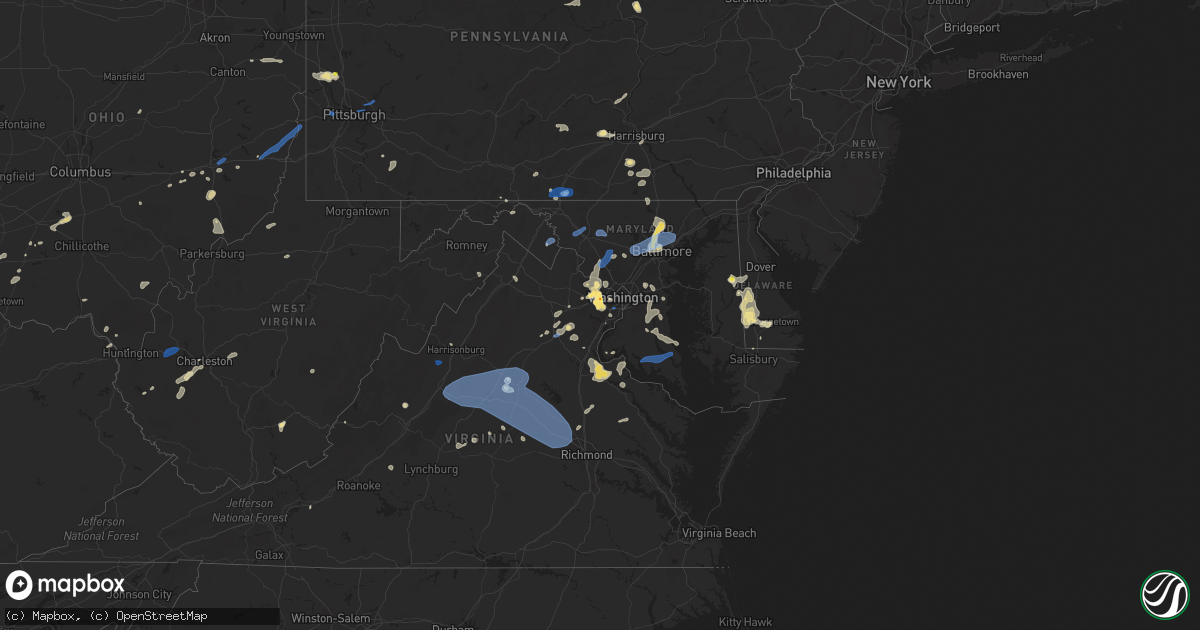
Hail Map in Maryland on August 13, 2021
Get this storm
August 13 map
$229
one time, instant access
Download today. No call, no setup
Keep the $229
Bought the map and want the full workflow? Apply the entire $229 to a subscription within 7 days. None of it is wasted.
Every map, not just this one
This buys you this map. Subscription and you get every map we run, in the markets you choose from a few cities to whole states to nationwide. Plus real-time alerts the moment a storm fires.
Contact data
Name, contact info, occupancy, even credit band for addresses in the footprint. You go from where it hit to who to call.
Become the source they trust
Unlimited branding weather history reports on demand. You already have the documented answer ready for the property owner, and you are the one who showed up with it.
Property data and RoofTrace estimates
Pull up any address you have got, its value and the exact code rules for that jurisdiction, straight from One Click Code. Then RoofTrace estimates the squares, pitch, and roof value, priced the way you price.
Storm reports in Maryland
Maryland
| Date | Description |
|---|---|
| 08/13/20216:43 PM CDT | Several trees down along point lookout road in leonardtown. |
| 08/13/20216:20 PM CDT | Several trees and wires down in the prince frederick area. |
| 08/13/20216:10 PM CDT | Trees down on md-238 maddox road near vixen run lane. |
| 08/13/20216:06 PM CDT | Several trees down along yowaiski mill road in mechanicsville. |
| 08/13/20215:58 PM CDT | A local report indicates 62 MPH wind near 1 NE SWAN POINT |
| 08/13/20215:57 PM CDT | Numerous trees and power lines down in the cobb island area |
| 08/13/20215:53 PM CDT | A local report indicates 63 MPH wind near 3 ENE DAHLGREN |
| 08/13/20215:53 PM CDT | Trees down on us-301 crain highway near edge hill road. |
| 08/13/20215:52 PM CDT | Numerous trees and power lines down in the newburg area |
| 08/13/20215:50 PM CDT | Numerous trees down in the morgantown and newburg area. |
| 08/13/20215:20 PM CDT | Trees down on md-468 muddy creek road near md-255 galesville road. |
| 08/13/20215:20 PM CDT | Trees down near the intersection of md-725 main street and md-202 largo road. |
| 08/13/20215:15 PM CDT | Trees down on southbound md-222 susquehanna river road near us-1 conowingo road. |
| 08/13/20215:15 PM CDT | Trees down on md-4 southern maryland boulevard near md-408 mount zion marlboro road. |
| 08/13/20215:06 PM CDT | Wires down on md 424 at md 214. |
| 08/13/20214:55 PM CDT | Tree down in the 1400 block of hollingsworth road. Branch down on wires and on fire in the 3000 block of clayton road. |
| 08/13/20214:50 PM CDT | Trees down near the intersection of md-193 watkins park drive and keverton drive. Trees down on md-193 watkins park drive near oak grove road. |
| 08/13/20214:43 PM CDT | 3 inch tree limbs broken off and a powerline pole down |
| 08/13/20214:43 PM CDT | Trees down on southbound md-197 near race track road. |
| 08/13/20214:40 PM CDT | Tree down near the intersection of coen road and rocks road. Tree down on wires on fire on southbound md-543 ady road near brinegar road. Tree down near the intersectio |
| 08/13/20214:40 PM CDT | Tree down blocking roadway in the 1100 block of harkins road. Tree down in the 4900 block of rocks road. Street down near the intersection of saint paul's church road a |
| 08/13/20214:40 PM CDT | Tree down at mile mark 1 on east-west highway. |
| 08/13/20214:40 PM CDT | Power lines down in the 300 block of baltimore pike. Tree down near the intersection of jade drive and emerald drive. |
| 08/13/20214:35 PM CDT | Tree down on md-152 fallston road near rochelle drive. Tree down near the intersection of durham road and bellechase road. Tree down in the 2800 block of pleasantville |
| 08/13/20214:30 PM CDT | Trees down near the intersection of md-152 and carrs mill road. |
| 08/13/20214:29 PM CDT | Trees down on md-24 rocks road near saint mary's road. |
| 08/13/20214:29 PM CDT | Trees down on southbound md-136 harkins road prior to linkous road. |
| 08/13/20214:20 PM CDT | Tree down on hess road near md-146 jarrettsville pike. |
| 08/13/20214:18 PM CDT | Hundreds of trees down throughout baltimore city. |
| 08/13/20214:18 PM CDT | Power line wires down on tree... Causing a fire |
| 08/13/20214:18 PM CDT | 2 trees down near the intersection of broken lane parkway and patuxent woods drive |
| 08/13/20214:17 PM CDT | Wires down near the intersection of md-586 veirs mill road and newport mill road. |
| 08/13/20214:14 PM CDT | Tree down on launcelot lane |
| 08/13/20214:04 PM CDT | Trees down on northbound i-83 at mile marker 35. |
| 08/13/20214:00 PM CDT | Several trees down in the columbia area. |
| 08/13/20213:57 PM CDT | Large tree and several branches down near intersection of biltmore ave and pinkney rd |
| 08/13/20213:53 PM CDT | Trees down on md-99 old frederick road near taylor farm road. |
| 08/13/20213:52 PM CDT | Large tree down near intersection of ten oaks rd and green bridge rd |
| 08/13/20213:52 PM CDT | Trees down near the intersection of us-40 baltimore national pike and md-144 frederick road. |
| 08/13/20213:48 PM CDT | Tree down near the intersection of md-124 and sweepstakes road |
| 08/13/20213:46 PM CDT | Tree down near gared rd and sharp rd |
| 08/13/20213:45 PM CDT | Numerous trees down in the dayton area. |
| 08/13/20213:45 PM CDT | Numerous trees down in the west friendship area. |
| 08/13/20213:42 PM CDT | Tree down at mcneal rd and union chapel rd |
| 08/13/20213:41 PM CDT | Multiple trees and powerlines down near the intersection of laytonsville road and hipsley mill road |
| 08/13/20213:41 PM CDT | Power line down on the 9500 block of pleasant plains road |
| 08/13/20213:41 PM CDT | Multiple trees near the intersection of rt 94 and damascus road |
| 08/13/20213:40 PM CDT | Numerous trees down in the woodbine area. |
| 08/13/20213:37 PM CDT | Trees down on md-94 woodbine road near annapolis rock road. |
| 08/13/20213:36 PM CDT | Multiple trees down near the intersection of md-108 and md-650 |
| 08/13/20213:36 PM CDT | Tree down near the intersection of hawkins creamery road and woodfield school road |
| 08/13/20213:31 PM CDT | Power lines down on the 30 block of clearwater court |
| 08/13/20213:31 PM CDT | Large tree down on central park circle at the south germantown recreational park |
| 08/13/20213:31 PM CDT | Numerous trees down on the 17000 block of germantown road |
| 08/13/20213:24 PM CDT | Trees down on md-117 clopper road near mateny road. |
| 08/13/20213:20 PM CDT | Several large pine trees snapped with many large branches down near the maryland soccerplex. |
| 08/13/20213:20 PM CDT | Wires down in the 24800 block of md-124 woodfield road. Wires down in the 25900 block of md-27 ridge road. Trees and wires down on md-124 near greenel road. |
| 08/13/20213:15 PM CDT | A wind gust of 50 knots |
| 08/13/20213:10 PM CDT | Trees blew down near the intersection of md-190 river road and travilah road. |
| 08/13/20213:08 PM CDT | Tree down on the 1500 block of bowersox road |
| 08/13/20212:53 PM CDT | Trees down on southbound md-75 walnut street near jones road. |
| 08/13/20212:48 PM CDT | Trees and wires down on mckaig road past allview drive. |
| 08/13/20212:47 PM CDT | Wires down in the 7600 block of mckaig road. |
| 08/13/20212:38 PM CDT | Trees down on northbound us-40 baltimore national pike near gambrills park road. |
| 08/13/20212:25 PM CDT | Several reports of wires down near middletown. |
| 08/13/20212:41 AM CDT | At 741 PM EDT, severe thunderstorms were located along a line extending from California to near Saint George Island, moving east at 30 mph. HAZARD...60 mph wind gusts. SOURCE...Radar indicated. IMPACT...Damaging winds will cause some trees and large branches to fall. This could injure those outdoors, as well as damage homes and vehicles. Roadways may become blocked by downed trees. Localized power outages are possible. Unsecured light objects may become projectiles. Locations impacted include... Lexington Park, Saint Marys City, Saint Inigoes Creek, Saint Marys River, California, Patuxent River Naval Air Station, Drum Point, Dameron, Saint Inigoes, Park Hall and Ridge. |
| 08/13/20212:23 AM CDT | At 722 PM EDT, severe thunderstorms were located along a line extending from near Prince Frederick to near Hollywood, moving east at 45 mph. HAZARD...60 mph wind gusts. SOURCE...Radar indicated. IMPACT...Expect damage to trees and powerlines. Severe thunderstorms will be near... Taylors Island around 740 PM EDT. University Of Maryland Center For Environmental Studies around 750 PM EDT. Cambridge around 755 PM EDT. Secretary around 805 PM EDT. Hurlock and Vienna around 810 PM EDT.Other locations impacted by these severe thunderstorms includeMadison, Brookview, Eldorado, Andrews, Hudson, Crocheron, Honga,Church Creek, Wingate and Lloyds.# # |
| 08/13/20212:12 AM CDT | At 712 PM EDT, a severe thunderstorm was located over Sandtown, or 12 miles southwest of Dover, moving east at 25 mph. HAZARD...60 mph wind gusts and penny size hail. SOURCE...Radar indicated. IMPACT...Damage to roofs, siding, trees, and power lines is possible. Locations impacted include... Dover, Milford, Denton, Harrington, Camden, Greensboro, Bowers, Goldsboro, Woodside, Viola, Hartly, Rising Sun-Lebanon, Hazlettville, Dover Base Housing, Dover Speedway, Sandtown, Andrewsville, Rising Sun, Wyoming and Felton. |
| 08/13/20212:11 AM CDT | At 710 PM EDT, severe thunderstorms were located along a line extending from Chesapeake Beach to near Hallowing Point, moving east at 35 mph. HAZARD...60 mph wind gusts. SOURCE...Radar indicated. IMPACT...Damaging winds will cause some trees and large branches to fall. This could injure those outdoors, as well as damage homes and vehicles. Roadways may become blocked by downed trees. Localized power outages are possible. Unsecured light objects may become projectiles. Locations impacted include... Chesapeake Beach, Prince Frederick, Hallowing Point, Breezy Point, Sheridan Point, Golden Beach, Dunkirk, Saint Leonard, Huntingtown, Hughesville, Owings, Baden, Mechanicsville, Charlotte Hall, Aquasco, Calvert Beach, Benedict, Eagle Harbor, Lower Marlboro and Barstow. |
| 08/13/20212:07 AM CDT | At 707 PM EDT, a severe thunderstorm was located near Leonardtown, moving east at 35 mph. HAZARD...60 mph wind gusts. SOURCE...Radar indicated. IMPACT...Damaging winds will cause some trees and large branches to fall. This could injure those outdoors, as well as damage homes and vehicles. Roadways may become blocked by downed trees. Localized power outages are possible. Unsecured light objects may become projectiles. Locations impacted include... Chesapeake Ranch Estates, Leonardtown, Cuckold Creek, Calvert Cliffs, Greenwell State Park, Saint Leonard Creek, Town Creek, Flag Harbor, California, Lusby, Saint Leonard, Hollywood, Drum Point, Long Beach, Mechanicsville, Calvert Beach, Bushwood, Clements, Chaptico and Sandgates. |
| 08/13/20211:45 AM CDT | At 644 PM EDT, a severe thunderstorm was located near Greensboro, or 18 miles east of Centerville, moving northeast at 10 mph. HAZARD...60 mph wind gusts. SOURCE...Radar indicated. IMPACT...Damage to roofs, siding, trees, and power lines is possible. Locations impacted include... Denton, Harrington, Greensboro, Oakland, Ridgely, Goldsboro, Woodside, Viola, Jumptown, Griffin, Sandtown, Felton, Henderson, Marydel, Woodside East and Riverview. |
| 08/13/20211:33 AM CDT | At 633 PM EDT, severe thunderstorms were located along a line extending from near Quantico to Port Royal, moving east at 20 mph. HAZARD...60 mph wind gusts and half dollar size hail. SOURCE...Radar indicated. IMPACT...Damaging winds will cause some trees and large branches to fall. This could injure those outdoors, as well as damage homes and vehicles. Roadways may become blocked by downed trees. Localized power outages are possible. Unsecured light objects may become projectiles. Locations impacted include... Waldorf, La Plata, King George, Dahlgren, Fairview Beach, Nanjemoy Creek, Popes Creek, Port Tobacco River, Saint Charles, Wicomico, Cobb Island, Rock Point, Port Tobacco Village, Issue, Potomac Beach, Weedonville, Tompkinsville, Ninde, Ironsides and Bel Alton. |
| 08/13/20211:29 AM CDT | At 629 PM EDT, a severe thunderstorm was located near Kent Point, or near South River, moving east at 25 mph. HAZARD...60 mph wind gusts. SOURCE...Radar indicated. IMPACT...Damage to roofs, siding, trees, and power lines is possible. Locations impacted include... Easton, Talbot, Trappe, St. Michaels, Oxford, Grasonville, Tilghman Island, Skipton, Copperville, Chester, Wye Mills, Hambleton, Cordova, Stevensville South and Dominion. |
| 08/13/20211:15 AM CDT | At 615 PM EDT, a severe thunderstorm was located over Dunkirk, or near Upper Marlboro, moving east at 5 mph. HAZARD...60 mph wind gusts. SOURCE...Radar indicated. IMPACT...Damaging winds will cause some trees and large branches to fall. This could injure those outdoors, as well as damage homes and vehicles. Roadways may become blocked by downed trees. Localized power outages are possible. Unsecured light objects may become projectiles. Locations impacted include... Shady Side, Chesapeake Beach, Deale, Marlton, Dunkirk, Owings, Baden, Galesville, Friendship, Tracys Landing, Lothian, Sunderland and Mount Harmony. |
| 08/13/20211:05 AM CDT | At 605 PM EDT, a severe thunderstorm was located near Fredericksburg, moving east at 15 mph. HAZARD...60 mph wind gusts and quarter size hail. SOURCE...Radar indicated. IMPACT...Damaging winds will cause some trees and large branches to fall. This could injure those outdoors, as well as damage homes and vehicles. Roadways may become blocked by downed trees. Localized power outages are possible. Unsecured light objects may become projectiles. Locations impacted include... Fredericksburg, King George, Fairview Beach, Potomac Creek, Port Royal, Falmouth, Passapatanzy, Stones Corner, Leeland, Weedonville, Brooke, Lambs Creek, White Oak, Sealston, Brookfield and Dogue. |
| 08/13/20211:01 AM CDT | At 601 PM EDT, severe thunderstorms were located along a line extending from Odenton to near Upper Marlboro, moving east at 15 mph. HAZARD...60 mph wind gusts and quarter size hail. SOURCE...Radar indicated. IMPACT...Damaging winds will cause some trees and large branches to fall. This could injure those outdoors, as well as damage homes and vehicles. Roadways may become blocked by downed trees. Localized power outages are possible. Unsecured light objects may become projectiles. Locations impacted include... Bowie, Severn, Annapolis, Crofton, Mayo, Shady Side, Naval Academy, Upper Marlboro, Severn River, South River, Gibson Island, Sillery Bay, Bodkin Point, Rhode River, Magothy River, Dobbins Island, Pinehurst, Glen Burnie, Severna Park and Odenton. |
| 08/13/202112:35 AM CDT | At 535 PM EDT, a severe thunderstorm was located near Goddard, or near Bowie, moving northeast at 10 mph. HAZARD...70 mph wind gusts and ping pong ball size hail. SOURCE...Radar indicated. IMPACT...Damaging winds will cause some trees and large branches to fall. This could injure those outdoors, as well as damage homes and vehicles. Roadways may become blocked by downed trees. Localized power outages are possible. Unsecured light objects may become projectiles. Locations impacted include... Bowie, Severn, Crofton, Odenton, Mitchellville, Fort Meade, Lanham-Seabrook, Goddard, Glenn Dale and Gambrills. |
| 08/13/202112:25 AM CDT | At 524 PM EDT, a severe thunderstorm was located over Marlton, or near Upper Marlboro, moving northeast at 10 mph. HAZARD...60 mph wind gusts and quarter size hail. SOURCE...Radar indicated. IMPACT...Damaging winds will cause some trees and large branches to fall. This could injure those outdoors, as well as damage homes and vehicles. Roadways may become blocked by downed trees. Localized power outages are possible. Unsecured light objects may become projectiles. Locations impacted include... Rosaryville, Marlton, Dunkirk, Owings, Baden and Friendship. |
| 08/13/202112:22 AM CDT | At 522 PM EDT, severe thunderstorms were located along a line extending from 6 miles west of Delta to near Kingsville, moving northeast at 25 mph. HAZARD...60 mph wind gusts. SOURCE...Radar indicated. IMPACT...Damaging winds will cause some trees and large branches to fall. This could injure those outdoors, as well as damage homes and vehicles. Roadways may become blocked by downed trees. Localized power outages are possible. Unsecured light objects may become projectiles. Locations impacted include... Aberdeen, Havre De Grace, Bel Air South, Bel Air North, Fallston, Pleasant Hills, Jarrettsville, Pylesville, Darlington, Cardiff, Benson, Churchville, Carsins, Scarboro, Forest Hill, Chrome Hill, Bynum, Harford Furnace, Street and Rocks. |
| 08/13/202112:20 AM CDT | At 520 PM EDT, severe thunderstorms were located along a line extending from near Parkville to near Brooklyn Park, moving east at 20 mph. HAZARD...60 mph wind gusts and quarter size hail. SOURCE...Radar indicated. IMPACT...Damaging winds will cause some trees and large branches to fall. This could injure those outdoors, as well as damage homes and vehicles. Roadways may become blocked by downed trees. Localized power outages are possible. Unsecured light objects may become projectiles. Locations impacted include... Baltimore, Pikesville, Middle River, Aberdeen, Millers Island, North Point State Park, Back River, Dundalk, Towson, Bel Air South, Catonsville, Essex, Parkville, Carney, Perry Hall, Arbutus, Rosedale, Rossville, Mays Chapel and Timonium. |
| 08/12/202111:59 PM CDT | At 459 PM EDT, severe thunderstorms were located along a line extending from near Cockeysville to near Pikesville, moving east at 15 mph. HAZARD...60 mph wind gusts. SOURCE...Radar indicated. IMPACT...Damaging winds will cause some trees and large branches to fall. This could injure those outdoors, as well as damage homes and vehicles. Roadways may become blocked by downed trees. Localized power outages are possible. Unsecured light objects may become projectiles. Locations impacted include... Baltimore, Pikesville, Cockeysville, Towson, Parkville, Bel Air North, Carney, Perry Hall, Rossville, Mays Chapel, Timonium, White Marsh, Fallston, Hampton, Kingsville, Pleasant Hills, Lutherville-Timonium, Lutherville, Nottingham and Glen Arm. |
| 08/12/202111:49 PM CDT | At 448 PM EDT, severe thunderstorms were located along a line extending from near Ellicott City to near Columbia to Fairland, moving southeast at 35 mph. HAZARD...70 mph wind gusts. SOURCE...Radar indicated. IMPACT...Damaging winds will cause some trees and large branches to fall. This could injure those outdoors, as well as damage homes and vehicles. Roadways may become blocked by downed trees. Localized power outages are possible. Unsecured light objects may become projectiles. Locations impacted include... Columbia, Bowie, Severn, Crofton, Beltsville, Elkridge, Baltimore-Washington Airport, Historic Ellicott City, Glen Burnie, Ellicott City, Catonsville, Severna Park, Odenton, Laurel, Pasadena, Fairland, Arbutus, Ferndale, Colesville and Brooklyn Park. |
| 08/12/202111:42 PM CDT | At 442 PM EDT, a severe thunderstorm was located over Lochearn, or near Baltimore, and is nearly stationary. HAZARD...60 mph wind gusts and quarter size hail. SOURCE...Radar indicated. IMPACT...Damaging winds will cause some trees and large branches to fall. This could injure those outdoors, as well as damage homes and vehicles. Roadways may become blocked by downed trees. Localized power outages are possible. Unsecured light objects may become projectiles. Locations impacted include... Baltimore, Pikesville, Catonsville, Woodlawn, Randallstown, Milford Mill and Lochearn. |
| 08/12/202111:30 PM CDT | At 430 PM EDT, a severe thunderstorm was located over Damascus, moving southeast at 5 mph. HAZARD...70 mph wind gusts and quarter size hail. SOURCE...Radar indicated. IMPACT...Damaging winds will cause some trees and large branches to fall. This could injure those outdoors, as well as damage homes and vehicles. Roadways may become blocked by downed trees. Localized power outages are possible. Unsecured light objects may become projectiles. Locations impacted include... Columbia, Germantown, Rockville, Bethesda, Gaithersburg, Olney, Damascus, Ellicott City, Aspen Hill, Potomac, North Bethesda, Montgomery Village, North Potomac, Redland, North Kensington, Mount Airy, South Kensington, Boyds, Rossmoor and Wheaton-Glenmont. |
| 08/12/202111:07 PM CDT | At 407 PM EDT, severe thunderstorms were located along a line extending from Rutherford to Emigsville to near Littlestown, moving east at 25 mph. HAZARD...60 mph wind gusts and quarter size hail. SOURCE...Radar indicated. IMPACT...Hail damage to vehicles is expected. Expect wind damage to roofs, siding, and trees. Locations impacted include... Harrisburg, York, Lebanon, Hanover, Hershey, Colonial Park, Weigelstown, Elizabethtown, Columbia, Progress, Middletown, Millersville, Mount Joy, Palmyra, New Cumberland, Parkville, Red Lion, Steelton, Spry and Manheim.This includes the following Interstates... The Pennsylvania Turnpike from mile markers 241 to 270. Interstate 81 from mile markers 69 to 70. Interstate 83 between mile markers 0 and 39...and from mile markers43 to 50. Interstate 283 from mile markers 0 to 2. |
| 08/12/202110:36 PM CDT | At 336 PM EDT, a severe thunderstorm was located over Clover Hill, or over Frederick, moving northeast at 20 mph. HAZARD...60 mph wind gusts. SOURCE...Radar indicated. IMPACT...Damaging winds will cause some trees and large branches to fall. This could injure those outdoors, as well as damage homes and vehicles. Roadways may become blocked by downed trees. Localized power outages are possible. Unsecured light objects may become projectiles. Locations impacted include... Frederick, Thurmont, Harry Grove Stadium, Ballenger Creek, Walkersville, Braddock Heights, New Market, Clover Hill, Discovery-Spring Garden, Linganore-Bartonsville, Jefferson, Myersville, Woodsboro, Union Bridge, Libertytown, New Midway, Utica, Unionville, Graceham and Lewistown. |
| 08/12/20219:38 PM CDT | At 238 PM EDT, severe thunderstorms were located along a line extending from Shepherdstown to 6 miles north of Berryville, moving southeast at 10 mph. HAZARD...60 mph wind gusts and quarter size hail. SOURCE...Radar indicated. IMPACT...Damaging winds will cause some trees and large branches to fall. This could injure those outdoors, as well as damage homes and vehicles. Roadways may become blocked by downed trees. Localized power outages are possible. Unsecured light objects may become projectiles. Locations impacted include... Charles Town, Shepherdstown, Ranson, Harpers Ferry, Kearneysville, Corporation Of Ranson, Bolivar, Sharpsburg, Shenandoah Junction, Middleway, Rohrersville, Gapland, Brownsville, Antietam, Gaylord, Moler Crossroads, Halltown, Wickliffe, Wadesville and Summit Point. |
| 08/12/20219:12 PM CDT | At 211 PM EDT, severe thunderstorms were located along a line extending from near Spruce Hill to near Claylick, moving east at 25 mph. HAZARD...60 mph wind gusts and penny size hail. SOURCE...Radar indicated. IMPACT...Expect damage to roofs, siding, and trees. Locations impacted include... Chambersburg, Carlisle, Waynesboro, Gettysburg, Shippensburg, Greencastle, Guilford, Plainfield, St. Thomas, Schlusser, Carroll Valley, Boiling Springs, Fayetteville, Warfordsburg, Wayne Heights, Mount Holly Springs, Mont Alto, Newport, Mercersburg and Duncannon.This includes the following Interstates... Interstate 70 from mile markers 168 to 169. The Pennsylvania Turnpike from mile markers 177 to 231. Interstate 81 from mile markers 0 to 57. |
All States Impacted by Hail Map on August 13, 2021
Cities Impacted by Hail Map on August 13, 2021
- Glen Aubrey, NY
- Whitney Point, NY
- Lisle, NY
- Dill City, OK
- Yellville, AR
- Lead Hill, AR
- Fort Mcdowell, AZ
- Pottsboro, TX
- Oakland, KY
- Chantilly, VA
- Centreville, VA
- Butler, OK
- Paden, OK
- Williamsport, OH
- New Holland, OH
- Prince Frederick, MD
- Catlett, VA
- Reston, VA
- Humboldt, TN
- Bells, TN
- Oklahoma City, OK
- Checotah, OK
- Pine Valley, UT
- New Harmony, UT
- Chandlersville, OH
- Willcox, AZ
- Foss, OK
- Cordell, OK
- Bessie, OK
- Corn, OK
- Rogers, AR
- Garfield, AR
- Cord, AR
- Windsor, NY
- Sweetwater, OK
- Booneville, AR
- Greensboro, MD
- Howard, OH
- Danville, OH
- Ash Fork, AZ
- Falls Church, VA
- China Grove, NC
- Mount Ulla, NC
- Sedona, AZ
- Stuttgart, AR
- Gould, OK
- Middlebourne, WV
- Sistersville, WV
- Pine, AZ
- Tappahannock, VA
- Saint Stephens Church, VA
- Phoenix, AZ
- Globe, AZ
- Miami, AZ
- Slingerlands, NY
- Voorheesville, NY
- South Charleston, WV
- Alum Creek, WV
- Chesapeake, OH
- Ballston Lake, NY
- Ballston Spa, NY
- Galway, NY
- McConnellsburg, PA
- Muskogee, OK
- Webbers Falls, OK
- Georgetown, DE
- Searchlight, NV
- New Blaine, AR
- Scranton, AR
- East Meredith, NY
- Davenport, NY
- Davenport Center, NY
- Oneonta, NY
- Crawfordsville, AR
- Proctor, AR
- Prescott, AR
- Covington, VA
- Hancock, MD
- Warfordsburg, PA
- Bedford, VA
- Great Falls, VA
- Fombell, PA
- New Brighton, PA
- Owings, MD
- Friendship, MD
- Dunkirk, MD
- Okmulgee, OK
- Haskell, OK
- Boynton, OK
- Morris, OK
- Colony, OK
- Valley Springs, AR
- Baltimore, MD
- Henderson, MD
- Goldsboro, MD
- Colorado City, AZ
- Wellsville, PA
- Dover, PA
- Bentonville, AR
- Zanesville, OH
- Peridot, AZ
- Mount Pleasant, NC
- Shermans Dale, PA
- Landisburg, PA
- Carlisle, PA
- Vinton, OH
- Bidwell, OH
- Langsville, OH
- Saint Johnsville, NY
- Congress, AZ
- Alderson, WV
- Meadow Bridge, WV
- Green Sulphur Springs, WV
- Salisbury, NC
- Dolgeville, NY
- Burnt Hills, NY
- Barnsdall, OK
- Black Canyon City, AZ
- Pine Bluff, AR
- Bowie, MD
- New Freedom, PA
- Glen Rock, PA
- Freeland, MD
- Witter, AR
- Eufaula, OK
- Barboursville, VA
- Gordonsville, VA
- Sod, WV
- Sumerco, WV
- Sayre, OK
- Elk City, OK
- Ogallala, NE
- Mountain Home, AR
- Vian, OK
- Mena, AR
- Rose, OK
- King George, VA
- Harrington, DE
- East Waterford, PA
- Blairs Mills, PA
- Orbisonia, PA
- Colonial Beach, VA
- Dillsburg, PA
- Covington, TN
- Eureka Springs, AR
- Mooresville, NC
- Keswick, VA
- Corning, NY
- Supai, AZ
- Williams, AZ
- Montoursville, PA
- Williamsport, PA
- Coalgate, OK
- Kingsport, TN
- Saint David, AZ
- Federalsburg, MD
- Denton, MD
- Greenwood, DE
- Paris, AR
- Subiaco, AR
- Grandin, MO
- Poplar Bluff, MO
- Bon Aqua, TN
- Burns, TN
- Arapaho, OK
- Gold Hill, NC
- Feura Bush, NY
- Selkirk, NY
- Coeymans Hollow, NY
- Rochester, PA
- Beaver Falls, PA
- Connellsville, PA
- Dunbar, PA
- Granite, OK
- Willow, OK
- Waverly, TN
- Hurricane Mills, TN
- Edmond, OK
- Lothian, MD
- Brandywine, MD
- Upper Marlboro, MD
- Centerville, TN
- Nunnelly, TN
- Lobelville, TN
- Central, UT
- Stigler, OK
- Mayer, AZ
- Mcalester, OK
- Decatur, AR
- Gravette, AR
- Franklin, TN
- Greencastle, PA
- Port Royal, VA
- Woodford, VA
- Rappahannock Academy, VA
- Fredericksburg, VA
- Potomac, MD
- Doniphan, MO
- Lascassas, TN
- Lebanon, TN
- Lutherville Timonium, MD
- Pikesville, MD
- Stevenson, MD
- Salem, OH
- Beloit, OH
- Washingtonville, OH
- Alliance, OH
- Damascus, OH
- Leetonia, OH
- Arlington, TN
- Eads, TN
- Sapulpa, OK
- Kiefer, OK
- Fairfax, VA
- Oakton, VA
- Vienna, VA
- Hillsboro, OH
- Herndon, VA
- Jenks, OK
- Glenpool, OK
- Newport, AR
- Newark Valley, NY
- Binghamton, NY
- Endicott, NY
- Johnson City, NY
- Maine, NY
- Leesburg, OH
- Willisburg, KY
- Lawrenceburg, KY
- Smiths Grove, KY
- Colcord, OK
- Gentry, AR
- Fisher, AR
- White Hall, AR
- Clinton, NY
- Nipton, CA
- York, PA
- Thomasville, PA
- Charleston, WV
- Golden, MO
- Eagle Rock, MO
- Seaford, DE
- Bridgeville, DE
- Cumberland, OH
- Belle Valley, OH
- Caldwell, OH
- Paulden, AZ
- Reydon, OK
- Peel, AR
- Marietta, OH
- Lowell, OH
- Whipple, OH
- Nanjemoy, MD
- Rockbridge Baths, VA
- Goshen, VA
- Bunch, OK
- Waynesboro, PA
- Glenwood, MD
- Dayton, MD
- Glenelg, MD
- Ravena, NY
- Andover, OH
- Weiner, AR
- Fountain Hills, AZ
- Gladstone, VA
- Wingina, VA
- Sheffield, AL
- Kirkwood, NY
- Conklin, NY
- Paris, KY
- Warner, OK
- Gore, OK
- Gwynn Oak, MD
- Phoenix, MD
- Cockeysville, MD
- Sparks Glencoe, MD
- Hunt Valley, MD
- Sterling, VA
- Boyds, MD
- Springfield, VA
- Poolesville, MD
- Fairfax Station, VA
- Ashburn, VA
- Germantown, MD
- Burke, VA
- Annandale, VA
- Clarksburg, MD
- Seminole, TX
- Payson, AZ
- Hope, AR
- Harrison, AR
- New Cumberland, PA
- Harrisburg, PA
- Marydel, DE
- Camden Wyoming, DE
- Felton, DE
- Carter, OK
- Sentinel, OK
- Bardstown, KY
- Garrett, WY
- Greenfield, OH
- Clarksburg, OH
- New Concord, OH
- Norwich, OH
- Albany, NY
- Delmar, NY
- East Berne, NY
- Clarksville, NY
- Blue Rock, OH
- Duncan Falls, OH
- Laurel, MD
- Glenn Dale, MD
- Quaker City, OH
- Adamsville, TN
- Cedar City, UT
- Keystone, NE
- Gaithersburg, MD
- Gainesville, VA
- Haymarket, VA
- Ripley, MS
- Blue Mountain, MS
- Palmyra, VA
- Scottsville, VA
- Wardensville, WV
- Midland, VA
- Nokesville, VA
- Warrenton, VA
- Bealeton, VA
- Brownsville, TN
- Brighton, TN
- Little Falls, NY
- Gambrills, MD
- Davidsonville, MD
- Trout Run, PA
- Wynne, AR
- Cherry Valley, AR
- Mercersburg, PA
- Stephens City, VA
- Saint Joe, AR
- Linden, TN
- Mangum, OK
- Spring Grove, PA
- East Berlin, PA
- Rosedale, MS
- Bella Vista, AR
- Hiwasse, AR
- Peach Springs, AZ
- Choctaw, OK
- Harrah, OK
- Bethany, OK
- Jones, OK
- Spencer, OK
- Ashford, WV
- Columbia, VA
- Cartersville, VA
- Dickson, TN
- Hazen, AR
- Cammal, PA
- Lock Haven, PA
- North Bend, PA
- Belmont, OH
- Flushing, OH
- Salina, OK
- Everton, AR
- Cheyenne, OK
- Ranger, WV
- Branchland, WV
- Cambridge, OH
- Clinton, OK
- Dahlgren, VA
- Windsor Mill, MD
- Towson, MD
- Catonsville, MD
- Monkton, MD
- Town Creek, AL
- Buckingham, VA
- Depew, OK
- Erick, OK
- Mesa, AZ
- Clendenin, WV
- Lebanon Junction, KY
- Boston, KY
- Monroe, MI
- Ashland, VA
- Berkeley Springs, WV
- Great Cacapon, WV
- Church Hill, TN
- Wheeler, TX
- Shamrock, TX
- McRae, AR
- Locust Grove, OK
- Rimrock, AZ
- Pleasant City, OH
- Millerstown, PA
- Liverpool, PA
- Scottdale, PA
- Dawson, PA
- Mounds, OK
- Poland, NY
- Newport, NY
- Fort Plain, NY
- Jeffersonton, VA
- Remington, VA
- Harrisonburg, VA
- Broad Run, VA
- White Bluff, TN
- Falkner, MS
- Ashland, MS
- Richwood, WV
- Claypool, AZ
- Mount Sterling, OH
- Washington Court House, OH
- Norfork, AR
- Vernon, TX
- Cave Springs, AR
- Charles Town, WV
- Ranson, WV
- Kearneysville, WV
- Denmark, TN
- Jackson, TN
- Stafford, VA
- Kitts Hill, OH
- Ironton, OH
- Lawrenceburg, TN
- Leoma, TN
- Artemas, PA
- Clarksville, TX
- Tulsa, OK
- San Carlos, AZ
- Sardinia, OH
- Winchester, OH
- Zelienople, PA
- Beaver, PA
- Darlington, PA
- Berryville, AR
- Roosevelt, AZ
- Lyles, TN
- Lore City, OH
- Byesville, OH
- Salesville, OH
- Senecaville, OH
- Port Republic, MD
- Aquasco, MD
- Huntingtown, MD
- Porum, OK
- Murphy, NC
- Lorton, VA
- Meridianville, AL
- Huntsville, AL
- Selmer, TN
- Bethel Springs, TN
- Altus Afb, OK
- Altus, OK
- Kansas, OK
- Jasper, AR
- Crowell, TX
- Junction City, OH
- Sevierville, TN
- Bosler, WY
- Edgewater, MD
- Harwood, MD
- Seven Valleys, PA
- Idabel, OK
- Denison, TX
- Dawson, GA
- Charlottesville, VA
- Rattan, OK
- Lone Wolf, OK
- Delmar, MD
- Delmar, DE
- Decatur, AL
- Trinity, AL
- Humphrey, AR
- Arnett, OK
- Sugar Tree, TN
- Harts, WV
- Julian, WV
- Danville, WV
- Huntsville, AR
- Waldorf, MD
- Ruther Glen, VA
- Cedarcreek, MO
- Smyrna, TN
- Murfreesboro, TN
- Rio Rico, AZ
- Painted Post, NY
- Deposit, NY
- Christiansburg, VA
- Riner, VA
- Lucasville, OH
- Burbank, OK
- Alexandria, VA
- Fort Belvoir, VA
- Brandy Station, VA
- Rixeyville, VA
- Lowell, AR
- Wellston, OK
- Mcloud, OK
- Meeker, OK
- Broken Arrow, OK
- Lemoyne, NE
- Lebanon, KY
- Roseville, OH
- Pedro, OH
- Macon, GA
- Atwood, TN
- Hillsboro, AL
- Manchester, MD
- Watertown, TN
- Concord, NC
- Griffithsville, WV
- Alkol, WV
- Yawkey, WV
- Fayetteville, OH
- Lynchburg, OH
- Midland, OH
- Blanchester, OH
- Bixby, OK
- Camp Verde, AZ
- Pawnee, OK
- Mason, TN
- Prague, OK
- Laurel, DE
- Sandstone, WV
- Ashland, KY
- Mount Judea, AR
- Savanna, OK
- Laveen, AZ
- Kiahsville, WV
- West Union, WV
- New Milton, WV
- Mount Solon, VA
- Bridgewater, VA
- Aroda, VA
- Kents Store, VA
- Rochelle, VA
- Mineral, VA
- North Garden, VA
- Grottoes, VA
- Greenwood, VA
- Staunton, VA
- Maidens, VA
- Henrico, VA
- Crimora, VA
- Ruckersville, VA
- Fork Union, VA
- Stanardsville, VA
- Bumpass, VA
- Sandy Hook, VA
- Earlysville, VA
- Dyke, VA
- Glen Allen, VA
- Fishersville, VA
- Rockville, VA
- Oilville, VA
- Crozet, VA
- Powhatan, VA
- Afton, VA
- Free Union, VA
- Stuarts Draft, VA
- Manakin Sabot, VA
- Goochland, VA
- Orange, VA
- Radiant, VA
- Louisa, VA
- Waynesboro, VA
- Crozier, VA
- Lyndhurst, VA
- State Farm, VA
- Somerset, VA
- Troy, VA
- Gum Spring, VA
- Montpelier, VA
- Herkimer, NY
- Round Lake, NY
- Schenectady, NY
- Rexford, NY
- Amsterdam, NY
- Schuylerville, NY
- Fort Hunter, NY
- Mechanicville, NY
- Pattersonville, NY
- Hagaman, NY
- Clifton Park, NY
- Broadalbin, NY
- Saratoga Springs, NY
- Fort Johnson, NY
- Stillwater, NY
- Schaghticoke, NY
- Tribes Hill, NY
- Gloversville, NY
- Johnstown, NY
- Fonda, NY
- Chenango Forks, NY
- Castle Creek, NY
- Port Crane, NY
- Glenmont, NY
- Castleton On Hudson, NY
- Hurricane, WV
- Winfield, WV
- Culloden, WV
- Scott Depot, WV
- Frederick, MD
- Middletown, MD
- Walkersville, MD
- New Market, MD
- Mount Airy, MD
- Union Bridge, MD
- Owings Mills, MD
- Parkville, MD
- Nottingham, MD
- Sykesville, MD
- Glen Arm, MD
- Marriottsville, MD
- Woodstock, MD
- Perry Hall, MD
- Randallstown, MD
- Rosedale, MD
- Ellicott City, MD
- West Friendship, MD
- Damascus, MD
- Montgomery Village, MD
- Loveville, MD
- Saint Leonard, MD
- Leonardtown, MD
- Clements, MD
- Chaptico, MD
- Mechanicsville, MD
- Hollywood, MD
- Broomes Island, MD
- Duke, OK
- Hollis, OK
- Wickenburg, AZ
- Crown King, AZ
- Aguila, AZ
- Morristown, AZ
- Scottsdale, AZ
- Apache Junction, AZ
- Gold Canyon, AZ
- New Hartford, NY
- Sauquoit, NY
- Old Washington, OH
- Follansbee, WV
- Cadiz, OH
- Dillonvale, OH
- Brilliant, OH
- Colliers, WV
- Adena, OH
- Saint Clairsville, OH
- Mount Pleasant, OH
- Rayland, OH
- Mingo Junction, OH
- Chambersburg, PA
- Harpers Ferry, WV
- Shepherdstown, WV
- Shenandoah Junction, WV
- Oakdale, PA
- Coraopolis, PA
- Imperial, PA
- Pittsburgh, PA
- Verona, PA
- Oakmont, PA
- Cheswick, PA
- New Kensington, PA
- Tarentum, PA
- Springdale, PA


