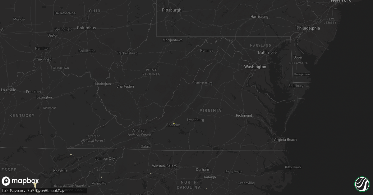
Hail Map in Virginia on August 9, 2022
Get this storm
August 9 map
$229
one time, instant access
Download today. No call, no setup
Keep the $229
Bought the map and want the full workflow? Apply the entire $229 to a subscription within 7 days. None of it is wasted.
Every map, not just this one
This buys you this map. Subscription and you get every map we run, in the markets you choose from a few cities to whole states to nationwide. Plus real-time alerts the moment a storm fires.
Contact data
Name, contact info, occupancy, even credit band for addresses in the footprint. You go from where it hit to who to call.
Become the source they trust
Unlimited branding weather history reports on demand. You already have the documented answer ready for the property owner, and you are the one who showed up with it.
Property data and RoofTrace estimates
Pull up any address you have got, its value and the exact code rules for that jurisdiction, straight from One Click Code. Then RoofTrace estimates the squares, pitch, and roof value, priced the way you price.
Storm reports in Virginia
Virginia
| Date | Description |
|---|---|
| 08/09/20225:15 PM CDT | Tree fell across road. |
| 08/09/20225:13 PM CDT | Tree fell across powerline and the road. |
| 08/09/20225:10 PM CDT | Nickel to quarter size hail observed at the waning point. Power went out briefly. Frequent lightning also observed. Aep indicates upwards of 2000 customers without powe |
| 08/09/20225:08 PM CDT | Powerlines down. Tree blown against powerline. |
| 08/09/20225:00 PM CDT | Tree across road. |
| 08/09/20221:04 AM CDT | At 603 PM EDT, a severe thunderstorm was located over Cloverdale, or near Vinton, moving east at 10 mph. HAZARD...60 mph wind gusts and quarter size hail. SOURCE...Radar indicated. IMPACT...Hail damage to vehicles is expected. Expect wind damage to roofs, siding, and trees. Locations impacted include... Roanoke... Vinton... Stewartsville... Montvale... Laymantown... Hollins... and Blue Ridge. |
| 08/08/20229:25 PM CDT | At 224 PM EDT, a severe thunderstorm was located over Lambsburg, or near Cana, moving southeast at 5 mph. HAZARD...60 mph wind gusts and quarter size hail. Very heavy rainfall. SOURCE...Radar indicated. IMPACT...Hail damage to vehicles is expected. Expect wind damage to roofs, siding, and trees. Flooding from very heavy rainfall. Locations impacted include... Mount Airy... Flat Rock... Fancy Gap... Bottom... Cana... Pine Ridge... and Toast. |
All States Impacted by Hail Map on August 9, 2022
Cities Impacted by Hail Map on August 9, 2022
- Chickasha, OK
- Middleton, TN
- Saulsbury, TN
- Jackson, TN
- Denmark, TN
- Kaw City, OK
- Union City, TN
- Piedmont, OK
- Fargo, OK
- Buffalo, OK
- Fort Supply, OK
- Collierville, TN
- Lawton, OK
- Tryon, OK
- Chandler, OK
- Cushing, OK
- Stroud, OK
- Agra, OK
- Paden, OK
- Carney, OK
- Depew, OK
- Bolivar, TN
- Dawsonville, GA
- Batesville, MS
- Marlow, OK
- Rush Springs, OK
- Okarche, OK
- Many, LA
- Robeline, LA
- Marthaville, LA
- Fyffe, AL
- Groveoak, AL
- Guthrie, OK
- Greenville, FL
- Laverne, OK
- Ponca City, OK
- El Paso, TX
- Hamlin, TX
- Riceville, TN
- Albany, OR
- Lebanon, OR
- Scio, OR
- Thomas, OK
- Edmond, OK
- Stillwater, OK
- Perry, OK
- Lexington, TN
- Dallas, TX
- Sweet Home, OR
- Crabtree, OR
- Foster, OR
- Jefferson, OR
- Hamburg, AR
- Bend, OR
- Sautee Nacoochee, GA
- Tucson, AZ
- Mooreland, OK
- Tazewell, TN
- Cleo Springs, OK
- Clinton, AR
- Portland, AR
- Lake Village, AR
- Rockholds, KY
- Spring City, TN
- Brooksville, FL
- Kirkland, AZ
- Congress, AZ
- Lockney, TX
- Custer City, OK
- Lookeba, OK
- Hinton, OK
- Baxley, GA
- Hornsby, TN
- La Pine, OR
- Ringwood, OK
- Arab, AL
- Decatur, TN
- Apache, OK
- Sardis, MS
- Tiplersville, MS
- Ashland, MS
- Falkner, MS
- Albertville, AL
- Horton, AL
- Guntersville, AL
- Evensville, TN
- Helena, OK
- Arnett, OK
- Perkins, OK
- Ninnekah, OK
- Pineville, KY
- Cement, OK
- Lubbock, TX
- Centerville, TN
- Memphis, TN
- Copeland, KS
- Meno, OK
- Leesville, LA
- Weaverville, NC
- Barnardsville, NC
- Bon Aqua, TN
- Lyles, TN
- Statesville, NC
- Humboldt, TN
- Brownsville, TN
- Cashion, OK
- Greenwood, MS
- Coila, MS
- Sidon, MS
- Blountsville, AL
- Jacksboro, TX
- Tuttle, OK
- Summer Lake, OR
- Clayton, GA
- Germantown, TN
- Arlington, TN
- Booneville, MS
- Goltry, OK
- Moulton, AL
- La Mesa, NM
- Tallahassee, FL
- Stockton, GA
- Pampa, TX
- Mclean, TX
- Roanoke, VA
- Cullman, AL
- Holly Pond, AL
- Elgin, OK
- Fort Sill, OK
- Fort Bidwell, CA
- Lake City, CA
- Crossville, AL
- Sunflower, MS
- Tolar, TX
- Granbury, TX
- Ramer, TN
- Section, AL
- Clarkesville, GA
- Shattuck, OK
- Woodward, OK
- McCool, MS
- Louisville, MS
- Williamsburg, KY
- Milford, UT
- Ten Mile, TN
- Athens, TN
- Calhoun, TN
- Dickson, TN
- Nettleton, MS
- Indianola, MS
- Lillington, NC
- Angier, NC
- Hornbeck, LA
- Medina, TN
- Oakfield, TN
- Allenhurst, GA
- Ludowici, GA
- Cleveland, GA
- Purlear, NC
- Aubrey, TX
- Stephenville, TX
- Rio Rico, AZ
- Lewisburg, KY
- Russellville, KY
- Elkton, KY
- Amber, OK
- Yukon, OK
- Lancaster, TX
- Ralls, TX
- Ainsworth, NE
- Cherry Log, GA
- El Reno, OK
- Anthony, NM
- Anthony, TX
- Sayre, OK
- Likely, CA
- Perry, FL
- Primm Springs, TN
- Franklin, TN
- Calico Rock, AR
- Doddsville, MS
- Geary, OK
- Fay, OK
- Mountain Rest, SC
- Fackler, AL
- Hollywood, AL
- Hermitage, AR
- Post, TX
- Medon, TN
- Toone, TN
- Coffeeville, MS
- Oakland, MS
- Dawson, AL
- Cumming, GA
- Silver Lake, OR
- Eugene, OR


