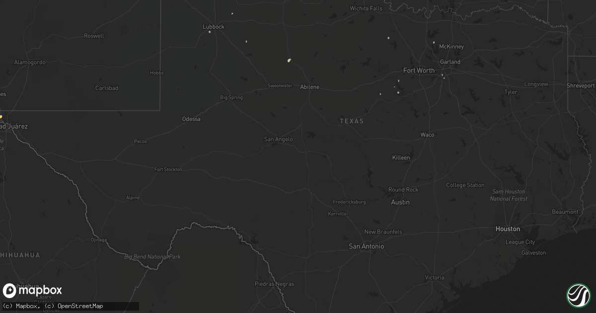
Hail Map in Texas on August 9, 2022
Get this storm
August 9 map
$229
one time, instant access
Download today. No call, no setup
Keep the $229
Bought the map and want the full workflow? Apply the entire $229 to a subscription within 7 days. None of it is wasted.
Every map, not just this one
This buys you this map. Subscription and you get every map we run, in the markets you choose from a few cities to whole states to nationwide. Plus real-time alerts the moment a storm fires.
Contact data
Name, contact info, occupancy, even credit band for addresses in the footprint. You go from where it hit to who to call.
Become the source they trust
Unlimited branding weather history reports on demand. You already have the documented answer ready for the property owner, and you are the one who showed up with it.
Property data and RoofTrace estimates
Pull up any address you have got, its value and the exact code rules for that jurisdiction, straight from One Click Code. Then RoofTrace estimates the squares, pitch, and roof value, priced the way you price.
Storm reports in Texas
Texas
| Date | Description |
|---|---|
| 08/09/20225:52 PM CDT | Time estimated from radar. Report from twitter. |
| 08/09/20225:42 PM CDT | A local report indicates 1.50 inch wind near 2 SSE CANUTILLO |
| 08/09/20225:40 PM CDT | Multiple 4-6 inch tree limbs down. |
| 08/09/20222:45 PM CDT | A local report indicates 61 MPH wind near 1 NE AMHERST |
| 08/08/202211:38 PM CDT | At 438 PM MDT, a severe thunderstorm was located near West El Paso, moving west at 10 mph. HAZARD...60 mph wind gusts and quarter size hail. SOURCE...Radar indicated. IMPACT...Hail damage to vehicles is expected. Expect wind damage to roofs, siding, and trees. Locations impacted include... West El Paso, Santa Teresa, Sunland Park, Canutillo, La Union, Vinton and Union Pacific Intermodal Terminal.This includes Interstate 10 in Texas between mile markers 4 and 12. |
All States Impacted by Hail Map on August 9, 2022
Cities Impacted by Hail Map on August 9, 2022
- Chickasha, OK
- Middleton, TN
- Saulsbury, TN
- Jackson, TN
- Denmark, TN
- Kaw City, OK
- Union City, TN
- Piedmont, OK
- Fargo, OK
- Buffalo, OK
- Fort Supply, OK
- Collierville, TN
- Lawton, OK
- Tryon, OK
- Chandler, OK
- Cushing, OK
- Stroud, OK
- Agra, OK
- Paden, OK
- Carney, OK
- Depew, OK
- Bolivar, TN
- Dawsonville, GA
- Batesville, MS
- Marlow, OK
- Rush Springs, OK
- Okarche, OK
- Many, LA
- Robeline, LA
- Marthaville, LA
- Fyffe, AL
- Groveoak, AL
- Guthrie, OK
- Greenville, FL
- Laverne, OK
- Ponca City, OK
- El Paso, TX
- Hamlin, TX
- Riceville, TN
- Albany, OR
- Lebanon, OR
- Scio, OR
- Thomas, OK
- Edmond, OK
- Stillwater, OK
- Perry, OK
- Lexington, TN
- Dallas, TX
- Sweet Home, OR
- Crabtree, OR
- Foster, OR
- Jefferson, OR
- Hamburg, AR
- Bend, OR
- Sautee Nacoochee, GA
- Tucson, AZ
- Mooreland, OK
- Tazewell, TN
- Cleo Springs, OK
- Clinton, AR
- Portland, AR
- Lake Village, AR
- Rockholds, KY
- Spring City, TN
- Brooksville, FL
- Kirkland, AZ
- Congress, AZ
- Lockney, TX
- Custer City, OK
- Lookeba, OK
- Hinton, OK
- Baxley, GA
- Hornsby, TN
- La Pine, OR
- Ringwood, OK
- Arab, AL
- Decatur, TN
- Apache, OK
- Sardis, MS
- Tiplersville, MS
- Ashland, MS
- Falkner, MS
- Albertville, AL
- Horton, AL
- Guntersville, AL
- Evensville, TN
- Helena, OK
- Arnett, OK
- Perkins, OK
- Ninnekah, OK
- Pineville, KY
- Cement, OK
- Lubbock, TX
- Centerville, TN
- Memphis, TN
- Copeland, KS
- Meno, OK
- Leesville, LA
- Weaverville, NC
- Barnardsville, NC
- Bon Aqua, TN
- Lyles, TN
- Statesville, NC
- Humboldt, TN
- Brownsville, TN
- Cashion, OK
- Greenwood, MS
- Coila, MS
- Sidon, MS
- Blountsville, AL
- Jacksboro, TX
- Tuttle, OK
- Summer Lake, OR
- Clayton, GA
- Germantown, TN
- Arlington, TN
- Booneville, MS
- Goltry, OK
- Moulton, AL
- La Mesa, NM
- Tallahassee, FL
- Stockton, GA
- Pampa, TX
- Mclean, TX
- Roanoke, VA
- Cullman, AL
- Holly Pond, AL
- Elgin, OK
- Fort Sill, OK
- Fort Bidwell, CA
- Lake City, CA
- Crossville, AL
- Sunflower, MS
- Tolar, TX
- Granbury, TX
- Ramer, TN
- Section, AL
- Clarkesville, GA
- Shattuck, OK
- Woodward, OK
- McCool, MS
- Louisville, MS
- Williamsburg, KY
- Milford, UT
- Ten Mile, TN
- Athens, TN
- Calhoun, TN
- Dickson, TN
- Nettleton, MS
- Indianola, MS
- Lillington, NC
- Angier, NC
- Hornbeck, LA
- Medina, TN
- Oakfield, TN
- Allenhurst, GA
- Ludowici, GA
- Cleveland, GA
- Purlear, NC
- Aubrey, TX
- Stephenville, TX
- Rio Rico, AZ
- Lewisburg, KY
- Russellville, KY
- Elkton, KY
- Amber, OK
- Yukon, OK
- Lancaster, TX
- Ralls, TX
- Ainsworth, NE
- Cherry Log, GA
- El Reno, OK
- Anthony, NM
- Anthony, TX
- Sayre, OK
- Likely, CA
- Perry, FL
- Primm Springs, TN
- Franklin, TN
- Calico Rock, AR
- Doddsville, MS
- Geary, OK
- Fay, OK
- Mountain Rest, SC
- Fackler, AL
- Hollywood, AL
- Hermitage, AR
- Post, TX
- Medon, TN
- Toone, TN
- Coffeeville, MS
- Oakland, MS
- Dawson, AL
- Cumming, GA
- Silver Lake, OR
- Eugene, OR


