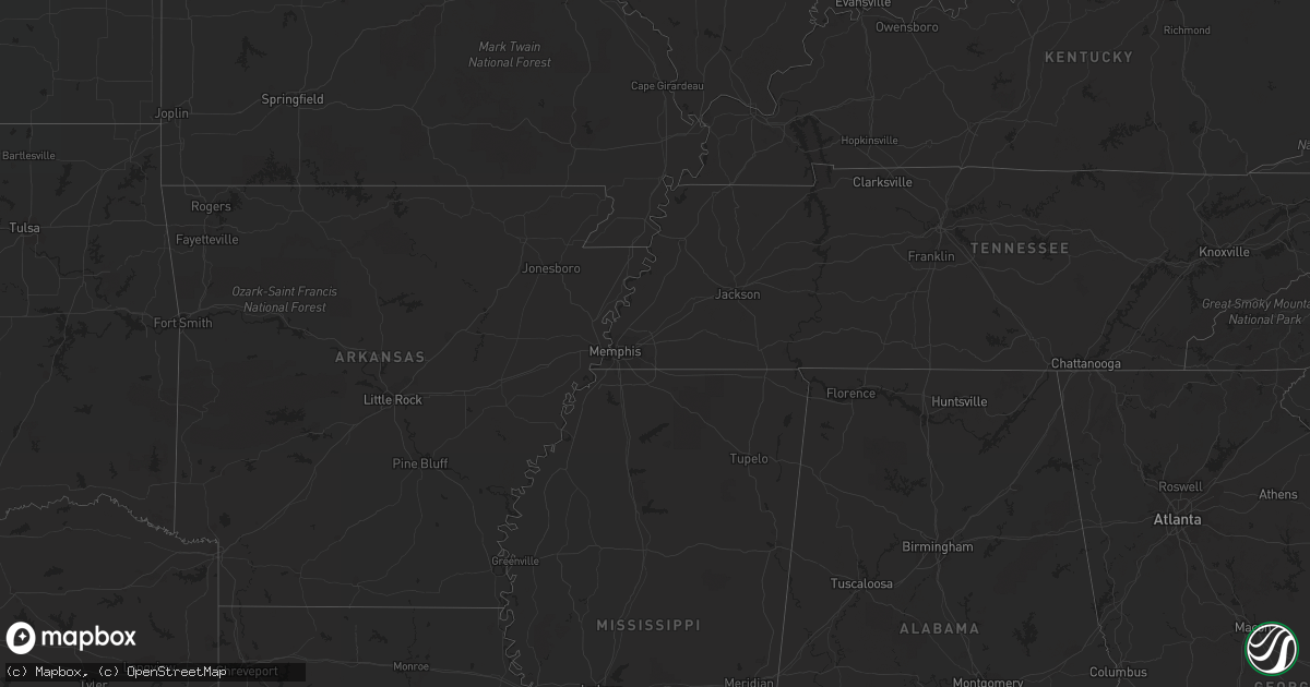
Hail Map in New York on August 4, 2022
Get this storm
August 4 map
$229
one time, instant access
Download today. No call, no setup
Keep the $229
Bought the map and want the full workflow? Apply the entire $229 to a subscription within 7 days. None of it is wasted.
Every map, not just this one
This buys you this map. Subscription and you get every map we run, in the markets you choose from a few cities to whole states to nationwide. Plus real-time alerts the moment a storm fires.
Contact data
Name, contact info, occupancy, even credit band for addresses in the footprint. You go from where it hit to who to call.
Become the source they trust
Unlimited branding weather history reports on demand. You already have the documented answer ready for the property owner, and you are the one who showed up with it.
Property data and RoofTrace estimates
Pull up any address you have got, its value and the exact code rules for that jurisdiction, straight from One Click Code. Then RoofTrace estimates the squares, pitch, and roof value, priced the way you price.
Storm reports in New York
New York
| Date | Description |
|---|---|
| 08/04/20224:27 PM CDT | Multiple trees down from state route 22 and county route 31 in hebron to the vermont state line. |
| 08/04/20224:15 PM CDT | Tree blocking roadway on country route 28. |
| 08/04/20223:56 PM CDT | Trees and wires down along county route 49 between saunders road and state route 40. Time estimated. |
| 08/04/20223:54 PM CDT | Tree down along route 40 between coach road spur and county farm road. |
| 08/04/20223:46 PM CDT | Downed tree and wires along route 66 between snyders corner road and round top road. Time estimated. |
| 08/04/20223:45 PM CDT | Tree blocking a roadway in the town of northumberland. |
| 08/04/20223:45 PM CDT | Trees and wires down along parsons avenue in hoosick falls. Time estimated. |
| 08/04/20223:44 PM CDT | Trees and wires down along tate road in hoosick falls. Time estimated. |
| 08/04/20223:40 PM CDT | Tree blocking roadway. |
| 08/04/20223:40 PM CDT | Trees down on route 308 and orchard hill road in the town of new scotland. Time estimated. |
| 08/04/20223:38 PM CDT | Large tree down on hartman road in the city of albany. Time estimated. |
| 08/04/20223:35 PM CDT | Tree blocking roadway on state route 40. |
| 08/04/20223:35 PM CDT | Photo of a large tree down near the intersection of route 32 and rugg road in northumberland. |
| 08/04/20223:30 PM CDT | Several trees down along linda lane near the town of waterford. Time estimated by radar. |
| 08/04/20223:30 PM CDT | Several trees down along linda lane near the town of waterford. Additional trees and structual damage also reported along james drive and pineview court. Time estimated |
| 08/04/20223:19 PM CDT | Tree downed near the intersection of stafford bridge road and route 29 near saratoga springs. |
| 08/04/20223:16 PM CDT | Trees and wires down in the town of jefferson including west kill road. Time estimated. |
| 08/04/20223:13 PM CDT | Quarter size hail reported on arnold street in ballston spa. |
| 08/04/20223:05 PM CDT | Large tree and wires down on a house on route 33 in town of middlefield... Causing significant damage to it. Radar-estimated time. |
| 08/04/20223:03 PM CDT | Trees down across from store. Via dispatch feed. |
| 08/04/20223:00 PM CDT | Tree and wires down onto vehicle near elm and delaware streets. Via county dispatch feed. |
| 08/04/20223:00 PM CDT | *** 1 inj *** corrects previous tstm wnd dmg report from cooperstown. Tree and wires down... Including a large limb onto vehicle on chestnut street injuring the occupan |
| 08/04/20222:58 PM CDT | Wires down near angel road. Via county dispatch feed. Radar-estimated time. |
| 08/04/20222:28 PM CDT | Tree and wires down... On west street. Via county dispatch feed. |
| 08/04/20222:11 PM CDT | Wires down along ingersoll road in the town of glen. |
| 08/04/20222:00 PM CDT | Tree down on car. State highway 8. |
| 08/04/20221:58 PM CDT | Trees and wires down along reservoir road in the town of mohawk. |
| 08/04/20221:25 PM CDT | Wires down campbell road and vermont ave. |
| 08/04/20221:15 PM CDT | Trees and wires down. |
| 08/04/20221:15 PM CDT | Several calls for trees and wires down. Goodrich rd. And glenmary dr. |
| 08/04/20221:00 PM CDT | Trees and wire down across road. |
| 08/04/202212:55 PM CDT | Numerous trees down. Pictures sent to nws via social media. Radar-estimated time. |
| 08/04/202212:49 PM CDT | Trees down. |
| 08/04/202212:46 PM CDT | Trees down near dutch hill road. |
| 08/04/202212:36 PM CDT | Trees down. |
| 08/04/202212:30 PM CDT | Tree down blocking road. |
| 08/04/202212:37 AM CDT | At 537 PM EDT, a severe thunderstorm was located near Arlington, moving east at 20 mph. HAZARD...60 mph wind gusts and penny size hail. SOURCE...Radar indicated. IMPACT...Expect damage to roofs, siding, and trees. Locations impacted include... Arlington, Londonderry, Townshend, Manchester, Stratton, Shaftsbury, Dorset, Manchester Center, West Wardsboro, Windham, Jamaica, Sunderland, Wardsboro, Rupert, Sandgate, Peru, Glastenbury, Wardsboro Center, Beartown and Chiselville. |
| 08/04/202212:24 AM CDT | At 523 PM EDT, a severe thunderstorm was located over Ravena, or 10 miles south of Delmar, moving east at 20 mph. HAZARD...60 mph wind gusts and penny size hail. SOURCE...Radar indicated. IMPACT...Expect damage to roofs, siding, and trees. Locations impacted include... East Greenbush, Nassau, New Baltimore, Ravena, Valatie, Castleton-On-Hudson, Kinderhook, Selkirk, Coeymans, East Nassau, Coeymans Hollow, Brookview, Van Hoesen Station, Jacks Corners, Spawn Hollow, Dormansville, Beckers Corners, Millers Corners, Rayville and Otter Hook. |
| 08/03/202211:59 PM CDT | At 459 PM EDT, a severe thunderstorm was located over Middleburgh, or 8 miles southeast of Cobleskill, moving northeast at 25 mph. HAZARD...60 mph wind gusts and penny size hail. SOURCE...Radar indicated. IMPACT...Expect damage to roofs, siding, and trees. Locations impacted include... Schenectady, Rotterdam, Scotia, Guilderland, Duanesburg, Berne, Voorheesville, Altamont, Middleburgh, Schoharie, Delanson, Rotterdam Junction, Livingstonville, Central Bridge, Pattersonville-Rotterdam Junction, New Scotland, Knox, Princetown, Carlisle and Rensselaerville. |
| 08/03/202211:06 PM CDT | At 405 PM EDT, a severe thunderstorm was located near Jefferson, or 14 miles southwest of Cobleskill, moving east at 30 mph. HAZARD...60 mph wind gusts and penny size hail. SOURCE...Radar indicated. IMPACT...Expect damage to roofs, siding, and trees. Locations impacted include... Cobleskill, Jefferson, Middleburgh, Summit, Schoharie, Richmondville, Sharon Springs, Livingstonville, North Blenheim, Breakabeen, Central Bridge, Carlisle, Sharon, Seward, Zeh Corners, Beekman Corners, West Richmondville, Baird Corners, Rockwell Corners and Warnerville. |
| 08/03/202210:48 PM CDT | At 348 PM EDT, a severe thunderstorm was located over Hartwick, or 8 miles southwest of Cooperstown, moving northeast at 30 mph. HAZARD...60 mph wind gusts and penny size hail. SOURCE...Radar indicated. IMPACT...Expect damage to roofs, siding, and trees. Locations impacted include... Middlefield, Hartwick, Cooperstown, Westville, Springfield, Westford, Milford, Laurens, Bowerstown and Elk Creek. |
| 08/03/20229:55 PM CDT | At 255 PM EDT, a severe thunderstorm was located over Bainbridge, or 15 miles south of Norwich, moving east at 15 mph. HAZARD...60 mph wind gusts and penny size hail. SOURCE...Radar indicated. IMPACT...Expect damage to roofs, siding, and trees. Locations impacted include... Sidney, Guilford, Bainbridge, Masonville, Unadilla, Otego, Afton, Gilbertsville, Franklin and Sidney Center. |
| 08/03/20229:49 PM CDT | At 249 PM EDT, a severe thunderstorm was located over Canajoharie, moving northeast at 30 mph. HAZARD...60 mph wind gusts and quarter size hail. SOURCE...Radar indicated. IMPACT...Hail damage to vehicles is expected. Expect wind damage to roofs, siding, and trees. Locations impacted include... Amsterdam, Gloversville, Johnstown, Canajoharie, Fonda, Fort Plain, Ephratah, Broadalbin, Hagaman, Mayfield, Fort Johnson, Galway, Ames, Cranberry Creek, Northampton Beach Public Campground, Tribes Hill, Perth, Glen, Berkshire and Fultonville. |
| 08/03/20228:48 PM CDT | At 148 PM EDT, a severe thunderstorm was located over Tioga Center, or near Owego, moving east at 15 mph. HAZARD...60 mph wind gusts and quarter size hail. SOURCE...Radar indicated. IMPACT...Hail damage to vehicles is expected. Expect wind damage to roofs, siding, and trees. Locations impacted include... Endicott, Owego, Newark Valley, Nichols, Apalachin, Tioga Terrace, Tioga Center, Lounsberry, Campville and Foster. |
| 08/03/20228:21 PM CDT | At 120 PM EDT, a severe thunderstorm was located over Elmira, moving east at 15 mph. HAZARD...60 mph wind gusts and half dollar size hail. SOURCE...Radar indicated. IMPACT...Hail damage to vehicles is expected. Expect wind damage to roofs, siding, and trees. Locations impacted include... Elmira, Southport, Barton, Horseheads, Waverly, Elmira Heights, Erin, Litchfield, Spencer and Wellsburg. |
| 08/03/20228:12 PM CDT | At 112 PM EDT, a severe thunderstorm was located over Shinglehouse, moving east at 35 mph. HAZARD...60 mph wind gusts and quarter size hail. SOURCE...Radar indicated. IMPACT...Hail damage to vehicles is expected. Expect wind damage to roofs, siding, and trees. Locations impacted include... Port Allegany, Shinglehouse, Genesee, Harrison Valley, Eldred, Ulysses and Oswayo. |
| 08/03/20227:53 PM CDT | Nyc em reports several trees down in and around eltingville on staten island. Time estimated by radar. |
All States Impacted by Hail Map on August 4, 2022
Cities Impacted by Hail Map on August 4, 2022
- Berkeley Springs, WV
- Campton, NH
- Holderness, NH
- Jefferson, NY
- Stamford, NY
- Melrose, NY
- Troy, NY
- Holtwood, PA
- Arlington, VT
- Wysox, PA
- Wyalusing, PA
- Mechanicville, NY
- Winner, SD
- Ravena, NY
- Slingerlands, NY
- Coeymans Hollow, NY
- Alcove, NY
- Feura Bush, NY
- Selkirk, NY
- Delmar, NY
- Bainbridge, NY
- Oxford, NY
- Greene, NY
- Schaghticoke, NY
- Stillwater, NY
- Schuylerville, NY
- Eldred, PA
- Turtlepoint, PA
- Smethport, PA
- Monongahela, PA
- Elizabeth, PA
- Sykesville, MD
- Woodbine, MD
- Gambrills, MD
- Millersville, MD
- Crownsville, MD
- Panhandle, TX
- Hart, TX
- Cohoes, NY
- Windsor, VA
- Suffolk, VA
- Mount Gilead, OH
- Cardington, OH
- New Park, PA
- Fawn Grove, PA
- Airville, PA
- Stewartstown, PA
- Pylesville, MD
- Ijamsville, MD
- Monrovia, MD
- New Market, MD
- Essex, MD
- Sparrows Point, MD
- Charlotte Court House, VA
- Cullen, VA
- Dimmitt, TX
- Petersburg, TX
- Long Valley, SD
- Mission, SD
- Martin, SD
- Kilgore, NE
- Tuthill, SD
- Cody, NE
- Saint Francis, SD
- Nenzel, NE
- Norris, SD
- Parmelee, SD
- Crookston, NE
- Valentine, NE
- Somerset, OH
- Beech Creek, PA
- Laurel Bloomery, TN
- Lake City, SC
- Kingstree, SC
- New Zion, SC
- Clio, SC
- Manchester Center, VT
- Gregory, SD
- Whiteford, MD
- Street, MD
- Patton, PA
- Martinsburg, PA
- Oil City, PA
- Bessemer, PA
- Hillsville, PA
- New Castle, PA
- Edinburg, PA
- Ashville, PA
- Loretto, PA
- Danby, VT
- Wallingford, VT
- Gifford, PA
- Lutherville Timonium, MD
- Rosedale, MD
- Parkville, MD
- Halethorpe, MD
- Baltimore, MD
- Catonsville, MD
- Cockeysville, MD
- Curtis Bay, MD
- Towson, MD
- Gwynn Oak, MD
- Brooklyn, MD
- Severn, MD
- Dundalk, MD
- Phoenix, MD
- Glen Burnie, MD
- Linthicum Heights, MD
- Nottingham, MD
- Summerhill, PA
- Portage, PA
- Cropseyville, NY
- White Post, VA
- Stephens City, VA
- Floydada, TX
- Owego, NY
- Candor, NY
- Anton, TX
- Littlefield, TX
- Needmore, PA
- Warfordsburg, PA
- Mardela Springs, MD
- Kim, CO
- Pleasantville, PA
- Turbeville, SC
- Howard, PA
- Northern Cambria, PA
- Nicktown, PA
- Silverton, TX
- Pampa, TX
- Kenbridge, VA
- Dundas, VA
- Stevensville, MD
- Easton, MD
- Claiborne, MD
- Saint Michaels, MD
- Mcdaniel, MD
- Spartanburg, SC
- Pauline, SC
- Groom, TX
- White Deer, TX
- Ballston Spa, NY
- Greenwich, NY
- Saratoga Springs, NY
- Fort Edward, NY
- Ulster, PA
- Rome, PA
- Guilford, NY
- Rockwood, PA
- Saxton, PA
- James Creek, PA
- Claremont, NH
- Charlestown, NH
- Amity, PA
- Royersford, PA
- Collegeville, PA
- Schwenksville, PA
- Carrollton, OH
- Nathalie, VA
- Burke, VA
- Fairfax Station, VA
- Wytheville, VA
- Fonda, NY
- Sprakers, NY
- Canajoharie, NY
- Palatine Bridge, NY
- Oldtown, MD
- Milan, PA
- Athens, PA
- Stanardsville, VA
- Elmira, NY
- Hedgesville, WV
- Shinglehouse, PA
- Port Allegany, PA
- Bellefonte, PA
- Julian, PA
- Huntingdon, PA
- Finleyville, PA
- Mountain Top, PA
- Freeland, PA
- White Haven, PA
- Drums, PA
- Ballston Lake, NY
- Burnt Hills, NY
- Schenectady, NY
- Punxsutawney, PA
- Milford, VA
- Hustle, VA
- Champlain, VA
- Claude, TX
- Campbell, NY
- Addison, NY
- Johnsonville, NY
- Buskirk, NY
- Valley Falls, NY
- Commodore, PA
- Cherry Tree, PA
- Wilkes Barre, PA
- Gouldsboro, PA
- Dysart, PA
- Divide, CO
- Florissant, CO
- Woodland Park, CO
- Horseheads, NY
- Wye Mills, MD
- Queen Anne, MD
- Centreville, MD
- Queenstown, MD
- Clifton Park, NY
- Tyrone, PA
- Spruce Creek, PA
- Peyton, CO
- Blairsville, PA
- Rougemont, NC
- Timberlake, NC
- Cloudcroft, NM
- Fairfax, VA
- Annandale, VA
- Falls Church, VA
- Florence, SC
- Brandywine, MD
- Mount Upton, NY
- North Bennington, VT
- Eagle Bridge, NY
- Bennington, VT
- Hoosick Falls, NY
- Tulia, TX
- Quitaque, TX
- Mill Hall, PA
- Greensboro, MD
- Ridgely, MD
- Cordova, MD
- Goldsboro, MD
- Denton, MD
- Felton, DE
- Hillsboro, MD
- Harrington, DE
- Royal Oak, MD
- Big Prairie, OH
- Glenmont, OH
- Brinkhaven, OH
- Alexandria, VA
- Monroeton, PA
- Towanda, PA
- Elida, NM
- Byron, GA
- Sussex, VA
- Yale, VA
- Stony Creek, VA
- Waverly, VA
- Donnybrook, ND
- Summit, NY
- Fultonham, NY
- Richmondville, NY
- West Fulton, NY
- Warnerville, NY
- Harleysville, PA
- Damascus, MD
- Brookeville, MD
- Gaithersburg, MD
- Mount Airy, MD
- Nichols, NY
- Waverly, NY
- Barton, NY
- Hancock, MD
- Kearneysville, WV
- Clear Brook, VA
- Bunker Hill, WV
- Berryville, VA
- Summit Point, WV
- Springfield, WV
- Cumberland, MD
- Newtown, VA
- Grasonville, MD
- Fallston, MD
- Monkton, MD
- Baldwin, MD
- Forest Hill, MD
- Jarrettsville, MD
- Lunenburg, VA
- Victoria, VA
- Bowie, MD
- Edgewater, MD
- Riva, MD
- Harwood, MD
- Annapolis, MD
- Galesville, MD
- Davidsonville, MD
- Upper Marlboro, MD
- West River, MD
- Lothian, MD
- Shady Side, MD
- New Waterford, OH
- East Palestine, OH
- Enon Valley, PA
- Petersburg, OH
- New Springfield, OH
- Pamplin, VA
- Allen, SD
- Schenevus, NY
- Worcester, NY
- Harpersfield, NY
- Charlotteville, NY
- Davenport, NY
- Hollis, OK
- Barney, GA
- Quitman, GA
- Morven, GA
- Henderson, NC
- Windsor, NY
- Alexandria, PA
- Petersburg, PA
- Pennsylvania Furnace, PA
- Port Crane, NY
- Linden, VA
- Flint Hill, VA
- Huntly, VA
- Hume, VA
- Belleville, PA
- Reedsville, PA
- Milroy, PA
- Dunkirk, MD
- Cripple Creek, CO
- White River, SD
- Wood, SD
- Okreek, SD
- Sayre, PA
- Ebensburg, PA
- Middletown, VA
- Strasburg, VA
- Odenton, MD
- Glenn Dale, MD
- Greenbelt, MD
- Lanham, MD
- Fort George G Meade, MD
- Laurel, MD
- Beltsville, MD
- Martinsburg, WV
- Olton, TX
- Plainview, TX
- Kress, TX
- Saint Johns, AZ
- Lakeland, GA
- Trappe, MD
- Canyon, TX
- Hudson, FL
- Brandon, MS
- Pelahatchie, MS
- King William, VA
- West Point, VA
- Saltsburg, PA
- Avonmore, PA
- Lakeview, TX
- Dorset, VT
- Childress, TX
- Yorktown, VA
- Happy, TX
- Wayside, TX
- Courtland, VA
- Tampa, FL
- Dublin, VA
- Voorheesville, NY
- Fort Hancock, TX
- New Port Richey, FL
- Skellytown, TX
- Trinidad, CO
- Nazareth, TX
- Chapel Hill, NC
- Hillsborough, NC
- Borger, TX
- Sierra Blanca, TX
- Shelby, NC
- Pittsboro, NC
- Easley, SC
- Bokeelia, FL
- West Rupert, VT
- Pawlet, VT
- Clover, VA
- Woodville, VA
- Washington, VA
- Sperryville, VA
- Lawrenceville, VA
- Dolphin, VA
- Webster Springs, WV
- Brownfield, TX
- Pritchett, CO
- Raleigh, NC
- Odessa, FL
- Graham, NC
- Efland, NC
- Shonto, AZ
- Randolph, VA
- Murrysville, PA
- Export, PA
- Slickville, PA
- Bryans Road, MD
- Accokeek, MD
- Effingham, SC
- Pamplico, SC
- Crewe, VA
- Turkey, TX
- Carrizozo, NM
- Woodbridge, VA
- Spring Hill, FL
- Land O'Lakes, FL
- Winburne, PA
- Lanse, PA
- Allport, PA
- Munson, PA
- Philipsburg, PA
- Hawk Run, PA
- West Decatur, PA
- Morrisdale, PA
- Gansevoort, NY
- Middleburgh, NY
- Flintstone, MD
- Ewell, MD


