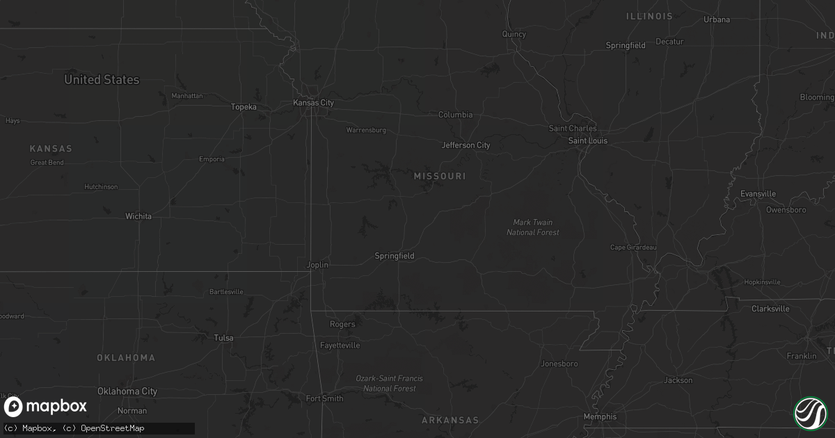
Hail Map on August 4, 2022
Get this storm
August 4 map
$229
one time, instant access
Download today. No call, no setup
Keep the $229
Bought the map and want the full workflow? Apply the entire $229 to a subscription within 7 days. None of it is wasted.
Every map, not just this one
This buys you this map. Subscription and you get every map we run, in the markets you choose from a few cities to whole states to nationwide. Plus real-time alerts the moment a storm fires.
Contact data
Name, contact info, occupancy, even credit band for addresses in the footprint. You go from where it hit to who to call.
Become the source they trust
Unlimited branding weather history reports on demand. You already have the documented answer ready for the property owner, and you are the one who showed up with it.
Property data and RoofTrace estimates
Pull up any address you have got, its value and the exact code rules for that jurisdiction, straight from One Click Code. Then RoofTrace estimates the squares, pitch, and roof value, priced the way you price.
States Impacted by Hail Map on August 4, 2022
Storm reports
New Jersey
| Date | Description |
|---|---|
| 08/04/20226:50 PM CDT | Lower alloways creek mesonet gusted to 59 mph. Time given in report. |
| 08/04/20226:45 PM CDT | Lower alloways creek mesonet gusted to 59 mph. |
| 08/04/20224:39 AM CDT | At 939 PM EDT, a severe thunderstorm was located over Twin Rivers, or 13 miles south of New Brunswick, moving east at 5 mph. HAZARD...60 mph wind gusts and penny size hail. SOURCE...Radar indicated. IMPACT...Damage to roofs, siding, trees, and power lines is possible. Locations impacted include... Old Bridge, Manalapan, Jamesburg, Hightstown, Cranbury, Roosevelt, Yorketown, Twin Rivers, Whittingham, West Freehold, Clearbrook Park, Morganville, Freehold, Spotswood, Helmetta, Englishtown, Concordia and Rossmoor.This includes New Jersey Turnpike between exits 8A and 9. |
| 08/04/20223:52 AM CDT | At 852 PM EDT, a severe thunderstorm was located over Oakwood, or over Todt Hill, and is nearly stationary. HAZARD...60 mph wind gusts and penny size hail. SOURCE...Radar indicated. IMPACT...Expect damage to trees and power lines. This severe thunderstorm will be near... Oakwood around 900 PM EDT. Tompkinsville around 925 PM EDT. The Verrazano Narrows Bridge around 945 PM EDT. |
| 08/04/20223:37 AM CDT | At 837 PM EDT, severe thunderstorms were located along a line extending from Bowers to near Andrewsville to 6 miles southeast of Cambridge, moving southeast at 25 mph. HAZARD...60 mph wind gusts and penny size hail. SOURCE...Radar indicated. IMPACT...Damage to roofs, siding, trees, and power lines is possible. Locations impacted include... Dover, Georgetown, Milford, Seaford, Millsboro, Laurel, Harrington, Lewes, Federalsburg, Milton, Bridgeville, Delmar, Dagsboro, Ellendale, Bowers, Henlopen Acres, Smithville, Gumboro, Cape Henlopen State Park and Agner. |
Ohio
| Date | Description |
|---|---|
| 08/04/20224:56 PM CDT | Tree down across waynesburg road ne. |
| 08/04/20221:28 PM CDT | Numerous trees uprooted and damaged near the greene county fish and game association. Time estimated by radar. |
| 08/04/202212:21 PM CDT | Tree down across waynesburg road ne. |
| 08/04/202212:13 AM CDT | At 513 PM EDT, a severe thunderstorm was located near New Cumberland, or near Wellsville, moving east at 30 mph. HAZARD...60 mph wind gusts. SOURCE...Radar indicated. IMPACT...Expect damage to trees and power lines, resulting in some power outages. Locations impacted include... Wellsville, Toronto, Chester, New Cumberland, Shippingport, Irondale, New Manchester, Empire, Stratton, Hookstown, Frankfort Springs, and Hammondsville. |
| 08/03/20228:24 PM CDT | At 124 PM EDT, a severe thunderstorm was located near East Palestine, moving east at 20 mph. HAZARD...60 mph wind gusts and nickel size hail. SOURCE...Radar indicated. IMPACT...Expect damage to trees and power lines, resulting in some power outages. Locations impacted include... New Castle, East Palestine, Ellwood City, Oakwood, New Castle Northwest, Big Beaver, New Beaver, Ellport, Bessemer, Koppel, Wampum, and South New Castle. |
| 08/03/20228:18 PM CDT | At 118 PM EDT, a severe thunderstorm was located over Carrollton, moving east at 15 mph. HAZARD...60 mph wind gusts and nickel size hail. SOURCE...Radar indicated. IMPACT...Expect damage to trees and power lines, resulting in some power outages. Locations impacted include... Carrollton, Salineville, Bergholz, Amsterdam, Summitville, Mechanicstown, Harlem Springs, and Kilgore. |
| 08/03/20228:00 PM CDT | At 1259 PM EDT, a severe thunderstorm was located over Oakwood, or near New Castle, moving east at 15 mph. HAZARD...60 mph wind gusts and quarter size hail. SOURCE...Radar indicated. IMPACT...Minor hail damage to vehicles is possible. Expect wind damage to trees and power lines, resulting in some power outages. Locations impacted include... New Castle, New Wilmington, Oakwood, New Castle Northwest, Pulaski, Bessemer, New Bedford, Plain Grove Township, South New Castle, Harlansburg, Volant, and Rose Point Park. |
Arizona
| Date | Description |
|---|---|
| 08/04/20227:50 AM CDT | At 1249 AM MST, severe thunderstorms were located along a line extending from 12 miles north of Safford Regional Airport to 6 miles east of Solomon, moving west at 10 mph. HAZARD...60 mph wind gusts and quarter size hail. SOURCE...Radar indicated. IMPACT...Hail damage to vehicles is expected. Expect wind damage to roofs, siding, and trees. Locations impacted include... Safford, Thatcher, Solomon, Roper Lake State Park, Safford Regional Airport and Swift Trail Junction. |
| 08/03/202211:55 PM CDT | At 454 PM MST, a severe thunderstorm was located 15 miles southwest of Bar Ten Ranch, or 57 miles southeast of Littlefield, moving west at 20 mph. HAZARD...60 mph wind gusts and quarter size hail. SOURCE...Radar indicated. IMPACT...Hail damage to vehicles is expected. Expect wind damage to roofs and trees. Locations impacted include... Grand Canyon Skywalk. |
Maine
| Date | Description |
|---|---|
| 08/04/20224:34 AM CDT | At 933 PM EDT, severe thunderstorms were located along a line extending from 8 miles northeast of Waterford to near Cornish, moving northeast at 30 mph. HAZARD...60 mph wind gusts and quarter size hail. SOURCE...Radar indicated. IMPACT...Hail damage to vehicles is expected. Expect wind damage to roofs, siding, and trees. Locations impacted include... Lewiston, Bridgton, Mechanic Falls, Naples, Turner, Gray, Jay, Livermore Falls, Hiram, Canton, Raymond, Waterford, Greene, Casco, Harrison, Leeds, Livermore, Buckfield, Brownfield and Hebron.This includes Interstate 95 between mile markers 66 and 79. |
| 08/04/20223:47 AM CDT | At 847 PM EDT, a severe thunderstorm was located 9 miles south of Dixfield, or 10 miles south of Rumford, moving northeast at 25 mph. HAZARD...60 mph wind gusts and quarter size hail. SOURCE...Radar indicated. IMPACT...Hail damage to vehicles is expected. Expect wind damage to roofs, siding, and trees. Locations impacted include... Bethel, Rumford, Jay, Livermore Falls, Dixfield, Canton, Wilton, Mexico, Livermore, Chesterville, Hartford, Carthage, Woodstock, Town Of Washington, Sumner, Milton, Peru, West Paris and Temple. |
| 08/04/20223:44 AM CDT | At 844 PM EDT, a severe thunderstorm was located near Conway, moving northeast at 20 mph. HAZARD...60 mph wind gusts and penny size hail. SOURCE...Radar indicated. IMPACT...Expect damage to roofs, siding, and trees. Locations impacted include... Conway, Fryeburg, Waterford, Bartlett, Madison, Lovell, Jackson, Albany, Chatham, Sweden, Stowe and Stoneham. |
| 08/03/20229:03 PM CDT | Tree across morrill st near high school. Time estimated by radar. |
| 08/03/20228:41 PM CDT | Large tree down with wires involved at intersection of buckfield rd. And cross st. Road is closed. Time estimated by radar. |
| 08/03/20228:36 PM CDT | Large tree down at intersection of e. Oxford rd and sam rowe hill rd. Time estimated by radar. |
| 08/03/20228:10 PM CDT | Power outage due to downed trees. |
| 08/03/20228:05 PM CDT | Multiple downed trees. |
| 08/03/20228:00 PM CDT | Tree down with wires involved on fern dr. Time estimated by radar. |
| 08/03/20228:00 PM CDT | Multiple trees down on n. Butterfield rd. |
| 08/03/20227:54 PM CDT | Large pine tree down across little chatham rd. Road is closed. Time estimated by radar. |
Nebraska
| Date | Description |
|---|---|
| 08/04/20223:30 AM CDT | At 829 PM CDT/729 PM MDT/, a severe thunderstorm was located 10 miles south of Nenzel, or 27 miles west of Valentine, moving south at 20 mph. HAZARD...Golf ball size hail and 60 mph wind gusts. SOURCE...Radar indicated. IMPACT...People and animals outdoors will be injured. Expect hail damage to roofs, siding, windows, and vehicles. Expect wind damage to roofs, siding, and trees. Locations impacted include... Merritt Reservoir, Steer Creek Campground and Anderson Bridge State Wildlife Management Area.This includes Highway 97 between mile markers 95 and 117. |
Florida
| Date | Description |
|---|---|
| 08/04/202212:44 AM CDT | At 544 PM EDT, a severe thunderstorm was located near Moss Bluff, or near Juniper Springs, moving northwest at 20 mph. HAZARD...60 mph wind gusts. SOURCE...Radar indicated. IMPACT...Expect damage to roofs, siding, and trees. Locations impacted include... Lynne, Juniper Springs and Moss Bluff. |
Vermont
| Date | Description |
|---|---|
| 08/04/20225:48 PM CDT | Multiple trees down in springfield |
| 08/04/20225:38 PM CDT | Report of downed trees and wires in rockingham. Radar estimated. |
| 08/04/20225:17 PM CDT | Trees and wires down in dummerstom near route 30. Time estimated. |
| 08/04/20225:07 PM CDT | Trees and wires down in west dover. Time estimated by radar. |
| 08/04/20224:59 PM CDT | Trees down on wires along rt 30. Time estimated from radar. |
| 08/04/20224:48 PM CDT | Trees and wires down near route 30 in jamaica. Time estimated by radar. |
| 08/04/20224:42 PM CDT | Multiple trees down in west pawlet village |
| 08/04/20224:32 PM CDT | Trees down partially blocking rt 7a in arlington. Time estimated from radar. |
| 08/04/20224:27 PM CDT | Trees and wires down throughout bennington and surrounding towns. |
| 08/04/20224:07 PM CDT | Tree and wires on a house on water street in north bennington. |
| 08/04/20224:07 PM CDT | Trees down on white creek rd. Time estimated from radar. |
| 08/04/202212:23 AM CDT | At 523 PM EDT, a severe thunderstorm was located over West Pawlet, moving northeast at 30 mph. HAZARD...60 mph wind gusts and quarter size hail. SOURCE...Radar indicated. IMPACT...Minor hail damage to vehicles is possible. Expect wind damage to trees and powerlines. Locations impacted include... Rutland, Castleton, Pawlet, Poultney Village, Mount Tabor, Tinmouth, Rutland City, Middletown Springs, Wallingford, Mt. Tabor, Danby, Proctor, Lake St. Catherine, Rutland - Southern Vermont Airport, Poultney, Clarendon, West Rutland, Ira, Wells and Pittsford. |
| 08/04/202212:01 AM CDT | At 501 PM EDT, a severe thunderstorm was located near Greenwich, or 8 miles west of Salem, moving northeast at 25 mph. HAZARD...60 mph wind gusts and quarter size hail. SOURCE...Radar indicated. IMPACT...Hail damage to vehicles is expected. Expect wind damage to roofs, siding, and trees. Locations impacted include... Salem, Dorset, Greenwich, Porter, Rupert, Peru, Argyle, Cossayuna, Beartown, Braymer School, Battenville, Goose Island, Peru Town Center, East Hebron, Rexleigh, Tiplady, Middle Falls, West Pawlet, Freedleyville and West Rupert. |
| 08/03/202211:43 PM CDT | At 442 PM EDT, a severe thunderstorm was located near Waterford, or near Mechanicville, moving east at 25 mph. HAZARD...60 mph wind gusts and quarter size hail. SOURCE...Radar indicated. IMPACT...Hail damage to vehicles is expected. Expect wind damage to roofs, siding, and trees. Locations impacted include... Troy, Bennington, Cohoes, Mechanicville, Hoosick Falls, Arlington, Latham, Shaftsbury, Green Island, Waterford, Cambridge, Center Brunswick, Halfmoon, Hoosick, Lee, Pittstown, White Creek, Stillwater, North Bennington and Schaghticoke. |
| 08/03/202211:27 PM CDT | At 427 PM EDT, a severe thunderstorm was located over Delmar, moving east at 25 mph. HAZARD...60 mph wind gusts and quarter size hail. SOURCE...Radar indicated. IMPACT...Hail damage to vehicles is expected. Expect wind damage to roofs, siding, and trees. Locations impacted include... Albany, Troy, East Greenbush, Watervliet, Rensselaer, Colonie, Delmar, Guilderland, Menands, Voorheesville, Green Island, Grafton, Berlin, Castleton-On-Hudson, Loudonville, West Sand Lake, Averill Park, Selkirk, Center Brunswick and Wyantskill. |
| 08/03/202211:00 PM CDT | At 400 PM EDT, a severe thunderstorm was located over Ballston Spa, or 7 miles southwest of Saratoga Springs, moving east at 30 mph. HAZARD...60 mph wind gusts and quarter size hail. SOURCE...Radar indicated. IMPACT...Hail damage to vehicles is expected. Expect wind damage to roofs, siding, and trees. Locations impacted include... Saratoga Springs, Salem, Ballston Spa, Cambridge, Greenwich, Round Lake, Burnt Hills, Rock City Falls, Country Knolls, North Ballston Spa, Gates, Malta, Greenfield, Porter, Lee, Northumberland, Easton, Stillwater, Schuylerville and Victory. |
North Carolina
| Date | Description |
|---|---|
| 08/04/20226:18 PM CDT | Relayed report of trees and lines downed along charles rd. |
| 08/04/20225:15 PM CDT | Tree and lines down along robinson-clemmer rd. |
| 08/04/20223:45 PM CDT | Tree and/or limbs downed caused damage to power equipment resulting in a power outage. Time estimated by radar. |
| 08/04/20224:16 AM CDT | At 916 PM EDT, severe thunderstorms were located along a line extending from near Hillsborough to 7 miles west of Carrboro to 8 miles northeast of Siler City, moving north at 5 mph. HAZARD...60 mph wind gusts and quarter size hail. SOURCE...Radar indicated. IMPACT...Hail damage to vehicles is expected. Expect wind damage to roofs, siding, and trees. Locations impacted include... Chapel Hill, Hillsborough, Carrboro, Mebane, Efland, Eno River State Park, Sutphin, Cane Creek Reservoir and Saxapahaw. |
| 08/04/202212:54 AM CDT | At 554 PM EDT, a severe thunderstorm was located 4 miles west of Rock Hill, or 4 miles south of Newport, moving north at 10 mph. HAZARD...60 mph wind gusts and penny size hail. SOURCE...Radar indicated. IMPACT...Expect damage to trees and power lines. Locations impacted include... Rock Hill, Tega Cay, Clover, Newport, Steele Creek, Carowinds, Lake Wylie, York, Fort Mill and Mcconnells. |
| 08/03/202211:40 PM CDT | At 440 PM EDT, a severe thunderstorm was located 10 miles south of Clinton, moving north at 10 mph. HAZARD...Quarter size hail. SOURCE...Radar indicated. IMPACT...Damage to vehicles is expected. Locations impacted include... Clinton, Roseboro, Garland and Salemburg. |
District of Columbia
| Date | Description |
|---|---|
| 08/04/20225:45 PM CDT | Trees blew down along beach drive northwest between the tunnel by the national zoo and porter street northwest/klingle road northwest. |
| 08/04/20224:57 PM CDT | A local report indicates 58 MPH wind near REAGAN NATIONAL APT |
| 08/04/20224:53 PM CDT | A local report indicates 58 MPH wind near REAGAN NATIONAL ARPT |
| 08/04/20224:52 PM CDT | Wind gusts of up to 50 knots |
| 08/04/20221:28 AM CDT | At 627 PM EDT, a severe thunderstorm was located over Annandale, moving east at 10 mph. HAZARD...60 mph wind gusts and quarter size hail. SOURCE...Radar indicated. IMPACT...Damaging winds will cause some trees and large branches to fall. This could injure those outdoors, as well as damage homes and vehicles. Roadways may become blocked by downed trees. Localized power outages are possible. Unsecured light objects may become projectiles. Locations impacted include... Arlington, Alexandria, Bethesda, Bowie, Annandale, Clinton, Springfield, College Park, Fort Washington, Greenbelt, Fairfax, Langley Park, Beltsville, Fort Hunt, Vienna, Groveton, Forestville, Falls Church, Huntington and Largo. |
| 08/03/20228:50 PM CDT | Trees blew down along beach drive northwest between the tunnel by the national zoo and porter street northwest/klingle road northwest. A tree blew down on northbound no |
West Virginia
| Date | Description |
|---|---|
| 08/04/20224:27 PM CDT | Multiple trees down across allison road. |
| 08/04/20223:46 PM CDT | Downed tree partially blocking the roadway near the 2500 block of shirley rd. |
| 08/04/20222:59 PM CDT | Multiple trees down just east of martinsburg. |
| 08/04/20222:52 PM CDT | Multiple trees down along hedgesville rd. |
| 08/04/20222:52 PM CDT | Multiple trees down along wv-9 hedgesville road. |
| 08/04/20222:38 PM CDT | Trees blew down near the intersection of ascension drive and terrain drive. |
| 08/04/20222:32 PM CDT | Trees down near the intersection of ascension dr and terrain dr. |
| 08/04/20222:32 PM CDT | Tree down along bald eagle trail |
| 08/04/20222:02 PM CDT | A tree was down along johnson mill road. |
| 08/04/20222:00 PM CDT | A tree was down along highland ridge road. |
| 08/04/202212:11 PM CDT | Three trees down in old fields near us-220. |
| 08/03/202211:24 PM CDT | At 423 PM EDT, a severe thunderstorm was located near Inwood, or 8 miles west of Charles Town, moving northeast at 10 mph. HAZARD...60 mph wind gusts and quarter size hail. SOURCE...Radar indicated. IMPACT...Damaging winds will cause some trees and large branches to fall. This could injure those outdoors, as well as damage homes and vehicles. Roadways may become blocked by downed trees. Localized power outages are possible. Unsecured light objects may become projectiles. Locations impacted include... Martinsburg, Ranson, Kearneysville, Shenandoah Junction, Middleway, Winebrenners Cross, Vanville and Martinsburg Airport. |
| 08/03/202211:07 PM CDT | At 407 PM EDT, severe thunderstorms were located along a line extending from near Wilson-Conococheague to 8 miles west of Williamsport to near Martinsburg, moving northeast at 25 mph. HAZARD...60 mph wind gusts and quarter size hail. SOURCE...Radar indicated. IMPACT...Damaging winds will cause some trees and large branches to fall. This could injure those outdoors, as well as damage homes and vehicles. Roadways may become blocked by downed trees. Localized power outages are possible. Unsecured light objects may become projectiles. Locations impacted include... Hagerstown, Martinsburg, Municipal Stadium, Wilson-Conococheague, Williamsport, Saint James, Berkeley, Halfway, Falling Waters, Hedgesville and Big Spring. |
| 08/03/202210:00 PM CDT | At 300 PM EDT, a severe thunderstorm was located near Berkeley Springs, or 8 miles south of Hancock, moving northeast at 15 mph. HAZARD...60 mph wind gusts and quarter size hail. SOURCE...Radar indicated. IMPACT...Damaging winds will cause some trees and large branches to fall. This could injure those outdoors, as well as damage homes and vehicles. Roadways may become blocked by downed trees. Localized power outages are possible. Unsecured light objects may become projectiles. Locations impacted include... Clear Spring, Pecktonville, Big Pool, Johnsons Mill, Cherry Run, Spohrs Crossroads, New Hope, Spruce Pine Hollow, Sleepy Creek and Shady Grove. |
| 08/03/20229:23 PM CDT | At 223 PM EDT, a severe thunderstorm was located 9 miles northeast of Weirton, moving east at 15 mph. HAZARD...60 mph wind gusts and quarter size hail. SOURCE...Radar indicated. IMPACT...Minor hail damage to vehicles is possible. Expect wind damage to trees and power lines, resulting in some power outages. Locations impacted include... Weirton, Imperial, Sturgeon-Noblestown, Burgettstown, Frankfort Springs, Pittsburgh International Airport, Enlow, Hanover Township, Raccoon Creek State Park, Langeloth, North Fayette Township, and Slovan. |
| 08/03/20229:05 PM CDT | At 205 PM EDT, a severe thunderstorm was located 11 miles east of Addison (Webster Springs), or 11 miles east of Webster Springs, moving east at 30 mph. HAZARD...60 mph wind gusts and penny size hail. SOURCE...Radar indicated. IMPACT...Expect damage to roofs, siding, and trees. Locations impacted include... Mingo, Monterville, Valley Head and Waneta. |
| 08/03/20228:06 PM CDT | At 106 PM EDT, a severe thunderstorm was located 9 miles north of Moorefield, moving east at 10 mph. HAZARD...60 mph wind gusts and quarter size hail. SOURCE...Radar indicated. IMPACT...Damaging winds will cause some trees and large branches to fall. This could injure those outdoors, as well as damage homes and vehicles. Roadways may become blocked by downed trees. Localized power outages are possible. Unsecured light objects may become projectiles. Locations impacted include... Williamsport, Mcneill, Old Fields and Purgitsville. |
| 08/03/20227:42 PM CDT | One tree down.time estimated from radar. |
South Carolina
| Date | Description |
|---|---|
| 08/04/20225:10 PM CDT | Trees downed along lake wylie... Reported via social media. |
| 08/04/202212:30 AM CDT | At 530 PM EDT, a severe thunderstorm was located 9 miles southeast of Spartanburg, or near Croft State Park, moving north at 10 mph. HAZARD...60 mph wind gusts and penny size hail. SOURCE...Radar indicated. IMPACT...Expect damage to trees and power lines. Locations impacted include... Pacolet, Cowpens, Jonesville, Pacolet Mills, Croft State Park, Cedar Springs, Thicketty, Pauline, Mayo and Spartanburg. |
| 08/03/202210:33 PM CDT | At 333 PM EDT, a severe thunderstorm was located near Woods Bay State Park, or 12 miles west of Lake City, moving north at 5 mph. HAZARD...60 mph wind gusts and penny size hail. SOURCE...Radar indicated. IMPACT...Expect damage to trees and powerlines. Locations impacted include... Woods Bay State Park, Turbeville, Shiloh and Gable. This includes Interstate 95 between mile markers 131 and 146. |
| 08/03/20229:35 PM CDT | At 234 PM EDT, a severe thunderstorm was located near Blue Brick, or 7 miles southwest of Marion, moving north at 25 mph. HAZARD...60 mph wind gusts. SOURCE...Radar indicated. IMPACT...Expect wind damage to trees and power lines. Locations impacted include... Marion, Dillon, Latta, Sellers, Floydale, Blue Brick, Oak Grove and Mcleod Medical Center. |
New Mexico
| Date | Description |
|---|---|
| 08/04/20227:28 AM CDT | At 1227 AM MDT, a severe thunderstorm was located 6 miles east of Road Forks, moving northwest at 15 mph. HAZARD...60 mph wind gusts and quarter size hail. SOURCE...Radar indicated. IMPACT...Hail damage to vehicles is expected. Expect wind damage to roofs, siding, and trees. Locations impacted include... Steins, Cotton City, Road Forks, Lordsburg Playa and Pyramid Mountains.This includes Interstate 10 in New Mexico between mile markers 1 and15. |
| 08/03/202211:40 PM CDT | At 439 PM MDT, a severe thunderstorm was located near Saint Vrain, or 17 miles northwest of Portales, moving north at 15 mph. HAZARD...60 mph wind gusts and penny size hail. SOURCE...Radar indicated. IMPACT...Expect damage to roofs, siding, and trees. Locations impacted include... Portales, Melrose, Floyd, Saint Vrain, Cannon Air Force Base, Oasis State Park and Portair.This includes Highway 60 between Mile Markers 359 and 383. |
| 08/03/202211:00 PM CDT | At 400 PM MDT, a severe thunderstorm was located 11 miles north of Elida, or 16 miles west of Portales, moving northwest at 10 mph. HAZARD...60 mph wind gusts and quarter size hail. SOURCE...Radar indicated. IMPACT...Hail damage to vehicles is expected. Expect wind damage to roofs, siding, and trees. Locations impacted include... Floyd. |
| 08/03/202210:36 PM CDT | At 336 PM MDT, a severe thunderstorm was located over McGregor Range Base, moving northwest at 10 mph. HAZARD...Quarter size hail. SOURCE...Radar indicated. IMPACT...Damage to vehicles is expected. Locations impacted include... McGregor Range Base.This includes Highway 54 in New Mexico between mile markers 5 and 16. |
Tennessee
| Date | Description |
|---|---|
| 08/04/20225:20 PM CDT | Few trees down. Time estimated. |
| 08/04/20221:22 AM CDT | At 622 PM EDT, a severe thunderstorm was located 10 miles east of Russellville, or 11 miles west of Greeneville, moving north at 15 mph. HAZARD...60 mph wind gusts and penny size hail. SOURCE...Radar indicated. IMPACT...Expect damage to roofs, siding, and trees. Locations impacted include... Greeneville, Rogersville, Mosheim, Bulls Gap, Baileyton, St. Clair, Kepler, McCloud, Romeo and Mohawk.This includes Interstate 81 in Tennessee between mile markers 17 and36. |
| 08/04/20221:00 AM CDT | At 600 PM EDT, a severe thunderstorm was located near Farragut, or near Lenoir City, moving north at 20 mph. HAZARD...60 mph wind gusts. SOURCE...Radar indicated. IMPACT...Expect damage to roofs, siding, and trees. Locations impacted include... Knoxville, Oak Ridge, Maryville, Clinton, Lenoir City, Alcoa, Farragut, Louisville, Friendsville and Karns.This includes the following highways... Interstate 40 in Tennessee between mile markers 367 and 394. Interstate 75 in Tennessee between mile markers 81 and 112. |
Nevada
| Date | Description |
|---|---|
| 08/04/202212:28 AM CDT | At 528 PM PDT, a severe thunderstorm was located near Panaca, or 12 miles southeast of Pioche, moving northwest at 25 mph. HAZARD...60 mph wind gusts and quarter size hail. SOURCE...Radar indicated. IMPACT...Hail damage to vehicles is expected. Expect wind damage to roofs and trees. Locations impacted include... Ursine, Pioche, Meadow Valley Campground, Panaca, Echo Canyon State Park, Cathedral Gorge State Park and Horsethief Gulch Campground. |
| 08/03/20227:30 PM CDT | Large tree down on the east side of panaca. |
Pennsylvania
| Date | Description |
|---|---|
| 08/04/20226:45 PM CDT | Em reports trees down on wires. Time estimated via radar. |
| 08/04/20226:41 PM CDT | Corrects time on previous tstm wnd dmg report from trappe. Meant 2341z rather than 2241z. Large limbs and branches down. Report via social media. Time estimated via rad |
| 08/04/20226:38 PM CDT | Reports of trees down on wires in limerick... Pa. Time estimated via radar. |
| 08/04/20226:30 PM CDT | Reports of trees and wires down around phoenixville. Time estimated via radar. |
| 08/04/20225:55 PM CDT | Reports of trees and wires down around wallace twp. Time estimated via radar. |
| 08/04/20225:41 PM CDT | Large limbs and branches down. Report via social media. Time estimated via radar. |
| 08/04/20225:40 PM CDT | Trees and wires down around west brandywine... Twp. Time estimated via radar. |
| 08/04/20225:30 PM CDT | Tree down on a car and a tree down on a propane tank between w main st and n market st. |
| 08/04/20225:07 PM CDT | Trees down near muddy creek forks rd and good rd. |
| 08/04/20224:00 PM CDT | Trees down. |
| 08/04/20223:45 PM CDT | Trees down. |
| 08/04/20223:30 PM CDT | Several reports of trees down. Trees on wires. |
| 08/04/20223:15 PM CDT | Power line down at cumberland dr and wayne rd. |
| 08/04/20222:36 PM CDT | Trees and wires down |
| 08/04/20222:26 PM CDT | Tree down |
| 08/04/20221:40 PM CDT | Trees down. Also hail up to quarter size. |
| 08/04/202212:57 PM CDT | Tree down at the intersection of sr36 and dory carson road. |
| 08/04/202212:51 PM CDT | Multiple trees and power poles down along sr108 ne of slippery rock. |
| 08/04/202212:35 PM CDT | Trees blown down on wires. |
| 08/04/202212:27 PM CDT | Tree down at leslie road and wampum mt air road. |
| 08/04/202212:23 PM CDT | Trees and wires down. |
| 08/04/202212:21 PM CDT | Multiple trees down |
| 08/04/202212:16 PM CDT | A couple of trees down across rockland cranberry road. |
| 08/04/20222:24 AM CDT | At 724 PM EDT, a severe thunderstorm was located near Royersford, or 17 miles north of West Chester, moving northeast at 35 mph. HAZARD...60 mph wind gusts and penny size hail. SOURCE...Radar indicated. IMPACT...Damage to roofs, siding, trees, and power lines is possible. Locations impacted include... Pottstown, Phoenixville, Lansdale, Quakertown, Perkasie, Doylestown, Souderton, Collegeville, Royersford, Chalfont, Trappe, Hatfield, Dublin, Schwenksville, Green Lane, Fricks, Pughtown, Spring Mount, Gilbertsville and Cedarville.This includes Northeast Extension between mile markers 28 and 44. |
| 08/04/202212:05 AM CDT | At 505 PM EDT, a severe thunderstorm was located over Chester Hill, moving east at 35 mph. HAZARD...60 mph wind gusts and penny size hail. SOURCE...Radar indicated. IMPACT...Expect damage to roofs, siding, and trees. Locations impacted include... Bellefonte, Park Forest Village, Pleasant Gap, Philipsburg, Woodland, Lemont, Houserville, Osceola Mills, Milesburg, Chester Hill, Houtzdale and Snow Shoe.For those driving on Interstate 80, this includes areas between theWoodland and Bellefonte exits, specifically from mile markers 124 to160.This includes Interstate 99 from mile markers 64 to 85. |
| 08/03/202211:10 PM CDT | At 410 PM EDT, a severe thunderstorm was located over Drums, or near Hazleton, moving east at 15 mph. HAZARD...60 mph wind gusts and quarter size hail. SOURCE...Radar indicated. IMPACT...Hail damage to vehicles is expected. Expect wind damage to roofs, siding, and trees. Locations impacted include... Hazleton, West Hazleton, Freeland, Bear Creek, Dorrance, Conyngham, Slocum, White Haven, Sugar Notch and Nuangola. |
| 08/03/202210:18 PM CDT | At 318 PM EDT, a cluster of severe thunderstorms was located near Plum, or near Penn Hills, and near Saltsburg moving east at 15 mph. HAZARD...60 mph wind gusts and quarter size hail. SOURCE...Radar indicated. IMPACT...Minor hail damage to vehicles is possible. Expect wind damage to trees and power lines, resulting in some power outages. Locations impacted include... Penn Hills, Monroeville, Indiana, Vandergrift, Homer City, Apollo, Plum, Murrysville, Wilkinsburg, New Kensington, Lower Burrell, and Harrison Township. |
| 08/03/20228:51 PM CDT | At 151 PM EDT, a severe thunderstorm was located over Slippery Rock, or near Grove City, moving east at 20 mph. HAZARD...60 mph wind gusts. SOURCE...Radar indicated. IMPACT...Expect damage to trees and power lines, resulting in some power outages. Locations impacted include... Grove City, Slippery Rock, Harrisville, Plain Grove Township, Bruin, Clintonville, West Liberty, Eau Claire, Petrolia, Karns City, Fairview, and West Sunbury. |
| 08/03/20228:48 PM CDT | At 147 PM EDT, a severe thunderstorm was located over Franklinville, moving northeast at 35 mph. HAZARD...60 mph wind gusts and half dollar size hail. SOURCE...Radar indicated. IMPACT...Hail damage to vehicles is expected. Expect wind damage to roofs, siding, and trees. Locations impacted include... State College, Bellefonte, Boalsburg, Pleasant Gap, Lemont, Zion, Houserville, Pine Grove Mills, Milroy, Centre Hall, Ramblewood and Reedsville.For those driving on Interstate 80, this includes areas between theBellefonte and Lamar exits, specifically near mile marker 162.This includes Interstate 99 from mile markers 74 to 83. |
| 08/03/20228:40 PM CDT | At 140 PM EDT, a severe thunderstorm was located near Oil City, moving east at 25 mph. HAZARD...60 mph wind gusts. SOURCE...Radar indicated. IMPACT...Expect damage to trees and power lines, resulting in some power outages. Locations impacted include... Oil City, Sugarcreek, Tionesta, Hasson Heights, Seneca, Rouseville, Woodland Heights, Fryburg, Kellettville, West Hickory, Leeper, and Starr. |
| 08/03/20228:29 PM CDT | At 127 PM EDT, a severe thunderstorm was located near Shinglehouse, or 12 miles southwest of Wellsville, moving northeast at 35 mph. HAZARD...60 mph wind gusts and quarter size hail. SOURCE...Radar indicated. IMPACT...Minor damage to vehicles is possible. Expect wind damage to trees and power lines. Locations impacted include... Wellsville, Whitesville, Andover, Alma, Stannards and Paynesville. |
| 08/03/20228:26 PM CDT | At 126 PM EDT, a severe thunderstorm was located over Bald Eagle State Park, moving east at 35 mph. HAZARD...60 mph wind gusts and quarter size hail. SOURCE...Radar indicated. IMPACT...Hail damage to vehicles is expected. Expect wind damage to roofs, siding, and trees. Locations impacted include... Lock Haven, Carroll, Lamar, Zion, Mill Hall, Avis, Dunnstown, Flemington, Castanea, Blanchard, McElhattan and Monument.For those driving on Interstate 80, this includes areas between theBellefonte and Mile Run exits, specifically from mile markers 161 to195. |
| 08/03/20228:18 PM CDT | At 118 PM EDT, a severe thunderstorm was located over Trough Creek State Park, moving east at 35 mph. HAZARD...60 mph wind gusts and nickel size hail. SOURCE...Radar indicated. IMPACT...Expect damage to roofs, siding, and trees. Locations impacted include... Mount Union, Rockhill Furnace, Dudley, Raystown Dam, Shy Beaver, Trough Creek State Park, Entriken, Broad Top City, Mapleton, Orbisonia, Saltillo and Mill Creek. |
Texas
| Date | Description |
|---|---|
| 08/04/20226:31 PM CDT | West texas mesonet site in goodnight. |
| 08/04/20225:18 PM CDT | A local report indicates 69 MPH wind near HAPPY |
| 08/04/20225:13 PM CDT | First gust of 58 mph or higher was at 5:12 pm cdt and lasted through 5:14 pm cdt. |
| 08/04/20224:58 PM CDT | A local report indicates 58 MPH wind near HAPPY |
| 08/04/20224:43 PM CDT | A local report indicates 60 MPH wind near VIGO PARK |
| 08/04/20224:23 PM CDT | A local report indicates 59 MPH wind near 7 ESE SILVERTON |
| 08/04/20225:40 AM CDT | West texas mesonet. |
| 08/04/20222:25 AM CDT | At 724 PM CDT, a severe thunderstorm was located over Childress, moving west at 10 mph. HAZARD...70 mph wind gusts. SOURCE...Radar indicated. At 714 PM a 75 mph wind gust was reported at the West Texas Mesonet station located 2 miles north northeast of Childress. IMPACT...Expect considerable tree damage. Damage is likely to mobile homes, roofs, and outbuildings. Locations impacted include... Childress, Tell and Estelline. |
| 08/04/202212:57 AM CDT | At 557 PM CDT, severe thunderstorms were located along a line extending from 10 miles north of Pampa to 4 miles south of Kingsmill to 11 miles south of Goodnight, moving east at 40 mph. HAZARD...70 mph wind gusts and penny size hail. SOURCE...Radar indicated. IMPACT...Expect some tree damage. Damage is likely to mobile homes, roofs, and outbuildings. Locations impacted include... Pampa, Panhandle, Clarendon, Claude, Miami, White Deer, Mclean, Groom, Lefors, Skellytown, Howardwick, Hedley, Lelia Lake, Lake Mcclellan, Wayside, Goodnight, Lora, Kingsmill, Alanreed and Codman. |
| 08/03/202211:58 PM CDT | At 458 PM CDT, severe thunderstorms were located along a line extending from 8 miles north of Caprock Canyon State Park to 5 miles west of Vigo Park to 11 miles southwest of Happy, moving north at 15 mph. HAZARD...60 mph wind gusts. SOURCE...Radar indicated. IMPACT...Expect damage to roofs, siding, and trees. Locations impacted include... Tulia, Silverton, Caprock Canyon State Park, Happy, Vigo Park, Mackenzie Reservoir and Nazareth. |
| 08/03/202211:56 PM CDT | At 455 PM CDT, severe thunderstorms were located along a line extending from 7 miles north of Groom to 4 miles southwest of Goodnight to Vigo Park, moving east at 30 mph. HAZARD...60 mph wind gusts and quarter size hail. SOURCE...Radar indicated. IMPACT...Minor damage to roofs, siding, and trees is possible. Hail damage to vehicles is expected. Locations impacted include... Clarendon, Claude, Groom, Lefors, Howardwick, Hedley, Lelia Lake, Lake Mcclellan, Wayside, Palo Duro Canyon, Goodnight, Alanreed and Greenbelt Lake. |
| 08/03/202211:51 PM CDT | At 450 PM MDT, a severe thunderstorm was located 4 miles southwest of Sierra Blanca, moving west at 10 mph. HAZARD...Quarter size hail. SOURCE...Radar indicated. IMPACT...Damage to vehicles is expected. Locations impacted include... Sierra Blanca and Quitman Canyon. This includes Interstate 10 in Texas near mile marker 107. |
| 08/03/202211:39 PM CDT | At 438 PM CDT, a severe thunderstorm was located 9 miles southwest of Claude, moving south at 20 mph. HAZARD...60 mph wind gusts and nickel size hail. SOURCE...Radar indicated. IMPACT...Minor damage to roofs, siding, and trees is possible. Locations impacted include... Claude, Wayside and Palo Duro Canyon. |
| 08/03/202211:20 PM CDT | At 419 PM CDT, a severe thunderstorm was located 5 miles northwest of Tulia, and is nearly stationary. HAZARD...60 mph wind gusts and quarter size hail. SOURCE...Radar indicated. IMPACT...Hail damage to vehicles is expected. Expect wind damage to roofs, siding, and trees. Locations impacted include... Tulia. |
| 08/03/202210:56 PM CDT | At 355 PM CDT, a severe thunderstorm was located 9 miles west of Panhandle, moving east at 15 mph. HAZARD...60 mph wind gusts and half dollar size hail. SOURCE...Radar indicated. IMPACT...Minor damage to roofs, siding, and trees is possible. Hail damage to vehicles is expected. Locations impacted include... Amarillo, Panhandle, Claude, White Deer, Washburn and Pantex. |
| 08/03/20229:14 PM CDT | A local report indicates 71 MPH wind near 5 SSW GRAHAM |
| 08/03/20227:14 PM CDT | A local report indicates 75 MPH wind near 2 NNE CHILDRESS |
| 08/03/20227:09 PM CDT | A local report indicates 66 MPH wind near 3 NNW MCADOO |
| 08/03/20227:05 PM CDT | A local report indicates 58 MPH wind near 1 W SPUR |
Virginia
| Date | Description |
|---|---|
| 08/04/20226:54 PM CDT | A large tree fell on a house off snider branch road. |
| 08/04/20226:40 PM CDT | 2 trees down blocking road. |
| 08/04/20226:35 PM CDT | Tree down. Time estimated from radar. |
| 08/04/20226:22 PM CDT | Tree down. Time estimated from radar. |
| 08/04/20225:55 PM CDT | Few trees down near the intersection of spotswood trail and constitution hwy. |
| 08/04/20225:45 PM CDT | A tree was down along arlington boulevard by seven corners. |
| 08/04/20225:32 PM CDT | Trees blew down along va-649 hummer road and va-613 sleepy hollow road. |
| 08/04/20225:11 PM CDT | Few trees down near the intersection of lahore rd and pamunkey ln. |
| 08/04/20224:35 PM CDT | Several trees blew down near rose hill. A tree blew down onto northbound i-95/i-495 capital beltway outer loop near exit 174/eisenhower avenue connector blocking the ri |
| 08/04/20224:26 PM CDT | Downed tree blocking northbound lanes on rt 8692 near castlewellan dr. |
| 08/04/20224:05 PM CDT | Trees and power lines blew down along va-600 campbell road between va-686 paddock wood road and va-641 burnley station road. |
| 08/04/20223:25 PM CDT | Trees down near the 2400 block of berryville pike. |
| 08/04/20223:25 PM CDT | Several downed trees near the 100 block of mill race dr. |
| 08/04/20223:25 PM CDT | Downed tree near the intersection of sulphur springs rd and landfill rd. |
| 08/04/20223:22 PM CDT | Trees down near the intersection of winchester rd and fairgrounds rd. |
| 08/04/20223:15 PM CDT | Trees down near the intersection of reliance road and hidden valley lane. |
| 08/04/20223:12 PM CDT | Several trees down near the 2200 block of front royal dr. |
| 08/04/20223:07 PM CDT | Several trees and large tree limbs blew down and there was damage to siding and shutters on a home near the intersection of cheviot place and albin drive. |
| 08/04/20223:05 PM CDT | Tree limbs down and damage |
| 08/04/20223:05 PM CDT | Tree limbs down and damage to siding and shutters on home near the intersection of cheviot pl and albin dr. |
| 08/04/20223:02 PM CDT | Downed power lines near the intersection of salem church rd and town run ln. |
| 08/04/20222:45 PM CDT | Multiple trees down on king william rd near powhatan trl and scotland landing rd. Time estimated. |
| 08/04/20222:20 PM CDT | Trees down near kings pond and rd. |
| 08/04/20221:13 PM CDT | Five trees down on bluff mountain road. |
| 08/04/20221:02 PM CDT | A local report indicates 1.00 inch wind near 1 NNW FLETCHER |
| 08/04/20223:44 AM CDT | At 844 PM EDT, a severe thunderstorm was located over The Plains, or 10 miles north of Warrenton, moving northeast at 25 mph. HAZARD...60 mph wind gusts. SOURCE...Radar indicated. IMPACT...Damaging winds will cause some trees and large branches to fall. This could injure those outdoors, as well as damage homes and vehicles. Roadways may become blocked by downed trees. Localized power outages are possible. Unsecured light objects may become projectiles. Locations impacted include... Leesburg, South Riding, Broadlands, Brambleton, Chantilly, Middleburg, Arcola, The Plains, Oatlands, Delaplane, Marshall, Gleedsville, Woolsey, Rectortown, Aldie, Halfway and Saint Louis. |
| 08/04/20223:08 AM CDT | At 807 PM EDT, severe thunderstorms were located along a line extending from near Front Royal to 10 miles southwest of Hume to near Sperryville, moving northeast at 25 mph. HAZARD...60 mph wind gusts. SOURCE...Radar indicated. IMPACT...Damaging winds will cause some trees and large branches to fall. This could injure those outdoors, as well as damage homes and vehicles. Roadways may become blocked by downed trees. Localized power outages are possible. Unsecured light objects may become projectiles. Locations impacted include... Front Royal, Hume, Delaplane, Linden, Marshall, Chester Gap, Flint Hill, Washington, Huntly, Arco, Hackleys Crossroads, Cresthill, Orlean, Five Forks, Rock Mills, Markham, Ashville and Ada. |
| 08/04/20221:21 AM CDT | At 621 PM EDT, a severe thunderstorm was located 7 miles east of Orange, moving northeast at 20 mph. HAZARD...60 mph wind gusts and quarter size hail. SOURCE...Radar indicated. IMPACT...Damaging winds will cause some trees and large branches to fall. This could injure those outdoors, as well as damage homes and vehicles. Roadways may become blocked by downed trees. Localized power outages are possible. Unsecured light objects may become projectiles. Locations impacted include... Culpeper, Raccoon Ford, Catalpa, Stevensburg, Rhoadesville, Rapidan, Everona, Verdiersville, Burr Hill, Locust Grove, Flat Run, Nasons, Winston, Lignum, Mitchells, Lake Of The Woods, Richardsville and Unionville. |
| 08/03/202211:02 PM CDT | At 402 PM EDT, a severe thunderstorm was located near Stephens City, or 7 miles northeast of Strasburg, moving northeast at 10 mph. HAZARD...60 mph wind gusts and quarter size hail. SOURCE...Radar indicated. IMPACT...Damaging winds will cause some trees and large branches to fall. This could injure those outdoors, as well as damage homes and vehicles. Roadways may become blocked by downed trees. Localized power outages are possible. Unsecured light objects may become projectiles. Locations impacted include... Winchester, Millwood Pike, Berryville, Stephens City, Middletown, Boyce, White Post, Greenwood, Reliance, Armel, Briggs, Nineveh and Albin. |
| 08/03/202210:39 PM CDT | At 338 PM EDT, a severe thunderstorm was located over King William, moving east at 10 mph. HAZARD...60 mph wind gusts and penny size hail. SOURCE...Radar indicated. IMPACT...Expect damage to trees and powerlines. This severe thunderstorm will be near... Stevensville around 415 PM EDT. King And Queen Court House around 425 PM EDT.Other locations impacted by this severe thunderstorm include Rumford,Lanesville, Crouch, Henley Fork, Palls, Upright, Bruington,Walkerton, Rose Garden and Howertons. |
| 08/03/202210:05 PM CDT | At 305 PM EDT, a severe thunderstorm was located near Petersburg, moving east at 15 mph. HAZARD...60 mph wind gusts. SOURCE...Radar indicated. IMPACT...Expect damage to trees and powerlines. This severe thunderstorm will be near... Prince George around 325 PM EDT. Disputanta around 345 PM EDT.Other locations impacted by this severe thunderstorm include NewBohemia, Richard Bland College, Templeton, Reams and Prince GeorgeGolf. |
| 08/03/20228:56 PM CDT | At 156 PM EDT, a severe thunderstorm was located near Stanardsville, or 9 miles west of Madison, and is nearly stationary. HAZARD...60 mph wind gusts and quarter size hail. SOURCE...Radar indicated. IMPACT...Damaging winds will cause some trees and large branches to fall. This could injure those outdoors, as well as damage homes and vehicles. Roadways may become blocked by downed trees. Localized power outages are possible. Unsecured light objects may become projectiles. Locations impacted include... Fletcher and Graves Mill. |
| 08/03/20227:47 PM CDT | Tree damage was reported near airlie and broken hill. A tr |
| 08/03/20227:47 PM CDT | Tree damage was reported near airlie and broken hill. A tree blew down in the 6600 block of va-628 blantyre road. A tree blew down in the 5800 block of va-674 georgetow |
| 08/03/20227:11 PM CDT | Several trees blew down around washington. A tree blew down onto power lines causing a fire in the 200 block of va-628 fodderstack road. Two trees blew down on va-628 m |
| 08/03/20227:08 PM CDT | Numerous trees and wires blew down around flint hill. At least seven trees blew down onto va-637 jericho road between us-522 zachary taylor highway and north poes road. |
| 08/03/20227:03 PM CDT | Tree down. Time estimated from radar. |
| 08/03/20227:03 PM CDT | Numerous trees blew down around five forks. Five trees blew down near the intersection of five forks road and rudasill mill road/hunters road. Three trees blew down in |
Massachusetts
| Date | Description |
|---|---|
| 08/04/20225:01 PM CDT | Tree down along glendale road in west stockbridge. Occurred due to outflow boundary ahead of line of thunderstorms. |
Montana
| Date | Description |
|---|---|
| 08/04/20226:48 PM CDT | A local report indicates 64 MPH wind near 2 W JORDAN |
| 08/04/20226:44 PM CDT | A local report indicates 60 MPH wind near 14 NNW HELL CREEK REC A |
| 08/04/20226:20 PM CDT | A local report indicates 68 MPH wind near 7 SE DEVILS CREEK REC A |
| 08/04/20226:00 PM CDT | A local report indicates 58 MPH wind near 4 ESE WAGNER |
| 08/04/20225:41 PM CDT | A local report indicates 64 MPH wind near 15 S ZORTMAN |
| 08/04/20225:06 PM CDT | Corrects previous tstm wnd gst report from 18 nne roy. Time estimated from radar. Temperature also fell from 101 degrees f to 74 degrees f between 341 pm and 441 pm. |
| 08/04/20224:55 PM CDT | A local report indicates 59 MPH wind near 2 SSW BIG TIMBER |
| 08/04/20224:32 PM CDT | Asos station klwt lewistown airport. |
| 08/04/20221:25 AM CDT | At 625 PM MDT, a severe thunderstorm was located 14 miles southwest of Opheim, moving east at 35 mph. HAZARD...60 mph wind gusts. SOURCE...Radar indicated. IMPACT...Expect damage to roofs, siding, and trees. Locations impacted include... Scobey, Opheim, Richland, Flaxville, Port Of Whitetail, Lustre, Madoc, Bredette, Port Of Scobey, Whitetail, St. Marie, Port Of Opheim, Peerless, Four Buttes, West Fork, Volt, Navajo, Thoeny, Baylor and Glentana. |
| 08/03/202211:55 PM CDT | At 454 PM MDT, severe thunderstorms were located along a line extending from 8 miles north of Fourchette to 12 miles northwest of Sand Springs, moving east at 55 mph. HAZARD...60 mph wind gusts. SOURCE...Public Surface Observations. IMPACT...Expect damage to roofs, siding, and trees. Locations impacted include... Glasgow, Jordan, Zortman, The Pines Rec Area, Sand Springs, Fourchette, U L Bend Rec Area, Crooked Creek Rec Area, Devils Creek Rec Area, Hell Creek Rec Area, Edwards, Brusett, Phillips, The Bentonite Plant, Steve Fork, Content, Sun Prairie, Valentine and Cat Creek. |
| 08/03/202210:41 PM CDT | At 340 PM MDT, severe thunderstorms were located along a line extending from 19 miles north of Winifred to 24 miles southeast of Lewistown, moving northeast at 60 mph. HAZARD...60 mph wind gusts. SOURCE...Radar indicated. IMPACT...Expect damage to roofs, siding, and trees. Locations impacted include... Lewistown, Winifred, Grass Range, Hays, Roy, Fergus, Forestgrove, Fred Robinson Bridge, Lodge Pole, Suffolk, Giltedge, Judith Landing, Hilger, Heath and Christina. |
| 08/03/20229:16 PM CDT | At 215 PM MDT, severe thunderstorms were located along a line extending from 15 miles north of Townsend to 19 miles east of Toston, moving east at 55 mph. HAZARD...60 mph wind gusts. SOURCE...Radar indicated. IMPACT...Expect damage to roofs, siding, and trees. Locations impacted include... White Sulphur Springs, Checkerboard, Newlan Creek Reservoir, Fort Logan, Lennep and Ringling. |
| 08/03/20227:53 PM CDT | A local report indicates 62 MPH wind near 3 E WOLF POINT |
| 08/03/20227:45 PM CDT | A local report indicates 65 MPH wind near 15 E HAXBY |
| 08/03/20227:40 PM CDT | A local report indicates 61 MPH wind near 1 NE SAINT MARIE |
| 08/03/20227:26 PM CDT | Spotter reported that a tree was slightly uprooted. |
| 08/03/20227:20 PM CDT | A local report indicates 60 MPH wind near 1 NE SAINT MARIE |
New York
| Date | Description |
|---|---|
| 08/04/20224:27 PM CDT | Multiple trees down from state route 22 and county route 31 in hebron to the vermont state line. |
| 08/04/20224:15 PM CDT | Tree blocking roadway on country route 28. |
| 08/04/20223:56 PM CDT | Trees and wires down along county route 49 between saunders road and state route 40. Time estimated. |
| 08/04/20223:54 PM CDT | Tree down along route 40 between coach road spur and county farm road. |
| 08/04/20223:46 PM CDT | Downed tree and wires along route 66 between snyders corner road and round top road. Time estimated. |
| 08/04/20223:45 PM CDT | Trees and wires down along parsons avenue in hoosick falls. Time estimated. |
| 08/04/20223:45 PM CDT | Tree blocking a roadway in the town of northumberland. |
| 08/04/20223:44 PM CDT | Trees and wires down along tate road in hoosick falls. Time estimated. |
| 08/04/20223:40 PM CDT | Trees down on route 308 and orchard hill road in the town of new scotland. Time estimated. |
| 08/04/20223:40 PM CDT | Tree blocking roadway. |
| 08/04/20223:38 PM CDT | Large tree down on hartman road in the city of albany. Time estimated. |
| 08/04/20223:35 PM CDT | Photo of a large tree down near the intersection of route 32 and rugg road in northumberland. |
| 08/04/20223:35 PM CDT | Tree blocking roadway on state route 40. |
| 08/04/20223:30 PM CDT | Several trees down along linda lane near the town of waterford. Additional trees and structual damage also reported along james drive and pineview court. Time estimated |
| 08/04/20223:30 PM CDT | Several trees down along linda lane near the town of waterford. Time estimated by radar. |
| 08/04/20223:19 PM CDT | Tree downed near the intersection of stafford bridge road and route 29 near saratoga springs. |
| 08/04/20223:16 PM CDT | Trees and wires down in the town of jefferson including west kill road. Time estimated. |
| 08/04/20223:13 PM CDT | Quarter size hail reported on arnold street in ballston spa. |
| 08/04/20223:05 PM CDT | Large tree and wires down on a house on route 33 in town of middlefield... Causing significant damage to it. Radar-estimated time. |
| 08/04/20223:03 PM CDT | Trees down across from store. Via dispatch feed. |
| 08/04/20223:00 PM CDT | *** 1 inj *** corrects previous tstm wnd dmg report from cooperstown. Tree and wires down... Including a large limb onto vehicle on chestnut street injuring the occupan |
| 08/04/20223:00 PM CDT | Tree and wires down onto vehicle near elm and delaware streets. Via county dispatch feed. |
| 08/04/20222:58 PM CDT | Wires down near angel road. Via county dispatch feed. Radar-estimated time. |
| 08/04/20222:28 PM CDT | Tree and wires down... On west street. Via county dispatch feed. |
| 08/04/20222:11 PM CDT | Wires down along ingersoll road in the town of glen. |
| 08/04/20222:00 PM CDT | Tree down on car. State highway 8. |
| 08/04/20221:58 PM CDT | Trees and wires down along reservoir road in the town of mohawk. |
| 08/04/20221:25 PM CDT | Wires down campbell road and vermont ave. |
| 08/04/20221:15 PM CDT | Trees and wires down. |
| 08/04/20221:15 PM CDT | Several calls for trees and wires down. Goodrich rd. And glenmary dr. |
| 08/04/20221:00 PM CDT | Trees and wire down across road. |
| 08/04/202212:55 PM CDT | Numerous trees down. Pictures sent to nws via social media. Radar-estimated time. |
| 08/04/202212:49 PM CDT | Trees down. |
| 08/04/202212:46 PM CDT | Trees down near dutch hill road. |
| 08/04/202212:36 PM CDT | Trees down. |
| 08/04/202212:30 PM CDT | Tree down blocking road. |
| 08/04/202212:37 AM CDT | At 537 PM EDT, a severe thunderstorm was located near Arlington, moving east at 20 mph. HAZARD...60 mph wind gusts and penny size hail. SOURCE...Radar indicated. IMPACT...Expect damage to roofs, siding, and trees. Locations impacted include... Arlington, Londonderry, Townshend, Manchester, Stratton, Shaftsbury, Dorset, Manchester Center, West Wardsboro, Windham, Jamaica, Sunderland, Wardsboro, Rupert, Sandgate, Peru, Glastenbury, Wardsboro Center, Beartown and Chiselville. |
| 08/04/202212:24 AM CDT | At 523 PM EDT, a severe thunderstorm was located over Ravena, or 10 miles south of Delmar, moving east at 20 mph. HAZARD...60 mph wind gusts and penny size hail. SOURCE...Radar indicated. IMPACT...Expect damage to roofs, siding, and trees. Locations impacted include... East Greenbush, Nassau, New Baltimore, Ravena, Valatie, Castleton-On-Hudson, Kinderhook, Selkirk, Coeymans, East Nassau, Coeymans Hollow, Brookview, Van Hoesen Station, Jacks Corners, Spawn Hollow, Dormansville, Beckers Corners, Millers Corners, Rayville and Otter Hook. |
| 08/03/202211:59 PM CDT | At 459 PM EDT, a severe thunderstorm was located over Middleburgh, or 8 miles southeast of Cobleskill, moving northeast at 25 mph. HAZARD...60 mph wind gusts and penny size hail. SOURCE...Radar indicated. IMPACT...Expect damage to roofs, siding, and trees. Locations impacted include... Schenectady, Rotterdam, Scotia, Guilderland, Duanesburg, Berne, Voorheesville, Altamont, Middleburgh, Schoharie, Delanson, Rotterdam Junction, Livingstonville, Central Bridge, Pattersonville-Rotterdam Junction, New Scotland, Knox, Princetown, Carlisle and Rensselaerville. |
| 08/03/202211:06 PM CDT | At 405 PM EDT, a severe thunderstorm was located near Jefferson, or 14 miles southwest of Cobleskill, moving east at 30 mph. HAZARD...60 mph wind gusts and penny size hail. SOURCE...Radar indicated. IMPACT...Expect damage to roofs, siding, and trees. Locations impacted include... Cobleskill, Jefferson, Middleburgh, Summit, Schoharie, Richmondville, Sharon Springs, Livingstonville, North Blenheim, Breakabeen, Central Bridge, Carlisle, Sharon, Seward, Zeh Corners, Beekman Corners, West Richmondville, Baird Corners, Rockwell Corners and Warnerville. |
| 08/03/202210:48 PM CDT | At 348 PM EDT, a severe thunderstorm was located over Hartwick, or 8 miles southwest of Cooperstown, moving northeast at 30 mph. HAZARD...60 mph wind gusts and penny size hail. SOURCE...Radar indicated. IMPACT...Expect damage to roofs, siding, and trees. Locations impacted include... Middlefield, Hartwick, Cooperstown, Westville, Springfield, Westford, Milford, Laurens, Bowerstown and Elk Creek. |
| 08/03/20229:55 PM CDT | At 255 PM EDT, a severe thunderstorm was located over Bainbridge, or 15 miles south of Norwich, moving east at 15 mph. HAZARD...60 mph wind gusts and penny size hail. SOURCE...Radar indicated. IMPACT...Expect damage to roofs, siding, and trees. Locations impacted include... Sidney, Guilford, Bainbridge, Masonville, Unadilla, Otego, Afton, Gilbertsville, Franklin and Sidney Center. |
| 08/03/20229:49 PM CDT | At 249 PM EDT, a severe thunderstorm was located over Canajoharie, moving northeast at 30 mph. HAZARD...60 mph wind gusts and quarter size hail. SOURCE...Radar indicated. IMPACT...Hail damage to vehicles is expected. Expect wind damage to roofs, siding, and trees. Locations impacted include... Amsterdam, Gloversville, Johnstown, Canajoharie, Fonda, Fort Plain, Ephratah, Broadalbin, Hagaman, Mayfield, Fort Johnson, Galway, Ames, Cranberry Creek, Northampton Beach Public Campground, Tribes Hill, Perth, Glen, Berkshire and Fultonville. |
| 08/03/20228:48 PM CDT | At 148 PM EDT, a severe thunderstorm was located over Tioga Center, or near Owego, moving east at 15 mph. HAZARD...60 mph wind gusts and quarter size hail. SOURCE...Radar indicated. IMPACT...Hail damage to vehicles is expected. Expect wind damage to roofs, siding, and trees. Locations impacted include... Endicott, Owego, Newark Valley, Nichols, Apalachin, Tioga Terrace, Tioga Center, Lounsberry, Campville and Foster. |
| 08/03/20228:21 PM CDT | At 120 PM EDT, a severe thunderstorm was located over Elmira, moving east at 15 mph. HAZARD...60 mph wind gusts and half dollar size hail. SOURCE...Radar indicated. IMPACT...Hail damage to vehicles is expected. Expect wind damage to roofs, siding, and trees. Locations impacted include... Elmira, Southport, Barton, Horseheads, Waverly, Elmira Heights, Erin, Litchfield, Spencer and Wellsburg. |
| 08/03/20228:12 PM CDT | At 112 PM EDT, a severe thunderstorm was located over Shinglehouse, moving east at 35 mph. HAZARD...60 mph wind gusts and quarter size hail. SOURCE...Radar indicated. IMPACT...Hail damage to vehicles is expected. Expect wind damage to roofs, siding, and trees. Locations impacted include... Port Allegany, Shinglehouse, Genesee, Harrison Valley, Eldred, Ulysses and Oswayo. |
| 08/03/20227:53 PM CDT | Nyc em reports several trees down in and around eltingville on staten island. Time estimated by radar. |
Oklahoma
| Date | Description |
|---|---|
| 08/04/20222:54 AM CDT | At 754 PM CDT, a severe thunderstorm was located 10 miles northwest of Vinson, and is nearly stationary. HAZARD...60 mph wind gusts. SOURCE...Radar indicated. IMPACT...Expect damage to roofs, siding, and trees. This severe thunderstorm will remain over mainly rural areas of northwestern Harmon and southwestern Beckham Counties. |
Kentucky
| Date | Description |
|---|---|
| 08/04/20221:00 AM CDT | At 559 PM EDT, a severe thunderstorm was located over Cadentown, moving northeast at 25 mph. HAZARD...60 mph wind gusts and penny size hail. SOURCE...Radar indicated. IMPACT...Expect damage to roofs, siding, and trees. Locations impacted include... Winchester. |
Colorado
| Date | Description |
|---|---|
| 08/04/20222:25 AM CDT | At 724 PM MDT, a severe thunderstorm was located over Cripple Creek, or 20 miles west of Colorado Springs, moving south at 20 mph. HAZARD...60 mph wind gusts and quarter size hail. SOURCE...Radar indicated. IMPACT...Hail damage to vehicles is expected. Expect wind damage to roofs, siding, and trees. Locations impacted include... Cripple Creek and Victor. |
| 08/04/202212:52 AM CDT | At 551 PM MDT, a severe thunderstorm was located near Divide, or 22 miles northwest of Colorado Springs, moving northeast at 10 mph. HAZARD...60 mph wind gusts and quarter size hail. SOURCE...Radar indicated. IMPACT...Hail damage to vehicles is expected. Expect wind damage to roofs, siding, and trees. Locations impacted include... Woodland Park, Green Mountain Falls and Divide. |
South Dakota
| Date | Description |
|---|---|
| 08/04/20226:45 PM CDT | A local report indicates 60 MPH wind near SAINT FRANCIS |
| 08/04/20226:02 PM CDT | A local report indicates 64 MPH wind near 6 W PARMELEE |
| 08/04/20225:42 PM CDT | A local report indicates 1.50 inch wind near 8 N VETAL |
| 08/04/20225:38 PM CDT | A local report indicates 80 MPH wind near 4 N VETAL |
| 08/04/20225:35 PM CDT | Lots of pea size hail with a few pieces around 1 inch. |
| 08/04/20225:35 PM CDT | Lots of pea size hail with a few pieces around 1 inch. |
| 08/04/20224:29 AM CDT | At 929 PM CDT, a severe thunderstorm was located near Horse Creek, or 4 miles south of White River, moving east at 15 mph. HAZARD...60 mph wind gusts and quarter size hail. SOURCE...Radar indicated. IMPACT...Hail damage to vehicles is expected. Expect wind damage to roofs, siding, and trees. Locations impacted include... Wood and Butte Creek. |
| 08/04/20222:55 AM CDT | At 755 PM CDT/655 PM MDT/, a severe thunderstorm was located over Nenzel, or 30 miles west of Valentine, moving east at 10 mph. HAZARD...Tennis ball size hail and 60 mph wind gusts. SOURCE...Radar indicated. IMPACT...People and animals outdoors will be injured. Expect hail damage to roofs, siding, windows, and vehicles. Expect wind damage to roofs, siding, and trees. Locations impacted include... Cody, Kilgore, Nenzel and Anderson Bridge State Wildlife Management Area.This includes Highway 20 between mile markers 160 and 184. |
| 08/04/20222:18 AM CDT | At 718 PM CDT/618 PM MDT/, a severe thunderstorm was located near Cody, or 27 miles southeast of Martin, moving east at 25 mph. HAZARD...60 mph wind gusts and half dollar size hail. SOURCE...Radar indicated. IMPACT...Hail damage to vehicles is expected. Expect wind damage to roofs, siding, and trees. Locations impacted include... Cody, Kilgore, Nenzel and Cody Lake. This includes Highway 20 between mile markers 155 and 185. |
| 08/04/20222:11 AM CDT | At 711 PM CDT, severe thunderstorms were located along a line extending from 7 miles northeast of Lakeview to 6 miles northeast of Cody, moving east at 25 mph. HAZARD...70 mph wind gusts and nickel size hail. SOURCE...Radar indicated. IMPACT...Expect considerable tree damage. Damage is likely to mobile homes, roofs, and outbuildings. Locations impacted include... Hidden Timber, Saint Francis, Lakeview, Sicangu Village and Littleburg. |
| 08/04/20221:15 AM CDT | At 615 PM CDT, severe thunderstorms were located along a line extending from Parmelee to 4 miles south of Spring Creek, moving east at 25 mph. HAZARD...70 mph wind gusts and quarter size hail. SOURCE...Radar indicated. IMPACT...Hail damage to vehicles is expected. Expect considerable tree damage. Wind damage is also likely to mobile homes, roofs, and outbuildings. Severe thunderstorms will be near... Grass Mountain around 625 PM CDT. Saint Francis and Soldier Creek around 630 PM CDT. Two Strike around 635 PM CDT.Other locations in the path of these severe thunderstorms includeRosebud, Ring Thunder, Fairgrounds Housing, Lakeview, Mission,Antelope and Haystack Butte. |
| 08/03/202211:35 PM CDT | At 434 PM MDT/534 PM CDT/, a severe thunderstorm was located 6 miles southeast of Long Valley, or 23 miles northeast of Martin, moving northeast at 15 mph. HAZARD...Tennis ball size hail. SOURCE...Radar indicated. IMPACT...People and animals outdoors will be injured. Expect damage to roofs, siding, windows, and vehicles. Locations impacted include... Norris, Black Pipe, Corn Creek and Cedar Butte. |
| 08/03/202211:23 PM CDT | At 423 PM MDT/523 PM CDT/, a severe thunderstorm was located 7 miles south of Long Valley, or 19 miles northeast of Martin, moving east at 20 mph. HAZARD...60 mph wind gusts and quarter size hail. SOURCE...Radar indicated. IMPACT...Hail damage to vehicles is expected. Expect wind damage to roofs, siding, and trees. This severe thunderstorm will be near... Vetal around 440 PM MDT.Other locations in the path of this severe thunderstorm include UpperCut Meat and He Dog. |
| 08/03/20229:35 PM CDT | Small hail as well |
| 08/03/20227:45 PM CDT | A local report indicates 70 MPH wind near 10 SSE SAINT FRANCIS |
New Hampshire
| Date | Description |
|---|---|
| 08/04/20226:53 PM CDT | Large tree down across fowler river rd in alexandria. Time estimated by radar. |
| 08/04/20226:35 PM CDT | Photo sent of a large pine tree down on wires on rt. 4. Time estimated by radar. |
| 08/04/20226:10 PM CDT | Measured 1 inch hail in west claremont. |
| 08/04/20226:10 PM CDT | Multiple social media reports of quarter-sized hail on nh hwy 12a. Time estimated by radar. |
| 08/04/20226:06 PM CDT | Several large branches and a few small trees |
| 08/04/20225:47 PM CDT | Observed hail for 4-5 minutes fall on lovers lane. Measured hail at 1 inch. Tore leaves off of trees. Time estimated by radar. |
| 08/04/20225:47 PM CDT | Downed tree damaged outhouse. Time estimated by radar. |
| 08/04/20225:35 PM CDT | Several branches and a few trees down on old acworth stage rd east of charlestown. Time estimated by radar. |
| 08/04/20225:35 PM CDT | Tree down blocking hackett swamp road. Time estimated by radar. |
| 08/04/20222:32 AM CDT | At 731 PM EDT, a severe thunderstorm was located near Enfield, or near Lebanon, moving northeast at 25 mph. HAZARD...60 mph wind gusts and penny size hail. SOURCE...Radar indicated. IMPACT...Expect damage to roofs, siding, and trees. Locations impacted include... Lebanon, Grafton, Hanover, Enfield, Canaan, Danbury, Groton, Bristol, Grantham, Lyme, Croydon, Hebron, Dorchester, Orange, Springfield, Wentworth, Rumney, Sunapee, Orford and Plainfield.This includes Interstate 89 between mile markers 38 and 60. |
| 08/04/20221:33 AM CDT | At 633 PM EDT, a severe thunderstorm was located near West Wardsboro, or near Stratton, moving east at 20 mph. HAZARD...60 mph wind gusts. SOURCE...Radar indicated. IMPACT...Expect damage to roofs, siding, and trees. Locations impacted include... Londonderry, Townshend, Stratton, Putney, Saxtons River, Newfane, West Wardsboro, Windham, Rockingham, Jamaica, Wardsboro, Grafton, Brookline, Athens, Wardsboro Center, Brockways Mills, South Windham, Dummerston Center, East Jamaica and Bartonsville. |
| 08/04/20221:29 AM CDT | At 629 PM EDT, severe thunderstorms were located along a line extending from 26 miles west of Lebanon to 13 miles west of Claremont to 8 miles northwest of Charlestown to 8 miles northwest of Walpole to 9 miles northwest of Westmoreland, moving east at 30 mph. HAZARD...60 mph wind gusts. SOURCE...Radar indicated. IMPACT...Expect damage to roofs, siding, and trees. Locations impacted include... Claremont, Henniker, New London, Grafton, Charlestown, Enfield, Antrim, Bradford, Bennington, Danbury, Newport, Gilsum, Windsor, Walpole, Warner, Hillsborough, Alstead, Marlow, Surry and Sullivan.This includes Interstate 89 between mile markers 18 and 48. |
| 08/04/20221:11 AM CDT | At 611 PM EDT, severe thunderstorms were located along a line extending from near South Wallingford to 9 miles southwest of Weston, moving northeast at 25 mph. HAZARD...60 mph wind gusts and quarter size hail. SOURCE...Radar indicated. IMPACT...Minor hail damage to vehicles is possible. Expect wind damage to trees and powerlines. Locations impacted include... Woodstock, Chester, Cavendish, Ludlow Village, Perkinsville Village, Wallingford, Mt. Holly, Mt. Tabor, Rutland - Southern Vermont Airport, Plymouth, Mount Holly, Ludlow, Mount Tabor, Weston, Andover, Tinmouth, Shrewsbury, Bridgewater, Reading and Baltimore. |
| 08/04/202212:45 AM CDT | At 545 PM EDT, a severe thunderstorm was located near Pownal, or near Bennington, moving east at 25 mph. HAZARD...60 mph wind gusts and quarter size hail. SOURCE...Radar indicated. IMPACT...Hail damage to vehicles is expected. Expect wind damage to roofs, siding, and trees. Locations impacted include... Bennington, Brattleboro, Pownal, Putney, Vernon, Wilmington, Stamford, Readsboro, Newfane, Guilford Center, Guilford, North Bennington, Whitingham, Dover, Marlboro, Halifax, Woodford, Jacksonville, Old Bennington and Searsburg. |
| 08/03/20227:52 PM CDT | Time estimated based on radar. Social media photos showing a few trees and several branches down east of conway. |
| 08/03/20227:52 PM CDT | Time estimated based on radar. Numerous trees... Branches and random debris down. Pea-sized hail fell for a few minutes. Max gust clocked at 52mph by a personal weather |
Maryland
| Date | Description |
|---|---|
| 08/04/20226:58 PM CDT | Trees down around watch goose farm. Time estimated via radar. |
| 08/04/20226:45 PM CDT | Public reports large tree down in backyard. Time estimated via radar. |
| 08/04/20226:40 PM CDT | Multiple trees down in chesapeake city. |
| 08/04/20226:35 PM CDT | Trees blew down on md-545 blue ball road between zeitler road and childs road. |
| 08/04/20226:26 PM CDT | Multiple trees down along solomons island rd. |
| 08/04/20226:25 PM CDT | Trees blew down on southbound md-272 turkey point road near cara cove road/log cabin road. |
| 08/04/20226:19 PM CDT | Multiple trees down along west bay front rd. |
| 08/04/20226:13 PM CDT | Multiple trees down in rising sun. |
| 08/04/20226:07 PM CDT | Multiple trees down near conowingo. |
| 08/04/20226:00 PM CDT | Trees down on earl nicholson road... With partial road closure. Time estimated via radar. |
| 08/04/20225:58 PM CDT | Numerous trees down across the northern and central portions of the county. |
| 08/04/20225:55 PM CDT | Rock hall road east/west at haven ct closed due to trees/debris on roadway. Time estimated via radar. |
| 08/04/20225:55 PM CDT | Md 298 north/south at st. James newtown road due to trees/debris on road. Time estimated via radar. |
| 08/04/20225:50 PM CDT | Numerous trees down across the northern and central portions of the county. |
| 08/04/20225:50 PM CDT | Trees blew down along md-648 baltimore annapolis boulevard near asquithoaks lane. |
| 08/04/20225:50 PM CDT | Trees blew down on md-24 rocks road near sharon road. |
| 08/04/20225:45 PM CDT | Trees blew down along us-1 baltimore avenue near charles l. Armentrout drive. |
| 08/04/20225:40 PM CDT | Trees blew down along us-1 baltimore avenue near charles l. Armentrout drive. |
| 08/04/20225:40 PM CDT | Multiple trees down in the jarrettsville area. |
| 08/04/20225:35 PM CDT | Trees blew down on md-145 sweet air road near greene road. |
| 08/04/20225:34 PM CDT | A local report indicates 61 MPH wind near 4 S MIDDLE RIVER |
| 08/04/20225:31 PM CDT | Multiple trees down in the jarrettsville area. |
| 08/04/20225:29 PM CDT | Wind gusts of up to 53 knots |
| 08/04/20225:26 PM CDT | Tree down blocking the baltimore washington pkwy. Near powder mill rd. |
| 08/04/20225:20 PM CDT | The city of baltimore emergency management reported 65 trees down across the city. Eighteen trees were blocking roadways. |
| 08/04/20225:17 PM CDT | Wind gusts of up to 58 knots |
| 08/04/20225:15 PM CDT | Tree down blocking all lanes on 295 sb near the exit for jessup. |
| 08/04/20225:09 PM CDT | Tree down on chappico rd. Near baptist church rd. |
| 08/04/20225:05 PM CDT | Several dozen trees blew down on the east side of baltimore city. |
| 08/04/20225:05 PM CDT | Tree blocking road near the intersection of deer park rd and louisville rd |
| 08/04/20225:02 PM CDT | Multiple trees down on thw west side of baltimore city. |
| 08/04/20225:01 PM CDT | Tree down onto vehicle on the 6400 block of cornwall dr. |
| 08/04/20224:58 PM CDT | Trees blew down on westbound us-40 baltimore national pike near us-29 columbia pike. |
| 08/04/20224:58 PM CDT | Tree down near the intersection of gibbons rd and barthlow rd. |
| 08/04/20224:55 PM CDT | Several trees blew down on the west side of baltimore city. |
| 08/04/20224:54 PM CDT | Multiple trees down on the east side of baltimore city. |
| 08/04/20224:53 PM CDT | Tree down and blocking the road on the 4500 block of cherry tree ln |
| 08/04/20224:53 PM CDT | Tree down near the 500 block of klees mill rd. |
| 08/04/20224:50 PM CDT | A tree... Large tree limbs and wires blew down in the 22800 block of howard chapel road. |
| 08/04/20224:43 PM CDT | Tree down near the royal farms on snowden river pkwy. In columbia. |
| 08/04/20224:33 PM CDT | Tree down near the intersection of hillside dr and parkview dr. |
| 08/04/20224:33 PM CDT | Trees down near the intersection of mt phillip rd and mt zion rd. |
| 08/04/20224:20 PM CDT | Multiple trees down just west of frederick |
| 08/04/20224:20 PM CDT | Tree limb down near the 500 block of over ridge dr. |
| 08/04/20224:17 PM CDT | Tree down near the 400 block of ednor rd. |
| 08/04/20224:14 PM CDT | Multiple large tree limbs... 8 to 10 inches in diameter... Snapped on overton ln. |
| 08/04/20224:10 PM CDT | Tree down near the intersection of notley rd and overton ln. |
| 08/04/20224:10 PM CDT | Tree down near the intersection mountville rd and lander rd. |
| 08/04/20224:07 PM CDT | Multiple trees down sw of frederick. |
| 08/04/20224:00 PM CDT | Trees blew down on northbound md-355 frederick road near shady grove road. |
| 08/04/20224:00 PM CDT | Multiple trees down nw of rockville |
| 08/04/20223:57 PM CDT | Tree down near the intersection of n dayton ave and west c st. |
| 08/04/20223:22 PM CDT | Tree down onto power lines on the 7500 block of dam number 4 rd. |
| 08/04/20221:45 PM CDT | Tree down near the intersection of oliver beltz rd se and warrior mountain cutoff rd. |
| 08/04/20221:31 PM CDT | Tree down near the intersection of oliver beltz rd se and warrior mountain cutoff rd. |
| 08/04/20223:12 AM CDT | At 812 PM EDT, a severe thunderstorm was located over Windyhill, or near Hurlock, moving southeast at 20 mph. HAZARD...60 mph wind gusts. SOURCE...Radar indicated. IMPACT...Expect damage to trees and powerlines. This severe thunderstorm will be near... Secretary around 820 PM EDT. Hurlock around 835 PM EDT. Sharptown around 900 PM EDT.Other locations impacted by this severe thunderstorm includeGalestown, Mardela Springs, Brookview, Eldorado, East New Market andLinkwood. |
| 08/04/20222:41 AM CDT | At 740 PM EDT, a severe thunderstorm was located over Cayots, or near Middletown, moving east at 35 mph. HAZARD...60 mph wind gusts and penny size hail. SOURCE...Radar indicated. IMPACT...Damage to roofs, siding, trees, and power lines is possible. Locations impacted include... Middletown, Pennsville, Salem, Delaware City, Saint Georges, Port Penn, Mount Pleasant, Townsend, Galena and Odessa. |
| 08/04/20222:24 AM CDT | At 724 PM EDT, a severe thunderstorm was located over Montclair, or near Dale City, moving northeast at 25 mph. HAZARD...60 mph wind gusts and quarter size hail. SOURCE...Radar indicated. IMPACT...Damaging winds will cause some trees and large branches to fall. This could injure those outdoors, as well as damage homes and vehicles. Roadways may become blocked by downed trees. Localized power outages are possible. Unsecured light objects may become projectiles. Locations impacted include... Dale City, Fort Belvoir, Woodbridge, Lake Ridge, Burke, Montclair, Lorton, Newington, Triangle, Dumfries, Cherry Hill, Fairfax Station, Independent Hill, Mason Neck and Occoquan. |
| 08/04/20222:15 AM CDT | At 715 PM EDT, a severe thunderstorm was located near Marlton, or near Clinton, moving northeast at 15 mph. HAZARD...60 mph wind gusts. SOURCE...Radar indicated. IMPACT...Damaging winds will cause some trees and large branches to fall. This could injure those outdoors, as well as damage homes and vehicles. Roadways may become blocked by downed trees. Localized power outages are possible. Unsecured light objects may become projectiles. Locations impacted include... Waldorf, Clinton, Shady Side, Chesapeake Beach, Deale, Rosaryville, Marlton, Dunkirk, Saint Charles, Brandywine, Huntingtown, Owings, Baden, Aquasco, Friendship, Lower Marlboro, Tracys Landing, Sunderland, Cheltenham and Mount Harmony. |
| 08/04/20222:13 AM CDT | At 712 PM EDT, a severe thunderstorm was located near Londontowne, or near Mayo, moving east at 35 mph. HAZARD...60 mph wind gusts. SOURCE...Radar indicated. IMPACT...Damaging winds will cause some trees and large branches to fall. This could injure those outdoors, as well as damage homes and vehicles. Roadways may become blocked by downed trees. Localized power outages are possible. Unsecured light objects may become projectiles. Locations impacted include... Bowie, Annapolis, Mayo, Naval Academy, South River, Parole, Londontowne, Edgewater, Riva, Hillsmere Shores, Harwood, Prince Georges Stadium, Davidsonville, Navy-Marine Corps Stadium, Eastport and Edgewater Beach. |
| 08/04/20221:53 AM CDT | At 653 PM EDT, a severe thunderstorm was located near Delta, or 15 miles northwest of Aberdeen, moving east at 25 mph. HAZARD...60 mph wind gusts and quarter size hail. SOURCE...Radar indicated. IMPACT...Damaging winds will cause some trees and large branches to fall. This could injure those outdoors, as well as damage homes and vehicles. Roadways may become blocked by downed trees. Localized power outages are possible. Unsecured light objects may become projectiles. Locations impacted include... Calvert, North East, Rising Sun, Zion, Richardsmere, Woodlawn, West Nottingham, Octoraro, Conowingo, Rock Springs, Bay View, Farmington, Pylesville, Darlington, Cardiff, Scarboro, Street and Whiteford. |
| 08/04/20221:19 AM CDT | At 619 PM EDT, a severe thunderstorm was located near Owings Mills, or near Pikesville, moving east at 30 mph. HAZARD...60 mph wind gusts and quarter size hail. SOURCE...Radar indicated. IMPACT...Damaging winds will cause some trees and large branches to fall. This could injure those outdoors, as well as damage homes and vehicles. Roadways may become blocked by downed trees. Localized power outages are possible. Unsecured light objects may become projectiles. Locations impacted include... Pikesville, Cockeysville, Towson, Bel Air South, Randallstown, Parkville, Owings Mills, Bel Air North, Carney, Perry Hall, Reisterstown, Lochearn, Mays Chapel, Timonium, Fallston, Hampton, Kingsville, Pleasant Hills, Jarrettsville and Lutherville-Timonium. |
| 08/04/20221:16 AM CDT | At 616 PM EDT, severe thunderstorms were located along a line extending from Smitville to Stewartstown, moving southeast at 5 mph. HAZARD...60 mph wind gusts and nickel size hail. SOURCE...Radar indicated. IMPACT...Expect damage to roofs, siding, and trees. Locations impacted include... Quarryville, Stewartstown, Gap, Delta, Wakefield, Smithville, Shenks Ferry, Holtwood, Sunnyburn, Susquehanna Trails, Christiana and Georgetown. |
| 08/04/20221:09 AM CDT | At 609 PM EDT, a severe thunderstorm was located near Sheridan Point, moving northeast at 25 mph. HAZARD...60 mph wind gusts and quarter size hail. SOURCE...Radar indicated. IMPACT...Damaging winds will cause some trees and large branches to fall. This could injure those outdoors, as well as damage homes and vehicles. Roadways may become blocked by downed trees. Localized power outages are possible. Unsecured light objects may become projectiles. Locations impacted include... Prince Frederick, Hallowing Point, Breezy Point, Sheridan Point, Flag Harbor, Calvert Cliffs, Golden Beach, Saint Leonard, Long Beach, Mechanicsville, Calvert Beach, Benedict, Barstow, Clements, Port Republic, Morganza, Hillville, Chaptico, Sandgates and Oakville. |
| 08/04/202212:58 AM CDT | At 558 PM EDT, a severe thunderstorm was located near Fort Meade, or near Crofton, moving northeast at 20 mph. HAZARD...60 mph wind gusts and quarter size hail. SOURCE...Radar indicated. IMPACT...Damaging winds will cause some trees and large branches to fall. This could injure those outdoors, as well as damage homes and vehicles. Roadways may become blocked by downed trees. Localized power outages are possible. Unsecured light objects may become projectiles. Locations impacted include... Baltimore, Bowie, Severn, Riviera Beach, Baltimore-Washington Airport, Fort Smallwood State Park, Glen Burnie, Severna Park, Odenton, Laurel, Pasadena, Lake Shore, Ferndale, Brooklyn Park, Fort Meade, Millersville, Green Haven, South Gate, Pumphrey and Savage-guilford. |
| 08/04/202212:42 AM CDT | At 542 PM EDT, a severe thunderstorm was located over Dundalk, or near Baltimore, moving north at 10 mph. HAZARD...60 mph wind gusts and quarter size hail. SOURCE...Radar indicated. IMPACT...Damaging winds will cause some trees and large branches to fall. This could injure those outdoors, as well as damage homes and vehicles. Roadways may become blocked by downed trees. Localized power outages are possible. Unsecured light objects may become projectiles. Locations impacted include... Baltimore, Middle River, Back River, Dundalk, Towson, Essex, Parkville, Carney, Perry Hall, Rosedale, Rossville, Timonium, White Marsh, Hampton, Lutherville-Timonium, Edgemere, Lutherville, Nottingham, Fullerton and Eudowood. |
| 08/04/202212:24 AM CDT | At 524 PM EDT, a severe thunderstorm was located near Olney, moving east at 30 mph. HAZARD...60 mph wind gusts and quarter size hail. SOURCE...Radar indicated. IMPACT...Damaging winds will cause some trees and large branches to fall. This could injure those outdoors, as well as damage homes and vehicles. Roadways may become blocked by downed trees. Localized power outages are possible. Unsecured light objects may become projectiles. Locations impacted include... Columbia, Olney, Elkridge, Damascus, Historic Ellicott City, Ellicott City, Catonsville, Woodlawn, Randallstown, Eldersburg, Milford Mill, Laurel, Fairland, Arbutus, Colesville, Sykesville, Oakland, Savage-guilford, Scaggsville and Ilchester. |
| 08/04/202212:19 AM CDT | At 519 PM EDT, a severe thunderstorm was located over Green Valley, or near Damascus, moving east at 30 mph. HAZARD...60 mph wind gusts and quarter size hail. SOURCE...Radar indicated. IMPACT...Damaging winds will cause some trees and large branches to fall. This could injure those outdoors, as well as damage homes and vehicles. Roadways may become blocked by downed trees. Localized power outages are possible. Unsecured light objects may become projectiles. Locations impacted include... Eldersburg, Ballenger Creek, Mount Airy, Sykesville, Oakland, New Market, Green Valley, Linganore-Bartonsville, Libertytown, Monrovia, Ijamsville, Winfield, Gaither, Watersville, Poplar Springs, Woodbine, Carrolltowne, Marston and Unionville. |
| 08/03/202211:52 PM CDT | Several trees and wires blew down between rockville and gaithersburg. Trees blew down onto wires near the intersection of keating street and jupiter street. A tree blew |
| 08/03/202210:23 PM CDT | At 323 PM EDT, a severe thunderstorm was located 7 miles southeast of Berkeley Springs, or 9 miles south of Hancock, moving east at 10 mph. HAZARD...60 mph wind gusts and quarter size hail. SOURCE...Radar indicated. IMPACT...Damaging winds will cause some trees and large branches to fall. This could injure those outdoors, as well as damage homes and vehicles. Roadways may become blocked by downed trees. Localized power outages are possible. Unsecured light objects may become projectiles. Locations impacted include... Falling Waters, Clear Spring, Hedgesville, Big Spring, Big Pool, Tomahawk, Johnsontown, Shanghai, Jones Springs and Oakland. |
| 08/03/20229:35 PM CDT | At 235 PM EDT, a severe thunderstorm was located 7 miles east of Cumberland, moving northeast at 10 mph. HAZARD...60 mph wind gusts and half dollar size hail. SOURCE...Radar indicated. IMPACT...Damaging winds will cause some trees and large branches to fall. This could injure those outdoors, as well as damage homes and vehicles. Roadways may become blocked by downed trees. Localized power outages are possible. Unsecured light objects may become projectiles. Locations impacted include... Flintstone and Pumpkin Center. |
| 08/03/20227:25 PM CDT | Numerous trees and wires down in federalsburg... Md. Time estimated via radar. |
| 08/03/20227:11 PM CDT | Reports of numerous downed wires around denton... Md. Time estimated via radar. |
| 08/03/20227:11 PM CDT | Reports of numerous downed wires around denton... Md. Time |
| 08/03/20227:08 PM CDT | Numerous trees and wires down around ridgely... Md. Time estimated via radar. |
| 08/03/20227:06 PM CDT | Numerous trees and wires down around hillsboro... Md. Time estimated via radar. |
| 08/03/20227:06 PM CDT | Tree down into barn around greensboro... Md. Time estimated via radar. |
| 08/03/20227:06 PM CDT | 911 call center reported tree down into a house. Time estimated via radar. |
| 08/03/20227:03 PM CDT | Trees down on chapel road. Time estimated via radar. |
| 08/03/20227:01 PM CDT | Trees down along nancy street in easton... Md. Time estimated via radar. |
| 08/03/20227:01 PM CDT | Numerous trees down on will street in easton... Md. Time estimated via radar. |
| 08/03/20227:00 PM CDT | Numerous trees down around peaneck road in talbot county. Time estimated via radar. |
Delaware
| Date | Description |
|---|---|
| 08/04/20226:51 PM CDT | Dedot gauge at us 1 at appoquinimink river measured 58 mph gust. |
| 08/04/20223:06 AM CDT | At 805 PM EDT, severe thunderstorms were located along a line extending from near Goldsboro to Ridgely to near University Of Maryland Center For Environmental Studies, moving east at 30 mph. HAZARD...70 mph wind gusts and penny size hail. SOURCE...Radar indicated. IMPACT...Expect considerable tree damage. Damage is likely to mobile homes, roofs, and outbuildings. Locations impacted include... Dover, Easton, Milford, Denton, Harrington, Camden, Federalsburg, Bridgeville, Greensboro, Oakland, Ridgely, Trappe, Preston, Bowers, Goldsboro, Queen Anne, Woodside, Viola, Smithville and Hazlettville. |
| 08/04/20222:37 AM CDT | At 737 PM EDT, severe thunderstorms were located along a line extending from Kennedyville to Grasonville to near Chesapeake Beach, moving east at 25 mph. HAZARD...60 mph wind gusts and penny size hail. SOURCE...Radar indicated. IMPACT...Damage to roofs, siding, trees, and power lines is possible. Locations impacted include... Easton, Centerville, Talbot, Chestertown, Centreville, Romancoke, Oakland, Ridgely, St. Michaels, Church Hill, Oxford, Millington, Sudlersville, Queen Anne, Old Town, Grasonville, Starr, Copperville, Jumptown and Morgnec. |
| 08/04/20221:35 AM CDT | At 634 PM EDT, a severe thunderstorm was located near Bowleys Quarters, or near Back River, moving east at 40 mph. HAZARD...60 mph wind gusts and penny size hail. SOURCE...Radar indicated. IMPACT...Damage to roofs, siding, trees, and power lines is possible. Locations impacted include... Chestertown, Rock Hall, Millington, Betterton, Sassafras, Old Town, Langford, Newtown, Morgnec, Massey, Crumpton, Kennedyville, Galena and Kingstown. |
| 08/03/20228:21 PM CDT | Multiple areas in bethany beach... De with wires down. Time estimated via radar. |
| 08/03/20227:54 PM CDT | *** 1 inj *** tree fell into camper at trap pond state park. 1 minor injury reported. Time estimated via radar. |
| 08/03/20227:49 PM CDT | Reports of wires down in georgetown. Time estimated via radar. |
| 08/03/20227:46 PM CDT | Numerous trees and wires down across laurel... De. Time estimated via radar. |
| 08/03/20227:25 PM CDT | Reports of trees and wires down in greenwood... De. Time estimated via radar. |
Cities Impacted by Hail Map on August 4, 2022
- Berkeley Springs, WV
- Campton, NH
- Holderness, NH
- Jefferson, NY
- Stamford, NY
- Melrose, NY
- Troy, NY
- Holtwood, PA
- Arlington, VT
- Wysox, PA
- Wyalusing, PA
- Mechanicville, NY
- Winner, SD
- Ravena, NY
- Slingerlands, NY
- Coeymans Hollow, NY
- Alcove, NY
- Feura Bush, NY
- Selkirk, NY
- Delmar, NY
- Bainbridge, NY
- Oxford, NY
- Greene, NY
- Schaghticoke, NY
- Stillwater, NY
- Schuylerville, NY
- Eldred, PA
- Turtlepoint, PA
- Smethport, PA
- Monongahela, PA
- Elizabeth, PA
- Sykesville, MD
- Woodbine, MD
- Gambrills, MD
- Millersville, MD
- Crownsville, MD
- Panhandle, TX
- Hart, TX
- Cohoes, NY
- Windsor, VA
- Suffolk, VA
- Mount Gilead, OH
- Cardington, OH
- New Park, PA
- Fawn Grove, PA
- Airville, PA
- Stewartstown, PA
- Pylesville, MD
- Ijamsville, MD
- Monrovia, MD
- New Market, MD
- Essex, MD
- Sparrows Point, MD
- Charlotte Court House, VA
- Cullen, VA
- Dimmitt, TX
- Petersburg, TX
- Long Valley, SD
- Mission, SD
- Martin, SD
- Kilgore, NE
- Tuthill, SD
- Cody, NE
- Saint Francis, SD
- Nenzel, NE
- Norris, SD
- Parmelee, SD
- Crookston, NE
- Valentine, NE
- Somerset, OH
- Beech Creek, PA
- Laurel Bloomery, TN
- Lake City, SC
- Kingstree, SC
- New Zion, SC
- Clio, SC
- Manchester Center, VT
- Gregory, SD
- Whiteford, MD
- Street, MD
- Patton, PA
- Martinsburg, PA
- Oil City, PA
- Bessemer, PA
- Hillsville, PA
- New Castle, PA
- Edinburg, PA
- Ashville, PA
- Loretto, PA
- Danby, VT
- Wallingford, VT
- Gifford, PA
- Lutherville Timonium, MD
- Rosedale, MD
- Parkville, MD
- Halethorpe, MD
- Baltimore, MD
- Catonsville, MD
- Cockeysville, MD
- Curtis Bay, MD
- Towson, MD
- Gwynn Oak, MD
- Brooklyn, MD
- Severn, MD
- Dundalk, MD
- Phoenix, MD
- Glen Burnie, MD
- Linthicum Heights, MD
- Nottingham, MD
- Summerhill, PA
- Portage, PA
- Cropseyville, NY
- White Post, VA
- Stephens City, VA
- Floydada, TX
- Owego, NY
- Candor, NY
- Anton, TX
- Littlefield, TX
- Needmore, PA
- Warfordsburg, PA
- Mardela Springs, MD
- Kim, CO
- Pleasantville, PA
- Turbeville, SC
- Howard, PA
- Northern Cambria, PA
- Nicktown, PA
- Silverton, TX
- Pampa, TX
- Kenbridge, VA
- Dundas, VA
- Stevensville, MD
- Easton, MD
- Claiborne, MD
- Saint Michaels, MD
- Mcdaniel, MD
- Spartanburg, SC
- Pauline, SC
- Groom, TX
- White Deer, TX
- Ballston Spa, NY
- Greenwich, NY
- Saratoga Springs, NY
- Fort Edward, NY
- Ulster, PA
- Rome, PA
- Guilford, NY
- Rockwood, PA
- Saxton, PA
- James Creek, PA
- Claremont, NH
- Charlestown, NH
- Amity, PA
- Royersford, PA
- Collegeville, PA
- Schwenksville, PA
- Carrollton, OH
- Nathalie, VA
- Burke, VA
- Fairfax Station, VA
- Wytheville, VA
- Fonda, NY
- Sprakers, NY
- Canajoharie, NY
- Palatine Bridge, NY
- Oldtown, MD
- Milan, PA
- Athens, PA
- Stanardsville, VA
- Elmira, NY
- Hedgesville, WV
- Shinglehouse, PA
- Port Allegany, PA
- Bellefonte, PA
- Julian, PA
- Huntingdon, PA
- Finleyville, PA
- Mountain Top, PA
- Freeland, PA
- White Haven, PA
- Drums, PA
- Ballston Lake, NY
- Burnt Hills, NY
- Schenectady, NY
- Punxsutawney, PA
- Milford, VA
- Hustle, VA
- Champlain, VA
- Claude, TX
- Campbell, NY
- Addison, NY
- Johnsonville, NY
- Buskirk, NY
- Valley Falls, NY
- Commodore, PA
- Cherry Tree, PA
- Wilkes Barre, PA
- Gouldsboro, PA
- Dysart, PA
- Divide, CO
- Florissant, CO
- Woodland Park, CO
- Horseheads, NY
- Wye Mills, MD
- Queen Anne, MD
- Centreville, MD
- Queenstown, MD
- Clifton Park, NY
- Tyrone, PA
- Spruce Creek, PA
- Peyton, CO
- Blairsville, PA
- Rougemont, NC
- Timberlake, NC
- Cloudcroft, NM
- Fairfax, VA
- Annandale, VA
- Falls Church, VA
- Florence, SC
- Brandywine, MD
- Mount Upton, NY
- North Bennington, VT
- Eagle Bridge, NY
- Bennington, VT
- Hoosick Falls, NY
- Tulia, TX
- Quitaque, TX
- Mill Hall, PA
- Greensboro, MD
- Ridgely, MD
- Cordova, MD
- Goldsboro, MD
- Denton, MD
- Felton, DE
- Hillsboro, MD
- Harrington, DE
- Royal Oak, MD
- Big Prairie, OH
- Glenmont, OH
- Brinkhaven, OH
- Alexandria, VA
- Monroeton, PA
- Towanda, PA
- Elida, NM
- Byron, GA
- Sussex, VA
- Yale, VA
- Stony Creek, VA
- Waverly, VA
- Donnybrook, ND
- Summit, NY
- Fultonham, NY
- Richmondville, NY
- West Fulton, NY
- Warnerville, NY
- Harleysville, PA
- Damascus, MD
- Brookeville, MD
- Gaithersburg, MD
- Mount Airy, MD
- Nichols, NY
- Waverly, NY
- Barton, NY
- Hancock, MD
- Kearneysville, WV
- Clear Brook, VA
- Bunker Hill, WV
- Berryville, VA
- Summit Point, WV
- Springfield, WV
- Cumberland, MD
- Newtown, VA
- Grasonville, MD
- Fallston, MD
- Monkton, MD
- Baldwin, MD
- Forest Hill, MD
- Jarrettsville, MD
- Lunenburg, VA
- Victoria, VA
- Bowie, MD
- Edgewater, MD
- Riva, MD
- Harwood, MD
- Annapolis, MD
- Galesville, MD
- Davidsonville, MD
- Upper Marlboro, MD
- West River, MD
- Lothian, MD
- Shady Side, MD
- New Waterford, OH
- East Palestine, OH
- Enon Valley, PA
- Petersburg, OH
- New Springfield, OH
- Pamplin, VA
- Allen, SD
- Schenevus, NY
- Worcester, NY
- Harpersfield, NY
- Charlotteville, NY
- Davenport, NY
- Hollis, OK
- Barney, GA
- Quitman, GA
- Morven, GA
- Henderson, NC
- Windsor, NY
- Alexandria, PA
- Petersburg, PA
- Pennsylvania Furnace, PA
- Port Crane, NY
- Linden, VA
- Flint Hill, VA
- Huntly, VA
- Hume, VA
- Belleville, PA
- Reedsville, PA
- Milroy, PA
- Dunkirk, MD
- Cripple Creek, CO
- White River, SD
- Wood, SD
- Okreek, SD
- Sayre, PA
- Ebensburg, PA
- Middletown, VA
- Strasburg, VA
- Odenton, MD
- Glenn Dale, MD
- Greenbelt, MD
- Lanham, MD
- Fort George G Meade, MD
- Laurel, MD
- Beltsville, MD
- Martinsburg, WV
- Olton, TX
- Plainview, TX
- Kress, TX
- Saint Johns, AZ
- Lakeland, GA
- Trappe, MD
- Canyon, TX
- Hudson, FL
- Brandon, MS
- Pelahatchie, MS
- King William, VA
- West Point, VA
- Saltsburg, PA
- Avonmore, PA
- Lakeview, TX
- Dorset, VT
- Childress, TX
- Yorktown, VA
- Happy, TX
- Wayside, TX
- Courtland, VA
- Tampa, FL
- Dublin, VA
- Voorheesville, NY
- Fort Hancock, TX
- New Port Richey, FL
- Skellytown, TX
- Trinidad, CO
- Nazareth, TX
- Chapel Hill, NC
- Hillsborough, NC
- Borger, TX
- Sierra Blanca, TX
- Shelby, NC
- Pittsboro, NC
- Easley, SC
- Bokeelia, FL
- West Rupert, VT
- Pawlet, VT
- Clover, VA
- Woodville, VA
- Washington, VA
- Sperryville, VA
- Lawrenceville, VA
- Dolphin, VA
- Webster Springs, WV
- Brownfield, TX
- Pritchett, CO
- Raleigh, NC
- Odessa, FL
- Graham, NC
- Efland, NC
- Shonto, AZ
- Randolph, VA
- Murrysville, PA
- Export, PA
- Slickville, PA
- Bryans Road, MD
- Accokeek, MD
- Effingham, SC
- Pamplico, SC
- Crewe, VA
- Turkey, TX
- Carrizozo, NM
- Woodbridge, VA
- Spring Hill, FL
- Land O'Lakes, FL
- Winburne, PA
- Lanse, PA
- Allport, PA
- Munson, PA
- Philipsburg, PA
- Hawk Run, PA
- West Decatur, PA
- Morrisdale, PA
- Gansevoort, NY
- Middleburgh, NY
- Flintstone, MD
- Ewell, MD