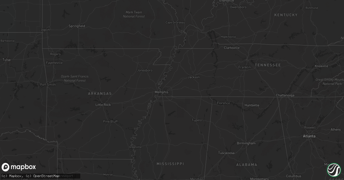
Hail Map in Maryland on August 4, 2022
Get this storm
August 4 map
$229
one time, instant access
Download today. No call, no setup
Keep the $229
Bought the map and want the full workflow? Apply the entire $229 to a subscription within 7 days. None of it is wasted.
Every map, not just this one
This buys you this map. Subscription and you get every map we run, in the markets you choose from a few cities to whole states to nationwide. Plus real-time alerts the moment a storm fires.
Contact data
Name, contact info, occupancy, even credit band for addresses in the footprint. You go from where it hit to who to call.
Become the source they trust
Unlimited branding weather history reports on demand. You already have the documented answer ready for the property owner, and you are the one who showed up with it.
Property data and RoofTrace estimates
Pull up any address you have got, its value and the exact code rules for that jurisdiction, straight from One Click Code. Then RoofTrace estimates the squares, pitch, and roof value, priced the way you price.
Storm reports in Maryland
Maryland
| Date | Description |
|---|---|
| 08/04/20226:58 PM CDT | Trees down around watch goose farm. Time estimated via radar. |
| 08/04/20226:45 PM CDT | Public reports large tree down in backyard. Time estimated via radar. |
| 08/04/20226:40 PM CDT | Multiple trees down in chesapeake city. |
| 08/04/20226:35 PM CDT | Trees blew down on md-545 blue ball road between zeitler road and childs road. |
| 08/04/20226:26 PM CDT | Multiple trees down along solomons island rd. |
| 08/04/20226:25 PM CDT | Trees blew down on southbound md-272 turkey point road near cara cove road/log cabin road. |
| 08/04/20226:19 PM CDT | Multiple trees down along west bay front rd. |
| 08/04/20226:13 PM CDT | Multiple trees down in rising sun. |
| 08/04/20226:07 PM CDT | Multiple trees down near conowingo. |
| 08/04/20226:00 PM CDT | Trees down on earl nicholson road... With partial road closure. Time estimated via radar. |
| 08/04/20225:58 PM CDT | Numerous trees down across the northern and central portions of the county. |
| 08/04/20225:55 PM CDT | Rock hall road east/west at haven ct closed due to trees/debris on roadway. Time estimated via radar. |
| 08/04/20225:55 PM CDT | Md 298 north/south at st. James newtown road due to trees/debris on road. Time estimated via radar. |
| 08/04/20225:50 PM CDT | Trees blew down on md-24 rocks road near sharon road. |
| 08/04/20225:50 PM CDT | Numerous trees down across the northern and central portions of the county. |
| 08/04/20225:50 PM CDT | Trees blew down along md-648 baltimore annapolis boulevard near asquithoaks lane. |
| 08/04/20225:45 PM CDT | Trees blew down along us-1 baltimore avenue near charles l. Armentrout drive. |
| 08/04/20225:40 PM CDT | Trees blew down along us-1 baltimore avenue near charles l. Armentrout drive. |
| 08/04/20225:40 PM CDT | Multiple trees down in the jarrettsville area. |
| 08/04/20225:35 PM CDT | Trees blew down on md-145 sweet air road near greene road. |
| 08/04/20225:34 PM CDT | A local report indicates 61 MPH wind near 4 S MIDDLE RIVER |
| 08/04/20225:31 PM CDT | Multiple trees down in the jarrettsville area. |
| 08/04/20225:29 PM CDT | Wind gusts of up to 53 knots |
| 08/04/20225:26 PM CDT | Tree down blocking the baltimore washington pkwy. Near powder mill rd. |
| 08/04/20225:20 PM CDT | The city of baltimore emergency management reported 65 trees down across the city. Eighteen trees were blocking roadways. |
| 08/04/20225:17 PM CDT | Wind gusts of up to 58 knots |
| 08/04/20225:15 PM CDT | Tree down blocking all lanes on 295 sb near the exit for jessup. |
| 08/04/20225:09 PM CDT | Tree down on chappico rd. Near baptist church rd. |
| 08/04/20225:05 PM CDT | Tree blocking road near the intersection of deer park rd and louisville rd |
| 08/04/20225:05 PM CDT | Several dozen trees blew down on the east side of baltimore city. |
| 08/04/20225:02 PM CDT | Multiple trees down on thw west side of baltimore city. |
| 08/04/20225:01 PM CDT | Tree down onto vehicle on the 6400 block of cornwall dr. |
| 08/04/20224:58 PM CDT | Tree down near the intersection of gibbons rd and barthlow rd. |
| 08/04/20224:58 PM CDT | Trees blew down on westbound us-40 baltimore national pike near us-29 columbia pike. |
| 08/04/20224:55 PM CDT | Several trees blew down on the west side of baltimore city. |
| 08/04/20224:54 PM CDT | Multiple trees down on the east side of baltimore city. |
| 08/04/20224:53 PM CDT | Tree down near the 500 block of klees mill rd. |
| 08/04/20224:53 PM CDT | Tree down and blocking the road on the 4500 block of cherry tree ln |
| 08/04/20224:50 PM CDT | A tree... Large tree limbs and wires blew down in the 22800 block of howard chapel road. |
| 08/04/20224:43 PM CDT | Tree down near the royal farms on snowden river pkwy. In columbia. |
| 08/04/20224:33 PM CDT | Trees down near the intersection of mt phillip rd and mt zion rd. |
| 08/04/20224:33 PM CDT | Tree down near the intersection of hillside dr and parkview dr. |
| 08/04/20224:20 PM CDT | Tree limb down near the 500 block of over ridge dr. |
| 08/04/20224:20 PM CDT | Multiple trees down just west of frederick |
| 08/04/20224:17 PM CDT | Tree down near the 400 block of ednor rd. |
| 08/04/20224:14 PM CDT | Multiple large tree limbs... 8 to 10 inches in diameter... Snapped on overton ln. |
| 08/04/20224:10 PM CDT | Tree down near the intersection of notley rd and overton ln. |
| 08/04/20224:10 PM CDT | Tree down near the intersection mountville rd and lander rd. |
| 08/04/20224:07 PM CDT | Multiple trees down sw of frederick. |
| 08/04/20224:00 PM CDT | Multiple trees down nw of rockville |
| 08/04/20224:00 PM CDT | Trees blew down on northbound md-355 frederick road near shady grove road. |
| 08/04/20223:57 PM CDT | Tree down near the intersection of n dayton ave and west c st. |
| 08/04/20223:22 PM CDT | Tree down onto power lines on the 7500 block of dam number 4 rd. |
| 08/04/20221:45 PM CDT | Tree down near the intersection of oliver beltz rd se and warrior mountain cutoff rd. |
| 08/04/20221:31 PM CDT | Tree down near the intersection of oliver beltz rd se and warrior mountain cutoff rd. |
| 08/04/20223:12 AM CDT | At 812 PM EDT, a severe thunderstorm was located over Windyhill, or near Hurlock, moving southeast at 20 mph. HAZARD...60 mph wind gusts. SOURCE...Radar indicated. IMPACT...Expect damage to trees and powerlines. This severe thunderstorm will be near... Secretary around 820 PM EDT. Hurlock around 835 PM EDT. Sharptown around 900 PM EDT.Other locations impacted by this severe thunderstorm includeGalestown, Mardela Springs, Brookview, Eldorado, East New Market andLinkwood. |
| 08/04/20222:41 AM CDT | At 740 PM EDT, a severe thunderstorm was located over Cayots, or near Middletown, moving east at 35 mph. HAZARD...60 mph wind gusts and penny size hail. SOURCE...Radar indicated. IMPACT...Damage to roofs, siding, trees, and power lines is possible. Locations impacted include... Middletown, Pennsville, Salem, Delaware City, Saint Georges, Port Penn, Mount Pleasant, Townsend, Galena and Odessa. |
| 08/04/20222:24 AM CDT | At 724 PM EDT, a severe thunderstorm was located over Montclair, or near Dale City, moving northeast at 25 mph. HAZARD...60 mph wind gusts and quarter size hail. SOURCE...Radar indicated. IMPACT...Damaging winds will cause some trees and large branches to fall. This could injure those outdoors, as well as damage homes and vehicles. Roadways may become blocked by downed trees. Localized power outages are possible. Unsecured light objects may become projectiles. Locations impacted include... Dale City, Fort Belvoir, Woodbridge, Lake Ridge, Burke, Montclair, Lorton, Newington, Triangle, Dumfries, Cherry Hill, Fairfax Station, Independent Hill, Mason Neck and Occoquan. |
| 08/04/20222:15 AM CDT | At 715 PM EDT, a severe thunderstorm was located near Marlton, or near Clinton, moving northeast at 15 mph. HAZARD...60 mph wind gusts. SOURCE...Radar indicated. IMPACT...Damaging winds will cause some trees and large branches to fall. This could injure those outdoors, as well as damage homes and vehicles. Roadways may become blocked by downed trees. Localized power outages are possible. Unsecured light objects may become projectiles. Locations impacted include... Waldorf, Clinton, Shady Side, Chesapeake Beach, Deale, Rosaryville, Marlton, Dunkirk, Saint Charles, Brandywine, Huntingtown, Owings, Baden, Aquasco, Friendship, Lower Marlboro, Tracys Landing, Sunderland, Cheltenham and Mount Harmony. |
| 08/04/20222:13 AM CDT | At 712 PM EDT, a severe thunderstorm was located near Londontowne, or near Mayo, moving east at 35 mph. HAZARD...60 mph wind gusts. SOURCE...Radar indicated. IMPACT...Damaging winds will cause some trees and large branches to fall. This could injure those outdoors, as well as damage homes and vehicles. Roadways may become blocked by downed trees. Localized power outages are possible. Unsecured light objects may become projectiles. Locations impacted include... Bowie, Annapolis, Mayo, Naval Academy, South River, Parole, Londontowne, Edgewater, Riva, Hillsmere Shores, Harwood, Prince Georges Stadium, Davidsonville, Navy-Marine Corps Stadium, Eastport and Edgewater Beach. |
| 08/04/20221:53 AM CDT | At 653 PM EDT, a severe thunderstorm was located near Delta, or 15 miles northwest of Aberdeen, moving east at 25 mph. HAZARD...60 mph wind gusts and quarter size hail. SOURCE...Radar indicated. IMPACT...Damaging winds will cause some trees and large branches to fall. This could injure those outdoors, as well as damage homes and vehicles. Roadways may become blocked by downed trees. Localized power outages are possible. Unsecured light objects may become projectiles. Locations impacted include... Calvert, North East, Rising Sun, Zion, Richardsmere, Woodlawn, West Nottingham, Octoraro, Conowingo, Rock Springs, Bay View, Farmington, Pylesville, Darlington, Cardiff, Scarboro, Street and Whiteford. |
| 08/04/20221:19 AM CDT | At 619 PM EDT, a severe thunderstorm was located near Owings Mills, or near Pikesville, moving east at 30 mph. HAZARD...60 mph wind gusts and quarter size hail. SOURCE...Radar indicated. IMPACT...Damaging winds will cause some trees and large branches to fall. This could injure those outdoors, as well as damage homes and vehicles. Roadways may become blocked by downed trees. Localized power outages are possible. Unsecured light objects may become projectiles. Locations impacted include... Pikesville, Cockeysville, Towson, Bel Air South, Randallstown, Parkville, Owings Mills, Bel Air North, Carney, Perry Hall, Reisterstown, Lochearn, Mays Chapel, Timonium, Fallston, Hampton, Kingsville, Pleasant Hills, Jarrettsville and Lutherville-Timonium. |
| 08/04/20221:16 AM CDT | At 616 PM EDT, severe thunderstorms were located along a line extending from Smitville to Stewartstown, moving southeast at 5 mph. HAZARD...60 mph wind gusts and nickel size hail. SOURCE...Radar indicated. IMPACT...Expect damage to roofs, siding, and trees. Locations impacted include... Quarryville, Stewartstown, Gap, Delta, Wakefield, Smithville, Shenks Ferry, Holtwood, Sunnyburn, Susquehanna Trails, Christiana and Georgetown. |
| 08/04/20221:09 AM CDT | At 609 PM EDT, a severe thunderstorm was located near Sheridan Point, moving northeast at 25 mph. HAZARD...60 mph wind gusts and quarter size hail. SOURCE...Radar indicated. IMPACT...Damaging winds will cause some trees and large branches to fall. This could injure those outdoors, as well as damage homes and vehicles. Roadways may become blocked by downed trees. Localized power outages are possible. Unsecured light objects may become projectiles. Locations impacted include... Prince Frederick, Hallowing Point, Breezy Point, Sheridan Point, Flag Harbor, Calvert Cliffs, Golden Beach, Saint Leonard, Long Beach, Mechanicsville, Calvert Beach, Benedict, Barstow, Clements, Port Republic, Morganza, Hillville, Chaptico, Sandgates and Oakville. |
| 08/04/202212:58 AM CDT | At 558 PM EDT, a severe thunderstorm was located near Fort Meade, or near Crofton, moving northeast at 20 mph. HAZARD...60 mph wind gusts and quarter size hail. SOURCE...Radar indicated. IMPACT...Damaging winds will cause some trees and large branches to fall. This could injure those outdoors, as well as damage homes and vehicles. Roadways may become blocked by downed trees. Localized power outages are possible. Unsecured light objects may become projectiles. Locations impacted include... Baltimore, Bowie, Severn, Riviera Beach, Baltimore-Washington Airport, Fort Smallwood State Park, Glen Burnie, Severna Park, Odenton, Laurel, Pasadena, Lake Shore, Ferndale, Brooklyn Park, Fort Meade, Millersville, Green Haven, South Gate, Pumphrey and Savage-guilford. |
| 08/04/202212:42 AM CDT | At 542 PM EDT, a severe thunderstorm was located over Dundalk, or near Baltimore, moving north at 10 mph. HAZARD...60 mph wind gusts and quarter size hail. SOURCE...Radar indicated. IMPACT...Damaging winds will cause some trees and large branches to fall. This could injure those outdoors, as well as damage homes and vehicles. Roadways may become blocked by downed trees. Localized power outages are possible. Unsecured light objects may become projectiles. Locations impacted include... Baltimore, Middle River, Back River, Dundalk, Towson, Essex, Parkville, Carney, Perry Hall, Rosedale, Rossville, Timonium, White Marsh, Hampton, Lutherville-Timonium, Edgemere, Lutherville, Nottingham, Fullerton and Eudowood. |
| 08/04/202212:24 AM CDT | At 524 PM EDT, a severe thunderstorm was located near Olney, moving east at 30 mph. HAZARD...60 mph wind gusts and quarter size hail. SOURCE...Radar indicated. IMPACT...Damaging winds will cause some trees and large branches to fall. This could injure those outdoors, as well as damage homes and vehicles. Roadways may become blocked by downed trees. Localized power outages are possible. Unsecured light objects may become projectiles. Locations impacted include... Columbia, Olney, Elkridge, Damascus, Historic Ellicott City, Ellicott City, Catonsville, Woodlawn, Randallstown, Eldersburg, Milford Mill, Laurel, Fairland, Arbutus, Colesville, Sykesville, Oakland, Savage-guilford, Scaggsville and Ilchester. |
| 08/04/202212:19 AM CDT | At 519 PM EDT, a severe thunderstorm was located over Green Valley, or near Damascus, moving east at 30 mph. HAZARD...60 mph wind gusts and quarter size hail. SOURCE...Radar indicated. IMPACT...Damaging winds will cause some trees and large branches to fall. This could injure those outdoors, as well as damage homes and vehicles. Roadways may become blocked by downed trees. Localized power outages are possible. Unsecured light objects may become projectiles. Locations impacted include... Eldersburg, Ballenger Creek, Mount Airy, Sykesville, Oakland, New Market, Green Valley, Linganore-Bartonsville, Libertytown, Monrovia, Ijamsville, Winfield, Gaither, Watersville, Poplar Springs, Woodbine, Carrolltowne, Marston and Unionville. |
| 08/03/202211:52 PM CDT | Several trees and wires blew down between rockville and gaithersburg. Trees blew down onto wires near the intersection of keating street and jupiter street. A tree blew |
| 08/03/202210:23 PM CDT | At 323 PM EDT, a severe thunderstorm was located 7 miles southeast of Berkeley Springs, or 9 miles south of Hancock, moving east at 10 mph. HAZARD...60 mph wind gusts and quarter size hail. SOURCE...Radar indicated. IMPACT...Damaging winds will cause some trees and large branches to fall. This could injure those outdoors, as well as damage homes and vehicles. Roadways may become blocked by downed trees. Localized power outages are possible. Unsecured light objects may become projectiles. Locations impacted include... Falling Waters, Clear Spring, Hedgesville, Big Spring, Big Pool, Tomahawk, Johnsontown, Shanghai, Jones Springs and Oakland. |
| 08/03/20229:35 PM CDT | At 235 PM EDT, a severe thunderstorm was located 7 miles east of Cumberland, moving northeast at 10 mph. HAZARD...60 mph wind gusts and half dollar size hail. SOURCE...Radar indicated. IMPACT...Damaging winds will cause some trees and large branches to fall. This could injure those outdoors, as well as damage homes and vehicles. Roadways may become blocked by downed trees. Localized power outages are possible. Unsecured light objects may become projectiles. Locations impacted include... Flintstone and Pumpkin Center. |
| 08/03/20227:25 PM CDT | Numerous trees and wires down in federalsburg... Md. Time estimated via radar. |
| 08/03/20227:11 PM CDT | Reports of numerous downed wires around denton... Md. Time |
| 08/03/20227:11 PM CDT | Reports of numerous downed wires around denton... Md. Time estimated via radar. |
| 08/03/20227:08 PM CDT | Numerous trees and wires down around ridgely... Md. Time estimated via radar. |
| 08/03/20227:06 PM CDT | Tree down into barn around greensboro... Md. Time estimated via radar. |
| 08/03/20227:06 PM CDT | 911 call center reported tree down into a house. Time estimated via radar. |
| 08/03/20227:06 PM CDT | Numerous trees and wires down around hillsboro... Md. Time estimated via radar. |
| 08/03/20227:03 PM CDT | Trees down on chapel road. Time estimated via radar. |
| 08/03/20227:01 PM CDT | Trees down along nancy street in easton... Md. Time estimated via radar. |
| 08/03/20227:01 PM CDT | Numerous trees down on will street in easton... Md. Time estimated via radar. |
| 08/03/20227:00 PM CDT | Numerous trees down around peaneck road in talbot county. Time estimated via radar. |
All States Impacted by Hail Map on August 4, 2022
Cities Impacted by Hail Map on August 4, 2022
- Berkeley Springs, WV
- Campton, NH
- Holderness, NH
- Jefferson, NY
- Stamford, NY
- Melrose, NY
- Troy, NY
- Holtwood, PA
- Arlington, VT
- Wysox, PA
- Wyalusing, PA
- Mechanicville, NY
- Winner, SD
- Ravena, NY
- Slingerlands, NY
- Coeymans Hollow, NY
- Alcove, NY
- Feura Bush, NY
- Selkirk, NY
- Delmar, NY
- Bainbridge, NY
- Oxford, NY
- Greene, NY
- Schaghticoke, NY
- Stillwater, NY
- Schuylerville, NY
- Eldred, PA
- Turtlepoint, PA
- Smethport, PA
- Monongahela, PA
- Elizabeth, PA
- Sykesville, MD
- Woodbine, MD
- Gambrills, MD
- Millersville, MD
- Crownsville, MD
- Panhandle, TX
- Hart, TX
- Cohoes, NY
- Windsor, VA
- Suffolk, VA
- Mount Gilead, OH
- Cardington, OH
- New Park, PA
- Fawn Grove, PA
- Airville, PA
- Stewartstown, PA
- Pylesville, MD
- Ijamsville, MD
- Monrovia, MD
- New Market, MD
- Essex, MD
- Sparrows Point, MD
- Charlotte Court House, VA
- Cullen, VA
- Dimmitt, TX
- Petersburg, TX
- Long Valley, SD
- Mission, SD
- Martin, SD
- Kilgore, NE
- Tuthill, SD
- Cody, NE
- Saint Francis, SD
- Nenzel, NE
- Norris, SD
- Parmelee, SD
- Crookston, NE
- Valentine, NE
- Somerset, OH
- Beech Creek, PA
- Laurel Bloomery, TN
- Lake City, SC
- Kingstree, SC
- New Zion, SC
- Clio, SC
- Manchester Center, VT
- Gregory, SD
- Whiteford, MD
- Street, MD
- Patton, PA
- Martinsburg, PA
- Oil City, PA
- Bessemer, PA
- Hillsville, PA
- New Castle, PA
- Edinburg, PA
- Ashville, PA
- Loretto, PA
- Danby, VT
- Wallingford, VT
- Gifford, PA
- Lutherville Timonium, MD
- Rosedale, MD
- Parkville, MD
- Halethorpe, MD
- Baltimore, MD
- Catonsville, MD
- Cockeysville, MD
- Curtis Bay, MD
- Towson, MD
- Gwynn Oak, MD
- Brooklyn, MD
- Severn, MD
- Dundalk, MD
- Phoenix, MD
- Glen Burnie, MD
- Linthicum Heights, MD
- Nottingham, MD
- Summerhill, PA
- Portage, PA
- Cropseyville, NY
- White Post, VA
- Stephens City, VA
- Floydada, TX
- Owego, NY
- Candor, NY
- Anton, TX
- Littlefield, TX
- Needmore, PA
- Warfordsburg, PA
- Mardela Springs, MD
- Kim, CO
- Pleasantville, PA
- Turbeville, SC
- Howard, PA
- Northern Cambria, PA
- Nicktown, PA
- Silverton, TX
- Pampa, TX
- Kenbridge, VA
- Dundas, VA
- Stevensville, MD
- Easton, MD
- Claiborne, MD
- Saint Michaels, MD
- Mcdaniel, MD
- Spartanburg, SC
- Pauline, SC
- Groom, TX
- White Deer, TX
- Ballston Spa, NY
- Greenwich, NY
- Saratoga Springs, NY
- Fort Edward, NY
- Ulster, PA
- Rome, PA
- Guilford, NY
- Rockwood, PA
- Saxton, PA
- James Creek, PA
- Claremont, NH
- Charlestown, NH
- Amity, PA
- Royersford, PA
- Collegeville, PA
- Schwenksville, PA
- Carrollton, OH
- Nathalie, VA
- Burke, VA
- Fairfax Station, VA
- Wytheville, VA
- Fonda, NY
- Sprakers, NY
- Canajoharie, NY
- Palatine Bridge, NY
- Oldtown, MD
- Milan, PA
- Athens, PA
- Stanardsville, VA
- Elmira, NY
- Hedgesville, WV
- Shinglehouse, PA
- Port Allegany, PA
- Bellefonte, PA
- Julian, PA
- Huntingdon, PA
- Finleyville, PA
- Mountain Top, PA
- Freeland, PA
- White Haven, PA
- Drums, PA
- Ballston Lake, NY
- Burnt Hills, NY
- Schenectady, NY
- Punxsutawney, PA
- Milford, VA
- Hustle, VA
- Champlain, VA
- Claude, TX
- Campbell, NY
- Addison, NY
- Johnsonville, NY
- Buskirk, NY
- Valley Falls, NY
- Commodore, PA
- Cherry Tree, PA
- Wilkes Barre, PA
- Gouldsboro, PA
- Dysart, PA
- Divide, CO
- Florissant, CO
- Woodland Park, CO
- Horseheads, NY
- Wye Mills, MD
- Queen Anne, MD
- Centreville, MD
- Queenstown, MD
- Clifton Park, NY
- Tyrone, PA
- Spruce Creek, PA
- Peyton, CO
- Blairsville, PA
- Rougemont, NC
- Timberlake, NC
- Cloudcroft, NM
- Fairfax, VA
- Annandale, VA
- Falls Church, VA
- Florence, SC
- Brandywine, MD
- Mount Upton, NY
- North Bennington, VT
- Eagle Bridge, NY
- Bennington, VT
- Hoosick Falls, NY
- Tulia, TX
- Quitaque, TX
- Mill Hall, PA
- Greensboro, MD
- Ridgely, MD
- Cordova, MD
- Goldsboro, MD
- Denton, MD
- Felton, DE
- Hillsboro, MD
- Harrington, DE
- Royal Oak, MD
- Big Prairie, OH
- Glenmont, OH
- Brinkhaven, OH
- Alexandria, VA
- Monroeton, PA
- Towanda, PA
- Elida, NM
- Byron, GA
- Sussex, VA
- Yale, VA
- Stony Creek, VA
- Waverly, VA
- Donnybrook, ND
- Summit, NY
- Fultonham, NY
- Richmondville, NY
- West Fulton, NY
- Warnerville, NY
- Harleysville, PA
- Damascus, MD
- Brookeville, MD
- Gaithersburg, MD
- Mount Airy, MD
- Nichols, NY
- Waverly, NY
- Barton, NY
- Hancock, MD
- Kearneysville, WV
- Clear Brook, VA
- Bunker Hill, WV
- Berryville, VA
- Summit Point, WV
- Springfield, WV
- Cumberland, MD
- Newtown, VA
- Grasonville, MD
- Fallston, MD
- Monkton, MD
- Baldwin, MD
- Forest Hill, MD
- Jarrettsville, MD
- Lunenburg, VA
- Victoria, VA
- Bowie, MD
- Edgewater, MD
- Riva, MD
- Harwood, MD
- Annapolis, MD
- Galesville, MD
- Davidsonville, MD
- Upper Marlboro, MD
- West River, MD
- Lothian, MD
- Shady Side, MD
- New Waterford, OH
- East Palestine, OH
- Enon Valley, PA
- Petersburg, OH
- New Springfield, OH
- Pamplin, VA
- Allen, SD
- Schenevus, NY
- Worcester, NY
- Harpersfield, NY
- Charlotteville, NY
- Davenport, NY
- Hollis, OK
- Barney, GA
- Quitman, GA
- Morven, GA
- Henderson, NC
- Windsor, NY
- Alexandria, PA
- Petersburg, PA
- Pennsylvania Furnace, PA
- Port Crane, NY
- Linden, VA
- Flint Hill, VA
- Huntly, VA
- Hume, VA
- Belleville, PA
- Reedsville, PA
- Milroy, PA
- Dunkirk, MD
- Cripple Creek, CO
- White River, SD
- Wood, SD
- Okreek, SD
- Sayre, PA
- Ebensburg, PA
- Middletown, VA
- Strasburg, VA
- Odenton, MD
- Glenn Dale, MD
- Greenbelt, MD
- Lanham, MD
- Fort George G Meade, MD
- Laurel, MD
- Beltsville, MD
- Martinsburg, WV
- Olton, TX
- Plainview, TX
- Kress, TX
- Saint Johns, AZ
- Lakeland, GA
- Trappe, MD
- Canyon, TX
- Hudson, FL
- Brandon, MS
- Pelahatchie, MS
- King William, VA
- West Point, VA
- Saltsburg, PA
- Avonmore, PA
- Lakeview, TX
- Dorset, VT
- Childress, TX
- Yorktown, VA
- Happy, TX
- Wayside, TX
- Courtland, VA
- Tampa, FL
- Dublin, VA
- Voorheesville, NY
- Fort Hancock, TX
- New Port Richey, FL
- Skellytown, TX
- Trinidad, CO
- Nazareth, TX
- Chapel Hill, NC
- Hillsborough, NC
- Borger, TX
- Sierra Blanca, TX
- Shelby, NC
- Pittsboro, NC
- Easley, SC
- Bokeelia, FL
- West Rupert, VT
- Pawlet, VT
- Clover, VA
- Woodville, VA
- Washington, VA
- Sperryville, VA
- Lawrenceville, VA
- Dolphin, VA
- Webster Springs, WV
- Brownfield, TX
- Pritchett, CO
- Raleigh, NC
- Odessa, FL
- Graham, NC
- Efland, NC
- Shonto, AZ
- Randolph, VA
- Murrysville, PA
- Export, PA
- Slickville, PA
- Bryans Road, MD
- Accokeek, MD
- Effingham, SC
- Pamplico, SC
- Crewe, VA
- Turkey, TX
- Carrizozo, NM
- Woodbridge, VA
- Spring Hill, FL
- Land O'Lakes, FL
- Winburne, PA
- Lanse, PA
- Allport, PA
- Munson, PA
- Philipsburg, PA
- Hawk Run, PA
- West Decatur, PA
- Morrisdale, PA
- Gansevoort, NY
- Middleburgh, NY
- Flintstone, MD
- Ewell, MD


