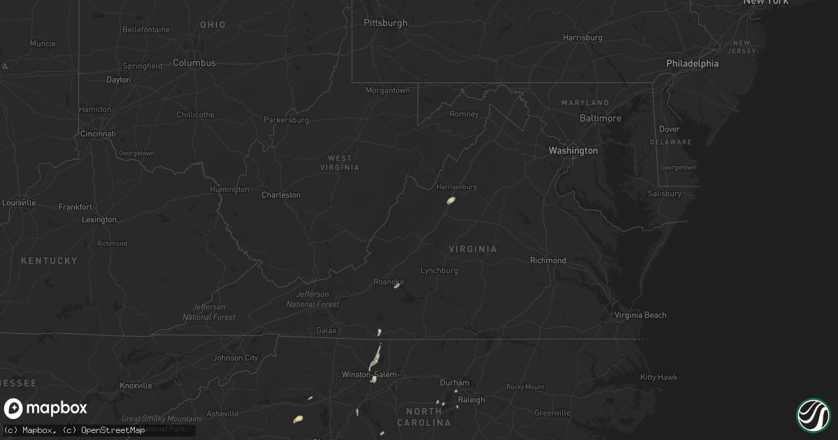
Hail Map in Virginia on August 2, 2018
Get this storm
August 2 map
$229
one time, instant access
Download today. No call, no setup
Keep the $229
Bought the map and want the full workflow? Apply the entire $229 to a subscription within 7 days. None of it is wasted.
Every map, not just this one
This buys you this map. Subscription and you get every map we run, in the markets you choose from a few cities to whole states to nationwide. Plus real-time alerts the moment a storm fires.
Contact data
Name, contact info, occupancy, even credit band for addresses in the footprint. You go from where it hit to who to call.
Become the source they trust
Unlimited branding weather history reports on demand. You already have the documented answer ready for the property owner, and you are the one who showed up with it.
Property data and RoofTrace estimates
Pull up any address you have got, its value and the exact code rules for that jurisdiction, straight from One Click Code. Then RoofTrace estimates the squares, pitch, and roof value, priced the way you price.
Storm reports in Virginia
Virginia
| Date | Description |
|---|---|
| 08/02/20185:45 PM CDT | Tree reported down on clearview road near rt. 211. |
| 08/02/20185:03 PM CDT | Trees down in multiple locations on captain yancy road. |
| 08/02/20185:01 PM CDT | Tree down near the intersection of white rose road and dave berry road. |
| 08/02/20185:00 PM CDT | Two different trees on powerlines reported in the windcrest area of timberlake dr. Time estimated from radar. |
| 08/02/20184:58 PM CDT | Tree down on the 400 block of daveberry road. |
| 08/02/20184:55 PM CDT | Tree down on the 700 block of jacob burner drive. |
| 08/02/20184:55 PM CDT | Tree down on 10200 block of katies street. |
| 08/02/20184:55 PM CDT | Tree down at the 300 block mcgahey lane. |
| 08/02/20184:53 PM CDT | Right westbound lane of spotswood trail |
| 08/02/20184:50 PM CDT | Postal carrier reported large limbs down just off of sago rd in callands. Time estimated from radar. |
| 08/02/20184:34 PM CDT | Powerlines down near 4000 block of friedens church road. |
| 08/02/20184:28 PM CDT | Power lines down at the intersection liberty street... Dices spring road and wrenn street. |
| 08/02/20183:50 PM CDT | At least 20 trees were blown down by thunderstorm winds at several locations across henry county and the city of martinsville. |
| 08/02/201811:02 AM CDT | Tree down on slaughter drive |
| 08/02/201810:34 AM CDT | Tree down at 1300 block of carpenter mill road |
| 08/02/201810:08 AM CDT | Tree down on scottsvill rd at avon street extended. |
| 08/02/201810:00 AM CDT | Ef-0 tornado. 2 mile path length. Est max wind speeds 70 mph... Max width 75 yards wide. Initial touchdown at 1100 am near intersection of avon street extended and scot |
| 08/02/20187:32 AM CDT | At 1231 PM EDT, a severe thunderstorm was located 7 miles south of Culpeper, moving northeast at 20 mph. HAZARD...60 mph wind gusts. SOURCE...Radar indicated. IMPACT...Damaging winds will cause some trees and large branches to fall. This could injure those outdoors, as well as damage homes and vehicles. Roadways may become blocked by downed trees. Localized power outages are possible. Unsecured light objects may become projectiles. Locations impacted include... Remington, Raccoon Ford, Lignum, Stevensburg and Sumerduck. |
| 08/02/20187:08 AM CDT | At 1208 PM EDT, a severe thunderstorm was located near Orange, moving northeast at 25 mph. HAZARD...60 mph wind gusts. SOURCE...Radar indicated. This storm has a history of producing wind damage. IMPACT...Damaging winds will cause some trees and large branches to fall. This could injure those outdoors, as well as damage homes and vehicles. Roadways may become blocked by downed trees. Localized power outages are possible. Unsecured light objects may become projectiles. Locations impacted include... Culpeper, Winston, Catalpa, Stevensburg, Mitchells, Brandy Station, Rapidan, Twymans Mill and Locust Dale. |
| 08/02/20186:24 AM CDT | At 1124 AM EDT, a severe thunderstorm was located 8 miles northeast of Charlottesville, moving northeast at 30 mph. HAZARD...60 mph wind gusts. SOURCE...Law enforcement reported several trees down in the Charlottesville area. IMPACT...Damaging winds will cause some trees and large branches to fall. This could injure those outdoors, as well as damage homes and vehicles. Roadways may become blocked by downed trees. Localized power outages are possible. Unsecured light objects may become projectiles. Locations impacted include... Madison, Hollymead, Ruckersville, Eheart, Oakpark, Barboursville, Stony Point, Montpelier Station, Pratts, Rochelle, Newtown, Aroda, Madison Mills, Montford, Old Somerset, Shelby, Dawsonville, Twymans Mill, Somerset and Burtonville. |
| 08/02/20184:13 AM CDT | At 913 PM EDT, a severe thunderstorm was located over Kimballton, moving northeast at 10 mph. HAZARD...60 mph wind gusts. SOURCE...Radar indicated. IMPACT...Expect damage to roofs, siding, and trees. Locations impacted include... Pearisburg... Pembroke... Peterstown... Rich Creek... and Red Sulphur Spring. |
| 08/02/20183:51 AM CDT | At 851 PM EDT, a severe thunderstorm was located near Waiteville, moving northeast at 25 mph. HAZARD...60 mph wind gusts. SOURCE...Radar indicated. IMPACT...Expect damage to roofs, siding, and trees. Locations impacted include... Alleghany... Paint Bank... Jordan Mines... Sweet Springs... and Craig Springs. |
| 08/02/20181:10 AM CDT | At 609 PM EDT, a severe thunderstorm was located near Shenandoah, or 14 miles east of Harrisonburg, moving northeast at 25 mph. HAZARD...60 mph wind gusts. SOURCE...Radar indicated. IMPACT...Damaging winds will cause some trees and large branches to fall. This could injure those outdoors, as well as damage homes and vehicles. Roadways may become blocked by downed trees. Localized power outages are possible. Unsecured light objects may become projectiles. Locations impacted include... Shenandoah, Massanutten, Stanley, Big Meadows, Elkton, Criglersville, Ida, Haywood, Syria, Banco, Pine Grove, Graves Mill, Jollett, Skyland and Aylor. |
| 08/02/201812:23 AM CDT | At 522 PM EDT, a severe thunderstorm was located near Bridgewater, or 8 miles south of Harrisonburg, moving northeast at 30 mph. HAZARD...60 mph wind gusts and quarter size hail. SOURCE...Radar indicated. IMPACT...Damaging winds will cause some trees and large branches to fall. This could injure those outdoors, as well as damage homes and vehicles. Roadways may become blocked by downed trees. Localized power outages are possible. Unsecured light objects may become projectiles. Locations impacted include... Harrisonburg, Bridgewater, Grottoes, Massanutten, Elkton, Weyers Cave, Mount Sidney, Mount Crawford, Rocky Bar, Penn Laird, Port Republic, Pleasant Valley, Fort Defiance, Keezletown, Mcgaheysville, Montevideo and Staunton Airport. |
| 08/02/201812:16 AM CDT | At 516 PM EDT, severe thunderstorms were located along a line extending from near Boonsboro to near Evington, moving east at 15 mph. HAZARD...60 mph wind gusts. SOURCE...Radar indicated. IMPACT...Expect damage to roofs, siding, and trees. Locations impacted include... Lynchburg... Concord... Rustburg... Forest... and Evington.This includes The following Locations Liberty University andLynchburg Airport. |
| 08/02/201812:15 AM CDT | At 514 PM EDT, severe thunderstorms were located along a line extending from near Dundas to 7 miles south of McKenney to near Emporia, moving northeast at 40 mph. HAZARD...60 mph wind gusts. SOURCE...Radar indicated. IMPACT...Expect damage to trees and powerlines. Severe thunderstorms will be near, McKenney around 525 PM EDT. Jarratt, Dewitt and Fort Pickett around 530 PM EDT. Dinwiddie around 540 PM EDT. Stony Creek and Wilsons around 545 PM EDT. Sutherland around 550 PM EDT.Other locations impacted by these severe thunderstorms include BaconsFork, North Wellville, Dolphin, Bowens Corner, Pleasant Shade, WharfsStore, Forksville, Wellville, Blackstone Airport and Brink. |
| 08/01/201811:25 PM CDT | At 425 PM EDT, severe thunderstorms were located along a line extending from Sanville to near Sandy Ridge, moving northeast at 30 mph. HAZARD...60 mph wind gusts. SOURCE...Radar indicated. IMPACT...Expect damage to roofs, siding, and trees. Locations impacted include... Martinsville... Spencer... Bassett... Axton... and Leatherwood.This includes The following Locations The Martinsville Speedway andMartinsville Airport. |
| 08/01/201810:34 PM CDT | At 333 PM EDT, severe thunderstorms were located along a line extending from near Stewartsville to near Burnt Chimney, moving northeast at 15 mph. HAZARD...60 mph wind gusts and quarter size hail. SOURCE...Radar indicated. IMPACT...Hail damage to vehicles is expected. Expect wind damage to roofs, siding, and trees. Locations impacted include... Vinton... Bedford... Stewartsville... Montvale... and Moneta. |
| 08/01/20188:06 PM CDT | At 106 PM EDT, a severe thunderstorm was located near Amelia Courthouse, moving northeast at 25 mph. HAZARD...60 mph wind gusts. SOURCE...Radar indicated. IMPACT...Expect damage to trees and powerlines. This severe thunderstorm will be near, Chula and Ballsville around 115 PM EDT. Macon around 130 PM EDT. Powhatan around 135 PM EDT.Other locations impacted by this severe thunderstorm include GoodwinsStore, Hatchers, Flat Rock, Pilkinton, Provost, Giles Mill,Winterham, Paineville, Maplewood and Belona. |
| 08/01/20188:05 PM CDT | Tree down in paint bank. Time estimated from radar. |
| 08/01/20187:58 PM CDT | Couple trees down on forest hill drive near perisburg. Time estimated from radar. |
All States Impacted by Hail Map on August 2, 2018
Cities Impacted by Hail Map on August 2, 2018
- Danville, IL
- Bismarck, IL
- Citra, FL
- Ocala, FL
- Anthony, FL
- Saint Anne, IL
- Martinton, IL
- Clifton, IL
- Kingman, AZ
- Pittsboro, NC
- Donovan, IL
- Pembroke Township, IL
- Kentland, IN
- Morocco, IN
- Brook, IN
- Beaverville, IL
- Goodland, IN
- Belcourt, ND
- Midland, MI
- Pinconning, MI
- Linwood, MI
- Ribera, NM
- Mora, NM
- Lake Village, IN
- O'Fallon, MO
- Brussels, IL
- Golden Eagle, IL
- Bapchule, AZ
- Meadview, AZ
- Lincolnton, NC
- Vale, NC
- Fowler, IN
- Sandy Ridge, NC
- Rensselaer, IN
- Wolcott, IN
- Remington, IN
- Monon, IN
- Erath, LA
- Chillicothe, MO
- Jamesport, MO
- Earl Park, IN
- Hebron, IN
- Pewamo, MI
- Prescott, AZ
- Brookston, IN
- Chalmers, IN
- Galien, MI
- Buchanan, MI
- Berrien Springs, MI
- East Carondelet, IL
- Columbia, IL
- East Saint Louis, IL
- Saint Louis, MO
- Dupo, IL
- Otterbein, IN
- Oxford, IN
- West Lafayette, IN
- Saint Peters, MO
- Winfield, MO
- Saint Charles, MO
- Old Monroe, MO
- New Buffalo, MI
- Walnut Cove, NC
- Ambia, IN
- Hoopeston, IL
- Plainwell, MI
- Maricopa, AZ
- Absarokee, MT
- Hubbardston, MI
- Muir, MI
- Baroda, MI
- Saint Joseph, MI
- Sawyer, MI
- Bridgman, MI
- Stevensville, MI
- Eau Claire, MI
- Sodus, MI
- Lowell, IN
- Shelby, IN
- Demotte, IN
- Bristol, IN
- Browning, IL
- Astoria, IL
- Weidman, MI
- Mount Pleasant, MI
- Remus, MI
- Surprise, AZ
- Tucson, AZ
- Port Hope, MI
- Kirkland, AZ
- Niles, MI
- Watseka, IL
- Potomac, IL
- Rossville, IL
- Boswell, IN
- Sheldon, IL
- Armstrong, IL
- Winston Salem, NC
- Bay City, MI
- Humphreys, MO
- Galt, MO
- Patrick Springs, VA
- Delcambre, LA
- Frankenmuth, MI
- Saginaw, MI
- Reese, MI
- Claremont, NC
- Conover, NC
- Boone Grove, IN
- Kouts, IN
- Thayer, IN
- Valparaiso, IN
- Allegan, MI
- Pullman, MI
- Grand Junction, MI
- Greenville, MI
- Germanton, NC
- Madison, NC
- Lilesville, NC
- Wadesboro, NC
- Bay Port, MI
- New Iberia, LA
- Sells, AZ
- Wittmann, AZ
- Leeds, UT
- Edwardsburg, MI
- Granger, IN
- Peoria, AZ
- Eloy, AZ
- Yucca, AZ
- Troy, NC
- Buckeye, AZ
- Mount Sidney, VA
- Weyers Cave, VA
- Crescent City, IL
- Las Vegas, NM
- Goodyear, AZ
- Rolling Prairie, IN
- Wagon Mound, NM
- Kawkawlin, MI
- Auburn, MI
- Gobles, MI
- Cassopolis, MI
- Dowagiac, MI
- Caseville, MI
- Screven, GA
- Shelbyville, IL
- Saint Albans, MO
- Jacksonville, FL
- Chesterfield, MO
- Defiance, MO
- Durham, NC
- Morrisville, NC
- Findlay, IL
- Hanna, IN
- Perth, ND
- Saint John, ND
- Casa Grande, AZ
- Hamlet, IN
- Lyons, MI
- Fowler, MI
- Ionia, MI
- Pana, IL
- Tower Hill, IL
- Vinton, VA
- Goodview, VA
- Hardy, VA
- Saint Johns, MI
- Myakka City, FL
- Rocklake, ND
- Rolla, ND
- Salisbury, NC
- Newton, NC
- Cherryville, NC
- Coleman, MI
- Rhodes, MI
- Lake City, MI
- Harbert, MI
- Three Oaks, MI
- Berrien Center, MI
- Union Pier, MI
- Lakeside, MI
- Stuart, VA
- Spencer, VA
- Critz, VA
- Bassett, VA
- Searchlight, NV
- Seligman, AZ
- Fort Defiance, VA
- Mount Crawford, VA
- Staunton, VA
- Verona, VA
- Salome, AZ
- Register, GA
- Metter, GA
- Statesboro, GA
- Delton, MI
- Hastings, MI
- New Douglas, IL
- Firth, ID
- Holly Springs, NC
- Apex, NC
- Chebanse, IL
- Gays, IL
- Reynolds, IN
- Schneider, IN
- Wheatfield, IN
- Momence, IL
- Iroquois, IL
- Lawrence, MI
- Hartford, MI
- Otsego, MI
- Lake Panasoffkee, FL
- Dunseith, ND
- Elkhart, IN


