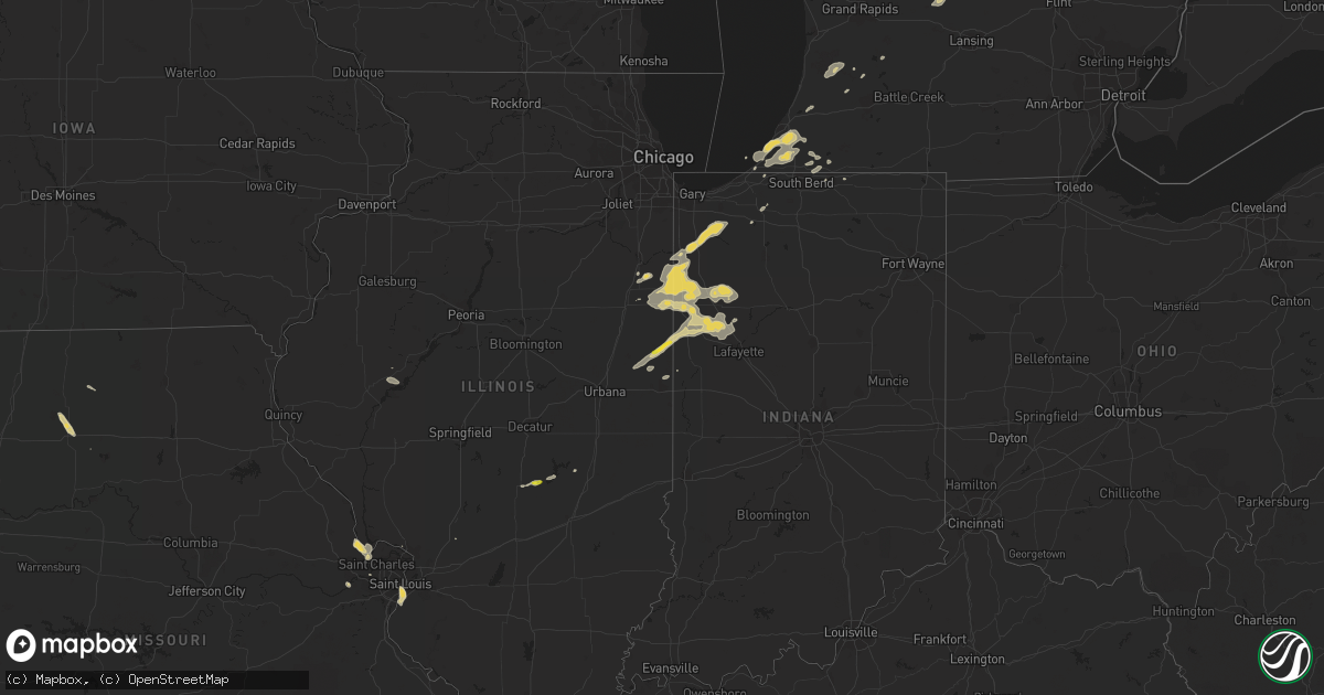
Hail Map on August 2, 2018
Get this storm
August 2 map
$229
one time, instant access
Download today. No call, no setup
Keep the $229
Bought the map and want the full workflow? Apply the entire $229 to a subscription within 7 days. None of it is wasted.
Every map, not just this one
This buys you this map. Subscription and you get every map we run, in the markets you choose from a few cities to whole states to nationwide. Plus real-time alerts the moment a storm fires.
Contact data
Name, contact info, occupancy, even credit band for addresses in the footprint. You go from where it hit to who to call.
Become the source they trust
Unlimited branding weather history reports on demand. You already have the documented answer ready for the property owner, and you are the one who showed up with it.
Property data and RoofTrace estimates
Pull up any address you have got, its value and the exact code rules for that jurisdiction, straight from One Click Code. Then RoofTrace estimates the squares, pitch, and roof value, priced the way you price.
States Impacted by Hail Map on August 2, 2018
Storm reports
Massachusetts
| Date | Description |
|---|---|
| 08/02/20184:35 PM CDT | Tree limb down blocking green road |
| 08/02/20184:30 PM CDT | Large branch down on lyman barnes road |
| 08/02/20184:15 PM CDT | Large branch down on power lines with power outage on wales road |
| 08/02/20184:05 PM CDT | Power lines down on north liberty street |
| 08/02/20183:59 PM CDT | Tree down on house and car |
| 08/01/201811:47 PM CDT | At 447 PM EDT, severe thunderstorms were located along a line extending from Ludlow to near Ellington, moving northeast at 30 mph. HAZARD...60 mph wind gusts. SOURCE...Radar indicated. IMPACT...Expect damage to trees and power lines. Locations impacted include... Springfield, Chicopee, Enfield, Vernon, South Windsor, Ludlow, Longmeadow, East Longmeadow, Ellington, Tolland, Belchertown, Wilbraham, Palmer, Stafford, Somers, East Windsor, Ware, Sturbridge, Monson and Granby. |
| 08/01/201811:37 PM CDT | At 437 PM EDT, a severe thunderstorm was located over Sharon, or 18 miles west of Torrington, moving northeast at 35 mph. HAZARD...60 mph wind gusts. SOURCE...Radar indicated. IMPACT...Expect damage to roofs, siding, and trees. This severe thunderstorm will be near... Sharon around 440 PM EDT. Millerton and Cornwall Bridge around 445 PM EDT. Falls Village around 455 PM EDT. Canaan around 505 PM EDT. Norfolk around 510 PM EDT. |
Montana
| Date | Description |
|---|---|
| 08/02/20184:59 PM CDT | Mesonet station lmrm8... Antelope raws. |
| 08/02/20183:51 PM CDT | A local report indicates 61 MPH wind near 6 E COLUMBUS |
| 08/02/20183:45 PM CDT | A local report indicates 60 MPH wind near 7 E COLUMBUS |
| 08/02/20183:41 PM CDT | A local report indicates 58 MPH wind near 6 E COLUMBUS |
| 08/02/20183:22 PM CDT | A local report indicates 58 MPH wind near 3 W FISHTAIL |
| 08/02/201812:58 AM CDT | At 557 PM MDT, a thunderstorm producing damaging wind gusts was located 12 miles south of Livingston, moving east at 35 mph. HAZARD...60 mph wind gusts. SOURCE...Trained weather spotters. At 545 PM a wind gust of 57 mph was reported at Pray in the Paradise Valley. IMPACT...Expect damage to roofs, siding, and trees. Locations impacted include... Livingston, Clyde Park, Pine Creek and Springdale. |
| 08/01/20189:57 PM CDT | At 255 PM MDT, a severe thunderstorm was located near Laurel, or 17 miles east of Columbus, moving east at 40 mph. HAZARD...60 mph wind gusts. SOURCE...Radar indicated. IMPACT...Expect damage to roofs, siding, and trees. Locations impacted include... Billings, Laurel, Lockwood, Shepherd, Huntley, Billings Heights, Billings West End, Park City and Silesia.This replaces the warning previously in effect for this area. |
| 08/01/20189:32 PM CDT | At 231 PM MDT, a severe thunderstorm was located near Columbus, moving east at 40 mph. HAZARD...60 mph wind gusts and nickel size hail. SOURCE...Radar indicated. IMPACT...Expect damage to roofs, siding, and trees. Locations impacted include... Columbus, Laurel, Joliet, Cooney Reservoir State Park, Edgar, Park City, Rockvale, Boyd and Silesia.This warning does not include the city of Billings. |
| 08/01/20188:07 PM CDT | A local report indicates 61 MPH wind near 12 SE EMIGRANT |
| 08/01/20187:03 PM CDT | Asos station lwt... Lewistown asos. |
Missouri
| Date | Description |
|---|---|
| 08/02/201812:18 AM CDT | At 517 PM CDT, a severe thunderstorm was located over Dupo, moving southeast at 15 mph. HAZARD...60 mph wind gusts and quarter size hail. SOURCE...Radar indicated. IMPACT...Hail damage to vehicles is expected. Expect wind damage to roofs, siding, and trees. Locations impacted include... St. Louis, Belleville, East St. Louis, Cahokia, Swansea, Columbia, Centreville, Dupo, Millstadt, Cahokia Parks Airport, Lemay, Alorton, East Carondelet and Sauget. |
New York
| Date | Description |
|---|---|
| 08/01/20189:20 PM CDT | Storm survey team confirmed an ef0 tornado with estimated peak winds of 70 to 85 mph along a three quarter mile long and 100 yard wide path from college point to malba. |
| 08/01/20189:20 PM CDT | Multiple trees down in the area of 3rd avenue and 147th street. |
| 08/01/20189:16 PM CDT | Numerous trees and wires down in the college point area. |
Illinois
| Date | Description |
|---|---|
| 08/02/20185:51 PM CDT | From wcia |
| 08/02/20185:38 PM CDT | From wics |
| 08/02/20181:47 AM CDT | At 647 PM CDT, a severe thunderstorm was located over Potomac, or 12 miles northwest of Danville, moving northeast at 25 mph. HAZARD...60 mph wind gusts and quarter size hail. SOURCE...Radar indicated. IMPACT...Hail damage to vehicles is expected. Expect wind damage to roofs, siding, and trees. Locations impacted include... Hoopeston, Rossville, Potomac, Bismarck, Henning, Middle Fork Wildlife Area, Armstrong, Collison and Alvin. |
| 08/02/201812:32 AM CDT | At 532 PM CDT, a severe thunderstorm was located over Shelbyville, moving east at 25 mph. HAZARD...60 mph wind gusts and quarter size hail. SOURCE...Radar indicated. IMPACT...Hail damage to vehicles is expected. Expect wind damage to roofs, siding, and trees. Locations impacted include... Shelbyville, Sullivan, Windsor, Findlay, Allenville, Westervelt, Clarksburg, Gays, Wolf Creek State Park, Eagle Creek State Park and Kirksville. |
Georgia
| Date | Description |
|---|---|
| 08/02/20183:09 PM CDT | Several trees reported down around statesboro. Time estimated based on radar. |
| 08/02/20183:05 PM CDT | Trees were blown down on powerlines along caney bay road between hoboken and nahunta. The time given was based on radar. |
| 08/02/20182:59 PM CDT | A brief tornado knocked down 6 to 10 trees near the intersection of round oak juliette rd and will russell rd in the piedmont national wildlife refuge. One home was dam |
| 08/02/20182:40 PM CDT | Tree reported down on powerline along dutch ford road near brown road. Time estimated based on radar. |
| 08/02/201812:12 AM CDT | At 512 PM EDT, a severe thunderstorm was located over North Alcovy, or 10 miles northwest of Monticello, moving northeast at 20 mph. HAZARD...60 mph wind gusts. SOURCE...Radar indicated. IMPACT...Expect damage to roofs, siding, and trees. Locations impacted include... Covington, Newborn, Mansfield, Stewart, Eudora, North Alcovy and Starrsville. |
| 08/01/201811:56 PM CDT | At 455 PM EDT, a severe thunderstorm was located over Central Georgia Experiment Stn, or 9 miles northwest of Eatonton, moving northeast at 20 mph. HAZARD...60 mph wind gusts. SOURCE...Radar indicated. IMPACT...Expect damage to roofs, siding, and trees. Locations impacted include... Madison, Shady Dale, Godfrey and Central Georgia Experiment Stn. |
| 08/01/201810:54 PM CDT | At 354 PM EDT, a severe thunderstorm was located near Braganza, or 13 miles southeast of Waycross, moving north at 25 mph. HAZARD...60 mph wind gusts and quarter size hail. SOURCE...Radar indicated. IMPACT...Hail damage to vehicles is expected. Expect wind damage to roofs, siding, and trees. Locations impacted include... Waycross, Braganza, Boggy Bay and Fort Mudge. |
| 08/01/201810:52 PM CDT | At 352 PM EDT, a severe thunderstorm was located 7 miles northeast of Race Pond, or 11 miles south of Nahunta, moving north at 25 mph. HAZARD...60 mph wind gusts. SOURCE...Radar indicated. IMPACT...Expect damage to roofs, siding, and trees. Locations impacted include... Nahunta, Hickox and Winokur. |
Indiana
| Date | Description |
|---|---|
| 08/02/20184:44 PM CDT | Numerous large trees down... Many uprooted... One tree into a garage. Damage in the area was described as significant and widespread. |
| 08/02/20182:45 AM CDT | At 744 PM EDT/644 PM CDT/, a severe thunderstorm was located near Monon, or 8 miles southeast of McCoysburg, moving east at 15 mph. Doppler radar also indicated weak rotation with this storm. HAZARD...60 mph wind gusts and quarter size hail. SOURCE...Radar indicated. IMPACT...Hail damage to vehicles is expected. Expect wind damage to roofs, siding, and trees. Locations impacted include... Monticello, Monon, Wolcott, Reynolds, Burnettsville, Lakeside In Pulaski County, Headlee, Lee, Indiana Beach, Norway, Idaville, Sitka, Bell Center and Buffalo. |
| 08/02/20182:28 AM CDT | At 727 PM CDT, a severe thunderstorm was located near Potomac, or 8 miles northwest of Danville, moving northeast at 15 mph. HAZARD...60 mph wind gusts and quarter size hail. SOURCE...Radar indicated. IMPACT...Hail damage to vehicles is expected. Expect wind damage to roofs, siding, and trees. Locations impacted include... Danville, Oakwood, Rossville, Potomac, Bismarck, Henning, Middle Fork Wildlife Area, Collison, Alvin, Vermilion County Airport and Kickapoo State Park.This includes Interstate 74 between mile markers 207 and 210. |
| 08/02/20182:21 AM CDT | At 721 PM CDT, severe thunderstorms were located along a line extending from near Goodland to Boswell, moving east at 20 mph. HAZARD...60 mph wind gusts and quarter size hail. SOURCE...Radar indicated. IMPACT...Hail damage to vehicles is expected. Expect wind damage to roofs, siding, and trees. Severe thunderstorms will be near, Wadena and Goodland around 825 PM EDT. Remington around 835 PM EDT. Barce and Oxford around 840 PM EDT. Atkinson around 845 PM EDT. Foresman around 855 PM EDT. Otterbein around 905 PM EDT. Including the following interstate... Indiana I-65 between mile markers 200 and 206. |
| 08/02/20181:58 AM CDT | At 658 PM CDT/758 PM EDT/, a severe thunderstorm was located near Hoopeston, or 8 miles southwest of Talbot, moving northeast at 25 mph. HAZARD...60 mph wind gusts and quarter size hail. SOURCE...Radar indicated. IMPACT...Hail damage to vehicles is expected. Expect wind damage to roofs, siding, and trees. Locations impacted include... Fowler, Dunnington, Talbot, Freeland Park, Oxford, Boswell and Ambia. |
| 08/02/20181:52 AM CDT | At 651 PM EDT, a severe thunderstorm was located from near Edwardsburg to just west of Cassopolis, moving northeast at 30 mph. HAZARD...60 mph wind gusts and quarter size hail. SOURCE...Radar indicated. IMPACT...Hail damage to vehicles is expected. Expect wind damage to roofs, siding, and trees. Locations impacted include... Dowagiac, Cassopolis, Edwardsburg, Marcellus, Union, Pokagon, Penn, Vandalia, Dailey, La Grange, Paradise Lake, Barron Lake, Calvin Center, Adamsville, Juno Lake, Donnell Lake, Jones, Diamond Lake, Shavehead Lake and Wakelee. |
| 08/02/201812:54 AM CDT | At 553 PM CDT/653 PM EDT/, a severe thunderstorm was located over Sheldon, or near Raub, moving east at 20 mph. HAZARD...60 mph wind gusts and quarter size hail. SOURCE...Radar indicated. IMPACT...Hail damage to vehicles is expected. Expect wind damage to roofs, siding, and trees. Locations impacted include... Kentland, Raub, Sheldon and Iroquois. |
| 08/02/201812:32 AM CDT | At 531 PM CDT, a severe thunderstorm was located near Foresman, moving east at 15 mph. HAZARD...60 mph wind gusts and quarter size hail. SOURCE...Radar indicated. IMPACT...Hail damage to vehicles is expected. Expect wind damage to roofs, siding, and trees. Locations impacted include... Rensselaer, Surrey, Brook, Collegeville and Mount Ayr. Including the following interstate... Indiana I-65 between mile markers 205 and 220. |
California
| Date | Description |
|---|---|
| 08/02/20184:42 PM CDT | *** 1 inj *** corrects previous tstm wnd dmg report from 19 wsw zzyzx. California highway patrol reports two overturned semi trucks from storm related gusts along i 15 |
| 08/01/201810:29 PM CDT | At 326 PM PDT, a severe thunderstorm was located 17 miles southeast of Essex, moving north at 30 mph. Strong southerly cross winds are expected to impact traffic along Interstate 40 between mile markers 99 and 123 through 345 PM. HAZARD...60 mph wind gusts. SOURCE...Radar indicated. IMPACT...Expect damage to roofs and trees. Locations impacted include... Essex.This includes Interstate 40 in California between mile markers 99 and123. |
| 08/01/201810:07 PM CDT | At 304 PM PDT, a severe thunderstorm was located 8 miles southeast of Essex, or 30 miles southeast of Mitchell Caverns, moving north at 30 mph. This includes Interstate 40 between milemarker 99 and 123. HAZARD...60 mph wind gusts. SOURCE...Radar indicated. IMPACT...Strong, southerly cross winds. Expect damage to roofs and trees. Locations impacted include... Essex.This includes Interstate 40 in California between mile markers 99 and123. |
| 08/01/20189:58 PM CDT | At 257 PM PDT, a severe thunderstorm was located 7 miles northeast of Afton Canyon Campground, or 17 miles southwest of Baker, moving northeast at 35 mph. This includes Interstate 15 between Baker and Barstow. HAZARD...60 mph wind gusts. SOURCE...Radar indicated. IMPACT...Expect damage to roofs and trees. Locations impacted include... Baker and Afton Canyon Campground. This includes Interstate 15 in California between mile markers 109and 140. |
Virginia
| Date | Description |
|---|---|
| 08/02/20185:45 PM CDT | Tree reported down on clearview road near rt. 211. |
| 08/02/20185:03 PM CDT | Trees down in multiple locations on captain yancy road. |
| 08/02/20185:01 PM CDT | Tree down near the intersection of white rose road and dave berry road. |
| 08/02/20185:00 PM CDT | Two different trees on powerlines reported in the windcrest area of timberlake dr. Time estimated from radar. |
| 08/02/20184:58 PM CDT | Tree down on the 400 block of daveberry road. |
| 08/02/20184:55 PM CDT | Tree down at the 300 block mcgahey lane. |
| 08/02/20184:55 PM CDT | Tree down on the 700 block of jacob burner drive. |
| 08/02/20184:55 PM CDT | Tree down on 10200 block of katies street. |
| 08/02/20184:53 PM CDT | Right westbound lane of spotswood trail |
| 08/02/20184:50 PM CDT | Postal carrier reported large limbs down just off of sago rd in callands. Time estimated from radar. |
| 08/02/20184:34 PM CDT | Powerlines down near 4000 block of friedens church road. |
| 08/02/20184:28 PM CDT | Power lines down at the intersection liberty street... Dices spring road and wrenn street. |
| 08/02/20183:50 PM CDT | At least 20 trees were blown down by thunderstorm winds at several locations across henry county and the city of martinsville. |
| 08/02/201811:02 AM CDT | Tree down on slaughter drive |
| 08/02/201810:34 AM CDT | Tree down at 1300 block of carpenter mill road |
| 08/02/201810:08 AM CDT | Tree down on scottsvill rd at avon street extended. |
| 08/02/201810:00 AM CDT | Ef-0 tornado. 2 mile path length. Est max wind speeds 70 mph... Max width 75 yards wide. Initial touchdown at 1100 am near intersection of avon street extended and scot |
| 08/02/20187:32 AM CDT | At 1231 PM EDT, a severe thunderstorm was located 7 miles south of Culpeper, moving northeast at 20 mph. HAZARD...60 mph wind gusts. SOURCE...Radar indicated. IMPACT...Damaging winds will cause some trees and large branches to fall. This could injure those outdoors, as well as damage homes and vehicles. Roadways may become blocked by downed trees. Localized power outages are possible. Unsecured light objects may become projectiles. Locations impacted include... Remington, Raccoon Ford, Lignum, Stevensburg and Sumerduck. |
| 08/02/20187:08 AM CDT | At 1208 PM EDT, a severe thunderstorm was located near Orange, moving northeast at 25 mph. HAZARD...60 mph wind gusts. SOURCE...Radar indicated. This storm has a history of producing wind damage. IMPACT...Damaging winds will cause some trees and large branches to fall. This could injure those outdoors, as well as damage homes and vehicles. Roadways may become blocked by downed trees. Localized power outages are possible. Unsecured light objects may become projectiles. Locations impacted include... Culpeper, Winston, Catalpa, Stevensburg, Mitchells, Brandy Station, Rapidan, Twymans Mill and Locust Dale. |
| 08/02/20186:24 AM CDT | At 1124 AM EDT, a severe thunderstorm was located 8 miles northeast of Charlottesville, moving northeast at 30 mph. HAZARD...60 mph wind gusts. SOURCE...Law enforcement reported several trees down in the Charlottesville area. IMPACT...Damaging winds will cause some trees and large branches to fall. This could injure those outdoors, as well as damage homes and vehicles. Roadways may become blocked by downed trees. Localized power outages are possible. Unsecured light objects may become projectiles. Locations impacted include... Madison, Hollymead, Ruckersville, Eheart, Oakpark, Barboursville, Stony Point, Montpelier Station, Pratts, Rochelle, Newtown, Aroda, Madison Mills, Montford, Old Somerset, Shelby, Dawsonville, Twymans Mill, Somerset and Burtonville. |
| 08/02/20184:13 AM CDT | At 913 PM EDT, a severe thunderstorm was located over Kimballton, moving northeast at 10 mph. HAZARD...60 mph wind gusts. SOURCE...Radar indicated. IMPACT...Expect damage to roofs, siding, and trees. Locations impacted include... Pearisburg... Pembroke... Peterstown... Rich Creek... and Red Sulphur Spring. |
| 08/02/20183:51 AM CDT | At 851 PM EDT, a severe thunderstorm was located near Waiteville, moving northeast at 25 mph. HAZARD...60 mph wind gusts. SOURCE...Radar indicated. IMPACT...Expect damage to roofs, siding, and trees. Locations impacted include... Alleghany... Paint Bank... Jordan Mines... Sweet Springs... and Craig Springs. |
| 08/02/20181:10 AM CDT | At 609 PM EDT, a severe thunderstorm was located near Shenandoah, or 14 miles east of Harrisonburg, moving northeast at 25 mph. HAZARD...60 mph wind gusts. SOURCE...Radar indicated. IMPACT...Damaging winds will cause some trees and large branches to fall. This could injure those outdoors, as well as damage homes and vehicles. Roadways may become blocked by downed trees. Localized power outages are possible. Unsecured light objects may become projectiles. Locations impacted include... Shenandoah, Massanutten, Stanley, Big Meadows, Elkton, Criglersville, Ida, Haywood, Syria, Banco, Pine Grove, Graves Mill, Jollett, Skyland and Aylor. |
| 08/02/201812:23 AM CDT | At 522 PM EDT, a severe thunderstorm was located near Bridgewater, or 8 miles south of Harrisonburg, moving northeast at 30 mph. HAZARD...60 mph wind gusts and quarter size hail. SOURCE...Radar indicated. IMPACT...Damaging winds will cause some trees and large branches to fall. This could injure those outdoors, as well as damage homes and vehicles. Roadways may become blocked by downed trees. Localized power outages are possible. Unsecured light objects may become projectiles. Locations impacted include... Harrisonburg, Bridgewater, Grottoes, Massanutten, Elkton, Weyers Cave, Mount Sidney, Mount Crawford, Rocky Bar, Penn Laird, Port Republic, Pleasant Valley, Fort Defiance, Keezletown, Mcgaheysville, Montevideo and Staunton Airport. |
| 08/02/201812:16 AM CDT | At 516 PM EDT, severe thunderstorms were located along a line extending from near Boonsboro to near Evington, moving east at 15 mph. HAZARD...60 mph wind gusts. SOURCE...Radar indicated. IMPACT...Expect damage to roofs, siding, and trees. Locations impacted include... Lynchburg... Concord... Rustburg... Forest... and Evington.This includes The following Locations Liberty University andLynchburg Airport. |
| 08/02/201812:15 AM CDT | At 514 PM EDT, severe thunderstorms were located along a line extending from near Dundas to 7 miles south of McKenney to near Emporia, moving northeast at 40 mph. HAZARD...60 mph wind gusts. SOURCE...Radar indicated. IMPACT...Expect damage to trees and powerlines. Severe thunderstorms will be near, McKenney around 525 PM EDT. Jarratt, Dewitt and Fort Pickett around 530 PM EDT. Dinwiddie around 540 PM EDT. Stony Creek and Wilsons around 545 PM EDT. Sutherland around 550 PM EDT.Other locations impacted by these severe thunderstorms include BaconsFork, North Wellville, Dolphin, Bowens Corner, Pleasant Shade, WharfsStore, Forksville, Wellville, Blackstone Airport and Brink. |
| 08/01/201811:25 PM CDT | At 425 PM EDT, severe thunderstorms were located along a line extending from Sanville to near Sandy Ridge, moving northeast at 30 mph. HAZARD...60 mph wind gusts. SOURCE...Radar indicated. IMPACT...Expect damage to roofs, siding, and trees. Locations impacted include... Martinsville... Spencer... Bassett... Axton... and Leatherwood.This includes The following Locations The Martinsville Speedway andMartinsville Airport. |
| 08/01/201810:34 PM CDT | At 333 PM EDT, severe thunderstorms were located along a line extending from near Stewartsville to near Burnt Chimney, moving northeast at 15 mph. HAZARD...60 mph wind gusts and quarter size hail. SOURCE...Radar indicated. IMPACT...Hail damage to vehicles is expected. Expect wind damage to roofs, siding, and trees. Locations impacted include... Vinton... Bedford... Stewartsville... Montvale... and Moneta. |
| 08/01/20188:06 PM CDT | At 106 PM EDT, a severe thunderstorm was located near Amelia Courthouse, moving northeast at 25 mph. HAZARD...60 mph wind gusts. SOURCE...Radar indicated. IMPACT...Expect damage to trees and powerlines. This severe thunderstorm will be near, Chula and Ballsville around 115 PM EDT. Macon around 130 PM EDT. Powhatan around 135 PM EDT.Other locations impacted by this severe thunderstorm include GoodwinsStore, Hatchers, Flat Rock, Pilkinton, Provost, Giles Mill,Winterham, Paineville, Maplewood and Belona. |
| 08/01/20188:05 PM CDT | Tree down in paint bank. Time estimated from radar. |
| 08/01/20187:58 PM CDT | Couple trees down on forest hill drive near perisburg. Time estimated from radar. |
Utah
| Date | Description |
|---|---|
| 08/02/20186:45 PM CDT | Salt flats sensor. |
| 08/02/20186:40 PM CDT | Target r sensor. |
| 08/02/20186:40 PM CDT | Playa station sensor. |
| 08/02/20186:40 PM CDT | Romeo and centerline sensor. |
| 08/02/20186:35 PM CDT | Apg sensor. |
| 08/02/20186:30 PM CDT | V-grid sensor. |
| 08/02/201812:46 AM CDT | At 544 PM MDT, a severe thunderstorm was located 23 miles west of Dugway, moving northeast at 25 mph. HAZARD...60 mph wind gusts and penny size hail. SOURCE...Trained weather spotters. At Dugway Proving Ground, Meteorologists reported 60 mph winds were occurring. IMPACT...Expect damage to roofs, siding, and trees. This severe thunderstorm will remain over mainly rural areas of central Tooele County. |
| 08/01/20187:25 PM CDT | Camel back mountain sensor. |
| 08/01/20187:24 PM CDT | Dugway-w sensor. |
| 08/01/20187:05 PM CDT | Upper cedar mountain sensor. |
Arizona
| Date | Description |
|---|---|
| 08/02/20181:45 PM CDT | Quarter-sized hail was reported by the public as a strong thunderstorm moved over the prescott area. |
| 08/02/20187:41 AM CDT | At 1238 PM PDT/1238 PM MST/, a severe thunderstorm was located near Railroad Pass, or 9 miles southwest of Boulder City, moving northeast at 15 mph. HAZARD...50 to 60 mph wind gusts. SOURCE...Radar indicated. IMPACT...Expect damage to roofs and trees. Locations impacted include... Henderson, Boulder City, Las Vegas Bay, Lake Las Vegas, Boulder Beach, Callville Bay Campground, Railroad Pass, Boulder Beach Campground, Las Vegas Bay Campground, Callville Bay, Hoover Dam and Black Mtn. |
| 08/02/20187:30 AM CDT | At 1230 PM MST, a severe thunderstorm was located near Brenda, or 36 miles southeast of Parker, moving northeast at 5 mph. HAZARD...60 mph wind gusts and half dollar size hail. SOURCE...Radar indicated. IMPACT...Hail damage to vehicles is expected. Expect wind damage to roofs, siding, and trees. Locations impacted include... Brenda. |
| 08/02/20186:46 AM CDT | At 1145 AM MST, a severe thunderstorm was located over Blake Ranch Road, or 14 miles east of Kingman, moving east at 10 mph. HAZARD...60 mph wind gusts. SOURCE...Radar indicated. IMPACT...Expect damage to roofs and trees. Locations impacted include... Dw Ranch Road, Wild Cow Campground, Blake Ranch Road and Hualapai Mountain Park.This includes Interstate 40 in Arizona between mile markers 61 and84. |
| 08/02/20183:05 AM CDT | At 805 PM MST, a severe thunderstorm was located near Estrella Mountain Ranch, or 10 miles south of Goodyear, moving northeast at 20 mph. HAZARD...60 mph wind gusts and penny size hail. SOURCE...Radar indicated. IMPACT...Expect damage to roofs, siding, and trees. Locations impacted include... Avondale, Goodyear, Estrella Mountain Park, Estrella Mountain Ranch and Rainbow Valley. |
| 08/02/20182:49 AM CDT | At 749 PM MST, a severe thunderstorm was located near Lake Pleasant, or 8 miles southwest of New River, moving northeast at 15 mph. HAZARD...60 mph wind gusts and nickel size hail. SOURCE...Radar indicated. IMPACT...Expect damage to roofs, siding, and trees. Locations impacted include... Phoenix, Glendale, Peoria, New River, Cave Creek, Lake Pleasant and Anthem. |
| 08/02/20182:40 AM CDT | At 740 PM MST, a severe thunderstorm was located over Camelback Ranch, or over Youngtown, moving southeast at 15 mph. HAZARD...60 mph wind gusts and penny size hail. SOURCE...Radar indicated. IMPACT...Expect damage to roofs, siding, and trees. Locations impacted include... Phoenix, Glendale, Avondale, Goodyear, El Mirage, Tolleson, Youngtown, Waddell, Cashion, Sun City, Litchfield Park, Glendale Sports Complex, Luke AFB, Downtown Peoria and Downtown Glendale. |
| 08/02/20182:23 AM CDT | At 723 PM MST, a severe thunderstorm was located near Beardsley, or near Sun City West, moving east at 20 mph. HAZARD...60 mph wind gusts and quarter size hail. SOURCE...Radar indicated. IMPACT...Hail damage to vehicles is expected. Expect wind damage to roofs, siding, and trees. Locations impacted include... Glendale, Peoria, Surprise, El Mirage, Youngtown, Sun City West, Sun City, Waddell, Surprise Stadium, Arrowhead Mall, Beardsley and Vistancia. |
| 08/02/20181:50 AM CDT | At 650 PM MST, a severe thunderstorm was located near Beardsley, or near Sun City West, and is nearly stationary. HAZARD...60 mph wind gusts and quarter size hail. SOURCE...Radar indicated. IMPACT...Hail damage to vehicles is expected. Expect wind damage to roofs, siding, and trees. Locations impacted include... Glendale, Surprise, El Mirage, Youngtown, Sun City West, Sun City, Waddell, Surprise Stadium, Arrowhead Mall, Beardsley and Vistancia. |
| 08/02/20181:42 AM CDT | At 642 PM MST, severe thunderstorms were located along a line extending from near Painted Rock Dam to 9 miles southeast of Estrella Mountain Park, moving northeast at 15 mph. HAZARD...60 mph wind gusts and penny size hail. SOURCE...Radar indicated. IMPACT...Expect damage to roofs, siding, and trees. Locations impacted include... Avondale, Goodyear, Buckeye, Palo Verde, Perryville, Liberty, Phoenix International Raceway, Estrella Mountain Park, Estrella Mountain Ranch, Hassayampa, Rainbow Valley, Komatke and Arlington. |
| 08/02/20181:32 AM CDT | At 632 PM MST, a severe thunderstorm was located near Sun Lakes, moving north at 15 mph. HAZARD...60 mph wind gusts and penny size hail. SOURCE...Radar indicated. IMPACT...Expect damage to roofs, siding, and trees. Locations impacted include... Chandler, Gilbert, Tempe, Sun Lakes, Bapchule, Tumbleweed Park, Chandler Fashion Center Mall, Chandler City Hall, Firebird Lake and Santan. |
| 08/02/20181:12 AM CDT | At 612 PM MST, severe thunderstorms were located along a line extending from near Liberty to 6 miles northwest of Estrella Sailport, moving northeast at 10 mph. HAZARD...60 mph wind gusts and penny size hail. SOURCE...Radar indicated. IMPACT...Expect damage to roofs, siding, and trees. Locations impacted include... Avondale, Goodyear, Perryville, Liberty, Estrella Mountain Park, Estrella Mountain Ranch and Rainbow Valley. |
| 08/02/201812:57 AM CDT | At 556 PM MST, a severe thunderstorm was located near Arizola, or near Casa Grande, moving northeast at 10 mph. HAZARD...60 mph wind gusts and penny size hail. SOURCE...Radar indicated. IMPACT...Expect damage to roofs, siding, and trees. Locations impacted include... Casa Grande, La Palma, Arizola, Randolph and Toltec. |
| 08/02/201812:43 AM CDT | At 543 PM MST, severe thunderstorms were located along a line extending from near Estrella Sailport to 14 miles west of Casa Grande, moving east at 5 mph. HAZARD...60 mph wind gusts and penny size hail. SOURCE...Radar indicated. IMPACT...Expect damage to roofs, siding, and trees. Locations impacted include... Maricopa, Estrella Sailport, Stanfield, Mobile and Ak- Chin Village. |
| 08/02/201812:19 AM CDT | At 518 PM MST, a severe thunderstorm was located near Freeman, or 24 miles east of Gila Bend, moving northeast at 15 mph. HAZARD...60 mph wind gusts and penny size hail. SOURCE...Radar indicated. IMPACT...Expect damage to roofs, siding, and trees. Locations impacted include... Estrella Sailport, Freeman, Ak-Chin Village and Stanfield. |
| 08/01/201811:38 PM CDT | At 435 PM MST, a severe thunderstorm was located just east of Covered Wells near Highway 86, or 25 miles northwest of Sells, moving northwest at 5 to 10 mph. HAZARD...60 mph wind gusts and quarter size hail. SOURCE...Radar indicated. IMPACT...Hail damage to vehicles is expected. Expect wind damage to roofs, siding, and trees. Locations impacted include... Mountain Village, San Simon Village and Covered Wells. This includes Route 86 between mile markers 70 and 96. |
| 08/01/201811:18 PM CDT | At 417 PM MST, a severe thunderstorm was located near Wilhoit, or 14 miles southwest of Prescott Valley, moving northeast at 5 mph. HAZARD...60 mph wind gusts and quarter size hail. SOURCE...Radar indicated. IMPACT...Hail damage to vehicles is expected. Expect wind damage to roofs, siding, and trees. Locations impacted include... Walker, Ponderosa Park, Groom Creek Subdivision, Lower Wolf Creek Campground and Upper Wolf Creek Group Campground. |
| 08/01/201811:12 PM CDT | At 412 PM MST, a severe thunderstorm was located 13 miles east of Santa Rosa, or 26 miles north of Sells, and is nearly stationary. HAZARD...70 mph wind gusts and ping pong ball size hail. SOURCE...Radar indicated. IMPACT...People and animals outdoors will be injured. Expect hail damage to roofs, siding, windows, and vehicles. Expect considerable tree damage. Wind damage is also likely to mobile homes, roofs, and outbuildings. Locations impacted include... Santa Rosa, Sil Naggia and Ak Chin. |
| 08/01/201810:59 PM CDT | At 358 PM MST, a severe thunderstorm was located 16 miles northeast of Wikieup, moving northwest at 15 mph. HAZARD...60 mph wind gusts. SOURCE...Radar indicated. IMPACT...Expect damage to roofs and trees. This severe thunderstorm will impact travelers along Highway 93 between Wikieup and Interstate 40. |
| 08/01/20189:53 PM CDT | Spotter reports that wind snapped a branch with a 5 inch diameter off of a tree in his yard.... |
| 08/01/20189:30 PM CDT | Spotter reported trees down in the area and some street flooding. |
| 08/01/20189:26 PM CDT | At 225 PM PDT/225 PM MST/, a severe thunderstorm was located 12 miles southeast of Boulder City, moving northeast at 10 mph. HAZARD...60 mph wind gusts. SOURCE...Radar indicated. IMPACT...Expect damage to roofs and trees. Locations impacted include... Boulder City, Hoover Dam, Lake Mead National Recreation Area and Willow Beach. |
| 08/01/20189:14 PM CDT | Overturned semi in i-10 at milepost 110. |
| 08/01/20188:55 PM CDT | [corrected lsr] corrects timing of previous hail report from 4 wnw waddell. Spotter reported hail of over 1 inch in diameter. |
| 08/01/20188:52 PM CDT | Power pole |
| 08/01/20188:48 PM CDT | Trees down and window cracked in home. |
| 08/01/20188:48 PM CDT | Trees down. |
| 08/01/20188:47 PM CDT | Spotter reporting hail of over 1 inch in diameter. |
| 08/01/20188:45 PM CDT | Trees down. |
| 08/01/20188:45 PM CDT | Minor to moderate roof damage to many houses in the subdivision. |
| 08/01/20188:39 PM CDT | At 139 PM MST, a severe thunderstorm was located over Yavapai Campground, or 8 miles west of Prescott Valley, moving northeast at 15 mph. HAZARD...60 mph wind gusts and quarter size hail. SOURCE...Radar indicated. IMPACT...Hail damage to vehicles is expected. Expect wind damage to roofs, siding, and trees. Locations impacted include... Chino Valley, Prescott Valley, Prescott, Prescott Airport, Williamson Valley, Prescott Gateway Mall, Iron Springs, Yavapai Campground, Downtown Prescott, Ponderosa Park, Indian Hill West Prescott, Oak Knoll Village, Wilhoit, Lynx Lake Dam, Prescott Valley Event Center and White Spar Campground.This includes the following highways... State Route 89 between mile markers 300 and 326. State Route 89A between mile markers 318 and 321. State Route 69 between mile markers 287 and 296. |
| 08/01/20188:37 PM CDT | At 137 PM MST, a severe thunderstorm was located near South Cove, or 39 miles southeast of Overton, moving northeast at 15 mph. HAZARD...60 mph wind gusts. SOURCE...Radar indicated. IMPACT...Expect damage to roofs and trees. Locations impacted include... Grand Canyon Skywalk, South Cove, Meadview and Lake Mead National Recreation Area. |
| 08/01/20188:35 PM CDT | Roof destroyed. Privacy wall down. |
| 08/01/20188:30 PM CDT | **delayed report** city of goodyear reported several large power lines/poles downed due to storm winds. Time estimated. |
| 08/01/20188:30 PM CDT | Home in estrella mountain ranch subdivision lost a couple trees... Several roof tiles and suffered a damaged garage door. |
| 08/01/20188:20 PM CDT | Chandler airport awos gust 61 mph and 1/4 mile visibility in blowing dust. |
| 08/01/20188:15 PM CDT | *** 2 inj *** corrects previous tstm wnd dmg report from 6 ne arizona city. **delayed report** 2 mobile homes demolished. 2 mobile homes with roof damage. 4 mobile home |
| 08/01/20188:15 PM CDT | **delayed report** news reported that buckeye valley fd stated 10-15 homes in the area suffered heavy damage from strong winds. Time estimated. |
| 08/01/20188:08 PM CDT | Homes reported destroyed with major roof damage. High tension power line down. 190th ave and arlington. Per fire dept. |
| 08/01/20188:00 PM CDT | At 100 PM MST, a severe thunderstorm was located over Brenda, or 37 miles southeast of Parker, moving north at 10 mph. HAZARD...60 mph wind gusts and half dollar size hail. SOURCE...Radar indicated. IMPACT...Hail damage to vehicles is expected. Expect wind damage to roofs, siding, and trees. Locations impacted include... Brenda. |
Florida
| Date | Description |
|---|---|
| 08/02/20185:28 AM CDT | At 1027 PM EDT, a severe thunderstorm was located over Tampa International Airport, or near Tampa, moving north at 15 mph. HAZARD...60 mph wind gusts. SOURCE...Radar indicated. IMPACT...Expect damage to roofs, siding, and trees. Locations impacted include... Tampa, Lutz, Egypt Lake-Leto, Citrus Park, Greater Carrollwood, Greater Northdale, Tampa International Airport, Lake Magdalene, Keystone, East Lake, West Park, Oldsmar, Raymond James Stadium, Westchase, University Of Tampa, Carrollwood, Town N Country, Soho and Cheval. |
Maryland
| Date | Description |
|---|---|
| 08/02/20182:55 PM CDT | Powerlines reported down on riverview road near tudor hall road. |
| 08/02/20182:50 PM CDT | Trees down on fire tower road near ironside road. |
| 08/01/201810:25 PM CDT | At 324 PM EDT, a severe thunderstorm was located over Largo, moving northeast at 20 mph. HAZARD...60 mph wind gusts. SOURCE...Radar indicated. IMPACT...Damaging winds will cause some trees and large branches to fall. This could injure those outdoors, as well as damage homes and vehicles. Roadways may become blocked by downed trees. Localized power outages are possible. Unsecured light objects may become projectiles. Locations impacted include... Bowie, Crofton, Forestville, Largo, Fedex Field, Odenton, Landover, Kettering, New Carrollton, Walker Mill, Mitchellville, Lake Arbor, Cheverly, Seat Pleasant, Woodmore, Lanham-Seabrook, Greater Landover, Carmody Hills-Pepper Mill Village, Glenn Dale and Edgewater. |
| 08/01/201810:03 PM CDT | At 302 PM EDT, severe thunderstorms were located along a line extending from Fort Washington to near Saint Charles to 7 miles northwest of La Plata, moving northeast at 20 mph. HAZARD...60 mph wind gusts. SOURCE...Radar indicated. IMPACT...Damaging winds will cause some trees and large branches to fall. This could injure those outdoors, as well as damage homes and vehicles. Roadways may become blocked by downed trees. Localized power outages are possible. Unsecured light objects may become projectiles. Locations impacted include... Waldorf, Clinton, Fort Washington, Camp Springs, Rosaryville, Friendly, Marlton, Saint Charles, Accokeek, Bryans Road, Brandywine, Baden, Tantallon, Cheltenham and Northwood. |
| 08/01/20188:55 PM CDT | At 154 PM EDT, a severe thunderstorm was located over Dumfries, or near Dale City, moving northeast at 25 mph. HAZARD...60 mph wind gusts. SOURCE...Radar indicated. IMPACT...Damaging winds will cause some trees and large branches to fall. This could injure those outdoors, as well as damage homes and vehicles. Roadways may become blocked by downed trees. Localized power outages are possible. Unsecured light objects may become projectiles. Locations impacted include... Dale City, Springfield, Fort Hunt, Groveton, Fort Belvoir, Woodbridge, Lake Ridge, Montclair, Lorton, Franconia, Hybla Valley, Newington, Triangle, Dumfries, West Springfield, Cherry Hill, Mount Vernon, Accokeek, Independent Hill and Bryans Road. |
Wyoming
| Date | Description |
|---|---|
| 08/01/201810:44 PM CDT | At 344 PM MDT, severe thunderstorms were located along a line extending from 13 miles north of Greybull to near Otto, moving east at 25 mph. HAZARD...60 to 70 mph wind gusts. SOURCE...Radar indicated. IMPACT...Expect considerable tree damage. Damage is likely to mobile homes, roofs, and outbuildings. Severe thunderstorms will be near... Greybull and Basin around 400 PM MDT. Shell and Shell Canyon around 430 PM MDT.Other locations impacted by these severe thunderstorms includeGreybull South Big Horn County Airport, Greybull Burlington NorthernSanta Fe Railroad Yard, Midway Golf Course and Big Horn CountyFairgrounds. |
| 08/01/201810:02 PM CDT | At 301 PM MDT, a severe thunderstorm was located 15 miles south of Garland, or 16 miles southeast of Powell, moving east southeast at 30 mph. HAZARD...70 mph wind gusts and half inch to nickel size hail. SOURCE...Radar indicated. IMPACT...Expect considerable tree damage. Damage is likely to mobile homes, roofs, and outbuildings. This severe thunderstorm will be near... Otto around 335 PM MDT. Greybull and Basin around 345 PM MDT.Other locations impacted by this severe thunderstorm include GreybullSouth Big Horn County Airport, Greybull Burlington Northern Santa FeRailroad Yard, Midway Golf Course, Burlington and Emblem. |
North Carolina
| Date | Description |
|---|---|
| 08/02/20186:10 PM CDT | Tree down on us route 21 near old highway 21 near elkin. Time estimated from radar. |
| 08/02/20186:06 PM CDT | Wilkes county dispatch reported trees down in pleasant hill. |
| 08/02/20185:23 PM CDT | Corrects previous tstm wnd dmg report from 2 wnw pfafftown. Shattalon dr and gracemont dr closed due to downed tree on powerlines. Powerlines snapped with knocking tran |
| 08/02/20183:30 PM CDT | 3-4 trees down at darrow rd and reidsville rd. |
| 08/02/20183:30 PM CDT | A large tree and multiple large limbs were blown down near the community of pine hall by thunderstorm winds. |
| 08/02/20183:30 PM CDT | Power lines down on walnut cove rd. |
| 08/02/20183:20 PM CDT | A few trees were blown down around the community of walnut cove. |
| 08/02/20183:10 PM CDT | Numerous trees and power lines down throughout the lewisville area. |
| 08/02/20183:00 PM CDT | Corrects previous tstm wnd dmg report from lewisville. Several trees down in the area. |
| 08/02/20182:59 PM CDT | 1 tree down on nc-109 outside of wadesboro. Time estimated from radar. |
| 08/02/20182:55 PM CDT | Several trees down in the area. |
| 08/02/20182:38 PM CDT | Tree down at s roxboro and vistawood. |
| 08/02/20182:35 PM CDT | Tree down on powerline near bynum rd and hearne rd. Time estimated from radar. |
| 08/02/20182:34 PM CDT | Tree down on nc-902 and meronies church rd. |
| 08/02/20182:34 PM CDT | Tree down on powerlines along sugar lake rd. Time estimated from radar. |
| 08/02/20182:20 PM CDT | Tree down on nc-22 and nc-42. Time estimated from radar. |
| 08/02/20182:18 PM CDT | Tree down. |
| 08/02/20182:12 PM CDT | Three trees down on olive chapel rd... Including one on a car. |
| 08/02/20182:05 PM CDT | Tree down on garrett rd. Time estimated from radar. |
| 08/02/20181:48 PM CDT | 2 trees down in carthage. |
| 08/02/20181:39 PM CDT | Tree down on collins mountain rd at orange county line. |
| 08/02/20181:08 PM CDT | Tree down on burnett rd and norris rd. Time estimated from radar. |
| 08/02/20181:02 PM CDT | Tree down at sherrill baggett rd and dunn rd. |
| 08/02/201812:04 PM CDT | A local report indicates 60 MPH wind near LUMBERTON |
| 08/02/20181:24 AM CDT | At 620 PM EDT, several thunderstorms extended from near Taylorsville through Mocksville to near Winston-Salem. These storms are moving north at 25 mph. The storms are expected to merge and reach severe levels during the next hour. HAZARD...60 mph wind gusts. SOURCE...Radar indicated. IMPACT...Expect damage to roofs, siding, and trees. Locations impacted include... North Wilkesboro... Elkin... Wilkesboro... Fairview... and Yadkinville. |
| 08/02/20181:14 AM CDT | At 611 PM EDT, a line of severe thunderstorms were located from Arcadia to near PTI Airport, moving north at 20 mph. These storms will move across the Winston-Salem area again. Saturated ground will contribute to the wind gusts in downing trees. HAZARD...60 mph wind gusts. SOURCE...Radar indicated. IMPACT...Expect damage to trees. Locations impacted include... Winston-Salem, High Point, Kernersville, Clemmons, Bermuda Run, Huntsville, Lewisville, Summerfield and Stokesdale. |
| 08/02/201812:26 AM CDT | At 525 PM EDT, severe thunderstorms were located along a line extending from near Penhook to Price, moving northeast at 30 mph. HAZARD...60 mph wind gusts. SOURCE...Radar indicated. IMPACT...Expect damage to roofs, siding, and trees. Locations impacted include... Martinsville... Callands... Axton... Penhook... and Snow Creek.This includes The following Locations The Martinsville Speedway andMartinsville Airport. |
| 08/01/201811:51 PM CDT | At 450 PM EDT, severe thunderstorms were located along a line extending from near Ayersville to near Ellisboro, moving northeast at 20 mph. HAZARD...60 mph wind gusts. SOURCE...Radar indicated. IMPACT...Expect damage to roofs, siding, and trees. Locations impacted include... Eden... Wentworth... Stoneville... and Price. |
| 08/01/201811:33 PM CDT | At 433 PM EDT, a severe thunderstorm was located near Oxford, moving northeast at 35 mph. HAZARD...60 mph wind gusts. SOURCE...Radar indicated. IMPACT...Expect damage to roofs, siding, and trees. Locations impacted include... Stovall, Dabney, Tungsten, Satterwhite Point Marina, John H Kerr Reservoir, Steele Creek Marina & Campground, Bullocksville and Kerr Lake. |
| 08/01/201811:18 PM CDT | At 418 PM EDT, severe thunderstorms were located along a line extending from near Germanton to near Kernersville, moving northeast at 15 mph. HAZARD...60 mph wind gusts. SOURCE...Radar indicated. IMPACT...Expect damage to roofs, siding, and trees. Locations impacted include... Mayodan... Madison... Walnut Cove... Stoneville... and Danbury. |
| 08/01/201811:08 PM CDT | At 407 PM EDT, a severe thunderstorm was located near Creedmoor, moving northeast at 30 mph. HAZARD...60 mph wind gusts. SOURCE...Radar indicated. IMPACT...Expect damage to roofs, siding, and trees. Locations impacted include... Henderson, Oxford, Creedmoor, Franklinton, Kittrell, Stem, Dabney, Ingleside, Gillburg and South Henderson. |
| 08/01/201810:56 PM CDT | At 354 PM EDT, a severe thunderstorm was located near Enon, or 7 miles west of Winston-Salem, moving east at 50 mph. HAZARD...60 mph wind gusts. SOURCE...Radar indicated. IMPACT...Expect damage to trees. Wet soils and strong winds may down numerous trees. Locations impacted include... Winston-Salem, Kernersville, Clemmons, Bermuda Run, Lewisville, Walkertown, Rural Hall, Pfafftown, Belews Creek and Stanleyville. |
| 08/01/201810:46 PM CDT | At 346 PM EDT, a severe thunderstorm was located near Wadesboro, moving east at 15 mph. HAZARD...60 mph wind gusts and penny size hail. SOURCE...Radar indicated. IMPACT...Expect damage to roofs, siding, and trees. Locations impacted include... Rockingham, Wadesboro, Hamlet, Ellerbe, Dobbins Heights, Lilesville, Morven, Norman, East Rockingham and Blewett Falls Lake. |
| 08/01/201810:39 PM CDT | At 339 PM EDT, a severe thunderstorm was located near Durham, moving northeast at 15 mph. HAZARD...60 mph wind gusts. SOURCE...Radar indicated. IMPACT...Expect damage to roofs, siding, and trees. Locations impacted include... Raleigh, Durham, Creedmoor, Butner, Stem, Falls Lake State Rec Area, Gorman, Falls Lake, Lake Butner and Falls Lake Boat Ramp. |
| 08/01/201810:39 PM CDT | Tree limbs down. Several windows broken and blown out by straight-line wind at the old troy hotel. |
| 08/01/201810:32 PM CDT | At 331 PM EDT, a severe thunderstorm was located near Pittsboro, moving northeast at 30 mph. HAZARD...60 mph wind gusts. SOURCE...Radar indicated. IMPACT...Expect damage to roofs, siding, and trees. Locations impacted include... Raleigh, Durham, Cary, Pittsboro, Apex, Holly Springs, Morrisville, Crosswinds Boating Center, Crosswinds Campground and New Hill. |
| 08/01/201810:11 PM CDT | At 311 PM EDT, a severe thunderstorm was located near Cary, moving north at 30 mph. HAZARD...60 mph wind gusts. SOURCE...Radar indicated. IMPACT...Expect damage to roofs, siding, and trees. Locations impacted include... Raleigh, Durham, Cary, Rdu International, Apex, Holly Springs, Morrisville, Lake Wheeler, New Hill and Parkwood. |
| 08/01/20189:58 PM CDT | At 257 PM EDT, a severe thunderstorm was located 7 miles south of Carrboro, or 7 miles northeast of Pittsboro, moving northeast at 20 mph. HAZARD...60 mph wind gusts. SOURCE...Radar indicated. IMPACT...Expect damage to roofs, siding, and trees. Locations impacted include... Durham, Cary, Chapel Hill, Carrboro, Morrisville, Crosswinds Boating Center, Crosswinds Campground, Parkwood, Research Triangle and Jordan Lake State Rec Area. |
| 08/01/20189:46 PM CDT | At 245 PM EDT, a severe thunderstorm was located near Benson, or 11 miles east of Lillington, moving north at 15 mph. HAZARD...60 mph wind gusts. SOURCE...Radar indicated. IMPACT...Expect damage to roofs, siding, and trees. Locations impacted include... Coats Crossroads. |
| 08/01/20189:34 PM CDT | At 233 PM EDT, a severe thunderstorm was located near Pittsboro, moving northeast at 20 mph. HAZARD...60 mph wind gusts. SOURCE...Radar indicated. IMPACT...Expect damage to roofs, siding, and trees. Locations impacted include... Durham, Chapel Hill, Pittsboro, Carrboro, Bynum, Fearrington, Lake Jordan and Cane Creek Reservoir. |
| 08/01/20189:26 PM CDT | At 225 PM EDT, a severe thunderstorm was located over Dunn, or 10 miles southeast of Lillington, moving north at 25 mph. HAZARD...60 mph wind gusts. SOURCE...Radar indicated. IMPACT...Expect damage to roofs, siding, and trees. Locations impacted include... Lillington, Dunn, Angier, Benson, Erwin, Coats, Four Oaks, Spivey's Corner, Coats Crossroads and Buies Creek. |
| 08/01/20188:58 PM CDT | At 158 PM EDT, a severe thunderstorm was located 9 miles south of Godwin, or 11 miles east of Fayetteville, moving north at 35 mph. HAZARD...60 mph wind gusts. SOURCE...Radar indicated. IMPACT...Expect damage to roofs, siding, and trees. Locations impacted include... Dunn, Benson, Godwin, Erwin, Eastover, Wade, Falcon, Linden, Spivey's Corner and Vander. |
| 08/01/20188:33 PM CDT | At 132 PM EDT, a severe thunderstorm was located over Tobermory, or 16 miles northeast of Lumberton, moving north at 35 mph. HAZARD...60 mph wind gusts. SOURCE...Radar indicated. IMPACT...Expect damage to roofs, siding, and trees. Locations impacted include... Fayetteville, Hope Mills, Eastover, Stedman, Wade, Autryville, Vander, Cedar Creek and Bushy Lake Natural Area. |
| 08/01/20188:11 PM CDT | At 111 PM EDT, a severe thunderstorm was located over Hestertown, or near Lumberton, moving north at 35 mph. HAZARD...60 mph wind gusts. SOURCE...Radar indicated. IMPACT...Minor hail damage to vehicles is possible. Expect wind damage to trees and power lines. Locations impacted include... Lumberton, Fairmont, St. Pauls, Smiths, Rex, Howellsville, Tolarsville, Duart, Hestertown, Buie, Robeson Community College, Tobermory, Barker Ten Mile, Jerome, Shannon, Parkton, Rennert, Proctorville, Tar Heel and Lumber Bridge.This includes the following highways... Interstate 74 between mile markers 212 and 207, and between milemarkers 209 and 210, and near mile marker 214. Interstate 95 IN North Carolina between mile markers 10 and 38. US Route 74 between mile markers 365 and 372. |
Connecticut
| Date | Description |
|---|---|
| 08/02/20183:40 PM CDT | Tree down on house on coro street... Tree down on rafia street and south road. Tree down on broad brook road at water street |
| 08/02/20183:25 PM CDT | Tree down on wires on suffield street... Tree down on house on hickory stteet |
| 08/02/20183:15 PM CDT | Trees and wires down on simsbury road at firetown road with numerous power outages. |
| 08/02/20183:15 PM CDT | Trees down with power outages on simsbury road. |
| 08/02/201812:28 AM CDT | At 528 PM EDT, a severe thunderstorm was located near Sturbridge, or 14 miles southwest of Worcester, moving east at 35 mph. HAZARD...60 mph wind gusts. SOURCE...Radar indicated. IMPACT...Expect damage to trees and power lines. Locations impacted include... Worcester, Framingham, Marlborough, Shrewsbury, Milford, Hudson, Westborough, Grafton, Holden, Webster, Southbridge, Ashland, Auburn, Northbridge, Hopkinton, Northborough, Oxford, Holliston, Millbury and Charlton. |
| 08/02/201812:07 AM CDT | At 507 PM EDT, a severe thunderstorm was located over Palmer, or 13 miles east of Springfield, moving northeast at 30 mph. HAZARD...60 mph wind gusts. SOURCE...Radar indicated. IMPACT...Expect damage to trees and power lines. Locations impacted include... Worcester, Shrewsbury, Ludlow, Holden, Belchertown, Charlton, Palmer, Spencer, Leicester, Ware, Sturbridge, Monson, Rutland, Sterling, West Boylston, Westminster, Barre, Warren, Paxton and North Brookfield. |
| 08/01/201810:37 PM CDT | At 337 PM EDT, a severe thunderstorm was located over Redding, or 8 miles southwest of Newtown, moving east at 35 mph. HAZARD...60 mph wind gusts. SOURCE...Radar indicated. IMPACT...Expect damage to trees and power lines. This severe thunderstorm will be near... Fairfield around 345 PM EDT. Bridgeport around 350 PM EDT. Trumbull around 355 PM EDT. Milford and Shelton around 400 PM EDT. |
Michigan
| Date | Description |
|---|---|
| 08/02/20186:10 PM CDT | Three trees down on powerlines. |
| 08/02/20185:20 PM CDT | 12 in diameter tree limb down. |
| 08/02/20185:09 PM CDT | Tree limbs down near intersection of baldwin and roosevelt. |
| 08/02/20184:48 PM CDT | Tree down near intersection of cr 215 and 38th. |
| 08/02/20184:43 PM CDT | 1 to 3 inch limbs down. Time estimated by radar. |
| 08/02/20184:40 PM CDT | 3 to 6 inch tree limbs down. Time estimated based on radar. |
| 08/02/20184:35 PM CDT | Tree down near van auken lake along 65th st. |
| 08/02/20184:00 PM CDT | Tree limb down. Also some small hail. |
| 08/02/20184:00 PM CDT | Trees down. |
| 08/02/20183:30 PM CDT | Downed large tree blocking intersection at boy scout road and 2 mile road. Report relayed via twitter. Time estimated by radar. |
| 08/02/20181:20 PM CDT | Tree down along leaton rd. |
| 08/02/20181:02 AM CDT | At 602 PM EDT, a severe thunderstorm was located near Allegan, moving northeast at 30 mph. HAZARD...60 mph wind gusts and quarter size hail. SOURCE...Radar indicated. IMPACT...Hail damage to vehicles is expected. Expect wind damage to roofs, siding, and trees. Locations impacted include... Allegan... Wayland... Martin... Dorr... Hopkins... Bradley... Shelbyville... |
| 08/02/201812:39 AM CDT | At 538 PM EDT, a severe thunderstorm was located 9 miles south of Carson City, or 12 miles west of St. Johns, moving northeast at 30 mph. HAZARD...60 mph wind gusts and quarter size hail. SOURCE...Radar indicated. IMPACT...Hail damage to vehicles is expected. Expect wind damage to roofs, siding, and trees. Locations impacted include... St. Johns... Elsie... Eureka... Fowler... Westphalia... Maple Rapids... Ashley... Pewamo... Perrinton... Hubbardston... Bannister... |
| 08/02/201812:26 AM CDT | At 526 PM EDT, a severe thunderstorm was located 8 miles south of Watervliet, or 8 miles southeast of Benton Heights, moving northeast at 35 mph. HAZARD...60 mph wind gusts and quarter size hail. SOURCE...Radar indicated. IMPACT...Hail damage to vehicles is expected. Expect wind damage to roofs, siding, and trees. Locations impacted include... Paw Paw... Hartford... Mattawan... Lawton... Decatur... Pine Grove... Keeler... Lawrence... Gobles... Kendall... Glendale... Mentha... |
| 08/02/201812:21 AM CDT | At 521 PM EDT, a severe thunderstorm was located 8 miles south of Watervliet, or 8 miles southeast of Benton Heights, moving northeast at 60 mph. HAZARD...60 mph wind gusts and quarter size hail. SOURCE...Radar indicated. IMPACT...Hail damage to vehicles is expected. Expect wind damage to roofs, siding, and trees. Locations impacted include... Dowagiac, Berrien Springs, Watervliet, Paw Paw Lake, Sodus, Eau Claire, Magician Lake, Spinks Corners, Dewey Lake, Indian Lake and Sandy Beach.This includes Interstate 94 in Michigan between mile markers 40 and42. |
| 08/01/201811:43 PM CDT | At 443 PM EDT, a severe thunderstorm was located near Caseville, moving east at 35 mph. HAZARD...60 mph wind gusts and quarter size hail. SOURCE...Radar indicated. IMPACT...Hail damage to vehicles is expected. Expect wind damage to roofs, siding, and trees. This severe thunderstorm will be near, Kinde around 455 PM EDT. Port Austin around 500 PM EDT. Port Hope around 520 PM EDT.Other locations impacted by this severe thunderstorm include Redman,Parisville, Huron City, White Rock, Ivanhoe, Rapson, Grindstone City,Bay Port, Pinnebog and Ruth. |
| 08/01/20188:51 PM CDT | At 151 PM EDT, a severe thunderstorm was located near Lake Isabella, or 6 miles northwest of Mount Pleasant, moving northeast at 35 mph. HAZARD...60 mph wind gusts and quarter size hail. SOURCE...Radar indicated. IMPACT...Hail damage to vehicles is expected. Expect wind damage to roofs, siding, and trees. Locations impacted include... Mount Pleasant... Clare... Rosebush... Lake Isabella... Delwin... Beal City... Loomis... Winn... Weidman... |
Nevada
| Date | Description |
|---|---|
| 08/02/20184:54 PM CDT | Large tree limb snapped due to thunderstorm wind near the intersection of sahara ave and arville street. Report via facebook. |
| 08/02/20183:29 PM CDT | 59 mph gust measured in the southern part of the las vegas valley. |
| 08/01/201810:21 PM CDT | At 321 PM PDT, a severe thunderstorm was located 16 miles south of Pinto Summit, moving east at 20 mph. HAZARD...60 mph wind gusts and quarter size hail. SOURCE...Radar indicated. IMPACT...Hail damage to vehicles is expected. Expect wind damage to roofs, siding, and trees. This severe thunderstorm will remain over mainly rural areas of west central White Pine and southern Eureka Counties. |
West Virginia
| Date | Description |
|---|---|
| 08/02/20183:38 AM CDT | At 838 PM EDT, a severe thunderstorm was located over Pearisburg, moving north at 10 mph. HAZARD...60 mph wind gusts. SOURCE...Radar indicated. IMPACT...Expect damage to roofs, siding, and trees. Locations impacted include... Pearisburg... Narrows... Pembroke... Peterstown... and Rich Creek. |
New Mexico
| Date | Description |
|---|---|
| 08/01/20187:08 PM CDT | Bobcat pass |
South Carolina
| Date | Description |
|---|---|
| 08/02/20186:49 PM CDT | Tree reported down on springhill road at white hall road... Possibly due to outflow boundary. |
| 08/02/20184:11 PM CDT | Corrects previous tstm wnd dmg report from 3 ene little mountain. Newberry dispatch reported a tree down on beagle run rd. Time estimated by radar. |
| 08/02/20184:10 PM CDT | Schp reported tree in roadway interstate 26 mile marker 88 eastbound. |
| 08/02/20184:10 PM CDT | Newberry dispatch reported a tree down on beagle run rd. Time estimated by radar. |
| 08/01/201811:56 PM CDT | At 455 PM EDT, a severe thunderstorm was located 8 miles east of Prosperity, or 13 miles northwest of Irmo, moving north at 30 mph. HAZARD...60 mph wind gusts. SOURCE...Radar indicated. IMPACT...Expect damage to roofs, siding, and trees. Locations impacted include... Little Mountain, Pomaria and Peak. This includes Interstate 26 between mile markers 80 and 89. |
Cities Impacted by Hail Map on August 2, 2018
- Danville, IL
- Bismarck, IL
- Citra, FL
- Ocala, FL
- Anthony, FL
- Saint Anne, IL
- Martinton, IL
- Clifton, IL
- Kingman, AZ
- Pittsboro, NC
- Donovan, IL
- Pembroke Township, IL
- Kentland, IN
- Morocco, IN
- Brook, IN
- Beaverville, IL
- Goodland, IN
- Belcourt, ND
- Midland, MI
- Pinconning, MI
- Linwood, MI
- Ribera, NM
- Mora, NM
- Lake Village, IN
- O'Fallon, MO
- Brussels, IL
- Golden Eagle, IL
- Bapchule, AZ
- Meadview, AZ
- Lincolnton, NC
- Vale, NC
- Fowler, IN
- Sandy Ridge, NC
- Rensselaer, IN
- Wolcott, IN
- Remington, IN
- Monon, IN
- Erath, LA
- Chillicothe, MO
- Jamesport, MO
- Earl Park, IN
- Hebron, IN
- Pewamo, MI
- Prescott, AZ
- Brookston, IN
- Chalmers, IN
- Galien, MI
- Buchanan, MI
- Berrien Springs, MI
- East Carondelet, IL
- Columbia, IL
- East Saint Louis, IL
- Saint Louis, MO
- Dupo, IL
- Otterbein, IN
- Oxford, IN
- West Lafayette, IN
- Saint Peters, MO
- Winfield, MO
- Saint Charles, MO
- Old Monroe, MO
- New Buffalo, MI
- Walnut Cove, NC
- Ambia, IN
- Hoopeston, IL
- Plainwell, MI
- Maricopa, AZ
- Absarokee, MT
- Hubbardston, MI
- Muir, MI
- Baroda, MI
- Saint Joseph, MI
- Sawyer, MI
- Bridgman, MI
- Stevensville, MI
- Eau Claire, MI
- Sodus, MI
- Lowell, IN
- Shelby, IN
- Demotte, IN
- Bristol, IN
- Browning, IL
- Astoria, IL
- Weidman, MI
- Mount Pleasant, MI
- Remus, MI
- Surprise, AZ
- Tucson, AZ
- Port Hope, MI
- Kirkland, AZ
- Niles, MI
- Watseka, IL
- Potomac, IL
- Rossville, IL
- Boswell, IN
- Sheldon, IL
- Armstrong, IL
- Winston Salem, NC
- Bay City, MI
- Humphreys, MO
- Galt, MO
- Patrick Springs, VA
- Delcambre, LA
- Frankenmuth, MI
- Saginaw, MI
- Reese, MI
- Claremont, NC
- Conover, NC
- Boone Grove, IN
- Kouts, IN
- Thayer, IN
- Valparaiso, IN
- Allegan, MI
- Pullman, MI
- Grand Junction, MI
- Greenville, MI
- Germanton, NC
- Madison, NC
- Lilesville, NC
- Wadesboro, NC
- Bay Port, MI
- New Iberia, LA
- Sells, AZ
- Wittmann, AZ
- Leeds, UT
- Edwardsburg, MI
- Granger, IN
- Peoria, AZ
- Eloy, AZ
- Yucca, AZ
- Troy, NC
- Buckeye, AZ
- Mount Sidney, VA
- Weyers Cave, VA
- Crescent City, IL
- Las Vegas, NM
- Goodyear, AZ
- Rolling Prairie, IN
- Wagon Mound, NM
- Kawkawlin, MI
- Auburn, MI
- Gobles, MI
- Cassopolis, MI
- Dowagiac, MI
- Caseville, MI
- Screven, GA
- Shelbyville, IL
- Saint Albans, MO
- Jacksonville, FL
- Chesterfield, MO
- Defiance, MO
- Durham, NC
- Morrisville, NC
- Findlay, IL
- Hanna, IN
- Perth, ND
- Saint John, ND
- Casa Grande, AZ
- Hamlet, IN
- Lyons, MI
- Fowler, MI
- Ionia, MI
- Pana, IL
- Tower Hill, IL
- Vinton, VA
- Goodview, VA
- Hardy, VA
- Saint Johns, MI
- Myakka City, FL
- Rocklake, ND
- Rolla, ND
- Salisbury, NC
- Newton, NC
- Cherryville, NC
- Coleman, MI
- Rhodes, MI
- Lake City, MI
- Harbert, MI
- Three Oaks, MI
- Berrien Center, MI
- Union Pier, MI
- Lakeside, MI
- Stuart, VA
- Spencer, VA
- Critz, VA
- Bassett, VA
- Searchlight, NV
- Seligman, AZ
- Fort Defiance, VA
- Mount Crawford, VA
- Staunton, VA
- Verona, VA
- Salome, AZ
- Register, GA
- Metter, GA
- Statesboro, GA
- Delton, MI
- Hastings, MI
- New Douglas, IL
- Firth, ID
- Holly Springs, NC
- Apex, NC
- Chebanse, IL
- Gays, IL
- Reynolds, IN
- Schneider, IN
- Wheatfield, IN
- Momence, IL
- Iroquois, IL
- Lawrence, MI
- Hartford, MI
- Otsego, MI
- Lake Panasoffkee, FL
- Dunseith, ND
- Elkhart, IN