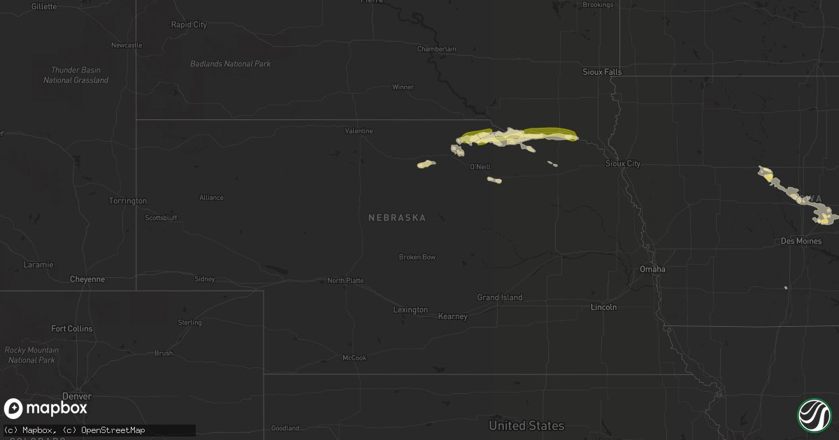
Hail Map in Nebraska on August 1, 2022
Get this storm
August 1 map
$229
one time, instant access
Download today. No call, no setup
Keep the $229
Bought the map and want the full workflow? Apply the entire $229 to a subscription within 7 days. None of it is wasted.
Every map, not just this one
This buys you this map. Subscription and you get every map we run, in the markets you choose from a few cities to whole states to nationwide. Plus real-time alerts the moment a storm fires.
Contact data
Name, contact info, occupancy, even credit band for addresses in the footprint. You go from where it hit to who to call.
Become the source they trust
Unlimited branding weather history reports on demand. You already have the documented answer ready for the property owner, and you are the one who showed up with it.
Property data and RoofTrace estimates
Pull up any address you have got, its value and the exact code rules for that jurisdiction, straight from One Click Code. Then RoofTrace estimates the squares, pitch, and roof value, priced the way you price.
Storm reports in Nebraska
Nebraska
| Date | Description |
|---|---|
| 08/01/20225:25 AM CDT | At 1024 PM CDT, a severe thunderstorm was located near Wynot, or 10 miles southeast of Yankton, moving east at 35 mph. HAZARD...60 mph wind gusts and quarter size hail. SOURCE...Radar indicated. IMPACT...Hail damage to vehicles is expected. Expect wind damage to roofs, siding, and trees. This severe thunderstorm will be near... Meckling around 1035 PM CDT. Maskell around 1045 PM CDT. Vermillion around 1050 PM CDT.Other locations impacted by this severe thunderstorm include Gayvilleand St. Helena Boat Dock. |
| 08/01/20224:10 AM CDT | At 909 PM CDT, a severe thunderstorm was located near Niobrara, or 13 miles southwest of Tyndall, moving northeast at 30 mph. HAZARD...60 mph wind gusts and half dollar size hail. SOURCE...Radar indicated. IMPACT...Hail damage to vehicles is expected. Expect wind damage to roofs, siding, and trees. This severe thunderstorm will be near... Avon around 920 PM CDT. Springfield around 925 PM CDT. Tyndall around 940 PM CDT. |
| 08/01/20224:04 AM CDT | At 904 PM CDT, a severe thunderstorm was located over Niobrara, or 18 miles southwest of Tyndall, moving east at 25 mph. HAZARD...60 mph wind gusts and half dollar size hail. SOURCE...Radar indicated. IMPACT...Hail damage to vehicles is expected. Expect wind damage to roofs, siding, and trees. Locations impacted include... Santee. |
| 08/01/20223:38 AM CDT | At 838 PM CDT, a severe thunderstorm was located near Lynch, or 15 miles east of Spencer, moving east at 35 mph. HAZARD...60 mph wind gusts and quarter size hail. SOURCE...Radar indicated. IMPACT...Hail damage to vehicles is expected. Expect wind damage to roofs, siding, and trees. This severe thunderstorm will be near... Wagner around 855 PM CDT. Dante around 905 PM CDT. Avon around 915 PM CDT.Other locations impacted by this severe thunderstorm include southernYankton Sioux Tribal Nation. |
| 08/01/20223:13 AM CDT | At 813 PM CDT, a severe thunderstorm was located near Spencer, moving east at 35 mph. HAZARD...60 mph wind gusts and quarter size hail. SOURCE...Radar indicated. IMPACT...Hail damage to vehicles is expected. Expect wind damage to roofs, siding, and trees. Locations impacted include... Spencer, Lynch, Gross, Bristow, Monowi, Spencer Dam, Parshall Bridge State Wildlife Management Area, Redbird State Wildlife Management Area and Anncar.This includes the following highways... Highway 281 between mile markers 202 and 220. Highway 12 between mile markers 116 and 144. |
| 08/01/20222:38 AM CDT | At 737 PM CDT, severe thunderstorms were located along a line extending from 10 miles northeast of Stuart to 6 miles northeast of Atkinson to 9 miles west of O'Neill, moving northeast at 30 mph. HAZARD...60 mph wind gusts and quarter size hail. SOURCE...Radar indicated. IMPACT...Hail damage to vehicles is expected. Expect wind damage to roofs, siding, and trees. Locations impacted include... Emmet, Midway, Scottville and Opportunity. This includes the following highways... Highway 20 between mile markers 293 and 301. Highway 281 between mile markers 186 and 206. |
| 07/31/20228:20 PM CDT | A local report indicates 1.00 inch wind near 1 W BRISTOW |
| 07/31/20228:00 PM CDT | A local report indicates 1.00 inch wind near 22 NNE ATKINSON |
| 07/31/20228:00 PM CDT | A local report indicates 1.00 inch wind near 20 NNE ATKINSON |
All States Impacted by Hail Map on August 1, 2022
Cities Impacted by Hail Map on August 1, 2022
- Fairfield, IL
- Madison, FL
- Rio, IL
- Oneida, IL
- Galesburg, IL
- Wataga, IL
- Dayton, IA
- Uniontown, AL
- Safford, AL
- Princeton, KY
- Ribera, NM
- Hopkinsville, KY
- Cerulean, KY
- Crofton, KY
- Gracey, KY
- Griffin, IN
- Sigel, IL
- Vincennes, IN
- Manitou, KY
- Hanson, KY
- Madisonville, KY
- Boone, IA
- Ames, IA
- Hidalgo, IL
- Greenup, IL
- Findlay, IL
- Shelbyville, IL
- Windsor, IL
- Browns, IL
- Mount Carmel, IL
- Albion, IL
- Bone Gap, IL
- Gilbert, IA
- Owensville, IN
- Nevada, IA
- Dawson Springs, KY
- Waverly, KY
- Uniontown, KY
- Morganfield, KY
- Sturgis, KY
- Stuart, NE
- Rio Rico, AZ
- Decker, IN
- Allendale, IL
- Verdigre, NE
- Niobrara, NE
- Henderson, KY
- Owensboro, KY
- Spottsville, KY
- Reed, KY
- Winter Garden, FL
- Colo, IA
- Tiffin, IA
- Oxford, IA
- Saint Charles, KY
- Athens, IL
- Merom, IN
- Palestine, IL
- Winter Haven, FL
- Lake Alfred, FL
- Haines City, FL
- Hartsburg, IL
- Green Cove Springs, FL
- Middleburg, FL
- Buffalo, IL
- Dawson, IL
- Williamsville, IL
- Sherman, IL
- Riverton, IL
- Cowden, IL
- Claysville, PA
- West Alexander, PA
- Rhodes, IA
- State Center, IA
- Moweaqua, IL
- Macon, IL
- Dalton City, IL
- Johnsonville, IL
- Flora, IL
- Iuka, IL
- Xenia, IL
- Rinard, IL
- Davenport, FL
- Polk City, FL
- Bethany, IL
- Assumption, IL
- Cantrall, IL
- Providence, KY
- Clay, KY
- Marion, KY
- Baxter, IA
- Mingo, IA
- Collins, IA
- West Salem, IL
- Burnt Prairie, IL
- Crossville, IL
- Mill Shoals, IL
- Carmi, IL
- Montrose, IL
- Edinburg, IL
- Atalissa, IA
- Rock Island, IL
- Davenport, IA
- Atkinson, NE
- Seaton, IL
- Aledo, IL
- Equality, IL
- Cadiz, KY
- Poseyville, IN
- Flat Rock, IL
- Ruston, LA
- Willow Hill, IL
- Newton, IL
- Palatka, FL
- Centreville, MS
- Liberty, MS
- Norwood, LA
- Moline, IL
- Livermore, KY
- Calhoun, KY
- Newport News, VA
- Hampton, VA
- Lincoln, IL
- Mount Pulaski, IL
- Haubstadt, IN
- Fort Branch, IN
- Cynthiana, IN
- Evansville, IN
- Bassett, NE
- Newport, NE
- Junction, IL
- Slaughters, KY
- Sebree, KY
- Punta Gorda, FL
- Bloomfield, NE
- Center, NE
- Hopedale, IL
- Atlanta, IL
- Armington, IL
- Emden, IL
- Delavan, IL
- Pekin, IL
- Tremont, IL
- Lawndale, IL
- Minier, IL
- San Jose, IL
- Beason, IL
- McLean, IL
- New Holland, IL
- Sutton, WV
- Little Birch, WV
- Lynch, NE
- Spencer, NE
- Bristow, NE
- Walcott, IA
- Osceola, IA
- Marengo, IA
- Blairstown, IA
- Belle Plaine, IA
- Luzerne, IA
- Wausa, NE
- Woodhull, IL
- Alpha, IL
- Sunman, IN
- Guilford, IN
- Laurel, IA
- Melbourne, IA
- New Harmony, IN
- Fort Dodge, IA
- Otho, IA
- Joy, IL
- Wheeler, IL
- Noble, IL
- Claremont, IL
- Ingraham, IL
- Dundas, IL
- Olney, IL
- Hilliard, FL
- Mount Vernon, IN
- Bellmont, IL
- Patoka, IN
- West Liberty, IL
- Watkins, IA
- Sullivan, IN
- Carlisle, IN
- Lynn Center, IL
- Altamont, IL
- Louisville, IL
- Grayville, IL
- Cisne, IL
- Sailor Springs, IL
- Golden Gate, IL
- Clay City, IL
- Mount Erie, IL
- Ellery, IL
- Geff, IL
- Montgomery, AL
- Beaver Dam, KY
- Windermere, FL
- Burnside, IA
- Lehigh, IA
- Inman, NE
- Morning Sun, IA
- Mediapolis, IA
- Coralville, IA
- Iowa City, IA
- Princeton, IN
- Payson, AZ
- Strasburg, IL
- Beaman, IA
- Conrad, IA
- Packwood, IA
- Richland, IA
- Fairfield, IA
- Springfield, IL
- Oneill, NE
- Avon, SD
- Wagner, SD
- Crofton, NE
- Springfield, SD
- Dante, SD
- Oakville, IA
- Burlington, IA
- Anton Chico, NM
- Sumner, IL
- Altona, IL
- Wadesville, IN
- Saint Helena, NE
- Wynot, NE
- Hammond, LA
- Ponchatoula, LA
- West Branch, IA
- New Boston, IL
- Robinson, IL
- Carbon, IN
- Brazil, IN
- Rose Hill, MS
- Yarmouth, IA
- Mount Union, IA
- Harristown, IL
- Decatur, IL
- Niantic, IL
- Orange Park, FL
- Shawneetown, IL
- Keithsburg, IL
- Toledo, IL
- Trilla, IL
- Oblong, IL
- Homestead, IA
- South Amana, IA
- Maxwell, IA
- Clermont, FL
- Kissimmee, FL
- Seymour, IN
- Hazleton, IN
- Monroe City, IN
- Petersburg, IN
- Boston, GA
- Prattville, AL
- McLeansboro, IL
- Dahlgren, IL
- Macedonia, IL
- New Haven, IL
- Ewing, NE
- Effingham, IL
- Teutopolis, IL
- Stonington, IL
- Kinmundy, IL
- Lerna, IL
- Stewardson, IL
- Mechanicsburg, IL
- Salem, IL
- Saint Elmo, IL
- Lawrenceville, IL
- Springerton, IL
- Dieterich, IL
- Calhoun, IL
- Kenney, IL
- Sainte Marie, IL
- Neoga, IL
- Tower Hill, IL
- Parkersburg, IL
- Yale, IL
- Pana, IL
- Enfield, IL
- Barnhill, IL
- Mason, IL
- Omaha, IL
- Mackinaw, IL
- Latham, IL
- Middletown, IL
- Corydon, KY
- Casey, IL
- Watson, IL
- Newburgh, IN
- Illiopolis, IL
- Warrensburg, IL
- Mason City, IL
- Taylorville, IL
- Utica, KY
- Bridgeport, IL
- Alma, IL
- Elkhart, IL
- Bluford, IL
- Fredonia, KY
- Norris City, IL
- Green Valley, IL
- Keenes, IL
- Shumway, IL
- Chestnut, IL
- Blue Mound, IL
- Island, KY
- Sims, IL
- Mount Auburn, IL
- Farina, IL
- Chandler, IN
- Edgewood, IL
- Centertown, KY
- Saint Francisville, IL
- Jewett, IL
- Mattoon, IL
- Duncombe, IA
- Lakewood, IL
- Wapello, IA
- Alexis, IL
- Little York, IL
- Stratford, IA
- Callender, IA
- Newton, IA
- Story City, IA
- Moorland, IA
- Stanhope, IA
- Galva, IL
- La Fayette, IL
- Greensburg, LA
- Eldorado, IL
- Harrisburg, IL
- Gerlaw, IL
- Magnet, NE
- Frametown, WV
- Gassaway, WV
- Ridgway, IL
- Strong, AR
- West Liberty, IA
- Westport, IN
- Butlerville, IN
- North Vernon, IN
- Vail, AZ
- Sonoita, AZ
- Hartford, KY
- Weldon, CA
- Darlington, IN
- Columbus Junction, IA
- New Windsor, IL
- Interlachen, FL
- Fordyce, NE
- Gayville, SD
- Vermillion, SD
- North Salem, IN
- Bainbridge, IN
- Danville, IN
- Clayton, LA
- Sycamore, PA
- East Millsboro, PA
- Marianna, PA
- Clarksville, PA
- Millsboro, PA
- Rices Landing, PA
- Marlette, MI
- Decker, MI
- Caro, MI
- Vassar, MI
- Mayville, MI
- Deford, MI
- Kingston, MI
- Zionsville, IN
- Westfield, IN
- Carmel, IN
- Fishers, IN
- Noblesville, IN
- Pendleton, IN
- Indianapolis, IN
- Shelbyville, IN
- Fountaintown, IN
- Fairland, IN
- Beech Grove, IN
- New Palestine, IN
- Butte, NE
- Yankton, SD
- Mission Hill, SD
- Tabor, SD
- Tyndall, SD
- North Salt Lake, UT
- Magna, UT
- Woods Cross, UT
- West Jordan, UT
- West Valley City, UT
- Salt Lake City, UT
- Bountiful, UT
- Ogden, UT
- Corinne, UT


