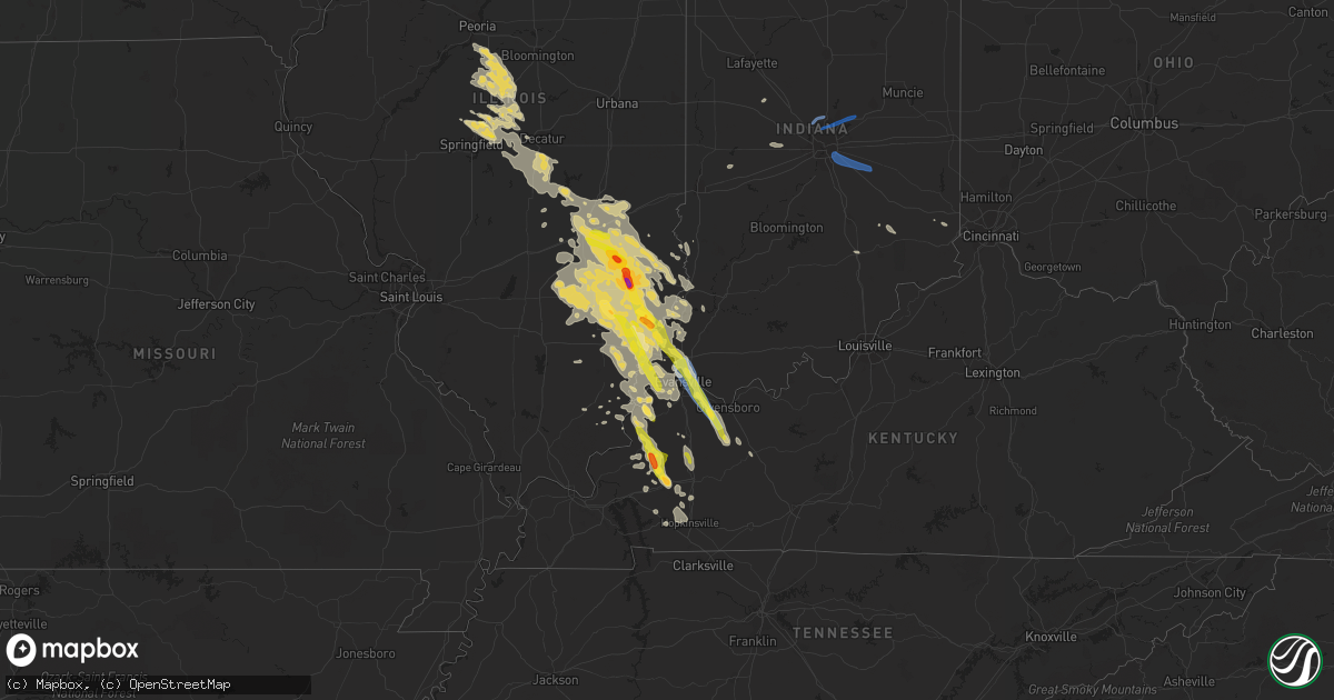
Hail Map on August 1, 2022
Get this storm
August 1 map
$229
one time, instant access
Download today. No call, no setup
Keep the $229
Bought the map and want the full workflow? Apply the entire $229 to a subscription within 7 days. None of it is wasted.
Every map, not just this one
This buys you this map. Subscription and you get every map we run, in the markets you choose from a few cities to whole states to nationwide. Plus real-time alerts the moment a storm fires.
Contact data
Name, contact info, occupancy, even credit band for addresses in the footprint. You go from where it hit to who to call.
Become the source they trust
Unlimited branding weather history reports on demand. You already have the documented answer ready for the property owner, and you are the one who showed up with it.
Property data and RoofTrace estimates
Pull up any address you have got, its value and the exact code rules for that jurisdiction, straight from One Click Code. Then RoofTrace estimates the squares, pitch, and roof value, priced the way you price.
States Impacted by Hail Map on August 1, 2022
Storm reports
West Virginia
| Date | Description |
|---|---|
| 08/01/20226:02 PM CDT | Structure and tree damage near oklahoma road and dallas pike; tornado damage likely. |
| 08/01/20225:14 PM CDT | Trees down in the little birch area. Time estomated from radar. |
| 08/01/202212:57 AM CDT | At 557 PM EDT, a severe thunderstorm was located near Gassaway, or 8 miles west of Sutton, moving southeast at 35 mph. HAZARD...60 mph wind gusts and penny size hail. SOURCE...Radar indicated. IMPACT...Expect damage to roofs, siding, and trees. Locations impacted include... Sutton, Gassaway, Birch River, Cowen, Diana, Frametown, Strange Creek, Wilsie, Servia, Boggs, Little Birch, Centralia and Erbacon.This includes the following highways... Interstate 79 between mile markers 45 and 66. Route 19 between mile markers 58 and 68. |
Oklahoma
| Date | Description |
|---|---|
| 08/01/202212:30 AM CDT | At 530 PM CDT, a severe thunderstorm was located 4 miles northeast of Eva, or 11 miles south of Elkhart, moving northwest at 10 mph. HAZARD...60 mph wind gusts and quarter size hail. SOURCE...Radar indicated. IMPACT...Minor damage to roofs, siding, and trees is possible. Hail damage to vehicles is expected. Locations impacted include... Keyes, Eva, Hough and Sturgis. |
Louisiana
| Date | Description |
|---|---|
| 08/01/20223:39 PM CDT | Trees reported down on interstate 12 at louisiana highway 445. |
| 08/01/20223:15 PM CDT | Central fire department shared a photo of a tree down on frenchtown rd between country and planchet rd on social media. |
| 08/01/20223:06 AM CDT | At 806 PM CDT, a severe thunderstorm was located near Farmerville, or 16 miles northeast of Ruston, and is nearly stationary. HAZARD...60 mph wind gusts and penny size hail. SOURCE...Radar indicated. IMPACT...Expect damage to roofs, siding, and trees. Locations impacted include... Farmerville, Bayou D Arbonne Lake and Shiloh. |
| 08/01/20222:38 AM CDT | At 738 PM CDT, a severe thunderstorm was located near Ruston, and is nearly stationary. HAZARD...60 mph wind gusts and nickel size hail. SOURCE...Radar indicated. IMPACT...Expect damage to roofs, siding, and trees. Locations impacted include... Ruston, Grambling, Dubach, Vienna and Unionville. |
| 07/31/202211:19 PM CDT | At 418 PM CDT, a severe thunderstorm was located over mainly rural areas of St. Helena Parish , moving northeast at 25 mph. HAZARD...60 mph wind gusts and half dollar size hail. SOURCE...Radar indicated. IMPACT...Hail damage to vehicles is expected. Expect wind damage to roofs, siding, and trees. Locations impacted include... Gillsburg, Easleyville and Darlington. |
South Carolina
| Date | Description |
|---|---|
| 08/01/20224:47 PM CDT | Tree down across twin bridge rd near the intersection with cale yarborough hwy |
| 08/01/202212:57 AM CDT | At 556 PM EDT, a severe thunderstorm was located near Lake City, moving east at 25 mph. HAZARD...60 mph wind gusts. SOURCE...Radar indicated. IMPACT...Expect wind damage to trees and power lines. Locations impacted include... Florence, Lake City, Timmonsville, Pamplico, Sardis, Hyman, Hannah, Effingham, Cades, Cartersville, Hebron, Friendfield, Claussen, New Hope, Evergreen, Scranton, Coward, Olanta, Lake City Community Hospital and Carolinas Hospital System. |
| 08/01/202212:37 AM CDT | At 536 PM EDT, a severe thunderstorm was located over Woods Bay State Park, or 12 miles northwest of Lake City, moving east at 40 mph. HAZARD...60 mph wind gusts. SOURCE...Radar indicated. IMPACT...Expect wind damage to trees and power lines. Locations impacted include... Florence, Lake City, Timmonsville, Pamplico, Sardis, Hyman, Hannah, Effingham, Cades, Cartersville, Hebron, Friendfield, Claussen, New Hope, Evergreen, Scranton, Coward, Olanta, Central Crossroads and Lake City Community Hospital. |
Michigan
| Date | Description |
|---|---|
| 08/01/20221:14 PM CDT | Report of multiple trees down near intersection of m24 and state rte 46. Possible tornado. |
| 08/01/20221:02 PM CDT | Report of multiple trees down near intersection of sheridan rd and waterman rd. Possible tornado. |
| 08/01/202212:56 PM CDT | Report of multiple trees down near intersection of caine rd and waterman rd. |
| 08/01/202212:45 PM CDT | Report of multiple trees down on intersection of saginaw rd and sheridan rd |
| 07/31/20229:45 PM CDT | At 244 PM EDT, a severe thunderstorm was located near Kingston, or 9 miles north of Marlette, moving northeast at 35 mph. HAZARD...60 mph wind gusts. SOURCE...Radar indicated. IMPACT...Expect damage to roofs, siding, and trees. This severe thunderstorm will be near... Argyle around 305 PM EDT. Deckerville around 315 PM EDT. Forestville around 335 PM EDT.Other locations impacted by this severe thunderstorm include Tyre,Decker, Palms, Watertown, McGregor, Forester, Minden, Snover, Juhland Elmer. |
New Mexico
| Date | Description |
|---|---|
| 08/01/202212:21 AM CDT | At 521 PM MDT, a severe thunderstorm was located 21 miles northeast of Engle, moving south at 10 mph. HAZARD...60 mph wind gusts and quarter size hail. SOURCE...Radar indicated. IMPACT...Hail damage to vehicles is expected. Expect wind damage to roofs, siding, and trees. This severe thunderstorm will remain over mainly rural areas of northeastern Sierra County. |
| 07/31/20229:00 PM CDT | Dime to quarter size hail. |
Mississippi
| Date | Description |
|---|---|
| 07/31/202211:42 PM CDT | At 442 PM CDT, a severe thunderstorm was located near Felps, or 11 miles southwest of Liberty, moving northeast at 5 mph. HAZARD...60 mph wind gusts and half dollar size hail. SOURCE...Radar indicated. IMPACT...Hail damage to vehicles is expected. Expect wind damage to roofs, siding, and trees. Locations impacted include... Liberty. |
Nevada
| Date | Description |
|---|---|
| 08/01/20221:50 AM CDT | At 649 PM PDT, a severe thunderstorm was located near Lida, moving northeast at 20 mph. HAZARD...60 mph wind gusts and quarter size hail. SOURCE...Radar indicated. IMPACT...Hail damage to vehicles is expected. Expect wind damage to roofs and trees. Locations impacted include... Lida and Gold Point. |
| 08/01/20221:10 AM CDT | At 609 PM PDT, a severe thunderstorm was located 10 miles southeast of Silver Peak, or 12 miles north of Lida, moving northeast at 20 mph. HAZARD...60 mph wind gusts and quarter size hail. SOURCE...Radar indicated. IMPACT...Hail damage to vehicles is expected. Expect wind damage to roofs and trees. Locations impacted include... Lida Junction, Silver Peak and Goldfield. |
| 07/31/20228:43 PM CDT | Mesonet station mpvn2 martin creek station elevation: 6438 ft. |
California
| Date | Description |
|---|---|
| 07/31/20229:54 PM CDT | At 252 PM PDT, a severe thunderstorm was located 25 miles west of Sr 127 Near Dumont Dunes, or 30 miles southwest of Shoshone, moving northeast at 10 mph. HAZARD...60 mph wind gusts and frequent cloud to ground lightning. SOURCE...Radar indicated. IMPACT...Possible damage to roofs and trees, blowing dust, and hail up to a half inch in diameter. This severe thunderstorm will remain over mainly rural areas of northwestern San Bernardino and south central Inyo Counties. |
| 07/31/20229:45 PM CDT | At 243 PM PDT, a severe thunderstorm was located just west of Barstow, moving north at 15 mph. HAZARD...60 mph wind gusts and frequent cloud to ground lightning. SOURCE...Radar indicated. IMPACT...Possible damage to roofs and trees, blowing dust, and small hail. Locations impacted include... Barstow, I-15 Between Victorville And Barstow, Owl Canyon Campground, Hwy 247 Between Lucerne Valley And Barstow, Lenwood and Nebo Center.This includes the following highways... Interstate 15 in California near mile marker 81. Interstate 40 in California between mile markers 1 and 6. |
Iowa
| Date | Description |
|---|---|
| 08/01/20227:36 AM CDT | At 1236 AM CDT, a severe thunderstorm was located over Norway, or 12 miles west of Cedar Rapids, moving east at 35 mph. HAZARD...60 mph wind gusts and quarter size hail. SOURCE...Radar indicated. IMPACT...Hail damage to vehicles is expected. Expect wind damage to roofs, siding, and trees. Locations impacted include... Cedar Rapids, Fairfax, Ely, Atkins, Walford, Swisher, Newhall, Shueyville, Norway, Bertram, Cou Falls, Watkins, Cedar Rapids Municipal Airport and Morgan Creek Park. |
| 08/01/20227:00 AM CDT | At 1200 AM CDT, a severe thunderstorm was located near Van Horne, or 7 miles south of Vinton, moving southeast at 35 mph. HAZARD...60 mph wind gusts and nickel size hail. SOURCE...Radar indicated. IMPACT...Expect damage to roofs, siding, and trees. Locations impacted include... Cedar Rapids, Vinton, Hiawatha, Robins, Fairfax, Atkins, Walford, Palo, Shellsburg, Newhall, Van Horne, Toddville, Benton County Fairgrounds and Morgan Creek Park. |
| 07/31/202210:16 PM CDT | At 316 AM CDT, severe thunderstorms were located along a line extending from Shale City to Seaton to Garland, moving east at 45 mph. HAZARD...60 mph wind gusts and penny size hail. SOURCE...Radar indicated. IMPACT...Expect damage to roofs, siding, and trees. Locations impacted include... Monmouth, Aledo, Oquawka, Burgess, Mediapolis, Viola, Morning Sun, Millersburg, Kirkwood, New Boston, Keithsburg, Joy, Little York, Rozetta, Seaton, North Henderson, Oakville, Shale City, Toolesboro and Lake Warren. |
North Carolina
| Date | Description |
|---|---|
| 08/01/20224:18 PM CDT | Tree reported down on garage and vehicle on gregory fork rd. Time estimated by radar. |
| 08/01/20224:18 PM CDT | Tree down near lakeview ave and catherine lake rd. |
| 08/01/20223:46 PM CDT | Multiple downed trees reported near bradford creek public golf course. |
| 08/01/20223:45 PM CDT | Duplin co em reports tree down on building. Time estimated by radar. |
| 08/01/20223:31 PM CDT | Pitt county 911 center reports a tree down across sunnyside rd near the intersection of old pactolus rd. Time estimated from radar. |
| 08/01/202212:39 AM CDT | At 538 PM EDT, a severe thunderstorm was located over Pungo Lake, or 13 miles southeast of Plymouth, moving east at 35 mph. HAZARD...60 mph wind gusts and penny size hail. SOURCE...Radar indicated. IMPACT...Expect damage to roofs, siding, and trees. Locations impacted include... Killkenny, Alligator, Gum Neck, Kilkenny, Columbia, Woodley, Wenona, Newfoundland, Fort Landing, Phelps Lake, Frying Pan Landing, Pungo Lake, Alligator Lake and Creswell. |
| 08/01/202212:05 AM CDT | At 504 PM EDT, a severe thunderstorm was located over Pinetown, or 11 miles northeast of River Road, moving east at 40 mph. HAZARD...60 mph wind gusts. SOURCE...Radar indicated. IMPACT...Expect damage to roofs, siding, and trees. Locations impacted include... Belhaven, Pinetown, Ponzer, Scranton, Pungo, Pike Road, Leechville, Rose Bay, Wenona, Hinson, Terra Ceia, Yeatesville, Phelps Lake, Pungo Lake, Alligator Lake, Long Acre VFD and Pantego. |
| 08/01/202212:04 AM CDT | At 503 PM EDT, severe thunderstorms were located along a line extending from near Albertson to near Chinquapin to near Harrells, moving east at 30 mph. HAZARD...60 mph wind gusts. SOURCE...Radar indicated. IMPACT...Expect damage to roofs, siding, and trees. Locations impacted include... Jacksonville, Wallace, New River Station, Pumpkin Center, Piney Green, Half Moon, Camp Lejeune Center, Swansboro, Phillips Crossroads, Hubert, Kornegay, Rose Hill, Richlands, Beulaville, Deep Run, Maysville, Catherine Lake, Silverdale, Kellum and Cypress Creek. |
| 07/31/202211:43 PM CDT | At 443 PM EDT, a severe thunderstorm was located over Pitt Greenville Airport, or near Greenville, moving east at 30 mph. HAZARD...60 mph wind gusts. SOURCE...Radar indicated. IMPACT...Expect damage to roofs, siding, and trees. Locations impacted include... Greenville, Washington, River Road, Pactolus, Bunyan, Old Ford, Chocowinity, Washington Park, Grimesland and Simpson. |
Florida
| Date | Description |
|---|---|
| 08/01/20223:58 AM CDT | At 857 PM EDT, a severe thunderstorm was located near Zellwood, moving north at 10 mph. HAZARD...60 mph wind gusts and quarter size hail. SOURCE...Radar indicated. IMPACT...Hail damage to vehicles is expected. Expect wind damage to roofs, siding, and trees. Locations impacted include... Apopka, Eustis, Mount Dora, Mount Plymouth and Zellwood. |
| 08/01/20223:52 AM CDT | At 852 PM EDT, a severe thunderstorm was located over Horizon West, or near Bay Lake, and is nearly stationary. HAZARD...60 mph wind gusts and nickel size hail. SOURCE...Radar indicated. IMPACT...Expect damage to roofs, siding, and trees. Locations impacted include... Winter Garden, Windermere, Bay Lake, Horizon West and Bay Hill. |
| 08/01/20222:04 AM CDT | At 704 PM EDT, a severe thunderstorm was located near Fleming Island, or near Green Cove Springs, moving southeast at 15 mph. HAZARD...60 mph wind gusts and penny size hail. SOURCE...Radar indicated. IMPACT...Expect damage to roofs, siding, and trees. Locations impacted include... Green Cove Springs, Middleburg, Doctors Inlet, Lakeside, Penney Farms and Asbury Lake. |
Maryland
| Date | Description |
|---|---|
| 08/01/20225:37 AM CDT | At 1037 PM EDT, a severe thunderstorm was located over Oatlands, or near Leesburg, moving east at 35 mph. HAZARD...60 mph wind gusts. SOURCE...Radar indicated. IMPACT...Damaging winds will cause some trees and large branches to fall. This could injure those outdoors, as well as damage homes and vehicles. Roadways may become blocked by downed trees. Localized power outages are possible. Unsecured light objects may become projectiles. Locations impacted include... Rockville, Gaithersburg, Reston, Leesburg, Herndon, Broadlands, Lansdowne, Lowes Island, Brambleton, Pimmit Hills, American Legion Bridge, Potomac, North Bethesda, Ashburn, Sterling, North Potomac, Tysons Corner, Wolf Trap, Great Falls and Countryside. |
| 08/01/20224:56 AM CDT | At 956 PM EDT, a severe thunderstorm was located near Bluemont, or near Charles Town, moving southeast at 35 mph. HAZARD...60 mph wind gusts. SOURCE...Radar indicated. IMPACT...Damaging winds will cause some trees and large branches to fall. This could injure those outdoors, as well as damage homes and vehicles. Roadways may become blocked by downed trees. Localized power outages are possible. Unsecured light objects may become projectiles. Locations impacted include... Leesburg, Lansdowne, Purcellville, Round Hill, Oatlands, Bluemont, Hamilton, Hillsboro, Paeonian Springs, Gleedsville, Wickliffe, Lincoln, Hughesville and Rippon. |
Alabama
| Date | Description |
|---|---|
| 08/01/20223:38 PM CDT | Large pine tree uprooted on hill hedge drive. |
| 08/01/20223:38 PM CDT | Trees down |
| 07/31/202211:04 PM CDT | At 403 PM CDT, a severe thunderstorm was located near Vancleave, or 11 miles northwest of Escatawpa, moving east at 15 mph. HAZARD...60 mph wind gusts. SOURCE...Radar indicated. IMPACT...Expect damage to roofs, siding, and trees. Locations impacted include... Escatawpa, Hurley, Big Point, Vancleave and Wade. |
| 07/31/202210:36 PM CDT | At 336 PM CDT, a severe thunderstorm was located over eastern Montgomery, and is nearly stationary. HAZARD...60 mph wind gusts. SOURCE...Radar indicated. IMPACT...Expect damage to roofs, siding, and trees. Locations impacted include... Montgomery, Eastdale Mall, Montgomery Zoo, Alabama State University, Auburn University In Montgomery, Montgomery Riverwalk Stadium, Lagoon Park, Gunter Air Force Base, Alabama State Capitol and Mitylene. |
Indiana
| Date | Description |
|---|---|
| 08/01/20226:59 PM CDT | Mping report: 1-inch tree limbs broken; shingles blown off. |
| 08/01/20226:58 PM CDT | Evansville airport asos. |
| 08/01/20226:55 PM CDT | A local report indicates 62 MPH wind near 2 S DARMSTADT |
| 08/01/20226:54 PM CDT | Tree down and took down power lines. |
| 08/01/20226:03 PM CDT | A local report indicates 1.00 inch wind near 2 SSE MOUNT CARMEL |
| 08/01/20228:27 AM CDT | Em reports trees down in the area of 200n and alexandria pike. Some trees down on houses. Time estimated via radar. |
| 08/01/20228:17 AM CDT | Trained spotter reports 60 mph estimated wind gust at london road and i-74. |
| 08/01/20228:13 AM CDT | Retired nws employee reports 70mph estimated wind gust in fishers. |
| 08/01/20228:09 AM CDT | Large tree limbs down at intersection of southport and combs. Time estimated via radar. |
| 08/01/20228:05 AM CDT | Em reports multiple trees down into power lines. |
| 08/01/20228:03 AM CDT | Large tree down at bear slide golf club in cicero. Time estimated via radar. |
| 08/01/20228:00 AM CDT | Em reports that a tree is down on a house in carmel; local fire and rescue responding. |
| 08/01/20228:00 AM CDT | Trees reported down at the intersection of raymond street and sherman drive. Time estimated via radar. |
| 08/01/20227:54 AM CDT | Law enforcement reports a downed tree is completely blocking us421 at valley meadow drive. Power is out in zionsville. |
| 08/01/20227:52 AM CDT | Five homes damaged in heatherwood estates subdivision. Multiple trees down... Some through the roofs of homes. No injuries reported. Time estimated via radar. |
| 08/01/20227:35 AM CDT | Numerous trees down on camp street near the elementary school. Powerlines affected by tree damage. Time estimated via radar. |
| 08/01/20227:35 AM CDT | Up to 900 without power due to thunderstorm wind damage. Time estimated via radar. |
| 08/01/20227:17 AM CDT | 1600 without power due to thunderstorm wind damage. Time estimated via radar. |
| 08/01/20227:03 AM CDT | Trees reported down between rosedale road and gallagher road in northern vigo county. Time estimated via radar. |
| 08/01/20226:00 AM CDT | At 1100 PM CDT, a severe thunderstorm was located near Carmi, moving southeast at 20 mph. HAZARD...Ping pong ball size hail and 60 mph wind gusts. SOURCE...Radar indicated. IMPACT...People and animals outdoors will be injured. Expect hail damage to roofs, siding, windows, and vehicles. Expect wind damage to roofs, siding, and trees. This severe thunderstorm will be near... Carmi and Crossville around 1110 PM CDT. |
| 08/01/20224:43 AM CDT | At 942 PM CDT, a severe thunderstorm was located over Morganfield, moving southeast at 20 mph. HAZARD...Ping pong ball size hail and 60 mph wind gusts. SOURCE...Radar indicated. IMPACT...People and animals outdoors will be injured. Expect hail damage to roofs, siding, windows, and vehicles. Expect wind damage to roofs, siding, and trees. This severe thunderstorm will be near... Morganfield and Breckinridge Center around 950 PM CDT.Other locations impacted by this severe thunderstorm includeWheatcroft. |
| 08/01/20224:40 AM CDT | At 939 PM CDT, a severe thunderstorm was located near Grayville, or near Albion, moving southeast at 30 mph. HAZARD...Ping pong ball size hail and 60 mph wind gusts. SOURCE...Radar indicated. IMPACT...People and animals outdoors will be injured. Expect hail damage to roofs, siding, windows, and vehicles. Expect wind damage to roofs, siding, and trees. This severe thunderstorm will be near... Grayville around 950 PM CDT. New Harmony around 1005 PM CDT. Poseyville around 1010 PM CDT. Cynthiana around 1015 PM CDT.Other locations impacted by this severe thunderstorm includePhillipstown, Griffin and Browns.This includes the following highways... Interstate 64 in Indiana between Mile Markers 1 and 16. Interstate 64 in Illinois between Mile Markers 122 and 130. |
| 08/01/20224:25 AM CDT | At 925 AM EDT, a severe thunderstorm was located over Anderson, moving east at 60 mph. HAZARD...70 mph wind gusts. SOURCE...Radar indicated. IMPACT...Expect considerable tree damage. Damage is likely to mobile homes, roofs, and outbuildings. This severe thunderstorm will be near... Daleville around 930 AM EDT. Yorktown around 935 AM EDT. Springport around 940 AM EDT. Summit Lake State Park and Prairie Creek Reservoir around 945 AM EDT.Other locations in the path of this severe thunderstorm includeMooreland and Blountsville.This includes Interstate 69 between mile markers 226 and 243. |
| 08/01/20224:14 AM CDT | At 914 AM EDT, severe thunderstorms were located along a line extending from 7 miles southwest of Anderson to 8 miles northwest of Shelbyville, moving east at 55 mph. HAZARD...70 mph wind gusts. SOURCE...Radar indicated. IMPACT...Expect considerable tree damage. Damage is likely to mobile homes, roofs, and outbuildings. Severe thunderstorms will be near... Shelbyville, Markleville and Wilkinson around 925 AM EDT. Shirley, Kennard, Cadiz, Manilla and Waldron around 930 AM EDT.Other locations in the path of these severe thunderstorms include St.Paul, Spiceland, Sulphur Springs, Mount Summit, Greensboro, Moscow,New Castle, Lewisville, Milroy, Dunreith, Sandusky, Straughn, NewSalem, Clarksburg and Lake Santee.This includes the following highways... Interstate 65 between mile markers 91 and 98. Interstate 69 between mile markers 210 and 226. Interstate 70 between mile markers 94 and 133. Interstate 74 between mile markers 99 and 131, between mile markers133 and 138, and between mile markers 143 and 144. |
| 08/01/20224:05 AM CDT | At 905 PM CDT, a severe thunderstorm was located 10 miles south of Schnell, or 10 miles northeast of Fairfield, moving southeast at 25 mph. HAZARD...60 mph wind gusts and half dollar size hail. SOURCE...Radar indicated. IMPACT...Hail damage to vehicles is expected. Expect wind damage to roofs, siding, and trees. Locations impacted include... Albion and Grayville. |
| 08/01/20223:35 AM CDT | At 834 AM EDT, a severe thunderstorm was located near Brownsburg, or 18 miles west of Indianapolis, moving east at 60 mph. HAZARD...60 mph wind gusts and nickel size hail. SOURCE...Radar indicated. IMPACT...Expect damage to roofs, siding, and trees. This severe thunderstorm will be near... Avon around 840 AM EDT. Plainfield, Speedway, Clermont, Eagle Creek Reservoir and Indianapolis Int'l Airport around 845 AM EDT. Meridian Hills, Rocky Ripple, Williams Creek, Wynnedale, Spring Hill, Crows Nest and North Crows Nest around 850 AM EDT.Other locations in the path of this severe thunderstorm include BeechGrove, Monument Circle, Indiana State Fairgrounds, Broad Ripple,Warren Park and Cumberland.This includes the following highways... Interstate 65 between mile markers 84 and 147. Interstate 69 between mile markers 200 and 211. Interstate 70 between mile markers 57 and 93. Interstate 74 between mile markers 59 and 100. |
| 08/01/20223:23 AM CDT | At 823 PM CDT, a severe thunderstorm was located near Claremont, or 7 miles southeast of Olney, moving southeast at 30 mph. HAZARD...60 mph wind gusts and half dollar size hail. SOURCE...Radar indicated. IMPACT...Hail damage to vehicles is expected. Expect wind damage to roofs, siding, and trees. This severe thunderstorm will remain over mainly rural areas of southwestern Lawrence and southeastern Richland Counties, including the following locations... Berryville, Red Hills State Park, Helena and Mount Carmel Airport. |
| 08/01/20223:12 AM CDT | At 812 AM EDT, a severe thunderstorm was located 8 miles northeast of Brazil, or 22 miles northeast of Terre Haute, moving east at 45 mph. HAZARD...60 mph wind gusts. SOURCE...Radar indicated. IMPACT...Expect damage to roofs, siding, and trees. This severe thunderstorm will be near... Reelsville around 815 AM EDT. Greencastle around 820 AM EDT. Cloverdale and Cagles Mill Lake around 825 AM EDT. Belle Union and Devore around 830 AM EDT.Other locations in the path of this severe thunderstorm includeEminence, Quincy, Little Point and Paragon.This includes the following highways... Interstate 70 between mile markers 17 and 19, and between milemarkers 29 and 56. Interstate 74 between mile markers 34 and 58. |
| 08/01/20223:01 AM CDT | At 800 PM CDT, a severe thunderstorm was located near Henderson, moving southeast at 45 mph. HAZARD...60 mph wind gusts and quarter size hail. SOURCE...Radar indicated. IMPACT...Hail damage to vehicles is expected. Expect wind damage to roofs, siding, and trees. This severe thunderstorm will be near... Henderson around 805 PM CDT.This includes the following highways... Interstate 69 in Kentucky between Mile Markers 141 and 148. Audubon Parkway between Mile Markers 1 and 13. |
| 08/01/20222:45 AM CDT | At 745 AM EDT, severe thunderstorms were located along a line extending from near Newport to 6 miles northeast of Vermilion, moving east at 50 mph. HAZARD...60 mph wind gusts. SOURCE...Radar indicated. IMPACT...Expect damage to roofs, siding, and trees. Severe thunderstorms will be near... Newport and Universal around 750 AM EDT. Clinton, Fairview Park, Montezuma, Mecca, Shepardsville and North Terre Haute around 755 AM EDT. Rosedale, Bloomingdale and Turkey Run State Park around 800 AM EDT. Rockville, Marshall and Fontanet around 805 AM EDT.Other locations in the path of these severe thunderstorms includeStaunton, Judson, Bridgeton, Brazil, Knightsville, Harmony, Carbon,Cecil Harden Lake and Lena.This includes Interstate 70 between mile markers 20 and 28. |
| 08/01/20221:46 AM CDT | At 646 PM CDT, a severe thunderstorm was located near Sumner, or 9 miles southwest of Lawrenceville, moving southeast at 35 mph. HAZARD...60 mph wind gusts and half dollar size hail. SOURCE...Radar indicated. IMPACT...Hail damage to vehicles is expected. Expect wind damage to roofs, siding, and trees. This severe thunderstorm will be near... St. Francisville around 700 PM CDT. |
| 07/31/202211:12 PM CDT | At 412 PM CDT, severe thunderstorms were located along a line extending from Willow Hill to near Bogota to 6 miles southeast of Watson, moving southeast at 25 mph. HAZARD...60 mph wind gusts and half dollar size hail. SOURCE...Radar indicated. IMPACT...Hail damage to vehicles is expected. Expect wind damage to roofs, siding, and trees. Severe thunderstorms will be near... Newton, Willow Hill and Bogota around 415 PM CDT. Ste. Marie around 420 PM CDT. Oblong around 425 PM CDT.Other locations in the path of these severe thunderstorms includeWest Liberty, Sailor Springs, Hardinville, Ingraham, New Hebron, FlatRock, Chauncey and Birds. |
| 07/31/20229:25 PM CDT | Late report. Multiple trees downed in two locations near sr3 and cr 400n. Estimated 50-60 mph winds. |
| 07/31/20227:15 PM CDT | Numerous tree limbs down. |
| 07/31/20227:08 PM CDT | Mping report; 3-inch tree limbs broken; power poles broken. |
| 07/31/20227:08 PM CDT | Trees down near wesselman park; roof damage to nearby building. |
| 07/31/20227:05 PM CDT | Tree across heidelbach ave. |
| 07/31/20227:04 PM CDT | Tree down across road on n boeke rd. |
| 07/31/20227:03 PM CDT | Large tree down and across st george road... Taking out a power line. |
| 07/31/20227:02 PM CDT | Kevv asos. |
Nebraska
| Date | Description |
|---|---|
| 08/01/20225:25 AM CDT | At 1024 PM CDT, a severe thunderstorm was located near Wynot, or 10 miles southeast of Yankton, moving east at 35 mph. HAZARD...60 mph wind gusts and quarter size hail. SOURCE...Radar indicated. IMPACT...Hail damage to vehicles is expected. Expect wind damage to roofs, siding, and trees. This severe thunderstorm will be near... Meckling around 1035 PM CDT. Maskell around 1045 PM CDT. Vermillion around 1050 PM CDT.Other locations impacted by this severe thunderstorm include Gayvilleand St. Helena Boat Dock. |
| 08/01/20224:10 AM CDT | At 909 PM CDT, a severe thunderstorm was located near Niobrara, or 13 miles southwest of Tyndall, moving northeast at 30 mph. HAZARD...60 mph wind gusts and half dollar size hail. SOURCE...Radar indicated. IMPACT...Hail damage to vehicles is expected. Expect wind damage to roofs, siding, and trees. This severe thunderstorm will be near... Avon around 920 PM CDT. Springfield around 925 PM CDT. Tyndall around 940 PM CDT. |
| 08/01/20224:04 AM CDT | At 904 PM CDT, a severe thunderstorm was located over Niobrara, or 18 miles southwest of Tyndall, moving east at 25 mph. HAZARD...60 mph wind gusts and half dollar size hail. SOURCE...Radar indicated. IMPACT...Hail damage to vehicles is expected. Expect wind damage to roofs, siding, and trees. Locations impacted include... Santee. |
| 08/01/20223:38 AM CDT | At 838 PM CDT, a severe thunderstorm was located near Lynch, or 15 miles east of Spencer, moving east at 35 mph. HAZARD...60 mph wind gusts and quarter size hail. SOURCE...Radar indicated. IMPACT...Hail damage to vehicles is expected. Expect wind damage to roofs, siding, and trees. This severe thunderstorm will be near... Wagner around 855 PM CDT. Dante around 905 PM CDT. Avon around 915 PM CDT.Other locations impacted by this severe thunderstorm include southernYankton Sioux Tribal Nation. |
| 08/01/20223:13 AM CDT | At 813 PM CDT, a severe thunderstorm was located near Spencer, moving east at 35 mph. HAZARD...60 mph wind gusts and quarter size hail. SOURCE...Radar indicated. IMPACT...Hail damage to vehicles is expected. Expect wind damage to roofs, siding, and trees. Locations impacted include... Spencer, Lynch, Gross, Bristow, Monowi, Spencer Dam, Parshall Bridge State Wildlife Management Area, Redbird State Wildlife Management Area and Anncar.This includes the following highways... Highway 281 between mile markers 202 and 220. Highway 12 between mile markers 116 and 144. |
| 08/01/20222:38 AM CDT | At 737 PM CDT, severe thunderstorms were located along a line extending from 10 miles northeast of Stuart to 6 miles northeast of Atkinson to 9 miles west of O'Neill, moving northeast at 30 mph. HAZARD...60 mph wind gusts and quarter size hail. SOURCE...Radar indicated. IMPACT...Hail damage to vehicles is expected. Expect wind damage to roofs, siding, and trees. Locations impacted include... Emmet, Midway, Scottville and Opportunity. This includes the following highways... Highway 20 between mile markers 293 and 301. Highway 281 between mile markers 186 and 206. |
| 07/31/20228:20 PM CDT | A local report indicates 1.00 inch wind near 1 W BRISTOW |
| 07/31/20228:00 PM CDT | A local report indicates 1.00 inch wind near 20 NNE ATKINSON |
| 07/31/20228:00 PM CDT | A local report indicates 1.00 inch wind near 22 NNE ATKINSON |
South Dakota
| Date | Description |
|---|---|
| 08/01/20225:23 AM CDT | At 1022 PM CDT, a severe thunderstorm was located over St. Helena, or 9 miles southeast of Yankton, moving east at 35 mph. HAZARD...60 mph wind gusts and quarter size hail. SOURCE...Radar indicated. IMPACT...Hail damage to vehicles is expected. Expect wind damage to roofs, siding, and trees. This severe thunderstorm will be near... Wynot around 1030 PM CDT. |
| 08/01/20224:19 AM CDT | At 919 PM CDT, a severe thunderstorm was located 4 miles northeast of Center, or 20 miles southwest of Lewis And Clark State Recreation Area, moving east at 40 mph. HAZARD...60 mph wind gusts and quarter size hail. SOURCE...Radar indicated. IMPACT...Hail damage to vehicles is expected. Expect wind damage to roofs, siding, and trees. This severe thunderstorm will be near... Bloomfield around 935 PM CDT.Other locations in the path of this severe thunderstorm includeCrofton and Fordyce. |
| 08/01/20223:33 AM CDT | At 833 PM CDT, a severe thunderstorm was located over Lynch, or 12 miles east of Spencer, moving east at 35 mph. HAZARD...60 mph wind gusts and quarter size hail. SOURCE...Radar indicated. IMPACT...Hail damage to vehicles is expected. Expect wind damage to roofs, siding, and trees. Locations impacted include... Verdel. |
| 07/31/202210:05 PM CDT | Social media report with picture of 1 inch hail. Time reported by observer... Aligns with radar data. |
| 07/31/20229:15 PM CDT | Reported heavy lightning and quarter inch hail. |
Pennsylvania
| Date | Description |
|---|---|
| 08/01/20226:39 PM CDT | Trees down on oak forrest road near stone hill road. |
| 08/01/20226:39 PM CDT | Trees down on state route 21 near harvey hill road. |
| 08/01/20226:39 PM CDT | Trees and lines down on scott run road. Potential unoccupied trailer flipped over. |
| 08/01/20226:37 PM CDT | Lines down along browns creek road near tripp hill. |
| 08/01/20226:36 PM CDT | Multiple trees down on morris run road. |
| 08/01/20225:40 PM CDT | Public reported downed trees and damage to homes on spring valley drive. |
| 08/01/20225:25 PM CDT | A couple trees down near vista valley road and bedillion road. |
| 08/01/20225:25 PM CDT | 4 large trees down along pikes peak road. |
| 08/01/20225:04 PM CDT | Wires down in claysville. |
| 08/01/20221:09 AM CDT | At 609 PM EDT, a severe thunderstorm was located 8 miles southwest of Wolfdale, or 8 miles southwest of Washington, moving east at 35 mph. HAZARD...60 mph wind gusts and quarter size hail. SOURCE...Radar indicated. IMPACT...Minor hail damage to vehicles is possible. Expect wind damage to trees and power lines, resulting in some power outages. Locations impacted include... Bentleyville, Fredericktown-Millsboro, Jefferson Boro, Ellsworth, Claysville, Deemston, Cokeburg, Marianna, Beallsville, Clarksville, Centerville, and Taylorstown. |
| 08/01/202212:48 AM CDT | At 548 PM EDT, a severe thunderstorm was located over East Washington, or over Washington, moving east at 25 mph. HAZARD...60 mph wind gusts and quarter size hail. SOURCE...Radar indicated. IMPACT...Minor hail damage to vehicles is possible. Expect wind damage to trees and power lines, resulting in some power outages. Locations impacted include... Washington, California, Monongahela, Wolfdale, McGovern, Bentleyville, East Washington, Wickerham Manor-Fisher, Baidland, North Charleroi, Ellsworth, and Deemston. |
| 07/31/20227:18 PM CDT | Numerous trees down along sugarloaf road. |
Utah
| Date | Description |
|---|---|
| 08/01/20225:17 AM CDT | At 1015 PM MDT, a severe thunderstorm was located near North Salt Lake, or near Bountiful, moving north at 45 mph. HAZARD...60 mph wind gusts. SOURCE...Radar indicated. At 1015 PM, a wind gust of 58 mph was reported at the Salt Lake International Airport. IMPACT...Expect damage to roofs, siding, and trees. Locations impacted include... Salt Lake City, Layton, Bountiful, Farmington, Kaysville, Syracuse, North Salt Lake, Centerville, Woods Cross, West Bountiful, Salt Lake City International Airport, Fruit Heights, East Layton and Antelope Island State Park.This includes Interstate 15 between mile markers 310 and 320, andbetween mile markers 324 and 332. |
| 07/31/202211:30 PM CDT | Freut sensor |
| 07/31/202211:15 PM CDT | 4 inch tree branch down... Causing vehicle damage. Time estimated based on radar. |
| 07/31/202211:10 PM CDT | Utmv2 sensor |
| 07/31/202211:08 PM CDT | A local report indicates 58 MPH wind near 5 W SALT LAKE CITY |
Illinois
| Date | Description |
|---|---|
| 08/01/20226:50 PM CDT | Three foot diameter trees snapped and uprooted. |
| 08/01/20226:10 PM CDT | Reported via social media. |
| 08/01/20225:56 PM CDT | Reported on highway 15 just east of bellmont. |
| 08/01/20225:00 PM CDT | Range of sizes averaging 1.25 inch and as large as golf ball size. |
| 08/01/20224:58 PM CDT | Via social media. |
| 08/01/20224:55 PM CDT | A local report indicates 1.00 inch wind near 1 SSE OLNEY |
| 08/01/20224:55 PM CDT | Large tree blown down on n east st... A few yds from carle richland memorial hospital. Via social media. |
| 08/01/20224:40 PM CDT | Via social media. |
| 08/01/20224:40 PM CDT | A local report indicates 1.75 inch wind near BOGOTA |
| 08/01/20224:35 PM CDT | Quarter size hail report near newton power station. Time estimated by radar. |
| 08/01/20224:31 PM CDT | A local report indicates 1.50 inch wind near 3 SE BOGOTA |
| 08/01/20224:10 PM CDT | Mix of pea to quarter size hail. |
| 08/01/20223:45 PM CDT | Report relayed from broadcast media. |
| 08/01/20225:36 AM CDT | At 1036 PM CDT, a severe thunderstorm was located 7 miles west of Mount Vernon, moving southeast at 20 mph. HAZARD...60 mph wind gusts and half dollar size hail. SOURCE...Radar indicated. IMPACT...Hail damage to vehicles is expected. Expect wind damage to roofs, siding, and trees. This severe thunderstorm will be near... Mount Vernon around 1040 PM CDT.Other locations in the path of this severe thunderstorm includeUniontown, Morganfield and Breckinridge Center. |
| 08/01/20225:17 AM CDT | At 1015 PM CDT, a severe thunderstorm was located near New Harmony, or 9 miles north of Mount Vernon, moving southeast at 30 mph. HAZARD...70 mph wind gusts and half dollar size hail. SOURCE...Radar indicated. IMPACT...Hail damage to vehicles is expected. Expect considerable tree damage. Wind damage is also likely to mobile homes, roofs, and outbuildings. This severe thunderstorm will be near... Mount Vernon around 1035 PM CDT.Other locations impacted by this severe thunderstorm include Maunie. |
| 08/01/20224:56 AM CDT | At 955 PM CDT, a severe thunderstorm was located near Clay City, or 7 miles southeast of Flora, moving southeast at 25 mph. HAZARD...60 mph wind gusts and half dollar size hail. SOURCE...Radar indicated. IMPACT...Hail damage to vehicles is expected. Expect wind damage to roofs, siding, and trees. Locations impacted include... West Salem. |
| 08/01/20224:22 AM CDT | At 922 PM CDT, a severe thunderstorm was located near Uniontown, or near Morganfield, moving southeast at 20 mph. HAZARD...60 mph wind gusts and quarter size hail. SOURCE...Radar indicated. IMPACT...Hail damage to vehicles is expected. Expect wind damage to roofs, siding, and trees. This severe thunderstorm will be near... Morganfield around 940 PM CDT.Other locations in the path of this severe thunderstorm includeBreckinridge Center. |
| 08/01/20223:39 AM CDT | Report from mping: quarter |
| 08/01/20223:31 AM CDT | At 830 PM CDT, a severe thunderstorm was located over Clay City, or near Flora, moving southeast at 25 mph. HAZARD...60 mph wind gusts and half dollar size hail. SOURCE...Radar indicated. IMPACT...Hail damage to vehicles is expected. Expect wind damage to roofs, siding, and trees. Locations impacted include... Schnell. |
| 08/01/20223:10 AM CDT | Delayed report. Large tree branch |
| 08/01/20222:57 AM CDT | At 757 PM CDT, a severe thunderstorm was located near West Salem, or 12 miles northwest of Mount Carmel, moving southeast at 35 mph. HAZARD...60 mph wind gusts and half dollar size hail. SOURCE...Radar indicated. IMPACT...Hail damage to vehicles is expected. Expect wind damage to roofs, siding, and trees. Locations impacted include... Mount Carmel, Princeton and Owensville. |
| 08/01/20222:56 AM CDT | At 755 PM EDT, severe thunderstorms were located along a line extending from near St. Francisville to near Lancaster, moving southeast at 40 mph. HAZARD...60 mph wind gusts and nickel size hail. SOURCE...Radar indicated. IMPACT...Expect damage to roofs, siding, and trees. Severe thunderstorms will be near... Decker around 815 PM EDT. |
| 08/01/20221:52 AM CDT | At 651 PM CDT, a severe thunderstorm was located near Lancaster, or 11 miles southwest of Lawrenceville, moving southeast at 40 mph. HAZARD...60 mph wind gusts and half dollar size hail. SOURCE...Radar indicated. IMPACT...Hail damage to vehicles is expected. Expect wind damage to roofs, siding, and trees. This severe thunderstorm will be near... Mount Carmel around 710 PM CDT.Other locations in the path of this severe thunderstorm includePatoka. |
| 08/01/20221:32 AM CDT | At 632 PM EDT, severe thunderstorms were located along a line extending from 8 miles west of Washington to 7 miles northeast of Albion, moving southeast at 50 mph. HAZARD...60 mph wind gusts and quarter size hail. SOURCE...Radar indicated. IMPACT...Hail damage to vehicles is expected. Expect wind damage to roofs, siding, and trees. These severe thunderstorms will remain over mainly rural areas of southwestern Knox County. |
| 08/01/20221:26 AM CDT | At 626 PM CDT, a severe thunderstorm was located near Cynthiana, or 8 miles west of Fort Branch, moving southeast at 25 mph. HAZARD...60 mph wind gusts and half dollar size hail. SOURCE...Radar indicated. IMPACT...Hail damage to vehicles is expected. Expect wind damage to roofs, siding, and trees. This severe thunderstorm will be near... Fort Branch and Cynthiana around 635 PM CDT. Haubstadt around 640 PM CDT.Other locations in the path of this severe thunderstorm includeDarmstadt.This includes Interstate 64 in Indiana between Mile Markers 10 and29. |
| 08/01/20221:19 AM CDT | At 619 PM EDT, severe thunderstorms were located along a line extending from near Vincennes to near Mount Carmel, moving southeast at 65 mph. HAZARD...60 mph wind gusts and half dollar size hail. SOURCE...Radar indicated. IMPACT...Hail damage to vehicles is expected. Expect wind damage to roofs, siding, and trees. These severe thunderstorms will remain over mainly rural areas of southwestern Knox County. |
| 08/01/202212:59 AM CDT | At 558 PM CDT, a severe thunderstorm was located near Bogota, moving east-southeast at 25 mph. HAZARD...60 mph wind gusts and half dollar size hail. SOURCE...Radar indicated. IMPACT...Hail damage to vehicles is expected. Expect wind damage to roofs, siding, and trees. This severe thunderstorm will be near... Willow Hill, West Liberty and Dundas around 615 PM CDT.Other locations in the path of this severe thunderstorm include Ste.Marie, Chauncey and Hardinville. |
| 08/01/202212:53 AM CDT | At 552 PM CDT, severe thunderstorms were located along a line extending from near Patoka to near Owensville to near Grayville, moving south at 30 mph. HAZARD...60 mph wind gusts and half dollar size hail. SOURCE...Radar indicated. IMPACT...Hail damage to vehicles is expected. Expect wind damage to roofs, siding, and trees. Severe thunderstorms will be near... Princeton around 600 PM CDT. Owensville around 605 PM CDT. Oakland City around 610 PM CDT.Other locations in the path of these severe thunderstorms includeFort Branch, Poseyville, Cynthiana, Haubstadt and New Harmony.This includes the following highways... Interstate 69 in Indiana between Mile Markers 22 and 37. Interstate 64 in Indiana between Mile Markers 1 and 17. |
| 08/01/202212:15 AM CDT | At 514 PM CDT, severe thunderstorms were located along a line extending from near Lancaster to near Parkersburg, moving south at 25 mph. HAZARD...Ping pong ball size hail and 60 mph wind gusts. SOURCE...Radar indicated. IMPACT...People and animals outdoors will be injured. Expect hail damage to roofs, siding, windows, and vehicles. Expect wind damage to roofs, siding, and trees. Severe thunderstorms will be near... Lancaster and West Salem around 525 PM CDT.Other locations in the path of these severe thunderstorms includeMount Carmel, Albion and Grayville. |
| 08/01/202212:11 AM CDT | At 510 AM CDT, a severe thunderstorm was located near Lincoln, moving southeast at 50 mph. HAZARD...60 mph wind gusts. SOURCE...Radar indicated. IMPACT...Expect damage to roofs, siding, and trees. Locations impacted include... Decatur, Lincoln, Clinton, Forsyth, Maroa, Atlanta, Mount Pulaski, Harristown, Warrensburg, Argenta, Oreana, Latham, Kenney, Chestnut, Beason, Lawndale, Weldon Springs State Park, Lane, Midland City and Rowell.This includes the following highways... Interstate 55 between mile markers 132 and 139. Interstate 72 between mile markers 132 and 145. |
| 08/01/202212:01 AM CDT | At 500 AM CDT, a severe thunderstorm was located over Fountain Green, or 11 miles northeast of Carthage, moving southeast at 50 mph. HAZARD...60 mph wind gusts and quarter size hail. SOURCE...Radar indicated. IMPACT...Hail damage to vehicles is expected. Expect wind damage to roofs, siding, and trees. Locations impacted include... Macomb, Colchester, La Harpe, Blandinsville, Industry, Bardolph, Tennessee, Western Illinois University, Adair, Fandon, Colmar, Fountain Green, Pennington Point, Doddsville, Webster, Spring Lake, McDonough County 4-H Grounds and Argyle Lake State Park. |
| 07/31/202211:53 PM CDT | At 453 PM CDT, severe thunderstorms were located along a line extending from Chauncey to near Olney to near Noble, moving southeast at 25 mph. HAZARD...60 mph wind gusts and half dollar size hail. SOURCE...Radar indicated. IMPACT...Hail damage to vehicles is expected. Expect wind damage to roofs, siding, and trees. Severe thunderstorms will be near... Chauncey around 500 PM CDT. Claremont around 505 PM CDT. Sumner and Calhoun around 510 PM CDT.Other locations in the path of these severe thunderstorms includeLawrenceville, Parkersburg and St. Francisville. |
| 07/31/202211:31 PM CDT | At 430 AM CDT, a severe thunderstorm was located near Manito, or 13 miles southeast of Canton, moving southeast at 50 mph. HAZARD...60 mph wind gusts and penny size hail. SOURCE...Radar indicated. IMPACT...Expect damage to roofs, siding, and trees. Locations impacted include... Lincoln, Mason City, Delavan, Manito, South Pekin, Green Valley, San Jose, Emden, Middletown, Easton, Hartsburg, New Holland, Forest City, Topeka and Goofy Ridge.This includes the following highways... Interstate 155 between mile markers 0 and 16. Interstate 55 between mile markers 121 and 131. |
| 07/31/202211:02 PM CDT | At 401 AM CDT, a severe thunderstorm was located over London Mills, or 13 miles northwest of Canton, moving southeast at 60 mph. HAZARD...60 mph wind gusts and penny size hail. SOURCE...Radar indicated. IMPACT...Expect damage to roofs, siding, and trees. Locations impacted include... Canton, Lewistown, Farmington, Cuba, Glasford, St. David, Fairview, London Mills, Maquon, Dunfermline, Bryant, Norris, Banner, Ellisville, Little America, Fiatt and Middle Grove. |
| 07/31/202210:31 PM CDT | At 331 PM CDT, a severe thunderstorm was located near Wheeler, or 10 miles northwest of Newton, moving east at 25 mph. HAZARD...60 mph wind gusts and half dollar size hail. SOURCE...Radar indicated. IMPACT...Hail damage to vehicles is expected. Expect wind damage to roofs, siding, and trees. This severe thunderstorm will be near... Hidalgo around 350 PM CDT.Other locations in the path of this severe thunderstorm includeNewton, Ste. Marie and Willow Hill.This includes Interstate 70 between mile markers 98 and 104. |
| 07/31/202210:19 PM CDT | At 318 AM CDT, a severe thunderstorm was located near Dunlap, or 11 miles north of Peoria, moving southeast at 50 mph. HAZARD...60 mph wind gusts and penny size hail. SOURCE...Radar indicated. IMPACT...Expect damage to roofs, siding, and trees. Locations impacted include... Peoria, East Peoria, Morton, Washington, Chillicothe, Metamora, Germantown Hills, Rome, Dunlap, Washburn, Spring Bay, Bay View Gardens, Peoria Heights, Cazenovia, Hopewell, Mossville, Alta, Low Point and Lawn Ridge.This includes Interstate 74 between mile markers 88 and 90, betweenmile markers 92 and 93, and between mile markers 102 and 106. |
| 07/31/20229:54 PM CDT | At 254 AM CDT, a severe thunderstorm was located over La Fayette, or 11 miles south of Kewanee, moving southeast at 45 mph. HAZARD...60 mph wind gusts and penny size hail. SOURCE...Radar indicated. IMPACT...Expect damage to roofs, siding, and trees. Locations impacted include... Elmwood, Princeville, Wyoming, Dunlap, Toulon, Brimfield, Bradford, Williamsfield, Elmira, Victoria, West Jersey, La Fayette, Castleton, Laura, Elmore, Duncan, Snake Den Hollow, Monica and Dahinda.This includes Interstate 74 between mile markers 57 and 76. |
| 07/31/20229:44 PM CDT | At 244 AM CDT, severe thunderstorms were located along a line extending from Mineral to Galva to near North Henderson, moving east at 45 mph. HAZARD...60 mph wind gusts and penny size hail. SOURCE...Radar indicated. IMPACT...Expect damage to roofs, siding, and trees. Locations impacted include... Kewanee, Cambridge, Galva, Woodhull, Bishop Hill, Nekoma, Kewanee Municipal Airport, Ulah, German Corner and Johnson-Sauk Trail State Park. |
| 07/31/20229:34 PM CDT | At 233 AM CDT, a severe thunderstorm was located near New Windsor, or 14 miles north of Galesburg, moving southeast at 40 mph. HAZARD...60 mph wind gusts. SOURCE...Radar indicated. IMPACT...Expect damage to roofs, siding, and trees. Locations impacted include... Galesburg, Knoxville, Wataga, Oneida, Altona, Victoria, Maquon, Rio, Gilson, East Galesburg, Henderson, Snake Den Hollow and Dahinda.This includes Interstate 74 between mile markers 34 and 61. |
| 07/31/20229:12 PM CDT | At 212 AM CDT, a severe thunderstorm was located over Reynolds, or 10 miles south of Rock Island, moving southeast at 40 mph. HAZARD...60 mph wind gusts and penny size hail. SOURCE...Radar indicated. IMPACT...Expect damage to roofs, siding, and trees. Locations impacted include... Viola, Woodhull, Matherville, Alpha, Sherrard, Reynolds, Hamlet, Cable, Shale City, New Windsor, Taylor Ridge, Boden, Preemption, Ophiem, Wanlock, Swedona, Gingle Corners, Gilchrist, Old Gilchrist and Griffin. |
| 07/31/20229:08 PM CDT | At 207 AM CDT, a severe thunderstorm was located over Warner, or near East Moline, moving southeast at 35 mph. HAZARD...60 mph wind gusts and quarter size hail. SOURCE...Trained weather spotters. IMPACT...Hail damage to vehicles is expected. Expect wind damage to roofs, siding, and trees. Locations impacted include... Moline, East Moline, Cambridge, Silvis, Geneseo, Colona, Coal Valley, Orion, Atkinson, Andover, Cleveland, Lynn Center, Warner, Dayton, Carbon Cliff, Osco, Henry County Fairgrounds, Silvis Heights, Sunny Hill Estates and Sunny Hill. |
| 07/31/20228:40 PM CDT | A local report indicates 1.25 inch wind near 2 SW BONE GAP |
| 07/31/20228:30 PM CDT | A local report indicates 1.00 inch wind near 3 NE CALHOUN |
Virginia
| Date | Description |
|---|---|
| 08/01/20223:30 PM CDT | One tree fell on a car and multiple areas with downed power lines across the southern peninsula. Time estimated from radar. |
| 07/31/202211:51 PM CDT | At 451 PM EDT, severe thunderstorms were located along a line extending from Langley AFB to Fort Monroe to near Churchland, moving east at 35 mph. HAZARD...60 mph wind gusts and penny size hail. SOURCE...Radar indicated. IMPACT...Expect damage to trees and powerlines. Severe thunderstorms will be near... Norfolk and Norfolk International around 505 PM EDT. Virginia Beach, Regent University, Kempsville and Virginia Wesleyan University around 515 PM EDT.Other locations impacted by these severe thunderstorms includeBayside, Oceana, Rudee Heights, Princess Anne Plaza, SandbridgeBeach, North Virginia Beach, Dam Neck, Oceana NAS, Gallups Corner andMacons Corner. |
| 07/31/202211:24 PM CDT | At 424 PM EDT, a severe thunderstorm was located over Hampton University, moving east at 30 mph. HAZARD...60 mph wind gusts and penny size hail. SOURCE...Radar indicated. IMPACT...Expect damage to trees and powerlines. This severe thunderstorm will be near... Fort Monroe, Buckroe Beach and Grand View around 430 PM EDT. Norfolk NAS around 435 PM EDT. Ocean View around 440 PM EDT. Norfolk International around 445 PM EDT. Norfolk around 450 PM EDT. Virginia Beach around 510 PM EDT.Other locations impacted by this severe thunderstorm include Bayside,Fox Hill, Phoebus, Langley View, Wards Corner, Messick, WilloughbySpit and Raleigh Terrace. |
| 07/31/20229:50 PM CDT | Several trees and large tree limbs blew down near landsdowne... Including near inova loudoun hospital and on riverpoint drive near lansdowne golf course. |
| 07/31/20229:50 PM CDT | Large tree branch reported down on riverpoint drive near lansdowne golf course. |
| 07/31/20229:41 PM CDT | Several trees and large tree limbs blew down near va-7 east market street. |
| 07/31/20229:39 PM CDT | About 20 trees and large tree limbs were blown down near meade drive southwest... Hawling place southwest... Harle place southwest... Connery terrace southwest... And f |
| 07/31/20229:37 PM CDT | Trees and large tree limbs blew down near leesburg... Including in the 300 block of belmont drive southwest. |
| 07/31/20229:37 PM CDT | Tree reported down on the 300 block of belmont drive. |
| 07/31/20229:33 PM CDT | Trees blew down along va-797 mount gilead road. |
| 07/31/20229:25 PM CDT | Trees blew down along va-622 greggsville road. |
Kentucky
| Date | Description |
|---|---|
| 08/01/20226:27 AM CDT | At 1127 PM CDT, a severe thunderstorm was located near Olney, or 7 miles south of Providence, moving southeast at 20 mph. HAZARD...60 mph wind gusts and half dollar size hail. SOURCE...Radar indicated. IMPACT...Hail damage to vehicles is expected. Expect wind damage to roofs, siding, and trees. This severe thunderstorm will be near... Olney around 1140 PM CDT.Other locations in the path of this severe thunderstorm includeDawson Springs.This includes Interstate 69 in Kentucky between Mile Markers 83 and94. |
| 08/01/20226:10 AM CDT | At 1110 PM CDT, a severe thunderstorm was located over Morganfield, moving southeast at 20 mph. HAZARD...60 mph wind gusts and quarter size hail. SOURCE...Radar indicated. IMPACT...Hail damage to vehicles is expected. Expect wind damage to roofs, siding, and trees. This severe thunderstorm will be near... Morganfield and Breckinridge Center around 1115 PM CDT. |
| 08/01/20225:55 AM CDT | At 1055 PM CDT, a severe thunderstorm was located near Providence, moving southeast at 20 mph. HAZARD...Ping pong ball size hail and 60 mph wind gusts. SOURCE...Radar indicated. IMPACT...People and animals outdoors will be injured. Expect hail damage to roofs, siding, windows, and vehicles. Expect wind damage to roofs, siding, and trees. Locations impacted include... Olney. |
| 08/01/20225:22 AM CDT | At 1022 PM CDT, a severe thunderstorm was located near Sturgis, moving southeast at 20 mph. HAZARD...60 mph wind gusts and quarter size hail. SOURCE...Radar indicated. IMPACT...Hail damage to vehicles is expected. Expect wind damage to roofs, siding, and trees. This severe thunderstorm will be near... Clay around 1035 PM CDT.Other locations in the path of this severe thunderstorm includeProvidence. |
| 08/01/20225:04 AM CDT | At 1004 PM CDT, a severe thunderstorm was located near Madisonville, moving southeast at 20 mph. HAZARD...60 mph wind gusts and quarter size hail. SOURCE...Radar indicated. IMPACT...Hail damage to vehicles is expected. Expect wind damage to roofs, siding, and trees. This severe thunderstorm will be near... Madisonville around 1015 PM CDT. Earlington around 1020 PM CDT.Other locations in the path of this severe thunderstorm includeMortons Gap, Nortonville and Graham.This includes the following highways... Interstate 69 in Kentucky between Mile Markers 105 and 124. Western Kentucky Parkway between Mile Markers 39 and 55. Pennyrile Parkway between Mile Markers 32 and 34. |
| 08/01/20223:44 AM CDT | At 843 PM CDT, a severe thunderstorm was located near Hartford, moving southeast at 35 mph. HAZARD...60 mph wind gusts and quarter size hail. SOURCE...Radar indicated. IMPACT...Hail damage to vehicles is expected. Expect wind damage to roofs, siding, and trees. This severe thunderstorm will remain over mainly rural areas of southern Ohio County, including the following locations... Prentiss, Shultztown, Centertown, Horton, Nineteen, Scottown, Matanzas, Sandefur Crossing, Cromwell and Cool Springs. |
| 08/01/20223:09 AM CDT | At 809 PM CDT, a severe thunderstorm was located 7 miles north of Livermore, moving southeast at 35 mph. HAZARD...60 mph wind gusts and quarter size hail. SOURCE...Radar indicated. IMPACT...Hail damage to vehicles is expected. Expect wind damage to roofs, siding, and trees. Locations impacted include... Hartford. |
| 08/01/20222:54 AM CDT | At 753 PM CDT, a severe thunderstorm was located near St. Joseph, or 8 miles southwest of Owensboro, moving southeast at 30 mph. HAZARD...Ping pong ball size hail and 60 mph wind gusts. SOURCE...Radar indicated. IMPACT...People and animals outdoors will be injured. Expect hail damage to roofs, siding, windows, and vehicles. Expect wind damage to roofs, siding, and trees. This severe thunderstorm will be near... Livermore around 825 PM CDT.Other locations impacted by this severe thunderstorm include PleasantRidge, Island and Moseleyville.This includes Interstate 165 near Mile Marker 60. |
| 08/01/20222:10 AM CDT | At 709 PM CDT, a severe thunderstorm was located near Newburgh, moving southeast at 40 mph. HAZARD...70 mph wind gusts and half dollar size hail. SOURCE...Trained spotters reported a 70 mph gust on the southeast side of Evansville. IMPACT...Hail damage to vehicles is expected. Expect considerable tree damage. Wind damage is also likely to mobile homes, roofs, and outbuildings. This severe thunderstorm will be near... Eureka around 730 PM CDT. Stanley around 735 PM CDT. Owensboro around 740 PM CDT. Masonville around 755 PM CDT.Other locations impacted by this severe thunderstorm includeMoseleyville and Hebbardsville.This includes the following highways... Interstate 165 between Mile Markers 66 and 70. Interstate 69 in Indiana between Mile Markers 1 and 13. Audubon Parkway between Mile Markers 13 and 23. |
| 08/01/20221:45 AM CDT | Trees down east of cadiz on old hopkinsville road... On trigg county side of christian county line. |
| 08/01/20221:44 AM CDT | At 644 PM CDT, a severe thunderstorm was located over Darmstadt, or near Fort Branch, moving southeast at 30 mph. HAZARD...60 mph wind gusts and quarter size hail. SOURCE...Radar indicated. IMPACT...Hail damage to vehicles is expected. Expect wind damage to roofs, siding, and trees. This severe thunderstorm will be near... Melody Hill around 700 PM CDT.Other locations in the path of this severe thunderstorm includeEvansville, Chandler and Newburgh.This includes the following highways... Interstate 69 in Indiana between Mile Markers 1 and 19. Interstate 64 in Indiana between Mile Markers 18 and 27. |
| 08/01/20221:15 AM CDT | *** 2 inj *** numerous trees down... About 30. Some trees up to 4 feet diameter. Tree went through window of csx train. 2 injuries. All damage near us 41 from highway 4 |
| 08/01/202212:14 AM CDT | Report from mping: ping pong ball |
| 07/31/202210:45 PM CDT | A local report indicates 1.00 inch wind near UNIONTOWN |
| 07/31/202210:16 PM CDT | Multiple tree limbs down and several trees split. Time estimated. |
| 07/31/20228:30 PM CDT | Report from mping of half dollar |
| 07/31/20228:27 PM CDT | Personal weather station. |
| 07/31/20228:12 PM CDT | Mping report: trees uprooted or snapped; roof damage. |
| 07/31/20228:11 PM CDT | Large tree uprooted. Time estimated by radar. |
| 07/31/20227:51 PM CDT | Tree fell on a camper at diamond lakes. |
| 07/31/20227:51 PM CDT | A local report indicates 1.00 inch wind near 6 WNW MOSELEYVILLE |
| 07/31/20227:50 PM CDT | Power lines down in st. Joseph. |
| 07/31/20227:30 PM CDT | Two trees uprooted. |
| 07/31/20227:24 PM CDT | Trees down near baskett... Spottsville... And reed. |
Ohio
| Date | Description |
|---|---|
| 08/01/20224:42 AM CDT | At 941 AM EDT, severe thunderstorms were located along a line extending from Shelbyville to New Castle, moving east at 45 mph. HAZARD...60 mph wind gusts. SOURCE...Radar indicated. IMPACT...Expect damage to trees and power lines. Locations impacted include... Richmond, Connersville, Batesville, Brookville, Centerville, Cambridge City, Liberty, Hagerstown, Fountain City, Dublin, West College Corner, Oldenburg, Lake Santee, Franklin, Salem, Waterloo, Blooming Grove, Columbia, Metamora and Bunker Hill.This includes the following Interstates... I-70 in Indiana between mile markers 134 and 156. I-70 in Ohio near mile marker 0. I-74 in Indiana between mile markers 145 and 148. |
| 08/01/20221:30 AM CDT | At 629 PM EDT, a severe thunderstorm was located near Martins Ferry, moving southeast at 30 mph. HAZARD...60 mph wind gusts and quarter size hail. SOURCE...Radar indicated. IMPACT...Minor hail damage to vehicles is possible. Expect wind damage to trees and power lines, resulting in some power outages. Locations impacted include... Wheeling, Martins Ferry, Bellaire, Warwood, Bethlehem, West Liberty, Triadelphia, Clearview, Valley Grove, Tiltonsville, Bridgeport, and Benwood. |
| 08/01/202212:15 AM CDT | At 515 PM EDT, a severe thunderstorm was located over Tiltonsville, or near Clearview, moving east at 25 mph. HAZARD...60 mph wind gusts and nickel size hail. SOURCE...Radar indicated. IMPACT...Expect damage to trees and power lines, resulting in some power outages. Locations impacted include... Wheeling, Martins Ferry, Warwood, West Liberty, Clearview, Valley Grove, Tiltonsville, Yorkville, Bethany, Dillonvale, Beech Bottom, and Mount Pleasant. |
Arizona
| Date | Description |
|---|---|
| 08/01/202212:59 AM CDT | At 559 PM MST, a severe thunderstorm was located near Saddlebrooke, or near Oracle, moving northwest at 5 mph. HAZARD...60 mph wind gusts and quarter size hail. SOURCE...Radar indicated. IMPACT...Hail damage to vehicles is expected. Expect wind damage to roofs, siding, and trees. Locations impacted include... Catalina, Oracle, Saddlebrooke, Biosphere 2 and Oracle Junction. |
| 08/01/202212:35 AM CDT | At 534 PM MST, a severe thunderstorm was located 8 miles north of Spring Valley, or 14 miles southeast of Prescott Valley, moving north at 5 mph. HAZARD...60 mph wind gusts and half dollar size hail. SOURCE...Radar indicated. IMPACT...Hail damage to vehicles is expected. Expect wind damage to roofs, siding, and trees. Locations impacted include... Cherry and Powell Springs Campground. |
| 08/01/202212:21 AM CDT | At 521 PM MST, a severe thunderstorm was located near Oracle, and is nearly stationary. HAZARD...60 mph wind gusts and quarter size hail. SOURCE...Radar indicated. IMPACT...Hail damage to vehicles is expected. Expect wind damage to roofs, siding, and trees. Locations impacted include... Oracle and Biosphere 2. |
| 07/31/202211:29 PM CDT | At 429 PM MST, a severe thunderstorm was located over Rio Rico, or 8 miles southeast of Tubac, moving west at 15 mph. HAZARD...60 mph wind gusts and quarter size hail. SOURCE...Radar indicated. IMPACT...Hail damage to vehicles is expected. Expect wind damage to roofs, siding, and trees. Locations impacted include... Tubac, Rio Rico, Patagonia Lake State Park, Tumacacori, Amado, Pena Blanca Lake, Ruby and Arivaca Lake. |
| 07/31/202211:15 PM CDT | At 414 PM MST, a severe thunderstorm was located over Payson, moving northeast at 10 mph. HAZARD...60 mph wind gusts and quarter size hail. SOURCE...Doppler radar and trained weather spotters. At 412 PM MST, penny size hail was reported in Payson. IMPACT...Hail damage to vehicles is expected. Expect wind damage to roofs, siding, and trees. Locations impacted include... Payson, Star Valley, Flowing Springs, Mesa Del Caballo, Geronimo Estates, Freedom Acres, East Verde Estates, Whispering Pines, Mead Ranch, Houston Mesa Campground, Water Wheel Burn At Houston Mesa Rd-S, Beaver Valley and Water Wheel Burn At Houston Mesa Rd-N. |
| 07/31/202210:50 PM CDT | At 349 PM MST, a severe thunderstorm was located over Patagonia Lake State Park, or 10 miles northeast of Nogales, moving west at 10 mph. HAZARD...60 mph wind gusts and quarter size hail. SOURCE...Radar indicated. IMPACT...Hail damage to vehicles is expected. Expect wind damage to roofs, siding, and trees. Locations impacted include... Nogales, Tubac, Rio Rico, Patagonia, Nogales International Airport, Patagonia Lake State Park, Tumacacori, Kino Springs and Pena Blanca Lake. |
| 07/31/202210:17 PM CDT | At 317 PM MST, a severe thunderstorm was located near Sonoita, or 19 miles east of Tubac, moving northwest at 5 mph. HAZARD...60 mph wind gusts and quarter size hail. SOURCE...Radar indicated. IMPACT...Hail damage to vehicles is expected. Expect wind damage to roofs, siding, and trees. Locations impacted include... Sonoita, Elgin and Madera Canyon. |
| 07/31/202210:01 PM CDT | At 301 PM MST, a severe thunderstorm was located 9 miles south of Corona De Tucson, or 16 miles southeast of Sahuarita, moving north at 10 mph. HAZARD...60 mph wind gusts and quarter size hail. SOURCE...Radar indicated. IMPACT...Hail damage to vehicles is expected. Expect wind damage to roofs, siding, and trees. Locations impacted include... Sahuarita, Vail, East Sahuarita, Corona De Tucson and Madera Canyon. |
Cities Impacted by Hail Map on August 1, 2022
- Fairfield, IL
- Madison, FL
- Rio, IL
- Oneida, IL
- Galesburg, IL
- Wataga, IL
- Dayton, IA
- Uniontown, AL
- Safford, AL
- Princeton, KY
- Ribera, NM
- Hopkinsville, KY
- Cerulean, KY
- Crofton, KY
- Gracey, KY
- Griffin, IN
- Sigel, IL
- Vincennes, IN
- Manitou, KY
- Hanson, KY
- Madisonville, KY
- Boone, IA
- Ames, IA
- Hidalgo, IL
- Greenup, IL
- Findlay, IL
- Shelbyville, IL
- Windsor, IL
- Browns, IL
- Mount Carmel, IL
- Albion, IL
- Bone Gap, IL
- Gilbert, IA
- Owensville, IN
- Nevada, IA
- Dawson Springs, KY
- Waverly, KY
- Uniontown, KY
- Morganfield, KY
- Sturgis, KY
- Stuart, NE
- Rio Rico, AZ
- Decker, IN
- Allendale, IL
- Verdigre, NE
- Niobrara, NE
- Henderson, KY
- Owensboro, KY
- Spottsville, KY
- Reed, KY
- Winter Garden, FL
- Colo, IA
- Tiffin, IA
- Oxford, IA
- Saint Charles, KY
- Athens, IL
- Merom, IN
- Palestine, IL
- Winter Haven, FL
- Lake Alfred, FL
- Haines City, FL
- Hartsburg, IL
- Green Cove Springs, FL
- Middleburg, FL
- Buffalo, IL
- Dawson, IL
- Williamsville, IL
- Sherman, IL
- Riverton, IL
- Cowden, IL
- Claysville, PA
- West Alexander, PA
- Rhodes, IA
- State Center, IA
- Moweaqua, IL
- Macon, IL
- Dalton City, IL
- Johnsonville, IL
- Flora, IL
- Iuka, IL
- Xenia, IL
- Rinard, IL
- Davenport, FL
- Polk City, FL
- Bethany, IL
- Assumption, IL
- Cantrall, IL
- Providence, KY
- Clay, KY
- Marion, KY
- Baxter, IA
- Mingo, IA
- Collins, IA
- West Salem, IL
- Burnt Prairie, IL
- Crossville, IL
- Mill Shoals, IL
- Carmi, IL
- Montrose, IL
- Edinburg, IL
- Atalissa, IA
- Rock Island, IL
- Davenport, IA
- Atkinson, NE
- Seaton, IL
- Aledo, IL
- Equality, IL
- Cadiz, KY
- Poseyville, IN
- Flat Rock, IL
- Ruston, LA
- Willow Hill, IL
- Newton, IL
- Palatka, FL
- Centreville, MS
- Liberty, MS
- Norwood, LA
- Moline, IL
- Livermore, KY
- Calhoun, KY
- Newport News, VA
- Hampton, VA
- Lincoln, IL
- Mount Pulaski, IL
- Haubstadt, IN
- Fort Branch, IN
- Cynthiana, IN
- Evansville, IN
- Bassett, NE
- Newport, NE
- Junction, IL
- Slaughters, KY
- Sebree, KY
- Punta Gorda, FL
- Bloomfield, NE
- Center, NE
- Hopedale, IL
- Atlanta, IL
- Armington, IL
- Emden, IL
- Delavan, IL
- Pekin, IL
- Tremont, IL
- Lawndale, IL
- Minier, IL
- San Jose, IL
- Beason, IL
- McLean, IL
- New Holland, IL
- Sutton, WV
- Little Birch, WV
- Lynch, NE
- Spencer, NE
- Bristow, NE
- Walcott, IA
- Osceola, IA
- Marengo, IA
- Blairstown, IA
- Belle Plaine, IA
- Luzerne, IA
- Wausa, NE
- Woodhull, IL
- Alpha, IL
- Sunman, IN
- Guilford, IN
- Laurel, IA
- Melbourne, IA
- New Harmony, IN
- Fort Dodge, IA
- Otho, IA
- Joy, IL
- Wheeler, IL
- Noble, IL
- Claremont, IL
- Ingraham, IL
- Dundas, IL
- Olney, IL
- Hilliard, FL
- Mount Vernon, IN
- Bellmont, IL
- Patoka, IN
- West Liberty, IL
- Watkins, IA
- Sullivan, IN
- Carlisle, IN
- Lynn Center, IL
- Altamont, IL
- Louisville, IL
- Grayville, IL
- Cisne, IL
- Sailor Springs, IL
- Golden Gate, IL
- Clay City, IL
- Mount Erie, IL
- Ellery, IL
- Geff, IL
- Montgomery, AL
- Beaver Dam, KY
- Windermere, FL
- Burnside, IA
- Lehigh, IA
- Inman, NE
- Morning Sun, IA
- Mediapolis, IA
- Coralville, IA
- Iowa City, IA
- Princeton, IN
- Payson, AZ
- Strasburg, IL
- Beaman, IA
- Conrad, IA
- Packwood, IA
- Richland, IA
- Fairfield, IA
- Springfield, IL
- Oneill, NE
- Avon, SD
- Wagner, SD
- Crofton, NE
- Springfield, SD
- Dante, SD
- Oakville, IA
- Burlington, IA
- Anton Chico, NM
- Sumner, IL
- Altona, IL
- Wadesville, IN
- Saint Helena, NE
- Wynot, NE
- Hammond, LA
- Ponchatoula, LA
- West Branch, IA
- New Boston, IL
- Robinson, IL
- Carbon, IN
- Brazil, IN
- Rose Hill, MS
- Yarmouth, IA
- Mount Union, IA
- Harristown, IL
- Decatur, IL
- Niantic, IL
- Orange Park, FL
- Shawneetown, IL
- Keithsburg, IL
- Toledo, IL
- Trilla, IL
- Oblong, IL
- Homestead, IA
- South Amana, IA
- Maxwell, IA
- Clermont, FL
- Kissimmee, FL
- Seymour, IN
- Hazleton, IN
- Monroe City, IN
- Petersburg, IN
- Boston, GA
- Prattville, AL
- McLeansboro, IL
- Dahlgren, IL
- Macedonia, IL
- New Haven, IL
- Ewing, NE
- Effingham, IL
- Teutopolis, IL
- Stonington, IL
- Kinmundy, IL
- Lerna, IL
- Stewardson, IL
- Mechanicsburg, IL
- Salem, IL
- Saint Elmo, IL
- Lawrenceville, IL
- Springerton, IL
- Dieterich, IL
- Calhoun, IL
- Kenney, IL
- Sainte Marie, IL
- Neoga, IL
- Tower Hill, IL
- Parkersburg, IL
- Yale, IL
- Pana, IL
- Enfield, IL
- Barnhill, IL
- Mason, IL
- Omaha, IL
- Mackinaw, IL
- Latham, IL
- Middletown, IL
- Corydon, KY
- Casey, IL
- Watson, IL
- Newburgh, IN
- Illiopolis, IL
- Warrensburg, IL
- Mason City, IL
- Taylorville, IL
- Utica, KY
- Bridgeport, IL
- Alma, IL
- Elkhart, IL
- Bluford, IL
- Fredonia, KY
- Norris City, IL
- Green Valley, IL
- Keenes, IL
- Shumway, IL
- Chestnut, IL
- Blue Mound, IL
- Island, KY
- Sims, IL
- Mount Auburn, IL
- Farina, IL
- Chandler, IN
- Edgewood, IL
- Centertown, KY
- Saint Francisville, IL
- Jewett, IL
- Mattoon, IL
- Duncombe, IA
- Lakewood, IL
- Wapello, IA
- Alexis, IL
- Little York, IL
- Stratford, IA
- Callender, IA
- Newton, IA
- Story City, IA
- Moorland, IA
- Stanhope, IA
- Galva, IL
- La Fayette, IL
- Greensburg, LA
- Eldorado, IL
- Harrisburg, IL
- Gerlaw, IL
- Magnet, NE
- Frametown, WV
- Gassaway, WV
- Ridgway, IL
- Strong, AR
- West Liberty, IA
- Westport, IN
- Butlerville, IN
- North Vernon, IN
- Vail, AZ
- Sonoita, AZ
- Hartford, KY
- Weldon, CA
- Darlington, IN
- Columbus Junction, IA
- New Windsor, IL
- Interlachen, FL
- Fordyce, NE
- Gayville, SD
- Vermillion, SD
- North Salem, IN
- Bainbridge, IN
- Danville, IN
- Clayton, LA
- Sycamore, PA
- East Millsboro, PA
- Marianna, PA
- Clarksville, PA
- Millsboro, PA
- Rices Landing, PA
- Marlette, MI
- Decker, MI
- Caro, MI
- Vassar, MI
- Mayville, MI
- Deford, MI
- Kingston, MI
- Zionsville, IN
- Westfield, IN
- Carmel, IN
- Fishers, IN
- Noblesville, IN
- Pendleton, IN
- Indianapolis, IN
- Shelbyville, IN
- Fountaintown, IN
- Fairland, IN
- Beech Grove, IN
- New Palestine, IN
- Butte, NE
- Yankton, SD
- Mission Hill, SD
- Tabor, SD
- Tyndall, SD
- North Salt Lake, UT
- Magna, UT
- Woods Cross, UT
- West Jordan, UT
- West Valley City, UT
- Salt Lake City, UT
- Bountiful, UT
- Ogden, UT
- Corinne, UT