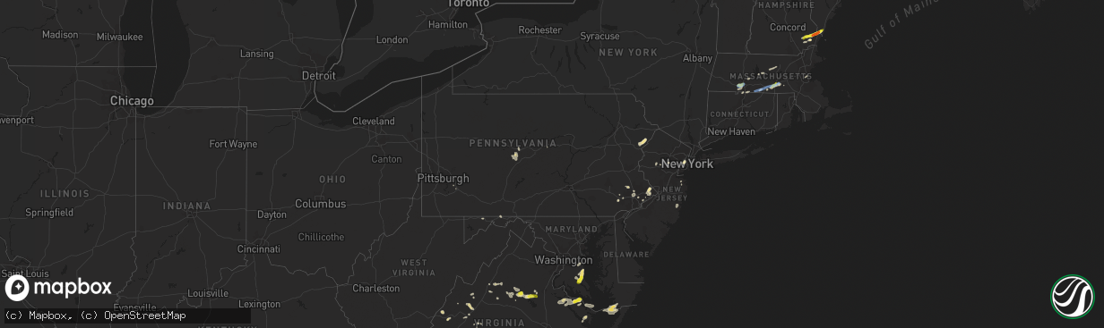
Hail Map in Pennsylvania on July 31, 2019
The weather event in Pennsylvania on July 31, 2019 includes Hail and Wind maps. 29 states and 540 cities were impacted and suffered possible damage. The total estimated number of properties impacted is 0.
Want more than just the map?
Turn this storm into a full workflow.
- Owner + property data so you know who to knock
- OnDemand branded weather history reports to win the "did we even have hail?" argument
- RoofTrace estimate so reps stop guessing numbers at the door
Bought this map? Upgrade within 7 days and we'll credit the $230. (10-15 min setup call)
Hail
Wind
0
Estimated number of impacted properties by a 1.00" hail or larger0
Estimated number of impacted properties by a 1.75" hail or larger0
Estimated number of impacted properties by a 2.50" hail or largerStorm reports in Pennsylvania
Pennsylvania
| Date | Description |
|---|---|
| 07/31/20196:25 PM CDT | Trees and wires down |
| 07/31/20195:30 PM CDT | Metal bleachers thrown across football field and damaged at father judge high school. |
| 07/31/20193:05 PM CDT | Corrects time of previous tstm wnd dmg report from 1 nne holmesburg. Metal bleachers thrown across football field and damaged at father judge high school. Time estimate |
| 07/31/20192:25 PM CDT | Multiple trees and limbs down. Time estimated from radar. |
| 07/31/20192:24 PM CDT | Large tree limbs downed in lafayette hill. Time estimated from radar. |
| 07/31/20192:24 PM CDT | Trees blown down. |
| 07/31/20192:06 PM CDT | Report of trees blown down. |
| 07/31/20192:00 PM CDT | Trees down. Time estimated from radar. |
| 07/31/20191:49 PM CDT | Report of trees blown down. |
| 07/31/201912:38 PM CDT | Mping report of trees uprooted;roof blown off in philadelphia county... Pa. |
| 07/31/201912:30 PM CDT | Trees down on wires resulting in some power outages. Delayed report. |
| 07/31/201912:44 AM CDT | At 543 PM EDT, a severe thunderstorm was located near Dingmans Ferry, or 12 miles southwest of Montague, moving northeast at 15 mph. HAZARD...60 mph wind gusts and quarter size hail. SOURCE...Radar indicated. IMPACT...Minor damage to vehicles is possible. Wind damage to roofs, siding, trees, and power lines is possible. Locations impacted include... Port Jervis, Montague, Branchville, Flatbrookville, Five Points, Pellettown, Crandon Lakes and Hainesville. |
| 07/31/201912:08 AM CDT | At 507 PM EDT, a severe thunderstorm was located over Shippingport, or 7 miles southwest of Monaca, moving southeast at 15 mph. HAZARD...Wind gusts to 60 mph. SOURCE...Radar. IMPACT...Expect damage to trees and power lines, resulting in some power outages. Locations impacted include... Moon Township... Franklin Park... Aliquippa... Economy... Ambridge... Coraopolis... Beaver... Baden... Sewickley... Harmony Township... Midland... Imperial...This includes the following highways... Interstate 79 in Pennsylvania between mile markers 67 and 72. Interstate 376 in Pennsylvania between mile markers 36 and 58. |
| 07/30/201911:52 PM CDT | At 451 PM EDT, severe thunderstorms were located along a line extending from Newton to near East Stroudsburg, moving east at 15 mph. HAZARD...60 mph wind gusts and penny size hail. SOURCE...Radar indicated. IMPACT...Damage to roofs, siding, trees, and power lines is possible. Locations impacted include... Newton, Dover, Hopatcong, East Stroudsburg, Hackettstown, Wharton, Washington, Blairstown, Bangor, Mount Arlington, Stanhope, Netcong, Belvidere, Oxford, Ogdensburg, Hope, East Bangor, Branchville, Andover and Brass Castle. |
| 07/30/201911:10 PM CDT | At 410 PM EDT, a severe thunderstorm was located near Columbiana, moving southeast at 10 mph. HAZARD...Wind gusts to 60 mph. SOURCE...Radar. IMPACT...Expect damage to trees and power lines, resulting in some power outages. Locations impacted include... Salem... Columbiana... East Palestine... Calcutta... Ohioville... Lisbon... Leetonia... New Waterford... Big Beaver... New Beaver... New Galilee... Enon Valley...This includes Pennsylvania Turnpike between mile markers 1 and 10. |
| 07/30/201910:49 PM CDT | At 349 PM EDT, severe thunderstorms were located along a line extending from near Newtown to Northeast Philadelphia to Ben Franklin Bridge, moving east at 25 mph. HAZARD...60 mph wind gusts. SOURCE...Radar indicated. IMPACT...Damage to roofs, siding, trees, and power lines is possible. Locations impacted include... Philadelphia, Trenton, Camden, Gloucester City, Cherry Hill, Bensalem, Evesham, Mount Laurel, Ewing, Willingboro, Medford, Lumberton, Florence, Yeadon, Burlington, Bristol, Mount Holly, Doylestown, Riverside and Palmyra.This includes the following highways... Interstate 195 in New Jersey between mile markers 0 and 13. Interstate 295 in New Jersey between mile markers 30 and 76. |
| 07/30/20199:11 PM CDT | At 209 PM EDT, severe thunderstorms were located over Yardley extending south into Burlington County New Jersey, moving northeast at 25 mph. HAZARD...60 mph wind gusts and quarter size hail. SOURCE...Radar indicated. IMPACT...Minor damage to vehicles is possible. Wind damage to roofs, siding, trees, and power lines is possible. Locations impacted include... Trenton, East Brunswick, South Brunswick, Manalapan, Ewing, Princeton, Florence, Burlington, Bristol, Jamesburg, Hightstown, Bordentown, Cranbury, Pennington, Yardley, Newtown, Hopewell, Tullytown, Allentown and Langhorne.This includes the following highways... Interstate 195 in New Jersey between mile markers 0 and 18. Interstate 295 in New Jersey between mile markers 49 and 76. |
| 07/30/20198:30 PM CDT | At 129 PM EDT, a severe thunderstorm was located over Philadelphia, moving east at 15 mph. HAZARD...60 mph wind gusts. SOURCE...Radar indicated. IMPACT...Damage to roofs, siding, trees, and power lines is possible. Locations impacted include... Philadelphia, Trenton, Camden, Gloucester City, Cherry Hill, Bensalem, Mount Laurel, Ewing, Willingboro, Lindenwold, Florence, Bellmawr, Yeadon, Woodbury, Burlington, Bristol, Riverside, Palmyra, Hatboro and Jenkintown.This includes the following highways... Interstate 195 in New Jersey near mile marker 0. Interstate 295 in New Jersey between mile markers 24 and 51, andbetween mile markers 58 and 60. |
| 07/30/20198:02 PM CDT | At 101 PM EDT, a severe thunderstorm was located over Andalusia, or 7 miles northeast of Philadelphia, moving northeast at 25 mph. HAZARD...60 mph wind gusts. SOURCE...Radar indicated. IMPACT...Damage to roofs, siding, trees, and power lines is possible. Locations impacted include... Philadelphia, Trenton, Bensalem, Willingboro, Florence, Burlington, Bristol, Riverside, Palmyra, Jenkintown, Bordentown, Beverly, Rockledge, Yardley, Tullytown, Langhorne, Bryn Athyn, Wissinoming, Feasterville-Trevose and Florence-Roebling.This includes Interstate 295 in New Jersey between mile markers 43and 58. |
All States Impacted by Hail Map on July 31, 2019
Cities Impacted by Hail Map on July 31, 2019
- Mallie, KY
- Hindman, KY
- Pippa Passes, KY
- Alsen, ND
- Langdon, ND
- New Town, ND
- Anniston, AL
- Thayer, KS
- Mars Hill, ME
- Elkton, VA
- Greensboro, NC
- Eliot, ME
- Portsmouth, NH
- Kittery, ME
- Greenland, NH
- Newmarket, NH
- Newfields, NH
- Stratham, NH
- Jacksonville, AL
- Adams, ND
- Fairdale, ND
- Fleming, CO
- Lankin, ND
- Southbridge, MA
- La Crosse, KS
- Meriden, KS
- Todd, NC
- Williamsburg, KS
- Waverly, KS
- Melvern, KS
- Netawaka, KS
- Whiting, KS
- Horton, KS
- Powhattan, KS
- Okeechobee, FL
- Torrington, WY
- Pearce, AZ
- Elfrida, AZ
- Killdeer, ND
- Stanley, ND
- Princeton, KS
- Richmond, KS
- Leesburg, FL
- Clearmont, WY
- Ault, CO
- Briggsdale, CO
- Barboursville, VA
- Independence, KS
- Buffalo, KS
- Chanute, KS
- Altoona, KS
- Cherryvale, KS
- Benedict, KS
- Liberty, KS
- Neodesha, KS
- Feeding Hills, MA
- Southwick, MA
- Holyoke, MA
- Westfield, MA
- West Springfield, MA
- Wiggins, CO
- Roggen, CO
- Laramie, WY
- Lake Lure, NC
- Mill Spring, NC
- Hendersonville, NC
- Glenburn, ND
- Vicco, KY
- Polk City, FL
- Orange, VA
- Mineral, VA
- Unionville, VA
- Spotsylvania, VA
- Hot Springs, NC
- Del Rio, TN
- Lansford, ND
- Claflin, KS
- Hoisington, KS
- Russell, KS
- Bunker Hill, KS
- Lusk, WY
- Sutton, MA
- Roanoke, VA
- Vinton, VA
- Kaycee, WY
- Glenrock, WY
- Douglas, WY
- Buford, WY
- Nekoma, KS
- Alexander, KS
- Rush Center, KS
- Glenside, PA
- Philadelphia, PA
- Edinburg, ND
- Amidon, ND
- Exeter, NH
- Hannah, ND
- Wales, ND
- Gridley, KS
- Le Roy, KS
- Yates Center, KS
- Burlington, KS
- Elkin, NC
- Dobson, NC
- Great Bend, KS
- Dorrance, KS
- Dora, AL
- Sumiton, AL
- Overbrook, KS
- East Stroudsburg, PA
- Bushkill, PA
- Renick, WV
- Downingtown, PA
- Exton, PA
- Topeka, KS
- Berryton, KS
- Tecumseh, KS
- Carbondale, KS
- Wakarusa, KS
- Covington, VA
- Hot Springs, VA
- Charlotte, NC
- Suffolk, VA
- Loretto, VA
- Champlain, VA
- Colonial Beach, VA
- Locust Dale, VA
- Madison, VA
- Aroda, VA
- Radiant, VA
- Caret, VA
- Hustle, VA
- Kinsale, VA
- Warsaw, VA
- Hague, VA
- Montross, VA
- Bosler, WY
- Baldwin City, KS
- Olmitz, KS
- Youngstown, OH
- Coila, MS
- McCune, KS
- Cope, SC
- Norway, SC
- Naples, FL
- Dunn Center, ND
- Bazine, KS
- Vaiden, MS
- Ottawa, KS
- State Road, NC
- Wadesboro, NC
- Beachwood, NJ
- Toms River, NJ
- Bayville, NJ
- Hoyt, KS
- Mayetta, KS
- Neosho Falls, KS
- Pomona, KS
- Garnett, KS
- Welda, KS
- Humboldt, KS
- Iola, KS
- Piqua, KS
- Colony, KS
- Westphalia, KS
- Lawrence, KS
- Feasterville Trevose, PA
- Morrisville, PA
- Langhorne, PA
- Newtown, PA
- Southampton, PA
- Garrett, WY
- Manning, ND
- Dickinson, ND
- Milton, ND
- Grafton, WV
- Kincaid, KS
- Morven, NC
- Grantsville, WV
- Baxter, KY
- Medora, ND
- Minot Afb, ND
- Berthold, ND
- Middlebrook, VA
- Goshen, VA
- Raphine, VA
- Donnybrook, ND
- Nunn, CO
- Ashville, AL
- Crozet, VA
- Free Union, VA
- Fort Morgan, CO
- Sulligent, AL
- Astor, FL
- Lecompton, KS
- Erie, KS
- Galesburg, KS
- Saint Paul, KS
- Hartford, TN
- Danville, NH
- Kingston, NH
- Scottsboro, AL
- Philipsburg, PA
- Ness City, KS
- Jefferson City, MT
- Buffalo, WY
- Apopka, FL
- Mount Dora, FL
- Sorrento, FL
- Huntingtown, MD
- Sunderland, MD
- Owings, MD
- Chesapeake Beach, MD
- Prince Frederick, MD
- Lebo, KS
- Ringgold, GA
- Tamiment, PA
- Perry, KS
- Grantville, KS
- La Harpe, KS
- Ozawkie, KS
- Fort Lupton, CO
- Platteville, CO
- Lothian, MD
- Lexington, MS
- Orangeburg, SC
- Frostburg, MD
- Telford, TN
- Limestone, TN
- Richmond, TX
- Rosenberg, TX
- Groveland, FL
- Howey In The Hills, FL
- Hallwood, VA
- Marion Station, MD
- Crisfield, MD
- Sanford, VA
- Jefferson, ME
- Morrisdale, PA
- Lanse, PA
- Grassflat, PA
- Quinton, AL
- Mandaree, ND
- Utica, KS
- Oldwick, NJ
- Califon, NJ
- Lebanon, NJ
- Edmore, ND
- Lawton, ND
- Baileyville, ME
- Princeton, ME
- Casa Grande, AZ
- Welch, OK
- Fleetwood, NC
- West Jefferson, NC
- Roslindale, MA
- Dorchester Center, MA
- Dorchester, MA
- Mattapan, MA
- Rillton, PA
- Irwin, PA
- Piedmont, AL
- Sloan, NV
- Wellsville, KS
- Bluefield, WV
- Jersey City, NJ
- Locust Grove, VA
- Lexington, VA
- Fairfield, VA
- Buena Vista, VA
- Freeburn, KY
- East Granby, CT
- West Suffield, CT
- Moran, KS
- Elsmore, KS
- Fairview, NC
- Horton, AL
- Grottoes, VA
- Port Republic, VA
- Parsons, KS
- Canfield, OH
- Salem, OH
- Columbiana, OH
- Matewan, WV
- Harrisonburg, VA
- Haxtun, CO
- Lenapah, OK
- Palermo, ND
- Jonesville, VA
- Hoboken, NJ
- Tellico Plains, TN
- Auburn, KS
- Ruckersville, VA
- Stanardsville, VA
- Crystal River, FL
- Punta Gorda, FL
- Hiawatha, KS
- Morrill, KS
- Fairview, KS
- Maida, ND
- Osnabrock, ND
- Harpersville, AL
- Lancaster, VA
- Pelham, GA
- Chula, GA
- Savonburg, KS
- Moultrie, GA
- York, ME
- Kittery Point, ME
- Fremont, NH
- Epping, NH
- Conshohocken, PA
- Plymouth Meeting, PA
- Norristown, PA
- Bridgeport, PA
- Blue Bell, PA
- King Of Prussia, PA
- Vale, NC
- Levittown, PA
- Bensalem, PA
- Helton, KY
- Mozelle, KY
- Swansea, SC
- Plaza, ND
- Blountsville, AL
- Guntersville, AL
- Boaz, AL
- Majestic, KY
- Starkville, MS
- Mechanicsville, MD
- Port Republic, MD
- Amherst, VA
- Deland, FL
- Paisley, FL
- Altoona, FL
- Loganton, PA
- Holton, KS
- Gordonsville, VA
- Waldoboro, ME
- Union, ME
- Lawrenceville, GA
- McGaheysville, VA
- Chuckey, TN
- Colts Neck, NJ
- Altamont, KS
- Oswego, KS
- Cedarbluff, MS
- Princeton, WV
- Vinita, OK
- Sabetha, KS
- Wetmore, KS
- Eagle Rock, VA
- Ware, MA
- Lansing, NC
- Michigan, ND
- Springville, AL
- Barre, MA
- New Braintree, MA
- Gilbertville, MA
- Oakham, MA
- Dawson, NE
- Malvern, PA
- Warrensville, NC
- Gladstone, ND
- Chester Springs, PA
- Fort Myers, FL
- Brookville, KS
- Ellsworth, KS
- Union City, NJ
- Belchertown, MA
- Granby, MA
- Collinsville, AL
- Fort Payne, AL
- North Oxford, MA
- Dudley, MA
- Oxford, MA
- South Grafton, MA
- Millbury, MA
- Grafton, MA
- Charlton, MA
- Northbridge, MA
- Auburn, MA
- Hampden, ND
- Lance Creek, WY
- Benedict, MD
- Saint Leonard, MD
- Hughesville, MD
- North Beach, MD
- Aquasco, MD
- New Stanton, PA
- Ruffs Dale, PA
- Sidney, KY
- Schwenksville, PA
- Harleysville, PA
- Grassy Butte, ND
- Morganton, NC
- Connelly Springs, NC
- Lake Toxaway, NC
- Sapphire, NC
- Black Mountain, NC
- Eustis, FL
- Okahumpka, FL
- Center Hill, FL
- Banner, WY
- Swoope, VA
- Minot, ND
- Rainelle, WV
- Buchanan, VA
- Fincastle, VA
- Lost Springs, WY
- Sandy Ridge, PA
- Osceola Mills, PA
- Port Matilda, PA
- Tyrone, PA
- Ochlocknee, GA
- Crumpler, NC
- Bowman, ND
- Weehawken, NJ
- North Bergen, NJ
- Woolwine, VA
- Ransom, KS
- Stark, KS
- Orma, WV
- Raymond, NH
- Durham, NH
- Seibert, CO
- Maxbass, ND
- Zieglerville, PA
- Perkiomenville, PA
- Tunnel Hill, GA
- Beeler, KS
- Englewood, TN
- Wales, MA
- Holland, MA
- Aurora, ME
- Sterling, MA
- Rutland, MA
- Princeton, MA
- Dighton, KS
- Bland, VA
- Nobleboro, ME
- Washington, ME
- Lyndon, KS
- Scranton, KS
- Vassar, KS
- Osage City, KS
- Quenemo, KS
- Williamsburg, WV
- Edna, KS
- Bartlett, KS
- Churchville, VA
- Monroe, VA
- Chetopa, KS
- Flintstone, MD
- Clearville, PA
- Nekoma, ND
- Somerset, VA
- Rochelle, VA
- Van Tassell, WY
- Jefferson, NC
- Lottsburg, VA
- Sturgis, MS
- Paola, KS
- Rantoul, KS
- Homosassa, FL
- East Longmeadow, MA
- Enfield, CT
- Somers, CT
- Clover, SC
- Burlingame, KS
- Oskaloosa, KS
- Denison, KS
- Valley Falls, KS
- Silver Lake, KS
- Greeley, KS
- Suffield, CT
- Augusta, GA
- Orient, ME
- Gates, NC
- Hamptonville, NC
- Boonville, NC
- Whitewood, SD
- Wellington, AL
- Middletown, NJ
- Lincroft, NJ
- Grovetown, GA
- Bledsoe, KY
- Rapidan, VA
- Bristol, PA
- Upton, MA
- Albemarle, NC
- Inglis, FL
- Cameron, SC
- Chatham, NJ
- Steeles Tavern, VA
- Glade Spring, VA
- Watford City, ND
- Trenton, FL
- Newberry, FL
- New Springfield, OH
- Bedminster, NJ
- Far Hills, NJ
- North Wales, PA
- Ambler, PA
- Lansdale, PA
- Christmas, FL
- Shawnee, WY
- Blue Ridge, VA
- Estill, SC
- Manville, WY
- Millboro, VA
- Java, VA
- High Point, NC
- Rome, GA
- East Kingston, NH
- New England, ND
- Belfield, ND
- Ross, ND
- Kenmare, ND
- Tolley, ND
- Carpio, ND
- Hoople, ND
- Chicopee, MA
- Broadus, MT
- Otter, MT
- Wilson, KS
- Kingston, GA
- Bison, KS
- McCracken, KS
- Ellinwood, KS
- Washburn, ME
- Mapleton, ME
- Ashland, ME
- Caribou, ME
- Brimfield, MA
- Stafford Springs, CT
- Fiskdale, MA
- Sturbridge, MA
- Monson, MA
- Hickory, NC


