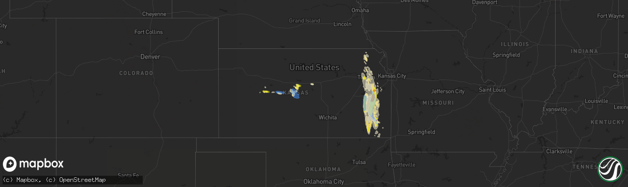
Hail Map in Kansas on July 31, 2019
The weather event in Kansas on July 31, 2019 includes Hail and Wind maps. 29 states and 540 cities were impacted and suffered possible damage. The total estimated number of properties impacted is 28,014.
Want more than just the map?
Turn this storm into a full workflow.
- Owner + property data so you know who to knock
- OnDemand branded weather history reports to win the "did we even have hail?" argument
- RoofTrace estimate so reps stop guessing numbers at the door
Bought this map? Upgrade within 7 days and we'll credit the $230. (10-15 min setup call)
Hail
Wind
28,014
Estimated number of impacted properties by a 1.00" hail or larger654
Estimated number of impacted properties by a 1.75" hail or larger0
Estimated number of impacted properties by a 2.50" hail or largerStorm reports in Kansas
Kansas
| Date | Description |
|---|---|
| 07/31/20196:30 PM CDT | Also reports of microburst winds. |
| 07/31/20194:37 PM CDT | Khp reported a semi trailer blown over in the 1700 block of north anderson rd. Garden city ks. |
| 07/31/20196:52 AM CDT | At 1151 PM CDT, a severe thunderstorm was located near Humboldt, moving south at 30 mph. HAZARD...Golf ball size hail and 60 mph wind gusts. SOURCE...Trained weather spotters. This storm has a history of producing hail up to at least half dollar size. IMPACT...People and animals outdoors will be injured. Expect hail damage to roofs, siding, windows, and vehicles. Expect wind damage to roofs, siding, and trees. Locations impacted include... Chanute, Erie, St. Paul, Thayer, Galesburg, Earlton, Lake Parsons, South Mound and Chanute Airport. |
| 07/31/20196:07 AM CDT | At 1106 PM CDT, a severe thunderstorm was located near Overbrook, moving south at 30 mph. HAZARD...60 mph wind gusts and half dollar size hail. SOURCE...Radar indicated. IMPACT...Hail damage to vehicles is expected. Expect wind damage to roofs, siding, and trees. Locations impacted include... Ottawa, Carbondale, Overbrook, Lyndon, Centropolis, Pomona, Scranton, Quenemo, Melvern, Globe and Pomona Lake.This includes Interstate 35 between mile markers 187 and 192. |
| 07/31/20195:59 AM CDT | At 1058 PM CDT, severe thunderstorms were located along a line extending from 6 miles southwest of Parker to near Colony to 5 miles east of Le Roy, moving south at 25 mph. HAZARD...60 mph wind gusts and half dollar size hail. SOURCE...Trained weather spotters. This storm has a history of producing wind damage and half dollar size hail in Anderson County. IMPACT...Hail damage to vehicles is expected. Expect wind damage to roofs, siding, and trees. Locations impacted include... Iola, Humboldt, La Harpe, Gas, Moran, Neosho Falls, Savonburg, Elsmore, Mildred, Bassett, Petrolia, Iola Airport and Piqua. |
| 07/31/20195:45 AM CDT | At 1044 PM CDT, a severe thunderstorm was located over western Topeka, moving southeast at 35 mph. HAZARD...60 mph wind gusts and quarter size hail. SOURCE...Radar indicated. IMPACT...Hail damage to vehicles is expected. Expect wind damage to roofs, siding, and trees. Locations impacted include... Topeka, Carbondale, Richland, Silver Lake, Auburn, Burlingame, Scranton, Pauline and Berryton.This includes the following highways... Interstate 70 between mile markers 348 and 355. Kansas Turnpike between mile markers 164 and 182. |
| 07/31/20195:30 AM CDT | At 1029 PM CDT, a severe thunderstorm was located 4 miles east of Harris, moving south at 30 mph. HAZARD...Golf ball size hail and 60 mph wind gusts. SOURCE...Radar indicated. IMPACT...People and animals outdoors will be injured. Expect hail damage to roofs, siding, windows, and vehicles. Expect wind damage to roofs, siding, and trees. Locations impacted include... Garnett, Colony, Greeley, Westphalia, Kincaid and Lone Elm. |
| 07/31/20195:03 AM CDT | At 1002 PM CDT, a severe thunderstorm was located 4 miles southeast of Pomona, moving south at 40 mph. HAZARD...60 mph wind gusts and half dollar size hail. SOURCE...Radar indicated. IMPACT...Hail damage to vehicles is expected. Expect wind damage to roofs, siding, and trees. Locations impacted include... Ottawa, Garnett, Pomona, Richmond, Williamsburg, Greeley, Princeton and Harris.This includes Interstate 35 between mile markers 168 and 185. |
| 07/31/20192:56 AM CDT | At 755 PM CDT, severe thunderstorms were located along a line extending from 10 miles southwest of Wilson to 5 miles west of Claflin to Albert, moving south at 10 mph. HAZARD...60 mph wind gusts and quarter size hail. SOURCE...Radar indicated. IMPACT...Hail damage to vehicles is expected. Expect wind damage to roofs, siding, and trees. Locations impacted include... Great Bend, Hoisington, Ellinwood, Claflin, Holyrood, Bushton, Pawnee Rock, Albert, Lorraine, Olmitz, Galatia, Susank, Frederick, Great Bend Airport, Cheyenne Bottoms, Silica and Odin. |
| 07/31/20192:30 AM CDT | Several large trees had 2 to 3 foot diameter limbs downed from high winds. Delayed report. Corrected time of occurrence. |
| 07/31/20192:28 AM CDT | At 727 PM CDT, a severe thunderstorm was located 11 miles south of Dorrance, or 12 miles northwest of Claflin, moving southeast at 15 mph. HAZARD...60 mph wind gusts and quarter size hail. SOURCE...Radar indicated. IMPACT...Hail damage to vehicles is expected. Expect wind damage to roofs, siding, and trees. Locations impacted include... Claflin, Susank and Odin. |
| 07/31/20192:20 AM CDT | At 720 PM CDT, a severe thunderstorm was located near La Crosse, moving east at 25 mph. HAZARD...60 mph wind gusts and quarter size hail. SOURCE...Radar indicated. IMPACT...Hail damage to vehicles is expected. Expect wind damage to roofs, siding, and trees. Locations impacted include... La Crosse, Otis, Bison, Rush Center, Timken, Nekoma, Hargrave and Shaffer. |
| 07/31/20192:15 AM CDT | Roof pealed off mobile home near morehead along 169 highway. Delayed report. Time estimated from radar. |
| 07/31/20191:48 AM CDT | At 647 PM CDT, a severe thunderstorm was located near Dorrance, or 7 miles southwest of Wilson, moving east at 20 mph. HAZARD...60 mph wind gusts and quarter size hail. SOURCE...Radar indicated. IMPACT...Hail damage to vehicles is expected. Expect wind damage to roofs, siding, and trees. Locations impacted include... Wilson and Dorrance. This includes Interstate 70 between Mile Markers 196 and 200. |
| 07/31/20191:36 AM CDT | At 636 PM CDT, a severe thunderstorm was located near Ransom, moving east at 20 mph. HAZARD...60 mph wind gusts and nickel size hail. SOURCE...Radar indicated. IMPACT...Expect damage to roofs, siding, and trees. Locations impacted include... Ness City, Bazine, Ransom, Brownell and Cedar Bluff. |
| 07/31/20191:32 AM CDT | A local report indicates 60 MPH wind near 1 WNW PARSONS |
| 07/31/20191:30 AM CDT | Several large trees had 2 to 3 foot diameter limbs downed from high winds. Delayed report. |
| 07/31/20191:00 AM CDT | A local report indicates 1.25 inch wind near ERIE |
| 07/31/201912:55 AM CDT | A local report indicates 1.75 inch wind near ERIE |
| 07/31/201912:30 AM CDT | Wind shattered a vinyl fence. |
| 07/31/201912:30 AM CDT | A local report indicates 1.00 inch wind near 1 W BURLINGTON |
| 07/31/201912:15 AM CDT | A local report indicates 60 MPH wind near 2 NNE NEW STRAWN |
| 07/31/201912:07 AM CDT | Rv blown into side of house. Deck and window damage sustained to house/rv. Time estimated from radar. Reported by wibw. |
| 07/30/201911:15 PM CDT | Time was estimated. |
| 07/30/201911:10 PM CDT | From social media. |
| 07/30/201911:00 PM CDT | Near 37th and wanamaker road via social media. |
| 07/30/201910:55 PM CDT | A local report indicates 1.00 inch wind near 4 W TOPEKA |
| 07/30/201910:55 PM CDT | Near washburn tech |
| 07/30/201910:54 PM CDT | A local report indicates 1.00 inch wind near 7 WSW TOPEKA |
| 07/30/201910:46 PM CDT | There is also tree limb damage. |
| 07/30/201910:45 PM CDT | Quarter size hail also was reported. |
| 07/30/201910:20 PM CDT | Winds also blew down some field corn as well. |
| 07/30/201910:12 PM CDT | Sheriff reported tree limbs down across hwy 68 between florida and delaware roads. |
| 07/30/201910:00 PM CDT | Near 1220 and colorado roads. Quarter size hail also was reported. |
| 07/30/20198:39 PM CDT | Delayed report. Ellinwood pd reporting numerous cases of power lines and tree branches down in the community. Crews are responding for cleanup. |
| 07/30/20198:33 PM CDT | Delayed report. Spotter measured a 64 mph gust at his residence. Large tree branches down and outdoor furniture blown 10 feet across the yard. |
| 07/30/20198:31 PM CDT | Peak gust at the great bend airport. |
| 07/30/20198:14 PM CDT | Delayed report. North highway 281 is blocked by power poles down about 5 miles north of great bend. Time estimated based on radar. |
| 07/30/20198:08 PM CDT | Delayed report. Spotter estimated 50 to 60 mph wind gusts. Time estimated based on radar. |
| 07/30/20197:43 PM CDT | 2 power poles snapped. |
| 07/30/20197:28 PM CDT | A local report indicates 60 MPH wind near LA CROSSE |
All States Impacted by Hail Map on July 31, 2019
Cities Impacted by Hail Map on July 31, 2019
- Mallie, KY
- Hindman, KY
- Pippa Passes, KY
- Alsen, ND
- Langdon, ND
- New Town, ND
- Anniston, AL
- Thayer, KS
- Mars Hill, ME
- Elkton, VA
- Greensboro, NC
- Eliot, ME
- Portsmouth, NH
- Kittery, ME
- Greenland, NH
- Newmarket, NH
- Newfields, NH
- Stratham, NH
- Jacksonville, AL
- Adams, ND
- Fairdale, ND
- Fleming, CO
- Lankin, ND
- Southbridge, MA
- La Crosse, KS
- Meriden, KS
- Todd, NC
- Williamsburg, KS
- Waverly, KS
- Melvern, KS
- Netawaka, KS
- Whiting, KS
- Horton, KS
- Powhattan, KS
- Okeechobee, FL
- Torrington, WY
- Pearce, AZ
- Elfrida, AZ
- Killdeer, ND
- Stanley, ND
- Princeton, KS
- Richmond, KS
- Leesburg, FL
- Clearmont, WY
- Ault, CO
- Briggsdale, CO
- Barboursville, VA
- Independence, KS
- Buffalo, KS
- Chanute, KS
- Altoona, KS
- Cherryvale, KS
- Benedict, KS
- Liberty, KS
- Neodesha, KS
- Feeding Hills, MA
- Southwick, MA
- Holyoke, MA
- Westfield, MA
- West Springfield, MA
- Wiggins, CO
- Roggen, CO
- Laramie, WY
- Lake Lure, NC
- Mill Spring, NC
- Hendersonville, NC
- Glenburn, ND
- Vicco, KY
- Polk City, FL
- Orange, VA
- Mineral, VA
- Unionville, VA
- Spotsylvania, VA
- Hot Springs, NC
- Del Rio, TN
- Lansford, ND
- Claflin, KS
- Hoisington, KS
- Russell, KS
- Bunker Hill, KS
- Lusk, WY
- Sutton, MA
- Roanoke, VA
- Vinton, VA
- Kaycee, WY
- Glenrock, WY
- Douglas, WY
- Buford, WY
- Nekoma, KS
- Alexander, KS
- Rush Center, KS
- Glenside, PA
- Philadelphia, PA
- Edinburg, ND
- Amidon, ND
- Exeter, NH
- Hannah, ND
- Wales, ND
- Gridley, KS
- Le Roy, KS
- Yates Center, KS
- Burlington, KS
- Elkin, NC
- Dobson, NC
- Great Bend, KS
- Dorrance, KS
- Dora, AL
- Sumiton, AL
- Overbrook, KS
- East Stroudsburg, PA
- Bushkill, PA
- Renick, WV
- Downingtown, PA
- Exton, PA
- Topeka, KS
- Berryton, KS
- Tecumseh, KS
- Carbondale, KS
- Wakarusa, KS
- Covington, VA
- Hot Springs, VA
- Charlotte, NC
- Suffolk, VA
- Loretto, VA
- Champlain, VA
- Colonial Beach, VA
- Locust Dale, VA
- Madison, VA
- Aroda, VA
- Radiant, VA
- Caret, VA
- Hustle, VA
- Kinsale, VA
- Warsaw, VA
- Hague, VA
- Montross, VA
- Bosler, WY
- Baldwin City, KS
- Olmitz, KS
- Youngstown, OH
- Coila, MS
- McCune, KS
- Cope, SC
- Norway, SC
- Naples, FL
- Dunn Center, ND
- Bazine, KS
- Vaiden, MS
- Ottawa, KS
- State Road, NC
- Wadesboro, NC
- Beachwood, NJ
- Toms River, NJ
- Bayville, NJ
- Hoyt, KS
- Mayetta, KS
- Neosho Falls, KS
- Pomona, KS
- Garnett, KS
- Welda, KS
- Humboldt, KS
- Iola, KS
- Piqua, KS
- Colony, KS
- Westphalia, KS
- Lawrence, KS
- Feasterville Trevose, PA
- Morrisville, PA
- Langhorne, PA
- Newtown, PA
- Southampton, PA
- Garrett, WY
- Manning, ND
- Dickinson, ND
- Milton, ND
- Grafton, WV
- Kincaid, KS
- Morven, NC
- Grantsville, WV
- Baxter, KY
- Medora, ND
- Minot Afb, ND
- Berthold, ND
- Middlebrook, VA
- Goshen, VA
- Raphine, VA
- Donnybrook, ND
- Nunn, CO
- Ashville, AL
- Crozet, VA
- Free Union, VA
- Fort Morgan, CO
- Sulligent, AL
- Astor, FL
- Lecompton, KS
- Erie, KS
- Galesburg, KS
- Saint Paul, KS
- Hartford, TN
- Danville, NH
- Kingston, NH
- Scottsboro, AL
- Philipsburg, PA
- Ness City, KS
- Jefferson City, MT
- Buffalo, WY
- Apopka, FL
- Mount Dora, FL
- Sorrento, FL
- Huntingtown, MD
- Sunderland, MD
- Owings, MD
- Chesapeake Beach, MD
- Prince Frederick, MD
- Lebo, KS
- Ringgold, GA
- Tamiment, PA
- Perry, KS
- Grantville, KS
- La Harpe, KS
- Ozawkie, KS
- Fort Lupton, CO
- Platteville, CO
- Lothian, MD
- Lexington, MS
- Orangeburg, SC
- Frostburg, MD
- Telford, TN
- Limestone, TN
- Richmond, TX
- Rosenberg, TX
- Groveland, FL
- Howey In The Hills, FL
- Hallwood, VA
- Marion Station, MD
- Crisfield, MD
- Sanford, VA
- Jefferson, ME
- Morrisdale, PA
- Lanse, PA
- Grassflat, PA
- Quinton, AL
- Mandaree, ND
- Utica, KS
- Oldwick, NJ
- Califon, NJ
- Lebanon, NJ
- Edmore, ND
- Lawton, ND
- Baileyville, ME
- Princeton, ME
- Casa Grande, AZ
- Welch, OK
- Fleetwood, NC
- West Jefferson, NC
- Roslindale, MA
- Dorchester Center, MA
- Dorchester, MA
- Mattapan, MA
- Rillton, PA
- Irwin, PA
- Piedmont, AL
- Sloan, NV
- Wellsville, KS
- Bluefield, WV
- Jersey City, NJ
- Locust Grove, VA
- Lexington, VA
- Fairfield, VA
- Buena Vista, VA
- Freeburn, KY
- East Granby, CT
- West Suffield, CT
- Moran, KS
- Elsmore, KS
- Fairview, NC
- Horton, AL
- Grottoes, VA
- Port Republic, VA
- Parsons, KS
- Canfield, OH
- Salem, OH
- Columbiana, OH
- Matewan, WV
- Harrisonburg, VA
- Haxtun, CO
- Lenapah, OK
- Palermo, ND
- Jonesville, VA
- Hoboken, NJ
- Tellico Plains, TN
- Auburn, KS
- Ruckersville, VA
- Stanardsville, VA
- Crystal River, FL
- Punta Gorda, FL
- Hiawatha, KS
- Morrill, KS
- Fairview, KS
- Maida, ND
- Osnabrock, ND
- Harpersville, AL
- Lancaster, VA
- Pelham, GA
- Chula, GA
- Savonburg, KS
- Moultrie, GA
- York, ME
- Kittery Point, ME
- Fremont, NH
- Epping, NH
- Conshohocken, PA
- Plymouth Meeting, PA
- Norristown, PA
- Bridgeport, PA
- Blue Bell, PA
- King Of Prussia, PA
- Vale, NC
- Levittown, PA
- Bensalem, PA
- Helton, KY
- Mozelle, KY
- Swansea, SC
- Plaza, ND
- Blountsville, AL
- Guntersville, AL
- Boaz, AL
- Majestic, KY
- Starkville, MS
- Mechanicsville, MD
- Port Republic, MD
- Amherst, VA
- Deland, FL
- Paisley, FL
- Altoona, FL
- Loganton, PA
- Holton, KS
- Gordonsville, VA
- Waldoboro, ME
- Union, ME
- Lawrenceville, GA
- McGaheysville, VA
- Chuckey, TN
- Colts Neck, NJ
- Altamont, KS
- Oswego, KS
- Cedarbluff, MS
- Princeton, WV
- Vinita, OK
- Sabetha, KS
- Wetmore, KS
- Eagle Rock, VA
- Ware, MA
- Lansing, NC
- Michigan, ND
- Springville, AL
- Barre, MA
- New Braintree, MA
- Gilbertville, MA
- Oakham, MA
- Dawson, NE
- Malvern, PA
- Warrensville, NC
- Gladstone, ND
- Chester Springs, PA
- Fort Myers, FL
- Brookville, KS
- Ellsworth, KS
- Union City, NJ
- Belchertown, MA
- Granby, MA
- Collinsville, AL
- Fort Payne, AL
- North Oxford, MA
- Dudley, MA
- Oxford, MA
- South Grafton, MA
- Millbury, MA
- Grafton, MA
- Charlton, MA
- Northbridge, MA
- Auburn, MA
- Hampden, ND
- Lance Creek, WY
- Benedict, MD
- Saint Leonard, MD
- Hughesville, MD
- North Beach, MD
- Aquasco, MD
- New Stanton, PA
- Ruffs Dale, PA
- Sidney, KY
- Schwenksville, PA
- Harleysville, PA
- Grassy Butte, ND
- Morganton, NC
- Connelly Springs, NC
- Lake Toxaway, NC
- Sapphire, NC
- Black Mountain, NC
- Eustis, FL
- Okahumpka, FL
- Center Hill, FL
- Banner, WY
- Swoope, VA
- Minot, ND
- Rainelle, WV
- Buchanan, VA
- Fincastle, VA
- Lost Springs, WY
- Sandy Ridge, PA
- Osceola Mills, PA
- Port Matilda, PA
- Tyrone, PA
- Ochlocknee, GA
- Crumpler, NC
- Bowman, ND
- Weehawken, NJ
- North Bergen, NJ
- Woolwine, VA
- Ransom, KS
- Stark, KS
- Orma, WV
- Raymond, NH
- Durham, NH
- Seibert, CO
- Maxbass, ND
- Zieglerville, PA
- Perkiomenville, PA
- Tunnel Hill, GA
- Beeler, KS
- Englewood, TN
- Wales, MA
- Holland, MA
- Aurora, ME
- Sterling, MA
- Rutland, MA
- Princeton, MA
- Dighton, KS
- Bland, VA
- Nobleboro, ME
- Washington, ME
- Lyndon, KS
- Scranton, KS
- Vassar, KS
- Osage City, KS
- Quenemo, KS
- Williamsburg, WV
- Edna, KS
- Bartlett, KS
- Churchville, VA
- Monroe, VA
- Chetopa, KS
- Flintstone, MD
- Clearville, PA
- Nekoma, ND
- Somerset, VA
- Rochelle, VA
- Van Tassell, WY
- Jefferson, NC
- Lottsburg, VA
- Sturgis, MS
- Paola, KS
- Rantoul, KS
- Homosassa, FL
- East Longmeadow, MA
- Enfield, CT
- Somers, CT
- Clover, SC
- Burlingame, KS
- Oskaloosa, KS
- Denison, KS
- Valley Falls, KS
- Silver Lake, KS
- Greeley, KS
- Suffield, CT
- Augusta, GA
- Orient, ME
- Gates, NC
- Hamptonville, NC
- Boonville, NC
- Whitewood, SD
- Wellington, AL
- Middletown, NJ
- Lincroft, NJ
- Grovetown, GA
- Bledsoe, KY
- Rapidan, VA
- Bristol, PA
- Upton, MA
- Albemarle, NC
- Inglis, FL
- Cameron, SC
- Chatham, NJ
- Steeles Tavern, VA
- Glade Spring, VA
- Watford City, ND
- Trenton, FL
- Newberry, FL
- New Springfield, OH
- Bedminster, NJ
- Far Hills, NJ
- North Wales, PA
- Ambler, PA
- Lansdale, PA
- Christmas, FL
- Shawnee, WY
- Blue Ridge, VA
- Estill, SC
- Manville, WY
- Millboro, VA
- Java, VA
- High Point, NC
- Rome, GA
- East Kingston, NH
- New England, ND
- Belfield, ND
- Ross, ND
- Kenmare, ND
- Tolley, ND
- Carpio, ND
- Hoople, ND
- Chicopee, MA
- Broadus, MT
- Otter, MT
- Wilson, KS
- Kingston, GA
- Bison, KS
- McCracken, KS
- Ellinwood, KS
- Washburn, ME
- Mapleton, ME
- Ashland, ME
- Caribou, ME
- Brimfield, MA
- Stafford Springs, CT
- Fiskdale, MA
- Sturbridge, MA
- Monson, MA
- Hickory, NC


