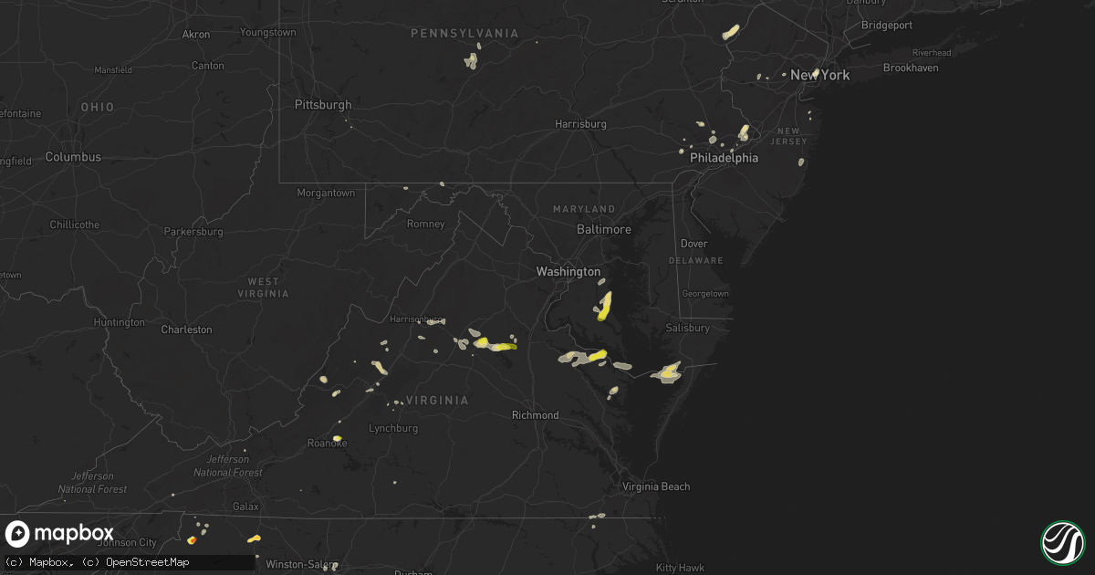
Hail Map in Maryland on July 31, 2019
Get this storm
July 31 map
$229
one time, instant access
Download today. No call, no setup
Keep the $229
Bought the map and want the full workflow? Apply the entire $229 to a subscription within 7 days. None of it is wasted.
Every map, not just this one
This buys you this map. Subscription and you get every map we run, in the markets you choose from a few cities to whole states to nationwide. Plus real-time alerts the moment a storm fires.
Contact data
Name, contact info, occupancy, even credit band for addresses in the footprint. You go from where it hit to who to call.
Become the source they trust
Unlimited branding weather history reports on demand. You already have the documented answer ready for the property owner, and you are the one who showed up with it.
Property data and RoofTrace estimates
Pull up any address you have got, its value and the exact code rules for that jurisdiction, straight from One Click Code. Then RoofTrace estimates the squares, pitch, and roof value, priced the way you price.
Storm reports in Maryland
Maryland
| Date | Description |
|---|---|
| 07/31/20195:30 PM CDT | Tree down |
| 07/31/20195:20 PM CDT | Tree down on wires near the intersection of md-408 mt zion marlboro road and md-259 greenock road. |
| 07/31/20194:30 PM CDT | Tree down in the 5000 block of hardesty road. |
| 07/31/20194:29 PM CDT | Tree down in the 5000 block of hardesty road. Corrected event time. |
| 07/31/20194:10 PM CDT | Multiple reports of trees down in prince frederick. |
| 07/31/20191:16 AM CDT | At 616 PM EDT, a severe thunderstorm was located near Deale, moving east at 10 mph. HAZARD...60 mph wind gusts and quarter size hail. SOURCE...Radar indicated. IMPACT...Damaging winds will cause some trees and large branches to fall. This could injure those outdoors, as well as damage homes and vehicles. Roadways may become blocked by downed trees. Localized power outages are possible. Unsecured light objects may become projectiles. Locations impacted include... Mayo, Shady Side, Deale, Rhode River, Galesville, Friendship, West River, Tracys Landing and Lothian. |
| 07/31/201912:58 AM CDT | At 558 PM EDT, a severe thunderstorm was located over Coles Point, or near Tall Timbers, moving northeast at 20 mph. HAZARD...60 mph wind gusts and quarter size hail. SOURCE...Radar indicated. IMPACT...Damaging winds will cause some trees and large branches to fall. This could injure those outdoors, as well as damage homes and vehicles. Roadways may become blocked by downed trees. Localized power outages are possible. Unsecured light objects may become projectiles. Locations impacted include... Lexington Park, Piney Point, Tall Timbers, Saint Inigoes Creek, Saint Marys City, Saint George Island, Saint Marys River, Dameron, Valley Lee, Scotland, Drayden, Saint Inigoes, Park Hall and Ridge. |
| 07/31/201912:21 AM CDT | At 520 PM EDT, a severe thunderstorm was located over Breezy Point, moving north at 20 mph. HAZARD...60 mph wind gusts and quarter size hail. SOURCE...Radar indicated. IMPACT...Damaging winds will cause some trees and large branches to fall. This could injure those outdoors, as well as damage homes and vehicles. Roadways may become blocked by downed trees. Localized power outages are possible. Unsecured light objects may become projectiles. Locations impacted include... Mayo, Shady Side, Chesapeake Beach, Deale, Breezy Point, Rhode River, South River, Dunkirk, Huntingtown, Owings, Aquasco, Galesville, Friendship, Lower Marlboro, Harwood, West River, Tracys Landing, Lothian, Sunderland and Mount Harmony. |
| 07/31/201912:05 AM CDT | At 504 PM EDT, a severe thunderstorm was located over Loretto, or near Champlain, moving northeast at 15 mph. HAZARD...60 mph wind gusts and quarter size hail. SOURCE...Radar indicated. IMPACT...Minor damage to vehicles is possible. Expect wind damage to trees and powerlines. This severe thunderstorm will be near, Loretto around 515 PM EDT. Leedstown around 525 PM EDT. Colonial Beach and Montross around 545 PM EDT.Other locations impacted by this severe thunderstorm include Lerty,Stratford Hall, Currioman Landing, Hustle, Potomac Mills, Oak Grove,Supply, Singerly, Peeds and Foneswood. |
| 07/30/201911:45 PM CDT | At 445 PM EDT, a severe thunderstorm was located near Sheridan Point, moving north at 10 mph. HAZARD...Ping pong ball size hail and 60 mph wind gusts. SOURCE...Radar indicated. IMPACT...Damaging winds will cause some trees and large branches to fall. This could injure those outdoors, as well as damage homes and vehicles. Roadways may become blocked by downed trees. Localized power outages are possible. Unsecured light objects may become projectiles. Locations impacted include... Prince Frederick, Breezy Point, Flag Harbor, Saint Leonard, Huntingtown, Long Beach, Calvert Beach, Barstow, Port Republic and Dares Beach. |
| 07/30/201910:16 PM CDT | At 316 PM EDT, a severe thunderstorm was located near Fort Ashby, or 11 miles west of Paw Paw, moving southeast at 10 mph. HAZARD...60 mph wind gusts and quarter size hail. SOURCE...Radar indicated. IMPACT...Damaging winds will cause some trees and large branches to fall. This could injure those outdoors, as well as damage homes and vehicles. Roadways may become blocked by downed trees. Localized power outages are possible. Unsecured light objects may become projectiles. Locations impacted include... Springfield, Green Spring, Levels, Higginsville, Points and Three Churches. |
| 07/30/20199:15 PM CDT | At 215 PM EDT, a severe thunderstorm was located near Frostburg, moving east at 20 mph. HAZARD...60 mph wind gusts and quarter size hail. SOURCE...Radar indicated. IMPACT...Damaging winds will cause some trees and large branches to fall. This could injure those outdoors, as well as damage homes and vehicles. Roadways may become blocked by downed trees. Localized power outages are possible. Unsecured light objects may become projectiles. Locations impacted include... Cumberland, Frostburg, Bel Air, La Vale, Lonaconing, Ridgeley, Cresaptown, Potomac Park, Wiley Ford, Eckhart Mines, Mount Savage, Rawlings, Ellerslie, Corriganville, Midland, Midlothian, Woodland, Patterson Creek, Pinto and Short Gap. |
All States Impacted by Hail Map on July 31, 2019
Cities Impacted by Hail Map on July 31, 2019
- Mallie, KY
- Hindman, KY
- Pippa Passes, KY
- Alsen, ND
- Langdon, ND
- New Town, ND
- Anniston, AL
- Thayer, KS
- Mars Hill, ME
- Elkton, VA
- Greensboro, NC
- Eliot, ME
- Portsmouth, NH
- Kittery, ME
- Greenland, NH
- Newmarket, NH
- Newfields, NH
- Stratham, NH
- Jacksonville, AL
- Adams, ND
- Fairdale, ND
- Fleming, CO
- Lankin, ND
- Southbridge, MA
- La Crosse, KS
- Meriden, KS
- Todd, NC
- Williamsburg, KS
- Waverly, KS
- Melvern, KS
- Netawaka, KS
- Whiting, KS
- Horton, KS
- Powhattan, KS
- Okeechobee, FL
- Torrington, WY
- Pearce, AZ
- Elfrida, AZ
- Killdeer, ND
- Stanley, ND
- Princeton, KS
- Richmond, KS
- Leesburg, FL
- Clearmont, WY
- Ault, CO
- Briggsdale, CO
- Barboursville, VA
- Independence, KS
- Buffalo, KS
- Chanute, KS
- Altoona, KS
- Cherryvale, KS
- Benedict, KS
- Liberty, KS
- Neodesha, KS
- Feeding Hills, MA
- Southwick, MA
- Holyoke, MA
- Westfield, MA
- West Springfield, MA
- Wiggins, CO
- Roggen, CO
- Laramie, WY
- Lake Lure, NC
- Mill Spring, NC
- Hendersonville, NC
- Glenburn, ND
- Vicco, KY
- Polk City, FL
- Orange, VA
- Mineral, VA
- Unionville, VA
- Spotsylvania, VA
- Hot Springs, NC
- Del Rio, TN
- Lansford, ND
- Claflin, KS
- Hoisington, KS
- Russell, KS
- Bunker Hill, KS
- Lusk, WY
- Sutton, MA
- Roanoke, VA
- Vinton, VA
- Kaycee, WY
- Glenrock, WY
- Douglas, WY
- Buford, WY
- Nekoma, KS
- Alexander, KS
- Rush Center, KS
- Glenside, PA
- Philadelphia, PA
- Edinburg, ND
- Amidon, ND
- Exeter, NH
- Hannah, ND
- Wales, ND
- Gridley, KS
- Le Roy, KS
- Yates Center, KS
- Burlington, KS
- Elkin, NC
- Dobson, NC
- Great Bend, KS
- Dorrance, KS
- Dora, AL
- Sumiton, AL
- Overbrook, KS
- East Stroudsburg, PA
- Bushkill, PA
- Renick, WV
- Downingtown, PA
- Exton, PA
- Topeka, KS
- Berryton, KS
- Tecumseh, KS
- Carbondale, KS
- Wakarusa, KS
- Covington, VA
- Hot Springs, VA
- Charlotte, NC
- Suffolk, VA
- Loretto, VA
- Champlain, VA
- Colonial Beach, VA
- Locust Dale, VA
- Madison, VA
- Aroda, VA
- Radiant, VA
- Caret, VA
- Hustle, VA
- Kinsale, VA
- Warsaw, VA
- Hague, VA
- Montross, VA
- Bosler, WY
- Baldwin City, KS
- Olmitz, KS
- Youngstown, OH
- Coila, MS
- McCune, KS
- Cope, SC
- Norway, SC
- Naples, FL
- Dunn Center, ND
- Bazine, KS
- Vaiden, MS
- Ottawa, KS
- State Road, NC
- Wadesboro, NC
- Beachwood, NJ
- Toms River, NJ
- Bayville, NJ
- Hoyt, KS
- Mayetta, KS
- Neosho Falls, KS
- Pomona, KS
- Garnett, KS
- Welda, KS
- Humboldt, KS
- Iola, KS
- Piqua, KS
- Colony, KS
- Westphalia, KS
- Lawrence, KS
- Feasterville Trevose, PA
- Morrisville, PA
- Langhorne, PA
- Newtown, PA
- Southampton, PA
- Garrett, WY
- Manning, ND
- Dickinson, ND
- Milton, ND
- Grafton, WV
- Kincaid, KS
- Morven, NC
- Grantsville, WV
- Baxter, KY
- Medora, ND
- Minot Afb, ND
- Berthold, ND
- Middlebrook, VA
- Goshen, VA
- Raphine, VA
- Donnybrook, ND
- Nunn, CO
- Ashville, AL
- Crozet, VA
- Free Union, VA
- Fort Morgan, CO
- Sulligent, AL
- Astor, FL
- Lecompton, KS
- Erie, KS
- Galesburg, KS
- Saint Paul, KS
- Hartford, TN
- Danville, NH
- Kingston, NH
- Scottsboro, AL
- Philipsburg, PA
- Ness City, KS
- Jefferson City, MT
- Buffalo, WY
- Apopka, FL
- Mount Dora, FL
- Sorrento, FL
- Huntingtown, MD
- Sunderland, MD
- Owings, MD
- Chesapeake Beach, MD
- Prince Frederick, MD
- Lebo, KS
- Ringgold, GA
- Tamiment, PA
- Perry, KS
- Grantville, KS
- La Harpe, KS
- Ozawkie, KS
- Fort Lupton, CO
- Platteville, CO
- Lothian, MD
- Lexington, MS
- Orangeburg, SC
- Frostburg, MD
- Telford, TN
- Limestone, TN
- Richmond, TX
- Rosenberg, TX
- Groveland, FL
- Howey In The Hills, FL
- Hallwood, VA
- Marion Station, MD
- Crisfield, MD
- Sanford, VA
- Jefferson, ME
- Morrisdale, PA
- Lanse, PA
- Grassflat, PA
- Quinton, AL
- Mandaree, ND
- Utica, KS
- Oldwick, NJ
- Califon, NJ
- Lebanon, NJ
- Edmore, ND
- Lawton, ND
- Baileyville, ME
- Princeton, ME
- Casa Grande, AZ
- Welch, OK
- Fleetwood, NC
- West Jefferson, NC
- Roslindale, MA
- Dorchester Center, MA
- Dorchester, MA
- Mattapan, MA
- Rillton, PA
- Irwin, PA
- Piedmont, AL
- Sloan, NV
- Wellsville, KS
- Bluefield, WV
- Jersey City, NJ
- Locust Grove, VA
- Lexington, VA
- Fairfield, VA
- Buena Vista, VA
- Freeburn, KY
- East Granby, CT
- West Suffield, CT
- Moran, KS
- Elsmore, KS
- Fairview, NC
- Horton, AL
- Grottoes, VA
- Port Republic, VA
- Parsons, KS
- Canfield, OH
- Salem, OH
- Columbiana, OH
- Matewan, WV
- Harrisonburg, VA
- Haxtun, CO
- Lenapah, OK
- Palermo, ND
- Jonesville, VA
- Hoboken, NJ
- Tellico Plains, TN
- Auburn, KS
- Ruckersville, VA
- Stanardsville, VA
- Crystal River, FL
- Punta Gorda, FL
- Hiawatha, KS
- Morrill, KS
- Fairview, KS
- Maida, ND
- Osnabrock, ND
- Harpersville, AL
- Lancaster, VA
- Pelham, GA
- Chula, GA
- Savonburg, KS
- Moultrie, GA
- York, ME
- Kittery Point, ME
- Fremont, NH
- Epping, NH
- Conshohocken, PA
- Plymouth Meeting, PA
- Norristown, PA
- Bridgeport, PA
- Blue Bell, PA
- King Of Prussia, PA
- Vale, NC
- Levittown, PA
- Bensalem, PA
- Helton, KY
- Mozelle, KY
- Swansea, SC
- Plaza, ND
- Blountsville, AL
- Guntersville, AL
- Boaz, AL
- Majestic, KY
- Starkville, MS
- Mechanicsville, MD
- Port Republic, MD
- Amherst, VA
- Deland, FL
- Paisley, FL
- Altoona, FL
- Loganton, PA
- Holton, KS
- Gordonsville, VA
- Waldoboro, ME
- Union, ME
- Lawrenceville, GA
- McGaheysville, VA
- Chuckey, TN
- Colts Neck, NJ
- Altamont, KS
- Oswego, KS
- Cedarbluff, MS
- Princeton, WV
- Vinita, OK
- Sabetha, KS
- Wetmore, KS
- Eagle Rock, VA
- Ware, MA
- Lansing, NC
- Michigan, ND
- Springville, AL
- Barre, MA
- New Braintree, MA
- Gilbertville, MA
- Oakham, MA
- Dawson, NE
- Malvern, PA
- Warrensville, NC
- Gladstone, ND
- Chester Springs, PA
- Fort Myers, FL
- Brookville, KS
- Ellsworth, KS
- Union City, NJ
- Belchertown, MA
- Granby, MA
- Collinsville, AL
- Fort Payne, AL
- North Oxford, MA
- Dudley, MA
- Oxford, MA
- South Grafton, MA
- Millbury, MA
- Grafton, MA
- Charlton, MA
- Northbridge, MA
- Auburn, MA
- Hampden, ND
- Lance Creek, WY
- Benedict, MD
- Saint Leonard, MD
- Hughesville, MD
- North Beach, MD
- Aquasco, MD
- New Stanton, PA
- Ruffs Dale, PA
- Sidney, KY
- Schwenksville, PA
- Harleysville, PA
- Grassy Butte, ND
- Morganton, NC
- Connelly Springs, NC
- Lake Toxaway, NC
- Sapphire, NC
- Black Mountain, NC
- Eustis, FL
- Okahumpka, FL
- Center Hill, FL
- Banner, WY
- Swoope, VA
- Minot, ND
- Rainelle, WV
- Buchanan, VA
- Fincastle, VA
- Lost Springs, WY
- Sandy Ridge, PA
- Osceola Mills, PA
- Port Matilda, PA
- Tyrone, PA
- Ochlocknee, GA
- Crumpler, NC
- Bowman, ND
- Weehawken, NJ
- North Bergen, NJ
- Woolwine, VA
- Ransom, KS
- Stark, KS
- Orma, WV
- Raymond, NH
- Durham, NH
- Seibert, CO
- Maxbass, ND
- Zieglerville, PA
- Perkiomenville, PA
- Tunnel Hill, GA
- Beeler, KS
- Englewood, TN
- Wales, MA
- Holland, MA
- Aurora, ME
- Sterling, MA
- Rutland, MA
- Princeton, MA
- Dighton, KS
- Bland, VA
- Nobleboro, ME
- Washington, ME
- Lyndon, KS
- Scranton, KS
- Vassar, KS
- Osage City, KS
- Quenemo, KS
- Williamsburg, WV
- Edna, KS
- Bartlett, KS
- Churchville, VA
- Monroe, VA
- Chetopa, KS
- Flintstone, MD
- Clearville, PA
- Nekoma, ND
- Somerset, VA
- Rochelle, VA
- Van Tassell, WY
- Jefferson, NC
- Lottsburg, VA
- Sturgis, MS
- Paola, KS
- Rantoul, KS
- Homosassa, FL
- East Longmeadow, MA
- Enfield, CT
- Somers, CT
- Clover, SC
- Burlingame, KS
- Oskaloosa, KS
- Denison, KS
- Valley Falls, KS
- Silver Lake, KS
- Greeley, KS
- Suffield, CT
- Augusta, GA
- Orient, ME
- Gates, NC
- Hamptonville, NC
- Boonville, NC
- Whitewood, SD
- Wellington, AL
- Middletown, NJ
- Lincroft, NJ
- Grovetown, GA
- Bledsoe, KY
- Rapidan, VA
- Bristol, PA
- Upton, MA
- Albemarle, NC
- Inglis, FL
- Cameron, SC
- Chatham, NJ
- Steeles Tavern, VA
- Glade Spring, VA
- Watford City, ND
- Trenton, FL
- Newberry, FL
- New Springfield, OH
- Bedminster, NJ
- Far Hills, NJ
- North Wales, PA
- Ambler, PA
- Lansdale, PA
- Christmas, FL
- Shawnee, WY
- Blue Ridge, VA
- Estill, SC
- Manville, WY
- Millboro, VA
- Java, VA
- High Point, NC
- Rome, GA
- East Kingston, NH
- New England, ND
- Belfield, ND
- Ross, ND
- Kenmare, ND
- Tolley, ND
- Carpio, ND
- Hoople, ND
- Chicopee, MA
- Broadus, MT
- Otter, MT
- Wilson, KS
- Kingston, GA
- Bison, KS
- McCracken, KS
- Ellinwood, KS
- Washburn, ME
- Mapleton, ME
- Ashland, ME
- Caribou, ME
- Brimfield, MA
- Stafford Springs, CT
- Fiskdale, MA
- Sturbridge, MA
- Monson, MA
- Hickory, NC


