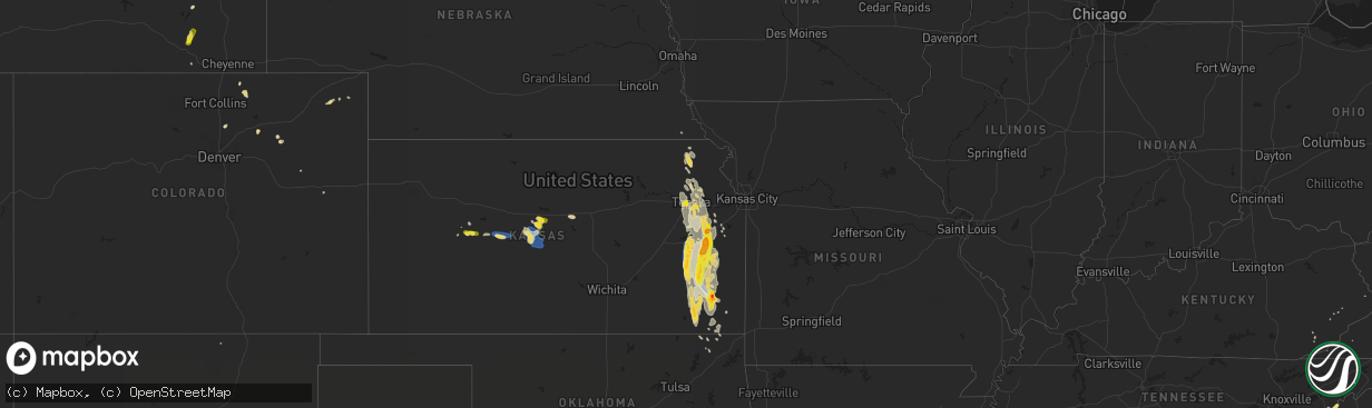
Hail Map on July 31, 2019
The weather event on July 31, 2019 includes Hail and Wind maps. 29 states and 540 cities were impacted and suffered possible damage. The total estimated number of properties impacted is 58,471.
Want more than just the map?
Turn this storm into a full workflow.
- Owner + property data so you know who to knock
- OnDemand branded weather history reports to win the "did we even have hail?" argument
- RoofTrace estimate so reps stop guessing numbers at the door
Bought this map? Upgrade within 7 days and we'll credit the $230. (10-15 min setup call)
Hail
Wind
58,471
Estimated number of impacted properties by a 1.00" hail or larger5,018
Estimated number of impacted properties by a 1.75" hail or larger0
Estimated number of impacted properties by a 2.50" hail or largerStates Impacted by Hail Map on July 31, 2019
Storm reports
New Hampshire
| Date | Description |
|---|---|
| 07/31/20193:10 PM CDT | Twitter photo |
| 07/31/20193:08 PM CDT | Picture from teiiter showing quarter size hail. |
| 07/31/20193:05 PM CDT | Trees down in exeter. Exeter police. |
| 07/31/20192:55 PM CDT | Numerous quarter to half dollar sized hail stones. Largest stones were golf ball size. |
| 07/31/20192:54 PM CDT | Epping coop reported half dollar size hail |
| 07/31/20192:32 PM CDT | Trees on wires on shirkin rd and beede hill road in freemont. |
| 07/31/20192:15 PM CDT | Epping coop reported half dollar size hail |
Georgia
| Date | Description |
|---|---|
| 07/31/20192:55 PM CDT | Public reported quarter size hail at the intersection of hwy. 411 and biddy rd. |
| 07/31/20192:35 PM CDT | Trained skywarn spotter reported multiple trees and power lines down on the 800 block of railroad ave in grovetown. Time estimated. |
| 07/31/20192:35 PM CDT | Columbia co ga sheriffs office reported multiple trees down at 970 reynolds farm rd. Time estimated. |
| 07/31/20192:26 PM CDT | Dispatch reported a tree down in a driveway along nugget drive. |
| 07/31/20192:54 AM CDT | At 753 PM EDT, a severe thunderstorm was located 14 miles southwest of Lake Warren State Park, moving east at 10 mph. HAZARD...60 mph wind gusts and penny size hail. SOURCE...Radar indicated. IMPACT...Expect damage to trees and powerlines. Locations impacted include... Lake Warren State Park, Estill, Gifford, Furman, Scotia, Luray, Lena and Shirley. |
| 07/30/201910:45 PM CDT | At 345 PM EDT, a severe thunderstorm was located near Lindale, or 7 miles southeast of Rome, moving northeast at 15 mph. HAZARD...60 mph wind gusts and quarter size hail. SOURCE...Radar indicated. IMPACT...Hail damage to vehicles is expected. Expect wind damage to roofs, siding, and trees. Locations impacted include... Rome and Kingston. |
Nevada
| Date | Description |
|---|---|
| 07/31/20194:39 PM CDT | Trees downed at the intersection of rainbow and erie avenue yesterday. Time estimated from radar. |
| 07/30/20199:49 PM CDT | At 248 PM PDT, a severe thunderstorm was located over Sloan, or near Southern Highlands and Interstate 15, moving southeast at 15 mph. HAZARD...60 mph wind gusts and quarter size hail. SOURCE...Radar indicated. IMPACT...Hail damage to vehicles is expected. Expect wind damage to roofs and trees. Locations impacted include... Henderson, Southern Highlands, Anthem, Enterprise, Jean, Mountains Edge, Paradise, Silverado Ranch, Sloan, Seven Hills, Black Mtn and Henderson Executive Airport.This includes Interstate 15 in Nevada between mile markers 12 and 25. |
Massachusetts
| Date | Description |
|---|---|
| 07/31/20194:04 PM CDT | Tree down on buckhorn terrace |
| 07/31/20193:37 PM CDT | Tree and wires down on washington street |
| 07/31/20193:28 PM CDT | Tree down on house on greendale ave |
| 07/31/20193:26 PM CDT | Trees down on ballard street |
| 07/31/20193:26 PM CDT | Multiple trees down across town |
| 07/31/20193:20 PM CDT | Tree down on lake street |
| 07/31/20193:18 PM CDT | Tree down on holyoke street |
| 07/31/20193:16 PM CDT | Trees down on ballard street |
| 07/31/20193:15 PM CDT | Tree down on washington street |
| 07/31/20193:01 PM CDT | Tree and wires down on powder house court |
| 07/31/20193:00 PM CDT | Tree down on concord ave and corp burns road |
| 07/31/20193:00 PM CDT | Tree down on sagamore street |
| 07/31/20193:00 PM CDT | Tree down blocking baywater and annavoy street |
| 07/31/20192:57 PM CDT | Tree down on wires on florence ave |
| 07/31/20192:57 PM CDT | Multiple sail boats capsized at cottage park yacht club due to microburst winds 70 to 80 mph |
| 07/31/20192:54 PM CDT | Multiple trees down across town |
| 07/31/20192:53 PM CDT | A local report indicates 73 MPH wind near LOGAN AP |
| 07/31/20192:52 PM CDT | Multiple sail boats capsized at cottage park yacht club due to microburst winds 70 to 80 mph |
| 07/31/20192:50 PM CDT | Many trees down on atlantic avenue |
| 07/31/20192:50 PM CDT | Multiple trees down across town |
| 07/31/20192:47 PM CDT | Multiple trees down in the annisquam area |
| 07/31/20192:44 PM CDT | Wires down between western ave and washington and franklin |
| 07/31/20192:30 PM CDT | A local report indicates 68 MPH wind near LOGAN AP |
| 07/31/20192:30 PM CDT | Multiple trees down across town |
| 07/31/20192:30 PM CDT | Tree down on forest street |
| 07/31/20192:30 PM CDT | Tree down on central turpike near oxford town line |
| 07/31/20192:28 PM CDT | Trees down on glenwood and campbell streets |
| 07/31/20192:27 PM CDT | Tree down on utility ploe on oakcrest road |
| 07/31/20192:27 PM CDT | Tree down blocking hopkington road at the hopkinton/upton line |
| 07/31/20192:27 PM CDT | Tree down on lake street |
| 07/31/20192:17 PM CDT | Tree down on wires on southbridge road |
| 07/31/20192:15 PM CDT | A local report indicates 1.00 inch wind near AUBURN |
| 07/31/20192:05 PM CDT | Tree down on car on slater street |
| 07/31/20191:55 PM CDT | Trees down on glenwood and campbell streets |
| 07/31/20191:50 PM CDT | Tree down on wires on southbridge road |
| 07/31/20191:42 PM CDT | Tree down on wires on muddy brook street |
| 07/31/20191:29 PM CDT | Tree down on car on beverly street |
| 07/31/20191:23 PM CDT | Tree down on wires on rte 5 and route 91 |
| 07/31/20191:00 PM CDT | Tree down on wires on north street extension |
| 07/31/201912:51 PM CDT | Tree down on wires on north street extension |
| 07/31/201912:50 PM CDT | Tractor trailer truck blown over by wind on route 90 mass pike by exit 4 also tree down on highland street which is route 5 at route 91. |
| 07/31/201912:50 PM CDT | Tree down on car on beverly street |
| 07/31/201912:50 PM CDT | Tree down on wires on rte 5 and route 91 |
| 07/31/201912:47 PM CDT | Amateur radio |
| 07/31/201912:30 PM CDT | Tree down blocking road on lockhouse road |
| 07/31/201912:26 PM CDT | Amateur radio confirmed by broadcast media |
| 07/30/201911:14 PM CDT | At 413 PM EDT, a severe thunderstorm was located over Quincy, moving northeast at 35 mph. HAZARD...60 mph wind gusts and penny size hail. SOURCE...Radar indicated. IMPACT...Expect damage to trees and power lines. Locations impacted include... Boston, Quincy, Brookline, Weymouth, Braintree, Randolph, Milton, Hingham, Scituate, Winthrop, Holbrook, Hull, Cohasset, Avon and Nahant. |
| 07/30/201910:56 PM CDT | At 356 PM EDT, a severe thunderstorm was located over Exeter, moving east at 25 mph. HAZARD...60 mph wind gusts and quarter size hail. SOURCE...Radar indicated. IMPACT...Hail damage to vehicles is expected. Expect wind damage to roofs, siding, and trees. Locations impacted include... Portsmouth, Hampton, Exeter, Kittery, Epping, Brentwood, Greenland, Stratham, Seabrook, Rye, York, Newington, Newmarket, Eliot, Kingston, East Kingston, Hampton Falls, Kensington, Newfields and North Hampton.This includes the following highways... Interstate 95 between mile markers 1 and 2. Interstate 95 in New Hampshire between mile markers 0 and 16.This also includes... Hampton Beach. |
| 07/30/201910:55 PM CDT | At 354 PM EDT, a severe thunderstorm was located over Marblehead, or near Beverly, moving northeast at 20 mph. This storm will affect areas along the immediate coastline. HAZARD...60 mph wind gusts and penny size hail. SOURCE...Radar indicated. IMPACT...Expect damage to trees and power lines. Locations impacted include... Salem, Beverly, Gloucester, Marblehead, Swampscott, Ipswich, Hamilton, Rockport, Manchester, Wenham and Essex. |
| 07/30/201910:41 PM CDT | At 340 PM EDT, a severe thunderstorm was located near Boston, moving northeast at 15 mph. HAZARD...60 mph wind gusts and quarter size hail. SOURCE...Radar indicated. IMPACT...Expect damage to trees and power lines and possible damage from hail. Locations impacted include... Boston, Quincy and Winthrop. |
| 07/30/201910:03 PM CDT | At 302 PM EDT, a severe thunderstorm was located over Oxford, or 11 miles south of Worcester, moving east at 20 mph. HAZARD...60 mph wind gusts and quarter size hail. SOURCE...Radar indicated. IMPACT...Expect damage to trees and power lines and possibly some hail damage to vehicles. Locations impacted include... Westborough, Grafton, Webster, Auburn, Northbridge, Oxford, Uxbridge, Millbury, Charlton, Dudley, Sutton, Douglas, Upton, Mendon and Millville. |
| 07/30/20199:13 PM CDT | At 212 PM EDT, a severe thunderstorm was located over Hampden, or 7 miles southeast of Springfield, moving east at 20 mph. HAZARD...60 mph wind gusts and quarter size hail. SOURCE...Radar indicated. IMPACT...Hail damage to vehicles is possible. Expect damage to trees and power lines. Locations impacted include... Springfield, Southbridge, East Longmeadow, Wilbraham, Palmer, Stafford, Somers, Sturbridge, Monson, Woodstock, Hampden, Warren, West Brookfield, Brimfield, Brookfield, Holland, Wales and Union. |
| 07/30/20199:05 PM CDT | At 205 PM EDT, a severe thunderstorm was located over Belchertown, or 7 miles southeast of Amherst, moving east at 25 mph. HAZARD...60 mph wind gusts and quarter size hail. SOURCE...Radar indicated. IMPACT...Hail damage to vehicles is possible. Expect damage to trees and power lines. Locations impacted include... Amherst, Belchertown, Ware, Granby, Barre, North Brookfield, West Brookfield, Hardwick, Pelham, Petersham, New Braintree and New Salem. |
| 07/30/20198:22 PM CDT | At 121 PM EDT, a severe thunderstorm was located over Westfield, moving east at 15 mph. HAZARD...60 mph wind gusts and quarter size hail. SOURCE...Radar indicated. IMPACT...Hail damage to vehicles is possible. Expect damage to trees and power lines. Locations impacted include... Springfield, Chicopee, Westfield, Holyoke, West Springfield, Ludlow, South Hadley, Wilbraham, Granby and Southampton. |
Utah
| Date | Description |
|---|---|
| 07/31/20194:45 PM CDT | Wendover awos |
Alabama
| Date | Description |
|---|---|
| 07/31/20195:05 PM CDT | One tree blown down near the intersection of countess road and wayside drive |
| 07/31/20191:14 AM CDT | At 614 PM CDT, a severe thunderstorm was located near Huntland, or 12 miles southeast of Fayetteville, moving east at 5 mph. HAZARD...60 to 70 mph wind gusts and nickel size hail. SOURCE...Radar indicated. IMPACT...Expect damage to roofs, siding, and trees. Locations impacted include... Huntland, Smithland, Beans Creek, Plevna, Flintville, Elora and Maxwell. |
| 07/31/201912:09 AM CDT | At 507 PM CDT, a severe thunderstorm was located near Jacksonville, moving northeast at 5 mph. HAZARD...60 mph wind gusts and quarter size hail. SOURCE...Radar indicated. IMPACT...Hail damage to vehicles is expected. Expect wind damage to roofs, siding, and trees. Locations impacted include... Heflin, Edwardsville, Sweetwater Lake, Coleman Lake And Campground and Liberty Hill. |
| 07/30/201910:23 PM CDT | At 322 PM CDT, a severe thunderstorm was located near Ashville, or 9 miles northeast of Springville, moving east at 5 mph. HAZARD...60 mph wind gusts and nickel size hail. SOURCE...Radar indicated. IMPACT...Expect damage to roofs, siding, and trees. Locations impacted include... Ashville, Whitney Junction, Caldwell and I 59 Rest Areas At Oneonta. |
Arizona
| Date | Description |
|---|---|
| 07/30/201910:25 PM CDT | At 325 PM MST, a severe thunderstorm was located 16 miles northeast of Santa Rosa, or 29 miles south of Casa Grande, and is nearly stationary. HAZARD...60 mph wind gusts, quarter size hail and heavy rain which may lead to flash flooding. SOURCE...Radar indicated. IMPACT...Hail damage to vehicles is expected. Expect wind damage to roofs, siding, and trees. Locations impacted include... Jack Rabbit. |
| 07/30/20198:41 PM CDT | At 141 PM MST, a severe thunderstorm was located 11 miles southeast of Pearce-Sunsites, or 29 miles southeast of Willcox, moving northeast at 5 mph. HAZARD...60 mph wind gusts and quarter size hail. SOURCE...Radar indicated. IMPACT...Hail damage to vehicles is expected. Expect wind damage to roofs, siding, and trees. Locations impacted include... Sunizona.This includes the following highways... Route 181 between mile markers 39 and 55. Route 191 between mile markers 34 and 41. |
Tennessee
| Date | Description |
|---|---|
| 07/31/20191:33 AM CDT | At 632 PM EDT, a severe thunderstorm was located 8 miles southwest of Chilhowie, moving southeast at 5 mph. HAZARD...60 mph wind gusts and quarter size hail. SOURCE...Radar indicated. IMPACT...Hail damage to vehicles is expected. Expect wind damage to roofs, siding, and trees. Locations impacted include... Damascus and Konnarock. |
| 07/31/20191:17 AM CDT | At 616 PM EDT, a severe thunderstorm was located 11 miles west of Marshall, or near Hot Springs, moving northeast at 15 mph. HAZARD...60 mph wind gusts and quarter size hail. SOURCE...Radar indicated. IMPACT...Minor hail damage to vehicles is expected. Expect wind damage to trees and power lines. Locations impacted include... Hot Springs, Walnut and Max Patch. |
Florida
| Date | Description |
|---|---|
| 07/31/20193:44 PM CDT | Earth networks mesonet site located at the naples municipal airport tower recorded a wind gust of 38 knots /44 mph/ with an offshore moving thunderstorm. |
| 07/30/201911:12 PM CDT | At 411 PM EDT, a severe thunderstorm was located near Paisley or Alexander Springs, moving south at 5 mph. HAZARD...60 mph wind gusts and penny size hail. SOURCE...Radar indicated. IMPACT...Expect damage to roofs, siding, and trees. Locations impacted include... Eustis, Mount Dora, Mount Plymouth, Paisley and Cassia. |
| 07/30/20199:15 PM CDT | At 214 PM EDT, a severe thunderstorm was located near Okeechobee, and is drifting northwest at 5 mph. HAZARD...60 mph wind gusts and quarter size hail. SOURCE...Radar indicated. IMPACT...Hail damage to vehicles is expected. Expect wind damage to roofs, siding, and trees. Locations impacted include... Okeechobee, Whispering Pines, Basswood Estates and Okeechobee Airport. |
North Carolina
| Date | Description |
|---|---|
| 07/31/20196:15 PM CDT | 911 call center reported trees down near rumbling ridge. Time estimated from radar. |
| 07/31/20196:00 PM CDT | 911 call center reported trees down in the boys camp rd area of chimney rock. Time estimated from radar. |
| 07/31/20193:50 PM CDT | Fire dept/rescue reported trees down on power lines on quail hollow rd |
| 07/31/20193:40 PM CDT | 911 call center reported trees down and power outages in the steele creek area. Time estimated from radar. |
| 07/31/20193:00 PM CDT | Golf ball size hail reported at shelton vineyards. Time from radar. |
| 07/31/20192:48 PM CDT | Quarter size hail on george hildebrand school rd near johnson bridge rd. |
| 07/31/20192:17 PM CDT | 2 trees down near the intersection of highway 16 and smithey road. |
| 07/31/20191:36 PM CDT | Golf ball size hail now falling in baldwin. |
| 07/31/20195:56 AM CDT | At 1055 PM EDT, a severe thunderstorm was located over Belvidere, or near Winfall, moving southeast at 20 mph. HAZARD...60 mph wind gusts and penny size hail. SOURCE...Radar indicated. IMPACT...Expect damage to trees and powerlines. This severe thunderstorm will be near, Winfall around 1105 PM EDT. Hertford and Chapanoke around 1115 PM EDT. Burgess around 1120 PM EDT. Nixonton around 1135 PM EDT.Other locations impacted by this severe thunderstorm include HolidayIsland, Rabbit Corner, Peach, Whiteston, Parkville, Woodville, CenterHill, Nicanor, Yeopim Station and Okisko. |
| 07/31/20193:56 AM CDT | At 856 PM EDT, a severe thunderstorm was located 10 miles north of Pickens, or near Table Rock State Park, moving southeast at 10 mph. HAZARD...60 mph wind gusts and quarter size hail. SOURCE...Radar indicated. IMPACT...Minor hail damage to vehicles is expected. Expect wind damage to trees and power lines. Locations impacted include... Table Rock State Park, Sunset, Pumpkintown, Sassafras Mountain, Rocky Bottom and Jocassee Gorges. |
| 07/31/20192:00 AM CDT | At 659 PM EDT, a severe thunderstorm was located 13 miles northwest of Rutherfordton, or near Lake Lure, moving east at 5 mph. HAZARD...60 mph wind gusts and quarter size hail. SOURCE...Radar indicated. IMPACT...Minor hail damage to vehicles is expected. Expect wind damage to trees and power lines. Locations impacted include... Lake Lure, Chimney Rock State Park, Chimney Rock Village and Shingle Hollow. |
| 07/31/20191:11 AM CDT | At 611 PM EDT, severe thunderstorms were located along a line extending from 13 miles west of Marion to 14 miles north of Columbus, moving northeast at 15 mph. HAZARD...60 mph wind gusts and quarter size hail. SOURCE...Radar indicated. IMPACT...Minor hail damage to vehicles is expected. Expect wind damage to trees and power lines. Locations impacted include... Lake Lure, Chimney Rock Village, Chimney Rock State Park, Bat Cave, Sugar Hill, Gerton and Fairview In Buncombe County. |
| 07/30/201910:43 PM CDT | At 343 PM EDT, a severe thunderstorm was located near Wadesboro, moving northeast at 10 mph. HAZARD...60 mph wind gusts and quarter size hail. SOURCE...Radar indicated. IMPACT...Hail damage to vehicles is expected. Expect wind damage to roofs, siding, and trees. Locations impacted include... Wadesboro, Lilesville, Morven, McFarlan and Blewett Falls Lake. |
| 07/30/201910:21 PM CDT | At 321 PM EDT, a severe thunderstorm was located 7 miles southwest of Hickory, or near Hildebran, moving northeast at 10 mph. HAZARD...60 mph wind gusts and quarter size hail. SOURCE...Radar indicated. IMPACT...Minor hail damage to vehicles is expected. Expect wind damage to trees and power lines. Locations impacted include... Hickory, Newton, Longview, Granite Falls, Icard, Hildebran, Connelly Springs, Rutherford College, Rhodhiss and Hickory Regional Airport. |
| 07/30/201910:16 PM CDT | At 316 PM EDT, a severe thunderstorm was located over Lansing, moving southeast at 10 mph. HAZARD...60 mph wind gusts and quarter size hail. SOURCE...Radar indicated. IMPACT...Hail damage to vehicles is expected. Expect wind damage to roofs, siding, and trees. Locations impacted include... Sparta... Jefferson... West Jefferson... Lansing... and Laurel Springs. |
| 07/30/201910:05 PM CDT | Tree downed onto power line at sandy cross rd. |
| 07/30/20199:29 PM CDT | At 229 PM EDT, a severe thunderstorm was located 4 miles southeast of Newland, near the Blue Ridge Parkway, moving east at 5 mph. HAZARD...60 mph wind gusts and quarter size hail. SOURCE...Radar indicated. IMPACT...Minor hail damage to vehicles is expected. Expect wind damage to trees and power lines. Locations impacted include... Crossnore, Grandfather Mountain State Park, B.R. Parkway between Linville Falls and Grandfather, Pineola, Linville and Edgemont. |
| 07/30/20199:20 PM CDT | At 220 PM EDT, a severe thunderstorm was located over Todd, and is nearly stationary. HAZARD...60 mph wind gusts and quarter size hail. SOURCE...Radar indicated. IMPACT...Hail damage to vehicles is expected. Expect wind damage to roofs, siding, and trees. Locations impacted include... Jefferson... West Jefferson... Glendale Springs... Todd... and Deep Gap. |
| 07/30/20198:59 PM CDT | At 159 PM EDT, a severe thunderstorm was located 11 miles southeast of Newland, or 6 miles east of Linville Falls, and is nearly stationary. HAZARD...60 mph wind gusts and quarter size hail. SOURCE...Radar indicated. IMPACT...Minor hail damage to vehicles is expected. Expect wind damage to trees and power lines. Locations impacted include... Jonas Ridge. |
| 07/30/20197:15 PM CDT | Tree down. |
New Jersey
| Date | Description |
|---|---|
| 07/31/20195:23 PM CDT | Cwop site ew4321. |
| 07/31/20195:16 PM CDT | Cwop site ew4321. |
| 07/31/20193:20 PM CDT | Wires down in beverly. Time estimated from radar. |
| 07/31/20193:14 PM CDT | Wires down in cinnaminson. Time estimated from radar. |
| 07/31/20193:06 PM CDT | Tree fell on house and car. |
| 07/31/20193:05 PM CDT | Tree down on mechanic st in mulburn. |
| 07/31/20193:05 PM CDT | Tree down on hedden pl |
| 07/31/20192:45 PM CDT | Trees down in beachwood. Time estimated from radar. |
| 07/31/20192:40 PM CDT | Trees down along dover road. Delayed report. |
| 07/31/20192:38 PM CDT | Trees and wires down in far hills. Also a report of a house fire in the area; unclear if related to wind damage or a lightning strike. Time estimated from radar. |
| 07/31/20192:30 PM CDT | Tree down. |
| 07/31/20192:21 PM CDT | Trees and power lines down on vlietown rd. Time estimated from radar. |
| 07/31/20192:11 PM CDT | Several large branches down on a golf course. Time estimated from radar. |
| 07/31/20194:33 AM CDT | At 932 PM EDT, a severe thunderstorm was located near Bivalve, or 15 miles south of Millville, moving east at 20 mph. HAZARD...60 mph wind gusts and quarter size hail. SOURCE...Radar indicated. IMPACT...Minor damage to vehicles is possible. Wind damage to roofs, siding, trees, and power lines is possible. Locations impacted include... Ocean City, North Wildwood, Woodbine, Sea Isle City, Avalon, Stone Harbor, Cape May Court House, Leesburg, Scotch Bonnet, Port Norris, Seaville, Dividing Creek, Green Creek, Dennisville, Goshen, Strathmere, Rio Grande, Bivalve, Eldora and Villas.This includes Garden State Parkway between mile markers 5 and 23. |
| 07/31/201912:55 AM CDT | At 555 PM EDT, a severe thunderstorm was located over Bass River State Forest, or 18 miles north of Atlantic City, moving east at 25 mph. HAZARD...60 mph wind gusts and penny size hail. SOURCE...Radar indicated. IMPACT...Damage to roofs, siding, trees, and power lines is possible. Locations impacted include... Tuckerton, Surf City, Port Republic, Bass River State Forest, New Gretna, Beach Haven West, Mystic Island and Manahawkin.This includes Garden State Parkway between mile markers 48 and 63. |
| 07/31/201912:39 AM CDT | At 539 PM EDT, a severe thunderstorm was located near Bushkill, or 14 miles southwest of Montague, moving northeast at 15 mph. HAZARD...60 mph wind gusts and half dollar size hail. SOURCE...Radar indicated. IMPACT...Hail damage to vehicles is expected. Expect wind damage to roofs, siding, and trees. Locations impacted include... Bushkill, Dingmans Ferry and Tamiment. |
| 07/31/201912:27 AM CDT | At 526 PM EDT, severe thunderstorms were located along a line extending from near Port Republic to Weymouth to near South Vineland, moving southeast at 15 mph. HAZARD...60 mph wind gusts and penny size hail. SOURCE...Radar indicated. IMPACT...Damage to roofs, siding, trees, and power lines is possible. Locations impacted include... Vineland, Millville, Cumberland, Absecon, Buena, Egg Harbor City, Laurel Lake, Weymouth, Estell Manor, Port Republic, Pomona, Mays Landing, Dorothy, Mizpah, New Gretna, South Vineland, Rosenhayn, Elwood-Magnolia and Mystic Island.This includes the following highways... Atlantic City Expressway between mile markers 8 and 21. Garden State Parkway between mile markers 38 and 52. |
| 07/30/201910:58 PM CDT | At 358 PM EDT, a severe thunderstorm was located over Chatham, or over Summit, moving east at 30 mph. HAZARD...60 mph wind gusts. SOURCE...Radar indicated. IMPACT...Damage to roofs, siding, trees, and power lines is possible. Locations impacted include... Morristown, Madison, Florham Park, East Hanover, Chatham, Morris Plains, Millington, Parsippany, Martinsville, North Plainfield, Watchung and Hanover Township.This includes Interstate 287 in New Jersey between mile markers 30and 42. |
| 07/30/201910:54 PM CDT | At 354 PM EDT, severe thunderstorms were located along a line extending from Chatham to near Martinsville, moving southeast at 30 mph. HAZARD...60 mph wind gusts and quarter size hail. SOURCE...Radar indicated. IMPACT...Minor hail damage to vehicles is possible. Expect wind damage to trees and power lines. These severe thunderstorms will remain over mainly rural areas of northwestern Union and west central Essex Counties. |
| 07/30/201910:49 PM CDT | At 349 PM EDT, severe thunderstorms were located along a line extending from near Clark to Oakwood, moving northeast at 10 mph. HAZARD...60 mph wind gusts and quarter size hail. SOURCE...Radar indicated. IMPACT...Minor hail damage to vehicles is possible. Expect wind damage to trees and power lines. Severe thunderstorms will be near... Todt Hill and Huguenot around 355 PM EDT. Bayonne around 405 PM EDT. The Verrazano Narrows Bridge and Tompkinsville around 410 PM EDT. Jersey City around 425 PM EDT. Newark and Elizabeth around 430 PM EDT. |
| 07/30/201910:39 PM CDT | At 338 PM EDT, severe thunderstorms were located along a line extending from Keansburg to Collingwood Park to Brick Township to Brookville, moving northeast at 15 mph. HAZARD...60 mph wind gusts and penny size hail. SOURCE...Radar indicated. IMPACT...Damage to roofs, siding, trees, and power lines is possible. Locations impacted include... Toms River, Long Branch, Asbury Park, Lakewood, Middletown, Howell, Barnegat, Tinton Falls, Holmdel, Red Bank, Beachwood, Highlands, Farmingdale, Leisure Village, Allenwood, Leisure Village East, Ramtown, Navesink, Brick Township and Collingwood Park.This includes the following highways... Garden State Parkway between mile markers 61 and 118. Interstate 195 in New Jersey between mile markers 29 and 34. |
| 07/30/201910:20 PM CDT | At 320 PM EDT, severe thunderstorms were located along a line extending from Chester to Flemington, moving east at 20 mph. HAZARD...60 mph wind gusts. SOURCE...Radar indicated. IMPACT...Damage to roofs, siding, trees, and power lines is possible. Locations impacted include... New Brunswick, Morristown, Somerville, Somerset, East Brunswick, Bridgewater, North Brunswick, Madison, Middlesex, Florham Park, East Hanover, Bound Brook, Manville, Chatham, Morris Plains, Mendham, Flemington, Mountain Lakes, High Bridge and Clinton.This includes Interstate 287 in New Jersey between mile markers 5 and43. |
| 07/30/201910:05 PM CDT | At 305 PM EDT, severe thunderstorms were located along a line extending from Middletown to near Beachwood, moving northeast at 10 mph. HAZARD...60 mph wind gusts and nickel size hail. SOURCE...Radar indicated. IMPACT...Damage to roofs, siding, trees, and power lines is possible. Locations impacted include... Toms River, Long Branch, Asbury Park, Lakewood, Middletown, Howell, Tinton Falls, Holmdel, Red Bank, Beachwood, Manasquan, Highlands, Point Pleasant Beach, Seaside Heights, Farmingdale, Allenwood, Elberon, Navesink, Brick Township and Collingwood Park.This includes the following highways... Garden State Parkway between mile markers 71 and 116. Interstate 195 in New Jersey between mile markers 27 and 34. |
| 07/30/20199:53 PM CDT | At 253 PM EDT, a severe thunderstorm was located over Middletown, or 7 miles southwest of Sandy Hook, moving northeast at 10 mph. HAZARD...60 mph wind gusts and nickel size hail. SOURCE...Radar indicated. IMPACT...Damage to roofs, siding, trees, and power lines is possible. Locations impacted include... Sandy Hook, Middletown, Holmdel, Keansburg, Matawan, Highlands, Navesink, Lincroft, Keyport, North Middletown and Strathmore.This includes Garden State Parkway between mile markers 113 and 119. |
| 07/30/20199:49 PM CDT | At 248 PM EDT, severe thunderstorms were located along a line extending from Secaucus to Bay Ridge, moving northeast at 20 mph. HAZARD...60 mph wind gusts. SOURCE...Radar indicated. IMPACT...Expect damage to trees and power lines. Severe thunderstorms will be near... Secaucus and Union City around 255 PM EDT. Ridgefield around 300 PM EDT. Harlem and Lower East Side around 305 PM EDT. East Village and Fort Lee around 310 PM EDT. Midtown Manhattan around 315 PM EDT. Long Island City around 320 PM EDT. Jackson Heights and Astoria around 325 PM EDT. Mott Haven and RFK Bridge around 330 PM EDT. |
| 07/30/20199:29 PM CDT | At 229 PM EDT, severe thunderstorms were located along a line extending from near Allenwood to Dover Beaches North to near Beachwood, moving southeast at 15 mph. HAZARD...60 mph wind gusts and nickel size hail. SOURCE...Radar indicated. IMPACT...Damage to roofs, siding, trees, and power lines is possible. Locations impacted include... Toms River, Asbury Park, Tinton Falls, Beachwood, Manasquan, Point Pleasant Beach, Seaside Heights, Mantoloking, Allenwood, Dover Beaches North, Dover Beaches South, Collingwood Park, Brick Township, Ramtown, Leisure Village East, Holiday City South, Point Pleasant, Neptune City, Brielle and Spring Lake Heights.This includes the following highways... Garden State Parkway between mile markers 73 and 82, and betweenmile markers 92 and 102. Interstate 195 in New Jersey between mile markers 33 and 34. |
| 07/30/20199:23 PM CDT | At 223 PM EDT, a severe thunderstorm was located over Lincroft, or near Long Branch, and is nearly stationary. HAZARD...60 mph wind gusts and nickel size hail. SOURCE...Radar indicated. IMPACT...Damage to roofs, siding, trees, and power lines is possible. Locations impacted include... Long Branch, Asbury Park, Tinton Falls, Red Bank, Highlands, Elberon, Navesink, Lincroft, Eatontown, West Long Branch, Rumson, Little Silver, Oceanport, Shrewsbury, Interlaken, Deal, Allenhurst, Loch Arbour, Wanamassa and Oakhurst.This includes Garden State Parkway between mile markers 103 and 113. |
| 07/30/20199:19 PM CDT | At 219 PM EDT, a severe thunderstorm was located over Port Richmond, or over Todt Hill, moving northeast at 15 mph. HAZARD...60 mph wind gusts. SOURCE...Radar indicated. IMPACT...Expect damage to trees and power lines. This severe thunderstorm will be near... Tompkinsville around 230 PM EDT. The Verrazano Narrows Bridge around 235 PM EDT. Midtown Manhattan and Lower East Side around 245 PM EDT. |
Wyoming
| Date | Description |
|---|---|
| 07/31/20192:25 AM CDT | At 725 PM MDT, a severe thunderstorm was located 24 miles northwest of Recluse, or 35 miles southwest of Broadus, moving northeast at 35 mph. HAZARD...60 mph wind gusts and quarter size hail. SOURCE...Radar indicated. IMPACT...Hail damage to vehicles is expected. Expect wind damage to roofs, siding, and trees. Locations impacted include... Moorhead. |
| 07/31/20191:19 AM CDT | At 619 PM MDT, a severe thunderstorm was located near Manning Ranch, or 30 miles northeast of Douglas, moving east at 25 mph. HAZARD...60 mph wind gusts and quarter size hail. SOURCE...Radar indicated. IMPACT...Hail damage to vehicles is expected. Expect wind damage to roofs, siding, and trees. Locations impacted include... Lance Creek. |
| 07/31/201912:58 AM CDT | At 558 PM MDT, a severe thunderstorm was located near Spotted Horse, or 33 miles northwest of Gillette, moving northeast at 25 mph. HAZARD...60 mph wind gusts and half dollar size hail. SOURCE...Radar indicated. IMPACT...Hail damage to vehicles is expected. Expect wind damage to roofs, siding, and trees. Locations impacted include... Spotted Horse and Recluse. |
| 07/30/201910:11 PM CDT | At 311 PM MDT, a severe thunderstorm was located near Baldy Peak, or 12 miles north of Laramie, moving north at 20 mph. HAZARD...60 mph wind gusts and half dollar size hail. SOURCE...Radar indicated. IMPACT...Hail damage to vehicles is expected. Expect wind damage to roofs, siding, and trees. Locations impacted include... Bosler and Baldy Peak. |
| 07/30/20197:30 PM CDT | Aluminum storage shed blown over and destroyed from winds |
| 07/30/20197:20 PM CDT | A local report indicates 60 MPH wind near 6 WNW RECLUSE |
South Dakota
| Date | Description |
|---|---|
| 07/31/20194:48 AM CDT | At 948 PM MDT, a severe thunderstorm was located 7 miles south of Nisland, or 10 miles north of Sturgis, moving east at 35 mph. HAZARD...60 mph wind gusts and quarter size hail. SOURCE...Radar indicated. IMPACT...Hail damage to vehicles is expected. Expect wind damage to roofs, siding, and trees. Locations impacted include... Southeastern Spearfish, northwestern Sturgis, Belle Fourche, Whitewood, Newell, Nisland, Saint Onge, Vale, Fruitdale, Bear Butte State Park, Owl Butte and Belle Fourche Reservoir.This includes Interstate 90 in South Dakota between Mile Markers 16and 30. |
| 07/30/201910:00 PM CDT | At 259 AM MDT, severe thunderstorms were located along a line extending from Badlands National Park to 2 miles west of Rockyford, moving southeast at 40 mph. HAZARD...60 mph wind gusts and nickel size hail. SOURCE...Radar indicated. IMPACT...Expect damage to roofs, siding, and trees. Locations impacted include... Kadoka, Kyle, Wall, Wanblee, Potato Creek, Allen, Batesland, Interior, Scenic, Belvidere, Hisle, Cactus Flat, Cedar Pass, Rockyford, Sharps Corner, Swett, Delta 9 Missile Silo, Eagle Nest Butte, Snake Butte and Sheep Mountain Table.This includes Interstate 90 in South Dakota between Mile Markers 110and 164. |
| 07/30/20199:03 PM CDT | At 203 AM MDT, a severe thunderstorm was located near Box Elder, or 10 miles east of Rapid City, moving east at 40 mph. HAZARD...70 mph wind gusts and penny size hail. SOURCE...Radar indicated. IMPACT...Expect considerable tree damage. Damage is likely to mobile homes, roofs, and outbuildings. Locations impacted include... Rapid City, Rapid Valley, Ellsworth Air Force Base, Box Elder, Wall, New Underwood, Wasta, Scenic, Owanka, Caputa, Farmingdale, Wicksville, Curlew Lake, Rapid City Airport, Thompson Butte, Railroad Buttes, northern Badlands National Park, Black Gap and Viewfield.This includes Interstate 90 in South Dakota between Mile Markers 57and 113. |
| 07/30/20198:24 PM CDT | At 124 AM MDT, a severe thunderstorm was located near Roubaix Lake, or 9 miles southeast of Lead, moving southeast at 35 mph. HAZARD...Ping pong ball size hail and 60 mph wind gusts. SOURCE...Radar indicated. IMPACT...People and animals outdoors will be injured. Expect hail damage to roofs, siding, windows, and vehicles. Expect wind damage to roofs, siding, and trees. Locations impacted include... Rapid City, Rapid Valley, Ellsworth Air Force Base, Box Elder, Black Hawk, Summerset, Johnson Siding, Nemo, Piedmont, Silver City, Hisega, Brownsville, Rockerville, Pactola Reservoir, Dalton Lake, Rapid City Airport, Bear Country, Hart Ranch, Roubaix Lake and Black Gap.This includes Interstate 90 in South Dakota between Mile Markers 42and 72. |
| 07/30/20198:06 PM CDT | At 106 AM MDT, a severe thunderstorm was located 5 miles northwest of Upton, or 24 miles southwest of Sundance, moving east at 30 mph. HAZARD...Golf ball size hail and 60 mph wind gusts. SOURCE...Radar indicated. IMPACT...People and animals outdoors will be injured. Expect hail damage to roofs, siding, windows, and vehicles. Expect wind damage to roofs, siding, and trees. Locations impacted include... Upton, Osage, Four Corners, Buckhorn and Inyan Kara Mountain. |
South Carolina
| Date | Description |
|---|---|
| 07/31/20193:21 PM CDT | Orangeburg em reported several trees down at a gas station us highway 301 at i-26. |
| 07/31/20192:34 PM CDT | Sheriffs dispatch reported trees down near the intersection of binnicker bridge road and early morning road. |
| 07/31/20192:19 PM CDT | A national weather service storm survey determined that a downburst produced straight-line wind damage just south of the intersection of binnicker bridge road and early |
| 07/30/201911:20 PM CDT | At 420 PM EDT, a severe thunderstorm was located 8 miles southwest of Uptown Charlotte, or near Southwest Charlotte, moving northeast at 10 mph. HAZARD...60 mph wind gusts and quarter size hail. SOURCE...Radar indicated. IMPACT...Minor hail damage to vehicles is expected. Expect wind damage to trees and power lines. Locations impacted include... Central Charlotte, Southwest Charlotte, Pineville, Freedom Park, Steele Creek, Carowinds, Southpark Mall, Uptown Charlotte, Tega Cay and Lake Wylie. |
| 07/30/201911:02 PM CDT | At 401 PM EDT, a severe thunderstorm was located near Brookdale, moving east at 15 mph. HAZARD...60 mph wind gusts and penny size hail. SOURCE...Radar indicated. IMPACT...Expect damage to roofs, siding, and trees. Locations impacted include... Orangeburg, Brookdale, Cameron, Rowesville, Wilkinson Heights and Yonder Field.This includes Interstate 26 between mile markers 147 and 160. |
| 07/30/201910:25 PM CDT | At 325 PM EDT, a severe thunderstorm was located over Fort Gordon, moving northeast at 30 mph. HAZARD...60 mph wind gusts and nickel size hail. SOURCE...Radar indicated. IMPACT...Expect damage to roofs, siding, and trees. Locations impacted include... North Augusta, Grovetown, Evans, Martinez, Fort Gordon, Augusta, Clearwater, Belvedere, Hephzibah, Harlem, Glendale, South Augusta, Midtown, Summerville, Augusta Mall, Daniel Field, Village Plaza Shopping Center, Augusta National Golf Club, Gloverville and Augusta Regional Airport.This includes the following highways... Interstate 20 in Georgia between mile markers 188 and 201. Interstate 20 in South Carolina between mile markers 0 and 9. Interstate 520 in Georgia between mile markers 1 and 15. Interstate 520 in South Carolina between mile markers 16 and 23. |
| 07/30/201910:13 PM CDT | At 313 PM EDT, a severe thunderstorm was located 7 miles north of Bamberg, moving east at 10 mph. HAZARD...60 mph wind gusts and penny size hail. SOURCE...Radar indicated. IMPACT...Expect damage to roofs, siding, and trees. Locations impacted include... Bamberg, Denmark, Cordova, Cope and Edisto. |
| 07/30/20199:00 PM CDT | Amateur radio reported a tree down on n little river rd. |
| 07/30/20198:08 PM CDT | 911 call center reported power lines down on sugar likker rd. Time estimated from radar. |
New York
| Date | Description |
|---|---|
| 07/31/20192:44 PM CDT | Trees down in floral hill |
| 07/31/20191:19 PM CDT | Trees down on avon ln and ordell ave. Tree on ordell ave fell on house. |
| 07/31/201912:08 AM CDT | At 508 PM EDT, a severe thunderstorm was located over Werry Lake, or 16 miles east of Mount Pocono, moving northeast at 35 mph. HAZARD...60 mph wind gusts and quarter size hail. SOURCE...Radar indicated. IMPACT...Hail damage to vehicles is expected. Expect wind damage to roofs, siding, and trees. Locations impacted include... Port Jervis, Bushkill, Matamoras, Milford, Dingmans Ferry and Tamiment. |
| 07/30/201910:32 PM CDT | At 332 PM EDT, a severe thunderstorm was located over Great Neck, moving southeast at 5 mph. HAZARD...60 mph wind gusts and quarter size hail. SOURCE...Radar indicated. IMPACT...Minor hail damage to vehicles is possible. Expect wind damage to trees and power lines. This severe thunderstorm will be near... Port Washington around 345 PM EDT. Glen Cove around 350 PM EDT. Manhasset around 355 PM EDT. Garden City and Mineola around 415 PM EDT. |
Maryland
| Date | Description |
|---|---|
| 07/31/20195:30 PM CDT | Tree down |
| 07/31/20195:20 PM CDT | Tree down on wires near the intersection of md-408 mt zion marlboro road and md-259 greenock road. |
| 07/31/20194:30 PM CDT | Tree down in the 5000 block of hardesty road. |
| 07/31/20194:29 PM CDT | Tree down in the 5000 block of hardesty road. Corrected event time. |
| 07/31/20194:10 PM CDT | Multiple reports of trees down in prince frederick. |
| 07/31/20191:16 AM CDT | At 616 PM EDT, a severe thunderstorm was located near Deale, moving east at 10 mph. HAZARD...60 mph wind gusts and quarter size hail. SOURCE...Radar indicated. IMPACT...Damaging winds will cause some trees and large branches to fall. This could injure those outdoors, as well as damage homes and vehicles. Roadways may become blocked by downed trees. Localized power outages are possible. Unsecured light objects may become projectiles. Locations impacted include... Mayo, Shady Side, Deale, Rhode River, Galesville, Friendship, West River, Tracys Landing and Lothian. |
| 07/31/201912:58 AM CDT | At 558 PM EDT, a severe thunderstorm was located over Coles Point, or near Tall Timbers, moving northeast at 20 mph. HAZARD...60 mph wind gusts and quarter size hail. SOURCE...Radar indicated. IMPACT...Damaging winds will cause some trees and large branches to fall. This could injure those outdoors, as well as damage homes and vehicles. Roadways may become blocked by downed trees. Localized power outages are possible. Unsecured light objects may become projectiles. Locations impacted include... Lexington Park, Piney Point, Tall Timbers, Saint Inigoes Creek, Saint Marys City, Saint George Island, Saint Marys River, Dameron, Valley Lee, Scotland, Drayden, Saint Inigoes, Park Hall and Ridge. |
| 07/31/201912:21 AM CDT | At 520 PM EDT, a severe thunderstorm was located over Breezy Point, moving north at 20 mph. HAZARD...60 mph wind gusts and quarter size hail. SOURCE...Radar indicated. IMPACT...Damaging winds will cause some trees and large branches to fall. This could injure those outdoors, as well as damage homes and vehicles. Roadways may become blocked by downed trees. Localized power outages are possible. Unsecured light objects may become projectiles. Locations impacted include... Mayo, Shady Side, Chesapeake Beach, Deale, Breezy Point, Rhode River, South River, Dunkirk, Huntingtown, Owings, Aquasco, Galesville, Friendship, Lower Marlboro, Harwood, West River, Tracys Landing, Lothian, Sunderland and Mount Harmony. |
| 07/31/201912:05 AM CDT | At 504 PM EDT, a severe thunderstorm was located over Loretto, or near Champlain, moving northeast at 15 mph. HAZARD...60 mph wind gusts and quarter size hail. SOURCE...Radar indicated. IMPACT...Minor damage to vehicles is possible. Expect wind damage to trees and powerlines. This severe thunderstorm will be near, Loretto around 515 PM EDT. Leedstown around 525 PM EDT. Colonial Beach and Montross around 545 PM EDT.Other locations impacted by this severe thunderstorm include Lerty,Stratford Hall, Currioman Landing, Hustle, Potomac Mills, Oak Grove,Supply, Singerly, Peeds and Foneswood. |
| 07/30/201911:45 PM CDT | At 445 PM EDT, a severe thunderstorm was located near Sheridan Point, moving north at 10 mph. HAZARD...Ping pong ball size hail and 60 mph wind gusts. SOURCE...Radar indicated. IMPACT...Damaging winds will cause some trees and large branches to fall. This could injure those outdoors, as well as damage homes and vehicles. Roadways may become blocked by downed trees. Localized power outages are possible. Unsecured light objects may become projectiles. Locations impacted include... Prince Frederick, Breezy Point, Flag Harbor, Saint Leonard, Huntingtown, Long Beach, Calvert Beach, Barstow, Port Republic and Dares Beach. |
| 07/30/201910:16 PM CDT | At 316 PM EDT, a severe thunderstorm was located near Fort Ashby, or 11 miles west of Paw Paw, moving southeast at 10 mph. HAZARD...60 mph wind gusts and quarter size hail. SOURCE...Radar indicated. IMPACT...Damaging winds will cause some trees and large branches to fall. This could injure those outdoors, as well as damage homes and vehicles. Roadways may become blocked by downed trees. Localized power outages are possible. Unsecured light objects may become projectiles. Locations impacted include... Springfield, Green Spring, Levels, Higginsville, Points and Three Churches. |
| 07/30/20199:15 PM CDT | At 215 PM EDT, a severe thunderstorm was located near Frostburg, moving east at 20 mph. HAZARD...60 mph wind gusts and quarter size hail. SOURCE...Radar indicated. IMPACT...Damaging winds will cause some trees and large branches to fall. This could injure those outdoors, as well as damage homes and vehicles. Roadways may become blocked by downed trees. Localized power outages are possible. Unsecured light objects may become projectiles. Locations impacted include... Cumberland, Frostburg, Bel Air, La Vale, Lonaconing, Ridgeley, Cresaptown, Potomac Park, Wiley Ford, Eckhart Mines, Mount Savage, Rawlings, Ellerslie, Corriganville, Midland, Midlothian, Woodland, Patterson Creek, Pinto and Short Gap. |
West Virginia
| Date | Description |
|---|---|
| 07/31/20195:07 PM CDT | Several trees down along ingleside road a few miles west of the intersection with interstate 77. Time estimated from radar. |
| 07/31/20195:00 PM CDT | A local report indicates 1.00 inch wind near 1 NE CERES |
| 07/31/20193:55 PM CDT | A local report indicates 1.00 inch wind near 1 NNE RORER |
| 07/31/20192:20 PM CDT | A local report indicates 1.00 inch wind near 3 S WAGONER |
| 07/31/20191:33 AM CDT | At 633 PM EDT, a severe thunderstorm was located over Athens, moving northeast at 10 mph. HAZARD...60 mph wind gusts and quarter size hail. SOURCE...Radar indicated. IMPACT...Hail damage to vehicles is expected. Expect wind damage to roofs, siding, and trees. Locations impacted include... Princeton... Athens... Camp Creek... Oakvale... and Willowton. |
| 07/30/201910:00 PM CDT | At 259 PM EDT, a severe thunderstorm was located over Narrows, moving northeast at 10 mph. HAZARD...60 mph wind gusts and quarter size hail. SOURCE...Radar indicated. IMPACT...Hail damage to vehicles is expected. Expect wind damage to roofs, siding, and trees. Locations impacted include... Pearisburg... Narrows... Poplar Hill... Kimballton... and Thessalia. |
| 07/30/20198:39 PM CDT | At 139 PM EDT, a severe thunderstorm was located 7 miles southeast of Lake Gordon, or 11 miles east of Cumberland, moving east at 20 mph. HAZARD...60 mph wind gusts. SOURCE...Radar indicated. IMPACT...Damaging winds will cause some trees and large branches to fall. This could injure those outdoors, as well as damage homes and vehicles. Roadways may become blocked by downed trees. Localized power outages are possible. Unsecured light objects may become projectiles. Locations impacted include... Flintstone, Little Orleans, Bellegrove and Pleasant Valley. |
North Dakota
| Date | Description |
|---|---|
| 07/31/20196:20 PM CDT | Lots of quarter and dime sized hail. Time estimated by radar. |
| 07/31/20196:18 PM CDT | Reports from earlier this evening. |
| 07/31/20196:15 PM CDT | Hail lasted about 3 minutes. Nickel to quarter size. |
| 07/31/20195:53 PM CDT | Late report from july 31st. |
| 07/31/20196:50 AM CDT | At 1150 PM CDT, a severe thunderstorm was located near Langdon, moving southeast at 25 mph. HAZARD...60 mph wind gusts and quarter size hail. SOURCE...Radar indicated. IMPACT...Hail damage to vehicles is expected. Expect wind damage to roofs, siding, and trees. This severe thunderstorm will be near... Langdon around 1155 PM CDT. Osnabrock around 1225 AM CDT. |
| 07/31/20196:09 AM CDT | At 1109 PM CDT, a severe thunderstorm was located near Hannah, or 25 miles northwest of Langdon, moving southeast at 20 mph. HAZARD...60 mph wind gusts and quarter size hail. SOURCE...Radar indicated. IMPACT...Hail damage to vehicles is expected. Expect wind damage to roofs, siding, and trees. This severe thunderstorm will be near... Hannah around 1120 PM CDT. Wales around 1140 PM CDT. Dresden around 1200 AM CDT. |
| 07/31/20195:45 AM CDT | At 1044 PM CDT, a severe thunderstorm was located near Olga, or 11 miles east of Langdon, moving southeast at 20 mph. HAZARD...60 mph wind gusts and quarter size hail. SOURCE...Radar indicated. IMPACT...Hail damage to vehicles is expected. Expect wind damage to roofs, siding, and trees. This severe thunderstorm will be near... Osnabrock and Concrete around 1105 PM CDT. Milton and Mountain around 1120 PM CDT. |
| 07/31/20194:42 AM CDT | At 942 PM CDT, a severe thunderstorm was located over Maida, or 15 miles north of Langdon, moving southeast at 25 mph. HAZARD...60 mph wind gusts and quarter size hail. SOURCE...Radar indicated. IMPACT...Hail damage to vehicles is expected. Expect wind damage to roofs, siding, and trees. This severe thunderstorm will be near... Vang around 1005 PM CDT. Olga around 1025 PM CDT. |
| 07/31/20194:03 AM CDT | At 901 PM CDT, a severe thunderstorm was located near Minot Air Force Base, or 15 miles north of Minot, moving east at 15 mph. HAZARD...60 mph wind gusts and half dollar size hail. SOURCE...Radar indicated. IMPACT...Hail damage to vehicles is expected. Expect wind damage to roofs, siding, and trees. This severe thunderstorm will remain over mainly rural areas of east central Ward and southeastern Renville Counties, including the following locations... Wolseth. |
| 07/31/20193:39 AM CDT | At 839 PM CDT, a severe thunderstorm was located near Donnybrook, or 22 miles southeast of Bowbells, and is nearly stationary. HAZARD...60 mph wind gusts and half dollar size hail. SOURCE...Radar indicated. IMPACT...Hail damage to vehicles is expected. Expect wind damage to roofs, siding, and trees. This severe thunderstorm will be near... Donnybrook around 900 PM CDT.Other locations impacted by this severe thunderstorm include Coulee. |
| 07/31/20193:24 AM CDT | At 824 PM CDT, a severe thunderstorm was located near Glenburn, or 17 miles southeast of Mohall, moving east at 10 mph. HAZARD...60 mph wind gusts and half dollar size hail. SOURCE...Radar indicated. IMPACT...Hail damage to vehicles is expected. Expect wind damage to roofs, siding, and trees. This severe thunderstorm will be near... Glenburn around 845 PM CDT.Other locations impacted by this severe thunderstorm include Wolseth. |
| 07/31/20192:43 AM CDT | At 741 PM CDT, a cluster of severe thunderstorms was located 7 miles south of Palermo, or 11 miles southeast of Stanley, moving northeast at 40 mph. HAZARD...60 mph wind gusts and quarter size hail. SOURCE...Radar indicated. IMPACT...Hail damage to vehicles is expected. Expect wind damage to roofs, siding, and trees. These severe thunderstorms will be near... Blaisdell around 750 PM CDT. Berthold around 810 PM CDT. Donnybrook around 815 PM CDT. Carpio around 820 PM CDT.Other locations impacted by these severe thunderstorms include Coulee, Hartland and Tagus. |
| 07/31/20192:03 AM CDT | At 702 PM CDT, a severe thunderstorm was located near Belden, or 15 miles south of Stanley, moving east at 25 mph. HAZARD...60 mph wind gusts and half dollar size hail. SOURCE...Radar indicated. IMPACT...Hail damage to vehicles is expected. Expect wind damage to roofs, siding, and trees. This severe thunderstorm will be near... Parshall around 740 PM CDT.Other locations impacted by this severe thunderstorm include ParshallBay Recreation Area and White Earth Bay Recreation Area. |
| 07/31/20192:02 AM CDT | At 702 PM MDT, a severe thunderstorm was located 5 miles south of Manning, or 15 miles south of Killdeer, moving southeast at 30 mph. HAZARD...70 mph wind gusts and half dollar size hail. SOURCE...Radar indicated. IMPACT...Hail damage to vehicles is expected. Expect considerable tree damage. Wind damage is also likely to mobile homes, roofs, and outbuildings. This severe thunderstorm will be near... Taylor around 750 PM MDT. Richardton around 800 PM MDT.Other locations impacted by this severe thunderstorm includeHirschville. |
| 07/31/20191:35 AM CDT | Wind driven hail damaged crops across portions of southeast shepherd and northeast sauter townships. Time estimated based on radar. |
| 07/31/20191:14 AM CDT | At 613 PM CDT, a severe thunderstorm was located 8 miles south of 4 Bears Lodge, or 32 miles south of Stanley, moving east at 20 mph. HAZARD...60 mph wind gusts and half dollar size hail. SOURCE...Radar indicated. IMPACT...Hail damage to vehicles is expected. Expect wind damage to roofs, siding, and trees. This severe thunderstorm will be near... New Town around 635 PM CDT. Van Hook Park around 650 PM CDT.Other locations impacted by this severe thunderstorm include ParshallBay Recreation Area and Pouch Point Recreation Area. |
| 07/31/201912:47 AM CDT | At 547 PM CDT/447 PM MDT/, a severe thunderstorm was located over Little Missouri State Park, or 11 miles north of Killdeer, moving east at 20 mph. HAZARD...60 mph wind gusts and half dollar size hail. SOURCE...Radar indicated. IMPACT...Hail damage to vehicles is expected. Expect wind damage to roofs, siding, and trees. This severe thunderstorm will be near... Halliday around 545 PM MDT.Other locations impacted by this severe thunderstorm include TwinButtes and Oakdale. |
| 07/31/201912:24 AM CDT | A few golf ball sized stones and many smaller ones. Road was covered at one point. |
| 07/31/201912:20 AM CDT | Tree branches down and nickel sized hail. |
| 07/30/201911:55 PM CDT | Hail covering the yard. Mainly nickel to quarter sized. |
| 07/30/201911:43 PM CDT | At 443 PM MDT, a severe thunderstorm was located 11 miles north of Amidon, and is nearly stationary. HAZARD...60 mph wind gusts and half dollar size hail. SOURCE...Radar indicated. IMPACT...Hail damage to vehicles is expected. Expect wind damage to roofs, siding, and trees. This severe thunderstorm will remain over mainly rural areas of south central Billings, northeastern Slope and southwestern Stark Counties. |
| 07/30/201911:29 PM CDT | Many quarter sized hail stones with a few possibly larger. Delayed report. |
| 07/30/201911:05 PM CDT | A couple of round of hail came though over the late evening. Largest ranged from quarter to half dollar in size. |
| 07/30/201910:05 PM CDT | A local report indicates 1.00 inch wind near 10 N LANGDON |
| 07/30/20199:10 PM CDT | Correction for time. Report from july 31 2019. |
| 07/30/20199:00 PM CDT | Time estimated from radar. |
| 07/30/20198:45 PM CDT | Hail events lasted from 830 to 845 pm. |
| 07/30/20198:44 PM CDT | Ongoing at the time of the call. |
| 07/30/20198:07 PM CDT | Lots of pea size hail. Time estimated from radar. |
| 07/30/20198:05 PM CDT | Penny to quarter size hail lasted only a minute or so. |
| 07/30/20197:27 PM CDT | Also received 1.5 of rainfall. Time estimated by radar. |
Virginia
| Date | Description |
|---|---|
| 07/31/20195:35 PM CDT | One tree down on glove road on the southeast side of glade springs. |
| 07/31/20195:23 PM CDT | A couple of trees reported down in and around the town of glade springs. |
| 07/31/20195:20 PM CDT | Public posted picture of downed tree near their home and also had dime size hail. Timing estimated by radar. |
| 07/31/20195:15 PM CDT | Multiple trees downed/split due to wind. Estimated 50-60 mph. |
| 07/31/20195:10 PM CDT | Multiple trees downed on erica road. Time is radar estimated. |
| 07/31/20195:07 PM CDT | A few trees down at the intersection of jackson river road and falls road. Time estimated from radar. |
| 07/31/20195:04 PM CDT | Two trees and several branches blown down along lee highway... West of its intersection with virginia route 100. Time estimated from radar. |
| 07/31/20194:42 PM CDT | Tree down in the 10600 block of va-612 catharpin road. Corrected event time. |
| 07/31/20194:33 PM CDT | Tree down in the 10600 block of va-612 catharpin road. |
| 07/31/20194:19 PM CDT | Several large branches snapped off of trees along the blue ridge parkway. Time estimated with radar. |
| 07/31/20194:10 PM CDT | Tree and wires down near the intersection of belmont road and sunset harbor boulevard. Corrected event time. |
| 07/31/20194:09 PM CDT | Tree down blocking the webster road near the intersection of park drive. Time estimated from radar. |
| 07/31/20194:03 PM CDT | Wires down near the intersection of belmont road and sunset harbor boulevard. |
| 07/31/20194:00 PM CDT | A local report indicates 1.00 inch wind near 2 SSE NASONS |
| 07/31/20193:57 PM CDT | Tree down in the 19000 block of va-612 monrovia road. |
| 07/31/20193:55 PM CDT | Tree down in the 11300 block of va-625 porter road. |
| 07/31/20193:49 PM CDT | Trees down along jennings creek road. |
| 07/31/20193:44 PM CDT | Tree down in the 11300 block of va-625 porter road. Corrected event time. |
| 07/31/20193:36 PM CDT | Large maple tree snapped over driveway. |
| 07/31/20193:33 PM CDT | Tree down on us-33 spotswood trail near va-645 magnolia road. |
| 07/31/20193:30 PM CDT | Several trees down on va-20 in northeastern albemarle county. |
| 07/31/20193:30 PM CDT | Tree blown down on old buena vista road near mountain view elementary. Time estimated from radar. |
| 07/31/20193:27 PM CDT | Tree down on va-609 scuffletown road near spring brook road. |
| 07/31/20193:25 PM CDT | Multiple reports of trees down in the city of charlottesville. |
| 07/31/20193:15 PM CDT | Tree down in the 1800 block of dairy road. |
| 07/31/20193:15 PM CDT | Trees down along us-29 southwest of the city of charlottesville. |
| 07/31/20192:59 PM CDT | A couple of trees blown down onto power lines in the 1800 block of grove hill road. Time estimated from radar. |
| 07/31/20192:45 PM CDT | Tree down in the 7100 block of ruth road. |
| 07/31/20192:42 PM CDT | Few large trees blown down near linden park. Time estimated from radar. |
| 07/31/20192:40 PM CDT | Broadcast media shared image of hail from the raphine area. Timing estimated by radar. |
| 07/31/20192:35 PM CDT | Two trees down on a house on flower drive. |
| 07/31/20192:25 PM CDT | A few trees down on lanier lane in massanutten... One onto a residence. |
| 07/31/20192:10 PM CDT | Quarter size hail and several trees down in the 300 block of dry branch road. |
| 07/31/20192:10 PM CDT | Quarter size hail and several trees down in the 300 block of dry branch road. |
| 07/31/20192:04 PM CDT | Power line down across the roadway at the intersection of elizabeth st. And myrtle st. In harrisonburg |
| 07/31/20193:03 AM CDT | At 803 PM EDT, a severe thunderstorm was located near Mt Laurel, moving east at 10 mph. HAZARD...60 mph wind gusts. SOURCE...Radar indicated. IMPACT...Expect damage to roofs, siding, and trees. Locations impacted include... Redoak... Clover... Drakes Branch... Mt Laurel... and Wylliesburg. |
| 07/31/20191:30 AM CDT | At 629 PM EDT, a severe thunderstorm was located over Java, moving east at 10 mph. HAZARD...60 mph wind gusts and quarter size hail. SOURCE...Radar indicated. IMPACT...Hail damage to vehicles is expected. Expect wind damage to roofs, siding, and trees. Locations impacted include... South Boston... Halifax... Chatham... Gretna... and Ingram. |
| 07/31/20191:14 AM CDT | At 614 PM EDT, severe thunderstorms were located along a line extending from near Marion Station to near Tangier, moving east at 30 mph. HAZARD...60 mph wind gusts. SOURCE...Radar indicated. IMPACT...Expect damage to trees and powerlines. Severe thunderstorms will be near, Marion Station around 620 PM EDT. Parksley around 640 PM EDT. Pocomoke City and West Pocomoke around 645 PM EDT. Snow Hill around 705 PM EDT.Other locations impacted by these severe thunderstorms includeHorntown, Mappsville, Goodwill, Greenbackville, Saxis,Temperanceville, Nelsonia, Shelltown, Sanford and Modest Town. |
| 07/31/20191:02 AM CDT | At 602 PM EDT, a severe thunderstorm was located near Natural Well, moving southeast at 20 mph. HAZARD...60 mph wind gusts and quarter size hail. SOURCE...Radar indicated. IMPACT...Hail damage to vehicles is expected. Expect wind damage to roofs, siding, and trees. Locations impacted include... Covington... Clifton Forge... Eagle Rock... Iron Gate... and Low Moor. |
| 07/31/201912:55 AM CDT | At 555 PM EDT, a severe thunderstorm was located over Hague, or 7 miles south of White Point Beach, moving east at 20 mph. HAZARD...60 mph wind gusts and half dollar size hail. SOURCE...Radar indicated. IMPACT...Minor damage to vehicles is possible. Expect wind damage to trees and powerlines. Locations impacted include... Coles Point, Hague, Westmoreland, Currioman Landing, Mount Holly, Sandy Point, Erica and Kremlin. |
| 07/31/201912:36 AM CDT | At 536 PM EDT, severe thunderstorms were located along a line extending from 12 miles west of Fredericksburg to 8 miles south of Spotsylvania, moving east at 20 mph. HAZARD...60 mph wind gusts and quarter size hail. SOURCE...Radar indicated. IMPACT...Damaging winds will cause some trees and large branches to fall. This could injure those outdoors, as well as damage homes and vehicles. Roadways may become blocked by downed trees. Localized power outages are possible. Unsecured light objects may become projectiles. Locations impacted include... Fredericksburg, Massaponax, Spotsylvania, Falmouth, Stones Corner, Leeland, Brokenburg, Parker, Snell, Spring Valley, Alsop, Brooke, Gatewood, Chancellorsville, Holly Corner, Post Oak, Thornburg, Dunavant, White Oak and Glendie. |
| 07/31/201912:05 AM CDT | At 505 PM EDT, a severe thunderstorm was located 9 miles north of Mineral, moving east at 25 mph. HAZARD...Ping pong ball size hail and 60 mph wind gusts. SOURCE...Radar indicated. IMPACT...Damaging winds will cause some trees and large branches to fall. This could injure those outdoors, as well as damage homes and vehicles. Roadways may become blocked by downed trees. Localized power outages are possible. Unsecured light objects may become projectiles. Locations impacted include... Fredericksburg, Massaponax, Spotsylvania, Mine Run, Brokenburg, Parker, Locust Grove, Flat Run, Snell, Alsop, Gold Dale, Gatewood, Chancellorsville, Logan, Partlow, Glenora, Post Oak, Thornburg, Dunavant and Lake Of The Woods. |
| 07/31/201912:01 AM CDT | At 501 PM EDT, a severe thunderstorm was located near Laymantown, moving northeast at 5 mph. HAZARD...60 mph wind gusts and half dollar size hail. SOURCE...Radar indicated. IMPACT...Hail damage to vehicles is expected. Expect wind damage to roofs, siding, and trees. Locations impacted include... Bedford... Buchanan... Montvale... Stewartsville... and Laymantown.This includes The following Location The National D-Day Memorial. |
| 07/30/201911:52 PM CDT | At 452 PM EDT, a severe thunderstorm was located near Arcadia, moving east at 25 mph. HAZARD...60 mph wind gusts and quarter size hail. SOURCE...Radar indicated. IMPACT...Hail damage to vehicles is expected. Expect wind damage to roofs, siding, and trees. Locations impacted include... Buena Vista... Amherst... Buchanan... Glasgow... and Forks Of Buffalo. |
| 07/30/201911:42 PM CDT | At 442 PM EDT, severe thunderstorms were located along a line extending from 8 miles south of Culpeper to near Orange, moving east at 10 mph. HAZARD...60 mph wind gusts and quarter size hail. SOURCE...Radar indicated. IMPACT...Damaging winds will cause some trees and large branches to fall. This could injure those outdoors, as well as damage homes and vehicles. Roadways may become blocked by downed trees. Localized power outages are possible. Unsecured light objects may become projectiles. Locations impacted include... Orange, Raccoon Ford, Mine Run, Rhoadesville, Rapidan, Everona, Verdiersville, Madison Run, Burr Hill, Thornhill, Nasons, Madison Mills, Mitchells, Lahore, Unionville and Locust Dale. |
| 07/30/201911:21 PM CDT | At 420 PM EDT, a severe thunderstorm was located over Lithia, moving northeast at 20 mph. HAZARD...60 mph wind gusts. SOURCE...Radar indicated. IMPACT...Expect damage to roofs, siding, and trees. Locations impacted include... Buchanan... Glasgow... Big Island... Arcadia... and Snowden. |
| 07/30/201911:18 PM CDT | At 417 PM EDT, severe thunderstorms were located along a line extending from 8 miles east of Free Union to 9 miles south of Crozet, moving east at 25 mph. HAZARD...60 mph wind gusts. SOURCE...Radar indicated. IMPACT...Damaging winds will cause some trees and large branches to fall. This could injure those outdoors, as well as damage homes and vehicles. Roadways may become blocked by downed trees. Localized power outages are possible. Unsecured light objects may become projectiles. Locations impacted include... Charlottesville, Campbell, Westmoreland, Hollymead, Cobham, Cismont, Newcomb Hall, Boyd Tavern, Woodridge, Monticello, Keswick, Stony Point, Carrsbrook, Shadwell, Keene, Overton, Alberene and Scott Stadium. |
| 07/30/201911:13 PM CDT | At 412 PM EDT, a severe thunderstorm was located near Stanardsville, or 9 miles southwest of Madison, moving east at 25 mph. HAZARD...60 mph wind gusts. SOURCE...Radar indicated. IMPACT...Damaging winds will cause some trees and large branches to fall. This could injure those outdoors, as well as damage homes and vehicles. Roadways may become blocked by downed trees. Localized power outages are possible. Unsecured light objects may become projectiles. Locations impacted include... Orange, Gordonsville, Ruckersville, Quinque, Eheart, Barboursville, Madison Run, Montpelier Station, Rochelle, Newtown, Montford, Old Somerset, Shelby, Dawsonville, Somerset and Burtonville. |
| 07/30/201911:04 PM CDT | At 404 PM EDT, a severe thunderstorm was located near Madison, moving southeast at 25 mph. HAZARD...60 mph wind gusts. SOURCE...Radar indicated. IMPACT...Damaging winds will cause some trees and large branches to fall. This could injure those outdoors, as well as damage homes and vehicles. Roadways may become blocked by downed trees. Localized power outages are possible. Unsecured light objects may become projectiles. Locations impacted include... Orange, Madison, Brightwood, Raccoon Ford, Rhoadesville, Rapidan, Oakpark, Everona, Verdiersville, Burr Hill, Pratts, Aroda, Nasons, Madison Mills, Mitchells, Lahore, Shelby, Fordsville, Twymans Mill and Unionville. |
| 07/30/201910:56 PM CDT | At 355 PM EDT, a severe thunderstorm was located over State Road, moving northeast at 15 mph. HAZARD...60 mph wind gusts and quarter size hail. SOURCE...Radar indicated. IMPACT...Hail damage to vehicles is expected. Expect wind damage to roofs, siding, and trees. Locations impacted include... Mount Airy... Elkin... Fairview... Flat Rock... and Dobson. |
| 07/30/201910:50 PM CDT | At 349 PM EDT, severe thunderstorms were located along a line extending from near Free Union to 6 miles south of Crozet, moving east at 15 mph. HAZARD...60 mph wind gusts. SOURCE...Radar indicated. IMPACT...Damaging winds will cause some trees and large branches to fall. This could injure those outdoors, as well as damage homes and vehicles. Roadways may become blocked by downed trees. Localized power outages are possible. Unsecured light objects may become projectiles. Locations impacted include... Charlottesville, Waynesboro, Crozet, Free Union, Afton, Westmoreland, Hollymead, Lyndhurst, Ivy, Greenwood, North Garden, Newcomb Hall, Batesville, Yancey Mills, Flordon, Carrsbrook, Earlysville, Barracks, Greenfield and Scott Stadium. |
| 07/30/201910:46 PM CDT | At 346 PM EDT, a severe thunderstorm was located 11 miles east of Romney, moving southeast at 20 mph. HAZARD...60 mph wind gusts. SOURCE...Radar indicated. IMPACT...Damaging winds will cause some trees and large branches to fall. This could injure those outdoors, as well as damage homes and vehicles. Roadways may become blocked by downed trees. Localized power outages are possible. Unsecured light objects may become projectiles. Locations impacted include... Capon Bridge, Slanesville, Timber Ridge, Bloomery, High View and Lehew. |
| 07/30/201910:39 PM CDT | At 339 PM EDT, severe thunderstorms were located along a line extending from near Stuarts Draft to near Brownsburg, moving east at 20 mph. HAZARD...60 mph wind gusts and quarter size hail. SOURCE...Radar indicated. IMPACT...Damaging winds will cause some trees and large branches to fall. This could injure those outdoors, as well as damage homes and vehicles. Roadways may become blocked by downed trees. Localized power outages are possible. Unsecured light objects may become projectiles. Locations impacted include... Stuarts Draft, Sherando, Wintergreen, Montebello, Lyndhurst, Nellysford, Greenville, Middlebrook, Mint Spring and Spottswood. |
| 07/30/201910:38 PM CDT | At 338 PM EDT, a severe thunderstorm was located over Glen Wilton, moving northeast at 20 mph. HAZARD...60 mph wind gusts and quarter size hail. SOURCE...Radar indicated. IMPACT...Hail damage to vehicles is expected. Expect wind damage to roofs, siding, and trees. Locations impacted include... Lexington... Clifton Forge... Goshen... Millboro... and Collierstown.This includes The following Location VMI. |
| 07/30/201910:34 PM CDT | At 334 PM EDT, a severe thunderstorm was located near Brownsburg, moving southeast at 25 mph. HAZARD...60 mph wind gusts and quarter size hail. SOURCE...Radar indicated. IMPACT...Hail damage to vehicles is expected. Expect wind damage to roofs, siding, and trees. Locations impacted include... Vesuvius. |
| 07/30/201910:31 PM CDT | At 330 PM EDT, a severe thunderstorm was located over Massanutten, or 9 miles east of Harrisonburg, moving east at 15 mph. HAZARD...60 mph wind gusts. SOURCE...Radar indicated. IMPACT...Damaging winds will cause some trees and large branches to fall. This could injure those outdoors, as well as damage homes and vehicles. Roadways may become blocked by downed trees. Localized power outages are possible. Unsecured light objects may become projectiles. Locations impacted include... Shenandoah, Massanutten, Elkton, Swift Run and Mcgaheysville. |
| 07/30/201910:25 PM CDT | At 325 PM EDT, a severe thunderstorm was located near Big Meadows, or 12 miles west of Madison, moving northeast at 10 mph. HAZARD...60 mph wind gusts and quarter size hail. SOURCE...Radar indicated. IMPACT...Damaging winds will cause some trees and large branches to fall. This could injure those outdoors, as well as damage homes and vehicles. Roadways may become blocked by downed trees. Localized power outages are possible. Unsecured light objects may become projectiles. Locations impacted include... Big Meadows, Criglersville, Banco, Pine Grove, Fletcher, Graves Mill, Haywood, Jollett, Aylor and Syria. |
| 07/30/201910:22 PM CDT | At 322 PM EDT, a severe thunderstorm was located over Grottoes, or 11 miles southeast of Harrisonburg, moving east at 20 mph. HAZARD...60 mph wind gusts. SOURCE...Radar indicated. IMPACT...Damaging winds will cause some trees and large branches to fall. This could injure those outdoors, as well as damage homes and vehicles. Roadways may become blocked by downed trees. Localized power outages are possible. Unsecured light objects may become projectiles. Locations impacted include... Grottoes, Rocky Bar, Mission Home, Port Republic, Boonesville, Haneytown, Saint George and Shady Grove. |
| 07/30/201910:04 PM CDT | At 304 PM EDT, a severe thunderstorm was located near Bells Valley, or 8 miles northeast of Goshen, and is nearly stationary. HAZARD...60 mph wind gusts and quarter size hail. SOURCE...Radar indicated. IMPACT...Damaging winds will cause some trees and large branches to fall. This could injure those outdoors, as well as damage homes and vehicles. Roadways may become blocked by downed trees. Localized power outages are possible. Unsecured light objects may become projectiles. Locations impacted include... Craigsville, Augusta Springs, Middlebrook and Summerdean. |
| 07/30/201910:03 PM CDT | At 303 PM EDT, a severe thunderstorm was located 10 miles northwest of Staunton, moving east at 5 mph. HAZARD...60 mph wind gusts. SOURCE...Radar indicated. IMPACT...Damaging winds will cause some trees and large branches to fall. This could injure those outdoors, as well as damage homes and vehicles. Roadways may become blocked by downed trees. Localized power outages are possible. Unsecured light objects may become projectiles. Locations impacted include... Churchville. |
| 07/30/20199:48 PM CDT | At 248 PM EDT, severe thunderstorms were located along a line extending from near Harrisonburg to Bridgewater, moving east at 20 mph. HAZARD...60 mph wind gusts. SOURCE...Radar indicated. IMPACT...Damaging winds will cause some trees and large branches to fall. This could injure those outdoors, as well as damage homes and vehicles. Roadways may become blocked by downed trees. Localized power outages are possible. Unsecured light objects may become projectiles. Locations impacted include... Harrisonburg, Bridgewater, Massanutten, Dale Enterprise, Dayton, Penn Laird, Montezuma, Pleasant Valley, Keezletown, Mcgaheysville and Montevideo. |
| 07/30/20199:41 PM CDT | At 241 PM EDT, a severe thunderstorm was located over Warm Springs, moving east at 15 mph. HAZARD...60 mph wind gusts and quarter size hail. SOURCE...Radar indicated. IMPACT...Hail damage to vehicles is expected. Expect wind damage to roofs, siding, and trees. Locations impacted include... Goshen... Millboro... Warm Springs... Hot Springs... and Rockbridge Baths. |
| 07/30/20198:25 PM CDT | At 124 PM EDT, a severe thunderstorm was located over Troutdale, moving north at 5 mph. HAZARD...60 mph wind gusts and quarter size hail. SOURCE...Radar indicated. IMPACT...Hail damage to vehicles is expected. Expect wind damage to roofs, siding, and trees. Locations impacted include... Marion... Sugar Grove... Mount Rogers National Recreation Area... Troutdale... and Nebo. |
| 07/30/20197:33 PM CDT | Tree reported down on moody creek rd. Near wylliesburg. Timing estimated by radar. |
| 07/30/20197:06 PM CDT | County 911 dispatch reported call of downed tree along black walnut rd... Just north of clover. Timing estimated by radar. |
Pennsylvania
| Date | Description |
|---|---|
| 07/31/20196:25 PM CDT | Trees and wires down |
| 07/31/20195:30 PM CDT | Metal bleachers thrown across football field and damaged at father judge high school. |
| 07/31/20193:05 PM CDT | Corrects time of previous tstm wnd dmg report from 1 nne holmesburg. Metal bleachers thrown across football field and damaged at father judge high school. Time estimate |
| 07/31/20192:25 PM CDT | Multiple trees and limbs down. Time estimated from radar. |
| 07/31/20192:24 PM CDT | Large tree limbs downed in lafayette hill. Time estimated from radar. |
| 07/31/20192:24 PM CDT | Trees blown down. |
| 07/31/20192:06 PM CDT | Report of trees blown down. |
| 07/31/20192:00 PM CDT | Trees down. Time estimated from radar. |
| 07/31/20191:49 PM CDT | Report of trees blown down. |
| 07/31/201912:38 PM CDT | Mping report of trees uprooted;roof blown off in philadelphia county... Pa. |
| 07/31/201912:30 PM CDT | Trees down on wires resulting in some power outages. Delayed report. |
| 07/31/201912:44 AM CDT | At 543 PM EDT, a severe thunderstorm was located near Dingmans Ferry, or 12 miles southwest of Montague, moving northeast at 15 mph. HAZARD...60 mph wind gusts and quarter size hail. SOURCE...Radar indicated. IMPACT...Minor damage to vehicles is possible. Wind damage to roofs, siding, trees, and power lines is possible. Locations impacted include... Port Jervis, Montague, Branchville, Flatbrookville, Five Points, Pellettown, Crandon Lakes and Hainesville. |
| 07/31/201912:08 AM CDT | At 507 PM EDT, a severe thunderstorm was located over Shippingport, or 7 miles southwest of Monaca, moving southeast at 15 mph. HAZARD...Wind gusts to 60 mph. SOURCE...Radar. IMPACT...Expect damage to trees and power lines, resulting in some power outages. Locations impacted include... Moon Township... Franklin Park... Aliquippa... Economy... Ambridge... Coraopolis... Beaver... Baden... Sewickley... Harmony Township... Midland... Imperial...This includes the following highways... Interstate 79 in Pennsylvania between mile markers 67 and 72. Interstate 376 in Pennsylvania between mile markers 36 and 58. |
| 07/30/201911:52 PM CDT | At 451 PM EDT, severe thunderstorms were located along a line extending from Newton to near East Stroudsburg, moving east at 15 mph. HAZARD...60 mph wind gusts and penny size hail. SOURCE...Radar indicated. IMPACT...Damage to roofs, siding, trees, and power lines is possible. Locations impacted include... Newton, Dover, Hopatcong, East Stroudsburg, Hackettstown, Wharton, Washington, Blairstown, Bangor, Mount Arlington, Stanhope, Netcong, Belvidere, Oxford, Ogdensburg, Hope, East Bangor, Branchville, Andover and Brass Castle. |
| 07/30/201911:10 PM CDT | At 410 PM EDT, a severe thunderstorm was located near Columbiana, moving southeast at 10 mph. HAZARD...Wind gusts to 60 mph. SOURCE...Radar. IMPACT...Expect damage to trees and power lines, resulting in some power outages. Locations impacted include... Salem... Columbiana... East Palestine... Calcutta... Ohioville... Lisbon... Leetonia... New Waterford... Big Beaver... New Beaver... New Galilee... Enon Valley...This includes Pennsylvania Turnpike between mile markers 1 and 10. |
| 07/30/201910:49 PM CDT | At 349 PM EDT, severe thunderstorms were located along a line extending from near Newtown to Northeast Philadelphia to Ben Franklin Bridge, moving east at 25 mph. HAZARD...60 mph wind gusts. SOURCE...Radar indicated. IMPACT...Damage to roofs, siding, trees, and power lines is possible. Locations impacted include... Philadelphia, Trenton, Camden, Gloucester City, Cherry Hill, Bensalem, Evesham, Mount Laurel, Ewing, Willingboro, Medford, Lumberton, Florence, Yeadon, Burlington, Bristol, Mount Holly, Doylestown, Riverside and Palmyra.This includes the following highways... Interstate 195 in New Jersey between mile markers 0 and 13. Interstate 295 in New Jersey between mile markers 30 and 76. |
| 07/30/20199:11 PM CDT | At 209 PM EDT, severe thunderstorms were located over Yardley extending south into Burlington County New Jersey, moving northeast at 25 mph. HAZARD...60 mph wind gusts and quarter size hail. SOURCE...Radar indicated. IMPACT...Minor damage to vehicles is possible. Wind damage to roofs, siding, trees, and power lines is possible. Locations impacted include... Trenton, East Brunswick, South Brunswick, Manalapan, Ewing, Princeton, Florence, Burlington, Bristol, Jamesburg, Hightstown, Bordentown, Cranbury, Pennington, Yardley, Newtown, Hopewell, Tullytown, Allentown and Langhorne.This includes the following highways... Interstate 195 in New Jersey between mile markers 0 and 18. Interstate 295 in New Jersey between mile markers 49 and 76. |
| 07/30/20198:30 PM CDT | At 129 PM EDT, a severe thunderstorm was located over Philadelphia, moving east at 15 mph. HAZARD...60 mph wind gusts. SOURCE...Radar indicated. IMPACT...Damage to roofs, siding, trees, and power lines is possible. Locations impacted include... Philadelphia, Trenton, Camden, Gloucester City, Cherry Hill, Bensalem, Mount Laurel, Ewing, Willingboro, Lindenwold, Florence, Bellmawr, Yeadon, Woodbury, Burlington, Bristol, Riverside, Palmyra, Hatboro and Jenkintown.This includes the following highways... Interstate 195 in New Jersey near mile marker 0. Interstate 295 in New Jersey between mile markers 24 and 51, andbetween mile markers 58 and 60. |
| 07/30/20198:02 PM CDT | At 101 PM EDT, a severe thunderstorm was located over Andalusia, or 7 miles northeast of Philadelphia, moving northeast at 25 mph. HAZARD...60 mph wind gusts. SOURCE...Radar indicated. IMPACT...Damage to roofs, siding, trees, and power lines is possible. Locations impacted include... Philadelphia, Trenton, Bensalem, Willingboro, Florence, Burlington, Bristol, Riverside, Palmyra, Jenkintown, Bordentown, Beverly, Rockledge, Yardley, Tullytown, Langhorne, Bryn Athyn, Wissinoming, Feasterville-Trevose and Florence-Roebling.This includes Interstate 295 in New Jersey between mile markers 43and 58. |
Maine
| Date | Description |
|---|---|
| 07/31/20194:46 PM CDT | Trees and wires down on depot st. |
| 07/31/20194:45 PM CDT | Trees down. |
| 07/31/20194:42 PM CDT | Numerous trees down in waldoboro. |
| 07/31/20194:39 PM CDT | Five softwood trees blown down. |
| 07/31/20193:48 PM CDT | Trees on wires on river road. |
| 07/31/20193:12 PM CDT | Trees down in york maine blocking long sands and southside rd. |
| 07/31/20193:10 PM CDT | Multiple trees down in the vicinity of the i-95 south of the york toll booths. |
| 07/31/201911:10 AM CDT | Tree down and blocking rt. 161. Time estimated based on radar. |
| 07/31/201911:00 AM CDT | Small birch tree down along caribou lake rd. |
| 07/31/201910:55 AM CDT | Large tree down in washburn via social media. Time estimated based on radar. |
| 07/31/201910:30 AM CDT | Large tree limbs down at ashland community library. Reported via social media. |
| 07/31/20192:23 AM CDT | At 722 PM EDT, a severe thunderstorm was located 14 miles southeast of Grand Falls, or 26 miles east of Old Town, moving northeast at 30 mph. HAZARD...60 mph wind gusts and quarter size hail. SOURCE...Radar indicated. IMPACT...Minor hail damage to vehicles is possible. Expect wind damage to trees and power lines. Locations impacted include... Princeton, Grand Lake Stream, Alexander, Crawford, Waite, Nicatous Lake and Big Lake. |
| 07/31/201912:35 AM CDT | At 535 PM EDT, a severe thunderstorm was located 10 miles north of Damariscotta, moving east at 30 mph. HAZARD...60 mph wind gusts and quarter size hail. SOURCE...Radar indicated. IMPACT...Hail damage to vehicles is expected. Expect wind damage to roofs, siding, and trees. Locations impacted include... Rockland, Belfast, Camden, Damariscotta, Lincolnville, Liberty, Rockport, Thomaston, Jefferson, Hope, Appleton, Nobleboro, Belmont, Searsmont, Union, Washington, Waldoboro, Whitefield, Newcastle and Morrill. |
| 07/31/201912:34 AM CDT | At 533 PM EDT, a severe thunderstorm was located 13 miles north of Andover, or 14 miles southwest of Rangeley, moving northeast at 30 mph. HAZARD...60 mph wind gusts and quarter size hail. SOURCE...Radar indicated. IMPACT...Hail damage to vehicles is expected. Expect wind damage to roofs, siding, and trees. Locations impacted include... Rangeley, Phillips, Weld, Avon, Dallas Plantation, Byron, Richardsontown, South Arm, Sandy River Plantation, Madrid, Rangeley Plantation, Redington, Lang, Coplin Plantation, Magalloway Plantation and Upton.This also includes... Saddleback Mountain, Old Blue Mountain, Bemis Mountain, and Elephant Mountain. |
| 07/30/201911:41 PM CDT | At 441 PM EDT, a severe thunderstorm was located 7 miles southeast of Litchfield, or 9 miles northwest of Wiscasset, moving east at 25 mph. HAZARD...60 mph wind gusts and quarter size hail. SOURCE...Radar indicated. IMPACT...Hail damage to vehicles is expected. Expect wind damage to roofs, siding, and trees. Locations impacted include... Gardiner, Damariscotta, Wiscasset, Litchfield, Bremen, Woolwich, Bowdoin, Bowdoinham, Chelsea, Jefferson, Dresden, Alna, Nobleboro, Whitefield, Newcastle, Pittston, Richmond and Windsor.This includes Interstate 295 between mile markers 39 and 49. |
| 07/30/201911:17 PM CDT | At 416 PM EDT, a severe thunderstorm was located 14 miles southeast of Grand Falls, or 24 miles east of Old Town, moving east at 25 mph. HAZARD...60 mph wind gusts and quarter size hail. SOURCE...Radar indicated. IMPACT...Minor hail damage to vehicles is possible. Expect wind damage to trees and power lines. Locations impacted include... Grand Lake Stream, Wesley, Great Pond and Nicatous Lake. |
| 07/30/201910:41 PM CDT | At 341 PM EDT, a severe thunderstorm was located over Newington, or near Portsmouth, moving east at 30 mph. HAZARD...Ping pong ball size hail and 60 mph wind gusts. SOURCE...Radar indicated. IMPACT...People and animals outdoors will be injured. Expect hail damage to roofs, siding, windows, and vehicles. Expect wind damage to roofs, siding, and trees. Locations impacted include... Portsmouth, Durham, Exeter, Kittery, Dover, Epping, Greenland, York, Newington, Stratham, Newmarket, Rye, Eliot, Lee, Madbury, Newfields, Ogunquit and New Castle.This includes the following highways... Interstate 95 between mile markers 1 and 13. Interstate 95 in New Hampshire between mile markers 10 and 16.This also includes... York Beach. |
| 07/30/201910:39 PM CDT | At 339 PM EDT, a severe thunderstorm was located 13 miles southwest of Grand Lake Stream, or 31 miles north of Cherryfield, moving east at 30 mph. HAZARD...60 mph wind gusts and quarter size hail. SOURCE...Radar indicated. IMPACT...Minor hail damage to vehicles is possible. Expect wind damage to trees and power lines. Locations impacted include... Princeton, Grand Lake Stream, Alexander, Crawford and Big Lake. |
| 07/30/20199:58 PM CDT | At 257 PM EDT, a severe thunderstorm was located over Raymond, or 10 miles west of Exeter, moving east at 30 mph. HAZARD...60 mph wind gusts and quarter size hail. SOURCE...Radar indicated. IMPACT...Hail damage to vehicles is expected. Expect wind damage to roofs, siding, and trees. Locations impacted include... Portsmouth, Durham, Exeter, Kittery, Dover, Somersworth, Barrington, Berwick, Epping, Brentwood, Greenland, South Berwick, Raymond, Newington, Rye, Stratham, Newmarket, York, Eliot and Chester.This includes the following highways... Interstate 95 between mile markers 1 and 3. Interstate 95 in New Hampshire between mile markers 8 and 16. |
Kentucky
| Date | Description |
|---|---|
| 07/31/20192:11 PM CDT | Trees down blocking one lane of hwy 421. |
| 07/30/20199:48 PM CDT | At 248 PM EDT, a severe thunderstorm was located over Rosspoint, or near Harlan, moving southeast at 15 mph. HAZARD...60 mph wind gusts and quarter size hail. SOURCE...Radar indicated. IMPACT...Hail damage to vehicles is expected. Expect wind damage to roofs, siding, and trees. Locations impacted include... Harlan, Loyall, Evarts, Clovertown, Bobs Creek, Bledsoe, Mary Alice, Dizney, Chevrolet, Sunshine, Coxton and Short Town. |
Connecticut
| Date | Description |
|---|---|
| 07/31/20191:23 PM CDT | Numerous trees and wires down on albany ave |
| 07/31/20191:15 PM CDT | Numerous trees and wires down on albany ave |
| 07/30/20199:46 PM CDT | At 245 PM EDT, a severe thunderstorm was located over Holland, or 20 miles east of Springfield, moving east at 20 mph. HAZARD...70 mph wind gusts and quarter size hail. SOURCE...Radar indicated. IMPACT...Hail damage to vehicles is possible. Expect considerable tree damage. Wind damage is also likely to mobile homes, roofs, and outbuildings. Locations impacted include... Webster, Southbridge, Oxford, Charlton, Dudley, Sturbridge, Brimfield, Holland and Union. |
Delaware
| Date | Description |
|---|---|
| 07/31/20191:05 AM CDT | At 604 PM EDT, a severe thunderstorm was located near Millsboro, or 9 miles southeast of Georgetown, moving east at 20 mph. HAZARD...60 mph wind gusts and penny size hail. SOURCE...Radar indicated. IMPACT...Damage to roofs, siding, trees, and power lines is possible. Locations impacted include... Millsboro, Dagsboro, Millville, Henlopen Acres, Long Neck, Ocean View, Frankford, South Bethany and Dewey Beach. |
| 07/30/201911:33 PM CDT | At 433 PM EDT, a severe thunderstorm was located near Millsboro, or near Georgetown, moving east at 10 mph. HAZARD...60 mph wind gusts and penny size hail. SOURCE...Radar indicated. IMPACT...Damage to roofs, siding, trees, and power lines is possible. Locations impacted include... Georgetown, Millsboro, Dagsboro, Millville, Henlopen Acres, Long Neck, Ocean View, Frankford, South Bethany and Dewey Beach. |
| 07/30/201910:24 PM CDT | At 323 PM EDT, severe thunderstorms were located along a line extending from Sand Brook to Plymouth Meeting to Marshallton, moving southeast at 15 mph. HAZARD...60 mph wind gusts and penny size hail. SOURCE...Radar indicated. IMPACT...Damage to roofs, siding, trees, and power lines is possible. Locations impacted include... Philadelphia, West Chester, Ewing, Norristown, West Norriton, East Norriton, Westtown, Doylestown, Byram, Downingtown, Conshohocken, Hatboro, Ambler, Flemington, Jenkintown, Narberth, Chalfont, East Lansdowne, Pennington and Rockledge. |
| 07/30/20199:46 PM CDT | At 246 PM EDT, severe thunderstorms were located along a line extending from Ottsville to near Phoenixville to near Marshallton, moving east at 20 mph. HAZARD...60 mph wind gusts and penny size hail. SOURCE...Radar indicated. IMPACT...Damage to roofs, siding, trees, and power lines is possible. Locations impacted include... Philadelphia, Wilmington, West Chester, Norristown, Phoenixville, Lansdale, West Norriton, East Norriton, Westtown, Perkasie, Doylestown, Byram, Downingtown, Conshohocken, Hatboro, Souderton, Bedminster, Ambler, Kennett Square and Collegeville. |
Kansas
| Date | Description |
|---|---|
| 07/31/20196:30 PM CDT | Also reports of microburst winds. |
| 07/31/20194:37 PM CDT | Khp reported a semi trailer blown over in the 1700 block of north anderson rd. Garden city ks. |
| 07/31/20196:52 AM CDT | At 1151 PM CDT, a severe thunderstorm was located near Humboldt, moving south at 30 mph. HAZARD...Golf ball size hail and 60 mph wind gusts. SOURCE...Trained weather spotters. This storm has a history of producing hail up to at least half dollar size. IMPACT...People and animals outdoors will be injured. Expect hail damage to roofs, siding, windows, and vehicles. Expect wind damage to roofs, siding, and trees. Locations impacted include... Chanute, Erie, St. Paul, Thayer, Galesburg, Earlton, Lake Parsons, South Mound and Chanute Airport. |
| 07/31/20196:07 AM CDT | At 1106 PM CDT, a severe thunderstorm was located near Overbrook, moving south at 30 mph. HAZARD...60 mph wind gusts and half dollar size hail. SOURCE...Radar indicated. IMPACT...Hail damage to vehicles is expected. Expect wind damage to roofs, siding, and trees. Locations impacted include... Ottawa, Carbondale, Overbrook, Lyndon, Centropolis, Pomona, Scranton, Quenemo, Melvern, Globe and Pomona Lake.This includes Interstate 35 between mile markers 187 and 192. |
| 07/31/20195:59 AM CDT | At 1058 PM CDT, severe thunderstorms were located along a line extending from 6 miles southwest of Parker to near Colony to 5 miles east of Le Roy, moving south at 25 mph. HAZARD...60 mph wind gusts and half dollar size hail. SOURCE...Trained weather spotters. This storm has a history of producing wind damage and half dollar size hail in Anderson County. IMPACT...Hail damage to vehicles is expected. Expect wind damage to roofs, siding, and trees. Locations impacted include... Iola, Humboldt, La Harpe, Gas, Moran, Neosho Falls, Savonburg, Elsmore, Mildred, Bassett, Petrolia, Iola Airport and Piqua. |
| 07/31/20195:45 AM CDT | At 1044 PM CDT, a severe thunderstorm was located over western Topeka, moving southeast at 35 mph. HAZARD...60 mph wind gusts and quarter size hail. SOURCE...Radar indicated. IMPACT...Hail damage to vehicles is expected. Expect wind damage to roofs, siding, and trees. Locations impacted include... Topeka, Carbondale, Richland, Silver Lake, Auburn, Burlingame, Scranton, Pauline and Berryton.This includes the following highways... Interstate 70 between mile markers 348 and 355. Kansas Turnpike between mile markers 164 and 182. |
| 07/31/20195:30 AM CDT | At 1029 PM CDT, a severe thunderstorm was located 4 miles east of Harris, moving south at 30 mph. HAZARD...Golf ball size hail and 60 mph wind gusts. SOURCE...Radar indicated. IMPACT...People and animals outdoors will be injured. Expect hail damage to roofs, siding, windows, and vehicles. Expect wind damage to roofs, siding, and trees. Locations impacted include... Garnett, Colony, Greeley, Westphalia, Kincaid and Lone Elm. |
| 07/31/20195:03 AM CDT | At 1002 PM CDT, a severe thunderstorm was located 4 miles southeast of Pomona, moving south at 40 mph. HAZARD...60 mph wind gusts and half dollar size hail. SOURCE...Radar indicated. IMPACT...Hail damage to vehicles is expected. Expect wind damage to roofs, siding, and trees. Locations impacted include... Ottawa, Garnett, Pomona, Richmond, Williamsburg, Greeley, Princeton and Harris.This includes Interstate 35 between mile markers 168 and 185. |
| 07/31/20192:56 AM CDT | At 755 PM CDT, severe thunderstorms were located along a line extending from 10 miles southwest of Wilson to 5 miles west of Claflin to Albert, moving south at 10 mph. HAZARD...60 mph wind gusts and quarter size hail. SOURCE...Radar indicated. IMPACT...Hail damage to vehicles is expected. Expect wind damage to roofs, siding, and trees. Locations impacted include... Great Bend, Hoisington, Ellinwood, Claflin, Holyrood, Bushton, Pawnee Rock, Albert, Lorraine, Olmitz, Galatia, Susank, Frederick, Great Bend Airport, Cheyenne Bottoms, Silica and Odin. |
| 07/31/20192:30 AM CDT | Several large trees had 2 to 3 foot diameter limbs downed from high winds. Delayed report. Corrected time of occurrence. |
| 07/31/20192:28 AM CDT | At 727 PM CDT, a severe thunderstorm was located 11 miles south of Dorrance, or 12 miles northwest of Claflin, moving southeast at 15 mph. HAZARD...60 mph wind gusts and quarter size hail. SOURCE...Radar indicated. IMPACT...Hail damage to vehicles is expected. Expect wind damage to roofs, siding, and trees. Locations impacted include... Claflin, Susank and Odin. |
| 07/31/20192:20 AM CDT | At 720 PM CDT, a severe thunderstorm was located near La Crosse, moving east at 25 mph. HAZARD...60 mph wind gusts and quarter size hail. SOURCE...Radar indicated. IMPACT...Hail damage to vehicles is expected. Expect wind damage to roofs, siding, and trees. Locations impacted include... La Crosse, Otis, Bison, Rush Center, Timken, Nekoma, Hargrave and Shaffer. |
| 07/31/20192:15 AM CDT | Roof pealed off mobile home near morehead along 169 highway. Delayed report. Time estimated from radar. |
| 07/31/20191:48 AM CDT | At 647 PM CDT, a severe thunderstorm was located near Dorrance, or 7 miles southwest of Wilson, moving east at 20 mph. HAZARD...60 mph wind gusts and quarter size hail. SOURCE...Radar indicated. IMPACT...Hail damage to vehicles is expected. Expect wind damage to roofs, siding, and trees. Locations impacted include... Wilson and Dorrance. This includes Interstate 70 between Mile Markers 196 and 200. |
| 07/31/20191:36 AM CDT | At 636 PM CDT, a severe thunderstorm was located near Ransom, moving east at 20 mph. HAZARD...60 mph wind gusts and nickel size hail. SOURCE...Radar indicated. IMPACT...Expect damage to roofs, siding, and trees. Locations impacted include... Ness City, Bazine, Ransom, Brownell and Cedar Bluff. |
| 07/31/20191:32 AM CDT | A local report indicates 60 MPH wind near 1 WNW PARSONS |
| 07/31/20191:30 AM CDT | Several large trees had 2 to 3 foot diameter limbs downed from high winds. Delayed report. |
| 07/31/20191:00 AM CDT | A local report indicates 1.25 inch wind near ERIE |
| 07/31/201912:55 AM CDT | A local report indicates 1.75 inch wind near ERIE |
| 07/31/201912:30 AM CDT | A local report indicates 1.00 inch wind near 1 W BURLINGTON |
| 07/31/201912:30 AM CDT | Wind shattered a vinyl fence. |
| 07/31/201912:15 AM CDT | A local report indicates 60 MPH wind near 2 NNE NEW STRAWN |
| 07/31/201912:07 AM CDT | Rv blown into side of house. Deck and window damage sustained to house/rv. Time estimated from radar. Reported by wibw. |
| 07/30/201911:15 PM CDT | Time was estimated. |
| 07/30/201911:10 PM CDT | From social media. |
| 07/30/201911:00 PM CDT | Near 37th and wanamaker road via social media. |
| 07/30/201910:55 PM CDT | A local report indicates 1.00 inch wind near 4 W TOPEKA |
| 07/30/201910:55 PM CDT | Near washburn tech |
| 07/30/201910:54 PM CDT | A local report indicates 1.00 inch wind near 7 WSW TOPEKA |
| 07/30/201910:46 PM CDT | There is also tree limb damage. |
| 07/30/201910:45 PM CDT | Quarter size hail also was reported. |
| 07/30/201910:20 PM CDT | Winds also blew down some field corn as well. |
| 07/30/201910:12 PM CDT | Sheriff reported tree limbs down across hwy 68 between florida and delaware roads. |
| 07/30/201910:00 PM CDT | Near 1220 and colorado roads. Quarter size hail also was reported. |
| 07/30/20198:39 PM CDT | Delayed report. Ellinwood pd reporting numerous cases of power lines and tree branches down in the community. Crews are responding for cleanup. |
| 07/30/20198:33 PM CDT | Delayed report. Spotter measured a 64 mph gust at his residence. Large tree branches down and outdoor furniture blown 10 feet across the yard. |
| 07/30/20198:31 PM CDT | Peak gust at the great bend airport. |
| 07/30/20198:14 PM CDT | Delayed report. North highway 281 is blocked by power poles down about 5 miles north of great bend. Time estimated based on radar. |
| 07/30/20198:08 PM CDT | Delayed report. Spotter estimated 50 to 60 mph wind gusts. Time estimated based on radar. |
| 07/30/20197:43 PM CDT | 2 power poles snapped. |
| 07/30/20197:28 PM CDT | A local report indicates 60 MPH wind near LA CROSSE |
Montana
| Date | Description |
|---|---|
| 07/31/201912:45 AM CDT | Portion of corrugated metal roof torn off of a business and blown into transformers... Knocking out power. Time estimated from radar. |
Cities Impacted by Hail Map on July 31, 2019
- Mallie, KY
- Hindman, KY
- Pippa Passes, KY
- Alsen, ND
- Langdon, ND
- New Town, ND
- Anniston, AL
- Thayer, KS
- Mars Hill, ME
- Elkton, VA
- Greensboro, NC
- Eliot, ME
- Portsmouth, NH
- Kittery, ME
- Greenland, NH
- Newmarket, NH
- Newfields, NH
- Stratham, NH
- Jacksonville, AL
- Adams, ND
- Fairdale, ND
- Fleming, CO
- Lankin, ND
- Southbridge, MA
- La Crosse, KS
- Meriden, KS
- Todd, NC
- Williamsburg, KS
- Waverly, KS
- Melvern, KS
- Netawaka, KS
- Whiting, KS
- Horton, KS
- Powhattan, KS
- Okeechobee, FL
- Torrington, WY
- Pearce, AZ
- Elfrida, AZ
- Killdeer, ND
- Stanley, ND
- Princeton, KS
- Richmond, KS
- Leesburg, FL
- Clearmont, WY
- Ault, CO
- Briggsdale, CO
- Barboursville, VA
- Independence, KS
- Buffalo, KS
- Chanute, KS
- Altoona, KS
- Cherryvale, KS
- Benedict, KS
- Liberty, KS
- Neodesha, KS
- Feeding Hills, MA
- Southwick, MA
- Holyoke, MA
- Westfield, MA
- West Springfield, MA
- Wiggins, CO
- Roggen, CO
- Laramie, WY
- Lake Lure, NC
- Mill Spring, NC
- Hendersonville, NC
- Glenburn, ND
- Vicco, KY
- Polk City, FL
- Orange, VA
- Mineral, VA
- Unionville, VA
- Spotsylvania, VA
- Hot Springs, NC
- Del Rio, TN
- Lansford, ND
- Claflin, KS
- Hoisington, KS
- Russell, KS
- Bunker Hill, KS
- Lusk, WY
- Sutton, MA
- Roanoke, VA
- Vinton, VA
- Kaycee, WY
- Glenrock, WY
- Douglas, WY
- Buford, WY
- Nekoma, KS
- Alexander, KS
- Rush Center, KS
- Glenside, PA
- Philadelphia, PA
- Edinburg, ND
- Amidon, ND
- Exeter, NH
- Hannah, ND
- Wales, ND
- Gridley, KS
- Le Roy, KS
- Yates Center, KS
- Burlington, KS
- Elkin, NC
- Dobson, NC
- Great Bend, KS
- Dorrance, KS
- Dora, AL
- Sumiton, AL
- Overbrook, KS
- East Stroudsburg, PA
- Bushkill, PA
- Renick, WV
- Downingtown, PA
- Exton, PA
- Topeka, KS
- Berryton, KS
- Tecumseh, KS
- Carbondale, KS
- Wakarusa, KS
- Covington, VA
- Hot Springs, VA
- Charlotte, NC
- Suffolk, VA
- Loretto, VA
- Champlain, VA
- Colonial Beach, VA
- Locust Dale, VA
- Madison, VA
- Aroda, VA
- Radiant, VA
- Caret, VA
- Hustle, VA
- Kinsale, VA
- Warsaw, VA
- Hague, VA
- Montross, VA
- Bosler, WY
- Baldwin City, KS
- Olmitz, KS
- Youngstown, OH
- Coila, MS
- McCune, KS
- Cope, SC
- Norway, SC
- Naples, FL
- Dunn Center, ND
- Bazine, KS
- Vaiden, MS
- Ottawa, KS
- State Road, NC
- Wadesboro, NC
- Beachwood, NJ
- Toms River, NJ
- Bayville, NJ
- Hoyt, KS
- Mayetta, KS
- Neosho Falls, KS
- Pomona, KS
- Garnett, KS
- Welda, KS
- Humboldt, KS
- Iola, KS
- Piqua, KS
- Colony, KS
- Westphalia, KS
- Lawrence, KS
- Feasterville Trevose, PA
- Morrisville, PA
- Langhorne, PA
- Newtown, PA
- Southampton, PA
- Garrett, WY
- Manning, ND
- Dickinson, ND
- Milton, ND
- Grafton, WV
- Kincaid, KS
- Morven, NC
- Grantsville, WV
- Baxter, KY
- Medora, ND
- Minot Afb, ND
- Berthold, ND
- Middlebrook, VA
- Goshen, VA
- Raphine, VA
- Donnybrook, ND
- Nunn, CO
- Ashville, AL
- Crozet, VA
- Free Union, VA
- Fort Morgan, CO
- Sulligent, AL
- Astor, FL
- Lecompton, KS
- Erie, KS
- Galesburg, KS
- Saint Paul, KS
- Hartford, TN
- Danville, NH
- Kingston, NH
- Scottsboro, AL
- Philipsburg, PA
- Ness City, KS
- Jefferson City, MT
- Buffalo, WY
- Apopka, FL
- Mount Dora, FL
- Sorrento, FL
- Huntingtown, MD
- Sunderland, MD
- Owings, MD
- Chesapeake Beach, MD
- Prince Frederick, MD
- Lebo, KS
- Ringgold, GA
- Tamiment, PA
- Perry, KS
- Grantville, KS
- La Harpe, KS
- Ozawkie, KS
- Fort Lupton, CO
- Platteville, CO
- Lothian, MD
- Lexington, MS
- Orangeburg, SC
- Frostburg, MD
- Telford, TN
- Limestone, TN
- Richmond, TX
- Rosenberg, TX
- Groveland, FL
- Howey In The Hills, FL
- Hallwood, VA
- Marion Station, MD
- Crisfield, MD
- Sanford, VA
- Jefferson, ME
- Morrisdale, PA
- Lanse, PA
- Grassflat, PA
- Quinton, AL
- Mandaree, ND
- Utica, KS
- Oldwick, NJ
- Califon, NJ
- Lebanon, NJ
- Edmore, ND
- Lawton, ND
- Baileyville, ME
- Princeton, ME
- Casa Grande, AZ
- Welch, OK
- Fleetwood, NC
- West Jefferson, NC
- Roslindale, MA
- Dorchester Center, MA
- Dorchester, MA
- Mattapan, MA
- Rillton, PA
- Irwin, PA
- Piedmont, AL
- Sloan, NV
- Wellsville, KS
- Bluefield, WV
- Jersey City, NJ
- Locust Grove, VA
- Lexington, VA
- Fairfield, VA
- Buena Vista, VA
- Freeburn, KY
- East Granby, CT
- West Suffield, CT
- Moran, KS
- Elsmore, KS
- Fairview, NC
- Horton, AL
- Grottoes, VA
- Port Republic, VA
- Parsons, KS
- Canfield, OH
- Salem, OH
- Columbiana, OH
- Matewan, WV
- Harrisonburg, VA
- Haxtun, CO
- Lenapah, OK
- Palermo, ND
- Jonesville, VA
- Hoboken, NJ
- Tellico Plains, TN
- Auburn, KS
- Ruckersville, VA
- Stanardsville, VA
- Crystal River, FL
- Punta Gorda, FL
- Hiawatha, KS
- Morrill, KS
- Fairview, KS
- Maida, ND
- Osnabrock, ND
- Harpersville, AL
- Lancaster, VA
- Pelham, GA
- Chula, GA
- Savonburg, KS
- Moultrie, GA
- York, ME
- Kittery Point, ME
- Fremont, NH
- Epping, NH
- Conshohocken, PA
- Plymouth Meeting, PA
- Norristown, PA
- Bridgeport, PA
- Blue Bell, PA
- King Of Prussia, PA
- Vale, NC
- Levittown, PA
- Bensalem, PA
- Helton, KY
- Mozelle, KY
- Swansea, SC
- Plaza, ND
- Blountsville, AL
- Guntersville, AL
- Boaz, AL
- Majestic, KY
- Starkville, MS
- Mechanicsville, MD
- Port Republic, MD
- Amherst, VA
- Deland, FL
- Paisley, FL
- Altoona, FL
- Loganton, PA
- Holton, KS
- Gordonsville, VA
- Waldoboro, ME
- Union, ME
- Lawrenceville, GA
- McGaheysville, VA
- Chuckey, TN
- Colts Neck, NJ
- Altamont, KS
- Oswego, KS
- Cedarbluff, MS
- Princeton, WV
- Vinita, OK
- Sabetha, KS
- Wetmore, KS
- Eagle Rock, VA
- Ware, MA
- Lansing, NC
- Michigan, ND
- Springville, AL
- Barre, MA
- New Braintree, MA
- Gilbertville, MA
- Oakham, MA
- Dawson, NE
- Malvern, PA
- Warrensville, NC
- Gladstone, ND
- Chester Springs, PA
- Fort Myers, FL
- Brookville, KS
- Ellsworth, KS
- Union City, NJ
- Belchertown, MA
- Granby, MA
- Collinsville, AL
- Fort Payne, AL
- North Oxford, MA
- Dudley, MA
- Oxford, MA
- South Grafton, MA
- Millbury, MA
- Grafton, MA
- Charlton, MA
- Northbridge, MA
- Auburn, MA
- Hampden, ND
- Lance Creek, WY
- Benedict, MD
- Saint Leonard, MD
- Hughesville, MD
- North Beach, MD
- Aquasco, MD
- New Stanton, PA
- Ruffs Dale, PA
- Sidney, KY
- Schwenksville, PA
- Harleysville, PA
- Grassy Butte, ND
- Morganton, NC
- Connelly Springs, NC
- Lake Toxaway, NC
- Sapphire, NC
- Black Mountain, NC
- Eustis, FL
- Okahumpka, FL
- Center Hill, FL
- Banner, WY
- Swoope, VA
- Minot, ND
- Rainelle, WV
- Buchanan, VA
- Fincastle, VA
- Lost Springs, WY
- Sandy Ridge, PA
- Osceola Mills, PA
- Port Matilda, PA
- Tyrone, PA
- Ochlocknee, GA
- Crumpler, NC
- Bowman, ND
- Weehawken, NJ
- North Bergen, NJ
- Woolwine, VA
- Ransom, KS
- Stark, KS
- Orma, WV
- Raymond, NH
- Durham, NH
- Seibert, CO
- Maxbass, ND
- Zieglerville, PA
- Perkiomenville, PA
- Tunnel Hill, GA
- Beeler, KS
- Englewood, TN
- Wales, MA
- Holland, MA
- Aurora, ME
- Sterling, MA
- Rutland, MA
- Princeton, MA
- Dighton, KS
- Bland, VA
- Nobleboro, ME
- Washington, ME
- Lyndon, KS
- Scranton, KS
- Vassar, KS
- Osage City, KS
- Quenemo, KS
- Williamsburg, WV
- Edna, KS
- Bartlett, KS
- Churchville, VA
- Monroe, VA
- Chetopa, KS
- Flintstone, MD
- Clearville, PA
- Nekoma, ND
- Somerset, VA
- Rochelle, VA
- Van Tassell, WY
- Jefferson, NC
- Lottsburg, VA
- Sturgis, MS
- Paola, KS
- Rantoul, KS
- Homosassa, FL
- East Longmeadow, MA
- Enfield, CT
- Somers, CT
- Clover, SC
- Burlingame, KS
- Oskaloosa, KS
- Denison, KS
- Valley Falls, KS
- Silver Lake, KS
- Greeley, KS
- Suffield, CT
- Augusta, GA
- Orient, ME
- Gates, NC
- Hamptonville, NC
- Boonville, NC
- Whitewood, SD
- Wellington, AL
- Middletown, NJ
- Lincroft, NJ
- Grovetown, GA
- Bledsoe, KY
- Rapidan, VA
- Bristol, PA
- Upton, MA
- Albemarle, NC
- Inglis, FL
- Cameron, SC
- Chatham, NJ
- Steeles Tavern, VA
- Glade Spring, VA
- Watford City, ND
- Trenton, FL
- Newberry, FL
- New Springfield, OH
- Bedminster, NJ
- Far Hills, NJ
- North Wales, PA
- Ambler, PA
- Lansdale, PA
- Christmas, FL
- Shawnee, WY
- Blue Ridge, VA
- Estill, SC
- Manville, WY
- Millboro, VA
- Java, VA
- High Point, NC
- Rome, GA
- East Kingston, NH
- New England, ND
- Belfield, ND
- Ross, ND
- Kenmare, ND
- Tolley, ND
- Carpio, ND
- Hoople, ND
- Chicopee, MA
- Broadus, MT
- Otter, MT
- Wilson, KS
- Kingston, GA
- Bison, KS
- McCracken, KS
- Ellinwood, KS
- Washburn, ME
- Mapleton, ME
- Ashland, ME
- Caribou, ME
- Brimfield, MA
- Stafford Springs, CT
- Fiskdale, MA
- Sturbridge, MA
- Monson, MA
- Hickory, NC