Hail Map in Oklahoma on July 28, 2022
Get this storm
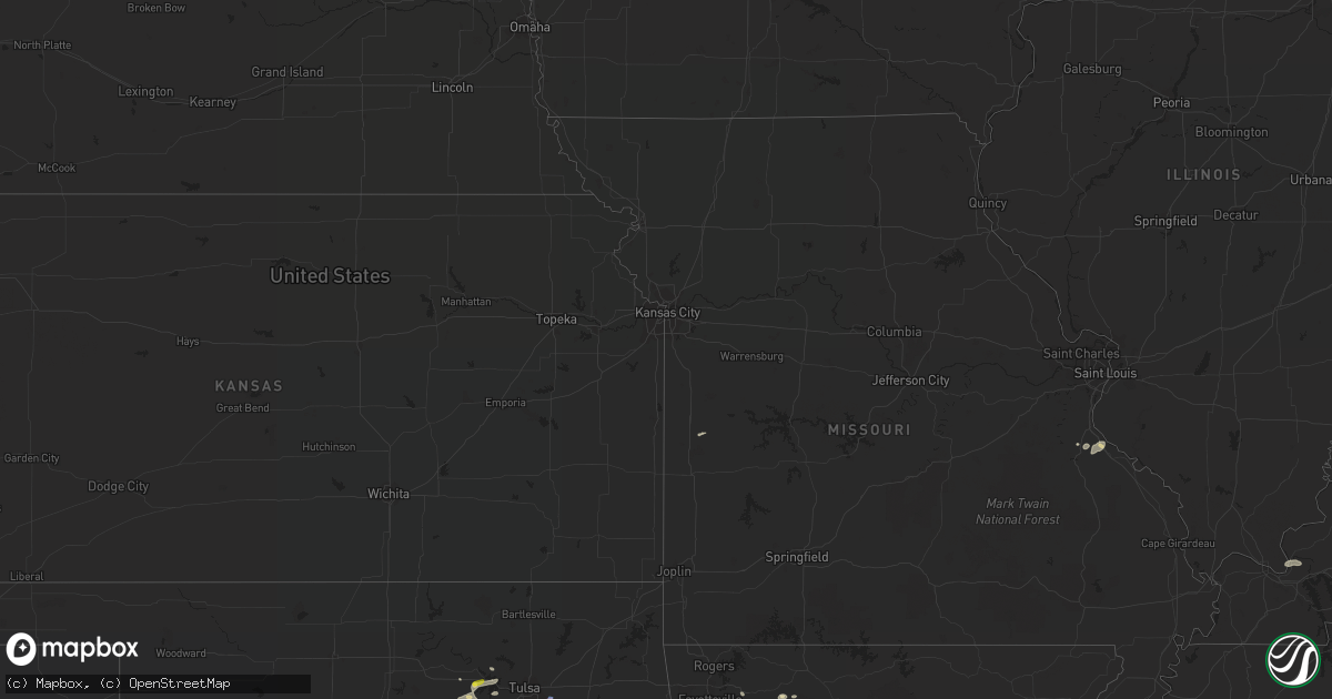
July 28 map
$229
one time, instant access
Download today. No call, no setup
Keep the $229
Bought the map and want the full workflow? Apply the entire $229 to a subscription within 7 days. None of it is wasted.
Every map, not just this one
This buys you this map. Subscription and you get every map we run, in the markets you choose from a few cities to whole states to nationwide. Plus real-time alerts the moment a storm fires.
Contact data
Name, contact info, occupancy, even credit band for addresses in the footprint. You go from where it hit to who to call.
Become the source they trust
Unlimited branding weather history reports on demand. You already have the documented answer ready for the property owner, and you are the one who showed up with it.
Property data and RoofTrace estimates
Pull up any address you have got, its value and the exact code rules for that jurisdiction, straight from One Click Code. Then RoofTrace estimates the squares, pitch, and roof value, priced the way you price.
Storm reports in Oklahoma
Oklahoma
| Date | Description |
|---|---|
| 07/28/20226:51 PM CDT | Also 6 inch tree downed. |
| 07/28/20226:50 PM CDT | Downed power poles. Time estimated from nearby reports. |
| 07/28/20226:42 PM CDT | Report from mping: 1-inch tree limbs broken; shingles blown off. |
| 07/28/20226:05 PM CDT | Report of a tree branch blown across the roadway... A tree branch downed. Also a twitter video of a flag pole coming apart. Public reports of small debris blown around. |
| 07/28/20225:30 PM CDT | Report of 2 inch diameter branches broken. |
| 07/28/20225:10 PM CDT | Tree and fence damage as well as shingles blown off roofs. Power out in rock creek area and earlsboro. Time estimated by radar. |
| 07/28/20224:50 PM CDT | Powerlines down... Wood patio thrown on top of house. Photos on twitter. |
| 07/28/20225:38 AM CDT | At 1037 PM CDT, a severe thunderstorm was located 3 miles northeast of Broken Arrow, moving northeast at 25 mph. HAZARD...60 mph wind gusts. SOURCE...Radar indicated. IMPACT...Expect damage to roofs, siding, and trees. Locations in or near the path include... Tulsa... Broken Arrow... Coweta... Catoosa... Inola... Oneta...This includes Interstate 44 between mile markers 234 and 239. |
| 07/28/20225:01 AM CDT | At 1001 PM CDT, a severe thunderstorm was located near Muskogee, moving northeast at 15 mph. HAZARD...60 mph wind gusts and quarter size hail. SOURCE...Radar indicated. IMPACT...Hail damage to vehicles is expected. Expect wind damage to roofs, siding, and trees. Locations in or near the path include... Muskogee... Fort Gibson... Okay... Sequoyah State Park... Summit... |
| 07/28/20224:26 AM CDT | At 925 PM CDT, a severe thunderstorm was located near Walnut Creek State Park, moving east at 25 mph. Another severe thunderstorm was just east of Oilton. HAZARD...60 mph wind gusts and quarter size hail. SOURCE...Radar indicated. IMPACT...Hail damage to vehicles is expected. Expect wind damage to roofs, siding, and trees. Locations in or near the path include... Tulsa... Broken Arrow... Sand Springs... Owasso... Bixby... Jenks... Skiatook... Catoosa... Collinsville... Mannford... Sperry... Westport... Keystone State Park... Walnut Creek State Park... Jenks Riverside Airport... Turley... Tulsa International Airport... Gray... Silver City... This includes Interstate 44 between mile markers 209 and 232. |
| 07/28/20223:07 AM CDT | At 807 PM CDT, a severe thunderstorm was located near Minco, moving northeast at 10 mph. HAZARD...60 mph wind gusts and penny size hail. SOURCE...Radar indicated. IMPACT...Expect damage to roofs, siding, and trees. Locations impacted include... Southwestern Oklahoma City, Mustang, Tuttle, Union City and Minco. |
| 07/28/20222:54 AM CDT | At 753 PM CDT, a severe thunderstorm was located 3 miles north of Krebs, and is nearly stationary. HAZARD...60 mph wind gusts and penny size hail. SOURCE...Radar indicated. IMPACT...Expect damage to roofs, siding, and trees. Locations in or near the path include... Mcalester... Krebs... Crowder... Alderson... Mcalester Regional Airport... Blocker... Bache... |
| 07/28/20222:53 AM CDT | At 753 PM CDT, a severe thunderstorm was located near Chandler, moving east at 15 mph. HAZARD...60 mph wind gusts and half dollar size hail. SOURCE...Radar indicated. IMPACT...Hail damage to vehicles is expected. Expect wind damage to roofs, siding, and trees. Locations impacted include... Chandler, Davenport and Kendrick. |
| 07/28/20222:25 AM CDT | At 725 PM CDT, a severe thunderstorm was located 5 miles south of Wellston, moving east at 15 mph. HAZARD...70 mph wind gusts and quarter size hail. SOURCE...Radar indicated. IMPACT...Hail damage to vehicles is expected. Expect considerable tree damage. Wind damage is also likely to mobile homes, roofs, and outbuildings. Locations impacted include... Chandler, Meeker, Wellston, Sparks and Warwick. |
| 07/28/20222:24 AM CDT | At 724 PM CDT, a severe thunderstorm was located 6 miles southeast of Minco, moving east at 10 mph. HAZARD...60 mph wind gusts and nickel size hail. SOURCE...Radar indicated. IMPACT...Expect damage to roofs, siding, and trees. Locations impacted include... Southwestern Oklahoma City, Mustang, Tuttle, Minco, Bridge Creek and Pocasset. |
| 07/28/20221:50 AM CDT | At 650 PM CDT, a severe thunderstorm was located near Jones, moving northeast at 10 mph. HAZARD...70 mph wind gusts and quarter size hail. SOURCE...Radar indicated. IMPACT...Hail damage to vehicles is expected. Expect considerable tree damage. Wind damage is also likely to mobile homes, roofs, and outbuildings. Locations impacted include... Eastern Oklahoma City, eastern Edmond, Midwest City, Choctaw, Harrah, McLoud, Spencer, Jones, Nicoma Park, Luther, Arcadia, Newalla and Tinker Air Force Base. |
| 07/28/20221:19 AM CDT | At 619 PM CDT, a severe thunderstorm was located near Spencer, moving northeast at 10 mph. HAZARD...60 mph wind gusts and quarter size hail. SOURCE...Radar indicated. IMPACT...Hail damage to vehicles is expected. Expect wind damage to roofs, siding, and trees. Locations impacted include... Oklahoma City, southern Edmond, Midwest City, Del City, Choctaw, Harrah, Spencer, Jones, Nicoma Park, Tinker Air Force Base, Forest Park and Lake Aluma. |
| 07/28/20221:14 AM CDT | At 614 PM CDT, a severe thunderstorm was located near Wewoka, moving east at 10 mph. HAZARD...70 mph wind gusts and quarter size hail. SOURCE...Radar indicated. IMPACT...Hail damage to vehicles is expected. Expect considerable tree damage. Wind damage is also likely to mobile homes, roofs, and outbuildings. Locations impacted include... Wewoka, Bowlegs and Lima. |
| 07/28/20221:10 AM CDT | At 609 PM CDT, an area of severe thunderstorms were located from Moore to Stanley Draper Lake, moving east at 10 mph. HAZARD...60 mph wind gusts and penny size hail. SOURCE...Radar indicated. IMPACT...Expect damage to roofs, siding, and trees. Locations impacted include... Southeastern Oklahoma City, Norman, Moore, Choctaw, Valley Brook, Stanley Draper Lake, Stella, Newalla, northern Lake Thunderbird, Tinker Air Force Base and Little Axe. |
| 07/28/202212:58 AM CDT | At 558 PM CDT, a severe thunderstorm was located 5 miles northwest of Yeager, moving east at 10 mph. HAZARD...60 mph wind gusts and penny size hail. SOURCE...Radar indicated. IMPACT...Expect damage to roofs, siding, and trees. Locations impacted include... Wetumka and Yeager. |
| 07/28/202212:27 AM CDT | At 527 PM CDT, a severe thunderstorm was located over southwestern Oklahoma City, or 6 miles south of Will Rogers Airport, moving east at 10 mph. HAZARD...60 mph wind gusts and quarter size hail. SOURCE...Radar indicated. IMPACT...Hail damage to vehicles is expected. Expect wind damage to roofs, siding, and trees. Locations impacted include... Southern Oklahoma City, western Norman, Moore, Newcastle and Valley Brook. |
| 07/28/202212:02 AM CDT | At 502 PM CDT, a severe thunderstorm was located near Earlsboro, moving east at 15 mph. HAZARD...60 mph wind gusts and penny size hail. SOURCE...Radar indicated. IMPACT...Expect damage to roofs, siding, and trees. Locations impacted include... Shawnee, Seminole, Tecumseh, Earlsboro, Johnson and Little. |
| 07/27/202210:41 PM CDT | Trees blown down; kinx wsr-88d tornadic debris signature just upstream from this location. |
| 07/27/202210:40 PM CDT | Several 6 to 8 inch diameter trees broken about 2 feet off the ground. |
| 07/27/202210:40 PM CDT | Power line and fence damage just south of kenosha and 225th east avenue. Time estimated from radar. |
| 07/27/202210:05 PM CDT | Corrects previous tstm wnd dmg report from muskogee. Numerous trees and branches downed. Power poles leaning. Time estimated from radar. |
| 07/27/20229:10 PM CDT | Reported by the hominy emergency manager on highway 412 near the intersection with highway 48. Time estimated by radar. |
| 07/27/20228:32 PM CDT | Roof damage to a barn north of town... As well as sheet metal wrapped around farm equipment. |
| 07/27/20228:32 PM CDT | Relayed through nwschat. |
| 07/27/20228:15 PM CDT | Large trees downed and a roof blown |
| 07/27/20228:15 PM CDT | Large trees downed and a roof blown off an odot building near the intersection of highways 113 and 69 north of mcalester. Relayed via twitter by local newspaper reporte |
All States Impacted by Hail Map on July 28, 2022
Cities Impacted by Hail Map on July 28, 2022
- Hurricane, UT
- Littlefield, AZ
- Wesley, AR
- Witter, AR
- Elkins, AR
- Fayetteville, AR
- Huntsville, AR
- Berryville, AR
- Compton, AR
- Franklin, TN
- Fairview, TN
- Nashville, TN
- Smithland, KY
- Tiline, KY
- Chandler, OK
- Wellston, OK
- Drumright, OK
- Yale, OK
- Evanston, IN
- Choctaw, OK
- Stigler, OK
- Keota, OK
- Wewoka, OK
- Nolensville, TN
- Arrington, TN
- Garrett, WY
- Sand Springs, OK
- Mannford, OK
- Muskogee, OK
- Happy, TX
- Rock River, WY
- Union City, OK
- Tuttle, OK
- Minco, OK
- Terlton, OK
- Jennings, OK
- Cleveland, OK
- Festus, MO
- De Soto, MO
- Hindsville, AR
- Texline, TX
- Brookport, IL
- Grand Rivers, KY
- Burna, KY
- Roy, NM
- Medicine Bow, WY
- West Fork, AR
- Holly Grove, AR
- Marvell, AR
- Spiro, OK
- Hockley, TX
- Cypress, TX
- College Grove, TN
- Oklahoma City, OK
- Spencer, OK
- Smithville, TN
- Warrenton, NC
- Earlsboro, OK
- Tecumseh, OK
- Shawnee, OK
- Laramie, WY
- Centennial, WY
- Las Vegas, NV
- Piney Flats, TN
- Kingsport, TN
- Henderson, NV
- Bristow, OK
- Bosler, WY
- Mcalester, OK
- Harrah, OK
- Luther, OK
- Meeker, OK
- Emporia, KS
- Waverly, KS
- Lebo, KS
- Scott, AR
- England, AR
- Little Rock, AR
- Cushing, OK
- Sparta, TN
- Cedar City, UT
- Stroud, OK
- Newalla, OK
- Holdenville, OK
- Wetumka, OK
- Benton, AR
- Maud, OK
- Seminole, OK
- Caliente, NV
- Magazine, AR
- Princess Anne, MD
- Nanticoke, MD
- Bivalve, MD
- Quantico, MD
- Tyaskin, MD
- Agra, OK
- Malvern, AR
- Jones, OK
- Tulia, TX
- Channing, TX
- Lockney, TX
- Silverton, TX
- Kingman, AZ
- Collierville, TN
- Boulder City, NV
- Bismarck, AR
- Butler, MO
- Bokoshe, OK
- Mccurtain, OK
- Donaldson, AR
- Porter, OK
- Bloomsdale, MO
- French Village, MO
- Mena, AR
- Broken Arrow, OK
- Paris, AR
- Mcminnville, TN
- Walling, TN
- Rock Island, TN
- Warwick, MA
- Winchester, NH
- Prue, OK
- Tucumcari, NM
- Conchas Dam, NM
- Neosho Rapids, KS
- Green Forest, AR
- Kingston, AR
- Dalhart, TX
- Tulsa, OK
- Corinth, NY
- Lake Luzerne, NY
- Hadley, NY
- Gainesville, NY
- Silver Springs, NY
- Bliss, NY
- Vega, TX
- Indian Springs, NV
- Searchlight, NV
- North Las Vegas, NV
- El Reno, OK
- Locke, NY
- McGraw, NY
- Lansing, NY
- Interlaken, NY
- Keuka Park, NY
- McDonough, NY
- Truxton, NY
- Hector, NY
- South Plymouth, NY
- Himrod, NY
- Prattsburgh, NY
- Homer, NY
- Branchport, NY
- De Ruyter, NY
- King Ferry, NY
- Pitcher, NY
- Trumansburg, NY
- Ithaca, NY
- Freeville, NY
- Cincinnatus, NY
- Cortland, NY
- South Otselic, NY
- Genoa, NY
- Groton, NY
- Penn Yan, NY
- North Pitcher, NY
- Lodi, NY
- Dundee, NY


