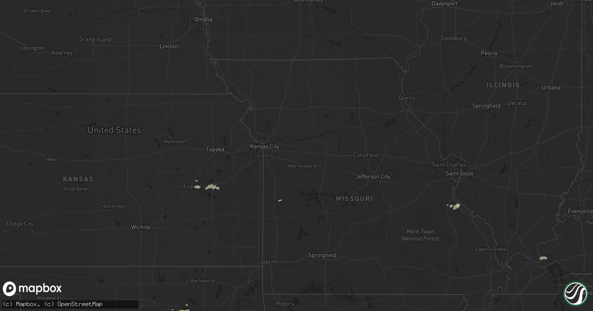
Hail Map on July 28, 2022
Get this storm
July 28 map
$229
one time, instant access
Download today. No call, no setup
Keep the $229
Bought the map and want the full workflow? Apply the entire $229 to a subscription within 7 days. None of it is wasted.
Every map, not just this one
This buys you this map. Subscription and you get every map we run, in the markets you choose from a few cities to whole states to nationwide. Plus real-time alerts the moment a storm fires.
Contact data
Name, contact info, occupancy, even credit band for addresses in the footprint. You go from where it hit to who to call.
Become the source they trust
Unlimited branding weather history reports on demand. You already have the documented answer ready for the property owner, and you are the one who showed up with it.
Property data and RoofTrace estimates
Pull up any address you have got, its value and the exact code rules for that jurisdiction, straight from One Click Code. Then RoofTrace estimates the squares, pitch, and roof value, priced the way you price.
States Impacted by Hail Map on July 28, 2022
Storm reports
Oklahoma
| Date | Description |
|---|---|
| 07/28/20226:51 PM CDT | Also 6 inch tree downed. |
| 07/28/20226:50 PM CDT | Downed power poles. Time estimated from nearby reports. |
| 07/28/20226:42 PM CDT | Report from mping: 1-inch tree limbs broken; shingles blown off. |
| 07/28/20226:05 PM CDT | Report of a tree branch blown across the roadway... A tree branch downed. Also a twitter video of a flag pole coming apart. Public reports of small debris blown around. |
| 07/28/20225:30 PM CDT | Report of 2 inch diameter branches broken. |
| 07/28/20225:10 PM CDT | Tree and fence damage as well as shingles blown off roofs. Power out in rock creek area and earlsboro. Time estimated by radar. |
| 07/28/20224:50 PM CDT | Powerlines down... Wood patio thrown on top of house. Photos on twitter. |
| 07/28/20225:38 AM CDT | At 1037 PM CDT, a severe thunderstorm was located 3 miles northeast of Broken Arrow, moving northeast at 25 mph. HAZARD...60 mph wind gusts. SOURCE...Radar indicated. IMPACT...Expect damage to roofs, siding, and trees. Locations in or near the path include... Tulsa... Broken Arrow... Coweta... Catoosa... Inola... Oneta...This includes Interstate 44 between mile markers 234 and 239. |
| 07/28/20225:01 AM CDT | At 1001 PM CDT, a severe thunderstorm was located near Muskogee, moving northeast at 15 mph. HAZARD...60 mph wind gusts and quarter size hail. SOURCE...Radar indicated. IMPACT...Hail damage to vehicles is expected. Expect wind damage to roofs, siding, and trees. Locations in or near the path include... Muskogee... Fort Gibson... Okay... Sequoyah State Park... Summit... |
| 07/28/20224:26 AM CDT | At 925 PM CDT, a severe thunderstorm was located near Walnut Creek State Park, moving east at 25 mph. Another severe thunderstorm was just east of Oilton. HAZARD...60 mph wind gusts and quarter size hail. SOURCE...Radar indicated. IMPACT...Hail damage to vehicles is expected. Expect wind damage to roofs, siding, and trees. Locations in or near the path include... Tulsa... Broken Arrow... Sand Springs... Owasso... Bixby... Jenks... Skiatook... Catoosa... Collinsville... Mannford... Sperry... Westport... Keystone State Park... Walnut Creek State Park... Jenks Riverside Airport... Turley... Tulsa International Airport... Gray... Silver City... This includes Interstate 44 between mile markers 209 and 232. |
| 07/28/20223:07 AM CDT | At 807 PM CDT, a severe thunderstorm was located near Minco, moving northeast at 10 mph. HAZARD...60 mph wind gusts and penny size hail. SOURCE...Radar indicated. IMPACT...Expect damage to roofs, siding, and trees. Locations impacted include... Southwestern Oklahoma City, Mustang, Tuttle, Union City and Minco. |
| 07/28/20222:54 AM CDT | At 753 PM CDT, a severe thunderstorm was located 3 miles north of Krebs, and is nearly stationary. HAZARD...60 mph wind gusts and penny size hail. SOURCE...Radar indicated. IMPACT...Expect damage to roofs, siding, and trees. Locations in or near the path include... Mcalester... Krebs... Crowder... Alderson... Mcalester Regional Airport... Blocker... Bache... |
| 07/28/20222:53 AM CDT | At 753 PM CDT, a severe thunderstorm was located near Chandler, moving east at 15 mph. HAZARD...60 mph wind gusts and half dollar size hail. SOURCE...Radar indicated. IMPACT...Hail damage to vehicles is expected. Expect wind damage to roofs, siding, and trees. Locations impacted include... Chandler, Davenport and Kendrick. |
| 07/28/20222:25 AM CDT | At 725 PM CDT, a severe thunderstorm was located 5 miles south of Wellston, moving east at 15 mph. HAZARD...70 mph wind gusts and quarter size hail. SOURCE...Radar indicated. IMPACT...Hail damage to vehicles is expected. Expect considerable tree damage. Wind damage is also likely to mobile homes, roofs, and outbuildings. Locations impacted include... Chandler, Meeker, Wellston, Sparks and Warwick. |
| 07/28/20222:24 AM CDT | At 724 PM CDT, a severe thunderstorm was located 6 miles southeast of Minco, moving east at 10 mph. HAZARD...60 mph wind gusts and nickel size hail. SOURCE...Radar indicated. IMPACT...Expect damage to roofs, siding, and trees. Locations impacted include... Southwestern Oklahoma City, Mustang, Tuttle, Minco, Bridge Creek and Pocasset. |
| 07/28/20221:50 AM CDT | At 650 PM CDT, a severe thunderstorm was located near Jones, moving northeast at 10 mph. HAZARD...70 mph wind gusts and quarter size hail. SOURCE...Radar indicated. IMPACT...Hail damage to vehicles is expected. Expect considerable tree damage. Wind damage is also likely to mobile homes, roofs, and outbuildings. Locations impacted include... Eastern Oklahoma City, eastern Edmond, Midwest City, Choctaw, Harrah, McLoud, Spencer, Jones, Nicoma Park, Luther, Arcadia, Newalla and Tinker Air Force Base. |
| 07/28/20221:19 AM CDT | At 619 PM CDT, a severe thunderstorm was located near Spencer, moving northeast at 10 mph. HAZARD...60 mph wind gusts and quarter size hail. SOURCE...Radar indicated. IMPACT...Hail damage to vehicles is expected. Expect wind damage to roofs, siding, and trees. Locations impacted include... Oklahoma City, southern Edmond, Midwest City, Del City, Choctaw, Harrah, Spencer, Jones, Nicoma Park, Tinker Air Force Base, Forest Park and Lake Aluma. |
| 07/28/20221:14 AM CDT | At 614 PM CDT, a severe thunderstorm was located near Wewoka, moving east at 10 mph. HAZARD...70 mph wind gusts and quarter size hail. SOURCE...Radar indicated. IMPACT...Hail damage to vehicles is expected. Expect considerable tree damage. Wind damage is also likely to mobile homes, roofs, and outbuildings. Locations impacted include... Wewoka, Bowlegs and Lima. |
| 07/28/20221:10 AM CDT | At 609 PM CDT, an area of severe thunderstorms were located from Moore to Stanley Draper Lake, moving east at 10 mph. HAZARD...60 mph wind gusts and penny size hail. SOURCE...Radar indicated. IMPACT...Expect damage to roofs, siding, and trees. Locations impacted include... Southeastern Oklahoma City, Norman, Moore, Choctaw, Valley Brook, Stanley Draper Lake, Stella, Newalla, northern Lake Thunderbird, Tinker Air Force Base and Little Axe. |
| 07/28/202212:58 AM CDT | At 558 PM CDT, a severe thunderstorm was located 5 miles northwest of Yeager, moving east at 10 mph. HAZARD...60 mph wind gusts and penny size hail. SOURCE...Radar indicated. IMPACT...Expect damage to roofs, siding, and trees. Locations impacted include... Wetumka and Yeager. |
| 07/28/202212:27 AM CDT | At 527 PM CDT, a severe thunderstorm was located over southwestern Oklahoma City, or 6 miles south of Will Rogers Airport, moving east at 10 mph. HAZARD...60 mph wind gusts and quarter size hail. SOURCE...Radar indicated. IMPACT...Hail damage to vehicles is expected. Expect wind damage to roofs, siding, and trees. Locations impacted include... Southern Oklahoma City, western Norman, Moore, Newcastle and Valley Brook. |
| 07/28/202212:02 AM CDT | At 502 PM CDT, a severe thunderstorm was located near Earlsboro, moving east at 15 mph. HAZARD...60 mph wind gusts and penny size hail. SOURCE...Radar indicated. IMPACT...Expect damage to roofs, siding, and trees. Locations impacted include... Shawnee, Seminole, Tecumseh, Earlsboro, Johnson and Little. |
| 07/27/202210:41 PM CDT | Trees blown down; kinx wsr-88d tornadic debris signature just upstream from this location. |
| 07/27/202210:40 PM CDT | Several 6 to 8 inch diameter trees broken about 2 feet off the ground. |
| 07/27/202210:40 PM CDT | Power line and fence damage just south of kenosha and 225th east avenue. Time estimated from radar. |
| 07/27/202210:05 PM CDT | Corrects previous tstm wnd dmg report from muskogee. Numerous trees and branches downed. Power poles leaning. Time estimated from radar. |
| 07/27/20229:10 PM CDT | Reported by the hominy emergency manager on highway 412 near the intersection with highway 48. Time estimated by radar. |
| 07/27/20228:32 PM CDT | Relayed through nwschat. |
| 07/27/20228:32 PM CDT | Roof damage to a barn north of town... As well as sheet metal wrapped around farm equipment. |
| 07/27/20228:15 PM CDT | Large trees downed and a roof blown |
| 07/27/20228:15 PM CDT | Large trees downed and a roof blown off an odot building near the intersection of highways 113 and 69 north of mcalester. Relayed via twitter by local newspaper reporte |
Vermont
| Date | Description |
|---|---|
| 07/28/20225:00 PM CDT | Tree down on upper falls road. |
| 07/28/20224:12 PM CDT | Numerous trees reported down but no structural damage |
| 07/28/20224:05 PM CDT | Midsized tree down on spear street. Didn't land in road or block traffic. |
| 07/28/202212:59 AM CDT | At 559 PM EDT, a severe thunderstorm was located over New Ashford, or 7 miles west of North Adams, moving east at 30 mph. HAZARD...60 mph wind gusts and penny size hail. SOURCE...Radar indicated. IMPACT...Expect damage to roofs, siding, and trees. Locations impacted include... Pittsfield, North Adams, Adams, Williamstown, Cheshire, Florida, Hancock, Savoy, New Ashford, Berkshire, Dalton, Lanesborough, Windsor, Hairpin Turn, Greylock, Soldiers Memorial Field, North Hancock, Cheshire Harbor, Arnoldville and Braytonville. |
Washington
| Date | Description |
|---|---|
| 07/27/20228:56 PM CDT | A member of the public in the bickleton area reported quarter to golf ball sized hail and heavy rain estimated at 1 inch of rain in 15 minutes. Some minor flooding in t |
Utah
| Date | Description |
|---|---|
| 07/27/20227:40 PM CDT | State route 7 at mile post 19.5 - sand hollow |
New Jersey
| Date | Description |
|---|---|
| 07/28/20224:04 AM CDT | At 904 PM EDT, a severe thunderstorm was located over Evesham, or 10 miles east of Camden, moving southeast at 35 mph. HAZARD...60 mph wind gusts. SOURCE...Radar indicated. IMPACT...Damage to roofs, siding, trees, and power lines is possible. Locations impacted include... Evesham, Mount Laurel, Voorhees, Medford, Tabernacle, Shamong, Springdale, Wharton State Forest, Atsion, Greentree, Marlton, Leisuretowne, Chatsworth, Ramblewood, Medford Lakes and Moorestown-Lenola.This includes Interstate 295 in New Jersey between mile markers 39and 42. |
Pennsylvania
| Date | Description |
|---|---|
| 07/28/20226:59 PM CDT | Report of tree down... Partially blocking the road on route 113 between kimberton and lionville on social media. Time estimated from radar. |
| 07/28/20226:55 PM CDT | Report of tree branch down on wire... Emergency services sent to address. Time estimated from radar. |
| 07/28/20226:55 PM CDT | Report of wires down relayed by county 911 center. Time estimated from radar. |
| 07/28/20224:45 PM CDT | Multiple reports of trees down in douglass township. Time estimated from radar. |
| 07/28/20222:29 AM CDT | At 729 PM EDT, a severe thunderstorm was located near Honey Brook, or 8 miles southeast of New Holland, moving east at 40 mph. HAZARD...60 mph wind gusts. SOURCE...Radar indicated. IMPACT...Damage to roofs, siding, trees, and power lines is possible. Locations impacted include... West Chester, Phoenixville, West Norriton, Coatesville, Westtown, Downingtown, Parkesburg, Honey Brook, Elverson, Cheyney, Marshallton, Lima, Lionville-Marchwood, Gradyville, Valley Forge, Glenmoore, Paoli, Chester Springs, Newtown Square and Lionville.This includes the following highways... Pennsylvania Turnpike between mile markers 300 and 327. Interstate 76 in Pennsylvania near mile marker 327. |
| 07/28/202212:38 AM CDT | At 537 PM EDT, a severe thunderstorm was located near Birdsboro, or 9 miles east of Reading, moving east at 25 mph. HAZARD...60 mph wind gusts. SOURCE...Radar indicated. IMPACT...Damage to roofs, siding, trees, and power lines is possible. Locations impacted include... Pottstown, Birdsboro, Collegeville, Royersford, Trappe, East Greenville, Schwenksville, Bally, Bechtelsville, Green Lane, Spring Mount, Geryville, Gilbertsville, Skippack, Stowe, Boyertown, Pennsburg, Red Hill, Trumbauersville and Harleysville.This includes Northeast Extension between mile markers 34 and 42. |
| 07/27/20227:30 PM CDT | Report of trees down in media area. Time estimated from radar. |
| 07/27/20227:21 PM CDT | Us-1 south was close due to a downed tree. Time estimated from radar. |
| 07/27/20227:21 PM CDT | Us-1 south was closed between the pa-252 exit and the intersection of baltimore pike due to a downed tree. Time estimated from radar. |
| 07/27/20227:08 PM CDT | Report on social media of 6 inch limbs down at ellis ln & strasburg rd. Time estimated from radar. |
| 07/27/20227:08 PM CDT | Report from social media of tree down on king rd. Time estimated from radar. |
Wyoming
| Date | Description |
|---|---|
| 07/28/20221:38 AM CDT | At 638 PM MDT, a severe thunderstorm was located near Arlington, or 32 miles northwest of Laramie, moving south at 20 mph. HAZARD...60 mph wind gusts and quarter size hail. SOURCE...Radar indicated. IMPACT...Hail damage to vehicles is expected. Expect wind damage to roofs, siding, and trees. Locations impacted include... Nash Fork Campground, Deep Creek Campground, Brooklyn Lake, Brooklyn Lake Campground, North Fork Campground and Arlington.This includes Interstate 80 in Wyoming between mile markers 272 and289. |
| 07/28/202212:27 AM CDT | At 526 PM MDT, a severe thunderstorm was located 7 miles east of Wheatland Reservoir 3, or 34 miles west of Wheatland, moving south at 25 mph. HAZARD...60 mph wind gusts and quarter size hail. SOURCE...Radar indicated. IMPACT...Hail damage to vehicles is expected. Expect wind damage to roofs, siding, and trees. This severe thunderstorm will remain over mainly rural areas of east central Albany County. |
| 07/27/202211:16 PM CDT | At 416 PM MDT, a severe thunderstorm was located 10 miles southeast of Wheatland Reservoir 3, or 33 miles north of Laramie, moving south at 20 mph. HAZARD...60 mph wind gusts and quarter size hail. SOURCE...Radar indicated. IMPACT...Hail damage to vehicles is expected. Expect wind damage to roofs, siding, and trees. Locations impacted include... Iron Mountain and Baldy Peak. |
Louisiana
| Date | Description |
|---|---|
| 07/27/202210:27 PM CDT | At 327 PM CDT, a severe thunderstorm was located near Old Jefferson, or 7 miles south of Denham Springs, moving north at 10 mph. HAZARD...60 mph wind gusts. SOURCE...Radar indicated. IMPACT...Expect damage to roofs, siding, and trees. Locations impacted include... Denham Springs, Walker, Port Vincent, Shenandoah and Old Jefferson.This includes Interstate 12 between mile markers 8 and 20. |
Nebraska
| Date | Description |
|---|---|
| 07/28/20227:30 AM CDT | At 1228 AM CDT, severe thunderstorms were located along a line extending from near Eddyville to 11 miles southwest of Willow Island to Moorefield to near Wellfleet, moving southeast at 45 mph. HAZARD...60 mph wind gusts. SOURCE...Radar indicated. IMPACT...Expect damage to roofs, siding, and trees. Locations impacted include... Overton and Loomis.This includes Interstate 80 between mile markers 209 and 252. |
| 07/28/20227:14 AM CDT | At 1214 AM CDT, severe thunderstorms were located along a line extending from near Gothenburg to 9 miles northwest of Moorefield to 8 miles east of Dickens, moving south at 30 mph. HAZARD...70 mph wind gusts and nickel size hail. SOURCE...Radar indicated. IMPACT...Expect considerable tree damage. Damage is likely to mobile homes, roofs, and outbuildings. Locations impacted include... Curtis, Brady, Eustis, Wellfleet, Moorefield, Stockville, Medicine Creek Reservoir State Recreation Area, Maywood, Quick, Cottonwood Canyon State Wildlife Management Area, Hansen Memorial Reserve State Wildlife Management Area, Jeffrey Canyon State Wildlife Management Area, Willow View Campground, Freedom, Orafino, Bluegill Haven Campground, Vroman, Red Willow Reservoir State Recreation Area, Somerset and Dancing Leaf Earth Lodge.This includes the following highways... Interstate 80 in Nebraska between mile markers 197 and 208. Highway 83 between mile markers 27 and 72. |
Kentucky
| Date | Description |
|---|---|
| 07/28/20226:45 PM CDT | Two trees down along liberty road. |
Massachusetts
| Date | Description |
|---|---|
| 07/28/20226:35 PM CDT | Tree down on wires. Relayed by amateur radio. |
| 07/28/20222:02 AM CDT | At 702 PM EDT, a severe thunderstorm was located over Huntington, or 8 miles southwest of Northampton, moving east at 30 mph. HAZARD...60 mph wind gusts. SOURCE...Radar indicated. IMPACT...Expect damage to trees and power lines. This severe thunderstorm will be near... Southampton around 710 PM EDT. Westfield, Northampton and Easthampton around 720 PM EDT. Holyoke around 725 PM EDT. South Hadley around 730 PM EDT. Springfield, Chicopee and Granby around 735 PM EDT. Ludlow and Wilbraham around 745 PM EDT. Monson and Hampden around 750 PM EDT. Palmer, Warren, West Brookfield and Brimfield around 800 PM EDT. |
| 07/28/20221:50 AM CDT | At 649 PM EDT, a severe thunderstorm was located near Winchester, or 14 miles southwest of Keene, moving east at 30 mph. HAZARD...60 mph wind gusts and penny size hail. SOURCE...Radar indicated. IMPACT...Expect damage to roofs, siding, and trees. Locations impacted include... Jaffrey, Swanzey, Rindge, Winchester, Dublin, Richmond, Hinsdale, Fitzwilliam, Troy, Marlborough and Chesterfield. |
| 07/28/20221:10 AM CDT | At 610 PM EDT, severe thunderstorms were located along a line extending from near Stamford to near Cheshire, moving east at 30 mph. HAZARD...60 mph wind gusts. SOURCE...Radar indicated. IMPACT...Expect damage to trees and power lines. Severe thunderstorms will be near... Monroe around 620 PM EDT. Charlemont, Cummington and Rowe around 630 PM EDT. Heath around 635 PM EDT. Plainfield and Hawley around 640 PM EDT. Buckland, Ashfield and Goshen around 645 PM EDT. Conway and Colrain around 650 PM EDT. Shelburne and Leyden around 655 PM EDT. Greenfield around 700 PM EDT. |
Arkansas
| Date | Description |
|---|---|
| 07/28/20223:25 PM CDT | **delayed report** the press box was blown off of the bleachers at the biskmarck high school football field. Additional damage was done to a gas station awning off hwy |
| 07/28/20223:11 PM CDT | Winds caused minor damage the southern bancorp building in bismarck. |
| 07/28/20223:11 PM CDT | A local report indicates 1.00 inch wind near BISMARCK |
| 07/28/20222:48 PM CDT | Multiple trees were blown down on lower steel bend road. |
| 07/27/202210:09 PM CDT | At 309 PM CDT, a severe thunderstorm was located near DeGray Lake State Park, or 13 miles southwest of Hot Springs, moving east at 10 mph. HAZARD...60 mph wind gusts and quarter size hail. SOURCE...Radar indicated. IMPACT...Hail damage to vehicles is expected. Expect wind damage to roofs, siding, and trees. Locations impacted include... Caddo Valley... Lofton... DeGray Lake State Park... Donaldson... Friendship... Bismarck... Red Oak... De Roche... Lake Catherine State Park... Pettyview... Midway in Hot Spring County... Social Hill...This includes Interstate 30 between mile markers 80 and 91. |
| 07/27/20229:44 PM CDT | At 244 PM CDT, a severe thunderstorm was located near Estes, or 9 miles southeast of Downtown Little Rock, moving east at 10 mph. HAZARD...60 mph wind gusts and quarter size hail. SOURCE...Radar indicated. IMPACT...Hail damage to vehicles is expected. Expect wind damage to roofs, siding, and trees. Locations impacted include... Little Rock... North Little Rock... England... Wrightsville... Keo... Sweet Home... Estes... Meto... Toltec Mounds State Park... Scott... Baucum... Bevis Corner... Higgins... Bredlow Corner... Willow Beach... Toltec... Woodson... Kerr... Terry Lock and Dam... College Station...This includes the following highways... Interstate 40 between mile markers 166 and 168. Interstate 530 between mile markers 3 and 5. Interstate 440 between mile markers 5 and 6. |
| 07/27/20228:39 PM CDT | At 139 PM CDT, a severe thunderstorm was located near Rockport, or near Malvern, moving east at 10 mph. HAZARD...60 mph wind gusts and quarter size hail. SOURCE...Radar indicated. IMPACT...Hail damage to vehicles is expected. Expect wind damage to roofs, siding, and trees. Locations impacted include... Malvern... Haskell... Rockport... Traskwood... Tull... Prattsville... Poyen... Perla... Jenkins Ferry State Park... Belfast... Magnet Cove... Fenter... Gifford... Glen Rose... Buie... Shaw... Lake Catherine State Park... This includes Interstate 30 between mile markers 92 and 107. |
| 07/27/20228:20 PM CDT | At 120 PM CDT, a severe thunderstorm was located near Salem in Saline County, or near Benton, moving east at 30 mph. HAZARD...60 mph wind gusts and quarter size hail. SOURCE...Radar indicated. IMPACT...Hail damage to vehicles is expected. Expect wind damage to roofs, siding, and trees. Locations impacted include... Little Rock... Benton... West Little Rock... Bryant... Downtown Little Rock... Southwest Little Rock... Haskell... Shannon Hills... Otter Creek... East End... Geyer Springs... Mabelvale... Salem in Saline County... State Fairgrounds... Ironton... Alexander... Baseline... Bauxite... Avilla... Vimy Ridge...This includes the following highways... Interstate 30 between mile markers 111 and 136. Interstate 430 between mile markers 1 and 6. Interstate 630 between mile markers 2 and 7. |
Virginia
| Date | Description |
|---|---|
| 07/28/20221:23 AM CDT | At 623 PM EDT, a severe thunderstorm was located near University Of Maryland Eastern Shore, moving east at 20 mph. HAZARD...60 mph wind gusts and quarter size hail. SOURCE...Radar indicated. IMPACT...Minor damage to vehicles is possible. Expect wind damage to trees and powerlines. This severe thunderstorm will be near... West Pocomoke around 635 PM EDT. Snow Hill around 700 PM EDT.Other locations impacted by this severe thunderstorm include Boxiron,Longridge, Cedartown, Cokesbury, Goodwill, Public Landing, MountWesley, Whiton, Girdletree and Stockton. |
Colorado
| Date | Description |
|---|---|
| 07/28/20227:26 AM CDT | At 1226 AM MDT, a severe thunderstorm was located 7 miles north of Riverside Reservoir, or 25 miles northwest of Fort Morgan, moving southeast at 15 mph. HAZARD...60 mph wind gusts and half dollar size hail. SOURCE...Radar indicated. IMPACT...Expect damage to roofs, siding, and trees. Hail damage to vehicles is expected. This severe thunderstorm will be near... Riverside Reservoir around 1240 AM MDT.Other locations in the path of this severe thunderstorm includeOrchard, Jackson Reservoir and Goodrich. |
| 07/28/20227:10 AM CDT | At 1210 AM MDT, a severe thunderstorm was located near Akron, moving southeast at 15 mph. HAZARD...60 mph wind gusts and half dollar size hail. SOURCE...Radar indicated. IMPACT...Expect damage to roofs, siding, and trees. Hail damage to vehicles is expected. This severe thunderstorm will be near... Akron around 1215 AM MDT.Other locations in the path of this severe thunderstorm includePlatner. |
| 07/28/20223:56 AM CDT | At 856 PM CDT, a severe thunderstorm was located 5 miles east of Texline, or 15 miles southeast of Clayton, moving north at 15 mph. HAZARD...60 mph wind gusts and quarter size hail. SOURCE...Radar indicated. IMPACT...Minor damage to roofs, siding, and trees is possible. Hail damage to vehicles is expected. Locations impacted include... Texline, Kenton, Wheeless, Black Mesa Park and Felt. |
| 07/28/20222:20 AM CDT | At 719 PM MDT, a severe thunderstorm was located over Libby Creek Campground, or 29 miles west of Laramie, moving south at 30 mph. HAZARD...60 mph wind gusts and quarter size hail. SOURCE...Radar indicated. IMPACT...Hail damage to vehicles is expected. Expect wind damage to roofs, siding, and trees. Locations impacted include... Albany, Woods Landing-Jelm, Libby Creek Campground, Illinois Creek Campground, Miller Lake Campground, Rob Roy Campground, Centennial, Nash Fork Campground, Evans Creek Campground, Lake Owen Campground, Boswell Creek Campground, Woods Landing, Rob Roy Reservoir, Lake Owen, North Fork Campground and Bobbie Thompson Campground. |
| 07/27/20228:53 PM CDT | Asos station keeo meeker airport. |
North Carolina
| Date | Description |
|---|---|
| 07/28/20226:10 PM CDT | Multiple trees and powerlines down near the intersection of nc highway 58 and county home road. Time estimated by radar. |
| 07/28/20222:01 AM CDT | At 701 PM EDT, a severe thunderstorm was located over Warrenton, moving east at 20 mph. HAZARD...60 mph wind gusts. SOURCE...Radar indicated. IMPACT...Expect damage to roofs, siding, and trees. Locations impacted include... Warrenton, Norlina, Littleton, Macon, Arcola, Medoc Mountain State Park, Airlie, Wise, Lake Gaston and Southpointe And Morningstar Marinas. |
| 07/27/202211:02 PM CDT | At 402 PM EDT, a severe thunderstorm was located 7 miles west of Cary, moving east at 25 mph. HAZARD...60 mph wind gusts. SOURCE...Radar indicated. IMPACT...Expect damage to roofs, siding, and trees. Locations impacted include... Raleigh, Cary, Garner, Fuquay-Varina, Zebulon, RDU International, Apex, Holly Springs, Morrisville and Knightdale. |
New Mexico
| Date | Description |
|---|---|
| 07/28/20226:42 AM CDT | At 1141 PM MDT, a severe thunderstorm was located 10 miles south of Windmill, moving west at 15 mph. HAZARD...Quarter size hail. SOURCE...Radar indicated. IMPACT...Damage to vehicles is expected. Locations impacted include... Animas. |
| 07/27/202211:14 PM CDT | At 414 PM MDT, a severe thunderstorm was located near Roy, or 14 miles northwest of Mosquero, moving northeast at 5 mph. HAZARD...60 mph wind gusts and quarter size hail. SOURCE...Radar indicated. IMPACT...Hail damage to vehicles is expected. Expect wind damage to roofs, siding, and trees. Locations impacted include... Roy and Solano. |
| 07/27/20229:45 PM CDT | At 244 PM MDT, a severe thunderstorm was located 7 miles north of Hayden, or 13 miles northwest of Amistad, moving northeast at 5 mph. HAZARD...60 mph wind gusts and quarter size hail. SOURCE...Radar indicated. IMPACT...Hail damage to vehicles is expected. Expect wind damage to roofs, siding, and trees. Locations impacted include... Sedan. |
Delaware
| Date | Description |
|---|---|
| 07/28/20223:07 AM CDT | At 807 PM EDT, severe thunderstorms were located along a line extending from near Paoli to near Westtown to near Landenberg, moving east at 35 mph. HAZARD...60 mph wind gusts. SOURCE...Radar indicated. IMPACT...Damage to roofs, siding, trees, and power lines is possible. Locations impacted include... Philadelphia, Camden, Wilmington, West Chester, Gloucester City, Cherry Hill, Chester, Deptford, West Deptford, Bellmawr, Yeadon, Westtown, Woodbury, Carneys Point, Conshohocken, Palmyra, Folcroft, Swarthmore, Elsmere and Paulsboro.This includes the following highways... New Jersey Turnpike between exits 2 and 3. Pennsylvania Turnpike between mile markers 317 and 325. Interstate 95 in Pennsylvania between mile markers 0 and 33. Interstate 95 in Delaware between mile markers 13 and 23. Interstate 76 in Pennsylvania between mile markers 327 and 351. Interstate 76 in New Jersey between mile markers 0 and 3. Interstate 295 in New Jersey between mile markers 4 and 30. Interstate 676 in Pennsylvania between mile markers 0 and 1. Interstate 676 in New Jersey between mile markers 0 and 4. Interstate 476 in Pennsylvania between mile markers 0 and 17. |
Arizona
| Date | Description |
|---|---|
| 07/28/20225:30 PM CDT | Emergency management reports power outage affecting 3000 customers in kingman due to wind damage at the blake ranch power station. Time estimated by radar. |
| 07/28/20225:18 AM CDT | At 1013 PM PDT/1013 PM MST/, a cluster of severe thunderstorms was located along a line extending from Sandy Valley to the Highway 93 corridor in Arizona northwest of Kingman. These storms were moving southwest at 30 mph. HAZARD...60 mph wind gusts and hail up to penny size. SOURCE...Radar indicated. IMPACT...Expect wind damage to roofs and trees, power lines and periods of blowing dust with the high winds. Locations impacted include... Bullhead City, Laughlin, Jean, Searchlight, Cima, Katherine Landing, Primm, Needles, Windy Point Campground, Oatman, Mid Hills Campground, Mojave Ranch Estates, Big Bend Rec Area, Golden Valley, Packsaddle Campground, Chloride, Mountain Pass, Goodsprings, Nipton and Mohave Valley.This includes the following highways... Interstate 15 in California between mile markers 146 and 186. Interstate 15 in Nevada between mile markers 1 and 21. |
| 07/28/20224:41 AM CDT | At 941 PM PDT/941 PM MST/, a severe thunderstorm was located near Callville Bay, or 10 miles east of Las Vegas Bay, moving southwest at 30 mph. HAZARD...60 mph wind gusts. SOURCE...Radar and surface wind observation indicated. IMPACT...Expect damage to roofs and trees. Locations impacted include... Henderson, North Las Vegas, Boulder City, Las Vegas Bay, Lake Las Vegas, Nellis AFB, The Motor Speedway, East Las Vegas, Boulder Beach, Railroad Pass, Boulder Beach Campground, Las Vegas Bay Campground, Callville Bay, Hoover Dam, Callville Bay Campground, Temple Bar Campground, Lake Mead National Recreation Area, Willow Beach, Sunrise Mtn and Temple Bar.This includes Interstate 15 in Nevada between mile markers 60 and 72. |
| 07/28/20221:51 AM CDT | At 651 PM PDT/651 PM MST/, a severe thunderstorm was located 11 miles southeast of Bunkerville, or 12 miles southeast of Mesquite, moving southwest at 20 mph. HAZARD...60 mph wind gusts. SOURCE...Radar indicated. IMPACT...Expect damage to roofs and trees. Locations impacted include... Mesquite, Virgin River Gorge, Beaver Dam, Littlefield, Overton, Moapa Valley, Overton Beach and Bunkerville.This includes the following highways... Interstate 15 in Arizona between mile markers 0 and 2, and betweenmile markers 4 and 17. Interstate 15 in Nevada between mile markers 107 and 120. |
| 07/27/20227:48 PM CDT | Photographs of trees down in downtown lake havasu city by the bowling alley. |
| 07/27/20227:35 PM CDT | 58 mph thunderstorm wind gust recorded at lake havasu airport. |
Connecticut
| Date | Description |
|---|---|
| 07/28/20225:45 PM CDT | Tree down on wires... And separate utility pole snapped on millbrook rd near winsted-norfolk rd. |
Indiana
| Date | Description |
|---|---|
| 07/28/20222:33 AM CDT | At 733 PM EDT/633 PM CDT/, a severe thunderstorm was located 15 miles east of Tell City, moving east at 25 mph. HAZARD...60 mph wind gusts. SOURCE...Radar indicated. IMPACT...Expect damage to roofs, siding, and trees. Locations impacted include... Brandenburg. |
New Hampshire
| Date | Description |
|---|---|
| 07/28/20226:05 PM CDT | 5 inch diameter tree down on province lake road south of pine river pond. Time estimated by radar. |
| 07/28/20226:00 PM CDT | Trees down on scotland road. Time estimated by radar. Time estimated by radar. |
| 07/28/20225:43 PM CDT | Several trees down on prospect street near the high school. Observed dime-sized hail for a few minutes. Time estimated by radar. |
| 07/28/20225:20 PM CDT | Tree blown down on top of a shed. Many branches scattered from storm. Time estimated by radar. |
| 07/28/20225:20 PM CDT | Multiple trees reported down on langdon rd between alstead and south charleston. Photos on social media. |
| 07/28/20222:19 AM CDT | At 719 PM EDT, severe thunderstorms were located along a line extending from near Rindge to Athol, moving east at 55 mph. HAZARD...60 mph wind gusts. SOURCE...Radar indicated. IMPACT...Expect damage to trees and power lines. Severe thunderstorms will be near... Ashburnham around 725 PM EDT. Gardner and Ashby around 735 PM EDT. Westminster and Princeton around 740 PM EDT. Leominster and Fitchburg around 745 PM EDT. Lunenburg, Townsend and Shirley around 750 PM EDT. Pepperell, Groton, Ayer and Harvard around 755 PM EDT. Dracut, Littleton and Dunstable around 800 PM EDT. Chelmsford and Tyngsborough around 805 PM EDT. |
| 07/28/202212:51 AM CDT | At 551 PM EDT, a severe thunderstorm was located over Baltimore, moving east at 25 mph. HAZARD...60 mph wind gusts and quarter size hail. SOURCE...Radar indicated. IMPACT...Minor hail damage to vehicles is possible. Expect wind damage to trees and powerlines. Locations impacted include... Chester, Windsor, Ludlow, Cavendish, Andover, Ludlow Village, Perkinsville Village, Ascutney, Baltimore, Springfield, Weathersfield, West Windsor, Reading, Perkinsville, Felchville, Brownsville, North Chester, Ascutney State Park, North Springfield Lake Recreation Area and Proctorsville. |
Tennessee
| Date | Description |
|---|---|
| 07/28/20224:04 AM CDT | At 903 PM EDT, severe thunderstorms were located along a line extending from near Decatur to near Walden, moving east at 20 mph. HAZARD...60 mph wind gusts. SOURCE...Radar indicated. IMPACT...Expect damage to roofs, siding, and trees. Locations impacted include... Chattanooga, Cleveland, Athens, Dayton, Sweetwater, Decatur, Soddy-Daisy, Walden, Lakesite and Charleston.This includes Interstate 75 in Tennessee between mile markers 15 and60. |
| 07/28/20223:29 AM CDT | At 828 PM EDT, a severe thunderstorm was located near Spring City, or 11 miles southwest of Rockwood, moving east at 25 mph. HAZARD...60 mph wind gusts. SOURCE...Radar indicated. IMPACT...Expect damage to roofs, siding, and trees. Locations impacted include... Kingston, Rockwood, Fairview, Spring City, Midtown, Harriman, Paint Rock, Peakland, Stinging Fork Falls State Park and Eagle Furnace.This includes Interstate 40 in Tennessee between mile markers 341 and354. |
| 07/28/202212:57 AM CDT | At 556 PM CDT, severe thunderstorms were located along a line extending from near Sparta to 9 miles southwest of Spencer, moving northeast at 35 mph. HAZARD...60 mph wind gusts. SOURCE...Radar indicated. IMPACT...Expect damage to roofs, siding, and trees. Locations impacted include... Spencer, Pleasant Hill, Virgin Falls State Natural Area and Fall Creek Falls State Park.This includes Interstate 40 between mile markers 311 and 315. |
| 07/28/202212:10 AM CDT | At 510 PM CDT, severe thunderstorms were located along a line extending from 7 miles south of Smithville to near McMinnville, moving northeast at 30 mph. HAZARD...60 mph wind gusts. SOURCE...Radar indicated. IMPACT...Expect damage to roofs, siding, and trees. Locations impacted include... McMinnville, Sparta, Morrison, Doyle, Bakers Crossroads and Rock Island State Park. |
| 07/27/202210:54 PM CDT | At 353 PM CDT, a severe thunderstorm was located near Murfreesboro, moving east at 30 mph. HAZARD...60 mph wind gusts. SOURCE...Radar indicated. IMPACT...Expect damage to roofs, siding, and trees. Locations impacted include... Murfreesboro, Smyrna, Walterhill, Auburntown, Cedars Of Lebanon State Park, Lascassas, Milton and Readyville.This includes the following highways... Interstate 24 between mile markers 76 and 82. Interstate 840 between mile markers 54 and 61. |
| 07/27/202210:32 PM CDT | At 331 PM CDT, a severe thunderstorm was located near Fairview, or 9 miles west of Franklin, moving east at 30 mph. HAZARD...60 mph wind gusts and quarter size hail. SOURCE...Radar indicated. IMPACT...Hail damage to vehicles is expected. Expect wind damage to roofs, siding, and trees. Locations impacted include... Franklin, Nashville, Brentwood, Nolensville, Forest Hills, Oak Hill, Belle Meade, Bellevue, Antioch, Fairview, Berry Hill, Natchez Trace At Highway 96 and Leipers Fork.This includes the following highways... Interstate 40 between mile markers 194 and 201, and between milemarkers 204 and 214. Interstate 65 between mile markers 64 and 85. Interstate 24 between mile markers 47 and 59. Interstate 840 near mile marker 13. |
| 07/27/20228:15 PM CDT | Tree down and some power outages across the county. Time estimated by radar. |
| 07/27/20228:15 PM CDT | A few trees down in and near decatur. |
Nevada
| Date | Description |
|---|---|
| 07/28/20225:45 PM CDT | Area 9 a09ab reports thunderstorm wind gust to 62 mph. |
| 07/28/20225:45 PM CDT | Station 7 a18aa reports gust to 59 mph in thunderstorm. |
| 07/28/20224:22 AM CDT | At 921 PM PDT, a severe thunderstorm was located over the Las Vegas Valley, or over Paradise, moving south at 20 mph. HAZARD...60 mph wind gusts. SOURCE...Radar indicated. IMPACT...Expect damage to roofs and trees. Locations impacted include... Las Vegas, Henderson, North Las Vegas, Anthem, Summerlin, Mountains Edge, The Strip, Nellis AFB, Downtown Las Vegas, East Las Vegas, Sam Boyd Stadium, Southern Highlands, Spring Valley, Green Valley, Enterprise, Paradise, Lone Mountain, Lake Las Vegas, Sloan and Seven Hills.This includes Interstate 15 in Nevada between mile markers 20 and 25. |
| 07/28/20223:10 AM CDT | At 810 PM PDT, a severe thunderstorm was located 21 miles north of Aliante, moving south at 25 mph. HAZARD...60 mph wind gusts. SOURCE...Radar indicated. IMPACT...Expect damage to roofs and trees and frequent cloud-to- ground lightning. Locations impacted include... Las Vegas, North Las Vegas, Lone Mountain, Centennial Hills, Aliante, Nellis AFB, The Motor Speedway, East Las Vegas, Summerlin, Sunrise Mtn, Gass Pk and Hayford Pk.This includes Interstate 15 in Nevada between mile markers 60 and 70. |
| 07/28/202212:35 AM CDT | Several large trees down and flooding with large rocks washed into the roadway. |
| 07/28/202212:28 AM CDT | At 527 PM PDT, a severe thunderstorm was located 13 miles east of Hiko, moving south at 15 mph. HAZARD...60 mph wind gusts and quarter size hail. SOURCE...Radar indicated. IMPACT...Hail damage to vehicles is expected. Expect wind damage to roofs and trees. Locations impacted include... Alamo, Hiko and Elgin. |
| 07/28/202212:04 AM CDT | Tree down on 13th street north of stewart. |
| 07/28/202212:02 AM CDT | Tree down blocking stewart near 13th street. |
| 07/27/202211:56 PM CDT | 59 mph wind gust recorded at klas harry reid intl airport. |
| 07/27/202211:53 PM CDT | At 452 PM PDT, a severe thunderstorm was located 17 miles northeast of Lathrop Wells, or 19 miles northwest of Mercury, moving southeast at 15 mph. HAZARD...60 mph wind gusts. SOURCE...Radar indicated. IMPACT...Expect damage to roofs and trees. This severe thunderstorm will remain over mainly rural areas of east central Nye County. |
| 07/27/202211:46 PM CDT | At 445 PM PDT/445 PM MST/, a severe thunderstorm was located near Oatman, or 14 miles southeast of Bullhead City, moving southwest at 20 mph. HAZARD...60 mph wind gusts and quarter size hail. SOURCE...Radar indicated. IMPACT...Hail damage to vehicles is expected. Expect wind damage to roofs and trees. Locations impacted include... Lake Havasu City, Bullhead City, Laughlin, Topock, Yucca, Katherine Landing, Needles, Oatman, Desert Hills, Mojave Ranch Estates, Mohave Valley, Big Bend Rec Area, Highway 95 And I-40, Mesquite Creek, Arizona Village and Willow Valley.This includes the following highways... Interstate 40 in Arizona between mile markers 0 and 28. Interstate 40 in California between mile markers 122 and 155. |
| 07/27/202211:30 PM CDT | 71 mph wind gust recorded near flamingo and eastern in las vegas. |
| 07/27/202211:20 PM CDT | 60 mph wind gust recorded at artesian sub nvenergy station in east las vegas. |
| 07/27/202211:16 PM CDT | 64 mph gust recorded near owens and bruce street in las vegas. |
| 07/27/202211:00 PM CDT | At 400 PM PDT, a severe thunderstorm was located near Panaca, or 10 miles northeast of Caliente, moving southwest at 30 mph. HAZARD...60 mph wind gusts and quarter size hail. SOURCE...Radar indicated. IMPACT...Hail damage to vehicles is expected. Expect wind damage to roofs and trees. Locations impacted include... Caliente, Ursine, Pioche, Horsethief Gulch Campground, Kershaw-Ryan Campground, Eagle Valley, Meadow Valley Campground, Panaca, Echo Canyon State Park and Cathedral Gorge State Park. |
| 07/27/202210:54 PM CDT | Public report of a large tree down near the intersection of 215 and north decatur blvd. |
| 07/27/20227:15 PM CDT | Area 25 east reports 59 mph wind gust from thunderstorms. |
California
| Date | Description |
|---|---|
| 07/28/20221:02 AM CDT | Moore upr station reports gust to 68 mph with thunderstorm activity. |
| 07/28/202212:46 AM CDT | At 546 PM PDT/546 PM MST/, a severe thunderstorm was located over Lake Havasu City, moving southwest at 20 mph. HAZARD...60 mph wind gusts. SOURCE...Radar indicated. IMPACT...Expect damage to roofs and trees. Locations impacted include... Lake Havasu City, Highway 95 At Mile Marker 29, Topock, Parker Dam, Needles, Three Dunes Campground, Desert Hills, Black Meadow Landing Campground, Cattail Cove State Park, Arizona Village, Essex, Earp, Vidal Junction, Big River and Mohave Valley.This includes the following highways... Interstate 40 in Arizona between mile markers 0 and 23. Interstate 40 in California between mile markers 139 and 155. |
| 07/27/20227:26 PM CDT | 59 mph thunderstorm wind gust recorded at needles asos. |
New York
| Date | Description |
|---|---|
| 07/28/20224:44 PM CDT | Law enforcement reported a couple of trees down in the town of grafton. Time estimated from radar. |
| 07/28/20224:31 PM CDT | Trees and a wire downed along hawley road |
| 07/28/20224:25 PM CDT | Multiple trees down in the town of schodack.time estimated from radar. |
| 07/28/20222:00 PM CDT | Several trees and wires down. Time estimated by radar. |
| 07/28/20221:53 PM CDT | Trees and wires down. |
| 07/28/20221:05 PM CDT | Power lines knocked down due to tree limbs. |
| 07/28/202212:37 PM CDT | Trees and wires down. Time estimated by radar. |
| 07/28/202212:35 PM CDT | Tree down through the roof of a building. Significant damage to the structure. |
| 07/28/202212:34 PM CDT | Tree down on a house on kent drive. Radar estimated time. |
| 07/28/202212:15 PM CDT | Via county dispatch feed. Tree down over wires... With fire response ongoing. Radar estimated time. |
| 07/28/202211:40 AM CDT | Via county dispatch feed. Large tree down blocking all of route 414. Radar estimated time. |
| 07/28/202211:21 AM CDT | Trees and wires down. |
| 07/28/202211:21 AM CDT | Trees and wires down. |
| 07/28/20229:49 AM CDT | Roof blown off barn and trees down on sheppard rd. |
| 07/28/20229:47 AM CDT | Corrects previous tornado report for updated path width from 3 nne bliss. Corrects previous tornado report from 3 nne bliss. Preliminary storm survey of ef-2 tornado da |
| 07/28/20229:47 AM CDT | Corrects previous tornado report from 3 nne bliss. Preliminary storm survey of ef-2 tornado damage along a 10 mile path from the southeast portion of the town of java t |
| 07/28/20229:43 AM CDT | Preliminary storm survey of ef-2 tornado damage along a 10 mile path from the southeast portion of the town of java to just north of gainesville. Maximum path width of |
| 07/28/20229:35 AM CDT | Trees down near route 78 and youngers rd. Damage to a house. |
| 07/28/20229:32 AM CDT | Barn collapsed on chaffee rd with trees and powerlines down along route 78. |
| 07/28/20227:41 AM CDT | At 1240 PM EDT, a severe thunderstorm was located 15 miles west of Stony Point, or 23 miles northwest of Sandy Island Beach State Park, moving northeast at 40 mph. HAZARD...60 mph wind gusts and penny size hail. SOURCE...Radar indicated. IMPACT...Expect damage to trees and power lines. Locations impacted include... Watertown, Stony Point, Clayton, Adams, Dexter, Henderson Harbor, Cedar Point State Park and Southwick Beach State Park.This includes Interstate 81 between exits 41 and 48. |
| 07/28/20227:26 AM CDT | At 1226 PM EDT, a severe thunderstorm was located over Keuka Park, or near Penn Yan, moving east at 40 mph. HAZARD...60 mph wind gusts. SOURCE...Radar indicated. IMPACT...Expect damage to roofs, siding, and trees. Locations impacted include... Penn Yan, Hector, Romulus, Starkey, Lansing, Benton, Covert, Ledyard, Trumansburg and Dundee. |
| 07/28/20226:59 AM CDT | At 1158 AM EDT, severe thunderstorms were located along a line extending from near Canandaigua to Haskinville, moving east at 25 mph. HAZARD...60 mph wind gusts. SOURCE...Radar indicated. IMPACT...Expect damage to roofs, siding, and trees. Locations impacted include... Benton, Urbana, Potter, Wayland, Middlesex, Pulteney, Wheeler, Italy, Avoca and Arkport. |
| 07/28/20226:22 AM CDT | At 1121 AM EDT, severe thunderstorms were located along a line extending from near Hemlock to 10 miles southeast of Portageville, moving east at 40 mph. HAZARD...60 mph wind gusts. SOURCE...Radar indicated. IMPACT...Expect damage to roofs, siding, and trees. Locations impacted include... Benton, Urbana, Potter, Wayland, Middlesex, Pulteney, Wheeler, Italy, Avoca and Arkport. |
| 07/28/20226:04 AM CDT | At 1103 AM EDT, severe thunderstorms were located along a line extending from near Mount Morris to near Portageville, moving east at 40 mph. HAZARD...60 mph wind gusts and penny size hail. SOURCE...Radar indicated. IMPACT...Expect damage to trees and power lines. Locations impacted include... Geneseo, Dansville, Letchworth State Park, Perry, Mount Morris, Conesus, Naples, Hemlock, Portageville and Honeoye.This includes Interstate 390 between exits 4 and 7. |
| 07/28/20222:12 AM CDT | At 712 PM EDT, a severe thunderstorm was located over Pleasant Mount, or 13 miles northwest of Honesdale, moving east at 20 mph. HAZARD...60 mph wind gusts. SOURCE...Radar indicated. IMPACT...Expect damage to roofs, siding, and trees. Locations impacted include... Pleasant Mount, Rutledgedale, Abrahamsville, Calkins, Lookout, Rileyville and Aldenville. |
| 07/28/202212:24 AM CDT | At 524 PM EDT, a severe thunderstorm was located over Castleton-On-Hudson, or near East Greenbush, moving east at 30 mph. HAZARD...60 mph wind gusts and penny size hail. SOURCE...Radar indicated. IMPACT...Expect damage to roofs, siding, and trees. Locations impacted include... Albany, East Greenbush, Rensselaer, Nassau, Stephentown, New Lebanon, Valatie, Castleton-On-Hudson, Kinderhook, West Sand Lake, Averill Park, Sand Lake, Coeymans, Canaan, East Nassau, Brookview, Van Hoesen Station, West Stephentown, Jacks Corners and Millers Corners. |
| 07/27/202211:29 PM CDT | At 429 PM EDT, a severe thunderstorm was located near Hudson Falls, moving east at 25 mph. HAZARD...60 mph wind gusts and quarter size hail. SOURCE...Radar indicated. IMPACT...Hail damage to vehicles is expected. Expect wind damage to roofs, siding, and trees. Locations impacted include... Hudson Falls, Granville, Hartford, Comstock, Kingsbury, Porter, Fort Ann, Middle Granville, Braymer School, Dunham Basin, Smiths Basin, Adamsville, North Granville, South Granville, Truthville, Raceville, Tripoli, West Granville, Slateville and East Hartford. |
| 07/27/202210:49 PM CDT | At 349 PM EDT, a severe thunderstorm was located near Lake Luzerne-Hadley, or 12 miles southwest of Lake George Village, moving east at 30 mph. HAZARD...60 mph wind gusts and quarter size hail. SOURCE...Radar indicated. IMPACT...Hail damage to vehicles is expected. Expect wind damage to roofs, siding, and trees. Locations impacted include... Glens Falls, Hudson Falls, Lake George Village, Fort Edward, Corinth, Hartford, Comstock, West Glens Falls, Lake Luzerne Campground, Glens Falls North, Queensbury, Kingsbury, Mount Hope, South Glens Falls, Lake Luzerne, Hadley, Lake George, Fort Ann, Cleverdale and Beartown. |
| 07/27/202210:46 PM CDT | At 345 PM EDT, a severe thunderstorm was located near Summit, or 12 miles southwest of Cobleskill, moving east at 35 mph. HAZARD...60 mph wind gusts and penny size hail. SOURCE...Radar indicated. IMPACT...Expect damage to roofs, siding, and trees. Locations impacted include... Cobleskill, Jefferson, Middleburgh, Summit, Schoharie, Richmondville, Livingstonville, North Blenheim, Breakabeen, West Richmondville, Baird Corners, Huntersland, Warnerville, Old Stone Fort, Lutheranville, Broome Center, West Fulton, Vintonton, Five Corners and Mineral Springs. |
| 07/27/20229:21 PM CDT | At 220 PM EDT, severe thunderstorms were located along a line extending from West Fowler to 14 miles south of Pitcairn, moving northeast at 45 mph. HAZARD...60 mph wind gusts and quarter size hail. SOURCE...Radar indicated. IMPACT...Minor hail damage to vehicles is possible. Expect wind damage to trees and powerlines. Locations impacted include... Potsdam, Gouverneur, Canton, Oswegatchie, Fowler, Parishville, Colton, Piercefield, Degrasse, Carry Falls Reservoir, Cranberry Lake, Hermon, Brasher Falls, Horseshoe Lake, Star Lake, Richville, Norwood, Pierrepont, Russell and Fine. |
| 07/27/20228:51 PM CDT | At 150 PM EDT, a severe thunderstorm was located over Solon, or 9 miles east of Cortland, moving east at 40 mph. HAZARD...60 mph wind gusts. SOURCE... Damage was reported to a building in Cortland. IMPACT...Expect damage to roofs, siding, and trees. Locations impacted include... Norwich, Plymouth, North Norwich, Sherburne, Solon, Cincinnatus, Otselic, McGraw, Preston and Earlville. |
| 07/27/20228:38 PM CDT | At 137 PM EDT, a cluster of severe thunderstorms was located 12 miles southwest of South Hammond, moving northeast at 25 mph. HAZARD...60 mph wind gusts and quarter size hail. SOURCE...Radar indicated. IMPACT...Minor hail damage to vehicles is possible. Expect wind damage to trees and powerlines. Locations impacted include... Potsdam, Massena, Gouverneur, Canton, Ogdensburg, Norfolk, Lisbon, Louisville, De Kalb, Fowler, Morley, Massena International Airport - Richards Field, Helena, Waddington, Richville, Hammond, Madrid, Rensselaer Falls, Norwood and Edwardsville. |
| 07/27/20228:26 PM CDT | At 125 PM EDT, severe thunderstorms were located along a line extending from near Cedar Point State Park to Adams, moving northeast at 45 mph. HAZARD...60 mph wind gusts and penny size hail. SOURCE...Radar indicated. IMPACT...Expect damage to trees and power lines. Locations impacted include... Watertown, Fort Drum, Carthage, West Carthage, Clayton, Glen Park, Herrings, Redwood, Copenhagen, Kring Point State Park and Wellesley Island State Park.This includes Interstate 81 between exits 45 and 52. |
| 07/27/20228:06 PM CDT | At 105 PM EDT, a severe thunderstorm was located near Genoa, or 11 miles north of Ithaca, moving east at 40 mph. HAZARD...70 mph wind gusts and penny size hail. SOURCE...Law enforcement has reported numerous trees and wires down over Yates county. IMPACT...Expect considerable tree damage. Damage is likely to mobile homes, roofs, and outbuildings. Locations impacted include... Cortland, Owasco, Homer, Otisco, Groton, Covert, Locke, Genoa, Ledyard and Trumansburg. |
Maryland
| Date | Description |
|---|---|
| 07/28/202212:49 AM CDT | At 548 PM EDT, a severe thunderstorm was located 8 miles north of Deal Island, or 12 miles northwest of Princess Anne, moving east at 20 mph. HAZARD...60 mph wind gusts. SOURCE...Radar indicated. IMPACT...Expect damage to trees and powerlines. This severe thunderstorm will be near... Princess Anne and University Of Maryland Eastern Shore around 625 PM EDT. Westover around 630 PM EDT.Other locations impacted by this severe thunderstorm include GreenHill, Catchpenny, Wetipquin, Oriole, Trinity, Cokesbury, Royal Oak,Eden, Dames Quarter and Allen. |
Texas
| Date | Description |
|---|---|
| 07/28/20225:28 PM CDT | Mesonet station 86 boys ranch 1wsw. |
| 07/28/20221:45 AM CDT | At 644 PM CDT, a severe thunderstorm was located 4 miles south of Romero, or 10 miles east of Nara Visa, moving north at 10 mph. HAZARD...60 mph wind gusts and quarter size hail. SOURCE...Radar indicated. IMPACT...Minor damage to roofs, siding, and trees is possible. Hail damage to vehicles is expected. Locations impacted include... Romero. |
| 07/28/202212:53 AM CDT | At 553 PM CDT, a severe thunderstorm was located 6 miles southeast of Buffalo Lake, or 13 miles southwest of Canyon, moving north at 15 mph. HAZARD...60 mph wind gusts. SOURCE...Radar indicated. IMPACT...Minor damage to roofs, siding, and trees is possible. Locations impacted include... Canyon, Umbarger, Buffalo Lake, Dawn and Mescalero Park. |
| 07/28/202212:49 AM CDT | At 549 PM CDT, a severe thunderstorm was located 5 miles northwest of Boys Ranch, or 24 miles north of Vega, moving north at 15 mph. HAZARD...60 mph wind gusts. SOURCE...Radar indicated. IMPACT...Minor damage to roofs, siding, and trees is possible. Locations impacted include... Channing and Boys Ranch. |
Kansas
| Date | Description |
|---|---|
| 07/28/202212:16 AM CDT | At 516 AM CDT, a severe thunderstorm was located over Solomon, moving east at 30 mph. HAZARD...60 mph wind gusts and penny size hail. SOURCE...Radar indicated. IMPACT...Expect damage to roofs, siding, and trees. Locations impacted include... Abilene, Chapman, Solomon, Enterprise and Moonlight. This includes Interstate 70 between mile markers 267 and 288. |
| 07/27/202211:25 PM CDT | At 425 AM CDT, a severe thunderstorm was located near Ada, moving southeast at 35 mph. HAZARD...60 mph wind gusts and quarter size hail. SOURCE...Radar indicated. IMPACT...Hail damage to vehicles is expected. Expect wind damage to roofs, siding, and trees. Locations impacted include... Minneapolis, Bennington, Delphos, Tescott, Culver, Wells and Ada. |
Cities Impacted by Hail Map on July 28, 2022
- Hurricane, UT
- Littlefield, AZ
- Wesley, AR
- Witter, AR
- Elkins, AR
- Fayetteville, AR
- Huntsville, AR
- Berryville, AR
- Compton, AR
- Franklin, TN
- Fairview, TN
- Nashville, TN
- Smithland, KY
- Tiline, KY
- Chandler, OK
- Wellston, OK
- Drumright, OK
- Yale, OK
- Evanston, IN
- Choctaw, OK
- Stigler, OK
- Keota, OK
- Wewoka, OK
- Nolensville, TN
- Arrington, TN
- Garrett, WY
- Sand Springs, OK
- Mannford, OK
- Muskogee, OK
- Happy, TX
- Rock River, WY
- Union City, OK
- Tuttle, OK
- Minco, OK
- Terlton, OK
- Jennings, OK
- Cleveland, OK
- Festus, MO
- De Soto, MO
- Hindsville, AR
- Texline, TX
- Brookport, IL
- Grand Rivers, KY
- Burna, KY
- Roy, NM
- Medicine Bow, WY
- West Fork, AR
- Holly Grove, AR
- Marvell, AR
- Spiro, OK
- Hockley, TX
- Cypress, TX
- College Grove, TN
- Oklahoma City, OK
- Spencer, OK
- Smithville, TN
- Warrenton, NC
- Earlsboro, OK
- Tecumseh, OK
- Shawnee, OK
- Laramie, WY
- Centennial, WY
- Las Vegas, NV
- Piney Flats, TN
- Kingsport, TN
- Henderson, NV
- Bristow, OK
- Bosler, WY
- Mcalester, OK
- Harrah, OK
- Luther, OK
- Meeker, OK
- Emporia, KS
- Waverly, KS
- Lebo, KS
- Scott, AR
- England, AR
- Little Rock, AR
- Cushing, OK
- Sparta, TN
- Cedar City, UT
- Stroud, OK
- Newalla, OK
- Holdenville, OK
- Wetumka, OK
- Benton, AR
- Maud, OK
- Seminole, OK
- Caliente, NV
- Magazine, AR
- Princess Anne, MD
- Nanticoke, MD
- Bivalve, MD
- Quantico, MD
- Tyaskin, MD
- Agra, OK
- Malvern, AR
- Jones, OK
- Tulia, TX
- Channing, TX
- Lockney, TX
- Silverton, TX
- Kingman, AZ
- Collierville, TN
- Boulder City, NV
- Bismarck, AR
- Butler, MO
- Bokoshe, OK
- Mccurtain, OK
- Donaldson, AR
- Porter, OK
- Bloomsdale, MO
- French Village, MO
- Mena, AR
- Broken Arrow, OK
- Paris, AR
- Mcminnville, TN
- Walling, TN
- Rock Island, TN
- Warwick, MA
- Winchester, NH
- Prue, OK
- Tucumcari, NM
- Conchas Dam, NM
- Neosho Rapids, KS
- Green Forest, AR
- Kingston, AR
- Dalhart, TX
- Tulsa, OK
- Corinth, NY
- Lake Luzerne, NY
- Hadley, NY
- Gainesville, NY
- Silver Springs, NY
- Bliss, NY
- Vega, TX
- Indian Springs, NV
- Searchlight, NV
- North Las Vegas, NV
- El Reno, OK
- Locke, NY
- McGraw, NY
- Lansing, NY
- Interlaken, NY
- Keuka Park, NY
- McDonough, NY
- Truxton, NY
- Hector, NY
- South Plymouth, NY
- Himrod, NY
- Prattsburgh, NY
- Homer, NY
- Branchport, NY
- De Ruyter, NY
- King Ferry, NY
- Pitcher, NY
- Trumansburg, NY
- Ithaca, NY
- Freeville, NY
- Cincinnatus, NY
- Cortland, NY
- South Otselic, NY
- Genoa, NY
- Groton, NY
- Penn Yan, NY
- North Pitcher, NY
- Lodi, NY
- Dundee, NY