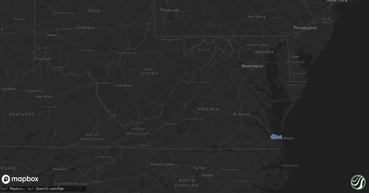
Hail Map in Virginia on July 26, 2022
Get this storm
July 26 map
$229
one time, instant access
Download today. No call, no setup
Keep the $229
Bought the map and want the full workflow? Apply the entire $229 to a subscription within 7 days. None of it is wasted.
Every map, not just this one
This buys you this map. Subscription and you get every map we run, in the markets you choose from a few cities to whole states to nationwide. Plus real-time alerts the moment a storm fires.
Contact data
Name, contact info, occupancy, even credit band for addresses in the footprint. You go from where it hit to who to call.
Become the source they trust
Unlimited branding weather history reports on demand. You already have the documented answer ready for the property owner, and you are the one who showed up with it.
Property data and RoofTrace estimates
Pull up any address you have got, its value and the exact code rules for that jurisdiction, straight from One Click Code. Then RoofTrace estimates the squares, pitch, and roof value, priced the way you price.
Storm reports in Virginia
Virginia
| Date | Description |
|---|---|
| 07/26/20224:26 PM CDT | Tree down on garden road. |
| 07/26/20224:14 PM CDT | Corrects previous tstm wnd dmg report from 3 sw abilene. Tree and powerline down on abilene road. |
| 07/26/20224:11 PM CDT | Tree down on tobacco hill road. |
| 07/26/20224:09 PM CDT | Tree down on winns creek rd. |
| 07/26/20224:07 PM CDT | Tree down near intersection of dudley road and lp bailey memorial highway. |
| 07/26/20224:07 PM CDT | Tree down on crystal hill road. |
| 07/26/20224:04 PM CDT | Tree down near intersection of tom fork and witcher road. |
| 07/26/20223:57 PM CDT | Tree down on lp bailey memorial highway. |
| 07/26/20223:47 PM CDT | Tree down near intersection of robin road and hawk road. |
| 07/26/20223:37 PM CDT | Tree down on west witt road. |
| 07/26/20223:34 PM CDT | Tree down near intersection of mitchell road and cox road. |
| 07/26/20223:29 PM CDT | Tree down on long island road near gladys va. |
| 07/26/20223:14 PM CDT | Tree down on chalk level road in chatam... Va. |
| 07/26/20222:58 PM CDT | Tree down and blocking the road on toddsbury road in altavista va. |
| 07/26/20222:52 PM CDT | Multiple trees knocked down across the central portion of new kent county. Time estimated from radar. |
| 07/26/20222:47 PM CDT | Tree down on deer haven drive. |
| 07/26/20222:44 PM CDT | Trees down on maryland avenue. Time estimated from radar. |
| 07/26/20222:38 PM CDT | Five helicopters on their side and roof damage near norfolk naval air station. |
| 07/26/20222:33 PM CDT | Tree reported down on a vehicle along bennetts pasture rd. Time estimated via radar. |
| 07/25/202211:25 PM CDT | At 425 PM EDT, a severe thunderstorm was located near Hat Creek, or near Brookneal, moving east at 25 mph. HAZARD...60 mph wind gusts. SOURCE...Radar indicated. IMPACT...Expect damage to roofs, siding, and trees. Locations impacted include... Brookneal... Charlotte Court House... Phenix... Red House... Drakes Branch... Madisonville... and Cullen. |
| 07/25/202210:47 PM CDT | At 346 PM EDT, a severe thunderstorm was located over Altavista, moving east at 30 mph. HAZARD...60 mph wind gusts. SOURCE...Radar indicated. IMPACT...Expect damage to roofs, siding, and trees. Locations impacted include... Altavista... Hurt... Brookneal... Red House... Rustburg... Evington... and Leesville. |
| 07/25/202210:34 PM CDT | At 334 PM EDT, a severe thunderstorm was located near Talleysville, moving southeast at 30 mph. HAZARD...60 mph wind gusts. SOURCE...Radar indicated. IMPACT...Expect damage to trees and powerlines. This severe thunderstorm will be near... Talleysville around 340 PM EDT. New Kent and Providence Forge around 350 PM EDT. Barhamsville and Holdcroft around 405 PM EDT. Toano and Norge around 415 PM EDT.Other locations impacted by this severe thunderstorm include Eltham,Chickahominy Shore, Croaker, Mountcastle, Cohoke, Lanexa, Mattaponi,Colonial Downs, Warren Mill and Cooke. |
| 07/25/202210:30 PM CDT | At 330 PM EDT, a severe thunderstorm was located over Churchland, moving east at 45 mph. HAZARD...60 mph wind gusts. SOURCE...Radar indicated. IMPACT...Expect damage to trees and powerlines. This severe thunderstorm will be near... Chesapeake and Portsmouth around 335 PM EDT. Downtown Norfolk, Old Dominion University, Downtown Portsmouth, Ghent, Norfolk NAS and Cradock around 340 PM EDT. Norfolk State University, Ocean View and Norview around 345 PM EDT. Virginia Wesleyan University, Kempsville, Regent University, Norfolk and Norfolk International around 350 PM EDT. Princess Anne around 400 PM EDT. Virginia Beach around 405 PM EDT.Other locations impacted by this severe thunderstorm include SouthNorfolk, Rudee Heights, Portlock, Princess Anne Plaza, Sigma,Sandbridge Beach, Huntersville, Oceana NAS, Macons Corner and Pungo. |
| 07/25/202210:27 PM CDT | At 327 PM EDT, a severe thunderstorm was located over Sydnorsville, moving east at 35 mph. HAZARD...60 mph wind gusts. SOURCE...Radar indicated. IMPACT...Expect damage to roofs, siding, and trees. Locations impacted include... Chatham... Gretna... Callands... Sydnorsville... Snow Creek... Dry Fork... and Mountain Valley. |
| 07/25/20229:19 PM CDT | At 219 PM EDT, a severe thunderstorm was located over Gum Spring, or near Goochland, moving east at 25 mph. HAZARD...60 mph wind gusts and penny size hail. SOURCE...Radar indicated. IMPACT...Expect damage to trees and powerlines. This severe thunderstorm will be near... Oilville around 235 PM EDT. Montpelier around 245 PM EDT. Wyndham around 250 PM EDT. Tuckahoe around 255 PM EDT.Other locations impacted by this severe thunderstorm include Orchid,Sandy Hook, Oliver, Vontay, Gum Tree, Irwin, Johnsons Springs,Goodall, Short Pump and Mabelton. |
All States Impacted by Hail Map on July 26, 2022
Cities Impacted by Hail Map on July 26, 2022
- Hastings, NE
- Doniphan, NE
- Dover, TN
- Hampton, NE
- Aurora, NE
- Naylor, MO
- Harviell, MO
- Fairdealing, MO
- Annandale, MN
- Maple Lake, MN
- Ewing, NE
- Idalia, CO
- Spring Hill, FL
- Mocksville, NC
- Seminole, FL
- Largo, FL
- Evergreen, CO
- Indian Hills, CO
- Colorado Springs, CO
- Yoder, CO
- Mason City, NE
- Rockville, NE
- Litchfield, NE
- Ansley, NE
- Loup City, NE
- Broken Bow, NE
- Parker, CO
- Aurora, CO
- Pueblo, CO
- Denver, CO
- Flagler, CO
- Stratton, CO
- Vona, CO
- Seibert, CO
- Cope, CO
- Hemingford, NE
- Alto, NM
- Inglis, FL
- Calhan, CO
- Grand Island, NE
- Chapman, NE
- Phillips, NE
- Rector, AR
- Darwin, MN
- Litchfield, MN
- Hutchinson, MN
- Giltner, NE
- College Grove, TN
- Nolensville, TN
- Arrington, TN
- Clarksville, TN
- Marsland, NE
- Crawford, NE
- Hugo, CO
- Woodlawn, TN
- Tribune, KS
- Syracuse, KS
- Lakin, KS
- Leoti, KS
- Geneva, NE
- Ohiowa, NE
- Ulysses, KS
- Satanta, KS
- Waverly, TN
- Pocahontas, AR
- Maynard, AR
- Union City, TN
- Martin, TN
- South Fulton, TN
- Nokomis, FL
- Osprey, FL
- Venice, FL
- Vermillion, SD
- Volin, SD
- Mission Hill, SD
- Utica, SD
- Irene, SD
- Lesterville, SD
- Wakonda, SD
- Boelus, NE
- Morrison, CO
- Littleton, CO
- Mitchell, SD
- Mount Vernon, SD
- Saint Charles, MO
- Moravian Falls, NC
- Wood River, NE
- Longmont, CO
- Boulder, CO
- Rush, CO
- Arnold, NE
- Anselmo, NE
- Piggott, AR
- South Haven, MN
- Shickley, NE
- Clarkton, MO
- Indian Mound, TN
- Port Richey, FL
- New Port Richey, FL
- Hudson, FL
- Oxly, MO
- Doniphan, MO
- Success, AR
- Henderson, NE
- Grafton, NE
- Sutton, NE
- Shakopee, MN
- Jordan, MN
- Bartlett, NE
- Chambers, NE
- Burwell, NE
- Sargent, NE
- Comstock, NE
- Trenton, KY
- Ogallala, NE
- Lemoyne, NE
- Stewart, TN
- New Johnsonville, TN
- Eva, TN
- Big Sandy, TN
- Alda, NE
- Tobias, NE
- Western, NE
- Dorchester, NE
- Milligan, NE
- Folsom, NM
- Lewellen, NE
- Strang, NE
- Imboden, AR
- Exeter, NE
- Fairmont, NE
- Friend, NE
- Harvard, NE
- Inverness, FL
- Hermann, MO
- Brooksville, FL
- Trumbull, NE
- Shelton, NE
- Brule, NE
- Ord, NE
- Ravenna, NE
- Cairo, NE
- Saint Petersburg, FL
- Ordway, CO
- Kit Carson, CO
- Bethune, CO
- Karval, CO
- Portsmouth, VA
- Chesapeake, VA
- Virginia Beach, VA
- Norfolk, VA
- Arthur, NE
- Swanton, NE
- Wilber, NE


