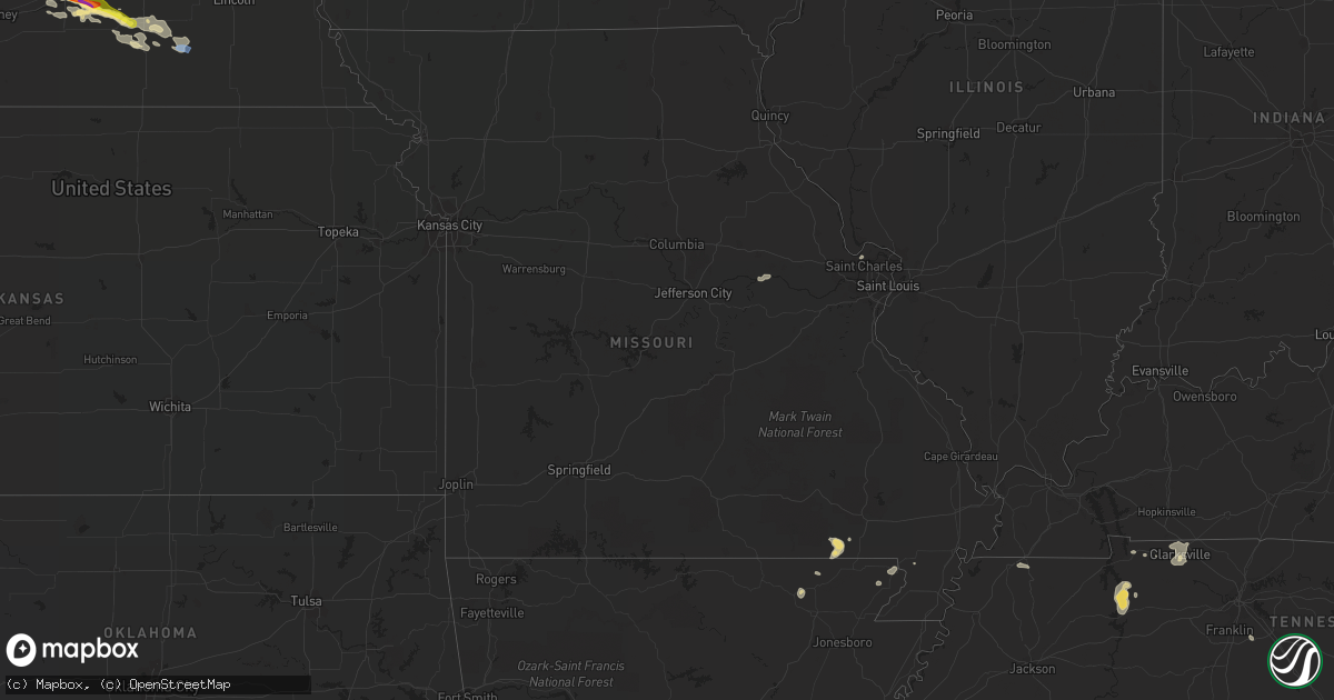
Hail Map in Missouri on July 26, 2022
Get this storm
July 26 map
$229
one time, instant access
Download today. No call, no setup
Keep the $229
Bought the map and want the full workflow? Apply the entire $229 to a subscription within 7 days. None of it is wasted.
Every map, not just this one
This buys you this map. Subscription and you get every map we run, in the markets you choose from a few cities to whole states to nationwide. Plus real-time alerts the moment a storm fires.
Contact data
Name, contact info, occupancy, even credit band for addresses in the footprint. You go from where it hit to who to call.
Become the source they trust
Unlimited branding weather history reports on demand. You already have the documented answer ready for the property owner, and you are the one who showed up with it.
Property data and RoofTrace estimates
Pull up any address you have got, its value and the exact code rules for that jurisdiction, straight from One Click Code. Then RoofTrace estimates the squares, pitch, and roof value, priced the way you price.
Storm reports in Missouri
Missouri
| Date | Description |
|---|---|
| 07/26/20222:05 PM CDT | Tree was snapped in clarkton. Nearby mesonet measured 36 mph wind gust. |
| 07/26/20221:45 PM CDT | The ripley county sheriff reported trees down from thunderstorm winds about 5 miles southeast of doniphan occurring at 145 pm. |
| 07/25/20228:39 PM CDT | At 138 PM CDT, a severe thunderstorm was located near Oxly, or 7 miles southeast of Doniphan, moving south at 20 mph. HAZARD...60 mph wind gusts and quarter size hail. SOURCE...Radar indicated. IMPACT...Hail damage to vehicles is expected. Expect wind damage to roofs, siding, and trees. This severe thunderstorm will remain over mainly rural areas of southeastern Ripley County. |
All States Impacted by Hail Map on July 26, 2022
Cities Impacted by Hail Map on July 26, 2022
- Hastings, NE
- Doniphan, NE
- Dover, TN
- Hampton, NE
- Aurora, NE
- Naylor, MO
- Harviell, MO
- Fairdealing, MO
- Annandale, MN
- Maple Lake, MN
- Ewing, NE
- Idalia, CO
- Spring Hill, FL
- Mocksville, NC
- Seminole, FL
- Largo, FL
- Evergreen, CO
- Indian Hills, CO
- Colorado Springs, CO
- Yoder, CO
- Mason City, NE
- Rockville, NE
- Litchfield, NE
- Ansley, NE
- Loup City, NE
- Broken Bow, NE
- Parker, CO
- Aurora, CO
- Pueblo, CO
- Denver, CO
- Flagler, CO
- Stratton, CO
- Vona, CO
- Seibert, CO
- Cope, CO
- Hemingford, NE
- Alto, NM
- Inglis, FL
- Calhan, CO
- Grand Island, NE
- Chapman, NE
- Phillips, NE
- Rector, AR
- Darwin, MN
- Litchfield, MN
- Hutchinson, MN
- Giltner, NE
- College Grove, TN
- Nolensville, TN
- Arrington, TN
- Clarksville, TN
- Marsland, NE
- Crawford, NE
- Hugo, CO
- Woodlawn, TN
- Tribune, KS
- Syracuse, KS
- Lakin, KS
- Leoti, KS
- Geneva, NE
- Ohiowa, NE
- Ulysses, KS
- Satanta, KS
- Waverly, TN
- Pocahontas, AR
- Maynard, AR
- Union City, TN
- Martin, TN
- South Fulton, TN
- Nokomis, FL
- Osprey, FL
- Venice, FL
- Vermillion, SD
- Volin, SD
- Mission Hill, SD
- Utica, SD
- Irene, SD
- Lesterville, SD
- Wakonda, SD
- Boelus, NE
- Morrison, CO
- Littleton, CO
- Mitchell, SD
- Mount Vernon, SD
- Saint Charles, MO
- Moravian Falls, NC
- Wood River, NE
- Longmont, CO
- Boulder, CO
- Rush, CO
- Arnold, NE
- Anselmo, NE
- Piggott, AR
- South Haven, MN
- Shickley, NE
- Clarkton, MO
- Indian Mound, TN
- Port Richey, FL
- New Port Richey, FL
- Hudson, FL
- Oxly, MO
- Doniphan, MO
- Success, AR
- Henderson, NE
- Grafton, NE
- Sutton, NE
- Shakopee, MN
- Jordan, MN
- Bartlett, NE
- Chambers, NE
- Burwell, NE
- Sargent, NE
- Comstock, NE
- Trenton, KY
- Ogallala, NE
- Lemoyne, NE
- Stewart, TN
- New Johnsonville, TN
- Eva, TN
- Big Sandy, TN
- Alda, NE
- Tobias, NE
- Western, NE
- Dorchester, NE
- Milligan, NE
- Folsom, NM
- Lewellen, NE
- Strang, NE
- Imboden, AR
- Exeter, NE
- Fairmont, NE
- Friend, NE
- Harvard, NE
- Inverness, FL
- Hermann, MO
- Brooksville, FL
- Trumbull, NE
- Shelton, NE
- Brule, NE
- Ord, NE
- Ravenna, NE
- Cairo, NE
- Saint Petersburg, FL
- Ordway, CO
- Kit Carson, CO
- Bethune, CO
- Karval, CO
- Portsmouth, VA
- Chesapeake, VA
- Virginia Beach, VA
- Norfolk, VA
- Arthur, NE
- Swanton, NE
- Wilber, NE


