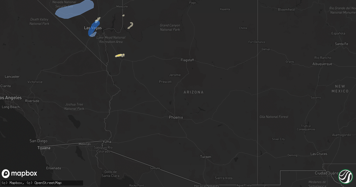
Hail Map in Arizona on July 25, 2021
Get this storm
July 25 map
$229
one time, instant access
Download today. No call, no setup
Keep the $229
Bought the map and want the full workflow? Apply the entire $229 to a subscription within 7 days. None of it is wasted.
Every map, not just this one
This buys you this map. Subscription and you get every map we run, in the markets you choose from a few cities to whole states to nationwide. Plus real-time alerts the moment a storm fires.
Contact data
Name, contact info, occupancy, even credit band for addresses in the footprint. You go from where it hit to who to call.
Become the source they trust
Unlimited branding weather history reports on demand. You already have the documented answer ready for the property owner, and you are the one who showed up with it.
Property data and RoofTrace estimates
Pull up any address you have got, its value and the exact code rules for that jurisdiction, straight from One Click Code. Then RoofTrace estimates the squares, pitch, and roof value, priced the way you price.
Storm reports in Arizona
Arizona
| Date | Description |
|---|---|
| 07/25/20213:59 AM CDT | At 857 PM PDT/857 PM MST/, severe thunderstorms were located along a line extending from 13 miles north of Cottonwood Cove Campground to Spring Valley to 15 miles north of Indian Springs, moving south at 35 mph. HAZARD...70 mph wind gusts. SOURCE...Radar indicated. IMPACT...Expect considerable tree damage. Damage is likely to mobile homes, roofs, and outbuildings. Locations impacted include... Las Vegas, Henderson, North Las Vegas, Pahrump, Boulder City, Laughlin, Rainbow Canyon, Summerlin, Nellis AFB, Red Rock Canyon, Green Valley, Searchlight, Spring Mountains, Paradise, Lone Mountain, Anthem, Mountains Edge, The Strip, Blue Diamond and Downtown Las Vegas.This includes Interstate 15 in Nevada between mile markers 1 and 25. |
| 07/25/20212:57 AM CDT | At 757 PM PDT/757 PM MST/, severe thunderstorms were located along a line extending from 18 miles north of The Motor Speedway to 7 miles southwest of Echo Bay Campground to Meadview, moving south at 20 mph. HAZARD...60 mph wind gusts. SOURCE...Radar indicated. IMPACT...Expect damage to roofs and trees. Locations impacted include... Las Vegas, Henderson, North Las Vegas, Boulder City, Rainbow Canyon, Summerlin, Nellis AFB, The Motor Speedway, Red Rock Canyon, Green Valley, Spring Mountains, Paradise, Lone Mountain, Anthem, Mountains Edge, The Strip, Blue Diamond, Downtown Las Vegas, East Las Vegas and Sam Boyd Stadium.This includes Interstate 15 in Nevada between mile markers 16 and 76. |
| 07/25/20212:08 AM CDT | At 706 PM PDT/706 PM MST/, a severe thunderstorm was located over Overton Beach, or near Overton, moving west at 35 mph. HAZARD...60 mph wind gusts. SOURCE...Radar indicated. IMPACT...Expect damage to roofs and trees. Locations impacted include... Las Vegas Bay, Overton, Moapa Town, Moapa Valley, Echo Bay, Boulder Beach, Boulder Beach Campground, Las Vegas Bay Campground, Echo Bay Campground, Callville Bay, Meadview, Hoover Dam, Valley Of Fire, Callville Bay Campground, Lake Mead National Recreation Area, Temple Bar Campground, Overton Beach, South Cove, Logandale and Bunkerville.This includes Interstate 15 in Nevada between mile markers 74 and115. |
| 07/24/20219:53 PM CDT | At 252 PM PDT/252 PM MST/, a severe thunderstorm was located 10 miles northwest of South Cove, or 24 miles southeast of Overton, moving southwest at 40 mph. HAZARD...60 mph wind gusts and quarter size hail. SOURCE...Radar indicated. IMPACT...Hail damage to vehicles is expected. Expect wind damage to roofs and trees. Locations impacted include... Las Vegas Bay, Echo Bay, Boulder Beach, Grand Canyon Skywalk, Boulder Beach Campground, Pierce Ferry And Antares Roads, Echo Bay Campground, Callville Bay, Meadview, Hoover Dam, Grand Canyon Ranch, Valley Of Fire, Callville Bay Campground, Lake Mead National Recreation Area, Temple Bar Campground, Dolan Springs, Overton Beach, South Cove, Willow Beach and Temple Bar. |
| 07/24/20219:14 PM CDT | Nevada dot hoover dam sensor at highway 93 measured a gust of 70 mph. |
| 07/24/20219:00 PM CDT | Reports of vessels in distress and numerous boat rescues where boaters had to be retrieved from their vessels and leave their boats behind. |
| 07/24/20218:48 PM CDT | Trained spotter reported a power outage due to severe thunderstorm winds in dolan springs. Happened while we were on the phone with them. Call dropped and they returned |
| 07/24/20217:23 PM CDT | Kingman airport asos reported a gust of 66 mph at 1723. Gusts above 58 mph began at 1657 and ended at 1732. |
All States Impacted by Hail Map on July 25, 2021
Cities Impacted by Hail Map on July 25, 2021
- Wanblee, SD
- Ashton, SD
- Corona, NM
- Sheridan Lake, CO
- Eads, CO
- Groom, TX
- Pampa, TX
- Cordell, OK
- Leedey, OK
- Seneca, SD
- Campbell, MN
- Fairmount, ND
- Nashua, MN
- Wendell, MN
- Las Animas, CO
- Littlefield, AZ
- Holly, CO
- Lamar, CO
- Syracuse, KS
- Enterprise, UT
- Saint George, UT
- Moline, KS
- Clarendon, TX
- Mclean, TX
- Miami, TX
- Limon, CO
- Cedar City, UT
- Mullinville, KS
- Hettinger, ND
- Ulysses, KS
- Highmore, SD
- Miller, SD
- Tulare, SD
- Ortonville, MN
- Okeene, OK
- Fairview, OK
- Foss, OK
- Burlington, CO
- Bethune, CO
- Levelland, TX
- Claire City, SD
- Veblen, SD
- Enderlin, ND
- Nome, ND
- Kathryn, ND
- New Effington, SD
- Altus, OK
- Leonard, ND
- Walcott, ND
- Frohna, MO
- Uniontown, MO
- Perryville, MO
- Sheldon, ND
- Tell, TX
- Childress, TX
- Stratton, CO
- Vona, CO
- Mayfield, KS
- Wellington, KS
- Panhandle, TX
- Amarillo, TX
- Litchville, ND
- Fort Ransom, ND
- Wood, SD
- White River, SD
- Okarche, OK
- Blunt, SD
- Fort Pierre, SD
- Pierre, SD
- Harrold, SD
- Ames, OK
- Happy, TX
- Tulia, TX
- Lisbon, ND
- Kit Carson, CO
- Haswell, CO
- Flomot, TX
- Caliente, NV
- Bucklin, KS
- Dodge City, KS
- Jetmore, KS
- Ford, KS
- Wright, KS
- Spearville, KS
- Wyndmere, ND
- Barney, ND
- Selfridge, ND
- Isabella, OK
- Aline, OK
- Waynoka, OK
- Cleo Springs, OK
- Eldorado, OK
- Arapaho, OK
- Clinton, OK
- Canadian, TX
- Floydada, TX
- Custer City, OK
- Rosholt, SD
- Raymond, SD
- Wallace, SD
- Bradley, SD
- Watertown, SD
- Florence, SD
- Clark, SD
- Conde, SD
- Midland, TX
- Arriba, CO
- Martin, SD
- Roaring Springs, TX
- Presho, SD
- Littlefield, TX
- Lockney, TX
- Plainview, TX
- Matador, TX
- Dimmitt, TX
- Muleshoe, TX
- Redfield, SD
- Cuba, KS
- Agenda, KS
- Munden, KS
- Belleville, KS
- Benton, KY
- Gilbertsville, KY
- Mooreton, ND
- Mantador, ND
- Colfax, ND
- Dumont, MN
- Rockham, SD
- Cheyenne Wells, CO
- Two Buttes, CO
- Walsh, CO
- Desert Center, CA
- Yuma, CO
- Spivey, KS
- McLaughlin, SD
- Perryton, TX
- Pine Valley, UT
- Amsterdam, MO
- Butler, MO
- Golden Valley, AZ
- Kingman, AZ
- Overton, NV
- Marion, ND
- Kress, TX
- Canute, OK
- Butler, OK
- Elk City, OK
- Seibert, CO
- Flagler, CO
- Oxford, KS
- Haviland, KS
- Corn, OK
- Ralls, TX
- Selden, KS
- Murdo, SD
- Petersburg, TX
- Johnson, KS
- Manter, KS
- Cope, CO
- Beaver, OK
- Turton, SD
- Cayuga, ND
- Wiley, CO
- Drummond, OK
- Claude, TX
- Gardendale, TX
- Turon, KS
- Wahpeton, ND
- Kingman, KS
- Hoxie, KS
- Odessa, MN
- Clinton, MN
- Hasty, CO
- McClave, CO
- Paragonah, UT
- Protection, KS
- Republican City, NE
- Foxhome, MN
- Breckenridge, MN
- Vulcan, MO
- Piedmont, MO
- Ellington, MO
- Andrews, TX
- Long Valley, SD
- Wolsey, SD
- Saint Lawrence, SD
- Wessington, SD
- Claremont, SD
- Groton, SD
- Columbia, SD
- Odessa, TX
- Cambridge, KS
- Abernathy, TX
- Anton, TX
- Silverton, TX
- Orient, SD
- Ree Heights, SD
- Shidler, OK
- Linn, KS
- Washington, KS
- Richfield, KS
- Shamrock, TX
- Lidgerwood, ND
- Faulkton, SD
- Doland, SD
- Garden City, SD
- Greenfield, OK
- Watonga, OK
- Paducah, TX
- Cee Vee, TX
- Joes, CO
- Coldwater, KS
- Carrizozo, NM
- Milnor, ND
- Kingfisher, OK
- Geary, OK
- Hitchcock, OK
- Omega, OK
- Calumet, OK
- Cedar Vale, KS
- Slaton, TX
- Winfield, KS
- Burden, KS
- Wheaton, MN
- Vinita, OK
- Chelsea, OK
- Karval, CO
- Collinsville, OK
- Lahoma, OK
- Pawhuska, OK
- Weatherford, OK
- Argonia, KS
- Sharon, OK
- Mellette, SD
- Marathon, TX
- Bartlesville, OK
- Greensburg, KS
- Coffeyville, KS
- Appleton, MN
- Orangeburg, NY
- Blauvelt, NY
- Valley Cottage, NY
- Tarrytown, NY
- New City, NY
- West Nyack, NY
- Irvington, NY
- Nanuet, NY
- Nyack, NY
- Arnett, OK
- Elmer, OK
- Olustee, OK
- Kennebec, SD
- Lower Brule, SD
- Sayre, OK
- Chokio, MN
- Graceville, MN
- Mountain View, OK
- Satanta, KS
- Stanton, TX
- Booker, TX
- Henry, SD
- Harper, KS
- Shallowater, TX
- Milford, UT
- Hammon, OK
- Beardsley, MN
- Sedan, KS
- Kendall, KS
- Higgins, TX
- Granada, CO
- New Leipzig, ND
- Elgin, ND
- Indian Springs, NV
- Hoffman, MN
- Herman, MN
- Barrett, MN
- Morrowville, KS
- Barnes, KS
- Greenleaf, KS
- Milan, KS
- Kirk, CO
- Sugar City, CO
- Clyde, KS
- Clifton, KS
- Mahaska, KS
- Holabird, SD
- Dumas, TX
- Hankinson, ND
- Adrian, TX
- Tuthill, SD
- Barnsdall, OK
- Big Cabin, OK
- Morris, MN
- Correll, MN
- Alberta, MN
- Sisseton, SD
- Bellingham, MN
- Donnelly, MN
- Madison, MN
- Holloway, MN
- Ashland, KS
- Wilmore, KS
- Skiatook, OK
- Woodrow, CO
- Sunray, TX
- Geuda Springs, KS
- South Haven, KS
- Conway Springs, KS
- Tintah, MN
- Norcross, MN
- Baldwin City, KS
- Lakin, KS
- Mcleod, ND
- Northville, SD
- Monroe, VA
- Delaware, OK
- Hollenberg, KS
- Tulsa, OK
- Anadarko, OK
- Cement, OK
- Madison Heights, VA
- Draper, SD
- Evansville, MN
- Elbow Lake, MN
- Hitchcock, SD
- Memphis, TX
- Wellington, TX
- Headrick, OK
- Tipton, OK
- Cadiz, KY
- South Shore, SD
- Wakpala, SD
- Chillicothe, TX
- Thomas, OK
- Hudson, KS
- St John, KS
- Sylvia, KS
- Sublette, KS
- Tunas, MO
- Macks Creek, MO
- Quanah, TX
- Offerle, KS
- Lamoure, ND
- Paola, KS
- Amoret, MO
- Stafford, KS
- Greenville, UT
- Ruidoso, NM
- Webster, SD
- Lebanon, SD
- Fergus Falls, MN
- Hedley, TX
- Nellis Afb, NV
- North Las Vegas, NV
- Las Vegas, NV
- Sloan, NV
- Henderson, NV
- Amargosa Valley, NV
- Freedom, OK
- Mooreland, OK
- Duke, OK
- Frederick, OK
- Broken Arrow, OK
- Oologah, OK
- Owasso, OK
- Ramona, OK
- Catoosa, OK
- Ochelata, OK
- Claremore, OK
- Sperry, OK
- Vera, OK
- Southard, OK
- Loyal, OK
- Longdale, OK
- Union City, OK
- El Reno, OK
- Dill City, OK
- Bessie, OK


