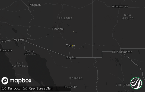
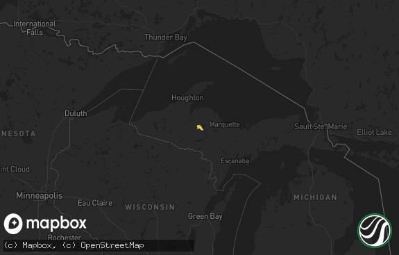
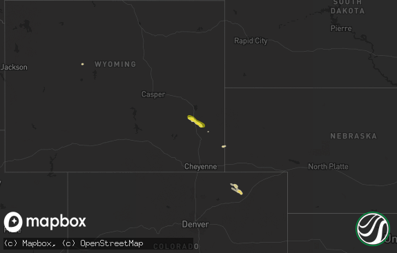
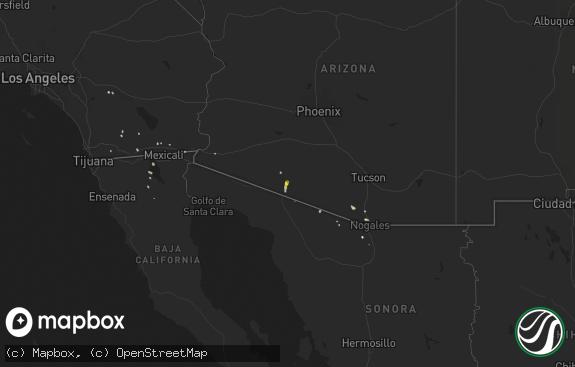
Hail Map in Wyoming on July 25, 2018
The weather event in Wyoming on July 25, 2018 includes Hail map. 13 states and 359 cities were impacted and suffered possible damage. The total estimated number of properties impacted is 24,823.

Hail
24,823
Estimated number of impacted properties by a 1.00" hail or larger0
Estimated number of impacted properties by a 1.75" hail or larger0
Estimated number of impacted properties by a 2.50" hail or largerStorm reports in Wyoming
Wyoming
| Date | Description |
|---|---|
| 07/25/20185:45 PM CDT | A local report indicates 1.50 inch wind near 7 SE CHEYENNE |
| 07/25/20185:45 PM CDT | A local report indicates 1.50 inch wind near 7 SE CHEYENNE |
| 07/25/20185:30 PM CDT | Also very heavy rain and one inch hail with the storm |
| 07/25/20185:15 PM CDT | Very heavy rain |
| 07/25/20185:05 PM CDT | A local report indicates 1.00 inch wind near 4 NW CHEYENNE |
| 07/25/20184:49 PM CDT | Heavy rain 1/3 inch in 10 minutes |
| 07/24/201811:36 PM CDT | At 435 PM MDT, a severe thunderstorm was located 14 miles east of Sand Draw, or 23 miles north of Jeffrey City, moving southeast at 40 mph. HAZARD...Golf ball size hail. SOURCE...Radar indicated. IMPACT...People and animals outdoors will be injured. Expect damage to roofs, siding, windows, and vehicles. This severe thunderstorm will be near... Split Rock around 515 PM MDT. |
| 07/24/201811:31 PM CDT | At 430 PM MDT, a severe thunderstorm was located 9 miles southeast of South Greeley, or 11 miles southeast of Cheyenne, moving southeast at 35 mph. HAZARD...60 mph wind gusts and quarter size hail. SOURCE...Radar indicated. IMPACT...Expect damage to roofs, siding, and trees. Hail damage to vehicles is expected. Locations impacted include... Grover, Purcell, Rockport and Hereford. |
| 07/24/201811:24 PM CDT | At 423 PM MDT, a severe thunderstorm was located near South Greeley, or 7 miles southeast of Cheyenne, moving southeast at 30 mph. HAZARD...70 mph wind gusts and quarter size hail. SOURCE...Trained weather spotters. This storm has a history of producing quarter sized hail and wind gusts up to 70 MPH. IMPACT...Hail damage to vehicles is expected. Expect considerable tree damage. Wind damage is also likely to mobile homes, roofs, and outbuildings. Locations impacted include... Cheyenne, Burns, Hillsdale, Carpenter, South Greeley, Ranchettes and Fox Farm-College.This includes Interstate 80 in Wyoming between mile markers 364 and396.This replaces the Severe Thunderstorm Warning which was previously in effect for the warned area. |
| 07/24/201810:17 PM CDT | At 317 PM MDT, a severe thunderstorm was located over Horse Creek, or 23 miles east of Laramie, moving southeast at 20 mph. HAZARD...Ping pong ball size hail and 60 mph wind gusts. SOURCE...Radar indicated. IMPACT...People and animals outdoors will be injured. Expect hail damage to roofs, siding, windows, and vehicles. Expect wind damage to roofs, siding, and trees. Locations impacted include... Whitaker and Horse Creek. This includes Interstate 25 in Wyoming between mile markers 28 and33. |
| 07/24/201810:10 PM CDT | At 309 PM MDT, a severe thunderstorm was located 8 miles north of Yellow Pine Campground, or 11 miles northeast of Laramie, moving southeast at 25 mph. HAZARD...Ping pong ball size hail and 60 mph wind gusts. SOURCE...Radar indicated. IMPACT...People and animals outdoors will be injured. Expect hail damage to roofs, siding, windows, and vehicles. Expect wind damage to roofs, siding, and trees. Locations impacted include... Crystal Lake Reservoir, Granite Springs Reservoir, North Crow Campground, Federal, Crystal Lake Campground and Granite Springs Campground. |
All States Impacted by Hail Map on July 25, 2018
Cities Impacted by Hail Map on July 25, 2018
- Webber, KS
- Courtland, KS
- Hardy, NE
- Superior, NE
- Wakeeney, KS
- Collyer, KS
- Plainville, KS
- Cylinder, IA
- Fenton, IA
- Hays, KS
- Ellis, KS
- McCracken, KS
- La Crosse, KS
- Quinter, KS
- Kinsley, KS
- Spearville, KS
- Colorado Springs, CO
- Fountain, CO
- Rociada, NM
- Sapello, NM
- Bode, IA
- Humboldt, IA
- Rutland, IA
- Ottosen, IA
- Livermore, IA
- Pendroy, MT
- Choteau, MT
- Bynum, MT
- Valier, MT
- Grover, CO
- Cheyenne, WY
- Nunn, CO
- Pierceville, KS
- Garden City, KS
- Jeffrey City, WY
- Healy, KS
- Bloomer, WI
- Colfax, WI
- Wheeler, WI
- New Auburn, WI
- Ridgeland, WI
- Markesan, WI
- Dalton, WI
- Riverton, WY
- Pavillion, WY
- Thermopolis, WY
- Meeteetse, WY
- Palco, KS
- Hill City, KS
- Lenora, KS
- Milladore, WI
- Wisconsin Rapids, WI
- Arpin, WI
- Stevens Point, WI
- Junction City, WI
- Rudolph, WI
- Springfield, CO
- Two Buttes, CO
- Winnebago, MN
- Delavan, MN
- Blue Earth, MN
- Granada, MN
- Truman, MN
- Windom, KS
- Mcpherson, KS
- Little River, KS
- Greene, IA
- Ness City, KS
- Shelton, NE
- Wood River, NE
- Burrton, KS
- Corwith, IA
- Belmond, IA
- Kanawha, IA
- Clarion, IA
- Holly, CO
- Lamar, CO
- Granada, CO
- Mason City, IA
- Clear Lake, IA
- Ingalls, KS
- Lugoff, SC
- Ridgeway, SC
- Moorefield, NE
- Farnam, NE
- Brady, NE
- New Raymer, CO
- Scott City, KS
- Longmont, CO
- Erie, CO
- Broomfield, CO
- Lafayette, CO
- Guide Rock, NE
- Cimarron, KS
- Ogema, WI
- Grinnell, KS
- Prentice, WI
- Hawkins, WI
- Catawba, WI
- Kennan, WI
- Black River Falls, WI
- Fe Warren Afb, WY
- Franktown, CO
- Elizabeth, CO
- Elbert, CO
- Neillsville, WI
- Loyal, WI
- Greenwood, WI
- Heart Butte, MT
- Gibbon, NE
- Rye, CO
- Cedar, MN
- Hudson, WI
- Lakefield, MN
- Mallard, IA
- Curlew, IA
- Emmetsburg, IA
- Norton, KS
- Red Cloud, NE
- Lawrence, NE
- Nelson, NE
- Ruskin, NE
- Karval, CO
- Wellsburg, IA
- Steamboat Rock, IA
- Ackley, IA
- Hanston, KS
- Jetmore, KS
- Byron, NE
- Chester, NE
- Deshler, NE
- Tribune, KS
- Buena Vista, NM
- Mora, NM
- Independence, WI
- Mountain Lake, MN
- Elmore, MN
- Lake Mills, IA
- Sanborn, MN
- Fertile, IA
- Frost, MN
- Saint James, MN
- Manly, IA
- Leland, IA
- Bristow, IA
- Dougherty, IA
- Ledyard, IA
- Dumont, IA
- Lewisville, MN
- Springfield, MN
- Fairmont, MN
- Comfrey, MN
- Hanlontown, IA
- Forest City, IA
- Buffalo Center, IA
- Marble Rock, IA
- Minnesota Lake, MN
- Thompson, IA
- Bricelyn, MN
- Darfur, MN
- Aredale, IA
- Lamberton, MN
- Nora Springs, IA
- Easton, MN
- Butterfield, MN
- Rake, IA
- Rockford, IA
- Joice, IA
- Rockwell, IA
- Wells, MN
- Belleville, KS
- Scandia, KS
- Sheboygan Falls, WI
- Plymouth, WI
- Park, KS
- Gove, KS
- Curtis, NE
- Guadalupita, NM
- Stockton, KS
- Syracuse, KS
- Johnson, KS
- Georgetown, SC
- Granton, WI
- Chili, WI
- Marshfield, WI
- Pittsville, WI
- Bartley, NE
- Wellington, CO
- Carr, CO
- Goldfield, IA
- Renwick, IA
- Wesley, IA
- Goodell, IA
- Otho, IA
- Fort Dodge, IA
- Brighton, CO
- Denver, CO
- Aurora, CO
- Commerce City, CO
- Henderson, CO
- Dupont, CO
- Thornton, CO
- Manter, KS
- Dighton, KS
- Shoshoni, WY
- Thor, IA
- Hialeah, FL
- Miami, FL
- Ettrick, WI
- Melrose, WI
- Leoti, KS
- Wallace, KS
- Sharon Springs, KS
- Bladen, NE
- Oak, NE
- Blue Hill, NE
- Maywood, NE
- Wellfleet, NE
- Pueblo, CO
- Webster City, IA
- Westboro, WI
- Medford, WI
- Vero Beach, FL
- Ashland, WI
- Marengo, WI
- Mason, WI
- Eustis, NE
- Cambridge, NE
- Great Falls, MT
- Cascade, MT
- Neihart, MT
- Grainfield, KS
- High Bridge, WI
- Bogue, KS
- Kendall, KS
- Laramie, WY
- Las Animas, CO
- Spring Valley, WI
- Blair, WI
- Republic, KS
- Neshkoro, WI
- Princeton, WI
- Dakota City, IA
- Model, CO
- Rainsville, NM
- Algona, IA
- Hutchinson, KS
- Buhler, KS
- Damar, KS
- La Junta, CO
- Friendship, WI
- Arkdale, WI
- Inman, KS
- Alexander, IA
- Thornton, IA
- Alexander, KS
- Nekoma, KS
- Stockville, NE
- Holbrook, NE
- Indianola, NE
- Ringle, WI
- Hatley, WI
- Belt, MT
- Stockett, MT
- Necedah, WI
- Kensett, IA
- Okabena, MN
- Sun River, MT
- Ulm, MT
- Badger, IA
- Pine Bluffs, WY
- Concordia, KS
- Woolstock, IA
- Dickens, NE
- Rush, CO
- Las Vegas, NM
- Wallace, NE
- Glen Flora, WI
- Sheldon, WI
- Gilman, WI
- Wilsonville, NE
- Lebanon, NE
- Ruthven, IA
- Ayrshire, IA
- Yoder, CO
- Cascade, WI
- Hugo, CO
- New London, WI
- Anoka, MN
- Wyoming, MN
- Adams, WI
- Jackson, MN
- Shiocton, WI
- Midkiff, TX
- Castle Rock, CO
- Dupuyer, MT
- Ozona, TX
- Warrens, WI
- Kim, CO
- Klemme, IA
- Eagle Grove, IA
- West Bend, IA
- Dickens, IA
- Browning, MT
- Camp Douglas, WI
- Bertrand, NE
- Elk River, MN
- Goldsmith, TX
- Arapahoe, NE
- Parker, CO
- Vesper, WI
- Phillipsburg, KS
- Logan, KS
- Auburndale, WI
- Round Lake, MN
- Weskan, KS
- Monarch, MT
- Tubac, AZ
- Marathon, WI
- Armstrong, IA
- Ringsted, IA
- Estherville, IA
- Martinsdale, MT
- Cut Bank, MT
- Worthington, MN
- Rio Rico, AZ
- Tumacacori, AZ
- Geneseo, KS
- Walsenburg, CO
- Worland, WY
- Wetmore, CO
- Ellinwood, KS
- Naponee, NE
- Spencer, WI
- Arcadia, WI
- Whitehall, WI
- Copeland, KS
- Chapin, IA
- Hampton, IA
- Sheffield, IA
- Roberts, WI
- Kohler, WI
- Bazine, KS
- Marion, WI
- Dayton, IA
- Lehigh, IA
- East Glacier Park, MT
- Cambria, WI
- Kingston, WI
- Parkersburg, IA
- Shell Rock, IA
- Ransom, KS
- Tigerton, WI
- Lucan, MN
- Walnut Grove, MN
- Hardy, IA
- Blairsburg, IA
- Kamrar, IA
- Carpenter, WY


