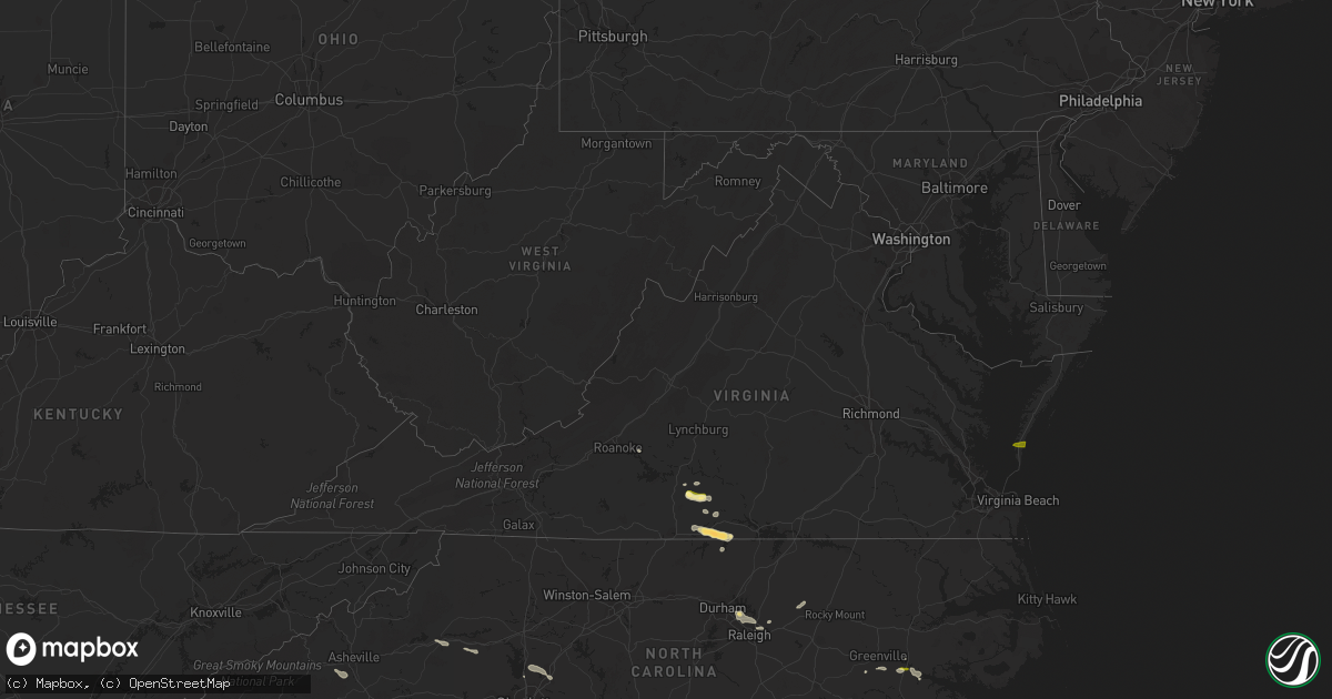
Hail Map in Virginia on July 24, 2014
Get this storm
July 24 map
$229
one time, instant access
Download today. No call, no setup
Keep the $229
Bought the map and want the full workflow? Apply the entire $229 to a subscription within 7 days. None of it is wasted.
Every map, not just this one
This buys you this map. Subscription and you get every map we run, in the markets you choose from a few cities to whole states to nationwide. Plus real-time alerts the moment a storm fires.
Contact data
Name, contact info, occupancy, even credit band for addresses in the footprint. You go from where it hit to who to call.
Become the source they trust
Unlimited branding weather history reports on demand. You already have the documented answer ready for the property owner, and you are the one who showed up with it.
Property data and RoofTrace estimates
Pull up any address you have got, its value and the exact code rules for that jurisdiction, straight from One Click Code. Then RoofTrace estimates the squares, pitch, and roof value, priced the way you price.
Storm reports in Virginia
Virginia
| Date | Description |
|---|---|
| 07/24/20146:30 PM CDT | Tree down on road |
| 07/24/20146:30 PM CDT | Trees down and one through the house...house may be destroyed |
| 07/24/20145:42 PM CDT | Wind gusts of 60 mph and very heavy rainfall |
| 07/24/20145:40 PM CDT | Trees down on 460 two different locations |
| 07/24/20145:35 PM CDT | Tree down on rt. 460 near the southampton sussex county line. |
| 07/24/20145:20 PM CDT | Tree down on rte 604 |
| 07/24/20144:33 PM CDT | Large tree limbs down on wilkerson trail at blaine road. A trampoline was blown 150 to 200 yards and wrapped around a tree. Report from facebook. Time from radar. |
| 07/24/20144:30 PM CDT | Quarter to golf ball size hail throughout alton. Time estimated by radar. |
| 07/24/20144:25 PM CDT | Trees down on power lines on south crater rd. |
| 07/24/20144:14 PM CDT | 2 trees down on rt 360. Time from radar |
| 07/24/20143:56 PM CDT | Tree down on leda road. Time from radar. |
| 07/24/20143:45 PM CDT | Large tree down...photo included |
| 07/24/20143:42 PM CDT | Several trees down around java. Time from radar. |
| 07/24/20143:25 PM CDT | Tree down on road |
| 07/24/20143:14 PM CDT | Tree down across genito road |
| 07/24/20141:44 PM CDT | One tree down on sandy level road |
| 07/24/20148:36 AM CDT | Tree down near carsville hwy and old myrtle rd |
| 07/24/20148:20 AM CDT | Tree down |
| 07/24/20148:12 AM CDT | Tree down near carsville hwy and old myrtle rd |
| 07/24/20148:10 AM CDT | Four large trees down...one on two vehicles and one on barn |
| 07/24/20148:02 AM CDT | A local report indicates 1.00 inch wind near FRANKLIN |
| 07/24/20148:00 AM CDT | Trees down near sedley |
| 07/24/20147:45 AM CDT | A local report indicates 1.00 inch wind near CHERITON |
| 07/24/20147:36 AM CDT | Several trees down near the end of old cherrystone rd. |
| 07/24/20147:35 AM CDT | Golfball size hail produced damage to homes...cars...crops and trees. |
| 07/24/20147:33 AM CDT | Overturned rv campers at and east of cherrystone campground. Trees down...large limbs snapped off. |
All States Impacted by Hail Map on July 24, 2014
Cities Impacted by Hail Map on July 24, 2014
- Olivia, MN
- Mission, SD
- Grenora, ND
- Dagmar, MT
- Fortuna, ND
- Antelope, MT
- Westby, MT
- Fairview, MT
- Lloyd, MT
- Wolf Point, MT
- Primrose, NE
- Cedar Rapids, NE
- Spalding, NE
- Albion, NE
- Lambert, MT
- Ramona, SD
- Jefferson, IA
- Grand Chenier, LA
- Cogswell, ND
- Gwinner, ND
- Stirum, ND
- Oakes, ND
- Blounts Creek, NC
- Virgilina, VA
- Tappen, ND
- Napoleon, ND
- Dawson, ND
- Wildrose, ND
- Mooresville, NC
- Davidson, NC
- Concord, NC
- Kannapolis, NC
- Roxboro, NC
- Sutherlin, VA
- Alton, VA
- South Boston, VA
- Malta, MT
- Loring, MT
- Bassett, NE
- Otter, MT
- Brockton, MT
- Harcourt, IA
- Rippey, IA
- Churdan, IA
- Ogden, IA
- Dana, IA
- Lohrville, IA
- Paton, IA
- Gowrie, IA
- Perry, IA
- Grand Junction, IA
- Buffalo, SD
- Brusett, MT
- Emmetsburg, IA
- Graettinger, IA
- Raleigh, NC
- Circle, MT
- Alzada, MT
- Cohagen, MT
- Estelline, SD
- Bryant, SD
- Lake Norden, SD
- Castlewood, SD
- Hayti, SD
- Alexander, ND
- Jackson, MN
- Alpha, MN
- Bruce, SD
- Badger, SD
- Lake Preston, SD
- Arlington, SD
- Erwin, SD
- Vienna, SD
- Henry, SD
- Hazel, SD
- Fort Dodge, IA
- Moorland, IA
- Duncombe, IA
- Webster City, IA
- Barnum, IA
- Ryder, ND
- Capitol, MT
- Camp Crook, SD
- Hay Springs, NE
- Ellsworth, NE
- Scobey, MT
- Glendive, MT
- Bloomfield, MT
- Saco, MT
- Hinsdale, MT
- Whitewater, MT
- Waseca, MN
- Owatonna, MN
- New Richland, MN
- Ellendale, MN
- Stockholm, SD
- Strandburg, SD
- Buffalo Lake, MN
- Brownton, MN
- Stewart, MN
- Springview, NE
- Hecla, SD
- Lindsay, MT
- Fort Peck, MT
- Sand Springs, MT
- Brockway, MT
- Jordan, MT
- Culbertson, MT
- Dayton, IA
- Hays, MT
- Hogeland, MT
- Harlem, MT
- Nashua, MT
- Frazer, MT
- Richland, MT
- Pipestone, MN
- Jasper, MN
- Edgerton, MN
- Wounded Knee, SD
- Batesland, SD
- Manderson, SD
- Porcupine, SD
- Webster, SD
- Bradley, SD
- Bristol, SD
- Ipswich, SD
- Madison, MN
- Medicine Lake, MT
- Homestead, MT
- Cope, CO
- Lytton, IA
- Sac City, IA
- Lake City, IA
- Rockwell City, IA
- Auburn, IA
- Greeley, NE
- Crane, MT
- Cartwright, ND
- Savage, MT
- Sidney, MT
- Lodgepole, NE
- Langford, SD
- Valentine, NE
- Ambrose, ND
- Crosby, ND
- Java, VA
- Gretna, VA
- Nathalie, VA
- Wibaux, MT
- Hartley, IA
- Sheldon, IA
- Primghar, IA
- Sanborn, IA
- Verona, ND
- Plaza, ND
- Makoti, ND
- Washington, NC
- Chocowinity, NC
- Plentywood, MT
- Columbus, NE
- Volborg, MT
- Opheim, MT
- Kenneth, MN
- Hardwick, MN
- Flandreau, SD
- Elkton, SD
- McBee, SC
- Hartsville, SC
- Eagle Butte, SD
- Prinsburg, MN
- Knoxville, IA
- Sisseton, SD
- Christmas, FL
- Bird Island, MN
- Prairie City, SD
- Martin, SD
- Timber Lake, SD
- Elbert, CO
- Elizabeth, CO
- Kiowa, CO
- Ainsworth, NE
- Epping, ND
- Williston, ND
- Mosby, MT
- Knightdale, NC
- Burwell, NE
- Taylor, NE
- Chinook, MT
- Rocksprings, TX
- Greeley, CO
- Platte Center, NE
- Browns Valley, MN
- Beardsley, MN
- Northfield, MN
- Arnegard, ND
- Watford City, ND
- Broadus, MT
- Hulett, WY
- Moorcroft, WY
- Okabena, MN
- Lakefield, MN
- Turner, MT
- Holyoke, CO
- Whitetail, MT
- Peerless, MT
- Bainville, MT
- Havana, ND
- Willow Lake, SD
- Appleton, MN
- Ashby, NE
- Faith, SD
- Dupree, SD
- Meadow, SD
- Donnybrook, ND
- Carpio, ND
- Madrid, IA
- Polk City, IA
- Clark, SD
- Westport, SD
- Zahl, ND
- Alamo, ND
- Grenville, SD
- Montrose, SD
- Madison, SD
- Hudson, SD
- Rock Hill, SC
- Casselberry, FL
- Woodward, IA
- Fredonia, ND
- Lehr, ND
- Poplar, MT
- Terry, MT
- Wilmot, SD
- Rock Valley, IA
- Isabel, SD
- Brewster, MN
- Gurley, NE
- Forman, ND
- Merriman, NE
- Hyannis, NE
- Glentana, MT
- Clear Lake, SD
- Goodwin, SD
- Raymond, SD
- Bison, SD
- Ocheyedan, IA
- Claremont, SD
- Houghton, SD
- Ellendale, ND
- Terril, IA
- Onida, SD
- Oviedo, FL
- Orlando, FL
- Nunda, SD
- Estherville, IA
- Ericson, NE
- Cerro Gordo, NC
- Fair Bluff, NC
- Oldham, SD
- Long Pine, NE
- Tioga, ND
- Clarkton, NC
- Hartford, SD
- Humboldt, SD
- Ray, ND
- Twin Brooks, SD
- De Smet, SD
- Winner, SD
- Watertown, SD
- Heron Lake, MN
- Aberdeen, SD
- Lester Prairie, MN
- Ord, NE
- Elyria, NE
- Darlington, SC
- Ross, ND
- Stanley, ND
- White Earth, ND
- New Smyrna Beach, FL
- Gettysburg, SD
- Durham, NC
- Cape Charles, VA
- Otley, IA
- Swan, IA
- Monroe, IA
- Rutland, ND
- Eden, SD
- Roslyn, SD
- Pierpont, SD
- Flaxville, MT
- Hammond, MT
- Brewster, NE
- Farnhamville, IA
- Somers, IA
- Stratford, IA
- Lehigh, IA
- Callender, IA
- Lumberton, NC
- Redstone, MT
- Reserve, MT
- Lake City, SD
- Lu Verne, IA
- Algona, IA
- Thedford, NE
- Cylinder, IA
- Tuthill, SD
- Linwood, NE
- Harvey, IA
- Pella, IA
- Andover, SD
- Fonda, IA
- Ashton, IA
- Westbrook, MN
- Storden, MN
- Colman, SD
- Revillo, SD
- Purdum, NE
- Ortley, SD
- Summit, SD
- Milliken, CO
- Johnstown, CO
- Parshall, ND
- Sparks, NE
- North Loup, NE
- Holland, MN
- Woodstock, MN
- Mud Butte, SD
- Harris, IA
- Round Lake, MN
- Labolt, SD
- Waverly, NE
- Greenwood, NE
- Ceresco, NE
- Gackle, ND
- Morganton, NC
- Valdese, NC
- Castalia, NC
- Spring Hope, NC
- Dawson, IA
- Ekalaka, MT
- Eagle Grove, IA
- Glencoe, MN
- Hutchinson, MN
- Schuyler, NE
- Ortonville, MN
- Correll, MN
- Nevada, IA
- Ames, IA
- Cambridge, IA
- Johnstown, NE
- Jolley, IA
- Pomeroy, IA
- Oskaloosa, IA
- Webb, IA
- Lake Wilson, MN
- Britton, SD
- Veblen, SD
- Glenburn, ND
- Lancaster, SC
- Iroquois, SD
- Keene, ND
- New Town, ND
- Winfred, SD
- Colton, SD
- Cody, NE
- Clinton, MN
- Ireton, IA
- Grove City, MN
- Litchfield, MN
- Hamel, MN
- Long Lake, MN
- Ayrshire, IA
- Corona, SD
- Claire City, SD
- Petersburg, NE
- Renville, MN
- Sacred Heart, MN
- Brookings, SD
- Saint Edward, NE
- Windom, MN
- Steele, ND
- Richey, MT
- Milford, IA
- Atwater, MN
- Cedar Bluffs, NE
- North Bend, NE
- Morse Bluff, NE
- Lidgerwood, ND
- Worthington, MN
- Amherst, SD
- Lafayette, MN
- Winthrop, MN
- Bouton, IA
- Grimesland, NC
- Lake Waccamaw, NC
- Hallsboro, NC
- Bolton, NC
- Bussey, IA
- Tracy, IA
- Halifax, VA
- Sioux Rapids, IA
- Comstock, NE
- Sargent, NE
- Florence, SD
- Cayuga, ND
- Conde, SD
- Big Sandy, MT
- Milan, MN
- Kulm, ND
- Edgeley, ND
- Whitman, NE
- Littleton, CO
- Huntersville, NC
- Ayden, NC
- Winterville, NC
- Fullerton, ND
- Hector, MN
- Effingham, SC
- Dundas, MN
- Lake Lillian, MN
- Canton, SD
- Worthing, SD
- Dickens, IA
- Spencer, IA
- Lisbon, ND
- Milnor, ND
- Berthold, ND
- Aurora, SD
- Danube, MN
- Hawarden, IA
- Goodview, VA
- Greenville, NC
- Boone, IA
- Fulda, MN
- Ruthven, IA
- Cannon Falls, MN
- Spirit Lake, IA
- Lennox, SD
- Vernon Hill, VA
- Lebanon, SD
- Pilot Mound, IA
- Whiteville, NC
- Council, NC
- Litchville, ND
- Marion, ND
- Dolliver, IA
- Armstrong, IA
- Marvin, SD
- Waubay, SD
- Loma, MT
- Bancroft, IA
- Fenton, IA
- Ringsted, IA
- Port Orange, FL
- Wallace, SD
- Garden City, SD
- Greenville, IA
- Candler, NC
- Arden, NC
- Fairfield, ND
- Bellingham, MN
- Raymond, MN
- Hickory, NC
- Everly, IA
- Lone Rock, IA
- Manson, IA
- Olive, MT
- York, SC
- Whittemore, IA
- Avoca, MN
- Wake Forest, NC
- Wendell, NC
- Zebulon, NC
- Chandler, MN


