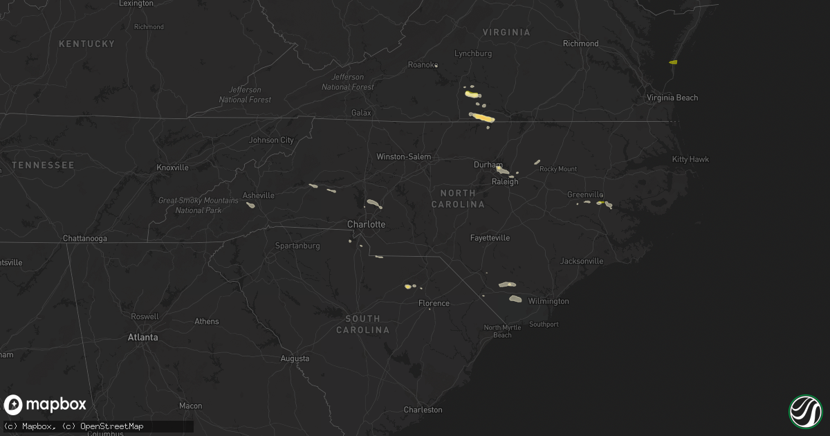
Hail Map in North Carolina on July 24, 2014
Get this storm
July 24 map
$229
one time, instant access
Download today. No call, no setup
Keep the $229
Bought the map and want the full workflow? Apply the entire $229 to a subscription within 7 days. None of it is wasted.
Every map, not just this one
This buys you this map. Subscription and you get every map we run, in the markets you choose from a few cities to whole states to nationwide. Plus real-time alerts the moment a storm fires.
Contact data
Name, contact info, occupancy, even credit band for addresses in the footprint. You go from where it hit to who to call.
Become the source they trust
Unlimited branding weather history reports on demand. You already have the documented answer ready for the property owner, and you are the one who showed up with it.
Property data and RoofTrace estimates
Pull up any address you have got, its value and the exact code rules for that jurisdiction, straight from One Click Code. Then RoofTrace estimates the squares, pitch, and roof value, priced the way you price.
Storm reports in North Carolina
North Carolina
| Date | Description |
|---|---|
| 07/24/20146:55 PM CDT | One tree was reported down on beeson farm road in the sophia community. |
| 07/24/20146:30 PM CDT | Very large tree limb down blocking lizard lick road. Fire department had to cut it up to clear the road. |
| 07/24/20146:28 PM CDT | Tree down and local power outages on marshburn road. |
| 07/24/20146:28 PM CDT | Tree blown down along massengale road. Time estimated. |
| 07/24/20146:28 PM CDT | One tree was reported down along ward road near nick coley road. |
| 07/24/20146:20 PM CDT | Multiple trees down |
| 07/24/20146:15 PM CDT | Tree down on a powerline in the salem area |
| 07/24/20146:10 PM CDT | Tree down along burkemont ave |
| 07/24/20145:40 PM CDT | Large limb blown down near dunhill terrace. Time estimated. |
| 07/24/20145:40 PM CDT | Tree down |
| 07/24/20145:20 PM CDT | Quarter size hail reported on rierson road |
| 07/24/20145:18 PM CDT | Tree fell on a house on due west st. |
| 07/24/20145:18 PM CDT | Tree down across road |
| 07/24/20145:10 PM CDT | Powerlines down. |
| 07/24/20145:00 PM CDT | Trees and power lines down on blackburn ridge rd in the blackburn area. |
| 07/24/20144:45 PM CDT | Tree down on front street |
| 07/24/20144:44 PM CDT | Trees and powerlines down...one tree on a vehicle. West union st and burkemont ave |
| 07/24/20144:30 PM CDT | Roof removed from a mobile home... Extensive damage to trees and power lines |
| 07/24/20144:10 PM CDT | Quarter size hail along summers rd near drexel. Time estimated from radar. |
| 07/24/201410:56 AM CDT | A local report indicates 1.00 inch wind near CHOCOWINITY |
| 07/23/20147:15 PM CDT | Tree down on route 122 south of hobgood |
All States Impacted by Hail Map on July 24, 2014
Cities Impacted by Hail Map on July 24, 2014
- Olivia, MN
- Mission, SD
- Grenora, ND
- Dagmar, MT
- Fortuna, ND
- Antelope, MT
- Westby, MT
- Fairview, MT
- Lloyd, MT
- Wolf Point, MT
- Primrose, NE
- Cedar Rapids, NE
- Spalding, NE
- Albion, NE
- Lambert, MT
- Ramona, SD
- Jefferson, IA
- Grand Chenier, LA
- Cogswell, ND
- Gwinner, ND
- Stirum, ND
- Oakes, ND
- Blounts Creek, NC
- Virgilina, VA
- Tappen, ND
- Napoleon, ND
- Dawson, ND
- Wildrose, ND
- Mooresville, NC
- Davidson, NC
- Concord, NC
- Kannapolis, NC
- Roxboro, NC
- Sutherlin, VA
- Alton, VA
- South Boston, VA
- Malta, MT
- Loring, MT
- Bassett, NE
- Otter, MT
- Brockton, MT
- Harcourt, IA
- Rippey, IA
- Churdan, IA
- Ogden, IA
- Dana, IA
- Lohrville, IA
- Paton, IA
- Gowrie, IA
- Perry, IA
- Grand Junction, IA
- Buffalo, SD
- Brusett, MT
- Emmetsburg, IA
- Graettinger, IA
- Raleigh, NC
- Circle, MT
- Alzada, MT
- Cohagen, MT
- Estelline, SD
- Bryant, SD
- Lake Norden, SD
- Castlewood, SD
- Hayti, SD
- Alexander, ND
- Jackson, MN
- Alpha, MN
- Bruce, SD
- Badger, SD
- Lake Preston, SD
- Arlington, SD
- Erwin, SD
- Vienna, SD
- Henry, SD
- Hazel, SD
- Fort Dodge, IA
- Moorland, IA
- Duncombe, IA
- Webster City, IA
- Barnum, IA
- Ryder, ND
- Capitol, MT
- Camp Crook, SD
- Hay Springs, NE
- Ellsworth, NE
- Scobey, MT
- Glendive, MT
- Bloomfield, MT
- Saco, MT
- Hinsdale, MT
- Whitewater, MT
- Waseca, MN
- Owatonna, MN
- New Richland, MN
- Ellendale, MN
- Stockholm, SD
- Strandburg, SD
- Buffalo Lake, MN
- Brownton, MN
- Stewart, MN
- Springview, NE
- Hecla, SD
- Lindsay, MT
- Fort Peck, MT
- Sand Springs, MT
- Brockway, MT
- Jordan, MT
- Culbertson, MT
- Dayton, IA
- Hays, MT
- Hogeland, MT
- Harlem, MT
- Nashua, MT
- Frazer, MT
- Richland, MT
- Pipestone, MN
- Jasper, MN
- Edgerton, MN
- Wounded Knee, SD
- Batesland, SD
- Manderson, SD
- Porcupine, SD
- Webster, SD
- Bradley, SD
- Bristol, SD
- Ipswich, SD
- Madison, MN
- Medicine Lake, MT
- Homestead, MT
- Cope, CO
- Lytton, IA
- Sac City, IA
- Lake City, IA
- Rockwell City, IA
- Auburn, IA
- Greeley, NE
- Crane, MT
- Cartwright, ND
- Savage, MT
- Sidney, MT
- Lodgepole, NE
- Langford, SD
- Valentine, NE
- Ambrose, ND
- Crosby, ND
- Java, VA
- Gretna, VA
- Nathalie, VA
- Wibaux, MT
- Hartley, IA
- Sheldon, IA
- Primghar, IA
- Sanborn, IA
- Verona, ND
- Plaza, ND
- Makoti, ND
- Washington, NC
- Chocowinity, NC
- Plentywood, MT
- Columbus, NE
- Volborg, MT
- Opheim, MT
- Kenneth, MN
- Hardwick, MN
- Flandreau, SD
- Elkton, SD
- McBee, SC
- Hartsville, SC
- Eagle Butte, SD
- Prinsburg, MN
- Knoxville, IA
- Sisseton, SD
- Christmas, FL
- Bird Island, MN
- Prairie City, SD
- Martin, SD
- Timber Lake, SD
- Elbert, CO
- Elizabeth, CO
- Kiowa, CO
- Ainsworth, NE
- Epping, ND
- Williston, ND
- Mosby, MT
- Knightdale, NC
- Burwell, NE
- Taylor, NE
- Chinook, MT
- Rocksprings, TX
- Greeley, CO
- Platte Center, NE
- Browns Valley, MN
- Beardsley, MN
- Northfield, MN
- Arnegard, ND
- Watford City, ND
- Broadus, MT
- Hulett, WY
- Moorcroft, WY
- Okabena, MN
- Lakefield, MN
- Turner, MT
- Holyoke, CO
- Whitetail, MT
- Peerless, MT
- Bainville, MT
- Havana, ND
- Willow Lake, SD
- Appleton, MN
- Ashby, NE
- Faith, SD
- Dupree, SD
- Meadow, SD
- Donnybrook, ND
- Carpio, ND
- Madrid, IA
- Polk City, IA
- Clark, SD
- Westport, SD
- Zahl, ND
- Alamo, ND
- Grenville, SD
- Montrose, SD
- Madison, SD
- Hudson, SD
- Rock Hill, SC
- Casselberry, FL
- Woodward, IA
- Fredonia, ND
- Lehr, ND
- Poplar, MT
- Terry, MT
- Wilmot, SD
- Rock Valley, IA
- Isabel, SD
- Brewster, MN
- Gurley, NE
- Forman, ND
- Merriman, NE
- Hyannis, NE
- Glentana, MT
- Clear Lake, SD
- Goodwin, SD
- Raymond, SD
- Bison, SD
- Ocheyedan, IA
- Claremont, SD
- Houghton, SD
- Ellendale, ND
- Terril, IA
- Onida, SD
- Oviedo, FL
- Orlando, FL
- Nunda, SD
- Estherville, IA
- Ericson, NE
- Cerro Gordo, NC
- Fair Bluff, NC
- Oldham, SD
- Long Pine, NE
- Tioga, ND
- Clarkton, NC
- Hartford, SD
- Humboldt, SD
- Ray, ND
- Twin Brooks, SD
- De Smet, SD
- Winner, SD
- Watertown, SD
- Heron Lake, MN
- Aberdeen, SD
- Lester Prairie, MN
- Ord, NE
- Elyria, NE
- Darlington, SC
- Ross, ND
- Stanley, ND
- White Earth, ND
- New Smyrna Beach, FL
- Gettysburg, SD
- Durham, NC
- Cape Charles, VA
- Otley, IA
- Swan, IA
- Monroe, IA
- Rutland, ND
- Eden, SD
- Roslyn, SD
- Pierpont, SD
- Flaxville, MT
- Hammond, MT
- Brewster, NE
- Farnhamville, IA
- Somers, IA
- Stratford, IA
- Lehigh, IA
- Callender, IA
- Lumberton, NC
- Redstone, MT
- Reserve, MT
- Lake City, SD
- Lu Verne, IA
- Algona, IA
- Thedford, NE
- Cylinder, IA
- Tuthill, SD
- Linwood, NE
- Harvey, IA
- Pella, IA
- Andover, SD
- Fonda, IA
- Ashton, IA
- Westbrook, MN
- Storden, MN
- Colman, SD
- Revillo, SD
- Purdum, NE
- Ortley, SD
- Summit, SD
- Milliken, CO
- Johnstown, CO
- Parshall, ND
- Sparks, NE
- North Loup, NE
- Holland, MN
- Woodstock, MN
- Mud Butte, SD
- Harris, IA
- Round Lake, MN
- Labolt, SD
- Waverly, NE
- Greenwood, NE
- Ceresco, NE
- Gackle, ND
- Morganton, NC
- Valdese, NC
- Castalia, NC
- Spring Hope, NC
- Dawson, IA
- Ekalaka, MT
- Eagle Grove, IA
- Glencoe, MN
- Hutchinson, MN
- Schuyler, NE
- Ortonville, MN
- Correll, MN
- Nevada, IA
- Ames, IA
- Cambridge, IA
- Johnstown, NE
- Jolley, IA
- Pomeroy, IA
- Oskaloosa, IA
- Webb, IA
- Lake Wilson, MN
- Britton, SD
- Veblen, SD
- Glenburn, ND
- Lancaster, SC
- Iroquois, SD
- Keene, ND
- New Town, ND
- Winfred, SD
- Colton, SD
- Cody, NE
- Clinton, MN
- Ireton, IA
- Grove City, MN
- Litchfield, MN
- Hamel, MN
- Long Lake, MN
- Ayrshire, IA
- Corona, SD
- Claire City, SD
- Petersburg, NE
- Renville, MN
- Sacred Heart, MN
- Brookings, SD
- Saint Edward, NE
- Windom, MN
- Steele, ND
- Richey, MT
- Milford, IA
- Atwater, MN
- Cedar Bluffs, NE
- North Bend, NE
- Morse Bluff, NE
- Lidgerwood, ND
- Worthington, MN
- Amherst, SD
- Lafayette, MN
- Winthrop, MN
- Bouton, IA
- Grimesland, NC
- Lake Waccamaw, NC
- Hallsboro, NC
- Bolton, NC
- Bussey, IA
- Tracy, IA
- Halifax, VA
- Sioux Rapids, IA
- Comstock, NE
- Sargent, NE
- Florence, SD
- Cayuga, ND
- Conde, SD
- Big Sandy, MT
- Milan, MN
- Kulm, ND
- Edgeley, ND
- Whitman, NE
- Littleton, CO
- Huntersville, NC
- Ayden, NC
- Winterville, NC
- Fullerton, ND
- Hector, MN
- Effingham, SC
- Dundas, MN
- Lake Lillian, MN
- Canton, SD
- Worthing, SD
- Dickens, IA
- Spencer, IA
- Lisbon, ND
- Milnor, ND
- Berthold, ND
- Aurora, SD
- Danube, MN
- Hawarden, IA
- Goodview, VA
- Greenville, NC
- Boone, IA
- Fulda, MN
- Ruthven, IA
- Cannon Falls, MN
- Spirit Lake, IA
- Lennox, SD
- Vernon Hill, VA
- Lebanon, SD
- Pilot Mound, IA
- Whiteville, NC
- Council, NC
- Litchville, ND
- Marion, ND
- Dolliver, IA
- Armstrong, IA
- Marvin, SD
- Waubay, SD
- Loma, MT
- Bancroft, IA
- Fenton, IA
- Ringsted, IA
- Port Orange, FL
- Wallace, SD
- Garden City, SD
- Greenville, IA
- Candler, NC
- Arden, NC
- Fairfield, ND
- Bellingham, MN
- Raymond, MN
- Hickory, NC
- Everly, IA
- Lone Rock, IA
- Manson, IA
- Olive, MT
- York, SC
- Whittemore, IA
- Avoca, MN
- Wake Forest, NC
- Wendell, NC
- Zebulon, NC
- Chandler, MN


