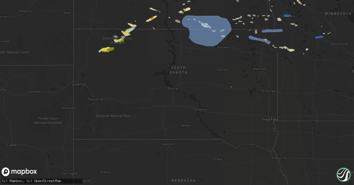
Hail Map in South Dakota on July 23, 2021
Get this storm
July 23 map
$229
one time, instant access
Download today. No call, no setup
Keep the $229
Bought the map and want the full workflow? Apply the entire $229 to a subscription within 7 days. None of it is wasted.
Every map, not just this one
This buys you this map. Subscription and you get every map we run, in the markets you choose from a few cities to whole states to nationwide. Plus real-time alerts the moment a storm fires.
Contact data
Name, contact info, occupancy, even credit band for addresses in the footprint. You go from where it hit to who to call.
Become the source they trust
Unlimited branding weather history reports on demand. You already have the documented answer ready for the property owner, and you are the one who showed up with it.
Property data and RoofTrace estimates
Pull up any address you have got, its value and the exact code rules for that jurisdiction, straight from One Click Code. Then RoofTrace estimates the squares, pitch, and roof value, priced the way you price.
Storm reports in South Dakota
South Dakota
| Date | Description |
|---|---|
| 07/23/20216:32 PM CDT | Wind gust estimated at 40 mph |
| 07/23/20216:13 AM CDT | At 1113 PM CDT, a severe thunderstorm was located over Lake Traverse Housing Units, or 9 miles east of Sisseton, moving east at 20 mph. HAZARD...60 mph wind gusts and penny size hail. SOURCE...Radar indicated. IMPACT...Expect damage to roofs, siding, and trees. This severe thunderstorm will be near... Traverse Country Park around 1120 PM CDT. Rainbow Island around 1125 PM CDT. Halls Landing around 1130 PM CDT.Other locations in the path of this severe thunderstorm includeBeardsley, Lake Traverse, Siloah Country Church and Barry. |
| 07/23/20215:54 AM CDT | At 1053 PM CDT, severe thunderstorms were located along a line extending from near Hoven to near Whitlocks Bay Rec Area, moving southeast at 55 mph. HAZARD...60 mph wind gusts and penny size hail. SOURCE...Radar indicated. IMPACT...Expect damage to roofs, siding, and trees. Severe thunderstorms will be near... Hoven around 1100 PM CDT. Gettysburg, Tolstoy and Gorman around 1105 PM CDT. Onaka around 1110 PM CDT.Other locations in the path of these severe thunderstorms includeSeneca, Brentwood Colony, Burkmere, Stone Lake and Faulkton. |
| 07/23/20215:42 AM CDT | At 1042 PM CDT, a severe thunderstorm was located over Buffalo Lakes, or 11 miles west of Sisseton, moving east at 25 mph. HAZARD...60 mph wind gusts and penny size hail. SOURCE...Radar indicated. IMPACT...Expect damage to roofs, siding, and trees. This severe thunderstorm will be near... Long Hollow Housing around 1055 PM CDT.Other locations in the path of this severe thunderstorm includeSisseton, Agency Village, Dakota Connection & Casino and FinleyHeights Housing. |
| 07/23/20215:29 AM CDT | At 1029 PM CDT, severe thunderstorms were located along a line extending from near Leola to near Plainview Colony to near Hosmer, moving east at 45 mph. HAZARD...60 mph wind gusts and penny size hail. SOURCE...Trained weather spotters. IMPACT...Expect damage to roofs, siding, and trees. Severe thunderstorms will be near... Leola, Deerfield Colony and Plainview Colony around 1035 PM CDT. Long Lake Colony and Grassland Colony around 1040 PM CDT. Wetonka around 1045 PM CDT.Other locations in the path of these severe thunderstorms includeMina Lake Rec Area, Westport, Richmond Lake Rec Area, Ipswich,Aberdeen, Columbia, Cravens Corner, Pembrook Colony, Bath, Putney,Mina and Tacoma Park. |
| 07/23/20214:30 AM CDT | At 930 PM CDT, severe thunderstorms were located along a line extending from 11 miles southwest of Napoleon to near Hague, moving east at 45 mph. HAZARD...60 mph wind gusts and quarter size hail. SOURCE...Radar indicated. IMPACT...Hail damage to vehicles is expected. Expect wind damage to roofs, siding, and trees. Locations impacted include... Venturia, Lehr and Ashley. |
| 07/23/20214:25 AM CDT | At 924 PM CDT, severe thunderstorms extended from 9 miles west of Norden to 13 miles southeast of Valentine, moving east at 30 mph. HAZARD...60 mph wind gusts and quarter size hail. SOURCE...Radar indicated. IMPACT...Hail damage to vehicles is expected. Expect wind damage to roofs, siding, and trees. Locations impacted include... Norden, Meadville, North River Trail, Sparks, Smith Falls State Park and Bobcat State Wildlife Management Area.This includes the following highways... Highway 183 between mile markers 129 and 225. Highway 12 between mile markers 16 and 48. |
| 07/23/20214:15 AM CDT | At 914 PM CDT, a severe thunderstorm was located near Lake Thompson State Recreation Area, moving east at 40 mph. HAZARD...60 mph wind gusts. SOURCE...Radar indicated. IMPACT...Expect damage to roofs, siding, and trees. This severe thunderstorm will be near... Lake Thompson State Recreation Area around 920 PM CDT. Lake Preston around 930 PM CDT. Hetland around 940 PM CDT. |
| 07/23/20214:11 AM CDT | At 910 PM CDT, a severe thunderstorm was located over Mount Vernon, or 10 miles west of Mitchell, moving east at 25 mph. HAZARD...60 mph wind gusts. SOURCE...Radar indicated. IMPACT...Expect damage to roofs, siding, and trees. This severe thunderstorm will be near... Loomis around 930 PM CDT. Mitchell around 935 PM CDT. |
| 07/23/20214:06 AM CDT | At 906 PM CDT, a severe thunderstorm was located 7 miles northeast of Iroquois, or 15 miles northwest of Lake Thompson State Recreation Area, moving east at 25 mph. HAZARD...60 mph wind gusts. SOURCE...Radar indicated. IMPACT...Expect damage to roofs, siding, and trees. This severe thunderstorm will be near... De Smet around 925 PM CDT.Other locations impacted by this severe thunderstorm include Bancroftand Erwin. |
| 07/23/20212:14 AM CDT | At 713 PM MDT, a severe thunderstorm was located 8 miles south of Thunder Hawk, or 13 miles southeast of Lemmon, moving east at 30 mph. HAZARD...60 mph wind gusts and quarter size hail. SOURCE...Radar indicated. IMPACT...Hail damage to vehicles is expected. Expect wind damage to roofs, siding, and trees. This severe thunderstorm will be near... Keldron around 725 PM MDT.Other locations in the path of this severe thunderstorm includeMorristown and Watauga. |
| 07/23/20211:23 AM CDT | At 623 PM MDT, a severe thunderstorm was located 7 miles south of Shadehill Reservoir, or 21 miles south of Lemmon, moving east at 20 mph. HAZARD...60 mph wind gusts and quarter size hail. SOURCE...Radar indicated. IMPACT...Hail damage to vehicles is expected. Expect wind damage to roofs, siding, and trees. Locations impacted include... Meadow and Shadehill Reservoir. |
| 07/23/202112:59 AM CDT | Mesonet station mrls2 hillhead 3 wsw. |
| 07/23/202112:29 AM CDT | Mesonet station 58 victor |
| 07/23/202112:25 AM CDT | At 524 PM MDT, a severe thunderstorm was located 3 miles south of Sorum, or 32 miles southeast of Buffalo, moving east at 15 mph. HAZARD...Ping pong ball size hail and 60 mph wind gusts. SOURCE...Radar indicated. IMPACT...People and animals outdoors will be injured. Expect hail damage to roofs, siding, windows, and vehicles. Expect wind damage to roofs, siding, and trees. Locations impacted include... Sorum, Date, Prairie City and southeastern Slim Buttes. |
| 07/23/202112:25 AM CDT | Apple tree knocked over. Relayed through social media. Time estimated. |
| 07/23/202112:24 AM CDT | Monson creek weather station. |
| 07/23/202112:14 AM CDT | A local report indicates 61 MPH wind near LAKE CITY |
| 07/23/202112:00 AM CDT | Several large branches down in roy lake. Relayed through social media. Time estimated. |
| 07/22/202111:44 PM CDT | Glacial farms weather station. |
| 07/22/202111:41 PM CDT | Branches broken... At least one tree toppled. Time estimated. |
| 07/22/202111:24 PM CDT | Minor damage but a few limbs up to 5 inches diameter broken. |
| 07/22/202111:06 PM CDT | Several large tree branches down and large flag pole tipped over. Via social media. Time estimated from radar. |
| 07/22/202110:28 PM CDT | A local report indicates 69 MPH wind near LAKE CITY |
| 07/22/202110:14 PM CDT | A local report indicates 63 MPH wind near 1 ESE EUREKA |
| 07/22/202110:01 PM CDT | Radar estimated time. |
| 07/22/202110:00 PM CDT | Roof peeled off out building. |
| 07/22/20219:16 PM CDT | Mesonet station 205 mclaughlin |
| 07/22/20218:25 PM CDT | A local report indicates 1.00 inch wind near 8 ESE LEMMON |
| 07/22/20218:25 PM CDT | A local report indicates 60 MPH wind near 8 ESE LEMMON |
| 07/22/20218:20 PM CDT | A local report indicates 60 MPH wind near 6 E LEMMON |
| 07/22/20218:20 PM CDT | A local report indicates 1.00 inch wind near 7 E LEMMON |
| 07/22/20217:30 PM CDT | Mostly pea to dime size... A few pieces the size of a quarter. |
All States Impacted by Hail Map on July 23, 2021
Cities Impacted by Hail Map on July 23, 2021
- Saint Johns, AZ
- Meadowlands, MN
- Floodwood, MN
- Napoleon, ND
- Stirum, ND
- Gwinner, ND
- Oakes, ND
- Socorro, NM
- Dawson, ND
- Shields, ND
- Selfridge, ND
- Solen, ND
- Madison, NH
- Silver Lake, NH
- Freedom, NH
- Cook, MN
- Pie Town, NM
- Willard, NM
- Elk River, MN
- Saint Francis, MN
- Danvers, MA
- Barnum, MN
- Holyoke, MN
- Kerrick, MN
- Orr, MN
- Tower, MN
- Mooreton, ND
- Barney, ND
- Lake Wales, FL
- Prairie City, SD
- New Leipzig, ND
- Sisseton, SD
- Moriarty, NM
- Wood Lake, NE
- Remer, MN
- Reva, SD
- Hankinson, ND
- Mantador, ND
- Tierra Amarilla, NM
- Contoocook, NH
- Harris, MN
- North Branch, MN
- Immokalee, FL
- Farmington, NM
- Solway, MN
- Bemidji, MN
- Northome, MN
- Blackduck, MN
- Kelliher, MN
- Fredonia, ND
- Mayo, FL
- Day, FL
- Wishek, ND
- Park Falls, WI
- West Bridgewater, MA
- East Bridgewater, MA
- Flasher, ND
- Squaw Lake, MN
- Mizpah, MN
- Leesburg, GA
- Smithville, GA
- Plympton, MA
- Kingston, MA
- Halifax, MA
- Ashley, ND
- Ogema, MN
- Hazelhurst, WI
- Clinton, MN
- Ortonville, MN
- Perham, MN
- Hugo, MN
- Somerset, WI
- Marine On Saint Croix, MN
- Stillwater, MN
- Magdalena, NM
- Clewiston, FL
- Detroit Lakes, MN
- Frazee, MN
- Audubon, MN
- Lake Park, MN
- Pelican Rapids, MN
- Show Low, AZ
- Littlefork, MN
- Jemez Springs, NM
- Groveland, MA
- Georgetown, MA
- Boxford, MA
- Ely, MN
- Callaway, MN
- Keldron, SD
- Lemmon, SD
- Ponemah, MN
- Bison, SD
- Wahpeton, ND
- Moffat, CO
- Stanchfield, MN
- Central, SC
- Clemson, SC
- El Rito, NM
- Beardsley, MN
- Graceville, MN
- Corrales, NM
- Nashwauk, MN
- Britton, SD
- Kintyre, ND
- Atlanta, GA
- Prescott, AZ
- Prescott Valley, AZ
- Veblen, SD
- Claire City, SD
- Winslow, AZ
- Barnesville, GA
- Milnor, ND
- Alpharetta, GA
- Claremont, SD
- Amherst, SD
- Balmorhea, TX
- West Newbury, MA
- Merrimac, MA
- Haverhill, MA
- Isanti, MN
- Cambridge, MN
- Cogswell, ND
- Park Rapids, MN
- Max, MN
- Kent, MN
- Rib Lake, WI
- Crane Lake, MN
- Rochert, MN
- Meadow, SD
- Luck, WI
- Cushing, WI
- Moorhead, MN
- Long Prairie, MN
- Lehr, ND
- Datil, NM
- Ashby, MN
- Appleton, MN
- Holloway, MN
- Hancock, MN
- International Falls, MN
- New York Mills, MN
- Vergas, MN
- Dent, MN
- Linton, ND
- East Kingston, NH
- Effingham, NH
- Ossipee, NH
- Bethel, MN
- Cedar, MN
- Leola, SD
- New Smyrna Beach, FL
- Gallup, NM
- Ash Fork, AZ
- Williams, AZ
- Akeley, MN
- Thief River Falls, MN
- Burtrum, MN
- Grey Eagle, MN
- Corona, NM
- Barnard, SD
- Kathryn, ND
- Lisbon, ND
- Jacksonville, FL
- Middleburg, FL
- Morris, MN
- Chokio, MN
- Benson, MN
- Glenwood, MN
- Murdock, MN
- Hettinger, ND
- Nevis, MN
- Wyndmere, ND
- Baileyville, ME
- Ganado, AZ
- Chino Valley, AZ
- Encino, NM
- Mcgregor, MN
- Forman, ND
- Arthur, NE
- Huron, SD
- Evansville, MN
- Summerdale, AL
- Brockton, MA
- Fence Lake, NM
- Frederick, SD
- Elbow Lake, MN
- Bunnell, FL
- Danvers, MN
- Hanson, MA
- Sargents, CO
- Cayuga, ND
- Rutland, ND
- Kingston, NH
- Newton, NH
- Bowlus, MN
- Little Falls, MN
- Wolverton, MN
- Andover, MN
- Foxhome, MN
- Campbell, MN
- Breckenridge, MN
- Danbury, WI
- Green Cove Springs, FL
- Tappen, ND
- Dry Branch, GA
- Bonaire, GA
- Warner Robins, GA
- Forbes, ND
- Rio Rancho, NM
- Grand Rapids, MN
- Inglis, FL
- Capitan, NM
- Gray, ME
- Windham, ME
- Delray Beach, FL
- Boynton Beach, FL
- Pelican Lake, WI
- Elcho, WI
- Kettle River, MN
- Moose Lake, MN
- Scandia, MN
- Swanville, MN
- Upsala, MN
- Strasburg, ND
- Isabella, MN
- Mountainair, NM
- Meredith, NH
- Moultonborough, NH
- Center Harbor, NH
- Amesbury, MA
- Exeter, NH
- Byfield, MA
- Concord, NH
- Aberdeen, SD
- Roscoe, SD
- Hosmer, SD
- Westport, SD
- Kulm, ND
- Long Lake, SD
- Columbia, SD
- Eureka, SD
- Hecla, SD
- Zeeland, ND
- Ipswich, SD
- Fullerton, ND
- Hague, ND
- Ellendale, ND
- Edgeley, ND
- Lake City, SD
- Peever, SD
- Browns Valley, MN
- New Effington, SD
- Norcross, MN
- Rosholt, SD
- Wheaton, MN
- Fergus Falls, MN
- Brookston, MN
- Saginaw, MN
- Alborn, MN
- Duluth, MN
- Superior, WI
- Cloquet, MN
- Sauk Centre, MN
- Melrose, MN


