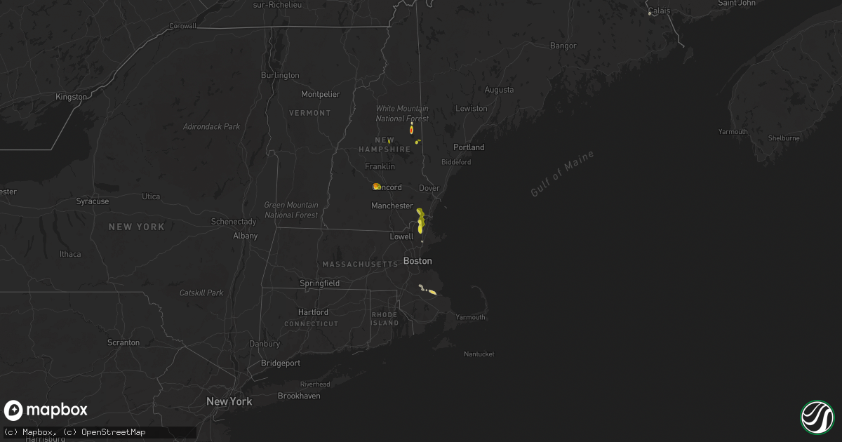
Hail Map on July 23, 2021
Get this storm
July 23 map
$229
one time, instant access
Download today. No call, no setup
Keep the $229
Bought the map and want the full workflow? Apply the entire $229 to a subscription within 7 days. None of it is wasted.
Every map, not just this one
This buys you this map. Subscription and you get every map we run, in the markets you choose from a few cities to whole states to nationwide. Plus real-time alerts the moment a storm fires.
Contact data
Name, contact info, occupancy, even credit band for addresses in the footprint. You go from where it hit to who to call.
Become the source they trust
Unlimited branding weather history reports on demand. You already have the documented answer ready for the property owner, and you are the one who showed up with it.
Property data and RoofTrace estimates
Pull up any address you have got, its value and the exact code rules for that jurisdiction, straight from One Click Code. Then RoofTrace estimates the squares, pitch, and roof value, priced the way you price.
States Impacted by Hail Map on July 23, 2021
Storm reports
South Carolina
| Date | Description |
|---|---|
| 07/23/20215:35 PM CDT | Public reported |
| 07/23/20211:32 AM CDT | At 631 PM EDT, a severe thunderstorm was located over Clemson, moving south at 15 mph. HAZARD...60 mph wind gusts and quarter size hail. SOURCE...Radar indicated. IMPACT...Minor hail damage to vehicles is expected. Expect wind damage to trees and power lines. Locations impacted include... Clemson, Central, Northlake, Pendleton, Norris, Townville, Sandy Springs, Anderson and Lake Hartwell. |
New Mexico
| Date | Description |
|---|---|
| 07/23/20214:30 PM CDT | Large tree limb downed at fruit ave and luna blvd |
| 07/23/202112:33 AM CDT | At 533 PM MDT, a severe thunderstorm was located 5 miles north of Cuchillo, moving northeast at 5 mph. HAZARD...60 mph wind gusts and nickel size hail. SOURCE...Radar indicated. IMPACT...Expect damage to roofs, siding, and trees. Locations impacted include... Monticello, Cuchillo, North Monticello Point, Alamosa Canyon, Las Placitas, Lakeshore Highlands, Elephant Butte Lake and South Monticello Campground.This includes Interstate 25 in New Mexico between mile markers 81 and96. |
| 07/22/202110:56 PM CDT | At 356 PM MDT, a severe thunderstorm was located 10 miles west of La Joya, or 23 miles southwest of Belen, and is nearly stationary. HAZARD...60 mph wind gusts and half dollar size hail. SOURCE...Radar indicated. IMPACT...Hail damage to vehicles is expected. Expect wind damage to roofs, siding, and trees. This severe thunderstorm will remain over mainly rural areas of north central Socorro County. |
| 07/22/202110:26 PM CDT | At 326 PM MDT, a severe thunderstorm was located over Fairacres, moving east at 15 mph. HAZARD...60 mph wind gusts and quarter size hail. SOURCE...Radar indicated. IMPACT...Hail damage to vehicles is expected. Expect wind damage to roofs, siding, and trees. Locations impacted include... Las Cruces, Dona Ana, Mesilla, Fairacres, Picacho, Northeast Las Cruces and Mesilla Valley Bosque State Park.This includes the following highways... Interstate 10 in New Mexico between mile markers 130 and 141. Interstate 25 in New Mexico near mile marker 1, and between milemarkers 3 and 11. Highway 70 in New Mexico between mile markers 150 and 152. |
| 07/22/202110:15 PM CDT | At 314 PM MDT, a severe thunderstorm was located 7 miles south of Willard, or 18 miles south of Estancia, moving west at 25 mph. HAZARD...60 mph wind gusts and half dollar size hail. SOURCE...Radar indicated. IMPACT...Hail damage to vehicles is expected. Expect wind damage to roofs, siding, and trees. Locations impacted include... Mountainair, Willard, Torreon, Manzano Mountain State Park, Manzano and Abo.This includes Highway 60 between Mile Markers 177 and 226. |
| 07/22/202110:08 PM CDT | At 308 PM MDT, a severe thunderstorm was located 12 miles west of Nutt, moving northwest at 5 mph. HAZARD...60 mph wind gusts and quarter size hail. SOURCE...Radar indicated. IMPACT...Hail damage to vehicles is expected. Expect wind damage to roofs, siding, and trees. Locations impacted include... Cookes Peak. |
| 07/22/20219:27 PM CDT | At 227 PM MDT, a severe thunderstorm was located near Cedarvale, or 13 miles northwest of Corona, moving west at 25 mph. HAZARD...60 mph wind gusts and quarter size hail. SOURCE...Radar indicated. IMPACT...Hail damage to vehicles is expected. Expect wind damage to roofs, siding, and trees. Locations impacted include... Estancia, Willard, Corona and Cedarvale. This includes Highway 60 between Mile Markers 216 and 234. |
| 07/22/20218:45 PM CDT | At 145 PM MDT, a severe thunderstorm was located near Fenton Lake State Park, or 16 miles southeast of Cuba, moving northwest at 10 mph. HAZARD...60 mph wind gusts and half dollar size hail. SOURCE...Radar indicated. IMPACT...Hail damage to vehicles is expected. Expect wind damage to roofs, siding, and trees. Locations impacted include... Fenton Lake State Park. |
| 07/22/20218:41 PM CDT | At 140 PM MDT, a severe thunderstorm was located 12 miles northeast of Corona, moving northwest at 25 mph. HAZARD...60 mph wind gusts and half dollar size hail. SOURCE...Radar indicated. IMPACT...Hail damage to vehicles is expected. Expect wind damage to roofs, siding, and trees. Locations impacted include... Corona, Cedarvale and Duran. This includes Highway 60 between Mile Markers 242 and 243. |
| 07/22/20218:14 PM CDT | At 114 PM MDT, a severe thunderstorm was located 15 miles east of Corona, moving southwest at 10 mph. HAZARD...60 mph wind gusts and half dollar size hail. SOURCE...Radar indicated. IMPACT...Hail damage to vehicles is expected. Expect wind damage to roofs, siding, and trees. This severe thunderstorm will remain over mainly rural areas of north central Lincoln and southeastern Torrance Counties. |
Arizona
| Date | Description |
|---|---|
| 07/23/20217:46 AM CDT | At 1245 AM MST, an area of severe thunderstorms with torrential rainfall was located near Silver Bell and Avra Valley, moving west at 15 mph. HAZARD...60 mph wind gusts and torrential rainfall leading to flash flooding. SOURCE...Radar indicated. IMPACT...Expect damage to roofs, siding, and trees. Locations impacted include... Avra Valley, Picture Rocks, Queens Well and Silver Bell. |
| 07/23/20214:52 AM CDT | At 949 PM MST, severe thunderstorms were located along a line extending from 7 miles east of South Cove to near Diamond Creek Campground, moving southwest at 15 mph. HAZARD...60 mph wind gusts. SOURCE...Radar indicated. IMPACT...Expect damage to roofs and trees and possible blowing dust due to high winds. Locations impacted include... Pierce Ferry And Antares Roads, Grand Canyon Ranch, Meadview, Lake Mead National Recreation Area and Peach Springs. |
| 07/23/20212:58 AM CDT | At 756 PM PDT/756 PM MST/, severe thunderstorms were located along a line extending from 7 miles west of Valley Of Fire to 15 miles north of South Cove, moving southwest at 25 mph. HAZARD...40-50 mph wind gusts. SOURCE...Radar indicated. IMPACT...Strong winds resulting in very dangerous boating conditions on the lake and near marinas. Locations impacted include... Las Vegas Bay, Lake Las Vegas, Overton, Echo Bay, Las Vegas Bay Campground, Echo Bay Campground, Callville Bay, Meadview, Valley Of Fire, Callville Bay Campground, Lake Mead National Recreation Area, Temple Bar Campground, Overton Beach, South Cove and Temple Bar. |
| 07/23/20212:11 AM CDT | At 707 PM PDT/707 PM MST/, strong outflow from thunderstorms was located along a line extending from near Logandale to 23 miles southeast of Bunkerville, moving south at 40 mph. HAZARD...40-50 mph wind gusts over Lake Mead NRA. SOURCE...Radar and observations. IMPACT...Strong winds resulting in very dangerous boating conditions on the lake and near marinas. Locations impacted include... Las Vegas Bay, Lake Las Vegas, Overton, Moapa Valley, Echo Bay, Las Vegas Bay Campground, Echo Bay Campground, Callville Bay, Meadview, Valley Of Fire, Callville Bay Campground, Lake Mead National Recreation Area, Temple Bar Campground, Overton Beach, South Cove and Temple Bar.This includes Interstate 15 in Nevada between mile markers 87 and 88. |
| 07/23/202112:56 AM CDT | At 556 PM MST, a severe thunderstorm was located 14 miles east of Lyman Lake State Park, or 21 miles northeast of Springerville, moving southeast at 15 mph. HAZARD...Quarter size hail and wind gusts to 45 mph. SOURCE...Radar indicated. IMPACT...Damage to vehicles is expected. Locations impacted include... St. Johns. |
| 07/23/202112:52 AM CDT | At 550 PM PDT/550 PM MST/, outflow from thunderstorms were along a line extending from 16 miles southwest of Gunlock State Park to 26 miles southwest of Cabin Pines Campground, moving south at 40 mph. HAZARD...60 mph wind gusts. SOURCE...Radar indicated. IMPACT...Expect damage to roofs and trees. Locations impacted include... Mesquite, Beaver Dam, Littlefield, Moapa Town, Moapa Valley, Bunkerville and Carp.This includes the following highways... Interstate 15 in Arizona between mile markers 0 and 2, and between mile markers 4 and 10. Interstate 15 in Nevada between mile markers 90 and 120. |
| 07/22/20218:31 PM CDT | At 131 PM MST, a severe thunderstorm was located near Chino Valley, moving southeast at 25 mph. HAZARD...60 mph wind gusts and quarter size hail. SOURCE...Radar indicated. IMPACT...Hail damage to vehicles is expected. Expect wind damage to roofs, siding, and trees. Locations impacted include... Chino Valley, Prescott Valley, Yavapai County Fairgrounds, Prescott Airport, Williamson Valley and Prescott Valley Event Center. |
Vermont
| Date | Description |
|---|---|
| 07/23/202112:18 AM CDT | At 517 PM EDT, a severe thunderstorm was located near Lancaster, moving south at 25 mph. HAZARD...60 mph wind gusts and quarter size hail. SOURCE...Radar indicated. IMPACT...Hail damage to vehicles is expected. Expect wind damage to roofs, siding, and trees. Locations impacted include... Berlin, Lancaster, Bethlehem, Lincoln, Pinkham Notch, Mount Washington, Carroll, Bartlett, Jefferson, Jackson, Hart's Location, Randolph, Northumberland, Whitefield, Stark, Livermore and Milan.This also includes... Crawford Notch State Park, Mount Jefferson, Mount Madison, MountEisenhower, and Mount Adams. |
Alabama
| Date | Description |
|---|---|
| 07/23/202112:47 AM CDT | At 547 PM CDT, a severe thunderstorm was located over Summerdale, or 5 miles southeast of Robertsdale, moving southeast at 15 mph. HAZARD...60 mph wind gusts and penny size hail. SOURCE...Radar indicated. IMPACT...Expect damage to roofs, siding, and trees. Locations impacted include... Foley, Summerdale and Elberta. |
North Dakota
| Date | Description |
|---|---|
| 07/23/20216:17 AM CDT | At 1117 PM CDT, a severe thunderstorm was located over Houghton, or 21 miles west of Britton, moving east at 35 mph. HAZARD...60 mph wind gusts and penny size hail. SOURCE...Radar indicated. IMPACT...Expect damage to roofs, siding, and trees. This severe thunderstorm will be near... Claremont around 1135 PM CDT.Other locations in the path of this severe thunderstorm includeAmherst and Britton. |
| 07/23/20215:31 AM CDT | At 1031 PM CDT, a severe thunderstorm was located near Spring Creek Colony, or 19 miles southwest of Ellendale, moving east at 45 mph. HAZARD...70 mph wind gusts and penny size hail. SOURCE...Trained weather spotters. At 1000 PM CDT, a 75 mph wind gust was reported 10 miles WNW of Long Lake. IMPACT...Expect considerable tree damage. Damage is likely to mobile homes, roofs, and outbuildings. This severe thunderstorm will be near... Elm Lake around 1040 PM CDT.Other locations in the path of this severe thunderstorm includeFrederick, Barnard, Houghton and Sand Lake Wildlife Refuge. |
| 07/23/20215:09 AM CDT | At 1008 PM CDT, a severe thunderstorm was located 9 miles east of Ashley, moving east at 50 mph. HAZARD...60 mph wind gusts and nickel size hail. SOURCE...Radar indicated. IMPACT...Expect damage to roofs, siding, and trees. Locations impacted include... Forbes and Ellendale. |
| 07/23/20214:47 AM CDT | At 946 PM CDT, severe thunderstorms were located along a line extending from 6 miles southwest of Ashley to 8 miles south of Artas, moving southeast at 55 mph. HAZARD...60 mph wind gusts and nickel size hail. SOURCE...Radar indicated. IMPACT...Expect damage to roofs, siding, and trees. Severe thunderstorms will be near... Eureka around 955 PM CDT. Long Lake around 1000 PM CDT. Hillsview around 1005 PM CDT.Other locations in the path of these severe thunderstorms includeHosmer. |
| 07/23/20212:40 AM CDT | At 739 PM CDT/639 PM MDT/, a severe thunderstorm was located near Shields, or 15 miles northwest of Selfridge, moving northeast at 25 mph. HAZARD...Ping pong ball size hail. SOURCE...Radar indicated. IMPACT...People and animals outdoors will be injured. Expect damage to roofs, siding, windows, and vehicles. This severe thunderstorm will be near... Shields around 650 PM MDT. |
| 07/23/20212:31 AM CDT | At 730 PM CDT/630 PM MDT/, a severe thunderstorm was located 6 miles north of Keldron, or 17 miles east of Lemmon, moving southeast at 25 mph. HAZARD...60 mph wind gusts and quarter size hail. SOURCE...Radar indicated. IMPACT...Hail damage to vehicles is expected. Expect wind damage to roofs, siding, and trees. This severe thunderstorm will remain over mainly rural areas of southwestern Sioux and south central Grant Counties. |
| 07/23/20212:20 AM CDT | At 720 PM MDT, a severe thunderstorm was located over Thunder Hawk, or 9 miles east of Lemmon, moving northeast at 25 mph. HAZARD...Ping pong ball size hail and 60 mph wind gusts. SOURCE...Radar indicated. IMPACT...People and animals outdoors will be injured. Expect hail damage to roofs, siding, windows, and vehicles. Expect wind damage to roofs, siding, and trees. This severe thunderstorm will remain over mainly rural areas of southwestern Sioux, southwestern Grant and southeastern Adams Counties. |
| 07/23/20212:15 AM CDT | At 715 PM MDT, a severe thunderstorm was located 3 miles southwest of Thunder Hawk, or 6 miles east of Lemmon, moving east at 25 mph. HAZARD...Ping pong ball size hail and 60 mph wind gusts. SOURCE...Radar indicated. IMPACT...People and animals outdoors will be injured. Expect hail damage to roofs, siding, windows, and vehicles. Expect wind damage to roofs, siding, and trees. Locations impacted include... Lemmon. |
| 07/23/20211:54 AM CDT | Tree broken halfway up the trunk; time estimated from radar and relayed via social media. |
| 07/22/202111:55 PM CDT | Trees snapped. Report and photo posted via social media. |
| 07/22/202111:30 PM CDT | A small shed was blown down the street... Siding was peeled off a trailer... And several large tree branches were broken down. Time estimated based on nearby airport wi |
| 07/22/202110:15 PM CDT | A local report indicates 60 MPH wind near 10 E ASHLEY |
| 07/22/20219:50 PM CDT | A large cottonwood tree broke over onto a road. Time estimated from radar. |
| 07/22/20219:23 PM CDT | Thunderstorm winds gusting up to 68 mph lasted 15 minutes from 9:23 pm until 9:38 pm. |
| 07/22/20218:54 PM CDT | Ndawn station linton 5n. |
South Dakota
| Date | Description |
|---|---|
| 07/23/20216:32 PM CDT | Wind gust estimated at 40 mph |
| 07/23/20216:13 AM CDT | At 1113 PM CDT, a severe thunderstorm was located over Lake Traverse Housing Units, or 9 miles east of Sisseton, moving east at 20 mph. HAZARD...60 mph wind gusts and penny size hail. SOURCE...Radar indicated. IMPACT...Expect damage to roofs, siding, and trees. This severe thunderstorm will be near... Traverse Country Park around 1120 PM CDT. Rainbow Island around 1125 PM CDT. Halls Landing around 1130 PM CDT.Other locations in the path of this severe thunderstorm includeBeardsley, Lake Traverse, Siloah Country Church and Barry. |
| 07/23/20215:54 AM CDT | At 1053 PM CDT, severe thunderstorms were located along a line extending from near Hoven to near Whitlocks Bay Rec Area, moving southeast at 55 mph. HAZARD...60 mph wind gusts and penny size hail. SOURCE...Radar indicated. IMPACT...Expect damage to roofs, siding, and trees. Severe thunderstorms will be near... Hoven around 1100 PM CDT. Gettysburg, Tolstoy and Gorman around 1105 PM CDT. Onaka around 1110 PM CDT.Other locations in the path of these severe thunderstorms includeSeneca, Brentwood Colony, Burkmere, Stone Lake and Faulkton. |
| 07/23/20215:42 AM CDT | At 1042 PM CDT, a severe thunderstorm was located over Buffalo Lakes, or 11 miles west of Sisseton, moving east at 25 mph. HAZARD...60 mph wind gusts and penny size hail. SOURCE...Radar indicated. IMPACT...Expect damage to roofs, siding, and trees. This severe thunderstorm will be near... Long Hollow Housing around 1055 PM CDT.Other locations in the path of this severe thunderstorm includeSisseton, Agency Village, Dakota Connection & Casino and FinleyHeights Housing. |
| 07/23/20215:29 AM CDT | At 1029 PM CDT, severe thunderstorms were located along a line extending from near Leola to near Plainview Colony to near Hosmer, moving east at 45 mph. HAZARD...60 mph wind gusts and penny size hail. SOURCE...Trained weather spotters. IMPACT...Expect damage to roofs, siding, and trees. Severe thunderstorms will be near... Leola, Deerfield Colony and Plainview Colony around 1035 PM CDT. Long Lake Colony and Grassland Colony around 1040 PM CDT. Wetonka around 1045 PM CDT.Other locations in the path of these severe thunderstorms includeMina Lake Rec Area, Westport, Richmond Lake Rec Area, Ipswich,Aberdeen, Columbia, Cravens Corner, Pembrook Colony, Bath, Putney,Mina and Tacoma Park. |
| 07/23/20214:30 AM CDT | At 930 PM CDT, severe thunderstorms were located along a line extending from 11 miles southwest of Napoleon to near Hague, moving east at 45 mph. HAZARD...60 mph wind gusts and quarter size hail. SOURCE...Radar indicated. IMPACT...Hail damage to vehicles is expected. Expect wind damage to roofs, siding, and trees. Locations impacted include... Venturia, Lehr and Ashley. |
| 07/23/20214:25 AM CDT | At 924 PM CDT, severe thunderstorms extended from 9 miles west of Norden to 13 miles southeast of Valentine, moving east at 30 mph. HAZARD...60 mph wind gusts and quarter size hail. SOURCE...Radar indicated. IMPACT...Hail damage to vehicles is expected. Expect wind damage to roofs, siding, and trees. Locations impacted include... Norden, Meadville, North River Trail, Sparks, Smith Falls State Park and Bobcat State Wildlife Management Area.This includes the following highways... Highway 183 between mile markers 129 and 225. Highway 12 between mile markers 16 and 48. |
| 07/23/20214:15 AM CDT | At 914 PM CDT, a severe thunderstorm was located near Lake Thompson State Recreation Area, moving east at 40 mph. HAZARD...60 mph wind gusts. SOURCE...Radar indicated. IMPACT...Expect damage to roofs, siding, and trees. This severe thunderstorm will be near... Lake Thompson State Recreation Area around 920 PM CDT. Lake Preston around 930 PM CDT. Hetland around 940 PM CDT. |
| 07/23/20214:11 AM CDT | At 910 PM CDT, a severe thunderstorm was located over Mount Vernon, or 10 miles west of Mitchell, moving east at 25 mph. HAZARD...60 mph wind gusts. SOURCE...Radar indicated. IMPACT...Expect damage to roofs, siding, and trees. This severe thunderstorm will be near... Loomis around 930 PM CDT. Mitchell around 935 PM CDT. |
| 07/23/20214:06 AM CDT | At 906 PM CDT, a severe thunderstorm was located 7 miles northeast of Iroquois, or 15 miles northwest of Lake Thompson State Recreation Area, moving east at 25 mph. HAZARD...60 mph wind gusts. SOURCE...Radar indicated. IMPACT...Expect damage to roofs, siding, and trees. This severe thunderstorm will be near... De Smet around 925 PM CDT.Other locations impacted by this severe thunderstorm include Bancroftand Erwin. |
| 07/23/20212:14 AM CDT | At 713 PM MDT, a severe thunderstorm was located 8 miles south of Thunder Hawk, or 13 miles southeast of Lemmon, moving east at 30 mph. HAZARD...60 mph wind gusts and quarter size hail. SOURCE...Radar indicated. IMPACT...Hail damage to vehicles is expected. Expect wind damage to roofs, siding, and trees. This severe thunderstorm will be near... Keldron around 725 PM MDT.Other locations in the path of this severe thunderstorm includeMorristown and Watauga. |
| 07/23/20211:23 AM CDT | At 623 PM MDT, a severe thunderstorm was located 7 miles south of Shadehill Reservoir, or 21 miles south of Lemmon, moving east at 20 mph. HAZARD...60 mph wind gusts and quarter size hail. SOURCE...Radar indicated. IMPACT...Hail damage to vehicles is expected. Expect wind damage to roofs, siding, and trees. Locations impacted include... Meadow and Shadehill Reservoir. |
| 07/23/202112:59 AM CDT | Mesonet station mrls2 hillhead 3 wsw. |
| 07/23/202112:29 AM CDT | Mesonet station 58 victor |
| 07/23/202112:25 AM CDT | Apple tree knocked over. Relayed through social media. Time estimated. |
| 07/23/202112:25 AM CDT | At 524 PM MDT, a severe thunderstorm was located 3 miles south of Sorum, or 32 miles southeast of Buffalo, moving east at 15 mph. HAZARD...Ping pong ball size hail and 60 mph wind gusts. SOURCE...Radar indicated. IMPACT...People and animals outdoors will be injured. Expect hail damage to roofs, siding, windows, and vehicles. Expect wind damage to roofs, siding, and trees. Locations impacted include... Sorum, Date, Prairie City and southeastern Slim Buttes. |
| 07/23/202112:24 AM CDT | Monson creek weather station. |
| 07/23/202112:14 AM CDT | A local report indicates 61 MPH wind near LAKE CITY |
| 07/23/202112:00 AM CDT | Several large branches down in roy lake. Relayed through social media. Time estimated. |
| 07/22/202111:44 PM CDT | Glacial farms weather station. |
| 07/22/202111:41 PM CDT | Branches broken... At least one tree toppled. Time estimated. |
| 07/22/202111:24 PM CDT | Minor damage but a few limbs up to 5 inches diameter broken. |
| 07/22/202111:06 PM CDT | Several large tree branches down and large flag pole tipped over. Via social media. Time estimated from radar. |
| 07/22/202110:28 PM CDT | A local report indicates 69 MPH wind near LAKE CITY |
| 07/22/202110:14 PM CDT | A local report indicates 63 MPH wind near 1 ESE EUREKA |
| 07/22/202110:01 PM CDT | Radar estimated time. |
| 07/22/202110:00 PM CDT | Roof peeled off out building. |
| 07/22/20219:16 PM CDT | Mesonet station 205 mclaughlin |
| 07/22/20218:25 PM CDT | A local report indicates 60 MPH wind near 8 ESE LEMMON |
| 07/22/20218:25 PM CDT | A local report indicates 1.00 inch wind near 8 ESE LEMMON |
| 07/22/20218:20 PM CDT | A local report indicates 60 MPH wind near 6 E LEMMON |
| 07/22/20218:20 PM CDT | A local report indicates 1.00 inch wind near 7 E LEMMON |
| 07/22/20217:30 PM CDT | Mostly pea to dime size... A few pieces the size of a quarter. |
Nevada
| Date | Description |
|---|---|
| 07/23/20215:18 AM CDT | At 1017 PM MST, severe thunderstorms were located along a line extending from near Meadview to 19 miles north of Valentine to 13 miles south of Diamond Creek Campground, moving southwest at 40 mph. HAZARD...60 mph wind gusts. SOURCE...Radar indicated. IMPACT...Expect damage to roofs and trees. Locations impacted include... Windy Point Campground, Packsaddle Campground, Grand Canyon Ranch, Lake Mead National Recreation Area, Valentine, Grand Canyon Skywalk, Dolan Springs, Pierce Ferry And Antares Roads, Diamond M Ranch, Meadview and Peach Springs. |
| 07/22/20218:41 PM CDT | 75mph gust reported at the kane springs raws site. |
| 07/22/20217:27 PM CDT | Mesonet station pann2 pancake raws. |
Massachusetts
| Date | Description |
|---|---|
| 07/23/20216:49 PM CDT | Large tree branch down in the road at oak street and marilyn way. Relayed by amateur radio. |
| 07/23/20216:25 PM CDT | Ranged from half-inch up to 1 inch diameter. Time estimated from radar. |
| 07/23/20214:35 PM CDT | On route 97 between groveland and georgetown ma |
| 07/23/20214:20 PM CDT | A local report indicates 1.00 inch wind near HAVERHILL |
| 07/23/20214:09 PM CDT | A local report indicates 1.00 inch wind near MERRIMAC |
| 07/23/20212:28 AM CDT | At 727 PM EDT, a severe thunderstorm was located over Kingston, or 7 miles northwest of Plymouth, moving east at 20 mph. HAZARD...60 mph wind gusts and quarter size hail. SOURCE...Radar indicated. IMPACT...Expect wind damage to trees and power lines. Minor hail damage to vehicles is possible. Locations impacted include... Plymouth, Middleborough, Pembroke, Duxbury, Kingston, Carver, Hanson, Halifax and Plympton. |
| 07/23/20211:42 AM CDT | At 642 PM EDT, a severe thunderstorm was located over Brockton, moving east at 15 mph. HAZARD...60 mph wind gusts and quarter size hail. SOURCE...Radar indicated. IMPACT...Expect wind damage to trees and power lines. Minor hail damage to vehicles is possible. Locations impacted include... Brockton, Plymouth, Weymouth, Braintree, Randolph, Stoughton, Bridgewater, Marshfield, Middleborough, Easton, Hingham, Scituate, Pembroke, Rockland, Abington, Duxbury, Whitman, Hanover, East Bridgewater and Raynham. |
| 07/22/202110:38 PM CDT | At 338 PM EDT, a severe thunderstorm was located over Rye, or near Portsmouth, moving south at 20 mph. HAZARD...60 mph wind gusts and quarter size hail. SOURCE...Radar indicated. IMPACT...Hail damage to vehicles is expected. Expect wind damage to roofs, siding, and trees. Locations impacted include... Portsmouth, Hampton, Exeter, Greenland, Stratham, Seabrook, Rye, Hampton Falls, North Hampton and New Castle.This includes Interstate 95 in New Hampshire between mile markers 0and 12. This also includes... Hampton Beach. |
| 07/22/202110:28 PM CDT | At 327 PM EDT, a severe thunderstorm was located over Danvers, moving south at 15 mph. HAZARD...60 mph wind gusts and quarter size hail. SOURCE...Radar indicated. IMPACT...Expect wind damage to trees and power lines. Minor hail damage to vehicles is possible. Locations impacted include... Boston, Lynn, Revere, Peabody, Salem, Beverly, Chelsea, North Andover, Saugus, Danvers, Marblehead, Winthrop, North Reading, Swampscott, Ipswich, Lynnfield, Middleton, Georgetown, Boxford and Hamilton. |
Minnesota
| Date | Description |
|---|---|
| 07/23/20216:47 PM CDT | Photos and measurements were received from the damaged trees in whiteside park. The two largest trees were elms. One was uprooted and had a diameter of 1 foot at the ba |
| 07/23/20216:46 PM CDT | Photo and report received via social media of trees down and damage to tents at a festival in downtown ely. Time estimated by radar. |
| 07/23/20216:46 PM CDT | Numerous reports of trees down in ely with multiple roads blocked. Time estimated by radar. |
| 07/23/20216:42 PM CDT | Report posted via social media. Time estimated based on radar. |
| 07/23/20216:41 PM CDT | Multiple canoes flipped over from thunderstorm wind gusts on trout lake. Crew of one canoe unaccounted for. Additional water emergencies ongoing in other portions of th |
| 07/23/20216:30 PM CDT | Branches snapped; relayed via social media. |
| 07/23/20216:30 PM CDT | A few tress were snapped near the high school. Photos and report posted via social media. Time estimated based on radar. |
| 07/23/20216:30 PM CDT | Mulitple reports of large hail in and around bemidji. Photos and reports posted via social media. |
| 07/23/20216:30 PM CDT | Relayed via social media. |
| 07/23/20216:23 PM CDT | Public report posted via social media. |
| 07/23/20216:23 PM CDT | Relayed via social media. |
| 07/23/20216:15 PM CDT | Photo of several large aspen trees down on facebook. |
| 07/23/20215:50 PM CDT | Photos shared on social media shows an uprooted red pine tree as well as a white pine broken in half about halfway up the tree. Tree heights are estimated to be around |
| 07/23/20215:48 PM CDT | Report from mping: trees uprooted or snapped; roof blown off. Changed time to match radar signature. |
| 07/23/20215:39 PM CDT | The spotter reported a few trees down at his location and his power was out. |
| 07/23/20215:30 PM CDT | Spotter reported a tree down onto power lines about two miles west of their home. Time estimated by radar. |
| 07/23/20214:53 PM CDT | Numerous 1 inch diameter hail with a few to 2 inches. Earlier hail was pea to small marble sized. |
| 07/23/20214:30 PM CDT | Koochiching county dispatch reported a tree down on a power line along county road 2 just south of cripple creek. Time estimated from radar. |
| 07/23/20214:05 PM CDT | A local report indicates 1.00 inch wind near 2 NNE PONEMAH |
| 07/23/20215:59 AM CDT | At 1056 PM CDT, a severe thunderstorm was located over Dairyland, or 29 miles northwest of Spooner, moving southeast at 40 mph. HAZARD...60 mph wind gusts and penny size hail. SOURCE...Radar indicated. IMPACT...Expect damage to roofs, siding, and trees. Locations impacted include... Minong. |
| 07/23/20215:10 AM CDT | Large trees down on arrowhead rd east of the rice lake intersection. |
| 07/23/20215:06 AM CDT | A local report indicates 64 MPH wind near 3 ENE HERMANTOWN |
| 07/23/20215:04 AM CDT | A tree branch about a foot in diameter was snapped off an ash tree at the nws office. Time estimated by radar. |
| 07/23/20213:55 AM CDT | Photos sent via twitter of large tree limbs down and power line poles broken along old towne road. |
| 07/23/20213:46 AM CDT | Large tree down on state highway 200 approximately 6 miles west of hill city. Time estimated based on radar. |
| 07/23/20213:39 AM CDT | At 838 PM CDT, a severe thunderstorm was located near Brookston, or 12 miles north of Cloquet, moving east at 35 mph. HAZARD...70 mph wind gusts and penny size hail. SOURCE...Radar indicated. IMPACT...Expect considerable tree damage. Damage is likely to mobile homes, roofs, and outbuildings. This severe thunderstorm will be near... Saginaw around 850 PM CDT.Other locations in the path of this severe thunderstorm include PikeLake Near Duluth and Hermantown. |
| 07/23/20213:30 AM CDT | Numerous power lines... 18-24 inch diameter trees down in and around chisago city. Time estimated by spotter... Corroborated by radar. |
| 07/23/20213:02 AM CDT | At 801 PM CDT, a severe thunderstorm was located near Remer, or 20 miles west of Grand Rapids, moving southeast at 35 mph. HAZARD...60 mph wind gusts and nickel size hail. SOURCE...Radar indicated. IMPACT...Expect damage to roofs, siding, and trees. This severe thunderstorm will be near... Remer around 810 PM CDT.Other locations in the path of this severe thunderstorm include HillCity. |
| 07/23/20212:58 AM CDT | Report from mping: trees uprooted or snapped; roof blown off. |
| 07/23/20212:43 AM CDT | Report from mping: 1-inch tree limbs broken; shingles blown off. |
| 07/23/20212:38 AM CDT | A local report indicates 59 MPH wind near PARK RAPIDS |
| 07/23/20212:38 AM CDT | Peak wind measured at the park rapids airport /kpkd/. |
| 07/23/20212:30 AM CDT | At 729 PM CDT, severe thunderstorms were located along a line extending from Boundary Waters Canoe Area Wilderness near Snowbank Lake, to 6 miles southwest of Forest Center, to 9 miles southeast of Birch Lake, moving east at 50 mph. HAZARD...70 mph wind gusts and penny size hail. SOURCE...Radar indicated. IMPACT...Expect considerable tree damage. Damage is likely to mobile homes, roofs, and outbuildings. Severe thunderstorms will be near... Forest Center around 735 PM CDT.Other locations in the path of these severe thunderstorms includeClear Lake, Isabella, Dumbbell Lake, Lutsen, Taconite Harbor, Tofteand Grand Marais. |
| 07/23/20212:18 AM CDT | Several large tree branches and limbs were broken down. Winds estimated in excess of 60 mph. Time estimated based on radar. Widespread power outages reported. |
| 07/23/20212:06 AM CDT | Large tree branches broken down. Power outages. Time estimated based on radar. |
| 07/23/20212:03 AM CDT | Large tree branches were broken down and an awning support was snapped around the leaf lake area in central leaf lake township. Time estimated based on radar. |
| 07/23/20212:00 AM CDT | Several large tree branches and lims were broken down and a few trees snapped between lake lizzie... Pelican lake... And lake melissa. Near the otter tail and becker co |
| 07/23/20211:55 AM CDT | Corn fields snapped and flattened by wind and hail. |
| 07/23/20211:41 AM CDT | Playground moved; relayed via social media. |
| 07/23/20211:40 AM CDT | Kd39 measured a 60 mph wind gust. |
| 07/23/20211:39 AM CDT | Report from mping: 3-inch tree limbs broken; power poles broken. |
| 07/23/20211:36 AM CDT | Received reports from two different wind sensors in the barnesville area with wind gusts to 60 mph between 136 and 144 am cdt. A few large tree branches were broken dow |
| 07/23/20211:36 AM CDT | Branches up to 6 inch diameter broken down. |
| 07/23/20211:30 AM CDT | Large 3 inch diameter and larger branches broken down. Winds estimated to 60 mph. |
| 07/23/20211:30 AM CDT | 3 inch tree limbs down. |
| 07/23/20211:28 AM CDT | At 627 PM CDT, severe thunderstorms were located along a line extending from Boundary Waters Canoe Area Wilderness northwest of Ely, to 11 miles northwest of Burntside Lake, to near Lake Vermilion, moving east at 50 mph. HAZARD...70 mph wind gusts and nickel size hail. SOURCE...Radar indicated. IMPACT...Expect considerable tree damage. Damage is likely to mobile homes, roofs, and outbuildings. Severe thunderstorms will be near... Burntside Lake around 645 PM CDT.Other locations in the path of these severe thunderstorms includeEly, Winton, Robinson, White Iron Lake, Fall Lake, Basswood Lake,Snowbank Lake, Birch Lake, Babbitt, Forest Center and Little SaganagaLake. |
| 07/23/20211:22 AM CDT | At 622 PM CDT, a severe thunderstorm was located over Wilton, or near Bemidji, moving east at 40 mph. HAZARD...60 mph wind gusts and quarter size hail. SOURCE...Radar indicated. IMPACT...Hail damage to vehicles is expected. Expect wind damage to roofs, siding, and trees. Locations impacted include... Bemidji, Wilton, Lavinia, Turtle River, Guthrie, Rosby and Pennington. |
| 07/23/20211:15 AM CDT | Measured by personal weather station. |
| 07/23/20211:15 AM CDT | Peak wind measured at a personal weather station in north ottawa township. |
| 07/23/20211:08 AM CDT | Report posted via social media. |
| 07/23/202112:55 AM CDT | Large branches broken down and a tree snapped. Time estimated based on radar. |
| 07/23/202112:50 AM CDT | Peak wind measured at a personal weather station. |
| 07/23/202112:50 AM CDT | Tree limbs up to 4 inches diameter broken. More minor damage leading into wheaton. Time estimated based on radar. |
| 07/23/202112:47 AM CDT | Multiple reports received of dime to quarter sized hail received around big detroit lake. |
| 07/23/202112:47 AM CDT | Hail on east side of big detroit lake. |
| 07/23/202112:40 AM CDT | Tree branches broken; time estimated from radar. |
| 07/23/202112:34 AM CDT | At 534 PM CDT, severe thunderstorms were located along a line extending from 9 miles southeast of Mizpah, to near Squaw Lake, to 6 miles southwest of Alvwood, moving east-southeast at 30 mph. HAZARD...70 mph wind gusts and quarter size hail. SOURCE...Radar indicated. IMPACT...Hail damage to vehicles is expected. Expect considerable tree damage. Wind damage is also likely to mobile homes, roofs, and outbuildings. Severe thunderstorms will be near... Squaw Lake around 540 PM CDT. Oslund around 545 PM CDT.Other locations in the path of these severe thunderstorms includeInger, Bigfork and Marcell. |
| 07/22/202111:59 PM CDT | At 458 PM CDT, a severe thunderstorm was located near Northome, or 34 miles northeast of Bemidji, moving southeast at 15 mph. HAZARD...Two inch hail and 70 mph wind gusts. SOURCE...At 453 PM, trained weather spotters reported 2 inch hail with this storm near Shooks. IMPACT...People and animals outdoors will be injured. Expect hail damage to roofs, siding, windows, and vehicles. Expect considerable tree damage. Wind damage is also likely to mobile homes, roofs, and outbuildings. Locations impacted include... Northome and Alvwood. |
| 07/22/202111:50 PM CDT | At 450 PM CDT, a severe thunderstorm was located near Mizpah, moving northeast at 35 mph. HAZARD...70 mph wind gusts and ping pong ball size hail. SOURCE...Radar indicated. IMPACT...People and animals outdoors will be injured. Expect hail damage to roofs, siding, windows, and vehicles. Expect considerable tree damage. Wind damage is also likely to mobile homes, roofs, and outbuildings. This severe thunderstorm will be near... Mizpah around 455 PM CDT. Gemmell around 505 PM CDT.Other locations in the path of this severe thunderstorm includeMargie. |
| 07/22/202111:45 PM CDT | At 444 PM CDT, a severe thunderstorm was located over Kelliher, or 35 miles northeast of Bemidji, moving east at 10 mph. HAZARD...60 mph wind gusts and quarter size hail. SOURCE...Radar indicated. IMPACT...Hail damage to vehicles is expected. Expect wind damage to roofs, siding, and trees. This severe thunderstorm will be near... Shooks around 450 PM CDT. |
| 07/22/202111:28 PM CDT | At 428 PM CDT, severe thunderstorms were located along a line extending from near Rainy Lake West, to 6 miles south of International Falls, to near Littlefork, moving east at 35 mph. HAZARD...60 mph wind gusts and quarter size hail. SOURCE...Radar indicated. IMPACT...Hail damage to vehicles is expected. Expect wind damage to roofs, siding, and trees. Severe thunderstorms will be near... Voyageurs National Park around 435 PM CDT. Rainy Lake West around 440 PM CDT. Rainy Lake East around 445 PM CDT.Other locations in the path of these severe thunderstorms includeKabetogama and Kabetogama Lake. |
| 07/22/202110:48 PM CDT | At 347 PM CDT, a severe thunderstorm was located over northeastern Red Lake Nation, or 43 miles north of Bemidji, moving east at 40 mph. HAZARD...70 mph wind gusts and ping pong ball size hail. SOURCE...Radar indicated. IMPACT...People and animals outdoors will be injured. Expect hail damage to roofs, siding, windows, and vehicles. Expect considerable tree damage. Wind damage is also likely to mobile homes, roofs, and outbuildings. This severe thunderstorm will be near... Upper Red Lake around 350 PM CDT. Ponemah around 400 PM CDT.Other locations in the path of this severe thunderstorm includeShotley. |
| 07/22/20218:42 PM CDT | Three trees were downed 1 mile south of highway 8 along highway 7 with one tree completely blocking the road. Time estimated by radar. |
| 07/22/20218:40 PM CDT | Two trees were reported down north of highway 8 along highway 7. Time estimated by radar. |
| 07/22/20218:31 PM CDT | Nws meteorologists noted multiple trees down east of hill city along highway 200. Delayed report. Time estimated by radar. |
| 07/22/20217:45 PM CDT | Power lines were reported down on trees along mitawan lake road northwest of isabella. Time estimated by radar. |
New Hampshire
| Date | Description |
|---|---|
| 07/23/20214:00 PM CDT | Occurred at hopkinton reservoir. |
| 07/23/20213:53 PM CDT | A local report indicates 1.50 inch wind near 1 NW HOPKINTON |
| 07/23/20213:53 PM CDT | Branches down on briar hill road. |
| 07/23/20213:35 PM CDT | Trees down on borrage and penacock roads. |
| 07/23/20213:30 PM CDT | A local report indicates 1.25 inch wind near 1 ESE KINGSTON |
| 07/23/20213:25 PM CDT | Tree limbs down due to winds. |
| 07/23/20213:25 PM CDT | A local report indicates 1.00 inch wind near HILL |
| 07/23/20211:50 PM CDT | A local report indicates 1.00 inch wind near 4 NNE MEREDITH |
| 07/23/20211:50 PM CDT | Bennett road. |
| 07/23/20211:50 PM CDT | A tree down along with several tree limbs on bennett road. |
| 07/23/20211:25 PM CDT | Multiple branches down due to thunderstorm winds. |
| 07/23/20211:25 PM CDT | Golf ball size hail reported... Which cracked a car windshield. |
| 07/23/20211:25 PM CDT | Several tree branches down across the area. Time estimated based on radar. |
| 07/23/202112:00 PM CDT | Quarter-sized hail fell from approximately 12:55 to 1pm at the pine river state forest. Measured hail with ruler. |
| 07/23/202111:35 AM CDT | Observed hail up to 1.25 inch; near the intersection of highway 153 and old pound rd. Hail lasted about 3 minutes. Gusty winds occurred as well. |
| 07/23/20217:57 AM CDT | At 1256 PM EDT, a severe thunderstorm was located over Ossipee, moving south at 15 mph. HAZARD...60 mph wind gusts and quarter size hail. SOURCE...Radar indicated. IMPACT...Hail damage to vehicles is expected. Expect wind damage to roofs, siding, and trees. Locations impacted include... Ossipee, Effingham, Wolfeboro, Acton, Brookfield, Wakefield, Middleton, New Durham, Newfield and Milton. |
| 07/23/202112:35 AM CDT | At 534 PM EDT, a severe thunderstorm was located over Fryeburg, moving south at 25 mph. HAZARD...60 mph wind gusts and quarter size hail. SOURCE...Radar indicated. IMPACT...Hail damage to vehicles is expected. Expect wind damage to roofs, siding, and trees. Locations impacted include... Conway, Bridgton, Fryeburg, Hiram, Effingham, Brownfield, Freedom, Denmark, Lovell, Eaton, Chatham, Baldwin, Porter, Sebago and Sweden.This also includes... Pleasant Mountain, Burnt Meadow Mountains, Peary Mountain, DouglasMountain, and Mount Cutler. |
| 07/22/202111:57 PM CDT | At 457 PM EDT, a severe thunderstorm was located over Merrimac, or near Haverhill, moving south at 15 mph. HAZARD...60 mph wind gusts and quarter size hail. SOURCE...Radar indicated. IMPACT...Expect wind damage to trees and power lines. Minor hail damage to vehicles is possible. Locations impacted include... Haverhill, Peabody, Salem, Beverly, Gloucester, North Andover, Danvers, Newburyport, Amesbury, North Reading, Ipswich, Lynnfield, Middleton, Salisbury, Georgetown, Boxford, Hamilton, Newbury, Groveland and Merrimac. |
| 07/22/202111:43 PM CDT | At 442 PM EDT, severe thunderstorms were located along a line extending from near Epsom to near Henniker, moving south at 15 mph. HAZARD...60 mph wind gusts and quarter size hail. SOURCE...Radar indicated. IMPACT...Hail damage to vehicles is expected. Expect wind damage to roofs, siding, and trees. Locations impacted include... Manchester, Concord, Derry, Henniker, Northwood, Bedford, Hooksett, Amherst, Epping, Hopkinton, New Boston, Epsom, Lyndeborough, Francestown, Raymond, Goffstown, Weare, Warner, Deering and Londonderry.This includes the following highways... Interstate 293 between mile markers 1 and 11. Interstate 89 between mile markers 0 and 14. Interstate 93 between mile markers 16 and 41. |
| 07/22/202111:38 PM CDT | At 437 PM EDT, a severe thunderstorm was located near Seabrook, or near Exeter, moving southeast at 20 mph. HAZARD...60 mph wind gusts and half dollar size hail. SOURCE...Radar indicated. IMPACT...Hail damage to vehicles is expected. Expect wind damage to roofs, siding, and trees. Locations impacted include... Exeter, Brentwood, Seabrook, Kingston, Danville, East Kingston, Hampton Falls, Kensington, Newton, South Hampton and Plaistow.This includes Interstate 95 in New Hampshire between mile markers 0and 2. |
| 07/22/20219:42 PM CDT | At 242 PM EDT, a severe thunderstorm was located near Meredith, moving south at 25 mph. HAZARD...60 mph wind gusts and quarter size hail. SOURCE...Radar indicated. IMPACT...Hail damage to vehicles is expected. Expect wind damage to roofs, siding, and trees. Locations impacted include... Laconia, Meredith, Moultonborough, Alton, Gilmanton, Holderness, Ashland, Belmont, Gilford, Center Harber, Sanbornton, Tilton, New Hampton and Tuftonboro.This includes Interstate 93 between mile markers 57 and 60. This also includes... Lake Winnipesaukee and Squam Lake. |
Georgia
| Date | Description |
|---|---|
| 07/23/20214:30 PM CDT | Numerous trees reported down within the grant park/glenwood park/ormewood park/east atlanta villiage neighborhoods in east atlanta. |
| 07/23/20212:41 PM CDT | Tree down on rountree bridge road. |
| 07/23/20212:30 PM CDT | Large truck trailer blew over in strong winds near jr suber road and ellenton norman road. |
| 07/23/20211:15 PM CDT | Tree down along county line road. |
| 07/23/202112:51 PM CDT | Tree down near intersection of langston and lake joy road. |
| 07/23/202112:00 PM CDT | Tree down across roadway along hwy 129. |
| 07/23/202112:26 AM CDT | At 526 PM EDT, a severe thunderstorm was located over Grant Park-Zoo Atlanta, or near Atlanta, moving southeast at 5 mph. HAZARD...60 mph wind gusts. SOURCE...Radar indicated. IMPACT...Expect damage to roofs, siding, and trees. Locations impacted include... Atlanta, Decatur, Grant Park-Zoo Atlanta, Candler-Mcafee, Druid Hills, Belvedere Park, West End, Sweet Auburn, Turner Field, Kirkwood, Lakewood Park, Panthersville, East Lake, Gresham Park and Little Five Points. |
| 07/22/202111:04 PM CDT | At 403 PM EDT, a severe thunderstorm was located over Aldora, or over Barnesville, moving southwest at 10 mph. HAZARD...60 mph wind gusts and quarter size hail. SOURCE...Radar indicated. IMPACT...Hail damage to vehicles is expected. Expect wind damage to roofs, siding, and trees. Locations impacted include... Barnesville, Meansville, Aldora, The Rock and Piedmont. |
| 07/22/202110:25 PM CDT | At 323 PM EDT, a severe thunderstorm was located near Sparks, or near Adel, moving southeast at 20 mph. HAZARD...60 mph wind gusts. SOURCE...Radar indicated. IMPACT...Expect damage to roofs, siding, and trees. Locations impacted include... Adel, Sparks, Norman Park, Berlin, Cecil, Ellenton, Reed Bingham State Park, Cook Co A/P, Cool Spring, Pineboro, Massee, Greggs, Barneyville, Pine Valley, Flat Ford, Wagon Wheel and Laconte. |
| 07/22/20218:33 PM CDT | At 133 PM EDT, a severe thunderstorm was located over Robins Air Force Base, or 13 miles northeast of Perry, and is nearly stationary. HAZARD...60 mph wind gusts and quarter size hail. SOURCE...Radar indicated. IMPACT...Hail damage to vehicles is expected. Expect wind damage to roofs, siding, and trees. Locations impacted include... Warner Robins, Centerville, Robins Air Force Base, Bullard, Elberta, Bonaire and Huber. |
Texas
| Date | Description |
|---|---|
| 07/23/20211:43 AM CDT | At 643 PM MDT, a severe thunderstorm was located 10 miles south of Afton, moving east at 30 mph. HAZARD...60 mph wind gusts. SOURCE...Radar indicated. IMPACT...Expect damage to roofs, siding, and trees. Locations impacted include... West El Paso, Santa Teresa, Vado, Anthony, Sunland Park, Afton, Mesquite, Chamberino, San Miguel, La Union, La Mesa, Union Pacific Intermodal Terminal, Afton Generating Plant, Mount Riley, Aden Crater and Kilbourne Hole.This includes Interstate 10 in New Mexico between mile markers 145and 146. |
Maine
| Date | Description |
|---|---|
| 07/23/20215:12 PM CDT | Photo taken 2 hours after storm of dime to penny size hail. Source estimated quarter size hail during the storm. |
| 07/23/20215:00 PM CDT | Branches and some large trees down on the south shore of forest lake. Time estimated based on radar. |
| 07/23/20211:17 AM CDT | At 616 PM EDT, a severe thunderstorm was located near the north side of Portland, moving southeast at 20 mph. This storm will likely affect the city of Portland and nearby areas. HAZARD...60 mph wind gusts and quarter size hail. SOURCE...Radar indicated. IMPACT...Hail damage to vehicles is expected. Expect wind damage to roofs, siding, and trees. Locations impacted include... Portland, South Portland, Westbrook, Cumberland, Gorham, Falmouth, Cape Elizabeth, Scarborough, Yarmouth, Chebeague Island, North Yarmouth and Windham.This includes the following highways... Interstate 295 between mile markers 1 and 16. Interstate 95 between mile markers 44 and 56.This also includes... Higgins Beach and Crescent Beach State Park. Peaks Island, Long Island, Cushing Island, Cousins Island, andGreat Diamond Island. |
| 07/23/20211:11 AM CDT | At 610 PM EDT, a severe thunderstorm was located 7 miles southwest of Calais, moving south at 10 mph. HAZARD...60 mph wind gusts and quarter size hail. SOURCE...Radar indicated. IMPACT...Minor hail damage to vehicles is possible. Expect wind damage to trees and power lines. Locations impacted include... Calais, Princeton, Meddybemps, Baileyville, Alexander, Dennysville, Charlotte, Baring, Cooper and Crawford. |
| 07/23/202112:53 AM CDT | At 553 PM EDT, a severe thunderstorm was located near Gray, or 11 miles north of Westbrook, moving south at 25 mph. HAZARD...60 mph wind gusts and quarter size hail. SOURCE...Radar indicated. IMPACT...Hail damage to vehicles is expected. Expect wind damage to roofs, siding, and trees. Locations impacted include... Portland, South Portland, Westbrook, Cumberland, Gorham, Falmouth, Gray, Yarmouth, Raymond, Scarborough, Standish, Chebeague Island, Windham, North Yarmouth and New Gloucester.This includes the following highways... Interstate 295 between mile markers 5 and 16. Interstate 95 between mile markers 46 and 65.This also includes... Long Island, Cousins Island, Great Diamond Island, MackworthIsland, and Hope Island. |
| 07/22/202111:57 PM CDT | At 456 PM EDT, severe thunderstorms were located along a line extending from near Mechanic Falls to 7 miles east of Bridgton, moving south at 20 mph. HAZARD...60 mph wind gusts and quarter size hail. SOURCE...Radar indicated. IMPACT...Hail damage to vehicles is expected. Expect wind damage to roofs, siding, and trees. Locations impacted include... Lewiston, Brunswick, Mechanic Falls, Naples, Gray, Raymond, Standish, Lisbon, Durham, Casco, Harrison, Frye Island, New Gloucester, Poland, Minot, Oxford, Pownal, Otisfield, Sebago and Windham.This includes Interstate 95 between mile markers 64 and 82. This also includes... Sebago Lake. |
| 07/22/202110:25 PM CDT | At 325 PM EDT, a severe thunderstorm was located near Skowhegan, moving south at 15 mph. HAZARD...60 mph wind gusts and quarter size hail. SOURCE...Radar indicated. IMPACT...Hail damage to vehicles is expected. Expect wind damage to roofs, siding, and trees. Locations impacted include... Fairfield, Skowhegan, Madison, Clinton, Norridgewock, Benton, Canaan, Hartland, Cornville, Athens and Smithfield.This includes Interstate 95 between mile markers 138 and 141. |
| 07/22/202110:19 PM CDT | At 319 PM EDT, a severe thunderstorm was located 7 miles southeast of Livermore Falls, or 12 miles northeast of Turner, moving south at 15 mph. HAZARD...60 mph wind gusts and quarter size hail. SOURCE...Radar indicated. IMPACT...Hail damage to vehicles is expected. Expect wind damage to roofs, siding, and trees. Locations impacted include... Lewiston, Turner, Litchfield, Livermore Falls, Canton, Winthrop, Greene, Leeds, Livermore, Fayette, Wales, Monmouth, Wayne, Readfield, Mount Vernon and West Gardiner. |
| 07/22/202110:13 PM CDT | At 313 PM EDT, a severe thunderstorm was located near Brunswick, moving south at 15 mph. HAZARD...60 mph wind gusts and quarter size hail. SOURCE...Radar indicated. IMPACT...Hail damage to vehicles is expected. Expect wind damage to roofs, siding, and trees. Locations impacted include... Brunswick, Freeport, Harpswell, West Bath and Phippsburg. This also includes... Bailey Island and Orrs Island. |
| 07/22/20219:50 PM CDT | At 250 PM EDT, a severe thunderstorm was located over Topsham, moving southeast at 20 mph. HAZARD...60 mph wind gusts and quarter size hail. SOURCE...Radar indicated. IMPACT...Hail damage to vehicles is expected. Expect wind damage to roofs, siding, and trees. Locations impacted include... Brunswick, Topsham, Freeport, Harpswell, West Bath and Phippsburg. This includes Interstate 295 between mile markers 26 and 33. This also includes... Orrs Island. |
| 07/22/20219:24 PM CDT | At 224 PM EDT, a severe thunderstorm was located near Tamworth, or 7 miles south of Conway, moving south at 15 mph. HAZARD...60 mph wind gusts and half dollar size hail. SOURCE...Radar indicated. IMPACT...Hail damage to vehicles is expected. Expect wind damage to roofs, siding, and trees. Locations impacted include... Conway, Ossipee, Effingham, Tamworth, Wolfeboro, Madison, Freedom, Eaton, Tuftonboro, Parsonsfield, Porter, Newfield and Wakefield. |
| 07/22/20219:13 PM CDT | At 212 PM EDT, a severe thunderstorm was located near South Berwick, or 8 miles north of Kittery, moving south at 15 mph. HAZARD...60 mph wind gusts and quarter size hail. SOURCE...Radar indicated. IMPACT...Hail damage to vehicles is expected. Expect wind damage to roofs, siding, and trees. Locations impacted include... Portsmouth, Durham, Kittery, Dover, Greenland, York, Newington, Rye, South Berwick, Wells, Eliot, New Castle, Rollinsford, North Hampton and Ogunquit.This includes the following highways... Interstate 95 between mile markers 1 and 12. Interstate 95 in New Hampshire between mile markers 11 and 16.This also includes... York Beach. |
| 07/22/20218:57 PM CDT | At 157 PM EDT, a severe thunderstorm was located near Naples, moving south at 20 mph. HAZARD...60 mph wind gusts and half dollar size hail. SOURCE...Radar indicated. IMPACT...Hail damage to vehicles is expected. Expect wind damage to roofs, siding, and trees. Locations impacted include... Naples, Gorham, Buxton, Hollis, Hiram, Standish, Raymond, Waterboro, Scarborough, Casco, Limington, Denmark, Frye Island, Sebago, Baldwin and Windham.This also includes... Sebago Lake and Douglas Mountain. |
Colorado
| Date | Description |
|---|---|
| 07/23/20214:45 PM CDT | 6 power poles blown down. |
Florida
| Date | Description |
|---|---|
| 07/23/20214:20 PM CDT | Delayed report of tree down at the intersection of golf st and prospect st. |
| 07/23/20213:37 PM CDT | Delayed report of tree and powerline down along school st. |
| 07/23/20213:27 PM CDT | Delayed report of tree down along coral farms rd. |
| 07/23/20213:26 PM CDT | Delayed report of tree down along ivanhoe dr. |
| 07/23/20211:22 AM CDT | At 622 PM EDT, a severe thunderstorm was located over Dania Beach, or over Hollywood, moving southeast at 15 mph. HAZARD...60 mph wind gusts and quarter size hail. SOURCE...Radar indicated. IMPACT...Hail damage to vehicles is expected. Expect wind damage to roofs, siding, and trees. Locations impacted include... Miami, Fort Lauderdale, Pembroke Pines, Hollywood and Miramar. |
| 07/23/202112:20 AM CDT | At 520 PM EDT, a severe thunderstorm was located near Middleburg, moving south at 15 mph. HAZARD...60 mph wind gusts. SOURCE...Radar indicated. IMPACT...Expect damage to roofs, siding, and trees. Locations impacted include... Keystone Heights, Middleburg, Kingsley, Maxville, Camp Blanding and Lawtey. |
| 07/22/202111:56 PM CDT | At 455 PM EDT, a severe thunderstorm was located near Miccosukee Indian Reservation, or 30 miles east of Ave Maria, moving southeast at 15 mph. HAZARD...60 mph wind gusts and nickel size hail. SOURCE...Radar indicated. IMPACT...Expect damage to roofs, siding, and trees. Locations impacted include... Big Cypress Seminole Reservation, Intersection Alligator Alley And Miami Canal, Big Cypress National Preserve, Dade-Collier Training Airport and Miccosukee Indian Reservation. |
| 07/22/202111:40 PM CDT | At 440 PM EDT, a severe thunderstorm was located near Kings Point, or near Delray Beach, moving southeast at 15 mph. HAZARD...60 mph wind gusts and nickel size hail. SOURCE...Radar indicated. IMPACT...Expect damage to roofs, siding, and trees. Locations impacted include... Pompano Beach, Boca Raton, Deerfield Beach, Boynton Beach and Delray Beach. |
| 07/22/202111:37 PM CDT | At 437 PM EDT, a severe thunderstorm was located 8 miles south of Middleburg, moving southeast at 20 mph. HAZARD...60 mph wind gusts. SOURCE...Radar indicated. IMPACT...Expect damage to roofs, siding, and trees. Locations impacted include... Bostwick, George's Lake, Kingsley, Bardin, Florahome, Penney Farms and Carraway. |
| 07/22/202111:18 PM CDT | At 418 PM EDT, a severe thunderstorm was located over Juniper Springs, moving southeast at 25 mph. HAZARD...60 mph wind gusts. SOURCE...Radar indicated. IMPACT...Expect damage to roofs, siding, and trees. Locations impacted include... Juniper Springs and Salt Springs. |
Wisconsin
| Date | Description |
|---|---|
| 07/23/20213:56 AM CDT | At 856 PM CDT, a severe thunderstorm was located over Pike Lake Near Duluth, or 9 miles northwest of Duluth, moving east at 35 mph. HAZARD...60 mph wind gusts and penny size hail. SOURCE...Radar indicated. IMPACT...Expect damage to roofs, siding, and trees. This severe thunderstorm will be near... Hermantown and Proctor around 905 PM CDT. Superior and City of Rice Lake around 915 PM CDT.Other locations in the path of this severe thunderstorm includeDuluth and French River. |
| 07/22/202110:59 PM CDT | Trees down and power out near cozy corner - not witnessed first hand. Time and location estimated by radar. |
Rhode Island
| Date | Description |
|---|---|
| 07/23/20211:09 AM CDT | At 608 PM EDT, a severe thunderstorm was located over Dighton, or near Taunton, moving south at 15 mph. HAZARD...60 mph wind gusts and quarter size hail. SOURCE...Radar indicated. IMPACT...Expect wind damage to trees and power lines. Minor hail damage to vehicles is possible. Locations impacted include... New Bedford, Fall River, Taunton, Dartmouth, Bridgewater, Attleboro, Easton, Norton, Somerset, Swansea, Westport, Raynham, Rehoboth, Lakeville, Acushnet, Freetown, Dighton and Berkley. |
Cities Impacted by Hail Map on July 23, 2021
- Saint Johns, AZ
- Meadowlands, MN
- Floodwood, MN
- Napoleon, ND
- Stirum, ND
- Gwinner, ND
- Oakes, ND
- Socorro, NM
- Dawson, ND
- Shields, ND
- Selfridge, ND
- Solen, ND
- Madison, NH
- Silver Lake, NH
- Freedom, NH
- Cook, MN
- Pie Town, NM
- Willard, NM
- Elk River, MN
- Saint Francis, MN
- Danvers, MA
- Barnum, MN
- Holyoke, MN
- Kerrick, MN
- Orr, MN
- Tower, MN
- Mooreton, ND
- Barney, ND
- Lake Wales, FL
- Prairie City, SD
- New Leipzig, ND
- Sisseton, SD
- Moriarty, NM
- Wood Lake, NE
- Remer, MN
- Reva, SD
- Hankinson, ND
- Mantador, ND
- Tierra Amarilla, NM
- Contoocook, NH
- Harris, MN
- North Branch, MN
- Immokalee, FL
- Farmington, NM
- Solway, MN
- Bemidji, MN
- Northome, MN
- Blackduck, MN
- Kelliher, MN
- Fredonia, ND
- Mayo, FL
- Day, FL
- Wishek, ND
- Park Falls, WI
- West Bridgewater, MA
- East Bridgewater, MA
- Flasher, ND
- Squaw Lake, MN
- Mizpah, MN
- Leesburg, GA
- Smithville, GA
- Plympton, MA
- Kingston, MA
- Halifax, MA
- Ashley, ND
- Ogema, MN
- Hazelhurst, WI
- Clinton, MN
- Ortonville, MN
- Perham, MN
- Hugo, MN
- Somerset, WI
- Marine On Saint Croix, MN
- Stillwater, MN
- Magdalena, NM
- Clewiston, FL
- Detroit Lakes, MN
- Frazee, MN
- Audubon, MN
- Lake Park, MN
- Pelican Rapids, MN
- Show Low, AZ
- Littlefork, MN
- Jemez Springs, NM
- Groveland, MA
- Georgetown, MA
- Boxford, MA
- Ely, MN
- Callaway, MN
- Keldron, SD
- Lemmon, SD
- Ponemah, MN
- Bison, SD
- Wahpeton, ND
- Moffat, CO
- Stanchfield, MN
- Central, SC
- Clemson, SC
- El Rito, NM
- Beardsley, MN
- Graceville, MN
- Corrales, NM
- Nashwauk, MN
- Britton, SD
- Kintyre, ND
- Atlanta, GA
- Prescott, AZ
- Prescott Valley, AZ
- Veblen, SD
- Claire City, SD
- Winslow, AZ
- Barnesville, GA
- Milnor, ND
- Alpharetta, GA
- Claremont, SD
- Amherst, SD
- Balmorhea, TX
- West Newbury, MA
- Merrimac, MA
- Haverhill, MA
- Isanti, MN
- Cambridge, MN
- Cogswell, ND
- Park Rapids, MN
- Max, MN
- Kent, MN
- Rib Lake, WI
- Crane Lake, MN
- Rochert, MN
- Meadow, SD
- Luck, WI
- Cushing, WI
- Moorhead, MN
- Long Prairie, MN
- Lehr, ND
- Datil, NM
- Ashby, MN
- Appleton, MN
- Holloway, MN
- Hancock, MN
- International Falls, MN
- New York Mills, MN
- Vergas, MN
- Dent, MN
- Linton, ND
- East Kingston, NH
- Effingham, NH
- Ossipee, NH
- Bethel, MN
- Cedar, MN
- Leola, SD
- New Smyrna Beach, FL
- Gallup, NM
- Ash Fork, AZ
- Williams, AZ
- Akeley, MN
- Thief River Falls, MN
- Burtrum, MN
- Grey Eagle, MN
- Corona, NM
- Barnard, SD
- Kathryn, ND
- Lisbon, ND
- Jacksonville, FL
- Middleburg, FL
- Morris, MN
- Chokio, MN
- Benson, MN
- Glenwood, MN
- Murdock, MN
- Hettinger, ND
- Nevis, MN
- Wyndmere, ND
- Baileyville, ME
- Ganado, AZ
- Chino Valley, AZ
- Encino, NM
- Mcgregor, MN
- Forman, ND
- Arthur, NE
- Huron, SD
- Evansville, MN
- Summerdale, AL
- Brockton, MA
- Fence Lake, NM
- Frederick, SD
- Elbow Lake, MN
- Bunnell, FL
- Danvers, MN
- Hanson, MA
- Sargents, CO
- Cayuga, ND
- Rutland, ND
- Kingston, NH
- Newton, NH
- Bowlus, MN
- Little Falls, MN
- Wolverton, MN
- Andover, MN
- Foxhome, MN
- Campbell, MN
- Breckenridge, MN
- Danbury, WI
- Green Cove Springs, FL
- Tappen, ND
- Dry Branch, GA
- Bonaire, GA
- Warner Robins, GA
- Forbes, ND
- Rio Rancho, NM
- Grand Rapids, MN
- Inglis, FL
- Capitan, NM
- Gray, ME
- Windham, ME
- Delray Beach, FL
- Boynton Beach, FL
- Pelican Lake, WI
- Elcho, WI
- Kettle River, MN
- Moose Lake, MN
- Scandia, MN
- Swanville, MN
- Upsala, MN
- Strasburg, ND
- Isabella, MN
- Mountainair, NM
- Meredith, NH
- Moultonborough, NH
- Center Harbor, NH
- Amesbury, MA
- Exeter, NH
- Byfield, MA
- Concord, NH
- Aberdeen, SD
- Roscoe, SD
- Hosmer, SD
- Westport, SD
- Kulm, ND
- Long Lake, SD
- Columbia, SD
- Eureka, SD
- Hecla, SD
- Zeeland, ND
- Ipswich, SD
- Fullerton, ND
- Hague, ND
- Ellendale, ND
- Edgeley, ND
- Lake City, SD
- Peever, SD
- Browns Valley, MN
- New Effington, SD
- Norcross, MN
- Rosholt, SD
- Wheaton, MN
- Fergus Falls, MN
- Brookston, MN
- Saginaw, MN
- Alborn, MN
- Duluth, MN
- Superior, WI
- Cloquet, MN
- Sauk Centre, MN
- Melrose, MN