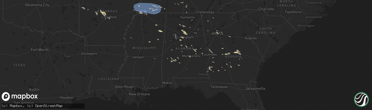
Hail Map in Alabama on July 21, 2023
The weather event in Alabama on July 21, 2023 includes Wind, Hail, and Tornado maps. 21 states and 481 cities were impacted and suffered possible damage. The total estimated number of properties impacted is 0.
Want more than just the map?
Turn this storm into a full workflow.
- Owner + property data so you know who to knock
- OnDemand branded weather history reports to win the "did we even have hail?" argument
- RoofTrace estimate so reps stop guessing numbers at the door
Bought this map? Upgrade within 7 days and we'll credit the $230. (10-15 min setup call)
Wind
Hail
Tornado
0
Estimated number of impacted properties by a 1.00" hail or larger0
Estimated number of impacted properties by a 1.75" hail or larger0
Estimated number of impacted properties by a 2.50" hail or largerStorm reports in Alabama
Alabama
| Date | Description |
|---|---|
| 07/21/20236:34 PM CDT | A few trees were blown down around gaylesville. |
| 07/21/20236:32 PM CDT | A tree was blown down on woodmont road and landed on a home. |
| 07/21/20236:32 PM CDT | A few trees were blown down around centre. |
| 07/21/20236:24 PM CDT | A few trees were blown down around sand rock. |
| 07/21/20236:20 PM CDT | Large tree uprooted along old tuscaloosa highway in mccalla. |
| 07/21/20236:20 PM CDT | Tree uprooted at 717 shades crest road. |
| 07/21/20236:20 PM CDT | Large tree uprooted at alford avenue and ivey lane. |
| 07/21/20235:58 PM CDT | Damage to exxon canopy in hampton cove. |
| 07/21/20235:43 PM CDT | Power lines down on ham road. |
| 07/21/20235:43 PM CDT | A few trees were blown down in weaver. |
| 07/21/20235:41 PM CDT | Trees down on wales road... Partially blocking the roadway. |
| 07/21/20235:40 PM CDT | A tree was uprooted and blocking the roadway on 55th st and glade road. |
| 07/21/20235:37 PM CDT | A few trees were blown down in the saks/lenlock area. |
| 07/21/20235:37 PM CDT | Tree down w/partial blockage on nuclear plant road... West of hatchett ridge in athens. |
| 07/21/20235:36 PM CDT | A tree was snapped and knocked power lines down into roadway. |
| 07/21/20235:33 PM CDT | Corrects previous tstm wnd dmg report from 4 nne owens crossroads. Several large branches were broken off of trees at this location. |
| 07/21/20235:33 PM CDT | Corrects previous tstm wnd dmg report from 4 nne owens crossroads. At this location 3 large trees were uprooted and fell in different directions. Two others were snappe |
| 07/21/20235:32 PM CDT | Corrects previous tstm wnd dmg report from 5 n owens crossroads. A large tree was blown across the entrance to the hampton cove waterfall near the golf course. |
| 07/21/20235:32 PM CDT | Corrects previous tstm wnd dmg report from 6 n owens crossroads. Several trees were either uprooted or broken off near their base. |
| 07/21/20235:28 PM CDT | Tree down county road 55 north of low gap. |
| 07/21/20235:28 PM CDT | Corrects previous tstm wnd dmg report from 6 nnw owens crossroads. Damage to exxon canopy in hampton cove. |
| 07/21/20235:28 PM CDT | Report from mping: 1-inch tree limbs broken; shingles blown off. |
| 07/21/20235:28 PM CDT | Corrects previous tstm wnd dmg report from 6 nnw owens crossroads. Sign to sonic was blown out at this location. |
| 07/21/20235:25 PM CDT | Corrects previous tstm wnd dmg report from 7 nnw owens crossroads. Large portion of a tree torn off on paul road. |
| 07/21/20235:22 PM CDT | Corrects previous tstm wnd dmg report from 6 nnw owens crossroads. Two large branches from a small oak tree torn off at this location. |
| 07/21/20235:21 PM CDT | Roof damage reported at the glencoe middle school. |
| 07/21/20235:21 PM CDT | Roof damage reported at the glencoe elementary school. |
| 07/21/20235:20 PM CDT | Corrects previous tstm wnd dmg report from 6 se huntsville. A large tree was uprooted and knocked down power lines at the intersection of weatherly road and valley view |
| 07/21/20235:19 PM CDT | Multiple trees and power lines reported down along strong drive se. |
| 07/21/20235:18 PM CDT | A few trees and power lines were blown down on highway 278. |
| 07/21/20235:14 PM CDT | Tree was blown down on rainbow drive. |
| 07/21/20235:12 PM CDT | A tree was blown over onto a home on berea ave. |
| 07/21/20235:12 PM CDT | A tree was blown down on grand ave. And landed on a vehicle. |
| 07/21/20235:10 PM CDT | Trees were blown down and blocking railroad tracks at popes chapel road. |
| 07/21/20235:10 PM CDT | Tree uprooted just west of natchez trace pkwy north of cloverdale... About 2 mi s of the tn state line. |
| 07/21/20235:04 PM CDT | A tree was blown down and blocking the roadway on 13th st nw. |
| 07/21/20235:04 PM CDT | Shingles off a home at brownsferry and lucas ferry roads in athens. |
| 07/21/20235:00 PM CDT | Roof partially torn off school and upstairs classrooms flooded. Athens renaissance middle school on clinton street. |
| 07/21/20234:58 PM CDT | Trees down partially blocking roadway on the 500 block of 7th avenue. |
| 07/21/20234:56 PM CDT | Trees and power lines were blown down on the 800 block of levert avenue. |
| 07/21/20234:52 PM CDT | Trees down near the intersection of elk river mills road and fort hampton road. |
| 07/21/20234:50 PM CDT | Multiple trees were blown down in the western half of the county. |
| 07/21/20234:33 PM CDT | At this location 3 large trees were uprooted and fell in different directions. Two others were snapped near the base near those uprooted trees. |
| 07/21/20234:33 PM CDT | Several large branches were broken off of trees at this location. |
| 07/21/20234:32 PM CDT | Several trees were either uprooted or broken off near their base. |
| 07/21/20234:32 PM CDT | Tree was blown down near reid road and spunky hollow road. |
| 07/21/20234:28 PM CDT | Sign to sonic was blown out at this location. |
| 07/21/20234:25 PM CDT | Large portion of a tree torn off on paul road. |
| 07/21/20234:24 PM CDT | Trees were blown down on twin oaks drive. |
| 07/21/20234:22 PM CDT | Two large branches from a small oak tree torn off at this location. |
| 07/21/20234:22 PM CDT | Trees and power lines were blown down near cr 51 and poultry drive. |
| 07/21/20234:21 PM CDT | Trees were blown down on cr 47. |
| 07/21/20234:20 PM CDT | A large tree was uprooted and knocked down power lines at the intersection of weatherly road and valley view drive se. |
| 07/21/20234:20 PM CDT | Tree was blown down and blocking the roadway near ketchum road and bullard road. |
| 07/21/20234:13 PM CDT | Multiple trees down. Some on vehicles. No injures reported. |
| 07/20/20237:42 PM CDT | A very large tree was blown down and blocking macedonia road. |
| 07/20/20237:42 PM CDT | A large tree was blown down at west blvd and birmingham hwy. |
| 07/20/20237:29 PM CDT | Reports of multiple trees down on red hill road in the kent community. |
| 07/20/20237:24 PM CDT | Reports of multiple trees blown down on castaway island road. |
All States Impacted by Hail Map on July 21, 2023
Cities Impacted by Hail Map on July 21, 2023
- Roland, AR
- Bigelow, AR
- Ola, AR
- Fort Smith, AR
- Morrilton, AR
- Adona, AR
- Perryville, AR
- Houston, AR
- Perry, AR
- Charleston, AR
- Lavaca, AR
- Magazine, AR
- Southaven, MS
- Olive Branch, MS
- Horn Lake, MS
- Little Rock, AR
- Plainview, AR
- Bryant, AR
- Alexander, AR
- Benton, AR
- Mayflower, AR
- Paron, AR
- Earle, AR
- West Memphis, AR
- Drummonds, TN
- Bassett, AR
- Marion, AR
- Wilson, AR
- Millington, TN
- Frenchmans Bayou, AR
- Tyronza, AR
- Joiner, AR
- Memphis, TN
- Crawfordsville, AR
- Gilmore, AR
- Turrell, AR
- Munford, TN
- Covington, TN
- Brighton, TN
- Burlison, TN
- Atoka, TN
- Stanton, TN
- Brownsville, TN
- Mason, TN
- Arlington, TN
- Cordova, TN
- Williston, TN
- Somerville, TN
- Collierville, TN
- Eads, TN
- Rossville, TN
- Oakland, TN
- Germantown, TN
- Moscow, TN
- Proctor, AR
- Dyess, AR
- Medon, TN
- Pinson, TN
- Henderson, TN
- Grand Junction, TN
- Jackson, TN
- Bolivar, TN
- Denmark, TN
- Mercer, TN
- Toone, TN
- Whiteville, TN
- Hickory Valley, TN
- Bethel Springs, TN
- Michigan City, MS
- Pocahontas, TN
- Walnut, MS
- Hornsby, TN
- Finger, TN
- Falkner, MS
- Tiplersville, MS
- Saulsbury, TN
- Middleton, TN
- La Grange, TN
- Ashland, MS
- Selmer, TN
- Lamar, MS
- Holly Springs, MS
- Byhalia, MS
- Alburgh, VT
- Ramer, TN
- Adamsville, TN
- Corinth, MS
- Brookline, NH
- Hollis, NH
- Ocate, NM
- Guadalupita, NM
- Las Vegas, NM
- Mora, NM
- Rociada, NM
- Sapello, NM
- Montezuma, NM
- Rapid City, SD
- Hermosa, SD
- Pavillion, WY
- Red Banks, MS
- South Hero, VT
- Williamstown, MA
- Aberdeen, MS
- Amory, MS
- Leominster, MA
- West Townsend, MA
- Townsend, MA
- Hayden, AL
- Bremen, AL
- Hanceville, AL
- Wendell, MA
- Los Alamos, NM
- Shelburne Falls, MA
- South Deerfield, MA
- Williamsburg, MA
- Ashfield, MA
- Conway, MA
- Deerfield, MA
- Columbia, TN
- Stone Mountain, GA
- Decatur, GA
- Atkins, AR
- Atlanta, GA
- Fayetteville, TN
- Taft, TN
- Buffalo, WY
- Belfast, TN
- Petersburg, TN
- Enterprise, MS
- Hickory, MS
- Chatsworth, GA
- Park Valley, UT
- Snowville, UT
- Tupelo, MS
- Lunenburg, MA
- Fitchburg, MA
- Westminster, MA
- Ashby, MA
- Lilburn, GA
- Snellville, GA
- Cimarron, NM
- Princeton, MA
- Pepperell, MA
- Chaplin, CT
- Mansfield Center, CT
- Storrs Mansfield, CT
- Montague, MA
- Zolfo Springs, FL
- Erving, MA
- Okolona, MS
- Vinemont, AL
- Addison, AL
- Danville, AL
- Fort Lauderdale, FL
- Walls, MS
- Cullman, AL
- Grant, AL
- Woodville, AL
- Sylacauga, AL
- Weogufka, AL
- Pontotoc, MS
- Calhoun, GA
- Armuchee, GA
- Downey, ID
- Champlain, NY
- Indianola, MS
- Rising Fawn, GA
- Shirley, MA
- Dunstable, MA
- Ashburnham, MA
- Hubbardston, MA
- Groton, MA
- Venus, FL
- Moore Haven, FL
- Crump, TN
- Savannah, TN
- Shelbyville, TN
- Lewisburg, TN
- Belden, MS
- Hohenwald, TN
- Volin, SD
- Mission Hill, SD
- Gayville, SD
- Whitewood, SD
- Sturgis, SD
- Deadwood, SD
- New Raymer, CO
- Stoneham, CO
- Merino, CO
- Raton, NM
- Conchas Dam, NM
- Tucumcari, NM
- Greeley, CO
- Kersey, CO
- Gill, CO
- Mcalister, NM
- Wellington, CO
- Cheyenne, WY
- Carr, CO
- Nunn, CO
- Johnstown, NE
- Ainsworth, NE
- Brewster, NE
- Purdum, NE
- Melrose, NM
- Floyd, NM
- Grover, CO
- Ault, CO
- Lander, WY
- Dunning, NE
- Cleveland, NM
- Sunderland, MA
- Irene, SD
- Fairburn, SD
- North Franklin, CT
- Willimantic, CT
- Windham, CT
- Lebanon, CT
- South Windham, CT
- Tyngsboro, MA
- Westford, MA
- Brookwood, AL
- McCalla, AL
- Bessemer, AL
- Bairoil, WY
- Wamsutter, WY
- Moriarty, NM
- Ware, MA
- Colchester, VT
- Burlington, VT
- Balaton, MN
- Perry, GA
- Fort Valley, GA
- Vienna, GA
- Preston, ID
- Briggsdale, CO
- East Dublin, GA
- Rockmart, GA
- Cedartown, GA
- Arabi, GA
- Berry, AL
- Easthampton, MA
- Flandreau, SD
- Elkton, SD
- Aiken, SC
- Pleasant Grove, AL
- Birmingham, AL
- Fairfield, AL
- Mulga, AL
- Dolomite, AL
- Mount Pleasant, TN
- House, NM
- Stanley, NM
- McCool, MS
- Gray Court, SC
- Enoree, SC
- Ponderosa, NM
- Snyder, CO
- Marshallville, GA
- Reynolds, GA
- Union, SC
- Dudley, GA
- Montrose, GA
- Dublin, GA
- Southampton, MA
- Holyoke, MA
- South Hadley, MA
- Florence, MA
- Watrous, NM
- Pine Hill, AL
- Thomasville, AL
- Centreville, AL
- Brierfield, AL
- Penasco, NM
- Kathleen, GA
- Crawford, MS
- Starkville, MS
- Auburn, AL
- Pinson, AL
- Morris, AL
- Sawyerville, AL
- Waverly, AL
- Camp Hill, AL
- Thomaston, AL
- Arlington, AL
- Gordo, AL
- Granite Canon, WY
- Arcadia, FL
- Pipestone, MN
- Lowell, MA
- Hadley, MA
- Northampton, MA
- Hatfield, MA
- West Hatfield, MA
- Plainville, GA
- La Salle, CO
- Hampton, CT
- Warrior, AL
- Valentine, NE
- Mission, SD
- Nashua, NH
- Linden, AL
- Magnolia, AL
- West Point, GA
- Hamilton, GA
- Clanton, AL
- Rutland, MA
- Evans, CO
- Adams, MA
- Pauline, SC
- Buffalo, SC
- Dry Branch, GA
- Bonaire, GA
- Trafford, AL
- Kimberly, AL
- Lamy, NM
- Elgin, AZ
- Wood Lake, NE
- Guilford, CT
- Oakman, AL
- Pena Blanca, NM
- Cochiti Pueblo, NM
- Equality, AL
- Alexander City, AL
- Dadeville, AL
- Thorndike, MA
- Belchertown, MA
- Palmer, MA
- Bondsville, MA
- Moorhead, MS
- Inverness, MS
- Marietta, GA
- Weir, MS
- Sparks, NE
- Adger, AL
- Hope Hull, AL
- Montgomery, AL
- Young, AZ
- Ohatchee, AL
- Ragland, AL
- Piedmont, AL
- Gadsden, AL
- Alexandria, AL
- Anniston, AL
- Summerville, GA
- Ridgeville, SC
- Cusseta, GA
- Tennille, GA
- Madison, GA
- Orrville, AL
- Safford, AL
- Scenic, SD
- Keystone, SD
- North Haven, CT
- East Haven, CT
- Branford, CT
- Hamden, CT
- New Haven, CT
- North Branford, CT
- Woodbridge, CT
- Northford, CT
- Catherine, AL
- Granby, MA
- Ludlow, MA
- Three Rivers, MA
- New Salem, MA
- Alamo, GA
- Tombstone, AZ
- Higdon, AL
- Flat Rock, AL
- Trenton, GA
- Douglas, AZ
- Devens, MA
- Ayer, MA
- Wetumpka, AL
- Tallassee, AL
- Eclectic, AL
- Box Springs, GA
- Jemison, AL
- Northport, AL
- Camden, AL
- Florissant, CO
- Glenwood, GA
- Carrollton, AL
- Altoona, AL
- Gardner, MA
- Acton, MA
- Littleton, MA
- Boxborough, MA
- Harvard, MA
- Lancaster, MA
- Trussville, AL
- Gardendale, AL
- Pennington, AL
- Musella, GA
- Jacksonville, GA
- Viborg, SD
- Salem, SD
- Tuscaloosa, AL
- Ellerslie, GA
- Midland, GA
- Cataula, GA
- Upatoi, GA
- Rockledge, GA
- Cambridge, MA
- Somerville, MA
- Boston, MA
- Charlestown, MA
- East Boston, MA
- Everett, MA
- Chelsea, MA
- Roswell, NM
- North Brookfield, MA
- Callaway, NE
- Monument, CO
- Fitzgerald, GA
- Rebecca, GA
- Ocilla, GA
- Colorado Springs, CO
- Franktown, CO
- Larkspur, CO
- Lynn, MA
- Revere, MA
- Saugus, MA
- Nahant, MA
- Abbeville, AL
- Adrian, GA
- Guffey, CO
- Elbert, CO
- Arlington, GA
- Encino, NM
- Blakely, GA
- Fort Gaines, GA
- Bluffton, GA
- Coleman, GA
- Ashburn, GA
- Fort Sumner, NM
- Leesburg, GA
- Holliston, MA
- Cross, SC
- Arnold, NE
- Hartsel, CO
- Pinopolis, SC
- South Boston, MA
- Hull, MA
- Orchard, CO
- Matheson, CO
- Cripple Creek, CO
- Denton, GA
- Hazlehurst, GA
- Cordele, GA
- Columbia, AL
- Brookline, MA
- Swampscott, MA
- Malden, MA
- Roxbury Crossing, MA
- Winthrop, MA
- West Brookfield, MA
- Warren, MA
- Mount Vernon, GA
- Norway, SC
- Anselmo, NE
- Clarkston, GA
- Scottdale, GA
- Elida, NM
- Albany, GA
- Newton, GA
- Shorterville, AL
- Rochelle, GA
- Pine Apple, AL
- Sylvester, GA
- Cuthbert, GA
- Red Level, AL
- Rainsville, NM
- Weston, GA
- Richland, GA
- Plantersville, AL
- Selma, AL
- Lumpkin, GA
- Dixons Mills, AL
- Castle Rock, CO


