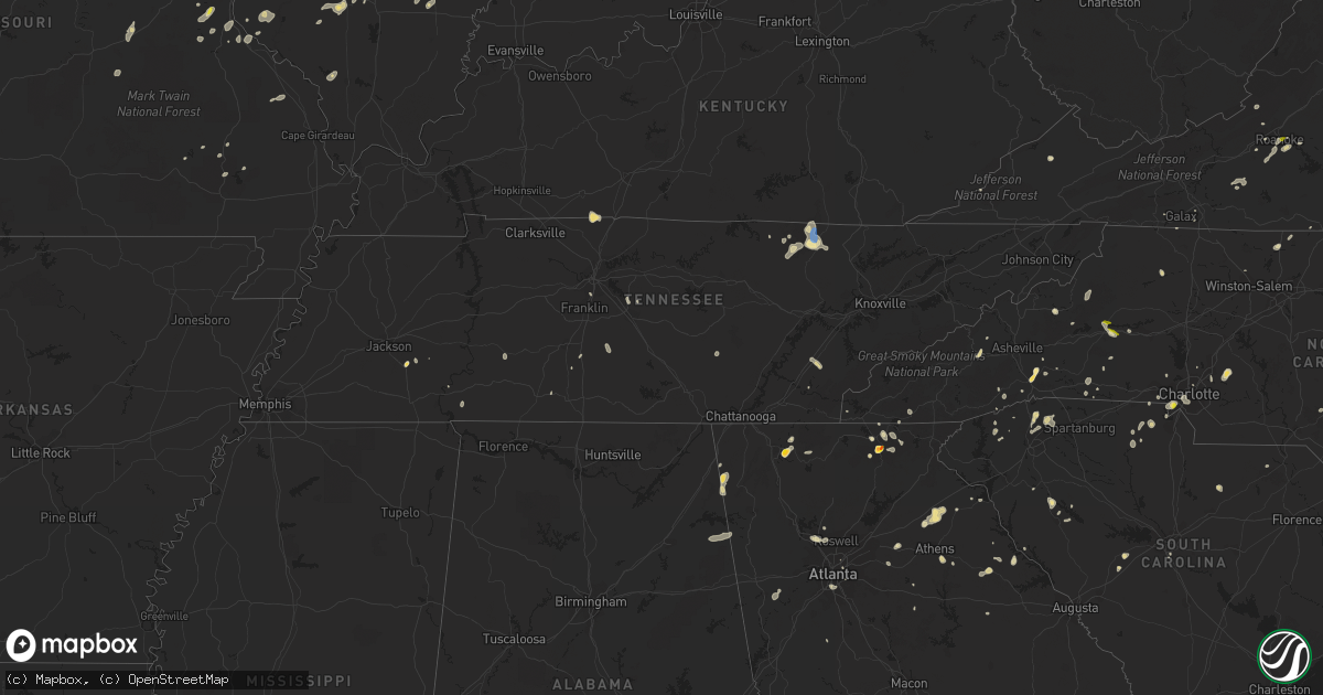
Hail Map in Tennessee on July 21, 2020
Get this storm
July 21 map
$229
one time, instant access
Download today. No call, no setup
Keep the $229
Bought the map and want the full workflow? Apply the entire $229 to a subscription within 7 days. None of it is wasted.
Every map, not just this one
This buys you this map. Subscription and you get every map we run, in the markets you choose from a few cities to whole states to nationwide. Plus real-time alerts the moment a storm fires.
Contact data
Name, contact info, occupancy, even credit band for addresses in the footprint. You go from where it hit to who to call.
Become the source they trust
Unlimited branding weather history reports on demand. You already have the documented answer ready for the property owner, and you are the one who showed up with it.
Property data and RoofTrace estimates
Pull up any address you have got, its value and the exact code rules for that jurisdiction, straight from One Click Code. Then RoofTrace estimates the squares, pitch, and roof value, priced the way you price.
Storm reports in Tennessee
Tennessee
| Date | Description |
|---|---|
| 07/21/20204:08 PM CDT | Several trees down and very windy. |
| 07/21/20204:07 PM CDT | Several trees down. |
| 07/21/20203:45 AM CDT | At 845 PM EDT, a severe thunderstorm was located over Helenwood, or near Oneida, moving north at 5 mph. HAZARD...60 mph wind gusts and penny size hail. SOURCE...Radar indicated. IMPACT...Expect damage to roofs, siding, and trees. Locations impacted include... Oneida, Huntsville, Helenwood, Winfield, Ketchen, Honey Creek State Park and Big South Fork National Park. |
| 07/21/202012:06 AM CDT | At 506 PM CDT, a severe thunderstorm was located 8 miles northwest of Cross Plains, moving north at 10 mph. HAZARD...60 mph wind gusts. SOURCE...Radar indicated. IMPACT...Expect damage to roofs, siding, and trees. Locations impacted include... Adairville, Schochoh, Middleton, Prices Mill, and Neosheo. |
| 07/20/202011:54 PM CDT | At 453 PM EDT, a severe thunderstorm was located near Athens, and is nearly stationary. HAZARD...60 mph wind gusts and penny size hail. SOURCE...Radar indicated. IMPACT...Expect damage to roofs, siding, and trees. Locations impacted include... Athens, Etowah, Englewood and Niota. This includes Interstate 75 in Tennessee between mile markers 50 and53. |
| 07/20/202011:32 PM CDT | At 432 PM EDT, a severe thunderstorm was located near Benton, and is nearly stationary. HAZARD...60 mph wind gusts and penny size hail. SOURCE...Radar indicated. IMPACT...Expect damage to roofs, siding, and trees. Locations impacted include... Etowah, Dentville and Hiwassee Ocoee State Park. |
| 07/20/202011:12 PM CDT | At 412 PM CDT, a severe thunderstorm was located 13 miles northeast of Gruetli-Laager, or 14 miles south of Spencer, and is nearly stationary. HAZARD...60 mph wind gusts. SOURCE...Radar indicated. IMPACT...Expect damage to roofs, siding, and trees. Locations impacted include... Fall Creek Falls State Park. |
| 07/20/202010:42 PM CDT | At 341 PM CDT, a severe thunderstorm was located over Oak Hill, or 8 miles northeast of Franklin, moving north at 10 mph. HAZARD...60 mph wind gusts. SOURCE...Radar indicated. IMPACT...Expect damage to roofs, siding, and trees. Locations impacted include... Franklin, Brentwood, Nolensville, Forest Hills, Oak Hill, Belle Meade, Antioch and Berry Hill. |
| 07/20/20208:42 PM CDT | *old report* tree down on power line in monroe |
| 07/20/20208:06 PM CDT | Several trees down across the county. |
| 07/20/20208:05 PM CDT | Delayed report. Several trees were blown down and roofs blown off outbuildings around the peyton road and bluebird road area. |
| 07/20/20207:40 PM CDT | Delayed report. Several trees were damaged in the shop springs area. |
| 07/20/20207:01 PM CDT | Trees and power lines on the corner of horseshoe dr and vine st. |
| 07/20/20207:01 PM CDT | A tree split and fell on a home on ridgeway ave. |
All States Impacted by Hail Map on July 21, 2020
Cities Impacted by Hail Map on July 21, 2020
- Callao, VA
- Lottsburg, VA
- Heathsville, VA
- Woodlawn, VA
- Cobbs Creek, VA
- Roanoke, VA
- Boones Mill, VA
- Rockholds, KY
- Williamsburg, KY
- Blairsville, GA
- Otis, CO
- Henderson, TN
- Buford, WY
- Laramie, WY
- Cheyenne, WY
- Woodford, VA
- Brent, AL
- Marion, AL
- North Wilkesboro, NC
- Center, MO
- Wheatland, WY
- Camden Wyoming, DE
- Keysville, VA
- Cascade, VA
- Murfreesboro, TN
- Brooksville, KY
- Augusta, KY
- Georgetown, OH
- Laurel, MD
- Fulton, MD
- Chetek, WI
- Weyerhaeuser, WI
- Chambersburg, PA
- Spring Grove, VA
- Clover, SC
- Belmont, NC
- Charlotte, NC
- Pickens, SC
- Sunset, SC
- Middletown, MO
- Bellflower, MO
- Cartersville, VA
- Birchleaf, VA
- Bee, VA
- Nashville, IL
- Senatobia, MS
- Lawrenceburg, TN
- Oneida, TN
- Dutton, VA
- Collinsville, AL
- Dawson, AL
- Jamestown, IN
- Crawfordsville, IN
- Las Vegas, NM
- Garita, NM
- Pontotoc, MS
- Connelly Springs, NC
- Hillsdale, WY
- Carpenter, WY
- Burns, WY
- Sugar City, CO
- Ordway, CO
- Karval, CO
- De Soto, MO
- Elberton, GA
- Travelers Rest, SC
- Taylors, SC
- Hodges, SC
- Sterling, CO
- Loganville, GA
- Fredericksburg, VA
- Stafford, VA
- Athens, TN
- Englewood, TN
- Niota, TN
- Honea Path, SC
- Florissant, MO
- Saint Charles, MO
- Saint Louis, MO
- Maryland Heights, MO
- Earth City, MO
- Bridgeton, MO
- Hazelwood, MO
- New Kent, VA
- King William, VA
- Bowling Green, KY
- Hohenwald, TN
- Goree, TX
- Sidney, NE
- Peetz, CO
- Akron, CO
- Port Tobacco, MD
- La Plata, MD
- Colfax, WI
- Mexico, MO
- Pocomoke City, MD
- Snow Hill, MD
- Ashley, IL
- Saint Peters, MO
- Humboldt, IL
- Oakland, IL
- Sullivan, IL
- Mattoon, IL
- Charleston, IL
- Windsor, IL
- Gays, IL
- Arcola, IL
- Neoga, IL
- Strasburg, IL
- Stewardson, IL
- Springfield, IL
- Cantrall, IL
- Fort Morgan, CO
- Snyder, CO
- Weldona, CO
- Newberry, FL
- New London, MO
- Whitestown, IN
- Lebanon, IN
- Sheridan, IN
- Cambridge, MD
- Woolford, MD
- Jerseyville, IL
- Grafton, IL
- Batesburg, SC
- Monetta, SC
- Morganton, NC
- Valdese, NC
- King George, VA
- Cross City, FL
- Bethalto, IL
- Moro, IL
- East Alton, IL
- Carrollton, AL
- Reform, AL
- Gordo, AL
- Aliceville, AL
- Garrett, WY
- Fe Warren Afb, WY
- Chugwater, WY
- Bayard, NE
- Harrisburg, NE
- Jewett, IL
- Newton, IL
- Hidalgo, IL
- Wheeler, IL
- Henderson, MD
- Marydel, MD
- Sudlersville, MD
- Barclay, MD
- Hendersonville, NC
- Merino, CO
- Atwood, CO
- Kinderhook, IL
- Ashburn, MO
- Frankford, MO
- Perry, MO
- New Canton, IL
- Louisiana, MO
- Piedmont, AL
- Centre, AL
- Young Harris, GA
- Quanah, TX
- Auburn, KY
- Hardy, VA
- Glenrock, WY
- Susanville, CA
- Old Town, FL
- Culleoka, TN
- Lodgepole, NE
- Bushnell, NE
- South Charleston, OH
- Moweaqua, IL
- Dalton City, IL
- Macon, IL
- Assumption, IL
- Blue Mound, IL
- Teutopolis, IL
- Sigel, IL
- Vance, AL
- Villa Rica, GA
- Whitesburg, GA
- Winston, GA
- Carrollton, GA
- Trinidad, CO
- Montrose, IL
- Suches, GA
- Ladoga, IN
- New Ross, IN
- Marydel, DE
- Chappell, NE
- Barry, IL
- Mount Pleasant, NC
- Concord, NC
- Kershaw, SC
- Fairfax Station, VA
- Lorton, VA
- Springfield, VA
- Steinhatchee, FL
- Algona, IA
- Wesley, IA
- Lusk, WY
- Bent Mountain, VA
- Pisgah, AL
- Mode, IL
- Beecher City, IL
- Shelbyville, IL
- Auxvasse, MO
- Atlanta, GA
- Canutillo, TX
- Isabel, SD
- Gordonsville, VA
- Louisa, VA
- Brierfield, AL
- Centralia, IL
- Raton, NM
- Douglas, WY
- Winchester, IL
- Pampa, TX
- Greer, SC
- Menlo, GA
- Marthasville, MO
- Washington, MO
- New Haven, MO
- Rice, VA
- Kimball, NE
- Royston, GA
- New Raymer, CO
- Helenwood, TN
- Robbins, TN
- Lovington, IL
- Bethany, IL
- Yuma, CO
- Williamsburg, VA
- Mcminnville, TN
- Moulton, AL
- Town Creek, AL
- McConnellsburg, PA
- Oakdale, IL
- Du Bois, IL
- Richview, IL
- Mayodan, NC
- Stoneville, NC
- Madison, NC
- Somerville, TN
- Dieterich, IL
- Yale, IL
- Vandalia, MO
- Pittsfield, IL
- Rockport, IL
- Vintondale, PA
- Bloomington, IN
- Unionville, IN
- Loami, IL
- Waverly, IL
- Saluda, VA
- Church View, VA
- Mascot, VA
- Sells, AZ
- Port Allen, LA
- Stanardsville, VA
- Madison, VA
- Disputanta, VA
- Stony Creek, VA
- Waverly, VA
- Petersburg, VA
- Carson, VA
- Flat Rock, AL
- Higdon, AL
- West Point, VA
- Mattaponi, VA
- Shacklefords, VA
- Barhamsville, VA
- Carbon Hill, AL
- Nauvoo, AL
- Bankston, AL
- White Plains, MD
- Pomfret, MD
- Buffalo, WY
- West Blocton, AL
- Dalton, GA
- Chatsworth, GA
- Trinchera, CO
- Stoneham, CO
- Festus, MO
- Rockfield, KY
- Leicester, NC
- Eldred, IL
- Commerce, GA
- Jefferson, GA
- Marion, NC
- Huntersville, NC
- Summerville, GA
- Gaylesville, AL
- Lyerly, GA
- Breezewood, PA
- Harrisonville, PA
- Warfordsburg, PA
- Crystal Spring, PA
- Needmore, PA
- Salem, MO
- Flat Rock, NC
- Hawkinsville, GA
- Perry, FL
- Edwardsville, IL
- Worden, IL
- Wood River, IL
- Granite City, IL
- Hartford, IL
- Cottage Hills, IL
- Dorsey, IL
- Roxana, IL
- South Roxana, IL
- Silva, MO
- Alachua, FL
- Henrico, VA
- Richmond, VA
- Brevard, NC
- Pisgah Forest, NC
- Alexander, IL
- Ashland, IL
- Pleasant Plains, IL
- Wana, WV
- Burton, WV
- Russellville, KY
- Topping, VA
- Black Mountain, NC
- Mooresboro, NC
- Springfield, TN
- Orlinda, TN
- Franklin, KY
- Adairville, KY
- Red Bud, IL
- Waterloo, IL
- California, MO
- Mineral, VA
- Patrick, SC
- Chesterfield, SC
- Sharon, SC
- Divide, CO
- Church Road, VA
- Sutherland, VA
- Blue Rock, OH
- Duncan Falls, OH
- New Concord, OH
- Zanesville, OH
- Chandlersville, OH
- Sulligent, AL
- Tunica, MS
- Kampsville, IL
- Pearl, IL
- Lancaster, VA
- Lewisburg, KY
- Woodbine, KY
- O'Fallon, MO
- Brussels, IL
- Golden Eagle, IL
- West Columbia, SC
- Jamestown, TN
- Allardt, TN
- Leesville, SC
- Oldtown, MD
- Water Valley, MS
- Wilsons, VA
- Blackstone, VA
- Greenville, SC
- Clarksville, MD
- Columbia, MD
- Marietta, GA
- Kennesaw, GA
- Milford, CA
- Woodlawn, IL
- Clyde, NC
- Waynesville, NC
- Trappe, MD
- Curryville, MO
- Griggsville, IL
- Vinton, VA
- Valley Head, AL
- Westville, SC
- Buffalo, IL
- Tishomingo, MS
- Urbanna, VA
- Cedartown, GA
- High Hill, MO
- Truxton, MO
- Jonesburg, MO
- Shady Dale, GA
- Newborn, GA
- York, SC
- Powhatan, VA
- Grenada, MS
- Proctor, AR
- Bosler, WY
- Lascassas, TN
- Burnsville, NC
- Washington, GA
- Tignall, GA
- Danbury, WI
- Webster, WI
- Saint Thomas, PA
- Carrollton, IL
- Winder, GA
- Cotopaxi, CO
- Murphy, NC
- Byers, CO
- Ellington, MO
- Hiawassee, GA
- Leesburg, AL
- Trenton, FL
- Sparks, NV
- Kingfisher, OK
- Rio, WV
- Olmstead, KY
- Idalou, TX
- Gloucester, VA
- North, VA
- Hallieford, VA
- Granite Canon, WY
- Arthur, IL
- Cuba, MO
- Sherman, IL
- Mount Crawford, VA
- Bridgewater, VA
- Harrisonburg, VA
- Dayton, VA
- Lake Junaluska, NC
- Duck Hill, MS
- Brookwood, AL
- Spotsylvania, VA
- Partlow, VA
- Goochland, VA
- Preston, MD
- Fieldon, IL
- Chillicothe, TX
- Carr, CO
- Nunn, CO
- Mount Pulaski, IL
- Mechanicsville, VA
- Mill Spring, NC
- Fults, IL
- Salem, VA
- Prince George, VA
- Perryville, MO
- Sedgewickville, MO
- Homer City, PA
- Ebensburg, PA
- Nanty Glo, PA
- Twin Rocks, PA
- Greenville, FL
- Woodland Park, CO
- Sedalia, CO
- New Berlin, IL
- Jacksonville, IL
- Holton, IN
- Eagle Butte, SD
- Janesville, CA
- Forest Park, GA
- White Hall, IL
- Roodhouse, IL
- Rockville, IN
- Russellville, IN
- Bluffs, IL
- Murrayville, IL
- Woodland, MS
- Mantee, MS
- Callaway, VA
- Floyd, VA
- Keokee, VA
- Goodview, VA
- Rural Hall, NC
- Detroit, AL
- Huntsville, TN
- Murphysboro, IL
- Hinckley, MN
- Amelia Court House, VA
- Meherrin, VA
- Green Bay, VA
- Manchester, KY
- Monroe, GA
- Blackwell, MO
- Cadet, MO
- Houston, MS
- Wakefield, VA
- Wiggins, CO
- Chatham, IL
- Hartselle, AL
- Danville, AL
- Hoyleton, IL
- Danielsville, GA
- Carnesville, GA
- Harrisburg, NC
- Manitou Springs, CO
- Aberdeen, MS
- Hayesville, NC
- Williamson, GA
- Onancock, VA
- Patterson, MO
- Piedmont, MO
- Hartwell, GA
- Fountain Run, KY
- Tuscola, IL
- Camargo, IL
- Hurlock, MD
- Hamersville, OH
- Centertown, MO
- Newland, NC
- Collettsville, NC
- Seymour, TX
- Crawfordsville, AR
- Wake, VA
- Cherokee, AL
- Swoope, VA
- Gum Spring, VA
- Sandy Hook, VA
- Reagan, TN
- Ocate, NM
- Hillsboro, MO
- Cave Spring, GA
- Hamilton, AL
- Woodson, IL
- Chapin, IL
- Wheatland, IN
- Rock Hill, SC
- Tallahassee, FL
- Wappapello, MO
- Flat Lick, KY
- Decatur, GA
- New Douglas, IL
- Eden, NC
- Sedley, VA
- Crozet, VA
- Big Springs, NE
- Eldorado, OK
- Welcome, MD
- Bryans Road, MD
- Indian Head, MD
- West Salem, IL
- Lewisburg, TN
- Unionville, TN
- Chapel Hill, TN
- Altamont, IL
- Oneida, KY
- Big Creek, KY
- Forest City, NC
- Dittmer, MO
- Marietta, SC
- Sand Fork, WV
- Brightwood, VA
- Oakpark, VA
- Bloomsdale, MO
- Arab, AL
- Free Union, VA
- Brentwood, TN
- Fairfield, IL
- Prairie Du Rocher, IL
- Spruce Pine, NC
- Franklin, IL
- Midlothian, VA
- Chesterfield, VA
- Rutherfordton, NC
- Earlysville, VA
- Charlottesville, VA
- Mannington, WV
- Metz, WV
- Fairview, WV
- Cullman, AL
- Hillview, IL
- New Castle, VA
- Leighton, AL
- Rantoul, IL
- Marshall, IL
- Savannah, TN
- Randolph, AL
- Thorsby, AL
- Maplesville, AL
- Jemison, AL
- Belsano, PA
- Columbia, VA
- Kents Store, VA
- Riceville, TN
- Stanley, NC
- Mount Holly, NC
- Gastonia, NC
- West Alton, MO
- Craigsville, VA
- Camden, WV
- Campobello, SC
- Lyman, SC
- Inman, SC
- McCormick, SC
- Illiopolis, IL
- Gosport, IN
- Montross, VA
- Florence, AL
- Lake Lure, NC
- Houlka, MS
- Fork Union, VA
- Palmyra, VA
- Goldsboro, MD
- Ingleside, MD
- Hartly, DE
- Felton, DE
- Church Hill, MD
- Alhambra, IL
- Athens, GA
- Arnoldsville, GA
- Watkinsville, GA
- Winterville, GA
- Ellijay, GA
- Paris, IL
- Dyke, VA
- Champlain, VA
- Warsaw, VA
- Crowell, TX
- Rayle, GA
- Fleming, CO
- Moorefield, WV
- Quantico, VA
- Hickory Grove, SC
- Ennice, NC
- Wayne City, IL
- Sims, IL
- Norman, IN
- Freetown, IN
- Surry, VA
- Port Royal, VA
- Bowling Green, VA
- Chester, SC
- Shelby, NC
- Ellenboro, NC
- Mentone, AL
- Waterloo, SC
- Cross Hill, SC
- Lexington Park, MD
- Farnham, VA
- Ford, VA
- Pinebluff, NC
- Bethlehem, GA
- Kane, IL
- Greenville, MO
- Hildebran, NC
- Vina, AL
- Jetersville, VA
- Coulterville, IL
- Stephens, GA
- Greensboro, AL
- Virden, IL
- Auburn, IL
- Thayer, IL
- Farmville, VA
- Cumberland, VA
- Shumway, IL
- Saint Elmo, IL
- Columbia, TN
- Brocton, IL
- Catawba, VA
- Williamsville, MO
- Bostic, NC
- Jefferson City, MO
- Galax, VA
- Bowersville, GA
- Rochester, IL
- Ninety Six, SC
- Greenwood, SC
- Woodstock, GA
- Cottondale, AL
- Helen, GA
- Felicity, OH
- Foster, KY
- Russellville, OH
- Independence, VA
- Casar, NC
- Frederick, OK
- Sparta, GA
- Staunton, IL
- Fort Payne, AL
- Rutledge, GA
- Newman, IL
- Effingham, IL
- Pioneer, TN
- Montgomery City, MO
- Liberty, SC
- Girdletree, MD
- Imperial, NE
- Haysi, VA
- Ellettsville, IN
- Pawnee, IL
- Weems, VA
- Staunton, VA
- Cloverport, KY
- Washington, DC
- Chevy Chase, MD
- Groom, TX
- Chester, VA
- Hopewell, VA
- Colonial Heights, VA
- Smithfield, VA
- Windsor, VA
- Ider, AL
- Glenarm, IL
- Divernon, IL
- Federalsburg, MD
- Denton, MD
- Bridgeville, DE
- Dewey, IL
- Arrowsmith, IL
- Ludlow, IL
- Mahomet, IL
- Clinton, IL
- Bellflower, IL
- Farmer City, IL
- Foosland, IL
- Fisher, IL
- Hoopeston, IL
- Le Roy, IL
- Rossville, IL
- Rankin, IL
- Gifford, IL
- Dewitt, IL
- Penfield, IL
- Potomac, IL
- Paxton, IL
- Mansfield, IL
- De Land, IL
- Champaign, IL
- Bondville, IL
- Seymour, IL
- White Heath, IL
- Monticello, IL
- Thomasboro, IL
- Mt Zion, IL
- Decatur, IL
- Lafayette, IN
- Dayton, IN
- Alexandria, IN
- Muncie, IN
- Albany, IN
- Gaston, IN
- Yorktown, IN
- Anderson, IN
- Daleville, IN
- Logansport, IN
- Onward, IN
- Walton, IN
- Galveston, IN
- Camden, IN
- Peru, IN
- Gallitzin, PA
- Lilly, PA
- Loretto, PA
- Cresson, PA
- Johnstown, PA
- Windber, PA
- Fort Loudon, PA
- Cascade, CO
- Colorado Springs, CO
- Strasburg, CO
- Bellvue, CO


