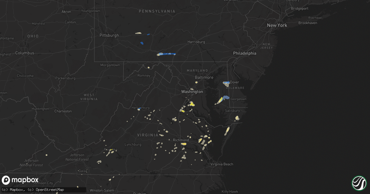
Hail Map in Maryland on July 21, 2020
Get this storm
July 21 map
$229
one time, instant access
Download today. No call, no setup
Keep the $229
Bought the map and want the full workflow? Apply the entire $229 to a subscription within 7 days. None of it is wasted.
Every map, not just this one
This buys you this map. Subscription and you get every map we run, in the markets you choose from a few cities to whole states to nationwide. Plus real-time alerts the moment a storm fires.
Contact data
Name, contact info, occupancy, even credit band for addresses in the footprint. You go from where it hit to who to call.
Become the source they trust
Unlimited branding weather history reports on demand. You already have the documented answer ready for the property owner, and you are the one who showed up with it.
Property data and RoofTrace estimates
Pull up any address you have got, its value and the exact code rules for that jurisdiction, straight from One Click Code. Then RoofTrace estimates the squares, pitch, and roof value, priced the way you price.
Storm reports in Maryland
Maryland
| Date | Description |
|---|---|
| 07/21/20206:54 PM CDT | Trees down on pomfret rd and bumpy oak rd causing road closures. |
| 07/21/20206:50 PM CDT | A local report indicates 1.00 inch wind near 1 SW LA PLATA |
| 07/21/20206:45 PM CDT | Several trees snapped and uprooted between 6905 and 7050 bumpy oak road |
| 07/21/20206:39 PM CDT | Downed trees on md-224 riverside rd at smith point rd causing road closure. |
| 07/21/20203:16 AM CDT | At 816 PM EDT, severe thunderstorms were located along a line extending from Dahlgren to near Fort A.p. Hill, moving east at 20 mph. HAZARD...60 mph wind gusts and quarter size hail. SOURCE...Radar indicated. IMPACT...Minor damage to vehicles is possible. Expect wind damage to trees and powerlines. Severe thunderstorms will be near, Colonial Beach around 830 PM EDT. Loretto around 845 PM EDT. Champlain and Leedstown around 855 PM EDT. Newland around 900 PM EDT.Other locations impacted by these severe thunderstorms include Lerty,Beazley, Sparta, Currioman Landing, Hustle, Potomac Beach, Elevon,Oak Grove, Supply and Singerly. |
| 07/21/20202:59 AM CDT | At 759 PM EDT, a severe thunderstorm was located near Savage-guilford, or near Columbia, moving east at 10 mph. HAZARD...60 mph wind gusts and quarter size hail. SOURCE...Radar indicated. IMPACT...Damaging winds will cause some trees and large branches to fall. This could injure those outdoors, as well as damage homes and vehicles. Roadways may become blocked by downed trees. Localized power outages are possible. Unsecured light objects may become projectiles. Locations impacted include... Columbia, Severn, Elkridge, Odenton, Laurel, Arbutus, Fort Meade, Savage-guilford, Scaggsville, Ilchester, Burtonsville, Jessup, Savage, Fulton, Highland, Hanover, Simpsonville, Clarksville, Harmans and Georgetown. |
| 07/21/20202:48 AM CDT | At 748 PM EDT, a severe thunderstorm was located over Fort Totten, moving east at 10 mph. HAZARD...60 mph wind gusts and quarter size hail. SOURCE...Radar indicated. IMPACT...Damaging winds will cause some trees and large branches to fall. This could injure those outdoors, as well as damage homes and vehicles. Roadways may become blocked by downed trees. Localized power outages are possible. Unsecured light objects may become projectiles. Locations impacted include... Bethesda, College Park, Greenbelt, Langley Park, Forestville, Coral Hills, Bladensburg, University of Maryland, Fedex Field, Howard University, Gallaudet University, Fort Totten, RFK Stadium, Landover, Camp Springs, Hyattsville, Takoma Park, East Riverdale, Adelphi and New Carrollton. |
| 07/21/20202:44 AM CDT | At 744 PM EDT, severe thunderstorms were located along a line extending from near Waldorf to Nanjemoy Creek, moving east at 20 mph. HAZARD...70 mph wind gusts and half dollar size hail. SOURCE...Radar indicated. IMPACT...Damaging winds will cause some trees and large branches to fall. This could injure those outdoors, as well as damage homes and vehicles. Roadways may become blocked by downed trees. Localized power outages are possible. Unsecured light objects may become projectiles. Locations impacted include... Waldorf, La Plata, Leonardtown, Dahlgren, Prince Frederick, Nanjemoy Creek, Popes Creek, Greenwell State Park, Hallowing Point, Saint Leonard Creek, Wicomico River, Sheridan Point, Calvert Cliffs, Saint Clements Bay, Port Tobacco River, Flag Harbor, White Point Beach, California, Golden Beach and Saint Charles. |
| 07/21/20202:20 AM CDT | At 719 PM EDT, severe thunderstorms were located along a line extending from near Stafford to near Potomac Creek, moving east at 15 mph. HAZARD...60 mph wind gusts and quarter size hail. SOURCE...Radar indicated. IMPACT...Damaging winds will cause some trees and large branches to fall. This could injure those outdoors, as well as damage homes and vehicles. Roadways may become blocked by downed trees. Localized power outages are possible. Unsecured light objects may become projectiles. Locations impacted include... King George, Fairview Beach, Potomac Creek, Nanjemoy Creek, Passapatanzy, Nanjemoy, Weedonville, Welcome, Berthaville and Ironsides. |
| 07/21/20202:13 AM CDT | At 713 PM EDT, a severe thunderstorm was located near La Plata, moving east at 15 mph. HAZARD...60 mph wind gusts. SOURCE...Radar indicated. IMPACT...Damaging winds will cause some trees and large branches to fall. This could injure those outdoors, as well as damage homes and vehicles. Roadways may become blocked by downed trees. Localized power outages are possible. Unsecured light objects may become projectiles. Locations impacted include... Waldorf, La Plata, Saint Charles, Accokeek, Bryans Road, Potomac Heights, Bryantown, Pomfret, Port Tobacco Village, Marbury, Dentsville, Port Tobacco, White Plains, Ripley, Bel Alton, Northwood, Pisgah and Faulkner. |
| 07/21/20201:43 AM CDT | At 643 PM EDT, a severe thunderstorm was located near Codorus, moving east at 10 mph. HAZARD...60 mph wind gusts. SOURCE...Radar indicated. IMPACT...Expect damage to trees, roofs, and siding. Locations impacted include... Hanover, Parkville, Red Lion, Dallastown, Shrewsbury, Codorus, Stewartstown, Glen Rock, Pennville, Jacobus, Windsor, Yoe, Cross Roads, Railroad, Loganville, Winterstown, Seven Valleys, Felton and Glenville.This includes Interstate 83 from mile markers 0 to 12. |
| 07/21/20201:08 AM CDT | At 608 PM EDT, a severe thunderstorm was located near Lake Ridge, or near Dale City, moving east at 15 mph. HAZARD...60 mph wind gusts and quarter size hail. SOURCE...Radar indicated. IMPACT...Damaging winds will cause some trees and large branches to fall. This could injure those outdoors, as well as damage homes and vehicles. Roadways may become blocked by downed trees. Localized power outages are possible. Unsecured light objects may become projectiles. Locations impacted include... Annandale, Springfield, Fort Belvoir, Lake Ridge, Burke, Lincolnia, Lorton, Franconia, Newington, I395 and I495 Interchange, West Springfield, Manassas Park, Fairfax Station, North Springfield, Hayfield, Ravensworth, Mason Neck, Occoquan and Clifton. |
| 07/21/202012:16 AM CDT | At 515 PM EDT, a severe thunderstorm was located 7 miles northwest of Paw Paw, moving east at 20 mph. HAZARD...60 mph wind gusts and quarter size hail. SOURCE...Radar indicated. IMPACT...Damaging winds will cause some trees and large branches to fall. This could injure those outdoors, as well as damage homes and vehicles. Roadways may become blocked by downed trees. Localized power outages are possible. Unsecured light objects may become projectiles. Locations impacted include... Paw Paw, Great Cacapon, Green Spring, Oldtown, Little Orleans, Lineburg, Largent, Levels, Fishers Bridge, Pumpkin Center, Green Ridge and Magnolia. |
| 07/21/202012:05 AM CDT | At 504 PM EDT, a severe thunderstorm was located near Needmore, moving east at 35 mph. HAZARD...60 mph wind gusts and penny size hail. SOURCE...Radar indicated. IMPACT...Expect damage to trees, roofs, and siding. This severe thunderstorm will be near... Big Cove Tannery and Harrisonville around 510 PM EDT. McConnellsburg around 520 PM EDT. Fort Loudon and Mercersburg around 530 PM EDT. Marion and St. Thomas around 540 PM EDT.Other locations impacted by this severe thunderstorm includeWilliamson, Upton, State Line, Quincy, Penn State Mont Alto andWhitetail Ski Area.This includes the following Interstates... Interstate 70 near mile marker 156...and from mile markers 160 to170. Interstate 81 from mile markers 0 to 22. |
| 07/20/202011:26 PM CDT | At 426 PM EDT, a severe thunderstorm was located near Paw Paw, moving northeast at 20 mph. HAZARD...60 mph wind gusts and quarter size hail. SOURCE...Radar indicated. IMPACT...Damaging winds will cause some trees and large branches to fall. This could injure those outdoors, as well as damage homes and vehicles. Roadways may become blocked by downed trees. Localized power outages are possible. Unsecured light objects may become projectiles. Locations impacted include... Hancock, Paw Paw, Berkeley Springs, Great Cacapon, Johnsons Mill, Tomahawk, Omps, Valley View, Spohrs Crossroads, Fishers Bridge, Spruce Pine Hollow, Oakland, Magnolia, Rock Gap, Stotlers Crossroads, Highland Ridge, Smith Crossroads, Jones Springs, Berryville and New Hope. |
| 07/20/20209:48 PM CDT | Numerous trees down in the 21000 block of bristol ave. |
| 07/20/20209:23 PM CDT | Two trees reported down between sudlersville and crumpton. Time estimated from radar. |
| 07/20/20209:18 PM CDT | Wind-blown debris closed maryland alternate route 404 near and west of cemetery road. Time estimated from radar. |
| 07/20/20209:16 PM CDT | Downed tree limbs and wires near mcginnes road near crumpton. Time estimated from radar. |
| 07/20/20209:08 PM CDT | Wind-blown debris closed state highway 213 near state highway 19. Time estimated from radar. |
| 07/20/20209:08 PM CDT | Reports of power lines down near devers branch road in hope. Time estimated from radar. |
| 07/20/20208:54 PM CDT | Dispatch reports a tree into a house on marsh creek road west of preston. Time estimated from radar. |
| 07/20/20208:53 PM CDT | Reports of trees and wires down near bethlehem road southeast of tanyard. Time estimated from radar. |
| 07/20/20208:53 PM CDT | Downed power lines near lewistown rod in matthews. Time estimated from radar. |
| 07/20/20208:53 PM CDT | Dispatch reports numerous trees down around the town of preston. Time estimated from radar. |
| 07/20/20208:48 PM CDT | Downed trees and power lines near blades road in choptank. Time estimated from radar. |
| 07/20/20208:45 PM CDT | Trained spotter reports 2 large trees down near his home along with many smaller trees blown over. Spotter also reports constant cloud to ground lightning. |
| 07/20/20208:45 PM CDT | Reports of downed power lines near windy hill road and bruceville road. Time estimated from radar. |
| 07/20/20208:33 PM CDT | At 132 PM EDT, a severe thunderstorm was located near Lake Gordon, moving east at 40 mph. This is a very dangerous storm. HAZARD...80 mph wind gusts and quarter size hail. SOURCE...Radar indicated. IMPACT...Extensive tree damage and power outages are likely. Expect considerable damage to roofs, windows, and vehicles. Flying debris will be dangerous to those caught without shelter. Mobile homes will be heavily damaged. Locations impacted include... Clearville, Crystal Springs, Barnes Gap, Inglesmith, Locust Grove and Lake Gordon.This includes Interstate 70 from mile markers 151 to 165. |
| 07/20/20207:04 PM CDT | Tree down on md-732 dorsey run rd near brock bridge rd. |
All States Impacted by Hail Map on July 21, 2020
Cities Impacted by Hail Map on July 21, 2020
- Callao, VA
- Lottsburg, VA
- Heathsville, VA
- Woodlawn, VA
- Cobbs Creek, VA
- Roanoke, VA
- Boones Mill, VA
- Rockholds, KY
- Williamsburg, KY
- Blairsville, GA
- Otis, CO
- Henderson, TN
- Buford, WY
- Laramie, WY
- Cheyenne, WY
- Woodford, VA
- Brent, AL
- Marion, AL
- North Wilkesboro, NC
- Center, MO
- Wheatland, WY
- Camden Wyoming, DE
- Keysville, VA
- Cascade, VA
- Murfreesboro, TN
- Brooksville, KY
- Augusta, KY
- Georgetown, OH
- Laurel, MD
- Fulton, MD
- Chetek, WI
- Weyerhaeuser, WI
- Chambersburg, PA
- Spring Grove, VA
- Clover, SC
- Belmont, NC
- Charlotte, NC
- Pickens, SC
- Sunset, SC
- Middletown, MO
- Bellflower, MO
- Cartersville, VA
- Birchleaf, VA
- Bee, VA
- Nashville, IL
- Senatobia, MS
- Lawrenceburg, TN
- Oneida, TN
- Dutton, VA
- Collinsville, AL
- Dawson, AL
- Jamestown, IN
- Crawfordsville, IN
- Las Vegas, NM
- Garita, NM
- Pontotoc, MS
- Connelly Springs, NC
- Hillsdale, WY
- Carpenter, WY
- Burns, WY
- Sugar City, CO
- Ordway, CO
- Karval, CO
- De Soto, MO
- Elberton, GA
- Travelers Rest, SC
- Taylors, SC
- Hodges, SC
- Sterling, CO
- Loganville, GA
- Fredericksburg, VA
- Stafford, VA
- Athens, TN
- Englewood, TN
- Niota, TN
- Honea Path, SC
- Florissant, MO
- Saint Charles, MO
- Saint Louis, MO
- Maryland Heights, MO
- Earth City, MO
- Bridgeton, MO
- Hazelwood, MO
- New Kent, VA
- King William, VA
- Bowling Green, KY
- Hohenwald, TN
- Goree, TX
- Sidney, NE
- Peetz, CO
- Akron, CO
- Port Tobacco, MD
- La Plata, MD
- Colfax, WI
- Mexico, MO
- Pocomoke City, MD
- Snow Hill, MD
- Ashley, IL
- Saint Peters, MO
- Humboldt, IL
- Oakland, IL
- Sullivan, IL
- Mattoon, IL
- Charleston, IL
- Windsor, IL
- Gays, IL
- Arcola, IL
- Neoga, IL
- Strasburg, IL
- Stewardson, IL
- Springfield, IL
- Cantrall, IL
- Fort Morgan, CO
- Snyder, CO
- Weldona, CO
- Newberry, FL
- New London, MO
- Whitestown, IN
- Lebanon, IN
- Sheridan, IN
- Cambridge, MD
- Woolford, MD
- Jerseyville, IL
- Grafton, IL
- Batesburg, SC
- Monetta, SC
- Morganton, NC
- Valdese, NC
- King George, VA
- Cross City, FL
- Bethalto, IL
- Moro, IL
- East Alton, IL
- Carrollton, AL
- Reform, AL
- Gordo, AL
- Aliceville, AL
- Garrett, WY
- Fe Warren Afb, WY
- Chugwater, WY
- Bayard, NE
- Harrisburg, NE
- Jewett, IL
- Newton, IL
- Hidalgo, IL
- Wheeler, IL
- Henderson, MD
- Marydel, MD
- Sudlersville, MD
- Barclay, MD
- Hendersonville, NC
- Merino, CO
- Atwood, CO
- Kinderhook, IL
- Ashburn, MO
- Frankford, MO
- Perry, MO
- New Canton, IL
- Louisiana, MO
- Piedmont, AL
- Centre, AL
- Young Harris, GA
- Quanah, TX
- Auburn, KY
- Hardy, VA
- Glenrock, WY
- Susanville, CA
- Old Town, FL
- Culleoka, TN
- Lodgepole, NE
- Bushnell, NE
- South Charleston, OH
- Moweaqua, IL
- Dalton City, IL
- Macon, IL
- Assumption, IL
- Blue Mound, IL
- Teutopolis, IL
- Sigel, IL
- Vance, AL
- Villa Rica, GA
- Whitesburg, GA
- Winston, GA
- Carrollton, GA
- Trinidad, CO
- Montrose, IL
- Suches, GA
- Ladoga, IN
- New Ross, IN
- Marydel, DE
- Chappell, NE
- Barry, IL
- Mount Pleasant, NC
- Concord, NC
- Kershaw, SC
- Fairfax Station, VA
- Lorton, VA
- Springfield, VA
- Steinhatchee, FL
- Algona, IA
- Wesley, IA
- Lusk, WY
- Bent Mountain, VA
- Pisgah, AL
- Mode, IL
- Beecher City, IL
- Shelbyville, IL
- Auxvasse, MO
- Atlanta, GA
- Canutillo, TX
- Isabel, SD
- Gordonsville, VA
- Louisa, VA
- Brierfield, AL
- Centralia, IL
- Raton, NM
- Douglas, WY
- Winchester, IL
- Pampa, TX
- Greer, SC
- Menlo, GA
- Marthasville, MO
- Washington, MO
- New Haven, MO
- Rice, VA
- Kimball, NE
- Royston, GA
- New Raymer, CO
- Helenwood, TN
- Robbins, TN
- Lovington, IL
- Bethany, IL
- Yuma, CO
- Williamsburg, VA
- Mcminnville, TN
- Moulton, AL
- Town Creek, AL
- McConnellsburg, PA
- Oakdale, IL
- Du Bois, IL
- Richview, IL
- Mayodan, NC
- Stoneville, NC
- Madison, NC
- Somerville, TN
- Dieterich, IL
- Yale, IL
- Vandalia, MO
- Pittsfield, IL
- Rockport, IL
- Vintondale, PA
- Bloomington, IN
- Unionville, IN
- Loami, IL
- Waverly, IL
- Saluda, VA
- Church View, VA
- Mascot, VA
- Sells, AZ
- Port Allen, LA
- Stanardsville, VA
- Madison, VA
- Disputanta, VA
- Stony Creek, VA
- Waverly, VA
- Petersburg, VA
- Carson, VA
- Flat Rock, AL
- Higdon, AL
- West Point, VA
- Mattaponi, VA
- Shacklefords, VA
- Barhamsville, VA
- Carbon Hill, AL
- Nauvoo, AL
- Bankston, AL
- White Plains, MD
- Pomfret, MD
- Buffalo, WY
- West Blocton, AL
- Dalton, GA
- Chatsworth, GA
- Trinchera, CO
- Stoneham, CO
- Festus, MO
- Rockfield, KY
- Leicester, NC
- Eldred, IL
- Commerce, GA
- Jefferson, GA
- Marion, NC
- Huntersville, NC
- Summerville, GA
- Gaylesville, AL
- Lyerly, GA
- Breezewood, PA
- Harrisonville, PA
- Warfordsburg, PA
- Crystal Spring, PA
- Needmore, PA
- Salem, MO
- Flat Rock, NC
- Hawkinsville, GA
- Perry, FL
- Edwardsville, IL
- Worden, IL
- Wood River, IL
- Granite City, IL
- Hartford, IL
- Cottage Hills, IL
- Dorsey, IL
- Roxana, IL
- South Roxana, IL
- Silva, MO
- Alachua, FL
- Henrico, VA
- Richmond, VA
- Brevard, NC
- Pisgah Forest, NC
- Alexander, IL
- Ashland, IL
- Pleasant Plains, IL
- Wana, WV
- Burton, WV
- Russellville, KY
- Topping, VA
- Black Mountain, NC
- Mooresboro, NC
- Springfield, TN
- Orlinda, TN
- Franklin, KY
- Adairville, KY
- Red Bud, IL
- Waterloo, IL
- California, MO
- Mineral, VA
- Patrick, SC
- Chesterfield, SC
- Sharon, SC
- Divide, CO
- Church Road, VA
- Sutherland, VA
- Blue Rock, OH
- Duncan Falls, OH
- New Concord, OH
- Zanesville, OH
- Chandlersville, OH
- Sulligent, AL
- Tunica, MS
- Kampsville, IL
- Pearl, IL
- Lancaster, VA
- Lewisburg, KY
- Woodbine, KY
- O'Fallon, MO
- Brussels, IL
- Golden Eagle, IL
- West Columbia, SC
- Jamestown, TN
- Allardt, TN
- Leesville, SC
- Oldtown, MD
- Water Valley, MS
- Wilsons, VA
- Blackstone, VA
- Greenville, SC
- Clarksville, MD
- Columbia, MD
- Marietta, GA
- Kennesaw, GA
- Milford, CA
- Woodlawn, IL
- Clyde, NC
- Waynesville, NC
- Trappe, MD
- Curryville, MO
- Griggsville, IL
- Vinton, VA
- Valley Head, AL
- Westville, SC
- Buffalo, IL
- Tishomingo, MS
- Urbanna, VA
- Cedartown, GA
- High Hill, MO
- Truxton, MO
- Jonesburg, MO
- Shady Dale, GA
- Newborn, GA
- York, SC
- Powhatan, VA
- Grenada, MS
- Proctor, AR
- Bosler, WY
- Lascassas, TN
- Burnsville, NC
- Washington, GA
- Tignall, GA
- Danbury, WI
- Webster, WI
- Saint Thomas, PA
- Carrollton, IL
- Winder, GA
- Cotopaxi, CO
- Murphy, NC
- Byers, CO
- Ellington, MO
- Hiawassee, GA
- Leesburg, AL
- Trenton, FL
- Sparks, NV
- Kingfisher, OK
- Rio, WV
- Olmstead, KY
- Idalou, TX
- Gloucester, VA
- North, VA
- Hallieford, VA
- Granite Canon, WY
- Arthur, IL
- Cuba, MO
- Sherman, IL
- Mount Crawford, VA
- Bridgewater, VA
- Harrisonburg, VA
- Dayton, VA
- Lake Junaluska, NC
- Duck Hill, MS
- Brookwood, AL
- Spotsylvania, VA
- Partlow, VA
- Goochland, VA
- Preston, MD
- Fieldon, IL
- Chillicothe, TX
- Carr, CO
- Nunn, CO
- Mount Pulaski, IL
- Mechanicsville, VA
- Mill Spring, NC
- Fults, IL
- Salem, VA
- Prince George, VA
- Perryville, MO
- Sedgewickville, MO
- Homer City, PA
- Ebensburg, PA
- Nanty Glo, PA
- Twin Rocks, PA
- Greenville, FL
- Woodland Park, CO
- Sedalia, CO
- New Berlin, IL
- Jacksonville, IL
- Holton, IN
- Eagle Butte, SD
- Janesville, CA
- Forest Park, GA
- White Hall, IL
- Roodhouse, IL
- Rockville, IN
- Russellville, IN
- Bluffs, IL
- Murrayville, IL
- Woodland, MS
- Mantee, MS
- Callaway, VA
- Floyd, VA
- Keokee, VA
- Goodview, VA
- Rural Hall, NC
- Detroit, AL
- Huntsville, TN
- Murphysboro, IL
- Hinckley, MN
- Amelia Court House, VA
- Meherrin, VA
- Green Bay, VA
- Manchester, KY
- Monroe, GA
- Blackwell, MO
- Cadet, MO
- Houston, MS
- Wakefield, VA
- Wiggins, CO
- Chatham, IL
- Hartselle, AL
- Danville, AL
- Hoyleton, IL
- Danielsville, GA
- Carnesville, GA
- Harrisburg, NC
- Manitou Springs, CO
- Aberdeen, MS
- Hayesville, NC
- Williamson, GA
- Onancock, VA
- Patterson, MO
- Piedmont, MO
- Hartwell, GA
- Fountain Run, KY
- Tuscola, IL
- Camargo, IL
- Hurlock, MD
- Hamersville, OH
- Centertown, MO
- Newland, NC
- Collettsville, NC
- Seymour, TX
- Crawfordsville, AR
- Wake, VA
- Cherokee, AL
- Swoope, VA
- Gum Spring, VA
- Sandy Hook, VA
- Reagan, TN
- Ocate, NM
- Hillsboro, MO
- Cave Spring, GA
- Hamilton, AL
- Woodson, IL
- Chapin, IL
- Wheatland, IN
- Rock Hill, SC
- Tallahassee, FL
- Wappapello, MO
- Flat Lick, KY
- Decatur, GA
- New Douglas, IL
- Eden, NC
- Sedley, VA
- Crozet, VA
- Big Springs, NE
- Eldorado, OK
- Welcome, MD
- Bryans Road, MD
- Indian Head, MD
- West Salem, IL
- Lewisburg, TN
- Unionville, TN
- Chapel Hill, TN
- Altamont, IL
- Oneida, KY
- Big Creek, KY
- Forest City, NC
- Dittmer, MO
- Marietta, SC
- Sand Fork, WV
- Brightwood, VA
- Oakpark, VA
- Bloomsdale, MO
- Arab, AL
- Free Union, VA
- Brentwood, TN
- Fairfield, IL
- Prairie Du Rocher, IL
- Spruce Pine, NC
- Franklin, IL
- Midlothian, VA
- Chesterfield, VA
- Rutherfordton, NC
- Earlysville, VA
- Charlottesville, VA
- Mannington, WV
- Metz, WV
- Fairview, WV
- Cullman, AL
- Hillview, IL
- New Castle, VA
- Leighton, AL
- Rantoul, IL
- Marshall, IL
- Savannah, TN
- Randolph, AL
- Thorsby, AL
- Maplesville, AL
- Jemison, AL
- Belsano, PA
- Columbia, VA
- Kents Store, VA
- Riceville, TN
- Stanley, NC
- Mount Holly, NC
- Gastonia, NC
- West Alton, MO
- Craigsville, VA
- Camden, WV
- Campobello, SC
- Lyman, SC
- Inman, SC
- McCormick, SC
- Illiopolis, IL
- Gosport, IN
- Montross, VA
- Florence, AL
- Lake Lure, NC
- Houlka, MS
- Fork Union, VA
- Palmyra, VA
- Goldsboro, MD
- Ingleside, MD
- Hartly, DE
- Felton, DE
- Church Hill, MD
- Alhambra, IL
- Athens, GA
- Arnoldsville, GA
- Watkinsville, GA
- Winterville, GA
- Ellijay, GA
- Paris, IL
- Dyke, VA
- Champlain, VA
- Warsaw, VA
- Crowell, TX
- Rayle, GA
- Fleming, CO
- Moorefield, WV
- Quantico, VA
- Hickory Grove, SC
- Ennice, NC
- Wayne City, IL
- Sims, IL
- Norman, IN
- Freetown, IN
- Surry, VA
- Port Royal, VA
- Bowling Green, VA
- Chester, SC
- Shelby, NC
- Ellenboro, NC
- Mentone, AL
- Waterloo, SC
- Cross Hill, SC
- Lexington Park, MD
- Farnham, VA
- Ford, VA
- Pinebluff, NC
- Bethlehem, GA
- Kane, IL
- Greenville, MO
- Hildebran, NC
- Vina, AL
- Jetersville, VA
- Coulterville, IL
- Stephens, GA
- Greensboro, AL
- Virden, IL
- Auburn, IL
- Thayer, IL
- Farmville, VA
- Cumberland, VA
- Shumway, IL
- Saint Elmo, IL
- Columbia, TN
- Brocton, IL
- Catawba, VA
- Williamsville, MO
- Bostic, NC
- Jefferson City, MO
- Galax, VA
- Bowersville, GA
- Rochester, IL
- Ninety Six, SC
- Greenwood, SC
- Woodstock, GA
- Cottondale, AL
- Helen, GA
- Felicity, OH
- Foster, KY
- Russellville, OH
- Independence, VA
- Casar, NC
- Frederick, OK
- Sparta, GA
- Staunton, IL
- Fort Payne, AL
- Rutledge, GA
- Newman, IL
- Effingham, IL
- Pioneer, TN
- Montgomery City, MO
- Liberty, SC
- Girdletree, MD
- Imperial, NE
- Haysi, VA
- Ellettsville, IN
- Pawnee, IL
- Weems, VA
- Staunton, VA
- Cloverport, KY
- Washington, DC
- Chevy Chase, MD
- Groom, TX
- Chester, VA
- Hopewell, VA
- Colonial Heights, VA
- Smithfield, VA
- Windsor, VA
- Ider, AL
- Glenarm, IL
- Divernon, IL
- Federalsburg, MD
- Denton, MD
- Bridgeville, DE
- Dewey, IL
- Arrowsmith, IL
- Ludlow, IL
- Mahomet, IL
- Clinton, IL
- Bellflower, IL
- Farmer City, IL
- Foosland, IL
- Fisher, IL
- Hoopeston, IL
- Le Roy, IL
- Rossville, IL
- Rankin, IL
- Gifford, IL
- Dewitt, IL
- Penfield, IL
- Potomac, IL
- Paxton, IL
- Mansfield, IL
- De Land, IL
- Champaign, IL
- Bondville, IL
- Seymour, IL
- White Heath, IL
- Monticello, IL
- Thomasboro, IL
- Mt Zion, IL
- Decatur, IL
- Lafayette, IN
- Dayton, IN
- Alexandria, IN
- Muncie, IN
- Albany, IN
- Gaston, IN
- Yorktown, IN
- Anderson, IN
- Daleville, IN
- Logansport, IN
- Onward, IN
- Walton, IN
- Galveston, IN
- Camden, IN
- Peru, IN
- Gallitzin, PA
- Lilly, PA
- Loretto, PA
- Cresson, PA
- Johnstown, PA
- Windber, PA
- Fort Loudon, PA
- Cascade, CO
- Colorado Springs, CO
- Strasburg, CO
- Bellvue, CO


